Tag: GIS

  • New TIMMS 2 a Maneuverable Indoor Mapper

    Timms-From-the-angle-WTrimble has introduced its next-generation Trimble Indoor Mobile Mapping Solution (TIMMS) that produces fast and accurate maps of difficult-to-navigate indoor spaces and translates them directly into 2D and 3D models of structured interiors.

    TIMMS 2 is a fusion of technologies for capturing spatial data of indoor and other GNSS denied areas, the company said. It provides both lidar and spherical video, enabling the creation of accurate, real-life representations of interior spaces and all of their contents. The maps are geo-located, meaning that the real world positions of each area of the building and its contents are known and can be easily placed and oriented in a wide area model.

    TIMMS 2 is smaller, lighter and more easily maneuverable than its predecessor. It can negotiate tight corners, closets and catwalks, and can be carried up and down staircases where no elevator is available for travel between building levels.

    “The new Trimble Indoor Mobile Mapping Solution has been designed with greater emphasis on ease of use. It is very easy to maneuver, lift, ship and operate,” said Louis Nastro, director of Land Products at Applanix, a Trimble Company. “Our extensive experience with a broad range of projects with the previous generation TIMMS has led to a number of enhancements in data collection, processing and workflow management — making an indoor mapping project a seamless experience for users both pre- and post-mission. Whatever the building type and shape, TIMMS 2 can deliver exceptional results, both in accuracy and ease-of-use.”

    Building on the success of the first-generation solution, TIMMS 2 also provides improved software workflow to manage the complete process from collection through post-processing to model production. Fully compatible with POSPac MMS, Applanix’ post-processing suite, TIMMS data can be presented in a variety of ways, including integration into Trimble Business Center and other infrastructure management or CAD packages.

    Because of its increased efficiency, speed and ease-of-use, TIMMS 2 is an effective and high-productivity indoor mapping solution for buildings and facilities of all shapes and sizes, according to Trimble, including large or small areas, multi-level, industrial or commercial spaces. Users can obtain holistic 3D indoor geospatial views of all kinds of infrastructure including public buildings (government offices, schools, hospitals); industrial facilities (factories, warehouses); transportation hubs (airports, train stations); retail spaces (malls, concourses); entertainment venues (theatres, auditoriums, sound stages); and residential property (especially multi-occupancy high-rise buildings).

    Maps and models of these spaces can be used for activities including revenue management and space planning; emergency preparedness and disaster planning; and historical building conservation and preservation. In addition, the base map provides a platform on which building owners and managers can serve location-based services.

    Manufactured and sold by Applanix, TIMMS 2 indoor mobile mapping solution is available in the first quarter of 2016.

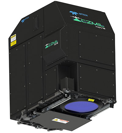
    Below, Eric Liberty of Applanix, a Trimble company, gives an overview of Applanix’s POS AV, POS AVX 210 and TIMMS indoor mobile mapping system at INTERGEO 2015, which was held Sept. 15-17 in Stuttgart, Germany.

  • Story Map: Mapping Liquid Water on Mars

    Mars-water-map-O2

    With NASA’s announcement on Monday that liquid water has been discovered on Mars, Esri has put together an interactive story map showing the craters and canyons on Mars that show evidence of water.

    Watch animations of the recurring slope lineae (water stains) across four different craters and explore satellite imagery and elevation data for the Red Planet.

    Below is an animation from the Jet Propulsion Laboratory showing seasonal flows in Hale Crater.

  • INTERGEO Product Showcase

    GNSS Receiver for Mobile Devices

    The R2 GNSS receiver works with Trimble handheld devices and iOS, Android or Window mobile handhelds, smartphones and tablets using Bluetooth or USB connectivity. When paired with a mobile device, the receiver adds professional-grade GNSS capabilities for better accuracy. The rugged Trimble R2 provides GIS and survey professionals the flexibility to choose the mobile device, workflows and accuracy they need based on applications.

    The Trimble R2 GNSS receiver is compact and portable, weighing 2.4 pounds. With one button operation and field swappable battery, the receiver can be pole or vehicle mounted or carried on a backpack. The R2 is a multi-constellation receiver that supports GPS, GLONASS, Galileo, BeiDou and QZSS satellite signals as well as SBAS.The Trimble R2 can achieve sub-meter to centimeter positioning.

    Trimble, www.trimble.com

    Source: GPS world staff
    The Optech CZMIL Nova airborne bathymetric mapping system.

    Coastal and Marine Mapping

    The Optech CZMIL Nova airborne bathymetric mapping system is designed for coastal and marine mapping.With a powerful yet efficient laser, it maps deeper while flying higher, reaching depths of 80 meters in clear waters. The enhanced design and automated processing tools produce simultaneous high-resolution 3D data and imagery of the beach and shallow water seafloor, including coastal topography, bathymetry, benthic classification and water column characterization. Its bathymetric lidar is integrated with a hyperspectral imaging system and digital metric camera. Optech HydroFusion, an end-to-end software suite, handles data from all three sensors.

    Teledyne Optech, www.teledyneoptech.com

    Source: GPS world staff
    Leica Viva GS14.

    GNSS with Hybrid Communication

    The latest generation Leica Viva GS14 GNSS receiver now supports Verizon CDMA solutions along with all standard 2G/3G networks and UHF TX/RX radio in a single device, making it a professional GNSS receiver with all three communication systems built in. Users simply slide in their SIM card to experience instant connectivity for faster and easier field communications and SmartNet RTK corrections. No external equipment is required.

    Leica Geosystems, www.leica-geosystems.com

    Source: GPS world staff
    Tallysman’s VeraPhase 6000 high-precision GNSS antenna.

    High-Precision GNSS Antenna

    The VeraPhase 6000 family of antennas provides the lowest axial ratios (horizon to horizon, through all azimuths) across all GNSS frequencies (70 percent), a tight PCV (± 1mm through all frequencies, azimuths, and elevations), and a consistent PCO through all frequencies.

    The performance of the VeraPhase rivals that of choke ring antennas, but is much lighter, smaller and more economical. The antenna family is designed for use in survey, precision RTK and reference antenna applications.

    The VeraPhase 6000 also provides an available PCB within the base of the antenna for integration of a custom system board such as a dual-band or RTK GNSS receivers or other applications.

    Tallysman, www.tallysman.com

    Source: GPS world staff
    The GIS 2go Cadenza software suite.

    GIS Software Suite

    The GIS 2go Cadenza software suite for mobile GIS visualizes geodata and attribute data for efficient result presentation. This version offers new features for tablet or smartphone, allowing users to transfer maps from Cadenza or ArcGIS for Desktop to mobile devices for use offline and availability to others via the cloud, creating an extended field workstation. The mobile app also features faster exporting and optimized use of land registers for geometry and attribute editing in the field.

    Disy Informationssysteme GmbH, www.gis2go.com

  • Gakstatter Speaks! At Commercial UAV Conference

    Eric Gakstatter
    Eric Gakstatter

    The editor of the Geospatial Solutions monthly newsletter, Eric Gakstatter, has two speaking engagements at the upcoming Commercial UAV Expo, which will be held Oct. 5–7 in Las Vegas. See him live at Caesar’s Palace!

    On Tuesday, Oct. 6, at 4:10 p.m. he will address “GPS/GNSS Technology Options for Commercial UAV.”

    There are several flavors of GPS/GNSS technologies to choose from when designing and deploying UAVs. Is 3-meter accuracy OK? How about sub-meter or centimeter? How realistic is it to have high-precision GPS/GNSS receivers on UAVs? This presentation will discuss different GPS/GNSS technologies and methods of achieving sub-meter and centimeter accurate GPS/GNSS receivers on commercial UAVs.

    Immediately following his presentation, he’ll participate in a panel discussion on “UAVs in Survey and Mapping,” in the same room, with Lewis Graham of GeoCue Group and Eric Andelin from Agerpoint.

  • Avenza Adds USGS US Topo Maps to PDF Maps App

    Thumbnail image of the 2015 Tupelo, Mississippi 7.5 minute series quadrangle (1:24,000-scale), US Topo map (orthoimage layer off)The United States Geological Survey (USGS) continues to support the delivery of its digital maps through Avenza Systems Inc.‘s PDF Maps app. It has widened the selection to more than 120,000 US Topo topographic maps on its digital mapping platform, which provides digital users access to USGS’ rich map content and extends its reach with a growing base of mobile consumers.

    The app currently aids a growing number of people who reference digital devices for work or recreation. Travelers, scientists and conservation and environmental decision makers already make use of USGS topo maps, but the expanded use of the maps via the PDF Maps app provides current USGS topo map users the ability to digitally access maps in areas with little to no internet reception and input notes and images within the map all while tracking current position.

    The USGS produces US Topo maps on a continuous basis with more than 18,000 revised quadrangles produced every year. Currently, thousands of maps from USGS’s extensive library are now available in Avenza’s PDF Maps database, including the most current variations that reflect the changing landscape of the country.

    Many historical maps can also be accessed, with thousands more dating back 130 years being added in the near future, according to Avenza. The app provides constant access to geographic information and points of interest, with additional interactive features such as measuring, place marking and location tagging. Avenza’s PDF Maps app operates without the risk of lost reception due to cell tower proximity, making it the ultimate traveling tool since it does not rely on an internet connection to use map data and obtain and display location.

    “Distinguished map publishers like the USGS fully recognize the shift to digital and how consumers are accessing and consuming information that was once static and digitally implementing it into their daily lives and making it more interactive,” said Ted Florence, president of Avenza Systems Inc. “Avenza’s PDF Maps app is an example of how a digital tool can expand the utility of a map beyond location guidance; it is also a tool to capture an experience in real-time. As the industry continues to evolve to fit into the world of a mobile consumer, we look forward to strengthening our ties with groups like the USGS.

    PDF Maps app 2.6 is available on the iTunes App Store free of charge for personal and private use. PDF Maps app is also available for use with Android devices in the Google Play Store free of charge for personal non-commercial use. A Windows version is currently in public beta targeted for a release later this year.

  • Esri Launches Photo Survey Web App for Property Surveys

    esri_photo_survey_W

    Many local governments use large teams of volunteers to evaluate property conditions and identify structures that may be abandoned or in disrepair. Property surveys may take several months to complete and are hard to maintain over time.

    To simplify survey data collection Esri has partnered with the City of New Orleans (NOLA) to create Photo Survey, an ArcGIS for Local Government solution. Photo Survey is a web application that can be used by local governments to publish street-level photo collections and conduct focused property surveys that may identify blight, damaged structures or construction activity. Like all ArcGIS for Local Government solutions, Photo Survey is included with an ArcGIS subscription.

    “Photo Survey leverages location-enabled photos produced by commercially available cameras and simplifies data processing so that street-level photo collections can be combined with relevant survey questions and used to inventory property conditions,” says Chris Buscaglia, Esri local government solutions engineer. “The street-level photo collection can then be published with the Photo Survey application and shared with the general public so property conditions can be crowdsourced from members of the community.”

    In addition to blight inventories, Photo Survey could also be used to identify structures damaged by a natural or man-made disaster, construction activity that may lead to reappraisal efforts, and/or dilapidated buildings that pose public health and safety concerns to fire service personnel, according to Esri.

    “We’re excited to crowdsource the property survey process with the Photo Survey application,” says Greg Hymel, NOLA enterprise GIS manager. “Enabling New Orleans citizens to conduct surveys for us with this app will effectively remove neighborhood bias so that, when we go live, we can make projections about the entire city instead of pockets of special-interest areas.”

    Photo Survey can be downloaded now from the ArcGIS for Local Government solution site.

  • Nikon-Trimble Introduces Updated Nikon Total Stations

    Nikon-Trimble Co., Ltd. introduced today updated mechanical total stations to expand its portfolio of solutions for mainstream surveying and construction applications.

    The announcement was made at INTERGEO 2015, the world’s largest conference on geodesy, geoinformatics and land management.

    The updated products include:

    Nikon NPL-322+ Series – an updated series of reflectorless 2” and 5” total stations providing powerful solutions and an excellent choice for value in terms of price and performance. The NPL-322+ Series feature a distance measurement accuracy of up to ±(2 + 2 ppm x D) mm and provide a long-distance reflectorless measurement range of 400 meters (1,312 feet.). The Nikon NPL-322+ Series also include a coaxial laser pointer, Bluetooth connection to external data collectors, onboard storage for 25,000 points and dual-axis compensation for significantly faster measurement times.

    Nikon DTM-322+ Series – an enhanced series of economic, prism-based 2” and 5” total stations offering full featured functionality in an entry-level package. The DTM-322+ Series offer a distance measurement accuracy of up to ±(3 + 2 ppm x D) mm and a measurement range of 2,300 meters (7,540 feet.) to a prism. In addition, the Nikon DTM-322+ Series include a Bluetooth connection to external data collectors, onboard storage for 25,000 points, dual-axis compensation and new, long-lasting Li-Ion batteries.

    “The Nikon optical portfolio continues to evolve to meet the ever changing needs of our customers who truly appreciate the reliability and dependability represented by the Nikon name,” said Olivier Casabianca, Spectra Precision Business Area Director. “Our customers enjoy the benefits of a mature, robust portfolio of survey and construction products from a single supplier they can trust.”

  • Spectra Precision Introduces New and Enhanced Survey Solutions

    Spectra Precision introduced at INTERGEO this week new and enhanced products in its portfolio of survey solutions. With the new additions, survey and construction professionals have more positioning instrument choices to meet their job requirements, the company said.

    Spectra Precision made the announcement at INTERGEO 2015, the world’s largest conference on geodesy, geoinformatics and land management.

    The new and enhanced products include:

    Spectra Precision FOCUS 35 RX – A new range of motorized total stations providing high-speed, accuracy and precision in measurement. The FOCUS 35 RX robotic instrument moves the power of the observer from the instrument to the range pole, improving efficiency. The speed of observation and precise positioning of the FOCUS 35 RX Robotic Total Station is provided by patented StepDrive motion technology, which controls the horizontal and vertical motion of the motors, eliminating the need for traditional motion locks. The FOCUS 35 RX includes a tracking sensor that uses LockNGo FastTrack tracking technology, enabling the instrument to constantly lock onto the prism.

    The FOCUS 35 RX is available in 2”, 3” or 5” accuracies, features market leading extended operating time with its dual battery system and is controlled externally by Spectra Precision Ranger, Nomad, or T41 data collectors running Spectra Precision Survey Pro or Spectra Precision Layout Pro field software on the Ranger or Nomad.

    “The streamlined design, extremely light weight, very quick turning speed and exceptional battery life enhance the overall value-proposition of the FOCUS 35 RX and make this instrument a very compelling choice for a wide range of survey and construction applications,” said Olivier Casabianca, Spectra Precision Business Area Director. “With the introduction of the FOCUS 35 RX, Spectra Precision continues to expand and improve its portfolio with powerful solutions using new technologies.”

    Spectra Precision Nomad 1050 Data Collector — The Nomad 900 has been updated with new features and capabilities. The Nomad 1050 has more RAM, more Flash and more speed. The base processor is now 1 GHz compared to 806 MHz on Nomad 900 and the Nomad 1050 has 512-MB RAM and 8GB flash storage. The other major enhancement is a new 3.75-G dual-mode GSM and CDMA WWAN modem to provide fast and versatile connectivity for Spectra Precision customers. Also, the new WWAN module uses an internal antenna eliminating the need for an external antenna.

    Spectra Precision Survey Pro 5.7 Field Software — Constant improvement and enhancement continues with Survey Pro. Survey Pro version 5.7 contains significant changes to enable more productive field data collection. Included in this update are new map displays that enable viewing and managing most of the map features that are located on the main map display. The GNSS and robotic staking screens can also display a map view to include background maps along with the standard dynamic guidance control option. The GNSS offsets routine has been updated and now includes a distance-distance option. For those customers who wish to use GNSS and robotic simultaneously, there are now enhanced options for configuration and switching between modes.

    Spectra Precision Survey Office v3.60 Software — Spectra Precision Survey Office now includes enhanced functionality; support for the Spectra Precision FOCUS DL-15 Digital Level and the import of leveling data from any DiNi level; least squares and 5 and 7 parameter Helmert transformations with reports; Geoid 12B support and grouping by country in the Coordinate System Manager; Point Cloud support plus many more additional enhancements.

    Spectra Precision MobileMapper Field GIS Application for Android Devices — A new version of the popular MobileMapper Field GIS application now running on Android devices. This new software is dedicated to GIS data collection and focuses on simplicity to maximize the number of field personnel contributing to the geospatial business. Primarily for MobileMapper 300 users, the application will be the key component of Spectra Precision’s Bring Your Own Device (BYOD) solution. This makes it possible to pair Android tablets and/or smart phones with the MobileMapper 300 GNSS receiver to collect GIS data with survey-grade accuracy.

    “With the introduction of these new and enhanced products into the Spectra Precision portfolio, survey and construction professionals have a wider range of economical choices to get the job done,” said Olivier Casabianca. “These new Spectra Precision optical products complement the ground-breaking line of Spectra Precision solutions, enabling Spectra Precision to offer a complete range of survey products.”

  • Trimble Launches R2 Receiver with GIS Workflow Integration

    Trimble-R2-GNSS-Receiver-with-Tablet-WTrimble debuted its new R2 GNSS receiver at INTERGEO 2015, held this week in Stuttgart, Germany.

    The R2 GNSS receiver is a receiver that works with Trimble handheld devices and iOS, Android or Window mobile handhelds, smartphones and tablets using Bluetooth or USB connectivity. When paired with a mobile device, the receiver adds professional-grade GNSS capabilities for better accuracy. The rugged Trimble R2 provides GIS and survey professionals the flexibility to choose the mobile device, workflows and accuracy they need based on applications.

    Trimble R2 GNSS Receiver for Mobile Devices

    The Trimble R2 GNSS receiver is compact and portable, weighing 2.4 pounds. With one button operation and field swappable battery, the receiver can be pole or vehicle mounted or carried on a backpack. The R2 is a multi-constellation receiver that supports GPS, GLONASS, Galileo, BeiDou and QZSS satellite signals as well as SBAS.

    With a variety of standard and optional correction capabilities, the Trimble R2 can achieve sub-meter to centimeter positioning for a broad range of accuracy requirements. The receiver is an option for the Bring Your Own Device (BYOD) strategy.

    “Today’s geospatial professionals require flexible solutions which allow for configuration to meet their specific job requirements,” said Ron Bisio, general manager of Trimble’s Surveying and Geospatial Division. “The Trimble R2’s versatility to support GIS and survey workflows as well as BYOD deployment enables geospatial professionals to collect data using the mobile device, workflow and accuracy they choose.”

    Workflows – GIS and Survey Field Software

    Designed for both GIS field data collection and survey workflows, the Trimble R2 receiver integrates with Trimble TerraFlex mapping and GIS field software and Trimble Access survey field software.

    TerraFlex software is a scalable cloud-based solution for geospatial data collection. By pairing the R2 with a smart device or Trimble handheld running TerraFlex, the solution addresses a wide variety of field requirements, including attribute-rich GIS data collection on consumer and professional devices.

    Trimble Access software supports the workflows of everyday surveying tasks such as topographic and control surveys and specialized surveying tasks such as roads, monitoring, tunnels and mines. By pairing the receiver with a Trimble handheld running Trimble Access or TerraFlex field software, the Trimble R2 is a versatile solution that supports the full range of geospatial data collection workflows for both GIS and survey applications.

    Flexible Accuracy

    It us capable of receiving a broad range of corrections from traditional RTK, VRS networks and SBAS to Trimble RTX correction services via cellular/IP connections or satellite (L-band), the Trimble R2 provides high-accuracy data worldwide.

    The R2 GNSS receiver can leverage the entire portfolio of subscription-based Trimble RTX correction services to accommodate a wide range of applications and accuracy requirements. This includes CenterPoint RTX (less than 4 centimeters), RangePoint RTX (less than 50 centimeters), and ViewPoint RTX (less than 1 meter) correction services.

  • First Day at INTERGEO: UAVs and RTK GNSS Receivers

    Every fall thousands of geospatial professionals are drawn to Germany, like bees are to honey, for the largest geospatial exhibition on Earth. This year in Stuttgart, more than 17,000 attendees from 92 countries are flooding the halls of the Stuttgart Exhibition grounds located adjacent to the Stuttgart International Airport. Attendees are being treated to a vast array of geospatial technology treats from 500+ exhibitors representing 30 countries.

    Unmanned Aerial Vehicles

    I recall a few short years ago, there were only a handful of UAV vendors at the entire exhibition. Now, there is hardly an aisle that does not contain a quad-copter, fixed-wing aircraft or a UAV-related accessory. The growth of UAVs into the geospatial market growth has been the most explosive geospatial technology introduced in the past 25 years, the span of time that I’ve been involved in the geospatial industry. It’s over the top — there is so much hype surrounding UAV technology that there might be more sellers than buyers. It’s become so crazy that there are vendors presenting UAVs that haven’t even been built yet! It reminds me of the days that Atari would announce a new game system nine months before it was ready to ship.

    In the UAV space, I wonder which companies are actually making money. My guess is very few. A few of the big players like DJI, Parrot (owns senseFly) and 3D Robotics are doing well, plus a few others. But it’s an unhealthy buyer/seller ratio. Something’s going to give.

    The sensefly eXom UAV in flight.
    The sensefly eXom UAV in flight.

    Today’s winners in the UAV market are companies like Pix4D, Agisoft and others who make mission planning and image-processing software for UAV-collected data. They are smart in that they aren’t competing against the hundreds of other UAV airframes on the market; they work with data from most of them. Following is a 3D example of what the Agisoft software can create given a bunch of images shot with a $1,500 DJI Phantom at 200-foot elevation.

    3DModel-W

    The resolution is very good, and you’re able compute material volume such as the piles of aggregate on the west side of the river.

    Inexpensive RTK

    NVM_L1RTK-WIn the past, I’ve written a lot about inexpensive RTK GNSS receivers. At the InfoAg Conference a couple of months ago, Swift Navigation announced it is testing its $500 RTK receivers. At INTERGEO, CHCNav introduced L1 RTK GNSS in a mobile phone (check our website for a video on that). It’s not capable of centimeter accuracy yet, but quickly heading in that direction. NVS Tech is also pushing sub-$500 L1 RTK GNSS modules.

    It’s interesting because L1 RTK is nothing new. That technology was first introduced almost 10 years ago, and wasn’t accepted very well. Now, the UAV phenomena is breathing new life into L1 RTK receiver technology because it’s driving the requirement for low-cost, high-precision GNSS receivers. L1 RTK GNSS are finally getting the love they were looking for nearly 10 years ago.

    In case you weren’t able to make it to INTERGEO this year, Joelle, Michelle and I are shooting a bunch of short (~2-minute) videos at various exhibition booths while we are here. We hope to give you a flavor of the geospatial technology being offered this year in Stuttgart.

    See you next time.

    Following me on Twitter at https://twitter.com/GPSGIS_Eric

  • Trimble Launches R2 GNSS Receiver at Intergeo

    Photo: TrimbleTrimble debuted its new R2 GNSS receiver at Intergeo 2015, held this week in Stuttgart, Germany.

    The R2 GNSS receiver is a receiver that works with Trimble handheld devices and iOS, Android or Window mobile handhelds, smartphones and tablets using Bluetooth or USB connectivity. When paired with a mobile device, the receiver adds professional-grade GNSS capabilities for better accuracy. The rugged Trimble R2 provides GIS and survey professionals the flexibility to choose the mobile device, workflows and accuracy they need based on applications.

    Trimble R2 GNSS Receiver for Mobile Devices

    The Trimble R2 GNSS receiver is compact and portable, weighing 2.4 pounds. With one-button operation and a field swappable battery, the receiver can be pole or vehicle mounted or carried on a backpack. The R2 is a multi-constellation receiver that supports GPS, GLONASS, Galileo, BeiDou and QZSS satellite signals, as well as SBAS.

    With a variety of standard and optional correction capabilities, the Trimble R2 can achieve sub-meter to centimeter positioning for a broad range of accuracy requirements. The receiver is an option for the Bring Your Own Device (BYOD) strategy.

    “Today’s geospatial professionals require flexible solutions which allow for configuration to meet their specific job requirements,” said Ron Bisio, general manager of Trimble’s Surveying and Geospatial Division. “The Trimble R2’s versatility to support GIS and survey workflows as well as BYOD deployment enables geospatial professionals to collect data using the mobile device, workflow and accuracy they choose.”

    Workflows – GIS and Survey Field Software

    Designed for both GIS field data collection and survey workflows, the Trimble R2 receiver integrates with Trimble TerraFlex mapping and GIS field software and Trimble Access survey field software.

    TerraFlex software is a scalable cloud-based solution for geospatial data collection. By pairing the R2 with a smart device or Trimble handheld running TerraFlex, the solution addresses a wide variety of field requirements, including attribute-rich GIS data collection on consumer and professional devices.

    Trimble Access software supports the workflows of everyday surveying tasks such as topographic and control surveys and specialized surveying tasks such as roads, monitoring, tunnels and mines. By pairing the receiver with a Trimble handheld running Trimble Access or TerraFlex field software, the Trimble R2 is a versatile solution that supports the full range of geospatial data collection workflows for both GIS and survey applications.

    Flexible Accuracy

    The receiver is capable of receiving a broad range of corrections from traditional RTK, VRS networks and SBAS to Trimble RTX correction services via cellular/IP connections or satellite (L-band), the Trimble R2 provides high-accuracy data worldwide.

    The R2 GNSS receiver can leverage the entire portfolio of subscription-based Trimble RTX correction services to accommodate a wide range of applications and accuracy requirements. This includes CenterPoint RTX (less than 4 centimeters), RangePoint RTX (less than 50 centimeters), and ViewPoint RTX (less than 1 meter) correction services.

  • Topcon Releases Three New GLS Laser Scanners

    GLS-2000_Series_Models-W

    Topcon Positioning Group is releasing three new models to the GLS line of laser scanners — the GLS-2000S, GLS-2000M and GLS-2000L. The scanners are designed to capture data based on the measurement range needs of specific applications.

    “These new GLS-2000 scanners offer purposeful solutions and versatility that comes from the multiple measurement modes with each model,” said Charles Rihner, vice president for the Topcon GeoPositioning Solutions Group. “The S model is optimized for short-range applications, while the M and L models are perfect for medium and long-range measurement fields, respectively.”

    Using Topcon Precise Scan Technology II, the GLS-2000 models are designed to emit pulse signals three times faster than earlier GLS systems. “Using faster pulse signals enables timing to be detected more precisely, which results in reduced noise and higher-accuracy data,” Rihner said.

    Additionally, the systems feature dual 5MP cameras, including one with a 170-degree wide-angle lens for high-speed imaging, as well as an 8.9-degree telephoto camera that is coaxial with the measuring axis.

    When paired with Topcon ScanMaster software, the models provide complete systems for capturing and processing 3D point cloud data.

    Topcon is exhibiting this week at the INTERGEO trade show, in Hall 6, Booth A6.002.