Tag: GIS

  • CoreLogic Expands Natural Catastrophe Risk Management Solution

    CoreLogic, a residential property information, analytics and data-enabled services provider, today released an expanded version of its natural catastrophe risk management solution, which features a new comprehensive probabilistic flood model that analyzes the potential damage and financial impact at the property-level from flood events in the continental United States.

    This probabilistic flood model is unique to the industry because its riverine and flash flood risk components provide better risk estimation for areas outside the 100-year flood zones–areas responsible for 20 percent of historic flood losses but which represent only 1 percent of the flood insurance policies in force.

    Measuring both severity and frequency of flood events, the probabilistic flood model loss calculations offer property, contents and business interruption analysis. The model also incorporates historical flood event footprints from the last 50 years and the accompanying property damage.

    Additionally, the model incorporates detailed user-provided building information to derive vulnerability assessments driven by both water depth and water velocity. These building characteristics include construction type, occupancy, floor elevation, basements and elevated building configurations. The new CoreLogic flood model provides insurers with an unprecedented tool to more accurately underwrite the risk associated with this complex peril, especially the proprietary flash flood component.

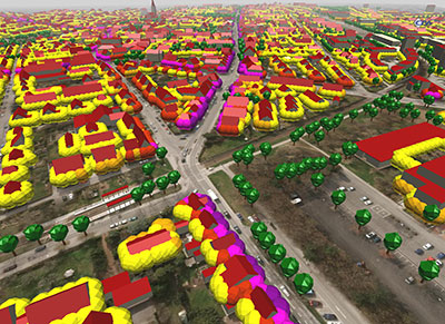
    With granular 10-meter elevation data, the catastrophe risk management solution incorporates the Digital Flood Insurance Rate Maps (DFIRMs) provided by the Federal Emergency Management Association (FEMA). It uses more than 80 different occupancy classes covering topography, land-use, stream coverage and inundation. In order to more accurately measure a property’s flood risk, more than 50 data layers ranging from elevation, hydrologic and catchment information are included, as well as data for over 6 million miles of streams and 20,000 stream flow gauges.

    “The release of the U.S. Inland Flood Model means insurers can now use this advanced probabilistic tool to help them determine a property’s potential for flood damage,” said Tom Larsen, CoreLogic product architect. “The model’s unique ability to provide granularity down to the property level will offer insurers a complete view of flood risk, including contents and business interruption, for all types of properties.”

    The catastrophe risk management solution contains parcel-level geocoding through PxPoint from CoreLogic, which can convert physical addresses or locations into precise geographic coordinates for over 142 million parcel boundaries. A new visualization feature identifies details in the data as well as exceptions via easy-to-use charts and graphics. Other new components include updates to three risk assessment models including Italy Earthquake, the North Atlantic Hurricane Risk and U.S. Offshore Energy.

    Highlights include:

    • The Italy Earthquake Model now incorporates an updated seismic source model based on the Seismic Hazard Harmonization in Europe (SHARE) to provide a current and more accurate view of seismic hazard in Italy. Increased maximum magnitudes, an updated magnitude-frequency distribution and a new ground motion model are part of the enhancements.
    • The North Atlantic Hurricane Risk Model update includes a high-resolution storm surge model and enhanced hazard risk assessment to more accurately capture the damage from storm surge as the surge attenuates inland (outside of the high velocity zones). It uses storm intensities from historical events based on the Atlantic hurricane reanalysis project by the National Oceanic and Atmospheric Administration (NOAA). Additionally, the North Atlantic Hurricane Risk Model includes a full set of default secondary structural modifiers by vintage and location for all hurricane states, which are based on the International Building Code as well as state-specific building codes to provide refined results. RQE 16 also includes a model version which was certified by the Florida Commission Hurricane for Loss Projection Methodology in June 2015.
    • The U.S. Offshore Energy Model features a distinctive wave model component and unique financial model which produces an improved estimate of potential damage to physical assets in U.S. territorial waters within the Gulf of Mexico. A network analysis is also built into the model to produce a better estimate of the lost production from oil wells.

    “All of these enhancements will help insurers understand hazard risk in a more granular and comprehensive way, and this precision in risk modeling will help the industry overall fine-tune its underwriting, claims and reinsurance efforts,” Larsen said.

  • Live updates from Intergeo 2015

    intergeo15_pano_WGPS World staff is reporting from Intergeo Sept. 15–17. The massive trade show, held this year in Stuttgart, Germany, is considered the world’s leading conference trade fair for geodesy, geoinformation and land management. With more than 16,000 visitors from 80 countries, it is one of the key platforms for industry dialogue.

    Editorial staff members attending include GPS World Survey/GIS Editor Eric Gakstatter and Senior Digital Editor Joelle Harms. Both are accepting meeting invitations for companies interested in discussing their products and services. Contact [email protected] for more information.

    BLOG

    First Day at INTERGEO: UAVs and RTK GNSS Receivers, by Eric Gakstatter (9/15)

    NEWS

    Nikon-Trimble Introduces Updated Nikon Total Stations (9/15)

    Spectra Precision Introduces New and Enhanced Survey Solutions (9/15)

    Trimble Launches R2 GNSS Receiver at INTERGEO (9/15)

    Applanix Offers Entry-Level Georeferencing Solution for Airborne Mapping (9/15)

    senseFly eXom Drone Capable of Millimeter Accuracy (9/15)

    Topcon Releases Three New GLS Laser Scanners (9/15)

    Carlson SurvCE 5.0 Improvements on Display at INTERGEO (9/14)

    Septentrio Launches AsteRx-U and AsteRx-U Marine (9/14)

    Hemisphere GNSS’ Atlas Makes Trade Show Debut at INTERGEO (9/14)

    Tallysman Introduces VeraPhase 6000 High-Precision GNSS Antenna (9/10)

    Mobile Surveying Solutions from Teledyne Optech Shown at INTERGEO 2015 (9/9)

    SBG, Viametris Present 3D Indoor Scanning System at INTERGEO (9/8)

    YellowScan Lidar for UAVs Aided by Ellipse-E Inertial Navigation System (9/4)

    INTERGEO 2015: Stuttgart Moves Toward Smart City (9/3)

    JAVAD GNSS to Showcase New Technology at INTERGEO (9/1)

    Tallysman Introduces Wideband Embedded GNSS Antennas (9/1)

    Tallysman Launches Higher Gain Dual-Frequency Antenna (8/19)

    Satel Joins with Antenna Maker Welotec at INTERGEO (8/12)

    INTERGEO in Stuttgart Looks to Mapping’s Future (8/4)

    VIDEO PLAYLIST

    PHOTOS

    SOCIAL MEDIA

  • DJI Offers New Micro Cameras for UAVs

    The Inspire UAV in flight.
    The Inspire UAV in flight.

    DJI is offering two new cameras for its DJI Inspire 1 professional aerial camera platform.

    The new Zenmuse X5 is a commercially available micro four-thirds (M4/3) camera designed specifically for aerial use. With a large sensor, aerial image makers will be able to capture up to 13 stops of dynamic range, making it easy to capture high-resolution 16 megapixel photos or 4k, 24fps and 30fps videos in complex lighting environments.

    Zenmuse X5 users will have more options for capturing images in the sky through additional supported lenses and full wireless aperture and focus control. At the time of launch, the Zenmuse X5 will support four interchangeable lenses, including the DJI MFT 15mm f/1.7 ASPH lens, Panasonic Lumix 15mm G Leica DG Summilux f/1.7 ASPH lens, Olympus M.ZUIKO DIGITAL ED 12mm f/2.0 lens, and Olympus M.Zuiko 17mm f/1.8 lens. While the Zenmuse X5 is in flight, pilots can adjust both focus and aperture via the DJI GO app or through DJI’s previously announced Follow Focus system.

    The Zenmuse-X5 aerial camera.
    The Zenmuse-X5 aerial camera.

    The camera’s lightweight 340-gram (0.75-pound) body integrates with DJI’s signature three-axis Zenmuse gimbal technology, creating effortlessly smooth video and stabilized long-exposure photos (up to 8 seconds).

    “The professional applications of the Zenmuse X5 are almost endless,” said Eric Cheng, DJI’s director of Aerial Imaging. “In addition to shooting professional-quality photos and 4K video, the new camera can be used to create high-quality aerial maps and 3D models, and can also help industrial teams get even more detail from their aerial imaging pursuits, for example, in utility inspection using a drone.”

    DJI also announced the Zenmuse X5R camera, which shares the same sensor and lens compatibility with the X5, but records video both to an onboard microSD card as well as to a removable 512GB solid state disk (SSD) on the gimbal’s top plate. The Zenmuse X5R records CinemaDNG (RAW) video to the SSD, and opens up lossless 4k video recording in a compact form factor with video bitrates averaging 1.7 Gbps (with a maximum of 2.4 Gbps).

    The Zenmuse X5R also offers a brand-new D-LOG mode that offers a broader array of color correction options in post production.

    To support the management of Zenmuse X5R Cinema DNG files, DJI will release software to edit and convert RAW camera footage. CineLight, which will be available when the Zenmuse X5R camera is released later this year, simplifies users’ workflows by offering offline proxy editing before converting the CinemaDNG files to ProRes.

    “In order to achieve the quality of video produced by Zenmuse X5 and X5R, pilots used to have to spend many thousands of dollars for large, complicated aerial equipment,” said Frank Wang, DJI CEO and founder. “Now, pilots can simply mount the Zenmuse X5 series cameras to their Inspire 1, put on their props, get up in the air, and have full control of their shot while in flight. This saves valuable time on film sets and makes high quality imaging for industrial applications smaller, lighter and easier to manage.”

    By mounting a small, easy-to-install bracket, the Zenmuse X5 series cameras are fully compatible with existing DJI Inspire 1 platforms as an interchangeable option for the Inspire 1’s standard Zenmuse X3 camera.

    The Zenmuse X5 is available for pre-order at store.dji.com for $4,499 (€4,999), including a DJI Inspire 1 and DJI’s MFT 15mm F1.7 ASPH lens, and will begin shipping before the end of September. The Zenmuse X5R will be available in Q4 2015 for $7,999 (€8,799). Both can be purchased as stand alone cameras with, or without lens. More information can be found at dji.com.

  • USGIF Announces 2015 Scholarship Recipients

    The annual scholarship program supports students studying geospatial sciences.


    The United States Geospatial Intelligence Foundation (USGIF) presented scholarships to 24 students as part of its annual Scholarship Program. USGIF awarded $99,000 in scholarship funds this year, bringing the total funds awarded since the program launched in 2004 to $891,000.

    Through its scholarship program, USGIF is dedicated to assisting promising students interested in the geospatial sciences and furthering the advancement of the geospatial intelligence tradecraft.

    “This year’s slate of USGIF Scholarship awardees represent a diversity of analytical interests to include spatiotemporal data science, visualization of Big Data analytics, GEOINT ontologies, open-source data fusion, emergency medical response in remote locations, natural language processing for activity-based intelligence, remote sensing assessment of aquifer vulnerability, and decision support systems for sustainable agriculture,” said Maxwell Baber, USGIF’s director of academic programs. “These GEOINT student revolutionaries are the future leaders of our discipline.”

    This year, USGIF granted scholarships to five doctoral candidates, six graduate students, six undergraduate students, and seven graduating high school seniors. Each undergraduate, graduate, and doctorate awardee received $5,000, and graduating high school seniors received $2,000 toward their education.

    All scholarship recipients are selected by USGIF’s Scholarship Subcommittee, which evaluates applicants based on academic and professional excellence.

    The 2015 USGIF scholarship awardees are:

    Doctorate
    • Crystal English, San Diego State University/University of California, Santa Barbara
    • Morteza Karimzadeh, Pennsylvania State University
    • Ron Mahabir, George Mason University
    • Monica Medel, Texas State University
    • Taylor Oshan, Arizona State University

    Graduate
    • Christopher S. Beddow, University of Washington
    • Seth Bishop, University of Utah
    • Steven Gilbert, Pennsylvania State University
    • Bridget Kane, University of Pennsylvania School of Design
    • Joel Max, Pennsylvania State University
    • Aishwarya Venkat, Tufts University

    Undergraduate
    • Sarah Campbell, West Virginia University
    • Charlotte Ector, University of South Carolina
    • Jory Fleming, University of South Carolina
    • Courtney Koch, Harrisburg University
    • Jeffrey Sherwood, Washington College
    • Elijah Staple, University of Colorado, Boulder

    Graduating High School Seniors
    • Elizabeth Cady van Assendelft, Robert E. Lee High School, Staunton, Va.; now attending Yale University
    • Kyle Bathgate, Carbondale Community High School, Carbondale, Ill.; now attending the University of Illinois at Urbana-Champaign
    • Christina Bohnet, South Lakes High School, Reston, Va.; now attending Calvin College
    • Kelly Carney, South Lakes High School, Reston, Va.; now attending Virginia Polytechnic Institute and State University
    • Andy Fleming, Dominion High School, Sterling, Va.; now attending Texas A&M University, West Texas
    • Colin Flynn, Heritage High School, Leesburg, Va.; now attending Northern Virginia Community College
    • Daniel Gurley, South Lakes High School, Reston, Va.; now attending James Madison University

    To learn more about the USGIF Scholarship Program, visit USGIF.org.

  • DigitalGlobe Expands Partnership with Orbital Insight

    This image depicts how Orbital Insight is detecting building shadows in Nanjing, China, to monitor construction rates in the area.
    This image depicts how Orbital Insight is detecting building shadows in Nanjing, China, to monitor construction rates in the area.

    DigitalGlobe has expanded its partnership and offering with Orbital Insight, a market intelligence and data science company that analyzes socioeconomic trends at global, regional and hyper-local scales.

    Within DigitalGlobe’s Geospatial Big Data platform, Orbital Insight’s machine vision engineers, artificial intelligence experts and data scientists now have access to 400 terabytes of high-resolution imagery, an increase of nearly 80 times the data that was available for analysis under the previous partnership agreement.

    The partnership is enabling Orbital Insight to more quickly validate its hypotheses and understand a variety of trends in the commercial and humanitarian markets. Having access to this volume of DigitalGlobe’s data allows the ability to visualize and analyze even larger areas of interest around the globe, allowing users to better understand the economic trends impacting industries and markets, according to DigitalGlobe.

    “Orbital Insight’s customers — hedge funds, Fortune 500 companies, and global humanitarian organizations — will now be able to understand near real-time global economic trends with even greater precision and scale,” DigitalGlobe writes in a blog. “In one recent project, Orbital Insight leveraged DigitalGlobe imagery to process 4 trillion DigitalGlobe pixels in a 48-hour period, counting 700 million cars that yielded tradable insights into national shopping behavior for the company’s customers on Wall Street. This fall, Orbital Insight expects to release several new data analytics products, including worldwide monitoring of crude oil storage inventories and monitoring construction rates across the major cities in China, which are powered by DigitalGlobe’s image library and Geospatial Big Data platform.”

    “This expanded partnership with DigitalGlobe accelerates the realization of Orbital Insight’s vision for a macroscope, a scientific instrument for helping human society to see itself in a new light,” said James Crawford, CEO of Orbital Insight. “The partnership enables us to more quickly validate our hypotheses and understand a variety of trends in the commercial and humanitarian markets. Having access to this volume of data gives us the ability to visualize and analyze even larger areas of interest around the globe, allowing us to better understand the economic trends that are impacting industries and markets.”

    “The era of geospatial big data has arrived,” said  Shay Har-Noy, DigitalGlobe’s Senior Director for Geospatial Big Data. “DigitalGlobe’s platform provides the largest commercial library of current and historical satellite imagery available, integrated into a cost-effective environment where meaningful insight can be extracted from the data through algorithms built by companies like Orbital Insight.”

    To learn more about DigitalGlobe’s Geospatial Big Data platform, visit developer.digitalglobe.com.

  • Mobile Surveying Solutions from Teledyne Optech Shown at INTERGEO 2015

    3D point cloud collected at highway speeds.
    3D point cloud collected at highway speeds.

    The latest solutions by Teledyne Optech for the productive and accurate collection of spatial data will be on display at INTERGEO 2015, taking place Sept. 15-17 in Stuttgart, Germany — including a new solution for survey-grade mobile mapping.

    At booth C4.019 in Hall 4, Teledyne Optech will present the latest addition to its high-powered Optech Lynx mobile survey systems. The new model is designed for both efficient asset collection and the delivery of engineering survey-grade results, giving operators flexibility for multiple types of jobs. Teledyne Optech will also demonstrate how the advanced features of Optech LMS 3.0 improve collection and processing efficiency by enabling access to survey control.

    Several other Teledyne Optech systems will be at the booth, including the Optech Galaxy airborne mapper. Visitors can take the opportunity to see how Galaxy vastly improves survey efficiency and consistency in variable terrain by letting surveyors ignore multipulse blind zones and keep their swath and point density on the ground constant with its PulseTRAK and SwathTRAK technologies. Forestry and coastal data from the Optech Titan will also be available, with Teledyne Optech experts ready to explain the new techniques that surveyors, government agencies and academics have developed to take advantage of its revolutionary multispectral lidar technology for topo/bathy surveys, land classification and biomass estimation.

    The CZMIL Nova System is designed for airborne coastal and marine mapping.
    The CZMIL Nova System is designed for airborne coastal and marine mapping.

    Groups interested in surveying deeper in turbid waters than any other airborne lidar can also drop by the booth to hear more about the Optech CZMIL Nova. Even smaller organizations with limited budgets can now make use of CZMIL Nova, thanks to redesigned hardware that lets it survey from aircraft as small as a Piper Navajo, plus the ability to rent the sensor and its HydroFusion workflow through the CZMIL Project Program.

    For smaller scale projects, Teledyne Optech will display integrated solutions using the flexible Optech ILRIS terrestrial lidar scanner: Users can rapidly survey open pit mines by combining ILRIS with photogrammetry from the new geo-XR6 UAV, constantly monitor dangerous areas for landslides with the Gexcel OPMMS solution, or even survey harbors above and below water simultaneously with an integrated ILRIS/Seabat sonar system.

    Visitors interested in improving productivity and safety in underground mining can see the Optech Cavity Monitoring System (CMS) V500 in action and try out its new integrated camera, georeferencing tools and more.

  • INTERGEO 2015: Stuttgart Moves Toward Smart City

    Photo courtesy: Alen Ajan / Fotolia.com
    Photo courtesy: Alen Ajan / Fotolia.com

    This year’s Intergeo host city, Stuttgart, offers interactive city maps packed with geoinformation in an effort to become a “smart city.” Founded in 2001, Working Group Geoinformation Systems of Stuttgart (GIS AG) has evaluated environmental and traffic issues, sustainable urban development and solutions for a climate-friendly energy supply. Intergeo 2015 is being held Sept. 15–17.

    Stuttgart is growing, according to a news release from Intergeo, and will continue to do so for the foreseeable future as newcomers flock to the region’s urban capital city. The number of inhabitants in the region has increased from 2.4 million in 1990 to 2.7 million today, Intergeo officials said.

    Stuttgart authorities have forged action plans addressing mobility, energy and a sustainable living environment, “and we lay the foundation for each of these spheres,” said Markus Müller, head of the geoinformation and cartography department at the City Surveyor’s Office.

    Müller wants to see Stuttgart’s immense GIS data put to the widest possible use, according to the news release. He believes that the move towards the “intelligent city,” also known as a “smart city” or “city of tomorrow,” is only a matter of time.

    Intelligently Networked

    Stuttgart’s geoinformation and cartography department is frequently called upon — whether it’s for a simulation of the different planning options for a new city headquarters in the heart of the city, long-term monitoring of the building works related to the Stuttgart 21 infrastructure project, implementing traffic concepts in the congested regional capital or planning affordable living.

    Stuttgart Aims for Dynamic, Interactive Maps

    Müller and his team are on a mission to bring geoinformation into wider circulation and further optimize the local authorities’ workflows. They plan for a perfectly tailored geographic information system (GIS) for professional administrators, as a public information tool and as an increasingly important preparatory aid for political decision-making.

    GIS-AG was founded in Stuttgart in 2001 to accomplish that task, and it now encompasses 15 specialist departments and municipal enterprises, according to Intergeo. Visit Stuttgart’s city website [click here for English] to find geoinformation — the city map alone covers about 70 subject areas, such as nature and the environment, leisure and culture, mobility and traffic, and planning and construction.

    “The city map scores a lot of hits, probably also due to its accessibility on all platforms,” Müller said. The city map is just one piece of the puzzle in the ‘Stuttgart Maps’ project, which is aimed at making geographical information increasingly accessible to the public. The idea is to offer more and more data and to construct dynamic, interactive maps from the city plans in order to make the city truly intelligent.

    StuttgartMaps
    Photo courtesy: Alen Ajan / Fotolia.com


    Sensor and Real-Time Data

    “The automatic capture of sensor data and the visualization of real-time data will continue to increase as intelligent cities develop,” Müller said.

    In relation to energy, this could mean interactive evaluation and visualization of the potential uses for waste-water heating, or dynamic representations of the city’s energy consumption or heating requirements. Traffic flow could be visualized and the spread of emissions depicted.

    “Once the foundation has been laid, ways can be found to optimize these systems and manage their success,” Müller said.

    Stuttgart3D Photo courtesy: Alen Ajan / Fotolia.com
    Photo courtesy: Alen Ajan / Fotolia.com

    Smart City Hamburg?

    Intergeo’s host city for 2016, Hamburg, is already seeking intelligent concepts for the cities of tomorrow — just like those already in use in Berlin, the host city for Intergeo 2017.


    GIS AG will be at Intergeo, stand C8.025 in Hall 8, with 10 departments and municipal enterprises from Stuttgart’s public authorities showcasing innovative applications and solutions using GIS.

  • Handheld’s Nautiz X8 Field Computer Gets Add-ons

    Handheld’s Nautiz X8 Field Computer Gets Add-ons

    Photo: Handheld Group

    Handheld Group is offering expansion pack features for its Nautiz X8 rugged field computer. The new functionalities will make the Nautiz X8 more versatile for field workers in a number of market segments, including forestry, surveying, construction, field services, warehouse projects and logistics.

    The Nautiz X8 was built to enable efficient and reliable data collection in the toughest of environments. Ultra-rugged with superior processing power, screen size and sunlight visibility, the X8 is used in the GIS, land surveying, public safety, forestry and military sectors.

    Handheld now offers three expansion packs for the Nautiz X8:

    • Nautiz X8 Long Range Bluetooth (LRBT) Expansion Pack features a LRBT u-blox module, which allows long-range communication up to 300 meters. This option is especially well-suited for advanced forestry solutions, surveying and construction work.
    • Nautiz X8 Barcode Expansion Pack features an imager module (Zebra SE4750SR) with an LED aimer, which allows for competitive scanning performance without sacrificing design, ruggedness or user experience. This option is ideal for workers in field service, warehouse projects and logistics.
    • Nautiz X8 Basic Expansion Pack is an empty add-on cap for an extension of your choice. It increases the Nautiz X8’s customizability and flexibility for specific customer requirements. It also allows users to install custom accessories under the cap using the proprietary interface.

    The new Nautiz X8 expansion packs will be available in September. All cap versions are designed to retain the Nautiz X8 IP67 classification.

    “The Nautiz X8 is the world’s best rugged handheld computer, with an outstanding screen and exceptional durability, connectivity, processing power and battery life — without compromising ergonomics or design,” said Jerker Hellström, CEO of Handheld Group. “These new expansions will make it even more versatile, customizable and attractive for field users in a number of industry segments. We take pride in always working with our partners and customers to understand their specific needs and create solutions they actually want and will benefit from.”

    The Nautiz X8 has an IP67 ingress protection rating and is protected against dust, sand and water immersion. It also meets MIL-STD-810G military test standards for overall durability and resistance to humidity, shock, vibrations, drops, salt and extreme temperatures.

  • Remote Geosystems Adds Support for Commercial UAV Video

    RemoteGeosystems-LineVision

    Remote GeoSystems is now offering direct support in all of its LineVision cloud, server and desktop applications for video from the DJI Inspire 1 unmanned aerial vehicle. The new LineVision capability gives DJI Inspire 1 operators and pilots the ability to create and deliver interactive professional-grade video inspection and survey work products using GIS software such as Esri ArcGIS, Bing Maps and Google Earth.

    DJI Inspire 1 users need to enable .SRT file logging while recording video during flight. Post-flight, LineVision allows users to load or upload the video and GPS track to a map. As the video plays, a cursor moves along the GPS track on the map, constantly indicating where and when the current video view was captured based on GPS data logged during the mission.

    Users can geographically navigate the video recordings by clicking any of the points along the GPS track on a map.  The video then automatically advances or reverses to that point in the video so that analysts and subject-matter experts can visually interpret what was recorded at that specific place and time.

    In addition to FMV, LineVision features import/upload and “one-click” geo-referencing of nearly any kind of rich media including photos, audio and electronic documents or files such as PDF, Microsoft Office and CAD files.

    LineVision features flexible mapping options allowing users to incorporate and “stream” background maps and data layers from your enterprise GIS and third-party map service providers. All these imported data types can be saved in a Remote GeoSystems .geoProject file for data portability and future analysis in LineVision software.

    The Remote GeoSystems technology has been developed commercially and independent of defense programs, making it easier for non-military customers outside the U.S. and around the globe to acquire the applications and expertise without having to go through the often lengthy ITAR export process.

  • FlightAware Partners with Esri on Flight Tracking and Status Data Mapping

    flightaware-partner-extensive-flight-tracking-status-data-mapping-initiative-W

    Esri and FlightAware have partnered to combine the power of a flight tracking and status company with the ArcGIS mapping platform. The partnership features the ability to view and analyze large amounts of accurate, live-aviation data in one powerful spatial system.

    FlightAware aggregates live flight tracking data from more than 50 government air traffic control authorities, satellite data link partners such as Garmin and ARINCDirect, and FlightAware’s own in-house ADS-B receiver network, consisting of more than 3,400 receivers in more than 100 countries.

    “Esri has the tools and expertise to visualize data in a proven GIS environment,” FlightAware business development manager Max Tribolet said. “FlightAware data is the perfect addition. We’re the largest flight tracking company in the world, based on how many disparate data feeds we have coming into our system. So it’s pretty powerful when you pull our data into GIS.”

    “This is a really good way to provide an additional option to our existing and potential customers, who might not have an easy way to consume larger volumes of flight tracking data,” Tribolet said. “A stand-alone app like Esri’s ArcGIS is adept at handling large quantities of data and is able to visualize it. This relationship with Esri allows FlightAware to focus on what we do best: constantly adding and aggregating quality flight tracking data and providing it to the industry.”

    Airports and agencies have started exploring opportunities to use FlightAware data in GIS to improve proactive noise monitoring and airspace design as well as monitoring airspace congestion in real time. FlightAware visualizes live and historic data — such as altitude, longitude, latitude, ground speed, and estimated and actual schedule times—in 2D, 3D, and even 4D maps.

    “The ability to fuse FlightAware data within the ArcGIS platform unlocks a host of new and innovative capabilities with regard to visualization, analysis and collaboration,” Esri aviation business development lead Stephen Willer said. “That results in a higher level of operational intelligence. We’re excited to bring this to our users across the globe. Real-time information access like this is essential not only today but also to our future air traffic systems.”

  • Night-Time Satellite Images Show ISIS-Controlled Regions

    ISIS-remote-sensing-city-lights
    Figure 1. Suomi NPP/VIIRS night-time light images for Iraq: (a) May 2014, (b) December 2014.

    A new paper published in the academic journal International Journal of Remote Sensing analyzed city night lights in Northern Iraq during 2014, suggesting a major loss of electrical power supply within the Iraqi cities seized by ISIS.

    The territory controlled by the Islamic State of Iraq and Syria (ISIS) has grown rapidly since the start of the Syrian Civil War, and in 2014 ISIS expanded its control into Northern Iraq. While there are many media reports on violence and geopolitical issues surrounding the takeover of these areas, the impact on everyday life, such as access to electricity for people living in ISIS-controlled regions, is less clear.

    In the study, Xi Li and Deren Li (Wuhan University, China) and Rui Zhang and Chengquan Huang (University of Maryland) analyzed city lights as a proxy for the power supply in ISIS-controlled regions between May 2014 and December 2014. The city light data were acquired from the Visible Infrared Imaging Radiometer Suite (VIIRS) sensor on the NASA/NOAA Suomi National Polar-orbiting Partnership (NPP) satellite.

    The analysis indicates that most of the ISIS-controlled cities, including Mosul and Tikrit, experienced a decrease of more than 90 percent in city light after being seized by ISIS, while the loss of light in cities controlled by the Iraqi security forces (ISF) was very limited. However, the city lights in Ar Raqqa, Syria, ISIS’ de facto capital, did not show a decline after that region was seized by ISIS.

    These comparisons suggest that the conflict in Northern Iraq has resulted in a major loss of electrical power supply within the Iraqi cities seized by ISIS, and that this loss is most likely due to lack of access to the Iraqi power grid, rather than a deliberate ISIS strategy of limiting night-time light.

    The insurgency in Northern Iraq since 2014 has led to a severe humanitarian crisis, the study authors say. It is widely known that it is extremely dangerous to collect information from ISIS-controlled regions; therefore, the use of remotely sensed night-time light images such as these offer humanitarian agencies and NGOs a low-risk indicator of socioeconomic conditions in war-torn countries like Iraq.

    The paper is “Detecting 2014 Northern Iraq Insurgency using night-time light imagery,” by Xi Li, Rui Zhang, Chengquan Huang and Deren Li, International Journal of Remote Sensing, 2015, published by Taylor & Francis Group.

  • USGS Selects Woolpert to Evaluate Lidar for 3DEP

    The U.S. Geological Survey (USGS) has contracted with Woolpert to evaluate new lidar (light detection and ranging) technologies to assess the suitability to support the 3D Elevation Program (3DEP).

    This use of the single photon and Geiger mode lidar for this evaluation is new to the commercial market, according to Woolpert Project Director John Gerhard.

    “This technology provides the ability to fly at higher altitudes while acquiring data at an increased point density,” Gerhard said. “The USGS has asked us to provide an evaluation of this sensor technology in support of 3DEP.”

    The USGS is developing the 3DEP initiative to respond to the growing need for high-quality topographic data nationwide, to address issues that include flood-risk management, precision agriculture, natural resource management, infrastructure management and hazard mitigation.

    Woolpert — a national architecture, engineering and geospatial firm — will then evaluate the data, conduct an accuracy analysis, develop final data products and provide a comprehensive report to the USGS by the end of the year.