“Nothing can remain immense if it can be measured,” Hannah Arendt wrote in 1958 in The Human Condition. This could be the guiding inspiration for any geodesist or surveyor throughout history. In about 240 B.C., Eratosthenes became the father of geodesy by ingeniously measuring Earth’s circumference using the Sun, a well, a vertical column, the distance a camel caravan traveled from Syene to Alexandria and some basic mathematics. His estimate of 46,000 kilometers was 16% too large but remarkably close considering that he lacked any modern measuring tool. (For a great account of this epic feat, see John Noble Wilford’s The Mapmakers.)
Geodesy, a branch of applied mathematics, is concerned with accurately measuring and understanding three of Earth’s fundamental properties: its geometric shape, its orientation in space, and its gravity field. Earth’s true shape varies from the mathematically smooth surface of an ellipsoid due to local differences in its density that cause variations in the strength of the gravitational pull, in turn causing regions to dip below or bulge above a reference ellipsoid.
This undulating shape is the geoid, which geodesists have defined as the three-dimensional surface along which the pull of gravity is a specific constant. It serves as the zero-level surface for height measurements globally, and all GNSS are pegged to it. It is a hypothetical surface that essentially represents an extension of the idealized mean sea level over (actually, mostly under) Earth’s land surface. Unlike the surface of the oceans, however, it is unaffected by wind, waves, the Moon, or forces other than Earth’s gravity.
Surveyors are content with measuring much smaller portions of Earth’s surface, from single lots to national boundaries. Unlike Eratosthenes, they work with the latest fruit of modern science and technology — including GNSS receivers, robotic total stations, inertial measurement units, lidar, other sensors and unmanned aerial vehicles — and can measure distances with millimeter precision.
When I started in this business a little more than 20 years ago, we used to group GPS receivers by accuracy into three buckets: consumer grade, resource/mapping grade and survey grade. As accuracy has increased for all GNSS receivers, the boundaries between those categories, especially between mapping and surveying, have blurred. Additionally, we now have way more GNSS satellites — in some parts of the world, as many as 70 are in view at one time — and a panoply of public and private, ground-based and satellite-based corrections services.
So, surveyors have a growing set of tools, and they are constantly getting more accurate and more user-friendly.
Now, let me throw another number in the mix: 66. That is the average age of surveyors in the United States. In the short run, employment for surveyors hinges in part on the vagaries of the economy. In the long run, however, population growth and climate change will force large investments in infrastructure. On most construction sites, the first to arrive and the last to leave are the surveyors. We know what their tools are, but who will they be?
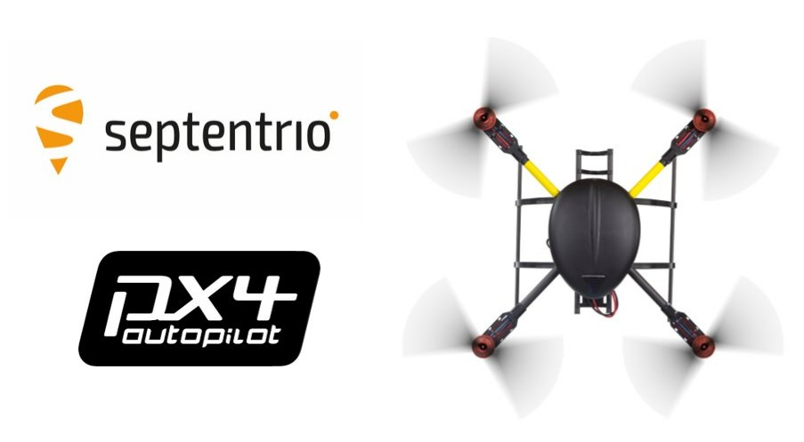
Septentrio’s latest GNSS boards and modules now support PX4 Autopilot for faster integration of high-accuracy positioning into UAVs and robots.
Both the AsteRx-m3 and mosaic receivers support PX4 Autopilot, opening the door to reliable and resilient real-time kinematic positioning.
PX4 Autopilot is one of the largest commercially adopted open-source navigation control stacks, enabling an innovative community to build and maintain drone hardware and software in a scalable way. Drones and robots, which operate autonomously or where a high level of safety is required, now benefit from Septentrio’s accurate positioning receivers, known to be secure against GPS jamming and spoofing with built-in AIM+ Advanced Interference Mitigation technology.
“Our developer community is looking forward to integrating Septentrio’s secure GNSS positioning technology into UAVs and robots, especially in those applications where reliability matters from mapping to surveillance and delivery,” said Ramon Roche, general manager, Dronecode Foundation. “Septentrio’s presence and talk at the PX4 Developer Summit will be an opportunity for developers and integrators to connect with Septentrio and to learn about the latest high-accuracy positioning tech for the PX4 ecosystem.”
“Septentrio has had a fantastic collaboration momentum with Dronecode and the larger PX4 community during the integration of Septentrio receivers into the PX4 Autopilot ecosystem,” said Gustavo Lopez, market access manager at Septentrio. “This collaboration is important because it brings resilient and secure GPS technology to the UAV industry, with tremendous potential in terms of assured positioning and improved safety.”
PX4 is supported by Septentrio’s GNSS boards and modules with both single-antenna and dual-antenna configurations, which offer either heading and pitch or heading and roll angles on top of accurate GNSS positioning.
The Septentrio PX4 driver is freely available on the GitHub.
Septentrio will demonstrate how simple it is to spoof or jam unprotected GPS receivers at the upcoming ION Joint Navigation Conference, which takes place June 6-9 in San Diego. The company will showcase how its resilient technology makes a difference for overall security and availability of positioning, navigation and timing (PNT) .
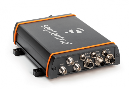
The AsteRx-U3 receiver. (Photo: Septentrio)
Septentrio will hold a GPS spoofing demonstration, as well as a detailed comparison of jamming solutions from various high-end receivers. The integration of the latest anti-spoofing authentication mechanism, Galileo’s Open Service Navigation Message Authentication (OSNMA), will also be shown.
“With our growing dependence on GPS technology, resilience of PNT is an important point of attention, especially for mission-critical applications, tactical ground or aerial vehicles as well as autonomous systems,” said Gustavo Lopez, market access manager, Septentrio. “Since the number of malicious jamming and spoofing attacks is on the rise, it is crucial to understand how various GPS receivers can be affected. We are pleased to explain and display this with specific examples at JNC this year.”
Advance Interference Mitigation (AIM+) is an interconnected set of sophisticated anti-jamming and anti-spoofing technology components, securing GPS/GNSS receivers against various forms of interference.
AIM+ is an interconnected set of anti-jamming and anti-spoofing technology components comprising a robust defense system against various forms of GPS/GNSS interference. Such resilience to jamming combined with anti-spoofing measures ensures the safety of autonomous machines, improves the security of GNSS-based infrastructure, and increases efficiency with extended PNT availability.
OSNMA anti-spoofing authentication from Galileo is available on Septentrio receivers such as the mosaic module as well as the recently released AsteRx-U3 boxed receiver. Other products such as AsteRx-SBi3 also add inertial sensors for increased protection against spoofing.
Septentrio will be at booth 220 in the ION JNC exhibit hall.
ADVA is enabling service providers to offer GPS/GNSS-backup-as-a-service (GBaaS) to answer the need for operators to safeguard services that rely on positioning, navigation and timing (PNT) information.
Along with spoofing and jamming of GNSS, in-network timing based on network time protocols (NTP) and precision time protocols (PTP) are also increasingly vulnerable to cyber threats.
As a response, ADVA is now empowering service providers to offer GBaaS and enable end users to address new guidelines and standards for redundant PNT architectures. GBaaS meets the latest recommendations for PNT homeland security, including U.S Executive Order 13905. Leveraging ADVA’s aPNT+ technology, GBaaS eliminates the risks and costs associated with GNSS dependence.
“Threats to hamper PNT capabilities are growing, and much of the world’s critical infrastructure is still without adequate protection from GNSS vulnerabilities,” said Gil Biran, general manager of Oscilloquartz, ADVA. “All of that can change when service providers are able to offer GBaaS.”
GBaas is based on ADVA’s aPNT+ platform, which leverages a suite of technologies, including multi-band GNSS receivers and management software based on artificial intelligence and machine-learning.
Service providers can offer ADVA’s aPNT+ protection as a subscription-based service as part of their service-level agreements.
ADVA’s GBaaS solution employs a combination of multi-layer detection, multi-source backup and fault-tolerant mitigation to render timing networks more secure. Embedded in all timing devices, ADVA’s Syncjack technology provides comprehensive and precise synchronization performance monitoring and analytics, enabling the Ensemble Sync Director network management suite to intelligently operate and prioritize multi-source timing feeds across the network.
Onboard multi-band GNSS receivers boost timing accuracy and also protect against attacks like jamming and spoofing. When GNSS is either unavailable or compromised, a dispersed network of autonomous cesium atomic clocks and network backup timing feeds is ready to deliver highly accurate network timing over long periods of GNSS unavailability.
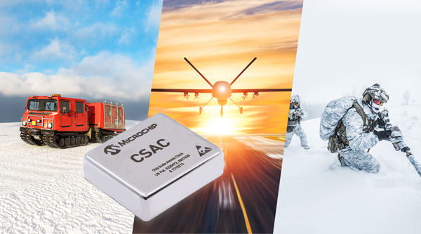
Chip-scale atomic clocks can supplement GNSS receivers to provide accurate and reliable time in GNSS-challenged environments. Photo: Microchip Technology
Accurate and reliable time is just as important as accurate and reliable location for a wide range of military and civilian applications — and GNSS receivers cannot provide either one when they are jammed. For timing, one solution is to supplement GNSS receivers with a miniature atomic clock. We asked Microchip Technology a few questions about their chip-scale atomic clock (CSAC) and Stewart Hampton, the company’s senior product line manager, responded.
How long was your SA65 CSAC in development before you announced it in August 2021? Typically, how often do you launch a new CSAC?
CSAC development started in 2001 under a contract from DARPA with Draper and Sandia laboratories. CSAC was first introduced to the commercial marketplace in 2011, and in 2016 we released an improved product design with an operating temperature range of –10 C° to +70 C°. Last year we released our CSAC SA65 with a wider operating temperature range, faster warm-up and improved frequency stability aimed at the defense and industrial marketplace. So, it has been about five years between major CSAC releases, but that may not be indicative of future products because we have also introduced specialized CSAC versions, such as the Low Noise CSAC (LNCSAC) in 2014 and the only commercially available radiation-tolerant CSAC (Space CSAC) in 2018.
What is the CSAC SA65’s drift rate?
Its typical drift rate is specified at <9 × 10⁻¹⁰ per month. Another key specification, particularly for many portable military applications, is total sensitivity of frequency to temperature (tempco) over a specified range. For the CSAC SA65, that specification is ±3 × 10⁻¹⁰ over the entire operating temperature range of –40 C° to +80 C °.
What are a few specific military use cases?
CSAC is designed into multiple military programs and used in a wide variety of military applications, particularly in GNSS-denied environments — including assured positioning, navigation and timing (APNT) modules, underwater unmanned and autonomous vehicles, software-defined radios, man-portable transceiver-based military communications, vehicle management computers, airborne reconnaissance/UAVs and GNSS-disciplined oscillators. It is also used in command, control, communications, computers, cyber, intelligence, surveillance and reconnaissance (C5ISR). The space CSAC variant is commonly used on low-Earth-orbit space defense payloads supporting such applications as low-latency communications networks, RF geolocation (geointelligence, or GEOINT), optical time transfer, alternative PNT satellites and Earth observation.
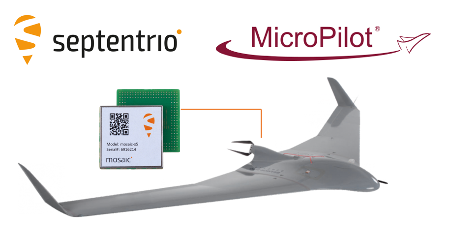
The collaboration ensures smooth and easy integration of high-accuracy GPS/GNSS positioning and professional-level autopilots into control systems where safety and reliability matter
Septentrio is collaborating with MicroPilot, maker of professional UAV autopilots.
Septentrio receivers, including the small form factor mosaic modules, as well as the OEM board AsteRx-m3, will support seamless integration of positioning and orientation into MicroPilot’s autopilot ecosystem.
MicroPilot chose Septentrio GNSS receivers for their resilience to radio interference such as jamming and spoofing, as well as security and robustness with high-accuracy real-time kinematic (RTK) positioning.
Self-interference or self-jamming is a common occurrence in UAVs, where devices such as cameras, servos or antennas, which emit electromagnetic radiation, are located close to the GPS receiver. Incorporating GNSS technology that is resilient to jamming and spoofing, in combination with reliable professional-level autopilots, is key to safe and secure flight navigation, according to Septentrio.
“Adopting new and resilient technology in UAVs is vital, and we want to ensure a smooth integration process into professional drone systems,” said Gustavo Lopez, senior market access manager at Septentrio. “We are very excited about the strong collaboration between Septentrio and MicroPilot, which now provides new alternatives to drone companies looking for safe and reliable flight operations.”
In addition to developing autopilots, MicroPilot provides supporting software and services that enable customers to use development time more efficiently, reducing time to market.
“Working closely with Septentrio gives MicroPilot the ability to better leverage resilient and robust GNSS technologies strengthening our offering to the professional UAV market for safe and reliable flight control,” said Howard Loewen, president of MicroPilot.
New Maxiva GNSS-PTP solution for broadcast and telecom facilities seamlessly connects to second-generation GNSS and other timing sources
GatesAir, specialist in television and radio technology, will soon ship a new timing and signal reference solution for broadcast and telecom facilities, the Maxiva GNSS-PTP.
GatesAir is demonstrating the Maxiva GNSS-PTP at the National Association of Broadcasters 2022 NAB Show, taking place April 23-26 in Las Vegas.
The new Maxiva GNSS-PTP is a standalone one-rack-unit solution with a sophisticated switching algorithm that assures high-precision 10 MHz and 1 PPS reference signals to mission-critical components in the signal chain, including transmitters, networking and studio equipment.
Each GNSS-PTP device feeds up to twelve 10 MHz and 1 PPS references in the technology infrastructure, removing the need to integrate a standalone timing source in each component. This substantially reduces equipment costs and installation timelines while providing a single, yet highly redundant, point of failure for engineers.
Precise timing and frequency generation is assured because of the product’s high level of redundancy, according to GatesAir. The product design includes redundant AC power supplies with built-in battery backup for always-on protection, and diverse timing sources including redundant GNSS receivers.
The GNSS receivers include OCXO temperature control to prevent frequency changes, and support GPS, GLONASS, Galileo, BeiDou and QZSS.
Timing sources also include a hardware-based precision time protocol (PTP) module and an external 10 MHz and 1 PPS reference. Built-in switching control logic ensures reliability and flexibility for selecting the highest priority source as a reference at all times.
Support for PTP v2 adds further reliability and flexibility for customers. Available as a modular option, users can prioritize PTP as a facility’s primary source, or configure PTP as a backup to one of the GNSS receivers. The PTP module can function as a master or slave and, as with the unit’s GNSS receivers, provide reliable timing and frequency reference to 12 external devices.
“GatesAir has strong experience in the area of timing and synchronization for video, audio and telecom networks, and the Maxiva GNSS-PTP represents a major step forward in timing reliability, network redundancy and cost reduction,” said Keyur Parikh, Vice President of Engineering, GatesAir. “Our Intraplex SynchroCast solutions have long provided timing and frequency reference generation to synchronize SFN networks, and the GNSS-PTP product builds upon that capability to provide precision timing to broadcast and telecom networks. Our customers can rest assured that they have a proven solution that will work in any broadcast studio, RF plant and telco facility worldwide with the rock-solid reliability they expect from GatesAir.”
GatesAir has further simplified the user experience with an integrated web interface that allows users to easily and flexibly select frequency bands for each GNSS constellation and configure timing source selection in automatic and manual modes. The user interface also offers useful visual aids, including detailed tracking maps and tables, satellite status and signal quality.
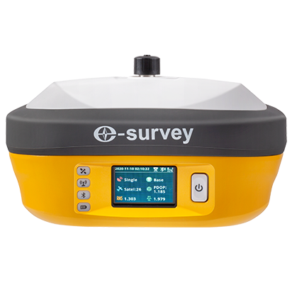
eSurvey is a specialized manufacturer of GNSS receivers and rugged handheld collectors founded in 2018 and part of the UniStrong Group. Based in Shanghai, eSurvey is serving OEM and survey companies throughout North America, as well as many other countries.
“We deliver our products to more than 50 countries, but we are relatively unknown in North America, where we are looking to develop long-term partnerships,” said Jorge Visoso, International Sales Manager. He said the company is prepared to furnish demonstrations to any interested party.
The name “eSurvey” was inspired by the philosophy of making the surveying job easier by using the best technologies, according to Visoso. eSurvey also aspires to be the confluence between high value and affordable cost.
The E800 high-precision receiver. (Photo: eSurvey)
As the international brand of the UniStrong products, eSurvey leverages the resources and the expertise of a family of companies with many years of accumulated experience. One strength of the company lies in its significant research and development advantages.
In contrast to many competitors that only supply receivers, eSurvey has a footprint in the entire value chain and is one of the few manufacturers with its own boards and chips, which translate to a more stable supply and reliable quality, Visoso said.
The company’s portfolio of GNSS receivers is highly diversified. Several models have been highly successful in South Korea and Poland, where the brand has become well known over the past years.
The most advanced and comprehensive eSurvey receiver is the E800 model, a multi-constellation and multi-frequency receiver with a micro-electromechanical (MEMS) dynamic tilt system and a 5-watt internal radio. Various engines available for this and other receiver models.
SurPad4.2 software for surveyors. (Photo: eSurvey)
eSurvey also offers its own surveying and mapping software, SurPad4.2. SurPad4.2 provides multiple operation and communication systems, has MAP and CAD functions, and has a coordinate system. It also includes a survey mode encompassing TOPO, Control, Quick Point and COGO.
Besides GNSS receivers, the company supplies precision agriculture and machine control systems as well as USV and UAV systems, which are now selling in markets such as Turkey and Spain.
A roundup of recent products in the GNSS and inertial positioning industry from the February 2022 issue of GPS World magazine.
OEM
GNSS Receiver
For tracking, telematics
Photo: u-blox
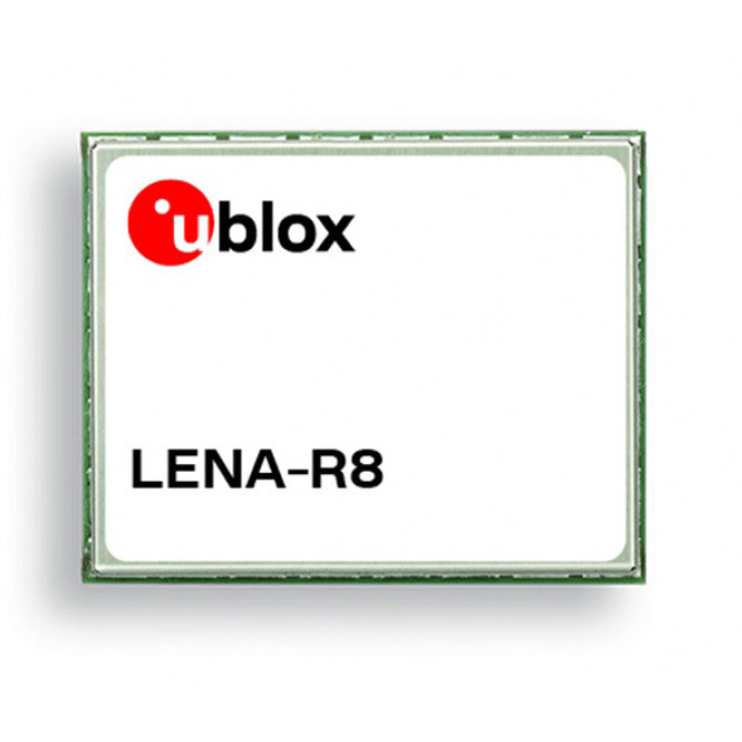
The LENA-R8 GNSS receiver is based on the u-blox M10 platform. The compact module balances cost and performance with a single antenna and primarily targets customer deployments in the Europe, Middle East, Africa, Asia, and South America regions. Designed for tracking and telematics, the module series was designed to minimize material costs and data charges. The LENA-R8 supports a broad range of frequency bands with 2G fallback, providing maximum roaming coverage for global tracking applications using a single stock keeping unit (SKU).
The low-profile triple-band HC997EXF embedded helical GNSS antenna features eXtended Filtering (XF). It is designed for precise positioning, covering the GPS/QZSS-L1/L2/L5, GLONASS-G1/G2/G3, Galileo-E1/E5a/E5b, BeiDou-B1/B2/B2a, and NavIC-L5 frequency bands. It also covers regional satellite-based augmentation systems (WAAS, EGNOS, MSAS, GAGAN) and L-band correction services. It is packaged in a light (11 g), compact form factor (60 x 25 mm). Its precision-tuned, high-accuracy helical element provides an excellent axial ratio and operates without a ground plane, making it suitable for lightweight unmanned aerial vehicle (UAV) navigation and a wide variety of precision applications.
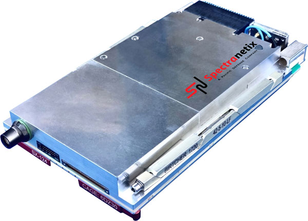
The SX-124 ruggedized 3U OpenVPX high-performance positioning, navigation and timing (PNT) card can provide timing and positioning information in a GPS-denied environment through sensor fusion. It is designed for highly integrated systems with a requirement for the U.S. Army’s C5ISR Modular Open Suite of Standards (CMOSS) and alignment with the Open Group Sensor Open Systems Architecture (SOSA) technical standard. The SX-124 can accept external sources or use its onboard GNSS receivers as reference inputs for timing and positioning data. The positioning data can be fused with internal and external inertial measurement units.
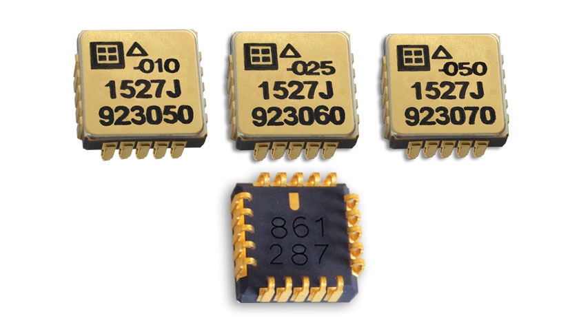
The Model 1527 series is a family of miniature, radiation-tested, tactical-grade micro-electromechanical (MEMS) accelerometers. Offered in three full-scale acceleration ranges — ±10 g, ±25 g and ±50 g — the series is designed to support a variety of critical space electronics testing requirements, including those of spacecraft, satellites and CubeSats. Their small bias and scale-factor temperature coefficients, excellent in-run bias stability and zero cross-coupling make the Model 1527 series particularly well-suited for spacecraft electronics testing applications requiring low power consumption (+5 VDC, 6.5 mA), low noise, long-term measurement stability in –55° C to +125° C environments, and performance reliability under intermittent radiation exposures.
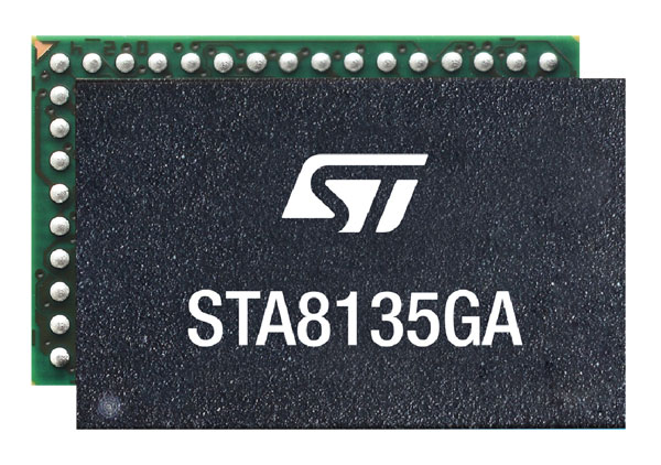
The STA8135GA automotive-qualified GNSS receiver is designed to deliver the high-quality position data needed by advanced driving systems. Part of the Teseo V family, the STA8135GA integrates a triple-band positioning measurement engine. It also provides standard multi-band position-velocity-time (PVT) and dead reckoning. The multi-constellation receiver delivers raw information for the host system to run any precise-positioning algorithm, such as PPP/RTK (precise point positioning/real-time kinematic). The receiver can track satellites in the GPS, GLONASS, BeiDou, Galileo, QZSS and NAVIC/IRNSS constellations.
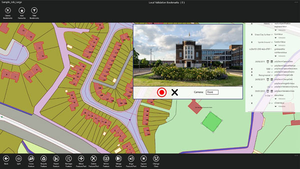
Survey application 1Edit now has increased support for photos and 2.5D data. 1Edit 3.1 allows users to attach feature photos, including automated geotagging, which enables surveyors to visualize assets and fine tune observations. Also included are new validation functions and improved handling for heights (2.5D data), typically useful for detailed asset and land-management surveys. Enhanced styling, including bitmap fills and dashed lines, make it easier to identify and classify different asset types during surveys. Additional control of editable layers and fields provides protection for non-editable data and protects the data quality. Significant improvements to rendering of thematic mapping enhances the speed and fluidity of the intuitive user interface.
The latest version of Surfer surface mapping software has improved map-making functionality and data exporting capabilities. Surfer is used by more than 100,000 people worldwide, many involved in oil and gas exploration, environmental consulting, mining, engineering and geospatial projects. It provides fast and powerful contouring algorithms, enabling users to model data sets, apply an array of advanced analytics tools, and graphically communicate the results. Frames now have outlines and background fill colors to make them easier to read when placed on top of maps and attribute data can now be exported as numeric data.
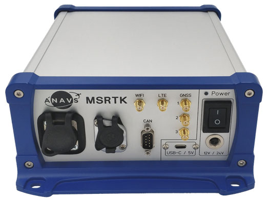
The Multi-Sensor (MS-) RTK/PPP device is a turnkey system easily integrated into surveying applications. The module includes up to three multi-frequency, multi-GNSS (GPS + Galileo + Glonass + BeiDou) receivers, a MEMS IMU, a barometer, a CAN interface for reception of vehicle data (wheel odometry and steering angle), and an LTE module for reception of RTK/PPP corrections. ANavS sensor fusion performs tight coupling of all sensor data with an Extended Kalman Filter (EKF). Various interfaces can connect additional sensors (such as camera or lidar) or output position information.
The HD-MapBox integrates high-precision map data based on high-precision positioning. Fusing data from a GNSS receiver, IMU, ADAS camera, vehicle dynamics and HD maps, the HD-MapBox can achieve a lateral error of less than 8 inches (0.2 meters) and a longitudinal error of less than 6.5 feet (2 meters) with a 95% confidence interval, providing an accurate reference for highway pilots and automated valet parking. Even if both GNSS and lane line detection are not available, the HD-MapBox can still enable vehicles to keep inside the lane for at least a quarter mile (400 meters).
Esri ArcGIS IPS is an indoor positioning system that adds a blue dot to indoor maps, enabling users to locate their current position inside a building in the same way GPS enables outdoor location indicators. It uses an alternative technology to enable real-time positioning and navigation inside buildings. It also provides live location sharing and tracking, location data capture and analytical insights. ArcGIS IPS is available for users of ArcGIS Indoors, an indoor mapping system for smart building management, and ArcGIS Runtime SDKs, which enable the indoor positioning capability in custom-built apps.
Space Codesign Systems has received funding from the European Space Agency (ESA) to support the design of a spaceborne GNSS receiver. The company is a provider of an end-to-end automated solution, from high-level application specification to physical board compilation.
The spaceborne receiver will target system-on-chip (SoC) field programmable gate arrays (FPGA). SpaceStudio software by Space Codesign Systems is a development environment that eases the design flow of advanced algorithms targeting FPGA technology without the inherent complexity of FPGA.
In avionic systems, transition from federated avionics architectures to integrated modular avionics (IMA) is observed. IMA architectures provide a shared computing platform, communications, and input/output resource pool that is partitioned by multiple tasks of differing design assurance criticalities. A similar transition is occurring in the world of satellite systems.
“The main objective of the project is to add features to explore different architectures and hardware/software partitions for spaceborne GNSS receivers, such as [for] GPS and Galileo, operating in both low Earth orbits (LEOs) and high Earth orbits (HEOs),” said Guy Bois, founder, Space Codesign System.
The project will also support the XtratuM Next Generation (XNG) hypervisor for mixed-criticality systems in the virtual platform offered by SpaceStudio, where multiple tasks with different criticality and certification assurance levels are integrated using a shared computing platform.
The funding is under ESA’s Navigation Innovation and Support Programme (NAVISP) Element 2, made possible thanks to the Canadian Space Agency’s participation in the NAVISP. NAVISP is an optional program of ESA initiated in 2017 to support the generation and introduction of innovation in various positioning, navigation and timing (PNT) market segments. The main goal of NAVISP is to generate innovative concepts, techniques and systems linked to the highly competitive and evolving global market for PNT technologies. Element 2 continues to demonstrate its relevance, with more than 120 projects incubated so far.
TerraStar-C PRO is the first global correction service from Hexagon to incorporate RTK From the Sky technology to achieve RTK-level accuracy in three minutes with 99.999% availability
In late 2020, Hexagon’s Autonomy & Positioning division announced its technological breakthrough of global RTK From the Sky, demonstrating a future where instantaneous PPP and global RTK-level accuracy is possible.
Integrating this innovation into the core of TerraStar-C PRO, NovAtel’s corrections service, is the first phase in implementing RTK From the Sky technology into the company’s diverse portfolio of correction services for users worldwide.
As a result, TerraStar-C PRO has become the fastest global correction service to provide centimeter-level accuracy, not just in open-sky environments but also across challenging conditions created by buildings and foliage, according to Hexagon | NovAtel.
“RTK From the Sky technology is the foundation that enables our global correction services to be world-leading across agriculture, automotive, defense, survey, marine and autonomous applications,” said Michael Ritter, Autonomy & Positioning division president and CEO. “Our dedication to research culminated in an industry-changing technology; we’ll continue that commitment by providing the best positioning experience in speed, accuracy, availability and reliability anywhere in the world.”
TerraStar-C PRO now converges in less than three minutes by utilizing quad-band receiver and antenna technology to leverage modernized BeiDou III, GPS III and Galileo E6 signals. The resulting process generates state-of-the-art corrections for all GNSS frequencies.
Hexagon is a consistent innovator in GNSS, as seen in its role in developing RTK and PPP solutions. With this next-generation modernization of PPP correction generation and algorithm development, the company continues this tradition in providing the highest quality and best performing global positioning experience to users with land- and air-based applications.
“It’s been a privilege to collaborate across the division to develop RTK From the Sky technology and leverage our collective expertise in correction generation, PPP algorithms and the entire positioning ecosystem,” said Leos Mervart, head of PPP algorithm development at Hexagon’s Autonomy & Positioning division. “I’ve worked with PPP technologies since the beginning of my career and am proud to say that this is a new era of what global positioning can look like.”
The TerraStar-C PRO improvements are accessible now through the 7.08.10 firmware release for users on OEM7700, OEM719 and OEM729 cards and their associated enclosures for land and air applications.
Future firmware releases will include global RTK From the Sky technology throughout Hexagon’s correction service portfolios for its global client base, including precision agriculture and marine applications.
To learn more about TerraStar correction services or to request a free 5-day trial, visit NovAtel.com/TerraStar.
Swiss company u-blox designs and manufactures GNSS receivers used in the automotive market, including driverless cars, and for micro-mobility devices, such as the Bird scooter.
In deep urban canyons, the biggest challenge for positioning cars is achieving sufficient accuracy despite multipath, said Aravinthan Athmanathan, product manager for the company’s Automotive GNSS line of receivers. “The challenge for autonomous driving is reliable lane-accurate positioning and integrity.”
The company develops its own dead-reckoning algorithms, which use data from an inertial measurement unit (IMU) and wheel speed sensors. “We also provide dual output, so the end customer can choose whether to use GNSS only or a sensor-fused solution,” said Athmanathan. This is especially challenging at the sub-meter accuracy level.
Different Uses, Different Sensors
Different automotive use cases require different GNSS receivers. To meet this challenge, u-blox offers the NEO-M9L for standard precision and the ZED-F9K for high precision, depending on the customer’s needs. Additionally, it is investing a lot “in functionally safe GNSS and in being the GNSS enabler for car manufacturers,” said Karin Steinhauser, the company’s senior marketing communications manager.
For navigation with meter-level accuracy, the NEO-M9L is integrated with dead-reckoning technology and sensor fusion, using algorithms that process sensor data from the IMU and from wheel-speed sensors. It can provide reliable location data in challenging environments, such as urban canyons, where multipath becomes an issue, or tunnels, where GNSS signals are partially or totally denied, Steinhauser said. Additionally, the NEO-M9L can operate in temperatures of up to 105° C, making it suitable for integration on the roof, behind the windscreen, or inside hot electronic control units. The NEO-M9L addresses the use cases in urban environments for both navigation and systems, such as Europe’s eCall, that provide an automated message to emergency services following a road crash, including the precise location of the accident.
The ZED-F9K, on the other hand, is well suited for use cases at the higher levels of advanced driver assist systems (ADAS) defined by the Society of Automotive Engineers (SAE), which require decimeter-level accuracy. “At L3 and above, you need correction services with integrity to allow for trustworthy and reliable GNSS positioning,” Steinhauser said. “We have partnerships with Bosch on projects to develop functionally safe GNSS solutions based on a ISO26262-certified version of u-blox generation 9 GNSS technology.” The ZED-F9K is a multi-band receiver that uses GPS signals on L1-L2 and Galileo signals on E5b. “We also have a special set of features adequate for the ADAS and the autonomous driving features,” Athmanathan said.
Image: 3alexd/E+/Getty Images
Bottlenecks
One of the factors limiting how quickly u-blox can roll out solutions based on the ISO 26262 standard (titled “Road vehicles – Functional safety”) is that highly autonomous systems require more integration work by the customers, said Alex Ngi, the company’s product manager for High Precision GNSS. “The first systems are now available.” Another hurdle, he pointed out, is the legal framework for deploying autonomous driving systems. “The regulations about how things need to be tested, and the liabilities for when systems fail, affect how quickly these systems can get adopted.”
GNSS can be used as a complementary technology to enable absolute positioning for systems that fuse data streams from cameras and lidars, such as those used for ADAS level 2 applications. “Fusing all this is computationally intensive and requires high processing power, such as NVIDIA GPUs, which tend to be very hot systems. We see a lot of requirements for very high-temperature GNSS receivers, because our receivers are often co-located with these hot systems.”
Of course, u-blox does not simply hand its modules to Bosch and car manufacturers and say, “You take it from here.” Design and integration is an iterative process. “We bring in the GNSS know-how and integration support and Bosch brings in the functional safe automotive development know-how,” Ngi said.
Dead Reckoning and Map Matching
For the automotive market, u-blox has more than 20 years of experience with dead reckoning. “The sensor-fusion solution receives data from both the GNSS and the IMU, and we provide the complete final solution,” Athmanathan explained.
The system also aids the receiver by providing it external map data. “If you’re driving your car northbound and the GNSS receiver tells you that it’s headed in the opposite direction, or that you’ve jumped over to the lane to the other side of the highway, clearly that cannot be right,” Ngi said. “Map matching relies on simple messages that come into our receivers to give us positive feedback on our measurements.”
For non-automotive applications, u-blox makes the ZED-F9R. It is used, for example, in robotic lawnmowers, very common in Asia and Europe, which require centimeter-level accuracies. “That’s why it focuses on delivering corrections using SPARTN, which can be a continent-wide data stream,” Ngi said. “We also make the design so that it’s very easy to integrate and enables the designers to easily pass the corrections to their receivers fully encrypted. This way, the value of the data is delivered to the lawnmower without exposing it to the system designer, so that we don’t need to go check every design to see whether somebody is leaking secured correction services.”
By the end of November, according to u-blox, updates of the ZED-F9P multi-band GNSS receiver will include decryption of the SPARTN correction data and a 95-percentile protection level. The protection level increases the trust non-safety-critical applications can place in its position output. By continuously outputting the upper bound of the maximum likely positioning error, referred to as the protection level, the receiver lets autonomous applications, such as UAVs or robotic lawnmowers, make efficient real time path planning, increasing the quality of their operations.
Guiding eScooters and EVs
In some places, Ngi pointed out, e-scooters are required to use a bike lane, which might be only two or three feet wide and may not be along the side of a building as it would be on a sidewalk. “The ZED-F9R is a much more flexible solution than camera systems that only know sidewalks or bike lanes.” Bird uses it to throttle driving speeds to match speed limits, which change from one location to another. “It is also much more scalable for them as opposed to such solutions as using UWB [ultra-wideband] beacons to fence off different areas, which are not really scalable for a company that wants to deploy solutions to hundreds of cities.”
Xpeng Motors, a manufacturer of smart electric vehicles, uses u-blox F9 GNSS receivers, which use signals from all four GNSS constellations, in its P7 super-long-range sports electric vehicle sedan. The vehicle uses ADAS for navigation-guided driving, automated parking and autonomous driving. For instance, once a navigation destination is set on a specific highway, the P7 will follow the route guidance to execute autonomous lane changing, switch to high-speed routes, and select the optimal route in real-time.