Tag: GNSS

  • AOGS Conference seeks abstract submissions

    The Asia Oceania Geosciences Society (AOGS) 2016 conference will be held in Beijing on July 31-Aug. 5. Abstract submissions are being accepted until Feb. 19. In particular, organizers are looking for papers for a session on GNSS positioning and atmospheric sounding.

    AOGS was established in 2003 to promote geosciences and its application for the benefit of humanity, specifically in Asia and Oceania and with an overarching approach to global issues.

    The Asia Oceania region is particularly vulnerable to natural hazards, accounting for almost 80% human lives lost globally. AOGS is deeply involved in addressing hazard-related issues through improving our understanding of the genesis of hazards through scientific, social and technical approaches.

    AOGS holds annual conventions providing a unique opportunity of exchanging scientific knowledge and discussion to address important geo-scientific issues among academia, research institution and public.

    Deadline for abstract submission is Feb. 19 Beijing time.

  • China launches 21st Beidou navigation satellite

    Source: GPS world staff
    A Long March-3C carrier rocket carrying the 21st satellite for the BeiDou Navigation Satellite System lifts off from Xichang Satellite Launch Center,southwest China’s Sichuan Province, Feb. 1, 2016.

    China has launched its 21st BeiDou satellite into orbit, according to Xinhua News Agency, the official press agency of the People’s Republic of China.

    The launch took place at 3:29 p.m. Beijing Time (07:29 UTC) on Monday, Feb. 1.

    Launched from Xichang Satellite Launch Center in the southwestern province of Sichuan, the satellite was boosted by a Long March-3C carrier rocket into medium Earth orbit (MEO).

    A video of the launch appears here. Also, below is amateur video of the launch.

  • Prize for GNSS opinions

    Geomatics specialist Larry Tinney won the $50 gift card in our January drawing among takers of the Reader Poll. You can win too! Take the poll below by Feb. 22 to answer the question: What is the biggest challenge in simulating GNSS environments for testing products under development? All poll takers will be entered in a drawing for a $50 gift card.

  • Out in Front: Resilient navigation and timing

    Space maps of some of 13,986 satellites, below, and some navigation satellites, above (courtesy Esri).
    Space maps of some of 13,986 satellites, below, and some navigation satellites, above (courtesy Esri).
    Alan Cameron
    Alan Cameron

    Advocacy in the U.S. capital urges augmentation of GPS/GNSS with eLoran and other “complementary terrestrial PNT services to increase resilience.” See the Resilient Navigation and Timing Foundation’s website, rntfnd.org. This is assuredly a good thing, a worthy cause.

    I’ve come to believe, however, that true resilience goes beyond what we normally think of as position and timing sensors. Stimulus comes from a keynote lecture by Dawn Wright, Esri chief scientist, at the 2015 American Geophysical Union Fall Meeting. I hope Esri or the AGU will publish the lecture or post the video. For now, bear with my limited rendition.

    In “Toward a Digital Resilience, with a Dash of Location Enlightenment,” Wright describes the new science of big data: the flood of info from satellites, sensors and other measuring systems; the issues inherent in large data sets; and the insight discovered through their manipulation and exploration. She talks to geographic information systems professionals, software makers and users, but her remarks resonate beyond that associated industry sector and well into that of PNT hardware, where we live.

    Integrate, integrate, integrate! Interoperability and crosswalking with other systems and data sets. To make it reproducible, make it virtual — as in virtual, living journals. These are three of the eight ideas toward digital resilience that she espouses, making communities more resilient with tools and data.

    I’ll return to this in a later editorial; there’s much around which still to wrap my head. But here’s the moral: resilient PNT will ultimately mean more than complementary sensors. It will entail a seamless mesh of hardware and software, of pre-existing and new data, much of it from sources we don’t currently consider PNT-relevant, of input from amateur app makers and users and more.

    It’s a big universe out there.

  • 12 GNSS birds for December, and a document under the tree

    Just what every satnav engineer wanted for the holidays: a new Interface Control Document to unwrap under the tree. On Nov. 30, the European Commission (EC) published version 1.2 of the Galileo Open Service Signal In Space Interface Control Document (OS SIS ICD v1.2). The document provides the information for receiver and chipset manufacturers, application developers and service providers to process and make use of the open signals generated by the Galileo satellites. This most recent iteration incorporates feedback from receiver manufacturers and other stakeholders.

    The Galileo OS SIS ICD v1.2 specifies:

    • Galileo signal characteristics.
    • Characteristics of Galileo spreading codes.
    • Galileo message structure.
    • Message data contents.

    Key new features in version 1.2 include:

    • An annex with numerical examples of FEC coding and interleaving.
    • A revised and simplified license agreement.
    • Cross-reference to a companion document, “Ionospheric Correction Algorithm for Galileo Single Frequency Users,” containing details on the ionospheric model used for Galileo.

    In addition, a number of minor editorial improvements including corrections and clarifications have been made.
    The Galileo OS SIS ICD v1.2 document can be downloaded here.

    The Ionospheric Correction Algorithm for Galileo Single Frequency Users document can be downloaded here.

    Twelve Birds for December

    Also timely for end-of-year celebrations, Galileo satellites 11 and 12 lifted off together on Dec. 17 atop a Soyuz rocket, and successfully deployed in space four hours later. The pair effectively doubles the number of Galileo satellites in space over the last nine months.

    Five satellites are now set operational to the user. Once 9 and 10 (launched in September 2015) as well as 11 and 12 are set operational, a total of nine usable satellites will be in orbit. Satellites 5 and 6 may be partially usable at some point.

    “Along with the ground stations put in place around the globe, this brings Galileo’s completion within reach,” said Jan Woerner, director general of the European Space Agency.

    “Production, testing and launch of the remaining satellites are now proceeding on a steady basis according to plan,” added Didier Faivre, ESA’s director of Galileo and navigation-related activities.

    Starting with launches in the third quarter of 2016, four satellites at a time will rise into orbit on all except one date, which remains at two. This accelerated deployment should bring 30 satellites on line — 24 operational and six orbit spares — by 2020 for full operational capability of the European GNSS. Initial operating capability is foreseen by the end of 2016.

    Service Centre and Help Desk

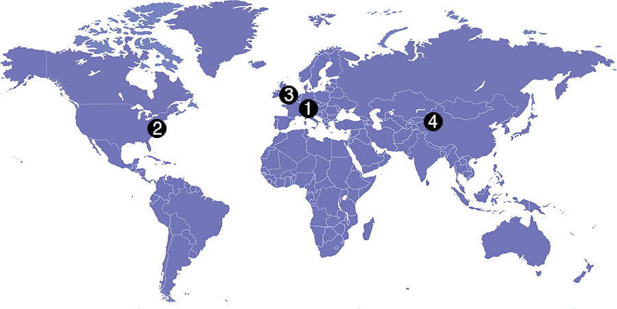
    The European GNSS Agency (GSA), responsible for Galileo service provision as directed by the EC, is developing the European GNSS Service Centre (GSC), which provides the single interface for information and help to users of the Galileo Open Service (OS). The GSC will eventually operate on a 24/7 basis and offer a range of services, including hosting the Galileo User Helpdesk, providing the interfaces between the Galileo System and OS users and hosting a centre of expertise for OS service aspects.

    Related links:
    Galileo Programme Reference Documents
    Video: “Message received: Ensuring that navigation devices are ready for Galileo”
    European Commission Galileo

    Information, images and videos referenced in this story all come courtesy of the GSA.

  • Expert Opinions: How many GNSS signals for a consumer-grade device?

    Expert Opinions: How many GNSS signals for a consumer-grade device?

    Question: What is the optimum number of GNSS signals to include/process in a consumer-grade PNT device?

    Mattos-philip
    Philip Mattos Receiver Designer Consultant

    A: A chip should support four signals, being GPS/GLONASS/Galileo/Beidou, but only process two of them — choice depending on region, geopolitical sensitivity, constellation availability — dropping to one to save power when satellite availability is good. Two constellations give enough satellites for accuracy and availability in obstructed environments. Which two depends on needs regarding cost, power and so on, GPS and Galileo being better in the future for less power, but GPS and GLONASS being better today.


    Greg Turetzky<br /> Principal Engineer<br /> Intel
    Greg Turetzky

    Principal Engineer

    Intel

    A: The receiver should be capable of processing sufficient signals to provide optimum performance in all expected use cases. This means it should be able to support all GNSS and augmentation systems to provide maximum robustness to blockages and interference. The management of receiver resources to accomplish that is highly dynamic on individual epochs and should be invisible to the user in consumer-grade devices. Optimizing tradeoff between performance, power and cost is where the secret sauce lies.


    Ruslan Budnik CEO SPIRIT Navigation
    Ruslan Budnik
    CEO
    SPIRIT Navigation

    A: Two constellations give reliable, fast cold start even after long overseas flights. There is room for improvement in challenging conditions, so application of three constellations is the saturation point. Choose the best combination in different parts of the globe. In Russia that should be GLONASS + 2, in China BeiDou + 2, in Europe Galileo plus two, GPS + QZSS + another one in Japan, and so on. Navigation chipmakers should support all operating satnav systems to offer the best combination, taking into account battery drain.

  • Seen & Heard: GNSS and PNT in the news

    Seen & Heard: GNSS and PNT in the news

    A snapshot of interesting stories involving GNSS and position, navigation and timing (PNT) technology from around the world

    Hover over a map, then the dots, to view the stories.
    (Map: iStock.com/nadla)

    2015 2016 2017 2018 2019

    April 2019

    Map: iStock.com/nadla
    View the April Seen & Heard — which covers global quantum communication, pigeon scientists and more — here.

    March 2019

    Map: iStock.com/nadla
    View the March Seen & Heard — which covers using GNSS to signals to obtain rain information, a Galileo constellation mobile app and more — here.

    February 2019

    January 2019


    December 2018

    November 2018

    October 2018

    September 2018

    August 2018

    July 2018

    May 2018

    April 2018

    March 2018

    February 2018

    January 2018


    December 2017

    November 2017

    October 2017

    September 2017

    August 2017

    July 2017

    June 2017

    May 2017

    April 2017

    March 2017

    February 2017

    January 2017


    December 2016

    November 2016

    October 2016

    September 2016

    May 2016

    April 2016

    March 2016

    February 2016

    January 2016


    December 2015

    November 2015

  • Research Online: HF beacon navigation, inertial sensors and GNSS-INS integration

    Photo: HF Beacon NavigationHF Beacon Navigation

    Navigation using High-Frequency Ground Beacons and Ionosphere Model Corrections, by Yoav Baumgarten and Mark L. Psiaki, Cornell University.

    A new navigation concept relies on passive one-way ranging using pseudorange measurements of high-frequency (HF) beacon signals reflected off the ionosphere.

    This is being developed as a possible alternative to GNSS positioning and timing services, with benefits in costs and system redundancy. The HF signals are transmitted from ground-based beacons, traveling from known locations to the unknown user equipment (UE) location along ray paths that reflect off the Earth and the ionosphere. If a set of beacon signals reaches the UE receiver with sufficient geometric diversity, then the three-dimensional position and the clock offset of the receiver can be determined.

    Presented at ION GNSS+ 2015.

    Inertial Sensors

    Dynamic Stochastic Modeling of Inertial Sensors for INS/GNSS Navigation, by M. Wis, Deimos Space, Spain; Ismael Colomina, GeoNumerics, Spain.

    Researchers performed a series of experiments with a low-cost inertial device rigidly attached to a navigation-grade reference IMU and found a direct relationship between the low-cost IMU errors and the high-order dynamics. Preliminary results suggest an approach of low-cost sensor modeling that might help reduce some of the errors inherent to the dynamics applied to the sensors.

    Presented at ION GNSS+ 2015.

    GNSS-INS Integration

    Quasi-Tightly-Coupled GNSS-INS Integration with a GNSS Kalman Filter, by Bruno Scherzinger, Applanix Corporation, Canada.

    This method, intended for integration of an existing GNSS navigation engine into a GNSS-INS closed-loop configuration with little/no modification of the navigation engine, uses a range measurement model matrix typically used to compute dilutions of precision (DOP) to identify the observable subspace in the time-space frame generated by the available satellites and project the loosely coupled INS-GNSS Kalman filter position measurement into this subspace.

    Presented at ION GNSS+ 2015.

  • Expert Opinions: FAA UAV registration requirement

    Q: What do you think of the FAA requirement that all UAV purchasers register their devices?

    Lydia Bock President and CEO Geodetics Inc.
    Lydia Bock
    President and CEO
    Geodetics Inc.
    A: We need a pragmatic and sensible response to the integration of UAVs into the civil airspace, balancing safety of civil aviation and the economic benefits associated with the emerging markets and applications of UAV technologies.

    Clearly maintaining flight safety in the national airspace is critical. A balanced approach would include registration of UAVs, education for hobbyists and FAA flight certifications for commercial operations.

    New technologies for automated sense-and-avoid should be investigated, and their certification for use should be streamlined.


    John Studenny Director System Engineering Esterline - CMC Navigation Systems
    John Studenny
    Director System Engineering
    Esterline – CMC Navigation Systems
    A: Registration of all radio-controlled (RC) aircraft or UAVs upon purchase may be too broad or harsh, and may conflict with current freedoms already enjoyed by hobbyists.

    However, as capabilities (altitude, speed, flight duration, payload capacity) increase beyond what today’s RC aircraft or UAVs can deliver, regulations and registration may be required.

    It comes down to UAV capability and how the UAVs are used. That needs to be the focus of any regulation or enforcement.

  • Out in Front: GLAC issues BeiDou market projections


    Alan Cameron
    Alan Cameron

    We have grown accustomed to seeing market projections for some GNSS, notably Galileo. European GNSS Agency economists have done a remarkable job analyzing and predicting the global market over the past five years. Business intelligence firms in the U.S. periodically report on the power of GPS driving, or participating in, significant portions of the U.S. economy. Figures from Russia are scant but do occasionally emerge, even if they are difficult to integrate into a meaningful global picture.

    Now the Global Navigation Satellite System and Location-based Services Association of China (GLAC) has issued a report asserting some lofty, often staggering, and occasionally surprising statistics and projections.

    • China’s satnav system is helping generate $31.3 billion for the country this year. That benefit is expected to double in five years.
    • 70 percent of China’s population uses smartphones. That’s 980 million people who may be sending location requests at any given time. This constitutes the biggest growth sector found by the GLAC.
    • China’s installed base of navigation devices in private vehicles lags behind the United States, at less than 500,000, or 5 percent of cars, but 20 percent of 1 million commercial vehicles in China use products that access BeiDou technology.

    “Sky’s the Limit for BeiDou’s Clients,” crowed China Daily. Meanwhile, halfway round the world in Prague, the Czech Republic, Jing Li of the China Transport Telecommunication & Information Center, reported to a conference of the International Association of Institutes of Navigation that a BeiDou global service will be provided by 2020. The National Differential BeiDou Ground-Based Augmentation System will have 175 reference stations, with more than 1,000 network stations and a space-based augmentation system to boot. So far, the system has hit every benchmark.

    Some market projection figures strike one as wildly optimistic, while others have proved true. Some GNSS appear to grow or modernize in fits and starts. But BeiDou appears steadily ascendant.

  • Galileo 11 and 12 mission to launch Dec. 17

    Galileo satellites 11 and 12 will be launched atop of the legendary Soyuz rocket on Dec. 17 from Europe’s Spaceport in French Guiana. Ten years after the launch of GIOVE A, on Dec. 28, 2005, Galileo is now a reality.

  • ION GNSS+ 2015: IFEN features GNSS simulator

    Dr. Günter Heinrichs, head of customer applications for business development at IFEN, talks about the new features of Ifen’s GNSS simulator at ION GNSS+ 2015.