Apple is working on its own autonomous car, according to Reuters. An auto industry source told Reuters that the tech giant is gathering information and parts to make a prototype for the autonomous electric vehicle — the entire car, not just automotive software or components.
“They don’t appear to want a lot of help from carmakers,” said the unnamed source.
Apple is gathering advice on parts and production methods, focusing on electric and connected-car technologies, while studying the potential for automated driving, the source told Reuters.
“Fully automated driving is an evolution. Carmakers will slowly build the market for autonomous cars by first releasing connected and partially automated cars,” the source said. “Apple is interested in all the potential ways you can evolve the car; that includes autonomous driving.”
Meanwhile, Sony is also turning to autonomous vehicles, according to USA Today. The electronics giant is teaming up with Japanese robotics company ZMP to develop self-driving automobiles, reports the Financial Times. Sony invested 100 million yen (about $842,000) in ZMP.
The Indian Space Research Organization (ISRO) will launch Google’s Skybox Imaging satellite by the end of this year, according to The Asian Age.
ISRO will launch its first U.S. satellite from the Satish Dhawan Space Center in Sriharikota, according to the news brief.
Google acquired Skybox Imaging in August of 2014 to develop advanced GPS mapping using its own network of satellites, according to the company’s blog. The Asian Age says Skybox had previously entered into an agreement with Antrix Corporation.
The article says the satellite will launch alongside a main payload this year.
Google has reaffirmed its commitment to Project Tango, moving it from the Advanced Technology and Projects Group (ATAP) to a new home inside the company itself, reports Digital Trends.
Project Tango, unveiled in 2014, aims to make it possible to create a 3D model of the space around a smartphone. For instance, a user can map an area, such as a home, by walking around with the phone.
ATAP is Google’s mobile-focused project development laboratory, and shifting Tango from there to a new base suggests Google is happy with the way the project is progressing and ready to take it to the next level, Digital Trends reports.
Google has been collaborating with universities, research labs, and industrial partners in nine countries to concentrate the past 10 years of research in robotics and computer vision into a mobile phone.
Project Tango devices contain customized hardware and software designed to track the full 3D motion of the device, while simultaneously creating a map of the environment. These sensors allow the device to make over a quarter million 3D measurements every second, updating its position and orientation in real-time, combining that data into a single 3D model of the space around you.
Early prototypes run Android and include development APIs to provide position, orientation, and depth data to standard Android applications written in Java, C/C++, as well as the Unity Game Engine.
Advanced Search Engine Replaces Google Local Search in 122 Countries
deCarta, Inc., an independent LBS platform company, is now providing the local search function for a worldwide, top-five mobile handset manufacturer. deCarta has been hosting and running the search service since August 7 using its advanced geosearch engine — L2 — and has replaced the search service previously provided by Google. The service delivers millions of responses per day to this handset manufacturer’s local search and mapping application to users in 122 countries.
deCarta’s L2 is a high-performance, scalable local search engine with single line input and intuitive user interface. deCarta sources and indexes map and POI (points of interest) content from a wide variety of sources globally but also enables customers to easily index, control and search on their own content. The customer service announced utilizes TomTom map and POI content.
deCarta’s L2 can be used as a pure geocoder for address search, or for POI search, or simultaneously as a combination of the two mixed in a single-line search query — with the additional ability to tune this behavior at runtime. This gives developers maximum flexibility and creativity in producing their applications. deCarta recently expanded country coverage to enable its customers to offer global services.
The L2 Search engine is an integral component of deCarta’s LBS platform which provides specialized geospatial technologies for maps, routing, navigation, geocoding, local search and geo-data integration and processing. deCarta provides its white-label LBS platform to companies that wish to offer their own customized, branded LBS services as opposed to utilizing industry standard services such as Bing or Google.
deCarta has two deployment options for its platform: a hosted LBS Platform Service (PaaS) or, alternatively, customers can self-host either on-premise or in a cloud service such as Amazon’s AWS. Both approaches utilize deCarta’s REST API architecture and can scale to support billions of maps and searches and millions of users per month.
“We are quite happy with the market reaction to L2 since its introduction last year,” said J. Kim Fennell, CEO of deCarta. “We’re seeing large mobile, telematics and automotive customers switch to L2 in competition against other local search engines and geocoders such as Google, Bing, Nokia/Here and Pitney Bowes. Customers appreciate L2’s technology advantages, customization capabilities, flexible content offerings, less restrictive license terms and our superior customer service — all of which creates a more satisfied end customer experience.”
L2 enables deCarta’s customers to offer flexible, advanced local search capabilities that are on par with Google Maps but beyond other search engines. Examples include:
Single line entry of POI or address or both
Fast typeahead, predictive entry – ideal for mobile devices
High tolerance for misspellings and partial entries
Random ordering of address parameters
Search for a POI near a POI such as “ATMs near AMC Theater” or “Parking near SFO”
Search for POI near a specific address, i.e. “Parking near 1234 Main Street”
Furthermore, L2 can be integrated with deCarta’s patented “Search Along A Route” technology. This combined with the ability to index custom content and boost result rankings gives automotive OEMs and service providers the ability to offer more advanced and helpful “driver-centric” connected car services.
Half the year is over. It’s gone. Now it’s time to figure out where the location industry is going for the remainder of the year. One analyst (actually, several) believe that the industry, fueled by indoor location and place-based advertising, is around $14 billion right now — with no place to go but up — given some bump in consumer awareness. In other news in a busy month, Google bought Skybox Imaging for $500 million in cash.
As the mid-point of 2014 arrives, with a few big location industry deals already consummated, there is a chance for industry executives to study what is going to be a strong niche market in the months ahead.
One analyst believes a big location niche is indoor analytics and proximity marketing, which is defined as nearby a store or within a business. “The latter would include ads and coupons. We’ve estimated that roughly $3.5 billion of potentially $14 billion, or so, in 2014 U.S. mobile ad revenue, will be location-based [broadly defined],” said Greg Sterling, founder of Sterling Market Research. “Of that, about $1.4 billion will be ‘geofenced’ or nearby.”
Sterling believes that the in-store component is still in an embryonic stage. “There are billions of dollars of coupons distributed every year, but most of that is still print. Some of that is in-store distribution and redemption,” he said. “A portion of that over time will migrate to mobile in or near stores.”
Sterling said there are billions of dollars available from proximity marketing, but it will take time. He cites “Mapping the Indoor Marketing Opportunity,” a report he authored for Opus Research, that says the market for indoor location and place-based marketing/advertising will surpass $10 billion by 2018. (See a preview of the report here.)
In a published report, Sterling admitted that he was nervous about the $10 billion number, but it may turn out that the figure could be conservative because of the software licensing from indoor markets.
Sterling says that while indoor positioning has been important to the older location business, it is still in its early stages. The big deal is mobile, which has brought new attention and interest to location, he said. “Indoor location will feed mobile and online marketing with data and analytics as well as targeting opportunities,” he said.
Many executives and analysts in the location industry have marginalized privacy issues; some even say it is dead with opt-in approval by consumers. However, privacy issues will continue to hamper the location industry, Sterling said.
“Privacy is far from dead. Indeed, it’s on the rise, and a major issue that everyone in the location and mobile segments needs to tackle head on,” Sterling said. “Denial, delay and obfuscation will result in regulatory intervention and/or consumer fear/rejection.”
In a blog, Sterling said that the San Francisco-based Philz Coffee chain no longer will be tracking customers after a local ABC affiliate revealed they were using Euclid retail analytics. Sterling said the ABC report acted as if it had uncovered a big government or corporate conspiracy.
Sterling will be giving the keynote address at the Place Conference in New York on July 22 at the W Hotel. Topics include proximity marketing, indoor positioning markets, privacy and other location topics.
Google Continues Location Industry Dominance with Acquisition
Google enhanced its online mapping service by acquiring Mountain View, California-based Skybox Imaging for $500 million in cash. Sources say both Google and Facebook are purchasing satellite and drone companies in an attempt to expand into other market areas.
One of the ways Google will be leveraging Skybox is in disaster relief and to improve Internet access in remote areas, something the company has been strongly pursuing.
On its website, the five-year-old Skybox said that it plans also to share in the development of the burgeoning autonomous vehicle market and continue to design its own satellites.
A Skybox satellite image of Tampa, Florida.
AT&T Expands Location Information Services
AT&T’s new Location Information Services, which includes a security function and LBS, is expanding into more than 150 countries this summer in a pilot project. The Location Information Services are enabled through an API that can notify companies when their customers, who opt-in for the service, arrive in a new country.
Some application examples, provided by AT&T, include credit card companies confirming customers have traveled to a new country as soon as a device is turned on; allowing the credit card company to either decline or approve purchases overseas; companies using the service to track the movement of equipment to prevent stolen property; and the ability for hospitality entities to offer restaurant and other suggestions to consumers based on their location.
In other LBS news:
The new Amazon Fire Phone has GPS and location functions plus a new feature, Dynamic Perspective, which can be used for such built-in apps as maps and games. The phone is available on July 25, but Amazon is taking pre-orders. In the meantime, competitor Apple has a new iOS 8 feature that allows shoppers to enter their payment details on an m-commerce site by scanning their credit card with the camera on their mobile device, according to published reports. The operating system will use sensors to provide apps with indoor positioning data.
HERE acquired the mobile predictive analytics firm, Seattle-based Medio, earlier this month. The company plans to integrate Medio’s predictive analytics, in conjunction with its map platform, to customize LBS “prediction experiences” for consumers, according to published reports. These experiences (full disclosure, I hate it when companies use the word, “experience”) may include delivering restaurant or other information at a relevant time, such as around lunch. While no financial details were released, the deal is expected to close at the end of July.
Hundreds of businesses in Brixton, near London, will be integrating Apple’s iBeacon as part of the first networks for mobile payments, according to published reports. Businesses in Brixton are switching from currency payments to mobile payments by text. Previously, iBeacons have been used for proximity offers, advertisements and product information when a user is in a retail area. The mobile payment application allows users to quickly check out, reports say.
Google enhanced its online mapping service by acquiring Mountain View, California-based Skybox Imaging for $500 million in cash. Sources say both Google and Facebook are purchasing satellite and drone companies in an attempt to expand into other market areas.
One of the ways Google will be leveraging Skybox is in disaster relief and to improve Internet access in remote areas, something the company has been strongly pursuing, according to GPS World’s LBS Editor Kevin Dennehy.
On its website, the five-year-old Skybox said that it plans also to share in the development of the burgeoning autonomous vehicle market and continue to design its own satellites.
Skybox posted a message about the acquisition on its website: “We’ve built and launched the world’s smallest high-resolution imaging satellite, which collects beautiful and useful images and video every day. We have built an incredible team and empowered them to push the state-of-the-art in imaging to new heights. The time is right to join a company who can challenge us to think even bigger and bolder, and who can support us in accelerating our ambitious vision.
“Skybox and Google share more than just a zip code. We both believe in making information (especially accurate geospatial information) accessible and useful. And to do this, we’re both willing to tackle problems head on — whether it’s building cars that drive themselves or designing our own satellites from scratch.”
The highest court in the European Union has granted the right to be forgotten by a search engine. Will location privacy be next on the docket? We are seeing the beginnings of the in-car smartphone-type apps market and are watching for approaching hockey-stick style growth that is a year or two away. Google has added rich, engaging features to maps. And we take a look at results from indoor location advertising. Read more.
The European Court (EU) of Justice, made a curious and powerful ruling on privacy. The court stated that upon request, Google is obliged to remove reputation-hurting information that is generated by searching a person’s name. Like Mr. González, who brought this case to court, many of us have things in our distant past that we don’t want to be aired each time we are Googled. Perhaps it is an old bankruptcy or a youthful prank gone bad. The continuous re-airing of this information can make it hard for people to move forward in their lives. But while the court rule serves a purpose, it is poorly conceived and vague. The administrative complexity for search engines to comply is staggeringly onerous. And the information that it seeks to shield will still reside in websites.
How does this relate to location privacy? The EU Court of Justice is in the mood for privacy restrictions, and the use and handling of location data may be in their scopes. Also, sensitive location information can turn up in Google searches. A person in the EU will be able to request to have it shielded. Location information can be revealing. There may be records of check-ins from the café outside a rehab center or other treatment center, for instance.
Market, Fast Approaching. Companies are falling over each other for a piece of a new market about to burst open — software apps within vehicles. Analysts at IHS Automotive expect there will be 370 million smartphone apps for cars in use by 2020, a hefty growth from the 6.9 million units projected by the end of this year. Aha Radio is in Honda cars. General Motors is embedding Pandora, the music streaming app. 4G Internet connectivity will be in some GM and Audi models next year. BMW is opening app stores, this year in Europe and next year in the U.S.
The Players. Google and Apple (Google Projected Mode and Apple CarPlay) are poised to together dominate the market for auto apps integration, but other companies are in pursuit as well, including MirrorLink, Aha by Harman, and Ford Sync AppLink. North America is ahead of the global rush. Let’s hope some money flows into Detroit.
Google v. Apple. Information about Googles’ Projected Mode is scarce. Daimler posted an ad for a software engineer to help implement Google’s new in-car system, referred to as “Google Projected Mode.” The employment ad described Project Mode as a way to “seamlessly integrate” Android smartphones into a dashboard’s head unit. There is no mystery about Apple’s CarPlay, an extension of IOS. CarPlay simplifies the in-car experience by offering the same look and feel as an iPhone.
GM Pulls Ahead. Ford was the early automotive leader to offer smartphone-type apps with its Sync system, but more recent versions of the offering have had issues. They weren’t alone. Other car makers have had confusing interfaces that often contained annoying bugs. IHS now predicts that vehicle OEM adoption and integration will be led by General Motors. “Apps for autos are growing rapidly and will have a profound impact on auto infotainment and connectivity in the next decade,” said Egil Juliussen of IHS Automotive. “Auto apps will influence the competitive landscape among auto manufacturers and will even change the brand market share between them. OEMs will have to keep up to remain competitive.”
Better Google Maps. Google’s navigation system will now offer less congested or otherwise quicker routes during navigation, a byproduct of Google’s purchase of Waze. In addition, the navigation system will now advise on the best traffic lane, replacing less precise directions such as “keep left at the fork.” Google has partnered with cab provider Uber to show how long it would take to get home via cab when searching for public transit or walking directions. Google maps also now enable users to save entire cities for offline use.
Indoor Location Pays? In order for retailers to adopt indoor location technology, there needs to be clear returns. “A body of information is now gathering that verifies the effectiveness of these technologies,” reports Dominque Bonte of ABI Research. “We can see how limited trials are showing increases of advertising local search click-through rates from 0.1 to 3.5 percent, indoor location applications increasing basket sizes 10 percent, and how smartphones are significantly changing the cross channel shopping habits of users.”
Ubisense, a location intelligence solutions company, has become an Authorized Partner of solutions based on Google’s Enterprise Maps for Business technologies. This new designation from Google enables customers to more easily assess Ubisense’s expertise advising on and deploying Google products.
In conjunction with the partnership, Ubisense formally announced Ubisense myWorld 2.0, an intuitive location intelligence platform that integrates Google Maps for Business technologies and provides visibility into an enterprise’s operations, enhancing operational awareness and enabling businesses to operate more effectively.
Ubisense provides location intelligence solutions that address enterprise visibility challenges, and as an Authorized Partner, Ubisense can now provide Google Maps for Business integration and OEM licenses to its customers in a simple and cost-efficient manner. Ubisense myWorld brings critical enterprise information together into a single application that can be accessed via any standard web browser on any smart device. Ubisense myWorld incorporates network asset data, work orders, customer information, and other critical operational data from a variety of spatial and enterprise systems vendors. Additionally, Ubisense myWorld can be integrated with Google Maps for Business solutions, including Google Maps, Google Search, Google Earth, Google Elevation and Google Street View with Ubisense myWorld.
“Google Maps give our customers a smart, simple, and fast way to view complex business operations so they can quickly understand the state of operations and make better and more informed business decisions,” said Jay Cadman, vice president of business development, Ubisense. “In, say, an outage caused by a natural disaster, having this detailed view of an organization’s operations in real time enables our customers to respond to safety issues, such as downed power lines, with the right equipment and safety precautions the first time. They can keep their employees and customers safer and restore services faster. Every telecommunications and utility company in the world strives for that and now we’re able to deliver a solution that enables them to achieve both goals.”
Using Ubisense myWorld with Google Maps technologies, Ubisense customers can realize a number of benefits that can significantly impact an organization’s bottom line and improve customer service. Ubisense myWorld customers gain the ability to react to issues and potentially harmful situations sooner and are better prepared to solve issues faster, work more efficiently, and enhance their customer service and support. Rapidly gaining traction among telecommunications and utility companies, Ubisense myWorld is already used by 26 customers spanning five continents. Ubisense customers are using Ubisense myWorld for many critical business processes, including storm damage assessment, network operations, gas leak surveying, field mobility and customer service.
Google Maps for Business brings the power of Google Maps to an organization, providing simple, familiar mapping technology to the workplace. Users can layer their data on top of Google’s base map and create their own maps and geospatial applications that can be used by anyone — anytime, anywhere. By using any of Google Maps business solutions, including Google Maps Engine, Google Maps Engine Pro, Google Maps Coordinate or the Google Maps APIs, organizations and their employees can rely on maps that are comprehensive, easy-to-use and always up to date.
The Google Maps Partner Program includes companies globally that sell, service and customize Google Maps for business solutions for their customers. As a part of the Google Maps Partner Program, Ubisense receives training, support and deployment tools from Google.
As the tragedy of Malaysia Airlines Flight 370 riveted our attention, many sprang into action. More than two million volunteers scoured online satellite images for signs of the plane via Tomnod, a crowdsourcing project of DigitalGlobe.
Volunteers like Robert Wilkinson are asked to view satellite photos and tag any signs of wreckage, rafts, oil spills and other objects that may be of interest. “It took me the first hour to understand that I was looking at waves or tidal pools rather than debris or anything useful to the search,” said Wilkinson. “After that, I might have seen one or two things that I couldn’t explain, but I tagged them appropriately.”
All images that are tagged are reviewed by special algorithms before being viewed by experts. Tomnod reported that more than 650,000 objects had been tagged, and the maps had been viewed more than 98 million times.
Calls on Flight 370. This month, the Internet was full of questions about mobile communications and the missing Malaysia airplane. People didn’t understand why passengers on board the flight hadn’t made mobile emergency calls. On September 11, 2001, it was widely recalled, some passengers were able to make phone calls from the hijacked planes. Flight 370 was likely too high or going too fast to enable phones to register with cell towers. Experts say that planes flying above 5-10,000 feet would have difficulty making connections. Radar analysis estimated that the plane may have been flying as low as 12,000 feet or as high as 45,000 feet. On 9/11, passengers made calls when the plane was low or used satellite air phones available in business class.
GPS and Football. Security at places where large crowds congregate is always a concern. At last month’s Super Bowl, GPS devices tracked and monitored the team vehicles. To protect the GPS, a product from Exelis was used to detect and locate GPS interference sources to protect critical GPS signal-dependent infrastructure. Eight sensors were positioned in an array pattern to detect and locate any jamming sources.
Lost in Space. Google’s Project Tango is showcasing a prototype phone brimming with software and sensors that creates a 3D map of the environment. A select group of developers has been given the device and are expected to create innovative applications, including navigation by sight. We do know that one of these devices will be heading to the International Space Station and will be part of a project to enable robots to explore the inside and outside of the craft. The terrestrial uses of the device will include being able to map the interior of a house (the sofa goes where?), navigate through complicated buildings, provide accessibility for those with impaired vision, and emergency response. Project Tango may find interesting uses with 3D printing, which is riding a wave of interest.
GPS and LED Lights. Philips has been demonstrating an indoor location-based shopping service based on location positioning from LED lighting infrastructure. The system works by using lighting fixtures that form a dense network that not only provides light, but also acts as a positioning grid. Each fixture is identifiable and able to communicate its position to an app on a shopper’s smart device. ByteLight is another company with LED indoor location technology. Wi-Fi and Bluetooth low-energy (BLE) beacons are more established for indoor positioning.
Truck Market on the Move. Market demand remains strong for mobile resource management (MRM) devices, particularly among local fleets, reports C.J. Driscoll & Associates. “Manufacturers of light and heavy commercial vehicles are becoming increasing involved with telematics,” says Clem Driscoll. “Heavy truck manufacturers are primarily focused on enabling remote vehicle diagnostics.” Many of the large MRM companies are establishing added offices around the world.
Awkward Timing. INRIX is launching Russia’s first comprehensive traffic information and driver services platform. Russia has many challenges including difficult traffic conditions. The service, available on Audi cars, was developed through an exclusive partnership with Russia’s navigation services provider cdcom. INRIX XD Traffic in Russia provides real-time traffic and incident information covering more than 236,000 kilometers of roadways across 55 cities.
When one talks about the worldwide location industry, mobile resource management — fleets and trucks, for instance — aren’t sexy at all, but they make money. What is supposed to be sexy is location-based advertising. According to many analysts, location-based advertising has been hampered by a few things: education for both consumers and mobile advertisers, privacy issues, and relevant proximity information so folks can use it to make purchases. Another concern could be the expense of rolling out indoor beacons.
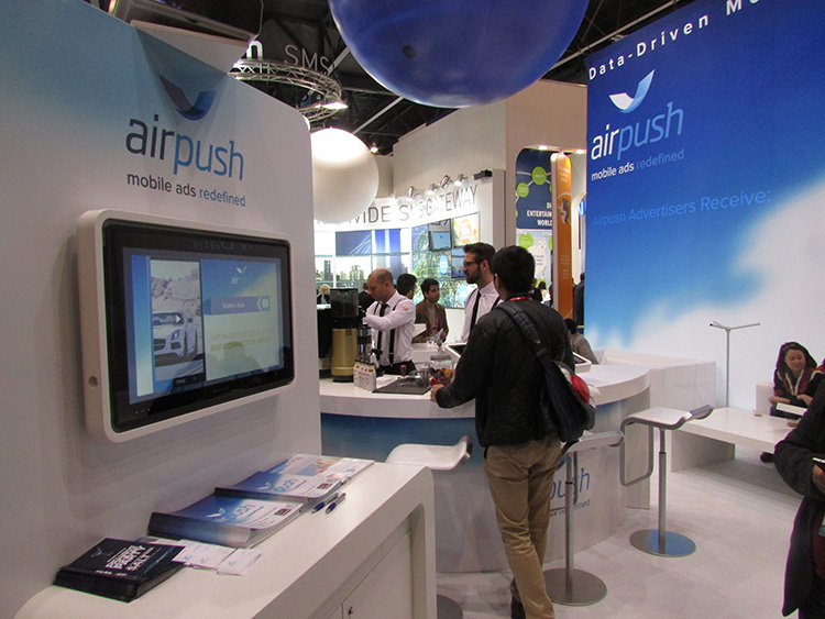
BARCELONA—Major consumer privacy concerns aside, companies are starting to see growth in location-based advertising, with new markets emerging in Europe. While the numbers of mobile advertising companies has decreased at the Mobile World Congress, held here in February, from just two years ago, the remaining players are seeing a more mature market.
Mobile advertisers are beginning to realize that location is the Holy Grail for growth, said Cameron Peeples, Airpush vice president of marketing. “People going into New York from Newark during rush hour can receive a different call to action because of a created geo-fence. Advertisers can determine whether the traveler is there on business or looking for a hotel and other travel deals,” he said.
Before Mobile World Congress, Los Angeles-based Airpush partnered with AirX, a large mobile ad exchange company. The majority of the AirX inventory, about 120,000 Android applications, includes highly-sought-after GPS location data, the company said.
There are large differences between the North American and European markets for mobile advertising, Peeples said. “The mobile advertising market [in Europe] is definitely evolving. The European market is key for us, dramatically higher than other markets,” he said. “[The European] market seems to have people connected to a lot of things — they are more mobile, use public transportation more, and always have a phone that is more centric to who they are.”
Making location-based advertising relevant to the consumer is still a major challenge. “Our focus next year is on native advertising. Native advertising combines not only the right message, but the right delivery vehicle,” Peeples said. “No one bicycling enthusiast wants ads tailored for someone who wants flowers.”
Peeples said the privacy issues are a big deal, but his company’s services are opt-in. “A lot of it is loyalty advertising. It’s all opt-in,” he said.
xAd Partners with Waze, Sees UK Growth
Another mobile advertising company, New York-based xAd, is also making inroads in Europe. “We are in the UK right now, which is really WiFi-focused. A lot of our early [location-based] advertising efforts are in education — to educate consumers and the advertising agencies about the power of location and mobile,” said Monica Ho, xAd vice president of marketing. “Not all location is created equal. The real value of [location-based advertising] is the proximity target to market to.”
Right before Mobile World Congress, Waze selected xAd as its third-party provider of search and display mobile ads in the United States. Waze, which was bought by Google in a deal worth more than $1 billion, is a top three map and navigation app in the iTunes store — a ranking that was probably helped by the Apple Maps debacle in 2012.
The companies say the deal will place xAd’s mobile ad targeting technologies into Waze’s location-based advertising platform.
Ho said there are still two areas of concern for location-based advertising: relevancy to the consumer and privacy issues. “There was privacy backlash from Nordstrom collecting consumer information from their Wi-Fi system,” she said, referring to the controversy last year when the retailer was accused of capturing consumer information during an indoor positioning test.
Apple to Roll out Upgraded Maps on iPhone 6
Speaking about Apple Maps, many industry analysts says the company has come a long way since the very public embarrassment nearly two years ago over map inaccuracies and flaws. The company recently released iOS 7.1, but is expected to rollout iOS 8 when the iPhone 6 debuts later this year.
With the debut of the iPhone 6, an updated version of Apple Maps will also be released, according to published reports.
Last year, Apple bought two companies, HopStop and Locationary, to allow the company to entrench itself once more in the location business. How firmly those roots prove to be, and how well they serve the company against archrival Google, remain to be seen.
Apple has been stockpiling companies and mapping software since its introduction of Apple Maps on iOS devices, which had a rough start. GPS World’s LBS Insiderreported extensively on the problems Apple encountered with its mapping software. Some of these problems included sending drivers to a wrong location and direction.
After the mapping software problems were made public, Apple CEO Tim Cook apologized for the mapping software’s problems and even suggested that users go to such competitors as Waze, MapQuest, and Microsoft’s Bing.
In other location news:
A Wall Street Journal reporter basically said there was nothing much new at Mobile World Congress — and that the excitement and action was at the outlying conferences at Fira Montjuic. One of these more interesting conferences, Four Years From Now, or 4YFN, featured start-up companies making pitches and displaying their new products, some of which included location capability.
The Mobile World Congress final stats. Organizers said MWC had more than 85,000 attendees from 200 countries — an increase of 13,000 from the previous year. It’s now being touted as the biggest and best wireless show.
In February, GPS World reported that TruePosition had purchased Skyhook for an undisclosed price. Skyhook provided location services to a number of companies including Apple and Samsung. The interesting issue is Skyhook’s lawsuit with Google, which alleged that the Internet giant influenced smartphone manufacturers to abandon the Boston-based company. According to published reports, the legal action still is going forward.
AT&T Mobility is shuttering its location-based Alerts marketing program. The company said it would release an updated version later this year. AT&T Mobility launched Alerts in late 2012. It featured free opt-in, location-based text message alert service. Participating retailers included Stapes, Gap, Zales, Neiman Marcus, and others.
I didn’t go to South by Southwest. Is my cool-guy card revoked? One of the reasons I didn’t is because, outside of meetings that were not part of the conference, there was not one location industry announcement made there. Maybe something will change my mind next year, but call me an old fogey — I just didn’t see the need to go to Austin this year.
Google’s 3D mapping project, Project Tango, is putting prototypes into developers’ hands.
Google has been collaborating with universities, research labs, and industrial partners in nine countries, to concentrate the past 10 years of research in robotics and computer vision into a mobile phone. “We now have prototypes ready to put into the hands of eager development partners that can help us imagine the possibilities and to transform those ideas into reality,” Google said on its Project Tango website.
Google’s Advanced Technology and Projects group (ATAP) heads the project, which aims to make it possible to create a 3D model of the space around a smartphone. For instance, a user can map an area, such as a home, by walking around with the phone.
Creation of 3D maps in this way would make it easy to navigate through buildings such as offices and supermarkets. Maps of a user’s home could also be used in games. As Google said on its website, “Imagine playing hide-and-seek in your house with your favorite game character, or transforming the hallways into a tree-lined path. Imagine competing against a friend for control over territories in your home with your own miniature army, or hiding secret virtual treasures in physical places around the world.”
The current prototype is a 5-inch Android phone containing highly customized hardware and software designed to track the full 3D motion of the device as a user holds it, while simultaneously creating a map of the environment. These sensors allow the phone to make more than a quarter million 3D measurements every second, updating its position and orientation in real time, combining that data into a single 3D model of the space. The mapped space is matched to the phone’s internal gyroscopic systems and more general location data from GPS.