Tag: Hexagon

  • Upgrade your survey GNSS — now

    Upgrade your survey GNSS — now

    jason poitras (left) and MARC VEINOTTE of MicroSurvey test a multi-constellation OEM rover with the FieldGenius for Android field controller software. (Photo: Gavin Schrock)
    Jason Poitras (left) and Marc Veinotte of MicroSurvey test a multi-constellation OEM rover with the FieldGenius for Android field controller software. (Photo: Gavin Schrock)

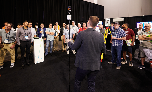
    It’s about more than advances in technology — peak times demand peak productivity

    Trusty legacy rovers have served surveyors well. Under the right conditions and with proper procedures, a 20-year-old rover might still deliver precisions that could match the latest and greatest.

    We’ve become so used to the limitations of legacy gear that we’ve built our workflows, expectations, and job estimates around them. However, in the past few years, the state of GNSS rovers has experienced a sea change, with gains in productivity, the ability to work in mixed environments, ease of use, and increased speed, repeatability and reliability — these developments have come at an opportune time.

    Peak Times

    Surveying always has been a feast-or-famine prospect; the rises and dips in economics are felt sharply within the profession.

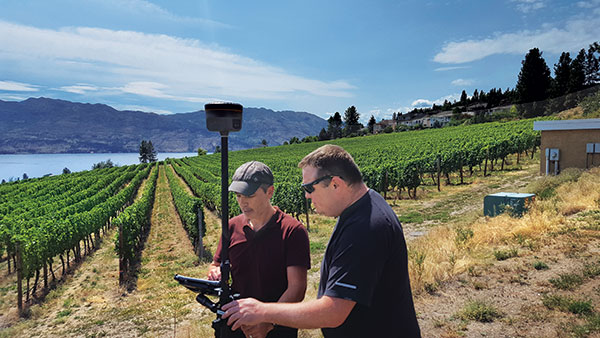
    In many places, there is more work than surveyors can accommodate, with competition to recruit and retain enough field personnel to meet demand. It is unclear how long this peak will last. Surveying firms recognize this and do their best to take on as many projects as they can.

    Staffing is an acute challenge. Firms have had to dip into incentives beyond the usual pay and benefits packages to attract and retain qualified field personnel. Having the latest gear is a definite plus. Experienced surveyors know much they struggled with legacy gear: GPS-only or GPS + GLONASS only, slow processors, poor multipath performance, and field-data-collector operating systems and software that are obsolete or no longer supported.

    Despite the immediate need, it’s generally less desirable to hire people with no surveying experience and train them from scratch. However, newer rovers and field software often do not have the same steep learning curve posed by legacy systems and methods.

    Productivity Now

    It is hard to say how much of the productivity gains, stated by various manufacturers for their newest systems, will be realized for your specific workflows, but simple testing can give you an idea.

    When surveyors try out new rovers, they tend to find themselves so impressed by the first unit tried, they conclude it must be “the best” and eschew due diligence in the selection process. That aside, I believe it is safe to say that there is a near across-the-board productivity improvement with the latest generation of rovers.

    Most rovers now provide no-calibration tilt compensation. (Photo: Gavin Schrock)
    Most rovers now provide no-calibration tilt compensation. (Photo: Gavin Schrock)

    A Confluence of Factors

    We haven’t seen such a sea change in GNSS rover technology in decades; most gains have been incremental. Similar jumps in the past included going from the static-only world to real-time and the first additional constellation beyond GPS.
    While the early days of GLONASS were rocky, and most manufacturers were hesitant to productize an unreliable and noisy solution, it did eventually improve. The effect of nearly doubling satellites in view translated to productivity gains. But that was two decades ago.

    The recent advent of true, multi-constellation GNSS has had a profound impact on the state of rovers. In 2020, both the Galileo and BeiDou constellations reached a full level of global coverage and signal integration.

    Many rovers were already equipped to utilize some (but not all) of the newest satellites and signals. Interface control documents (ICD) for some of the signals have only been released by the constellation providers in the past few years. ICDs provide signal specifics that manufacturers need to integrate them into GNSS solutions.

    Some rovers (and base receivers) developed four or more years ago may not be able to take advantage of the full complement of signals. And many did not have the processing power to utilize so many signals from so many satellites in real-time solutions.

    By contrast, nearly every new GNSS board released in the past few years has greatly increased processing power, often double that of legacy gear.

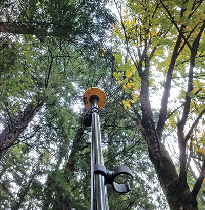
    Newer rovers are able to work better in sky-view-challenged and multipath hazard-prone places than rovers from only a few short years ago. And it is not just about the total number of channels on a rover datasheet, it is about how many are actually being utilized, how much of that data the processors and real-time kinematic (RTK) engine can handle, and how modernized signals are being leveraged.

    Modernized signals are yielding additional advantages. The expected benefits of L5 for the GPS constellation have been widely promoted. L5 was designed to be robust enough for certain safety-of-life applications. The L5 signal is being deployed incrementally to the GPS constellation and should be broadcast from 24 satellites by 2027.

    Modern receivers incorporate multi-GNSS signals that can improve performance under tree canopy. (Photo: Gavin Schrock)
    Modern receivers incorporate multi-GNSS signals that can improve performance under tree canopy. (Photo: Gavin Schrock)

    I have heard surveyors say they won’t bother upgrading until L5 is complete. But wait — two other constellations already have third-signal capabilities. Indeed, there are 3, 4, 5, even 6 usable signals (in the case of Galileo) already available — modernized, robust signals.

    Although L5 will only make this better, you can reap the benefits of signal modernization right now. Some of the innovation put into these modernized signals contributes to reducing certain sources of error. For instance, the Galileo E5a-E5b AltBOC — multiplexing signals in a wide band — is particularly beneficial for dealing with multipath.

    Rovers have evolved in other ways besides multi-constellation integration. The decades between these sea changes brought developments such as electronic bubbles, better operating systems, and automation of some functions, but essentially the form factor and functionality of a surveying rover has not changed much. There have been some gadgets and gimmicks along the way, but otherwise rovers had remained pretty much standard in those intervening years.

    Real-time precise-point positioning (PPP) has matured to the point that it could be viewed as survey-grade (at least in the horizontal). The delivery of clock, orbit and other data broadcast from geostationary communications satellites (as a service) for PPP means that, for many applications, high-precision positions can be processed by a rover over much of the globe — no base, no radio, no network and no cell phone connection required.

    Once research and development removed the lengthy convergence times that plagued legacy PPP, it became commercially viable for many applications. Commercial providers such as Trimble (RTX), Hexagon | Leica (SmartLink), Hemisphere GNSS (Atlas) and others provide subscription services for surveying, construction, agriculture and the growing autonomy market. Most new survey rovers have a PPP option.

    Multi-sensor integration, particularly of inertial measurement units (IMU), is becoming standard on new rovers. While there was some value from magnetometer-oriented tilt compensation in the past (though it could be cumbersome and somewhat unreliable), it served as a precursor to modern-day integrated GNSS/IMU no-calibration tilt.

    The first no-calibration tilt system hit the market as recently as 2017; now it is hard to find a rover without it. Accessing hard-to-reach points and improved stakeout workflows are some of the benefits of tilt compensation. The development of reliable IMU/GNSS processing was also the key to fully integrating camera-based offset point capture — and soon other sensors such as lidar might be incorporated.

    Market Choices

    Another set of changes in the high-precision GNSS industry coincided with the above developments, growing a more competitive marketplace. This equates to more choice. The secret sauce of high-precision GNSS is no longer in the hands of the few. The glass floor has been broken, with more rovers than ever available.

    Many tiers for choice have emerged.

    The Top End. The manufacturers traditionally considered to be the top end continue to innovate and are usually the first to productize developments such as multi-sensor integration and PPP. They continue to lead in integrated surveying solutions, track record, performance, quality, service, support and peer user networks — which continues to appeal to many users. However, they also have second-tier offerings to suit various markets, regions and value propositions.

    Whether to Use OEM Devices. For many users, there are compelling reasons to stick with top-end solutions, but there always has been room for other price point options. Until recently, most lesser-known rover brands exclusively integrated GNSS boards from a handful of well-known original equipment manufacturers (OEMs) such as Trimble and NovAtel. Sometimes new developments hit the OEM market quite rapidly — for instance, IMU integration. These third-party manufacturers may add their own touches, but in effect, nearly every rover out there offered a narrow set of DNA — until recently.

    Rolling Their Own. Globally, technical universities are graduating GNSS engineers at an unprecedented rate; the prospect of mass applications such as vehicular autonomy and robotics are driving demand. With this expanding pool of engineers, it is now much more practical to develop GNSS solutions from scratch and to fully leverage multiple constellations.

    Some third-party manufacturers began working with OEMs but have started developing their own boards and related technologies. I’ve tried several, and performance is, in most cases, as good as that of new boards from traditional sources..

    The Rise of Mid-Price Rovers. There are a growing number of breakout rovers from lesser-known brands or rebranded models. These are about half the price of some of the top-end models, yet performance is in most cases nearly par. Some include OEM boards, or the new wave of independent boards.

    I’ve seen a sharp rise in the popularity of mid-level rovers among small and mid-sized firms. However, there has not been a corresponding drop in sales of top-end rovers. It seems that surveyors are simply buying more rovers during this peak time.

    Receivers-as-a-Service. Another approach for surveying and asset-mapping rovers is pay-as-you-go. This means you do not have to make large up-front investments in hardware. Instead, you pay for high-precision capabilities through subscriptions or tokens when you need it. This can be a good choice for occasional or seasonal users.

    One example is Trimble’s Catalyst system. For Catalyst, the hardware investment is an inexpensive antenna, and then you access a subscription service via your mobile field data collector, tablet or smartphone to activate the software-defined receiver (SDR).

    Another such model is Flex. With Flex, you have the option to pay full price for the full receiver/antenna to operate as a conventional rover. Alternatively, you can choose to pay a lower up-front price for the rover and use tokens to activate the high-precision capabilities.

    Surveyors should put new rovers through their paces before choosing. (Photo: Gavin Schrock)
    Surveyors should put new rovers through their paces before choosing. (Photo: Gavin Schrock)

    Low-Priced Rovers. Two external factors have fostered a mini boom in low-cost rovers: R&D for mass markets such as autonomy, and RTK/post-processed kinematic (PPK) solutions for drones, which are often used to reduce the need to set ground control points.

    In both segments, inexpensive and often small GNSS boards have been developed. For drone applications where a base was needed for RTK/PPK methods, developers sometimes took the same GNSS board in the drone and packaged it as a base. It did not take long for some of these developers to package the rover for surveying or asset mapping (with geographic information system, or GIS).

    While these rovers can perform just as well as top-end or mid-priced rovers in optimal conditions, they may struggle in mixed environments. I’ve tried some, and I can see why every surveyor I’ve asked about performance adds “for the price” to their assessment.

    Other developers have taken this a step further, selling a bare-bones rover for less than $1,000, though these can take a lot of tinkering and extra attention to fit into a production workflow. There are even folks creating do-it-yourself rovers. I am not seeing many large firms, who have high-ticket projects and need to conduct integrated surveying, opting for lower priced systems.

    We are riding a new wave of GNSS rovers, awash with more choices than ever. In this period of increased demand for surveying services, it might be a great time to upgrade and boost productivity.


    New Players

    A “roll your own” example is Tersus GNSS, which has designed and manufactured in-house GNSS boards and RTK engines since its inception in 2014. I asked Winston Wen, founder and CEO of Tersus, why they chose this strategy. 

    “I’m a hardware guy; electronics, computer science, signal processing, etc.,” Wen said. “In 2014, I took a look at the price and portfolios for high-precision, and for equipment for surveyors — the price point looked exceptionally high. From my point of view, it looked like there was room for a new player, and I felt we could do better. There are also growing markets for applications for high-precision GNSS, such as the internet of things (IoT) and autonomy.” 

    Tersus has experienced solid reception for its products globally. I asked Wen if he felt GNSS for surveying has reached a new level of performance. “Yes, nowadays with 50 satellites, that is huge. Surveyors will be very happy with performance, especially in environments with limited sky view. At this time, there don’t appear to be any new signals announced, so rovers bought today should be top performers to, say, 2025 and beyond.”


    Industry Insights

    GNSS executives told Gavin Schrock about recent developments in their companies.

    Neil Gerein, Senior Director of Marketing,
    Autonomy & Positioning Division, Hexagon

    As satellite constellations were modernized, GNSS receivers kept pace to offer multi-constellation and multi-frequency capabilities to culminate in the latest technologies in PPP corrections. 

    For example, Hexagon’s RTK From the Sky technology is able to achieve highly available corrections with centimeter-level accuracy globally. However, modern GNSS receivers also offer other benefits, such as interference mitigation and spoofing detection for improved positioning robustness, multipath mitigation, and more powerful sensor fusion.

    Miles Ware, Vice President,
    Marketing & Global Customer Care, Hemisphere GNSS

    Much like the constantly evolving world of smartphones, tablets, and computers, the improvements in multi-constellation GNSS receiver performance have been significant, even over just the past few years.

    Many legacy rovers, bases and reference stations that are older than four years cannot track some of the newest signals, such as from BeiDou Phase 3 satellites. This means some of the highest performing signals available are now accessible to many users. As fewer BeiDou Phase 2 satellites continue to transmit, many legacy receivers will no longer have the performance they once did. 

    With upcoming services such as OSNMA (the Galileo GNSS data authentication service) and global PPP signals, many receivers from a few years ago do not have the CPU capacity to employ them. Today’s GNSS engines track more satellites, more signals per satellite, and have more CPU to perform advanced operations, all while consuming the same or less power than previous generations.

    Francois Martin, Vice General Manager,
    CHC Navigation

    The latest GNSS RTK rover technology evolutions are based on the maturity and enhancement of satellite navigation systems, as well as the integration of IMU sensors into the receivers. 

    The most recent generation of our GNSS rovers, such as the CHCNAV i83, is based on the sophisticated iStar algorithm that significantly improves the efficiency of GNSS satellite signals tracking for unmatched performance in GPS, GLONASS, BeiDou, Galileo and QZSS constellations, utilizing all available frequencies, including BeiDou 3. 

    Moreover, the fusion of GNSS and IMU technologies enables centimeter-level positioning, maintains fixed and reliable RTK accuracy, and collects points faster than ever before, even in challenging conditions. GNSS survey productivity is increased by up to 30%, and the user base expands from experienced users to new users such as construction site foremen.


    Gavin Schrock, PLS, is a practicing land surveyor, the operator of a cooperative real-time GNSS network in Washington state, and a technology writer.

  • HxGN LIVE Global: Summit keynotes and Formula 1 cars

    HxGN LIVE Global: Summit keynotes and Formula 1 cars

    Burkhard Boeckem and a Boston Dynamics robot dog share insights into smart digital realities. (Photo: Hexagon)
    Burkhard Boeckem and a Boston Dynamics robot dog share insights into smart digital realities. (Photo: Hexagon)

    At HxGN LIVE Global 2022, in-person attendees experienced the full breadth of what the flagship conference has to offer for the first time since 2019.  The conference is taking place this week at the Venetian hotel in Las Vegas.

    Tuesday began with a keynote address by Burkhard Boeckem, chief technology officer, who discussed the importance of smart digital realities and their role in the potential of the metaverse to impact and enhance the physical world. Hexagon’s technology platform Xalt enables intelligence at scale. By integrating sensors and data integration across systems and solutions, like the BLK series and HxDR, Xalt provides the next level of connectivity to harness and utilize data for autonomous systems.

    Summit-specific keynotes by speakers from Hexagon, its partners and sponsors provided expertise on  issues, solutions and innovations shaping and reimagining various industries.

    The Digital Innovation in Construction summit begins. (Photo: Hexagon)
    The Digital Innovation in Construction summit begins. (Photo: Hexagon)

    Tuesday was also the first day of breakouts for all summits, with more than 100 sessions throughout the day covering everything from training and tips for Hexagon products to project success stories, panel discussions of industry trends, and a look at the precision engineering of Formula 1 cars with Hexagon partner Oracle Red Bull Racing. Sessions continue through the close of the conference on Thursday.

    The Zone, the massive technology expo floor, officially opened for the first time this morning, where attendees explored some of the latest advancements, products and solutions available across seven summit-specific “islands” offering hands-on demonstrations and an opportunity to ask the questions that will help them make the best use of autonomous technology in their field.

    Surveyors get the lay of the land at the Pure Surveying Island. (Photo: Hexagon)
    Surveyors get the lay of the land at the Pure Surveying Island. (Photo: Hexagon)
    Advances in digital construction were provided by Leica Geosystems. (Photo: Hexagon)
    Advances in digital construction were provided by Leica Geosystems. (Photo: Hexagon)

    In the evening, summit events took attendees around the grounds of the Venetian resort for various experiences.


  • HxGN LIVE Global: New mining solutions, award winners announced

    HxGN LIVE Global: New mining solutions, award winners announced

    HxGN LIVE Global 2022, taking place this week in Las Vegas, is a cross-industry conference showcasing the latest technologies and innovations from Hexagon.

    The first two days brought numerous announcements and demonstrations. Here are a few highlights.

    Hexagon unveils mining smart platform

    The new Power of One platform is a holistic, life-of-mine smart solution connecting sensors, software, infield apps and cloudware. Available and ready to implement, the technology connects the mine to the boardroom via a single onboard ecosystem. Harnessing data from multiple sensors in a simple and consolidated software architecture, the platform helps mines to become situationally aware, self-learning and autonomously connected in the field and in the cloud.

    For the customer, the platform offers an effortless experience with a seamless UI/UX and consistent functionality. Reduced cost of ownership, reduced deployment and training time, reduced supply chain complexity and increased operator adoption are just some of the platform’s many benefits.

    “The Power of One platform is a landmark enabler for next-generation autonomy,” said Nick Hare, Hexagon’s Mining Division president. “It offers mines a uniquely intelligent approach based on open architecture to autonomously connect key mining ecosystems, such as exploration, planning, drill and blast, material movement and mine monitoring. “It’s the scalable, platform-agnostic answer to challenges previously addressed by point solutions and multiple vendors.”

    HxGN LIVE Global visitors can learn more about the Power of One platform during this week’s Intelligent Mining Summit.


    Ola Rollén, President and CEO of Hexagon., delivers the keynote address at HxGN LIVE 2022. (Photo: Hexagon)
    Ola Rollén, president and CEO of Hexagon, delivers the keynote address at HxGN LIVE 2022. (Photo: Hexagon)

    Hexagon and Fujitsu announce strategic partnership

    Hexagon’s Safety, Infrastructure & Geospatial division and Fujitsu Limited will partner to accelerate the development and promotion of use cases to solve societal challenges and contribute to the realization of the “Trusted Society” — a sustainable, resilient place where people can live together in peace and prosperity.

    Hexagon and Fujitsu will work together to provide joint use cases leveraging digital-twin technologies and solutions from both companies, including sensors, data processing, data analysis and advanced data visualization in the cloud and high-performance computing infrastructure. The partners will deploy these technologies to develop joint solutions that deliver richer information and deeper insight to customers in government, the public sector, transportation and utilities to help reduce emissions, increase safety, optimize operations and more.

    “Our goal at Fujitsu is to realize our vision for a ‘Trusted Society’,” said Yoshinami Takahashi, EVP and vice head of Global Solution Business Group, Fujitsu. “Partnering with Hexagon will allow us to extend our reach and provide even greater value to cities and regions around the world.”

    “Cities are playing a leading role in solving global challenges, from addressing climate change to eliminating traffic fatalities,” said Steven Cost, president, Hexagon’s Safety, Infrastructure & Geospatial division. “Our partnership with Fujitsu can help cities put data to work to solve these pressing problems and meet sustainability and safety goals.”

    The new global partnership builds from the companies’ work to solve urban sustainability challenges in Europe, including efforts to better manage and understand the impacts of shared mobility services in Germany, including a project with the City of Munich.

    The Hexagon mascot peruses a map during HxGN LIVE 2022. (Photo: Hexagon)
    Hex-E, the Hexagon mascot, peruses a map during HxGN LIVE 2022. (Photo: Hexagon)

    HxGN EAM asset management software leads in Green Quadrant

    HxGN EAM from Hexagon’s Asset Lifecycle Intelligence division was named a leader in the enterprise asset management (EAM) market in the Green Quadrant: Enterprise Asset Management Software 2022 report from Verdantix.

    Verdantix is an independent research and advisory firm with expertise in digital strategies.

    HxGN EAM received the highest weighted score for the technical capabilities of the platform. The report assessed 14 EAM software vendors across their product functionality, user interface and market momentum.

    Verdantix estimates that global spending on EAM will reach $5.4 billion in 2026, compared to $3.6 billion in 2021, and states that acquisitions and funding are reshaping the EAM market. This comes just after Hexagon’s $2.8 billion acquisition of Infor’s EAM software business to form HxGN EAM in 2021.

    “HxGN EAM’s growth ambitions align with the market outlook and Hexagon’s vision to be the world leader in digital realities and autonomous solutions,” said Kevin Price, vice president, Enterprise Asset Management Portfolio Segment, Hexagon’s Asset Lifecycle Intelligence division. “Asset visibility is the first step in proactive maintenance and the prevention of the breakdown of critical functions, and we’re proud that HxGN EAM’s wide availability of services matches the growing needs of our customers. It’s an honor to be classified as a leader in the EAM market.”

    The Hexagon mascot gets excited about his reflection at HxGN LIVE 2022. (Photo: Hexagon)
    Hex-E gets excited about his reflection at HxGN LIVE 2022. (Photo: Hexagon)

    Hexagon Elite Awards recognize customers

    Hexagon’s Asset Lifecycle Intelligence (formerly PPM) division  announced the recipients of the 2022 Hexagon Elite Awards, which honor Asset Lifecycle Intelligence division customers who are champions of progress and innovation using Hexagon solutions.

    “As we expand our portfolio and capabilities through acquisitions, our customers’ designs and animations using Hexagon solutions for this competition continue to amaze,” said David Cryer, Senior Vice President & Chief Marketing Officer, Hexagon’s Asset Lifecycle Intelligence division. “It’s an honor to recognize this year’s winners and we want to thank all of our customers who submitted entries.”

    This year’s awards were presented in six categories:

    • Best in Design recognizes the most innovative and well-executed uses of Intergraph Smart 3D, Intergraph Smart Review and/or CADWorx: Fandy Maulana, Reformer Petrochemical Plant, PT Rekayasa Industri (Rekind).
    • Best in Automation rewards the most innovative automation ideas for Intergraph Smart 3D, Intergraph Smart P&ID, Intergraph Smart Electrical and/or Intergraph Smart Instrumentation: Petrobras – Surface Systems Engineering.
    • Best in Analysis recognizes innovative applications of CAESAR II, PV Elite and/or GT STRUDL that helped successfully complete a project and meet design and engineering goals: Chengwen Wang, Wuhuan Engineering Co. Ltd.
    • Best in Operations highlights customers who are true champions of progress and continue to move their company and industry forward in digital transformation in the Operations and Maintenance segments: Sudharshan Nambiar, Engineering Data Management – Systems, Petronas.
    • Best in Project Performance recognizes customers who use Asset Lifecycle Intelligence division and EcoSys solutions to successfully complete a project or improve project performance: Yann Guyot, Cost Control & Risk Management, Technip Energies.
    • Best in Procurement, Fabrication & Construction Management honors the most innovative and well-executed uses of the Asset Lifecycle Intelligence division’s PF&C solutions to successfully complete a project or move the company and industry forward in digital transformation: Jingwei Zhang and Zhifang Li, Zhengzhou Coal Mining Machinery Shuyun Intelligence Technology Co. Ltd.

    Submissions for the 2023 Hexagon Elite Awards competition will be accepted starting Nov. 1.


    Photo: Hexagon
    Photo: Hexagon

    Hexagon and Mineral Resources partner on automated road-train solution

    Hexagon’s Autonomy & Positioning and Mining divisions announced the development of an automated road-train solution with mining services company Mineral Resources Limited (MRL). To be deployed on MRL’s haulage fleet, the solution integrates drive-by-wire technology with an autonomous management system to orchestrate vehicle movement in road-train haulage.

    The automated road-train solution focuses on safety, productivity and sustainability for MRL operations and will be phased in over the next two years. Both companies are confident that progressive automation will profoundly change the safety and economics of mining where macroeconomic challenges, including commodity prices and labor shortages, impact the feasibility of projects.

    The automated road-train solution improves the safety of long-range haulage, provides cost-efficiencies and reduces emissions to assist companies in lowering their carbon footprint. Beyond mining, this innovative solution will also benefit bulk haulage in many other off-road primary industries.

    “Autonomous vehicles are revolutionizing the way we work today and into the future, and Hexagon is very proud to be part of this revolution,” said Ola Rollén, president and CEO of Hexagon. “Our agreement with MRL further solidifies Hexagon’s commitment to autonomous mobility and fulfilling our customer’s safety and productivity requirements.”

  • Hexagon helps Ghana utility modernize electricity distribution

    Hexagon helps Ghana utility modernize electricity distribution

    Hexagon’s Safety, Infrastructure & Geospatial division successfully deployed an advanced utility geographic enterprise asset management (EAM) system for the Electricity Company of Ghana (ECG). The smart EAM, featuring Hexagon’s G/Technology, will allow ECG to plan, manage and efficiently operate its distribution network to meet the growing needs of 4.5 million customers.

    The enterprise system from Hexagon unifies data from a variety of geographic information systems (GIS), enabling bi-directional data flow with other systems based on the Common Information Model (CIM) standard. The system enhances ECG’s ability to geographically reference and manage assets with integrated tools for data surveying, capture and maintenance and network planning and calculation.

    Mobile capabilities enable efficient inspections and maintenance, while a web portal assists employees with locating assets, reviewing the network and more. Migrating to Hexagon’s system will increase process efficiency and reduce asset-management costs by harmonizing systems, validating existing data and capturing missing data.

    “The utility GIS is the critical component that fuels innovation in the utility,” said Keli Gadzekpo, board chairman of ECG. “This project is the foundation and the first step to modernizing ECG operations. It is the platform for digitization of electrical network assets, a prerequisite for bringing efficiency in the wire business.”

    Photo: Hexagon
    Photo: Hexagon

    Part of ECG’s Modernizing Utility Operations Activity, the project was commissioned by Millennium Development Authority (MiDA), Ghana, on behalf of the Government of Ghana’s Millennium Challenge Account Entity Program and funded by the U.S. government.

    “We are exceedingly grateful to Hexagon for working tirelessly to deliver this innovative product,” said Julius K. Kpekpena, Ag CEO and COO, Millennium Development Authority. “The technology sets Ghana’s biggest electric distribution utility on the path to modernizing its operations. The GIS is the foundation for modern tools to help ECG plan its networks, reduce losses, collect revenues and serve customers more efficiently.”

    The project included procurement and installation of system software, server hardware, mobile field units and services for data migration by Hexagon, field validation of assets by PDSA Ghana (part of Hexagon), and production of aerial imagery by ILV Wagner using Hexagon’s Leica Geosystems surveying and airborne imaging technologies.

    “Reliable electricity requires accurate data and tools to plan, design and manage networks, which can also reduce overall maintenance costs,” said Maximillian Weber, senior vice president, Global Utilities & Communications, Hexagon’s Safety, Infrastructure & Geospatial division. “We are proud to support Electricity Company of Ghana in delivering quality service to its customers.”

  • Hexagon: Mining safely with rock-solid technology

    Hexagon: Mining safely with rock-solid technology

    Photo:BeyondImages/iStock/Getty Images Plus/Getty Images
    A mining road-train loaded with ore passes through an outback town. A Hexagon system will guide autonomous movement of similar heavy vehicles. Photo: BeyondImages/iStock/Getty Images Plus/Getty Images

    Hexagon’s Autonomy & Positioning and Mining divisions recently partnered with Mineral Resources Limited (MRL), a mining services company, to develop an automated road-train solution for deployment on MRL’s haulage fleet over the next two years. The solution integrates drive-by-wire technology with an autonomous management system to orchestrate vehicle movement in road-train haulage to improve safety, productivity and sustainability. We asked Lee Baldwin, the director of Hexagon’s Autonomy & Positioning division, a few questions about the system.

    What does an automated road-train do?

    It is for haulage on roads hundreds of kilometers long. It first will be used to move ore from a mine processing facility in the Pilbara region of Western Australia, about 1,200 kilometers north of Perth, to Port Hedland, where it is loaded on ships bound for Asia for use in steel mills. Typically, this is done using either rail or a road train, which is a highway truck pulling multiple trailers. Today, a person drives a road train.

    What motivated this project?

    Mines have difficulty finding drivers for mining trucks and road trains because the mines are very far away from the nearest city, Perth, so they must fly workers in and out, which is very costly. Many of them are on 10-day shifts. Also, there are safety concerns.

    How does an automated road-train work?

    It requires three typical subsystems that you would have on any autonomous vehicle. The first one is positioning, including redundant GNSS receivers with our TerraStar correction services. The second is a perception system for collision avoidance, using our HxGN MineProtect Collision Avoidance System. The third one is route planning. We will start by platooning, with a driver in the first truck, which will be followed by three unmanned ones, each towing multiple trailers. Each truck will have the positioning, perception and route-planning systems. Later, we will achieve full autonomy by removing the driver from the lead vehicle.

    How will the transfer at the mine work?

    At a mine site, the road train will be commissioned in a sequestered area, then sent to a loading area where it will be loaded with ore, either automatically or by a manned wheel loader. Next, it will travel 200 kilometers to the port, where it will dump the ore. Finally, it will be decommissioned and queued up for the return journey.

    Which parts are already in place and which ones are still being developed?

    At Hexagon, we are already putting technology in manned mines. For example, we already have the collision-avoidance system, a fleet management system, and some sitewide planning systems. However, the trucks that the customers are choosing will have to be converted to be drive-by-wire to accommodate our autonomy system. They will use two PwrPak7 GNSS receivers and the TerraStar correction service.

  • Hexagon | Veripos expands SPAN GNSS+INS portfolio for dynamic positioning

    Hexagon | Veripos expands SPAN GNSS+INS portfolio for dynamic positioning

    Ensures safe operations through reliable, robust and continuous positioning with GNSS+INS integration

    Hexagon | Veripos has expanded its inertial solution SPAN GNSS+INS technology from NovAtel, also part of Hexagon, to dynamic positioning (DP) applications and vessels.

    SPAN technology delivers a deeply coupled GNSS and inertial navigation system (INS) that provides robust, reliable and continuous centimeter-level positioning for operators to maintain safety and maximize uptime.

    With a GNSS+INS solution, DP vessels can bridge outages in GNSS tracking and through short periods of radio-frequency interference, jamming or spoofing.

    Veripos is a leader in offshore high-precision positioning, delivering reliable and trustworthy GNSS solutions such as the LD900 receiver, PPP correction services and positioning visualization software. This expertise is demonstrated through SPAN technology’s deep coupling of GNSS and inertial measurements.

    Deep coupling describes how inertial measurements enhance the signal tracking for GNSS solutions, leading to improved resiliency against GNSS outages and enabling rapid reacquisition in case of interruptions. SPAN technology builds system robustness against potential signal outages, interference or disruptions while optimizing operational efficiency.

    “The robust positioning, heading, velocity and attitude measurements generated from a deeply coupled GNSS and inertial solution like SPAN technology is a game-changer to dynamic positioning operations,” said David Russell, marine segment portfolio manager at Hexagon’s Autonomy & Positioning division. “SPAN technology has a proven track record of bridging outages, enabling rapid reacquisition of signals, and building a reliable and robust positioning system. It’s the best option for vessels to ensure an added layer of resiliency and achieve continuous centimeter-level accuracy across all conditions.”

    SPAN GNSS+INS technology is compatible with commercial inertial measurement units (IMUs) and scalable with the LD900 GNSS receiver, Quantum visualization software and APEX correction services.

    Image: Hexagon
    Image: Hexagon
  • RTK From the Sky tech transforms TerraStar-C PRO service with 3-minute global convergence

    RTK From the Sky tech transforms TerraStar-C PRO service with 3-minute global convergence

    TerraStar-C PRO is the first global correction service from Hexagon to incorporate RTK From the Sky technology to achieve RTK-level accuracy in three minutes with 99.999% availability

    In late 2020, Hexagon’s Autonomy & Positioning division announced its technological breakthrough of global RTK From the Sky, demonstrating a future where instantaneous PPP and global RTK-level accuracy is possible.

    Integrating this innovation into the core of TerraStar-C PRO, NovAtel’s corrections service, is the first phase in implementing RTK From the Sky technology into the company’s diverse portfolio of correction services for users worldwide.

    As a result, TerraStar-C PRO has become the fastest global correction service to provide centimeter-level accuracy, not just in open-sky environments but also across challenging conditions created by buildings and foliage, according to Hexagon | NovAtel.

    “RTK From the Sky technology is the foundation that enables our global correction services to be world-leading across agriculture, automotive, defense, survey, marine and autonomous applications,” said Michael Ritter, Autonomy & Positioning division president and CEO. “Our dedication to research culminated in an industry-changing technology; we’ll continue that commitment by providing the best positioning experience in speed, accuracy, availability and reliability anywhere in the world.”

    TerraStar-C PRO now converges in less than three minutes by utilizing quad-band receiver and antenna technology to leverage modernized BeiDou III, GPS III and Galileo E6 signals. The resulting process generates state-of-the-art corrections for all GNSS frequencies.

    Hexagon is a consistent innovator in GNSS, as seen in its role in developing RTK and PPP solutions. With this next-generation modernization of PPP correction generation and algorithm development, the company continues this tradition in providing the highest quality and best performing global positioning experience to users with land- and air-based applications.

    “It’s been a privilege to collaborate across the division to develop RTK From the Sky technology and leverage our collective expertise in correction generation, PPP algorithms and the entire positioning ecosystem,” said Leos Mervart, head of PPP algorithm development at Hexagon’s Autonomy & Positioning division. “I’ve worked with PPP technologies since the beginning of my career and am proud to say that this is a new era of what global positioning can look like.”

    The TerraStar-C PRO improvements are accessible now through the 7.08.10 firmware release for users on OEM7700, OEM719 and OEM729 cards and their associated enclosures for land and air applications.

    Future firmware releases will include global RTK From the Sky technology throughout Hexagon’s correction service portfolios for its global client base, including precision agriculture and marine applications.

    To learn more about TerraStar correction services or to request a free 5-day trial, visit NovAtel.com/TerraStar.

  • Maritime surveillance supported by Hexagon lidar sensors

    Maritime surveillance supported by Hexagon lidar sensors

    Leica Chiroptera 4X bathymetric data with Leica OC60 screen visualizing objects in near real-time during the flight. (Photo: Hexagon)
    Leica Chiroptera 4X bathymetric data with Leica OC60 screen visualizing objects in near real-time during the flight. (Photo: Hexagon)

    Hexagon is partnering with Airbus on a near-real-time airborne bathymetric lidar surveillance system.

    Hexagon’s Geosystems division is partnering with Airbus to integrate two Leica Chiroptera 4X bathymetric lidar sensors for maritime surveillance into the C295 MSA, Airbus’ Maritime Surveillance Aircraft.

    Hexagon’s new technology enables detection of underwater objects in near real time, a significant innovation in the airborne bathymetry industry, the company said.

    The lidar system was developed to meet Airbus’ requirements and will first be implemented in two C295 MSA craft purchased by the Irish Air Corps. The aircraft are due for delivery to Ireland in 2023.

    The system’s unique object-detection feature enables real-time lidar data visualization and analysis during flight. Being able to locate the precise position of an object allows operators to preview and analyze information captured below water immediately — a process that previously could take several days.

    “When we acquired the C295 MSA, we explored various sensors to be added to our fleet, including bathymetric and topographic LiDAR. Airbus introduced us to the Chiroptera 4X, which now meets all our requirements,” said Stephen Connolly, captain of the Irish Air Corps. “The combined bathymetric and topographic lidar sensor will provide us with more details than ever before. Detecting objects close to real-time and having a clear picture of underwater activities will allow us to report directly to the Mission Support Centre on the ground and act faster to perform our duties more efficiently. The Chiroptera 4X will provide an overall better solution for the coastal maritime domain.”

    Airbus and Irish Air Corps visited Hexagon’s R&D and production facility in Jönköping, Sweden, in September for the factory acceptance test. (Photo: Hexagon)
    Airbus and Irish Air Corps visited Hexagon’s R&D and production facility in Jönköping, Sweden, in September for the factory acceptance test. (Photo: Hexagon)
  • Hexagon and Dayou partner to bring high-accuracy GNSS corrections to China

    Hexagon and Dayou partner to bring high-accuracy GNSS corrections to China

    TerraStar X corrections technology enables lane-level accuracy with under one-minute convergence for consumer and automotive-grade GNSS receivers

    Hexagon’s Autonomy & Positioning division has partnered with Chinese positioning company Dayou to bring TerraStar X technology to the Chinese market. TerraStar X provides fast precise point positioning (PPP) corrections for autonomous vehicles and has mass-market use such as in smartphones.

    The partnership enables Hexagon and Dayou to provide consistent positioning solutions globally, including North America, Europe and China, so original equipment manufacturers (OEMs) can deploy the same design worldwide.

    The GNSS corrections generated from TerraStar X technology enable lane-level accuracy with convergence in under a minute for consumer and automotive-grade GNSS receivers, supporting advanced driver-assistance systems (ADAS), autonomous applications, safety-critical applications, mobile-phone applications and more.

    TerraStar X technology delivers corrections using industry-standard formats compatible with mobile networks and enabling efficient delivery of corrections to millions of end-user devices. Through the partnership with Dayou, OEMs can now deploy the same high-accuracy solution across China as in North America and Europe, while having access to local sales, support and technical resources.

    “This partnership provides a way for global companies to leverage TerraStar X technology to bring consistent lane-level positioning around the globe,” said Sara Masterson, director of positioning services at Hexagon’s Autonomy & Positioning division. “With its hardware-agnostic design, industry-standard format and delivery of corrections, this technology opens up the possibility of precise positioning for a multitude of new mass-market applications for customers to use one software positioning solution on all platforms worldwide.”

    “Dayou is excited to be working with Hexagon in China to bring this next level of positioning technology to market,” said Han Jianxin, chief executive officer at Dayou. “High accuracy positioning used to be limited to expensive equipment and niche markets like survey and mapping. With TerraStar X technology, everyone can have the benefit of more accurate positioning, opening up new applications ranging from autonomous driving and freight to regular smartphone users moving from point A to B.”

    Test Regions Expand to China

    Using Dayou’s local infrastructure to calculate ionosphere corrections, TerraStar X technology ensures that fast convergence to lane-level and sub-meter accuracy is available when needed.

    Engineering development test areas are available around the world to support large-scale programs with functional safety requirements. With these test regions now expanded to China, the partnership with Dayou marks a significant milestone to bring Hexagon’s TerraStar X technology to a global scale.

    China Dayou PI is a Chinese company invested in by China Intelligent and Connected Vehicles (Beijing) Research Institute Co. Ltd. for high-precision positioning service and solutions based on GNSS, INS and HD map technology.

    Image: imaginima/iStock/Getty Images Plus/Getty Images
    Image: imaginima/iStock/Getty Images Plus/Getty Images
  • Navigating Urban Roads

    Navigating Urban Roads

    From its very first issues, 31 years ago, this magazine has covered the role of GPS, now GNSS, in guiding ships, trains and automobiles. What were then some of the most aspirational visions of future applications are now routine. For all forms of transportation, navigation is a safety-critical issue. This is particularly true in the case of cars on public roads, which is also where the technical challenges are the greatest. Ships mostly travel in deep waters, far away from other traffic and fixed obstructions, and nearly always enjoy an unobstructed line-of-sight to GNSS satellites. So do trains, which have the additional advantages of being kept, literally, on track and of operating in controlled environments, with hardly any concerns for unexpected intrusions on their path. Cars, trucks, and busses, on the other hand, must contend with many other vehicles, including those with distracted, drowsy, drunk, or drugged drivers, as well as cyclists, pedestrians, accidents, construction and a bedeviling myriad of sudden and often unpredictable circumstances. Additionally, their view of the sky is often limited by overpasses, tunnels and tall buildings, which challenge GNSS-based navigation with signal occultation and multipath, and their view of their surroundings is often blurred by weather conditions.

    Currently, prototype autonomous vehicles carry cameras, lidar scanners, radars and ultrasonic sensors to provide positioning relative to mapped features, as well as for collision avoidance. However, some use cases require absolute positioning sensors, consisting of GNSS receivers coupled with inertial sensors. For example, autonomy levels 3 and 4 require dynamic error bounds of no more than a few meters most of the time under challenging highway conditions and levels 4 and 5 will require this level of accuracy even in deep urban canyons.

    This month’s cover story highlights progress in several transportation-related GNSS/PNT applications

    u-blox partners with Bird e-scooters

    Domino’s delivers with Nuro

    u-blox shares autonomous insights

    Hexagon guides Indy Autonomous Challenge

    Swift Navigation provides precise corrections

    Skytraq Technology modules meet market needs

    SBG Systems drives GNSS+inertial in Paris

    Featured Photo: Bird

  • Speakers, program announced for Geo Week conference

    Speakers, program announced for Geo Week conference

    125+ speakers and 50+ sessions are confirmed for the 2022 edition of Geo Week in Denver

    Image: Geo Week 2022

    Organizers of Geo Week, which brings together geospatial technologies and the built world, have announced its conference sessions and speakers for the 2022 event, which will take place Feb. 6-8  in Denver, Colorado.

    The conference program features more than 125 speakers across 50 sessions with content that explores best practices in 3D capture, working in the built environment, gaining return on investment (ROI) from building information management (BIM), defining what’s possible now with lidar, and more.

    The coming together of AEC Next Technology Expo & Conference, International Lidar Mapping Forum, and SPAR 3D Expo & Conference to form Geo Week reflects the increased integration between the built environment, advanced airborne/terrestrial technologies, and commercial 3D technologies.

    Partner events taking place in conjunction with Geo Week include ASPRS Annual Conference, MAPPS Winter Meeting and USIBD Annual Symposium, ensuring the presence of geospatial and built-world industry experts in one place.

    Presenters represent Autodesk, Esri, USGS, The Beck Group, Hexagon Geosystems, GM, Caltrans, Velodyne Lidar, Draper, MLB and NASA. These experts will share their expertise on a range of topics. Sessions include:

    Geo Week will have multiple tracks with content clearly identified as relevant to one or more of the audience groups feeding into Geo Week.

    • The International Lidar Mapping Forum (ILMF) audience has historically been comprised of precision measurement professionals in surveying and mapping who use airborne and terrestrial lidar and related remote sensing technologies.
    • The AEC Next audience has historically been comprised of professionals in architecture, engineering and construction that use technologies such as reality capture, automation, artificial intelligence and XR to bid and manage projects and improve workflows.
    • The SPAR 3D audience has historically been comprised of professionals who use 3D capture, scanning, visualization and modeling technologies across a variety of verticals.

    “We’ve witnessed the growing convergence between geospatial and the built world,” said Lee Corkhill, group event director at Diversified Communications, organizer of Geo Week. “We believe the market is ready and eager for this next step of leveraging the confluence of technologies for improved collaboration, increased efficiency, and better outcomes. Much of the conference content and technology being showcased will reflect and support this increasing integration. At the same time, we recognize that individuals and organizations are at differing levels of adoption, and so there will be ample content more focused on what were traditional AEC Next, ILMF and SPAR 3D topics.”

    Geo Week will provide education, technology and resources for professionals in industries including AEC, asset and facility management, disaster and emergency response, Earth observation and satellite applications, energy and utilities, infrastructure and transportation, land and natural resource management, mining and aggregates, surveying and mapping, and urban planning and smart cities.

    More than 80 companies have confirmed booths on the Exhibition Floor with additional companies being confirmed every week and more than 100 associations and media companies are signed on as supporters.

    Geo Week takes place Feb. 6-8, 2022, with conference programming and exhibits all three days. Additional features of the programming are vendor-delivered product reviews, exhibition theaters, workshops and programming hosted by ASPRS, MAPPS and USIBD. Visit www.geo-week.com for more information on attending or exhibiting. Register before Dec, 10 for early bird rates.

  • Hexagon acquires Jovix material tracking company

    Hexagon acquires Jovix material tracking company

    Photo: Jovix
    Photo: Jovix

    Hexagon AB, a global leader in digital reality solutions, has acquired the Jovix software and services business from Atlas RFID Solutions LLC of Birmingham, Alabama.

    Jovix is a material tracking software developed specifically for the construction industry, providing project decision-makers with real-time, actionable data regarding material status and location.

    The cloud-based and mobile configurable workflow platform offers visibility and traceability into the status and location of materials throughout the engineering, procurement and construction (EPC) lifecycle. This streamlined process, coined “material readiness” by Jovix, ensures construction crews have required materials without delay to complete their work according to plan. This is achieved by fully digitizing the supply chain to provide real-time, geo-contextual, and relational visibility from fabrication to installation.

    Jovix combines web-based server software with information from multiple types of sensor tags and readers to automate previously manual, paper-based data-collection workflows about the status and location of material as it moves throughout the construction supply chain.

    The software has been deployed in 25 countries on more than 650 job sites, including multibillion-dollar oil and gas and chemical construction projects. There are more than 7,500 Jovix users worldwide.

    “The acquisition supports our continued expansion into the procurement, fabrication, and construction market,” said Hexagon President and CEO Ola Rollén. “By removing impediments to productivity that result from material management issues intending to reduce material wait times to zero, Jovix provides value for owner-operators, EPC firms, contractors, fabricators, and suppliers.”

    Jovix will be fully consolidated as of Oct. 1, operating within Hexagon’s Project Portfolio Management division. The acquisition has no significant impact on Hexagon’s earnings.