Tag: Hexagon

  • Hexagon acquires AutonomouStuff for autonomous vehicle solutions

    Hexagon acquires AutonomouStuff for autonomous vehicle solutions

    Hexagon AB has acquired AutonomouStuff, a supplier of integrated autonomous vehicle solutions.

    Founded in 2010, U.S.-based AutonomouStuff is developing turnkey platforms for autonomous vehicle development, robotics and data intelligence innovation. Its turnkey platforms are deployed in pilot programs worldwide representing more than 2,500 customers in the automotive and technology sectors across Silicon Valley, America, Europe and Asia.

    “The acquisition of AutonomouStuff accelerates Hexagon’s ability to move our customers beyond the data impasse of IoT [internet of things],” said Ola Rollén, Hexagon President and CEO. “We’re particularly interested in technologies that are the most disruptive — those capable of leveraging the vast potential of data being generated by connected things, integrating AI [artificial intelligence], edge-cloud orchestration, mobility and data visualization into autonomous connected ecosystems. When combined with our positioning intelligence, mapping and sensing technology leadership, this acquisition creates a nexus of domain expertise that will lead the autonomous mobility industry for years to come.”

    AutonomouStuff began when CEO Bobby Hambrick realized that robotics company representatives were having difficulty gaining access to the technology needed to solve their applications, according to the company. He envisioned a place where they could find the products needed to get their projects up and running. It is headquartered in Morton, Illinois, with offices in San Francisco, Detroit, Germany and China.

    AutonomouStuff has been closely involved in Project Apollo, an autonomous driving ecosystem helmed by Baidu, the so-called “Google of China.”

    Project Apollo seeks to provide an open, comprehensive and reliable software platform for Baidu’s partners in the automotive and autonomous driving industries. Partners can use the Apollo open software platform together with the reference hardware platform to accelerate development of their customized autonomous vehicle solutions.

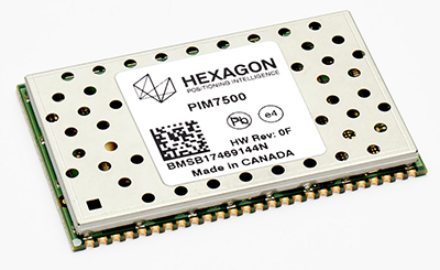
    AutonomouStuff provides the Apollo Kit to project partners: the hardware, software and services required to begin developing their own autonomous vehicle. NovAtel SPAN GNSS/INS products provide position, orientation and time as a critical component of this kit. A detailed description of the NovAtel (another Hexagon company in the Positioning Intelligence Group) and AutonomouStuff partnership is given in the August 2017 cover story of GPS World, “Autonomy assembled: Driverless kits to hit the road in 2020.”

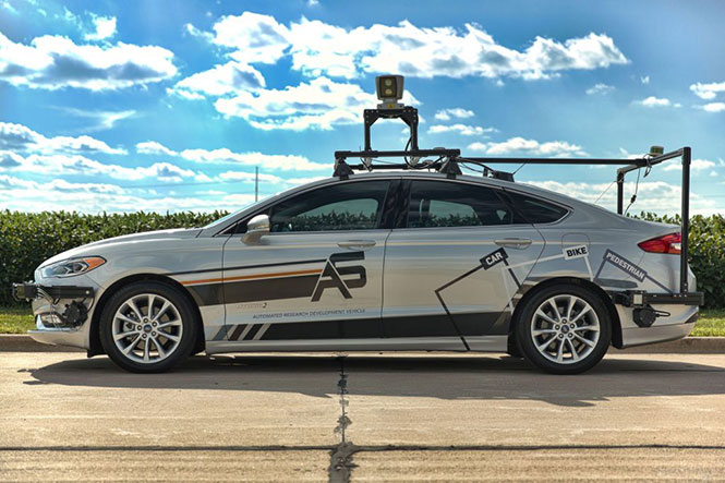
    At a Baidu conference in Beijing, April 2017, AutonomouStuff kitted out two standard Lincoln MKZ sedans for demonstration drives, with one technician completing each vehicle in about three hours — a task that would normally take a team of workers up to six weeks. The two Lincolns then drove simultaneously, driverless, around a test track.

    The technology has been developed to be transferrable to other vehicles. Each car is modified by adding lasers, camera, radar sensors, GPS and inertial measurement unit (IMU), a drive-by-wire computer interface and computer engine.

    As of August 2017, the kit incorporated a choice, depending on user needs, of a selection of NovAtel GNSS receivers, including the ProPak6 GNSS receiver and the SPAN-IGM-A1 GNSS+IMU combined system, IMUs such as the IMU-ISA-100C incorporating Northrop-Grumman Litef GMBH’s inertial measurement technology, and antennas such as the GNSS-703-GGG-HV high vibration triple-frequency GPS, GLONASS, BeiDou and Galileo antenna. A 64-beam Velodyne lidar sensor and 16-beam HDL-16E provide laser data. Some units may have changed since then.

    Terry Lamprecht, director of products at AutonomouStuff, gave a presentation on verifying proper installation, and creating a baseline data set to benchmark against data collected on autonomous vehicles in real-time, as part of a November 2017 GPS World webinar, “High Accuracy for Autonomous Driving.” Download the free webinar here.

    Completion of the transaction is subject to regulatory approvals, including a voluntary filing to the Committee on Foreign Investment in the United States, and other customary conditions that are expected to be satisfied within the next 90 days.

  • Hexagon’s new PIM7500 GNSS receiver chosen for autonomous buses

    The Hexagon PIM7500 GNSS receiver.

    Hexagon’s Positioning Intelligence division has released the PIM7500 GNSS receiver explicitly designed for autonomous automotive platform development and solutions.

    The single-sided receiver features a compact form factor that solders down directly for easy integration with electronic control modules and artificial intelligence (AI) development platforms, the company said.

    The new receiver features dual-frequency GNSS reception from all available constellations including GPS, GLONASS, Galileo, BeiDou, NavIC, QZSS and SBAS. It offers sub-meter and centimeter-level positioning using Hexagon Correction Services to deliver the high-accuracy positioning required for the autonomous industry.

    The PIM7500 is available in low to mid-volume quantities, making it a suitable GNSS receiver for mileage accumulation fleets.

    “Hexagon Positioning Intelligence has a strong commitment to the automotive market and will utilize its leadership in GNSS-based technology to provide high precision and safe positioning systems to the automotive market — now and in the future,” said Andreas Niemann, business development manager at Hexagon Positioning Intelligence.

    PIM7500 chosen for autonomous buses

    Autonomous commuter buses are being developed by Bertrandt, with the PIM7600 GNSS receiver. The test system will be installed on a bus in Regensburg, Germany. (Photo: Patrick Reinig)

    Bertrandt, a European company that specializes in automotive controls technology development, has selected the PIM7500 receiver as the precise positioning component on its innovation platform.

    Bertrandt’s innovation platform uses the PIM7500 receiver and inertial measurement unit (IMU) from Hexagon Positioning Intelligence, combined with lidar sensors, to perform image processing for object detection, collect precise route data and generate highly accurate maps.

    The innovation platform will be implemented on one of the public transportation electric busses in Regensburg, Germany.

    “We are pleased to have Hexagon Positioning Intelligence onboard our innovation platform for this project,” said Ulrich Haboeck, team leader of electronics and software development at Bertrandt. “Hexagon Positioning Intelligence is the perfect fit to provide the GNSS sensor components for the platform because their technology will ensure the success of the project.”

    Bertrandt announced the innovation platform on May 16. Hexagon Positioning Intelligence will be participating in Bertrandt’s TechDays Sept. 27-28 to demonstrate automotive and safety-critical GNSS and inertial solutions.

    “Bertrandt is an ideal technology partner for us, and we are excited to be invited to have the PIM7500 as a component on their innovation platform,” Niemann said.

  • Hexagon Positioning Intelligence attains milestone for safe autonomous driving

    Hexagon’s Positioning Intelligence division has achieved a milestone toward its goal of safe autonomy on the road. The division is developing functionally safe positioning technologies for fully autonomous vehicles and other applications.

    A third-party audit has been completed that confirms process compliance with key automotive specifications ISO/TS 16949 and ISO 26262 Functional Safety Design Assurance. This is an important step toward the development of functionally safe new technology that meets the exceptional safety standards set by the automotive industry, Hexagon said.

    “We’re thrilled to have our core engineering processes updated to meet the requirements of automotive applications,” said Jonathan Auld, vice president of Safety Critical Systems, Hexagon’s Positioning Intelligence division. “We are building on a 25+ year history in safety of life solutions for the marine and aviation industries, and we expect this leadership to serve us well in automotive.”

  • Hexagon offers intelligent cultivation management for agriculture

    Hexagon, a global provider of information technology solutions, has launched HxGN AgrOn Production, an integrated cultivation management solution that empowers customers to optimize resource efficiency, increase yield, reduce inputs and ensure quality.

    The solution is comprised of software and hardware solutions that optimize and automate entire crop cycles from planning to cultivation.

    Hexagon officially revealed HxGN AgrOn Production today at Agrishow, one of the world’s largest agricultural technology fairs in the world taking place in Ribeirão Preto, Brazil.

    “Real-time information is the key to efficient field management. HxGN AgrOn Production brings immediate benefits to agricultural and forestry companies — providing instant control of all stages of the cultivation process and enabling resource optimisation and efficiency,” said Ola Rollén, president and CEO of Hexagon.

    According to the company, the solution will enable Hexagon’s customers to achieve a smarter cultivation by connecting, synchronizing and optimizing workflows, teams and information while reducing operating costs.

    HxGN AgrOn Production addresses resource management challenges of enterprise farms and is a future-proof investment in information technology innovations that are enabling the smart digital reality in agriculture.

  • More interference potential from another tower set

    Satellite operator Iridium asked the Federal Communications Commission (FCC) in April 2017 to modify its license to add a new class of ground stations called Certus for expanded terrestrial, maritime and aeronautical operations.

    Iridium’s 66-satellite constellation provides, in addition to mobile communications signals, the Satelles time and location service: microsecond timing accuracy and 20- to 50-meter unaided position accuracy worldwide (see the “Innovation” column, July 2017 GPS World).

    GPSIA. The GPS Innovation Alliance (GPSIA) commented in September, “GPSIA seeks to ensure that radio navigation satellite service (RNSS) receivers operating in the 1559–1610 MHz band are adequately protected from out-of-band emissions (OOBE) generated from the new Certus mobile Earth station (MES) terminals that will operate on the second-generation Iridium satellite system.

    “GPSIA and Iridium are actively engaged in constructive discussions regarding the adequacy of that protection, but no final resolution has yet been reached. [….]

    “In the unlikely event that GPSIA is unable to reach an agreement with Iridium, it asks the commission to impose limitations on the operation of Certus terminal devices to protect GPS/RNSS operations in the 1559–1610 MHz band at a level equivalent to what terrestrial terminals in the same and other frequency ranges provide at –95 dBW/MHz.”

    Iridium Certus infographic.


    Hexagon.
     Hexagon, the parent company of GPS manufacturer NovAtel, commented on Jan. 8, “Certain statements in the modification application regarding output power and amount of terminals to be deployed cause great concern regarding the unimpeded operation of radio navigation satellite service (RNSS) receivers. The application does not include enough information to simulate the impact properly.

    “Hexagon politely requests that the FCC will exercise the same due diligence [as] during previous modification applications close to the RNSS bands (for example docket 11-109) and establish a technical working group or a similar testing process that ensures unimpeded coexistence of the modified Iridium terminals with the established RNSS systems.”

    Documents related to the case can be found here, on the FCC International Bureau website.

  • Indian university opens GNSS laboratory

    The Jawaharlal Nehru Technological University-Hyderabad (JNTU-H) and Hexagon Capability Centre India (HCCI) have established a GNSS laboratory at the Centre for Spatial Information Technology, JNTU-H, reports Telangana Today.

    The university is located in Kukatpally, Hyderabad, in the Indian state of Telangana.

    The lab is equipped with NovAtel GNSS receivers, antenna, systems, cables and other hardware components. The equipment enables reception, processing, analysis and development of navigational data and applications to augment curriculum for JNTU-H students for research and education.

    The establishment of the GNSS lab will also provide an opportunity to the students, scholars and faculty members to carry out research in satellite-based navigation and to develop advanced applications.

    HCCI will provide internship to the students with financial support and job opportunities. This provision will not only be for CSIT students, but also for students with geo-informatics background from other constituent units of JNTU-H.

    After opening the lab, Michael Kinahan, the software director of Hexagon Positioning Intelligence (NovAtel products division of Hexagon group) discussed various technical aspects of the NovAtel products with the potential of applying high-precision positioning capabilities to solve real-world challenges.

  • Hexagon acquires 5D visualization company Luciad

    Hexagon AB has acquired Luciad, a Belgian-based software company specializing in the visualization and analysis of real-time geospatial information.

    Hexagon_logoLuciad’s visualization technologies support live connections to dynamic sensor feeds in a 3D environment. The result is a 5D digital reality — real-time, rapid fusion of multi-source content and the ability to perform analytics on-the-fly.

    These intuitive command and control systems benefit all kinds of applications, from public safety to smart cities to defense and intelligence, enabling users to make critical decisions based on changing information in real time.

    “This acquisition strengthens Hexagon’s ability to deliver smart digital realities, enhancing our Smart M.App platform with 3D, 4D (real-time sensor feed integration) and 5D (dynamic analytics) capabilities,” said Hexagon president and CEO Ola Rollén. “The ability to rapidly integrate sensor data in a visually compelling environment provides the geospatial location intelligence and situational awareness necessary for mission critical operations.”

    Luciad has more than 100 highly-skilled professionals in eight countries, with 100,000 users of its technology globally.

    Luciad will be fully consolidated as of today, operating within Hexagon’s Geospatial division. The company’s turnover for 2016 amounted to 16 MEUR.

  • GeoMax highlights desktop software at Intergeo 2017

    GeoMax, part of Hexagon, highlighted its X-PAD Office Fusion desktop software at Intergeo 2017, which took place Sept. 26-28 in Berlin, Germany. Application Manager Diego Borsani discusses the software, which allows users to avoid passing data from one program to another, according to the company.

  • HxIP announces updates to 2017 airborne imagery collection plans

    Latest imagery collection covers U.S., Canada, Europe; plans include territories, cities

    The Hexagon Imagery Program (HxIP) has updated its 2017 airborne imagery collection plans of Wide Area Coverage (WAC) at 30-centimeter accuracy and Urban Area Coverage (UAC) at 15-cm accuracy in North America and Europe.

    By the end of 2017, the HxIP will update its content for more than 3.9 million km² in North America. This includes a refresh of 18 previously captured U.S. states and completes the full coverage of the continental United States, Hawaii, Puerto Rico, the U.S. and British Virgin Islands, and select areas of Alaska.

    The HxIP announces updates to 2017 airborne imagery collection plans of Wide Area Coverage (WAC) at 30-centimetre accuracy and Urban Area Coverage (UAC) at 15 cm accuracy in North America and Europe.
    The HxIP announces updates to 2017 airborne imagery collection plans of Wide Area Coverage (WAC) at 30-centimetre accuracy and Urban Area Coverage (UAC) at 15 cm accuracy in North America and Europe.

    In addition to the 30-cm program, the HxIP expands its 15-cm collection by 100 cities for a total of 347 U.S. urban areas covering more than 492,000 km². The HxIP also includes 23 Canadian cities at 30 cm with efforts underway to refresh and expand the Canadian library.

    This year will see the addition of approximately 650,000 km² in Europe bringing, the Western European coverage to more than 2.2 million km². Including countries such as Italy, Germany, Spain, France and Poland, this coverage expands the HxIP on the global stage, making it one of the most comprehensive, imagery programs in the world.

    Hexagon-Europe-W

    “Over the last three years since we launched the program, we have been extensively growing our coverage through adding new imagery acquisition partners and increasing our resources to support the program,” said John Welter, Hexagon Geosystems Content and Engineering Services president. “We are well on track to meet our 2017 goals, and we are continuously improving our offerings to better support our users, including completing coverage and reducing the time it takes to refresh our content.”

    Quality control by experts. Launched in June 2014, the HxIP provides valuable geospatial content and delivers professional-grade airborne images captured with Leica Geosystems’ airborne sensors, including enhanced-resolution, four-band orthos, rasterized point clouds, and stereo imagery.

    Captured by a network of Leica Geosystems airborne users, the data is processed by experienced photogrammetry professionals who ortho rectify, and correct colors and seam lines. Using the latest processing technology, these experts clean the data to be used in various applications, such as corridor mapping, real estate assessments and flood planning.

  • Hexagon launches HxGN AgrOn Logistics harvest solution for sugarcane, forestry

    Hexagon launches HxGN AgrOn Logistics harvest solution for sugarcane, forestry

    Hexagon, a global provider of information technology solutions, has launched HxGN AgrOn Logistics, an end-to-end solution enabling sugarcane and forestry producers to manage and optimize the complex logistics processes essential to harvest.

    HxGN AgrOn Logistics will be officially unveiled today at Agrishow, one of the world´s largest agricultural technology trade shows, in Ribeiro Preto, Brazil.

    “In agriculture and forestry operations, success is defined by productivity,” said Hexagon President and CEO Ola Rollén. “Efficiently moving product from field to processing is one of the most critical phases of production, and one filled with logistical risks. HxGN AgrOn Logistics is streamlining and optimizing this entire process,”

    AgrOn Logistics simplifies harvest with communications, insights and operations that are continuously optimized — from planning to field to processing. Real-time communications between machines enable easy coordination, while advanced software handles monitoring, capacity planning, scheduling, dispatching, resource management and more intensive data analysis.

    The benefit to sugarcane and forestry harvest operators is complete connectivity, with workflow synchronization that optimizes every step of the process – from planning to dispatching to real-time execution and full machine automation.

    Field-tested by more than 70 producers, AgrOn Logistics users are experiencing steep productivity gains and sharp decreases in raw materials loss, Hexagon said,

    HxGN AgrOn Logistics will put data to work for a more intelligent approach to harvest: connecting, synchronizing and optimizing workflows, people and information while reducing operating expenses.

  • Leica Cyclone REGISTER 360, cloud services offered for digital reality-capture market

    Lieca-Cyclone-WHexagon announced today its new Leica Cyclone REGISTER 360 laser scanning software for simpler, automated registration, and its Cyclone Cloud Services platform for secure global collaboration through an on-demand software-as-a-service model.

    Together, the new products offer users smarter ways to register, visualize and collaborate around digital reality projects, delivering solutions into the architecture, engineering and construction (AEC), plant, survey and public safety markets through the connected Leica Cyclone family.

    “Digital realities are enabling professionals and newcomers to laser scanning to shape the world around us. Whether it’s on a construction site for building documentation or in a plant environment for life cycle updates, efficiencies and productivity gains are realised with the ability to merge reality and digital data quicker and with more accuracy,” said Hexagon President and CEO Ola Rollén. “These new developments in laser scanning registration with our Cyclone software improve the user experience and overall workflow of point cloud processing.”

    Lieca-Cyclone-W2Cyclone REGISTER 360 is the a professional-grade registration software that combines automation, high performance and ease of use into one powerful package available to novices and experts alike. Simplifying and automating the entire production process, Cyclone REGISTER 360 enables users to automatically process, validate and deliver point clouds according to rigorous quality control and reporting standards.

    Cyclone Cloud offers professionals a new way to consume and deliver digital reality data through a highly scalable, intuitive and web-based platform. TruView Cloud Services is the only cloud-based digital reality visualization and collaboration platform that enables quick setup of private user communities, connecting with and making the data available anywhere in the world.

    Users can publish digital reality content in Cyclone from handheld devices and terrestrial, mobile and unmanned aerial vehicles. With open application programming interfacing, the data can be delivered in any device and operating system with connectivity for building information modeling, geographic information systems and computed-aided drafting.

  • Hexagon acquires mobile app company Catavolt

    Hexagon, a global provider of information technology solutions, has acquired Catavolt, a U.S.-based mobile app platform provider. Catavolt, founded in 2009 with headquarters in Atlanta, Georgia, offers an end-to-end platform for mobile application development and delivery, secure cloud orchestration and edge computing (real-time).

    Catavolt’s team of experts are highly skilled in cloud and mobile technologies as well as enterprise software solutions — all fundamental to furthering Hexagon’s SMART X strategy, which is driven by the desire to make entire systems more efficient. Systems built around an information network with connectivity at the core, serving up data in the most intelligent and visually meaningful way, Hexagon said.

    “Connectivity platforms and mobile applications are essential to driving improvements in productivity and efficiency. Both must also integrate with legacy systems and on premise infrastructures as customers make the transition from old to new,” says Hexagon President and CEO Ola Rollén. “Catavolt’s technologies provide an open architecture and solid foundation for realising the transformative potential of both cloud and edge computing and will seamlessly connect to Hexagon’s connectivity platform — SMART Convergence.”

    Edge computing, or edge data-processing and analytics, accelerates response times by analyzing streaming data at the source, in real-time, versus transferring it to the cloud first. This is especially important in time critical scenarios like smart traffic systems and autonomous vehicles.

    Catavolt’s expertise will enable Hexagon to advance its digital transformation platform, HxGN SMART Convergence, which orchestrates connectivity (IoT), intelligence (AI) and visualization (VR/AR/MR) technologies according to industry-specific needs and user-specific workflows.

    The platform is managed by Hexagon’s Innovation Hub, a central R&D unit that develops enabling technologies for leverage by all of Hexagon’s divisions. This ensures platform development is based on standard protocols and easily customizable for different industry use cases.

    Catavolt’s cloud technology is fully open and runs on any cloud. Currently deployed across AWS, Rackspace and Microsoft Azure, the robust and mature platform supports more than 3,000 client applications.