Tag: ICAO

  • ICAO urges action on drones, missiles and GNSS jamming threats to civil aviation

    ICAO urges action on drones, missiles and GNSS jamming threats to civil aviation

    The International Civil Aviation Organization (ICAO) is calling for stronger measures to protect civilian aircraft from military threats, warning that the risk of weapons targeting civilian planes is increasing worldwide.

    ICAO Secretary-General Juan Carlos Salazar told delegates at the 2026 World Overflight Risk Conference in Vallarta, Malta, that emerging military technologies — including long-range weapons systems, unmanned aircraft systems (UAS), GNSS radio frequency interference, and advanced air defense systems — pose growing risks to civil aviation.

    “We must now reach beyond the boundaries of aviation as we have known it,” Salazar said, adding that increasingly sophisticated weaponry is creating conditions in which civilian aircraft face a heightened risk of being targeted or caught in crossfire.

    While praising the aviation industry’s ability to reroute flights and maintain operations during the recent Middle East crisis, Salazar said operational flexibility alone cannot address the underlying security threats posed by weapons systems.

    He commended states and airspace users for measures taken to mitigate safety and security risks during the escalation in the Middle East, noting that more than 10 states partially or fully closed their airspace, significantly disrupting international air transport.

    “This commitment to resilience, adaptation, safety and security is the foundation of our industry,” he said, calling for concrete steps to prevent civil aviation facilities, airports and aircraft from being targeted.

    Salazar cited ICAO Assembly Resolution A42-4 and Article 3 bis of the Chicago Convention — which prohibit the use of weapons against civilian aircraft — as the legal basis for stronger protections. He said, however, that international law alone has proven insufficient as regional conflicts intensify.

    Following ICAO guidance, Salazar urged states to take three immediate actions: rapidly share threat intelligence when activities pose risks to civilian aircraft; strengthen risk assessment and timely decision-making; and improve coordination between military and civilian authorities to prevent misidentification of civilian aircraft as military targets.

    ICAO is finalizing a Global Crisis Management Framework to coordinate responses when civil aviation faces threats. Salazar said the reactive framework must be paired with proactive measures to prevent attacks.

    The organization is also updating its Manual Concerning Safety Measures Relating to Military Activities and its Risk Assessment Manual for Civil Aircraft Operations Over or Near Conflict Zones, with a focus on improving how authorities, airlines and air navigation service providers assess threats from malicious activity.

    Recent disruptions during the Middle East crisis demonstrated both the industry’s adaptability and the economic impact of operating in an increasingly militarized airspace environment. ICAO regional contingency frameworks have supported rerouting when airspace becomes unsafe, but officials said such measures are costly and temporary, not solutions to underlying security risks.

    The two-day Malta conference, which opened April 21, brought together aviation officials and security experts from multiple regions to discuss implementation of safety protocols and information-sharing mechanisms. The Safer Skies initiative also serves as a framework for those discussions.

    Salazar’s remarks mark one of ICAO’s most direct acknowledgments of growing risks to civil aviation arising from conflict zones, reflecting the organization’s core mission to maintain safe and secure international air travel amid rising geopolitical tensions.

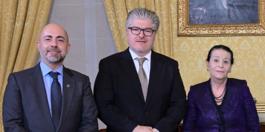
    Following the conference, Salazar met with Myriam Spiteri Debono to discuss global and regional developments affecting aviation, with a focus on the role of multilateral cooperation in addressing emerging challenges, including conflict-zone risks. He also commended Malta’s aviation sector.

    Salazar was accompanied by Nicolas Rallo, director of ICAO’s European and North Atlantic Regional Office.

  • Qatar hosts regional workshop on GNSS interference

    Qatar hosts regional workshop on GNSS interference

    The Qatar Civil Aviation Authority (QCAA) this week is hosting the Joint ICAO Europe and North Atlantic (EUR/NAT) and Middle East (MID) Workshop on GNSS Radio Frequency Interference, reports the Qatar News Agency.

    The workshop is organized jointly by the ICAO EUR/NAT and MID Regional Offices and is being held in Doha, Qatar, Nov.18-20.

    In the opening session, Mohamed bin Faleh Al Hajri, QCAA manager, reaffirmed Qatar’s commitment to enhancing aviation safety and efficiency through close collaboration with ICAO and regional partners.

    The workshop brings together countries and stakeholders from the EUR/NAT and MID regions to address the increasing threat that GNSS radio frequency interference poses to aviation safety and efficiency. Al Hajri emphasized the importance of active participation to exchange experiences, strengthen cooperation, and build sustainable partnerships that support GNSS resilience.

    He highlighted that hosting the workshop reflects joint efforts aimed at strengthening the robustness and reliability of GNSS — a core pillar in ensuring the safety and efficiency of international air navigation.

    Regional dialogue

    The workshop aims to:

    • facilitate regional dialogue on the operational impact of GNSS radio frequency interference
    • share experiences among participating States and stakeholders
    • explore measures to improve reporting mechanisms, enhance mitigation strategies, and strengthen the overall resilience of satellite-based navigation systems.

    It also seeks to reinforce cooperation between the EUR/NAT and MID Regions to safeguard the infrastructure and integrity of GNSS-based navigation systems.

  • Maritime agency warns of AIS jamming in Red Sea region, ICAO condemns Russia and North Korea

    Maritime agency warns of AIS jamming in Red Sea region, ICAO condemns Russia and North Korea

    The UK Maritime Trade Operations (UKMTO) has issued an advisory following a surge in reports of interference affecting GNSS and Automatic Identification System (AIS) displays. The disruptions, which began Oct. 3, are concentrated around Bandar-e-Pars (Iran), the Strait of Hormuz and Port Sudan.

    “UKMTO has received numerous reports of GNSS interference from vessels in the Red Sea and Persian Gulf, between October 3 and 7,” the operations centre said in the alert. “This is a significant increase of reports compared with the same period in the previous week.”

    UKMTO urged vessels to exercise heightened caution. Ships in the Gulf, Port Sudan, and Suez Canal areas are experiencing consistent AIS speed anomalies, further complicating navigation.

    Russia and North Korea named as culprits

    Also this week, the International Civil Aviation Organization (ICAO) Assembly issued two resolutions condeming Russia and North Korea for recurring incidents of GNSS interference, citing the intentional interference as infractions of the 1944 Convention on International Civil Aviation. The agency urgently called upon both countries to comply strictly with their obligations under the convention.

    The assembly also deplored the fact that incidents of GNSS interference originating from the two countries have continued despite concerns repeatedly expressed by the ICAO Council about the harmful impact of GNSS interference on the safety and security of international civil aviation. 

    Photo: ICAO
    Photo: ICAO

    The assembly reiterated the paramount importance of preserving the safety and security of international civil aviation through strict compliance with the principles enshrined in the Chicago Convention and its Annexes. It also recalled Assembly Resolution A41-8, which recognized that the spectrum used by GNSS should be free from harmful interference and urged countries to refrain from any form of jamming or spoofing affecting civil aviation.

    The resolutions were issued as the ICAO triennial assembly in Montreal concluded on Oct. 5.

  • Korea’s KASS now certified and operational

    Korea’s KASS now certified and operational

    Image: imaginima/ iStock / Getty Images Plus/ Getty Images
    Image: imaginima/ iStock / Getty Images Plus/ Getty Images

    The Korea Augmentation Satellite System (KASS), designed and implemented by Thales Alenia Space, has been officially certified by Korean national authorities and has entered operational service. The system was developed in partnership with the Korea Aerospace Research Institute (KARI) on behalf of the Korean Ministry of Land, Infrastructure and Transport (MOLIT).

    The project has received support from various international and European entities, including the European Commission, the European Union Agency for the Space Programme (EUSPA), the European Space Agency (ESA), the European Aviation Safety Agency (EASA) and the French Space Agency (CNES).

    KASS, operational via the MEASAT-3d geostationary satellite launched in 2022, will soon be enhanced by the addition of KOREASAT 6A. It is currently under development by Thales Alenia Space for KT SAT Corporation, South Korea’s leading satellite communications operator.

    The addition of KOREASAT 6A — equipped with a satellite-based augmentation system (SBAS) payload by Thales Alenia Space — aims to improve the system’s service continuity and operational availability.

    Designed to meet international standards set by the International Civil Aviation Organization (ICAO), KASS will initially prioritize aircraft applications and focus on Safety of Life services critical during flight phases, including landing. This focus is intended to enhance flight safety and efficiency while minimizing the environmental impact of aviation. Additionally, KASS is designed to be interoperable with other SBAS satellite navigation systems worldwide to offer seamless flight safety across different zones.

    KASS, the second SBAS system developed by Thales Alenia Space following EGNOS (the European Geostationary Navigation Overlay System), is designed to optimize GPS constellation performance and includes upgrades compatible with the Galileo and Korean Positioning System (KPS) constellations. By enhancing the integrity, availability, continuity of services and positioning accuracy, KASS aims to reduce GPS positioning errors from the current 15 to 33 m to approximately 1 m across Korea.

    Future expansions of the KASS services are anticipated to include public safety, road transport, shipping, and scientific applications.

  • ICAO adopts international standards for Galileo and future SBAS

    ICAO adopts international standards for Galileo and future SBAS

    Image: Chalabala/iStock/Getty Images Plus/Getty Images
    Image: Chalabala/iStock/Getty Images Plus/Getty Images

    The International Civil Aviation Organization (ICAO) has adopted international standards for Galileo and future satellite-based augmentation systems (SBAS). This is a milestone for the aviation industry, as the European Union Agency for the Space Programme (EUSPA) can now fully leverage the potential of satellite navigation services developed in Europe — in combination with GPS — to make air travel safer, more efficient, and more reliable.

    Galileo will provide advanced navigation capabilities to aviation, improving the availability and reliability of services. The risk of loss or interference will be significantly reduced with a more accurate and secure signal for positioning and timing.

    Additionally, the evolution to the European Geostationary Navigation Overlay Service (EGNOS) v3 will augment Galileo and enable the use of its dual-frequency bands — E1 and E5, protected for aviation use — in combination with GPS. This enhances vertical guidance to enable precision approach and landing capabilities for all equipped aircraft across Europe.

    The adoption of these international standards is a result of the work done by the European Commission Directorate-General for Defence Industry and Space, in partnership with EUSPA, DG-MOVE, European Aviation Safety Industry, the European Space Agency and in coordination with the EU Member States and their ANSPs.

  • African space weather center provides 24/7 forecasts

    African space weather center provides 24/7 forecasts

    Photo:
    Image: South African National Space Agency

    The South African National Space Agency (SANSA) launched the South Africa Space Weather Center at Hermanus in November to provide real-time space weather forecasts. The space weather center detects space weather conditions such as strong solar flares that could disturb Earth’s magnetic field and severely affect ground-based electrical and electronic systems.

    The space weather center collects data in real-time from solar satellites and a ground-based instrumentation network which consists of three kinds of sensors: GNSS receivers, magnetometers and an ionosonde system. Space weather conditions are then broadcast to South Africa and the rest of the continent to provide critical 24/7 space weather alerts for airlines, air traffic control agencies, telecommunications companies and satellite operators.

    The International Civil Aviation Organization now recognizes the space weather center, as the launch filled the void in global space weather monitoring and 24/7 forecasting coverage.

    SANSA received approval for the space weather center in 2019 and overcame many challenges during its development, such as limited funding for research, personnel, and equipment, as well as the COVID-19 pandemic.

  • UK’s SBAS signal repurposed for sovereign UK PNT capability

    UK’s SBAS signal repurposed for sovereign UK PNT capability

    The tests will assess whether UKSBAS can develop into a full operational capability to support safety-critical applications

    Artist's impression of an Inmarsat-3 satellite. (Image: Inmarsat)
    Artist’s impression of an Inmarsat-3 satellite. (Image: Inmarsat)

    An Inmarsat-led team of companies in the United Kingdom has begun broadcasting a satellite navigation signal as part of a program to explore the creation of a sovereign national capability in resilient positioning, navigation and timing (PNT) for the aviation and maritime sectors.

    The signal, being broadcast in coordination with the U.S. Federal Aviation Administration (FAA), the European Space Agency (ESA) and the European Union Space Programme Agency (EUSPA), is now stable and operational, enabling ongoing testing and validation by industry, regulators and users.

    Inmarsat, a satellite communications company, alongside British partners Goonhilly Earth Station and GMV NSL, is delivering the UK Space Agency-funded tests with the European Space Agency via ESA’s Navigation Innovation and Support Program (NAVISP).

    The UK Space-Based Augmentation System (UKSBAS) generates an overlay test signal to the U.S. GPS, compliant with International Civil Aviation Organization (ICAO) standards, to enable assessment of more precise, resilient and high-integrity navigation for maritime and aviation users in UK waters and airspace. It increases accuracy in positioning to a few centimeters of accuracy rather than the few meters provided by standard GPS.

    This is a similar system to that already under evaluation in Australia and New Zealand, supported by Inmarsat.

    Since leaving the European Union, the UK is not part of the Galileo satnav system and cannot use the European Geostationary Navigation Overlay Service (EGNOS) safety of life (SOL) services, which enable the use of GPS for airport approach and landing operations for aircraft. The UK ceased to have access to EGNOS on June 25, 2021.

    By repurposing the SBAS transponder on Inmarsat’s I-3 F5 satellite in geostationary orbit at 54° west, the UKSBAS signal enables testing of this potential alternative system. Built by Inmarsat’s Athena partner Lockheed Martin and launched in 1998, I-3 F5 covers the UK as part of its Atlantic Ocean region service overlay. This makes it a suitable candidate to participate in this test and demonstrates the commitment to sustainability of Inmarsat with a satellite that has already served the equivalent of several low Earth orbit (LEO) satellite life cycles.

    “The Inmarsat team is inspired by delivering solutions to new problems through technology and innovation,” said Todd McDonell, president, Global Government at Inmarsat. “Repurposing a transponder on a long-serving satellite to deliver a new capability to the UK, potentially a vital and enduring one, certainly lives up to that core Inmarsat ethos. Working with our fellow British companies at Goonhilly and GMVNSL to deliver such a capability for the country is very rewarding, and we look forward to reporting on the results.”

    The tests will assess whether UKSBAS can develop into a full operational capability to support safety-critical applications such as airport approach and landing operations or navigating ships through narrow channels, especially at night and in poor weather conditions.

    Goonhilly provides the signal uplink for the system from Cornwall; software from Nottingham-based GMVNSL generates the necessary navigational data.

    “The UK’s thriving space sector is developing at pace, and British-led innovations like this have the potential to deliver crucial navigation services for our aviation and maritime sectors.” said Transport Minister Robert Courts. “That’s why this government is investing millions in new technologies to make our transport network even safer while boosting high-skilled job opportunities across the nation.”

    UKSBAS is helping to regenerate UK strategic capabilities in this domain. The establishment of this new national platform creates the opportunity to evaluate high-integrity, resilient and precise navigation across the country, in its airspace and within surrounding waters. The project may be crucial for UK users who need accurate, high-integrity navigation capabilities to enable their operations, initially covering aviation and maritime operations but with potential extension into rail and road applications.

    “Congratulations to Inmarsat, Goonhilly and GMVNSL on this impressive achievement,” said Paul Bate, CEO of the UK Space Agency. “In recent years, the UK Space Agency has invested in the development of UK expertise in positioning, navigation and timing (PNT), and the government’s commitment to strengthening PNT resilience is set out in both the National Space Strategy and Integrated Review, given its importance to our critical national infrastructure and economy. “This project is a great example of the innovation found throughout the UK space sector and demonstrates how we can work effectively with the European Space Agency to strengthen our national space capabilities.”

  • ICAO requests information on unmanned traffic management systems

    During AUVSI Xponential 2017, the International Civil Aviation Organization (ICAO), a specialized agency of the United Nations, announced a Request for Information (RFI) on traffic management systems for unmanned aircraft systems (UAS).

    The RFI is an opportunity for industry and governments to submit ideas to define the issues so that global solutions can be proposed, debated and agreed on.

    As UAS operations become more complex and are increasingly used for both commercial and recreational purposes, UAS traffic management systems, or UTM, are necessary to seamlessly integrate UAS into the airspace and existing air traffic management systems.

    An operational UTM will ensure the safe and efficient use of the airspace as UAS operations become more complex, such as with established navigation routes and point-to-point route segments requiring specific equipage requirements. UTM will integrate UAS into the existing airspace infrastructure to ensure the continued safety of the airspace.

    Any framework for a UTM will include many components, three of which are fundamental and will therefore be addressed as a matter of priority: ​

    • Registration system from which data is accessible in real time to allow remote identification and tracking of each UA, its operator/owner and location of the remote pilot/control station. To accommodate UA that are increasingly transported from one state to another for either recreational or professional use, this database should allow global access.
    • Communications systems for control of the UA and for tracking all UA within the UTM area. The communications system used for tracking UA must be able to identify when a manned aircraft is entering UTM airspace and provide an acceptable level of protection between it and UA operating in the airspace. Furthermore, it must facilitate detection of potential collisions with other UA and with obstacles such that appropriate avoidance action can be taken.
    • Geofencing-like systems that will support automatic updates by national authorities on the 28-day aeronautical information regulation and control (AIRAC) cycle to prevent UA operation in sensitive security areas and restricted or danger areas such as near aerodromes.

    ICAO is soliciting proposals for a global framework for UTM ahead of its Drone Enable UAS Industry Symposium, which will take place in Montreal, Canada, in September.

    “ICAO is the natural agency to be gathering together the best and brightest from governments and industry to define the problem so that global solutions can be proposed, debated and agreed on,” said Leslie Cary, ICAO remotely piloted aircraft systems program manager.

    “Collaboration between stakeholders is key to addressing complex issues such as UTM,” added Brian Wynne, president and CEO of AUVSI. “AUVSI is pleased ICAO is taking steps to explore solutions for UTM that will allow companies to operate globally under the same standards, reducing barriers to innovation and improving safety and security for all aircraft – both manned and unmanned. We look forward to working with ICAO to draw awareness and facilitate industry engagement in the RFI process.”

    For more information about the RFI, visit ICAO’s RFI website. Submissions need to be received no later than July 15.

  • Traffic management systems for UAS requested by UN agency

    The International Civil Aviation Organization (ICAO), a specialized agency of the United Nations, and the Association for Unmanned Vehicle Systems International (AUVSI), announced a Request for Information (RFI) on traffic management systems for unmanned aircraft systems (UAS). ICAO announced the RFI at AUVSI’s Xponential 2017, the  trade show for the unmanned systems and robotics industry.

    As UAS operations become more complex and are increasingly used for both commercial and recreational purposes, UAS traffic management systems, or UTM, are necessary to seamlessly integrate UAS into the airspace and existing air traffic management systems. ICAO will solicit proposals for a global framework for UTM ahead of its Drone Enable UAS Industry Symposium, which will take place in Montreal, Canada in September.

    “ICAO is the natural agency to be gathering together the best and brightest from governments and industry to define the problem so that global solutions can be proposed, debated and agreed,” said Leslie Cary, remotely piloted aircraft systems program manager at ICAO.

    An operational UTM will ensure the safe and efficient use of the airspace as UAS operations become more complex, such as with established navigation routes and point-to-point route segments requiring specific equipage requirements. UTM will integrate UAS into the existing airspace infrastructure to ensure the continued safety of the airspace.

    “Collaboration between stakeholders is key to addressing complex issues such as UTM,” added Brian Wynne, president and CEO of AUVSI. “AUVSI is pleased ICAO is taking steps to explore solutions for UTM that will allow companies to operate globally under the same standards, reducing barriers to innovation and improving safety and security for all aircraft – both manned and unmanned. We look forward to working with ICAO to draw awareness and facilitate industry engagement in the RFI process.”