Tag: inertial measurement unit

  • Emcore SDI500/505 IMU receives non-ITAR status, company gets defense nods

    Emcore SDI500/505 IMU receives non-ITAR status, company gets defense nods

    The non-ITAR status greatly increases the marketability of the SDI500/SDI505 IMUs to international customers. Plus, Emcore releases new SDI170 IMU and is awarded defense contract.

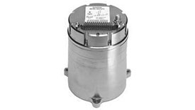
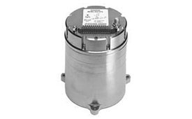
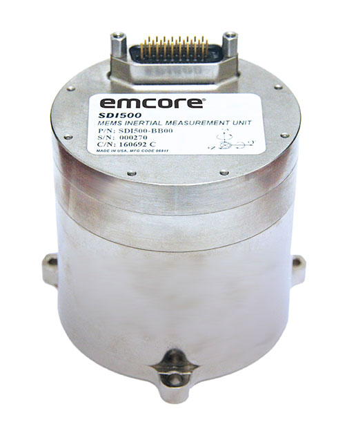
    Emcore’s dual-use SDI500/SDI505 Revision F inertial measurement units (IMUs) have received a determination that they are not subject to the International Traffic in Arms Regulations (ITAR) administered by the U.S. Department of State. Emcore has likewise determined that its SDN500 inertial navigation system (INS) is not subject to ITAR.

    The determination of non-ITAR status is expected to dramatically increase the size of the market that Emcore can address with its quartz micro-electro-mechanical systems (QMEMs) IMU and INS devices.

    Photo: Emcore
    Photo: Emcore

    Ranked Top in Trade Study. The SDI500/505 IMU was ranked first in overall accuracy, reported Emcore, in a U.S. military-commissioned trade study of 19 IMUs being evaluated as an alternative to the Honeywell HG1700 for various weapons systems.

    The objective of the third-party independent study was to deliver a comprehensive report to the government and make a recommendation supported by clear and compelling technical, financial, and other relevant data collected regarding the most advantageous IMU products and services available in the market today. 19 IMUs of various technologies, complexity, cost, and developmental status, from leading manufacturers, were evaluated in short and long flyout simulations against the HG1700.

    The dual-use non-ITAR SDI500/505 IMUs are designed to achieve the demanding performance levels required in sophisticated systems, including weapons guidance and targeting, commercial and defense fixed-wing aircraft and helicopters, unmanned autonomous vehicles (UAVs), and a wide variety of other high-precision commercial, industrial, marine, defense and space applications. They leverage quartz MEMS technology to deliver angle random walk (ARW) values of 0.02°/√hr with 1°/hr bias stability.

    Defense Contract Award. In March, Emcore was awarded a development contract valued at $1.1 million by a major U.S. prime contractor to design and manufacture a high-end IMU for tactical intelligence and reconnaissance systems. The prototype phase has been successfully completed and as part of the contract in this follow-on phase, Emcore will deliver initial production units that will be used for proof of manufacturing and system level qualification.

    The custom IMU will be based on Emcore’s proprietary closed-loop fiber-optic gyro (FOG) technology that delivers proven CSWaP (cost, size, weight and power) and performance advantages over other FOGs and competing technologies. It is designed to deliver the highest level of performance in Emcore’s tactical IMU product line, exceeding Emcore’s EN-300. Emcore’s FOG IMU technology delivers ten times the bias performance of legacy systems in compact form-, fit- and function-compatible packages.

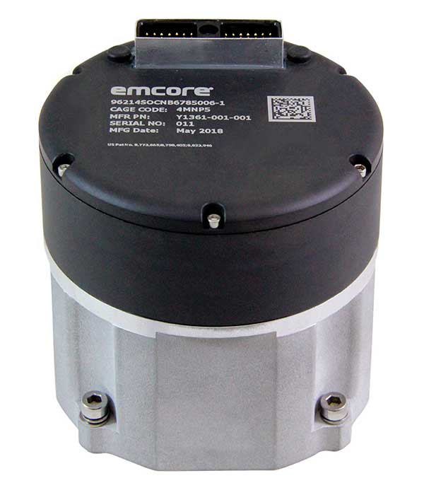
    New SDI170 IMU. Emcore also launched a replacement IMU. The new SDI170 quartz MEMS tactical-grade IMU is designed as a form-, fit- and function-compatible replacement for the HG1700-AG58 ring-laser gyroscope (RLG) IMU, but with superior overall performance, versatility and a significantly higher mean time between failures (MTBF) rating over ruggedized environments.

    The SDI170 IMU is suitable for continuous-use applications with no wear-out components and delivers highly linear accelerometer performance and longer life compared to the HG1700 IMU. It is not ITAR controlled and has completed extensive internal and external customer testing to confirm compatibility to replace legacy products.

    The unit is designed for a wide range of high-precision, integrated commercial and defense applications including aircraft Attitude Heading Reference Systems (AHRS), GPS-aided navigation, ground surveying, mobile mapping, ROVs, autonomous vehicles, tactical weapons, and stabilization platforms.

    Non-ITAR Determination. As a result of this Commodity Jurisdiction (CJ) determination concluded by the U.S. Department of State, EMCORE’s SDI500/SDI505 Revision F commercial off-the-shelf (COTS) offerings were confirmed to be subject to the Export Administration Regulations (EAR) administered by the Department of Commerce (DOC). EAR classification typically results in fewer export-related restrictions and requirements. For this reason, this CJ determination for the SDI500/SDI505 will greatly increase the marketability of these IMUs to international customers.

    The SDN500 is Emcore’s most advanced QMEMS INS/GPS tactical-grade system, combining the latest generation quartz gyros and accelerometers from the SDI500/SDI505, with high-speed signal processing and a 48-channel coarse/acquisition code GPS receiver into a powerful, tightly coupled guidance and navigation system.

    “We would like to thank the U.S. Department of State for its evaluation of our commodity jurisdiction request and conclusion that our dual-use SDI500/SDI505 IMUs are not subject to ITAR,” said David Hoyh, Emcore’s director of sales and marketing for navigation products. “The determination of EAR status under the DOC enables more customers worldwide to benefit from these important, high-precision Emcore products.”

  • Septentrio launches AsteRx-i3, its next-gen GNSS/INS product line

    Septentrio launches AsteRx-i3, its next-gen GNSS/INS product line

    By expanding its GNSS/INS product family, Septentrio starts offering more application-specific positioning and orientation solutions

    Septentrio, a leader in high-precision GNSS positioning solutions, has launched the AsteRx-i3 — a new product line of high-performance GNSS plus inertial navigation system (INS) receivers.

    The AsteRx-i3 product family brings to market an array of next-generation receivers from plug-and-play navigation solutions to feature-rich receivers with raw measurement access. OEM boards are available for rapid integration as well as ruggedized receivers enclosed in a waterproof IP68 housing.

    The variety of products in the AsteRx-i3 line accommodates the specific needs of applications that require high-accuracy positioning together with 3D orientation, heading, pitch and roll angles.

    The AsteRx-i3 Pro+ in a rugged housing. (Photo: Septentrio)
    The AsteRx-i3 Pro+ in a rugged housing. (Photo: Septentrio)

    “Using our off-the-shelf GNSS/INS systems allows our customers to focus their efforts on core technology and to reduce their products’ time-to-market,” said Danilo Sabbatini, product manager at Septentrio. “With this new generation of products, we aim to satisfy specific needs of various customers. Instead of releasing a single general-purpose product, we bring several dedicated solutions for fastest and easiest integration into systems that require robotic navigation or sensor fusion.”

    AsteRx-i3 Pro+ receivers support either single- or dual-antenna modes. The single-antenna mode is suitable for compact and light-weight configurations. The dual-antenna mode reduces the need for movement during IMU initialization, allowing fully informed navigation from mission start.

    The AsteRx-i3 product line includes five new GNSS/INS receivers.

    • The Pro receivers offer high accuracy positioning with 3D orientation and dead-reckoning functionality for fastest and easiest plug-and-play integrations.
    • The Pro+ are the most versatile receivers providing integrated positioning and orientation along with raw measurements, in single- or dual-antenna configurations, suitable for applications with sensor fusion. One of the receivers offers an off-board inertial measurement unit (IMU), which can be mounted exactly at the alignment point of interest.

    For more information about the new AsteRx-i3 product line visit Septentrio.com/products or contact Septentrio.

    Photo: Septentrio
    Photo: Septentrio
  • CHC Navigation launches light, accurate UAV lidar system

    CHC Navigation launches light, accurate UAV lidar system

    Photo: CHCNAV
    Photo: CHCNAV

    CHC Navigation (CHCNAV) has released the AlphaAir 450 (AA450) lidar system, a lightweight, compact all-in-one sensor for unmanned aerial vehicles (UAVs).

    Featuring an inertial measurement unit (IMU), GNSS, 3D scanner and camera, the AlphaAir 450 solution is suitable for power-line inspections, topographic mapping, emergency response, agricultural and forestry surveys. The unit is easy to use, and can be rapidly deployed in the field to collect geospatial data.

    “Despite the fact that the lidar scanning is an efficient technology to capture 3D data, it still often remains costly and complex to operate,” said Andrei Gorb, product manager of CHC Navigation’s Mobile Mapping Division. “Taking that into account, we introduce the AlphaAir 450 (AA450), a breakthrough lidar scanner that delivers user-friendly and high-accuracy capabilities at a reasonable price.”

    Key aspects of the AlphaAir 450

    Lightweight. The lidar’s weight is a constraint for any drone. The AlphaAir 450 weighs 1 kg, which is suitable to most drones’ payload requirements. The lighter the unit, the longer the operating time of the drone, and the greater the productivity. The AlphaAir 450 can be easily mounted on UAVs, making data capture efficient.

    Advanced Accuracy. By combining industrial-grade GNSS with a high-precision IMU, the AlphaAir 450 can easily achieve an absolute accuracy of 5 cm (vertical) and 10 cm (horizontal) for small survey areas — typically adequate for the most use cases. To further improve precision and accuracy, users can apply adjustment algorithms in the CHCNAV CoPre software.

    Industrial Reliability. Featuring IP64 high-level protection, the AlphaAir 450 extends its operating temperature capabilities, down to –20° C and up to +50° C in any field environment. This can increase users’ return on investment by providing more field survey days in a year.

    Learn more about the AlphaAir 450.

  • KVH offers TACNAV 3D with photonic integrated chip technology

    KVH offers TACNAV 3D with photonic integrated chip technology

    KVH’s widely fielded tactical navigation system now upgraded with its patented PIC technology

    Photo: KVH Industries
    Photo: KVH Industries

    KVH Industries’ TACNAV 3D tactical navigation system is now available with the P-1775 inertial measurement unit (IMU) featuring KVH’s new photonic integrated chip (PIC) technology.

    KVH has been developing and testing the PIC technology for more than three years and is continuing to roll the technology into existing product lines.

    KVH’s PIC technology features an integrated planar optical chip that replaces individual fiber optic components to simplify production while maintaining or improving accuracy and performance. KVH’s IMUs with PIC technology are designed to deliver improved bias stability and 20 times higher accuracy than other micro-electromechanical systems (MEMS) IMUs.

    The fiber-optic gyro (FOG)-based TACNAV 3D tactical navigation system provides an assured positioning, navigation and timing (A-PNT) solution with an embedded GNSS and optional chip-scale atomic clock (CSAC). TACNAV 3D’s modular tactical design enables it to function as a standalone inertial navigation solution and as the core of an A-PNT-capable multi-functional battlefield management system.

    “We are pleased to incorporate our newest technology into the TACNAV 3D,” said Dan Conway, executive vice president of KVH’s inertial navigation group. “We are committed to ensuring that this battle-proven system provides the precise navigation that is vital to mission success and addresses the military demand for assured positioning, navigation, and timing (A-PNT) solutions.”

    KVH’s TACNAV solutions are being used in vehicles that operate in demanding environments, from battle tanks and M-ATVs, to armored vehicles, reconnaissance and combat support vehicles.

    Defense forces using TACNAV systems include the U.S. Army and Marine Corps, as well as many allied customers including Australia, Botswana, Brazil, Canada, Egypt, France, Germany, Great Britain, Italy, Malaysia, New Zealand, Poland, Romania, Saudi Arabia, Singapore, South Korea, Spain, Sweden, Switzerland, Taiwan and Turkey.

  • DARPA-funded inertial sensors from Honeywell promise greater accuracy

    DARPA-funded inertial sensors from Honeywell promise greater accuracy

    Findings show accuracy of new sensors is improved by greater than an order of magnitude over current offerings.

    Honeywell, with funding from the U.S. Defense Advanced Research Projects Agency (DARPA), is creating the next generation of inertial sensor technology that will one day be used in both commercial and defense navigation applications.

    The HG1930 IMU. (Photo: Honeywell)
    The HG1930 IMU. (Photo: Honeywell)

    Findings gathered in Honeywell labs have shown the new sensors to be greater than an order of magnitude more accurate than Honeywell’s HG1930 inertial measurement unit (IMU) product, a tactical-grade product with more than 150,000 units currently in use.

    An IMU uses gyroscopes, accelerometers and electronics to give precise rotation and acceleration data to enable a vehicle system to calculate where it is, what direction it is going and at what speed, even when GPS signals aren’t available.

    There are various types of IMUs on the market, and some — like the next-generation version currently under development — use sensors based on micro-electromechanical systems (MEMS) technology to precisely measure motion.

    “Typically, MEMS inertial sensors have been on the lower end of the performance scale, but this latest milestone shows we are changing that paradigm,” said Jenni Strabley, director of offering management for Inertial Sensors, Honeywell Aerospace. “With this next-generation MEMS technology, we’re increasing performance without having to significantly change the size or weight of the IMU. This is a game-changer for the navigation industry, where customers need highly accurate solutions but cannot afford to compromise on weight or size.”

    Over the past few years, Honeywell has been working with DARPA to develop the next generation of high-precision navigation-grade IMU technology, under the Precise Robust Inertial Guidance for Munitions: Thermally Stabilized Inertial Guidance for Munitions program.

    The new MEMS sensors will use different sensor designs and electronics to enable higher performance. They will serve a broad range of applications in autonomous land and air vehicles for both military and commercial customers, including future urban air mobility aircraft.

    “Now that we have demonstrated that MEMS is capable of reaching these incredibly precise performance levels, it is the perfect time to start talking with potential users about how this technology could help their applications,” Strabley said. “We believe this new technology will have a variety of applications, such as onboard future vehicles that will fly in urban environments where lightweight, extremely precise navigation is critical to safer operations. Additionally, there are other applications that haven’t been invented yet but may be enabled by these types of technology innovations.”

    Commercial sales of an IMU containing these next-generation sensors are still several years away, but one of the first products using this new technology is expected to be more than 50 times more accurate while roughly the same size as Honeywell’s IMU.

    Honeywell has long been a pioneer in MEMS-based IMUs, including the HG1930. Honeywell’s lineage in navigation dates to the 1920s and since then Honeywell has developed and manufactured high-performance navigation solutions found on many aircraft and other vehicles worldwide.

  • Transportation requires a fusion; now to test it

    Transportation requires a fusion; now to test it

    Image: metamorworks/iStock/Getty Images Plus/Getty Images
    Image: metamorworks/iStock/Getty Images Plus/Getty Images
    Chris Hogstrom, Spirent Federal Systems
    Chris Hogstrom, Spirent Federal Systems

    Inertial navigation systems (INS), like most navigation systems, have evolved through countless iterations and improvements over many years. An INS, unlike other navigation technologies, does not rely on any external signals or inputs to aid navigation. It is, therefore, extremely difficult to spoof, jam or disrupt the system, and solar flares, ground/sky visibility and climate do not affect its ability to aid in navigation — unlike GNSS.

    An INS knows where it is going because it knows where it has been. Modern INS use a minimum of three orthogonal accelerometers to measure accelerations in the x, y, z planes and a minimum of three orthogonal gyroscopes to measure the angular accelerations about the x, y, z planes. When the INS is initializing, its current location is fed into the system. After initialization, the INS utilizes the sensor outputs to determine its position relative to its starting point.

    The INS made its debut during World War II, where it was used to guide German V2 missiles. At the time, the INS was still rather primitive, using two two-degrees-of-freedom gyroscopes and one integrating accelerometer. It wasn’t until the war’s end that Wernher von Braun and his team developed a stable platform with three single-degree-of-freedom gyroscopes and an integrating accelerometer.

    World War II Innovation

    Once the war was over, the United States Army acquired many of the lead scientists from the German V2 project and furthered research into INS. The Air Force also had an interest in INS and contracted Northrop Aircraft (now Northrop Grumman) to develop the guidance system aboard the SNARK cruise missile. However, the work under Charles Draper at MIT’s Instrumentation Laboratory spearheaded INS for use in aircraft. Draper was an amateur pilot and quickly saw the benefits that a self-contained system provided over the navigation systems of the day. The developments made by the Instrumentation Laboratory led to the success of the inertial-guided transcontinental flight in 1953.

    By the late 1960s, military bombers and aircraft used INS, and by the early 1970s, it was commonplace in commercial aircraft, too. Today, INS technology can be found in aircraft, spacecraft, ships and submarines, as well as smartphones, watches and other wearable tech. It has quickly become an essential enabling technology for autonomous vehicles, and future applications are being studied.

    The biggest weakness of INS is that they drift over time. This means that the longer an INS functions, the less accurate it becomes. For this reason, many INS are part of a sensor-fusion system. Incorporating data from many different sensors — such as GPS, a barometer, a compass and INS — a sensor-fusion system combines data through a Kalman filter to determine a more reliable and accurate positioning and navigation solution.

    Best of Both Worlds

    By combining INS with GPS, you get the benefit of both systems while minimizing their weaknesses. GPS and other GNSS have quickly become the gold standard for accurate positioning, as well as being the only global source of absolute position. Receivers tracking four or more satellites can provide their precise location anywhere on Earth.

    However, GPS has significant and well-documented weaknesses. These stem, primarily, from the fact that GPS signals are extremely weak by the time they reach terrestrial users. This means that GPS signals, intentionally or otherwise, are easy to jam, and the broadcast nature of the signals means they are open to a variety of spoofing attacks. Fusion systems using an INS and GPS receiver can rely on GPS when the GPS signal is unobstructed, and switch to the INS solution when GPS is unreliable.

    In a world where aircraft are now able to fly themselves and cars are quickly achieving autonomy, our dependence on these sensors is ever-increasing. Autonomous solutions with a navigation sensor suite of multiple sensor types are becoming common. Sensor suites can include other vehicle sensors that aid absolute positioning by sensing parameters such as steering angles, wheel rotations, etc. They are also beginning to incorporate non-GNSS-based RF signals to aid in navigation. Multiple sensors offer increased redundancy, helping achieve the required safety levels and the desired performance boundaries.

    High-Mileage Testing

    Testing and optimizing these sensor-fusion systems presents a serious challenge, especially in the transportation sector. Testing on a live platform can be hugely expensive and lacks any chance of repeatability. For these reasons, simulation is critical. In addition, representative models must take into account the impact of the environment and the dynamics of the vehicle frame (where sensors are installed) to achieve the requisite realism.

    My company, Spirent Federal, has spent the past 20 years building sophisticated and robust test solutions so that sensor-fusion systems can be fully tested and characterized. Thorough testing increases performance and reliability in safety- and mission-critical applications.

    Specifically, our GSS7000 and GSS9000 GNSS simulators deliver the precision and fidelity needed for high-performance applications, while our inertial emulation platforms incorporate the key industry models of both inertial measurement units (IMUs) and embedded GPS/inertial (EGIs) for dynamic integrated testing in the lab.

    We work closely with major defense contractors, such as Northrop Grumman and Honeywell, to provide robust test solutions as well as alternative RF PNT simulation capabilities.

    In addition, hardware-in-the-loop incorporation with ultra-low latency, modeling signal propagation in a 3D environment — and the ability to “shift left” with software-only testing — are what helps to make Spirent Federal the trusted partner in sensor fusion development.


    Chris Hogstrom is an engineer with Spirent Federal Systems.

  • EMCORE INS achieves success in CAST Navigation ultra-high-altitude flight simulation

    EMCORE INS achieves success in CAST Navigation ultra-high-altitude flight simulation

    Photo: Systron Donner
    Photo: Systron Donner

    Emcore achieved success in an ultra-high-altitude flight simulation conducted by CAST Navigation, which tested Emcore’s SDN500 inertial navigation system (INS).

    Emcore is a provider of advanced mixed-signal products that serve the aerospace & defense and broadband communications markets.CAST Navigation builds simulators for testing and validating GNSS/INS performance in high-end navigation systems.

    CAST used Emcore’s SDN500 inertial navigation system (INS) for the test, which required simulating performance at an altitude more than 24,000 meters and velocities over 600 m/s. Only a few aircraft in the world have such capabilities, including the SR-71 Blackbird, but it is not practical to participate in a test flight on the SR-71. Simulating the SDN500 INS test flight to specific customer profiles on a CAST system is straightforward and cost-effective.

    Testing began with a stationary period on the ground while the SDN500 initialized and transitioned into air-navigation mode. Then the flight trajectory entered a series of maneuvers, speed and altitude changes that provided observability for various parameters with corresponding changes in the calculated figures.

    Emcore relies on GNSS/INS simulators for hardware-in-the-loop testing to verify the expected performance of algorithms. Emcore CORE sought to validate the velocity and altitude limits of a new GNSS receiver along with the algorithm performance in a tactical-grade SDN500 system. In the final analysis, the GNSS receiver and navigation algorithm was confirmed to operate as expected throughout the operation for all three of the customer’s dynamic constraint scenarios.

    “We were extremely pleased to demonstrate how Emcore takes advantage of the functionality contained in the CAST simulator to prove-out our robust product performance in customer environments,” said David Hoyh, director of sales and marketing for navigation products, Emcore..

    “During the times when there was no valid solution from the GNSS receiver, the algorithm maintained an accurate solution using only the data from the IMU,” explained Andy Williams, senior field application engineer at Emcore who spearheaded the effort. “In addition, there was no algorithm instability or discontinuity when the GNSS receiver resumed, providing a solution to the algorithm. Throughout this entire profile, even when GNSS signal is lost, the SDN500 maintains an accurate navigation solution. This test is not possible without the synchronized GNSS radio frequency and trajectory matching IMU data provided by the CAST system.”


    Source: “A True Reference. Theory Meets Reality in Synchronized Simulation Environments,” Inside GNSS, Volume 15/Number 5, September/October 2020, Pages 28, 29, 30.

  • Alstom pioneers use of Galileo to help measure location and speed of trains

    Alstom pioneers use of Galileo to help measure location and speed of trains

    Photo: Alstrom
    Photo: Alstrom

    News from the European GNSS Agency

    In June, Alstom became the first railway manufacturer to integrate certified data-fusion algorithms for fail-safe train localization, using position and speed of trains based on GNSS data coming from multiple constellations, including Galileo.

    The added value of Galileo and EGNOS in the European railway sector is widely known, especially when it comes to non-safety applications, such asset management and passenger information services.

    In recent years, however, with multi-constellation becoming the norm and multifrequency receivers being adopted rapidly, rail stakeholders view GNSS-based solutions as game-changers for the future of European Train Control System (ETCS).

    A recent example of EGNSS adoption in rail operations is the innovative odometry solution deployed by Alstom to measure the location and speed of its trains. The French rolling-stock manufacturer introduced a new sensor type, with a hybridisation of satellite information and inertial sensors. The solution is primarily using GNSS Doppler information, derived from Galileo, GPS and GLONASS constellations (configurable).

    Such use allows to improve the overall confidence in the resulting speed, along with specific algorithms to master the resulting location accuracy. The GNSS receiver is an automotive grade receiver manufactured by u-blox. The inertial measurement unit (IMU) used to supplement information in case of GNSS loss is based on enhanced micro-electromechanical systems (MEMS) technology, with temperature compensation.

    The new odometry system based on data fusion, which Alstom is currently implementing in Norway, is applicable to all types of trains and all environments, including the harshest weather conditions. It is estimated that by 2026, 450 trains will be equipped with this new feature across Norway.

    Increased safety, lower costs for rail companies

    Wheel slipping and sliding especially during demanding weather conditions can affect the odometer accuracy and the proper functioning of the different sensors involved. By incorporating Galileo signals as an extra layer of accuracy, Alstom managed to create a system that is capable of providing a more robust speed and location estimate. This space data fusion approach —certified by Belgorail — minimizes the need for the costly external radar components for localisation and speed measurement currently used.

    “Industry embedding Galileo in their solutions is the proof that we are on the right path to ensure the market uptake of the EU Space Programme technology,” said Rodrigo da Costa, GSA executive director. “This is a recognition of the capability of EGNSS to reduce the need for infrastructure and related cost, while maintaining the operational safety of ETCS.”

  • Unmanned survey vessel efficiently maps seabeds

    Unmanned survey vessel efficiently maps seabeds

    Sometimes hands-on data collection just isn’t good enough. In the busy Shizuoka harbor, Weichao Liu of CHC Navigation used the company’s Apache6 marine drone to take a bathymetric survey of a channel in preparation for dredging at a Shizuoka seaport. The Apache6 also collected 3D lidar data above the water’s surface.

    In May, CHC Navigation launched the 2020 Edition of the Apache6 USV (unmanned surface vessel), which combines a dual GNSS positioning and heading receiver, stable and reliable hull attitude sensors, and an inertial measurement unit (IMU). The CHCNAV GNSS/INS control box maintains high accuracy during transient GNSS outage, according to CHC Navigation, such as providing uninterrupted surveying while passing under bridges.

    Just like an aerial drone, the Apache6 has an auto return feature, and like it’s much larger manned brothers, it uses sonic radar (sonar) to avoid obstacles. Its fully autonomous survey mode is powered by CHCNAV absolute straight line technology so that the craft follows a predetermined path even in adverse current conditions.

    Besides 3D bathymetric surveys, the USV has been used for positioning of underwater objects, offshore construction, underwater archaeology and wreck salvage. It is equipped with a high-performance single-beam echosounder, and can be installed with lidar to create a combined marine and terrestrial 3D high-accuracy survey in a single pass, such as for harbor and river surveys with height clearance evaluation.

    Check out more water applications below.

    Guiding an unmanned vessel
    GNSS receivers track port movements with CORS corrections
    Amphibious excavators guided by GNSS in bay cleanup
    Construction company adopts positioning tech for marine projects
    Plug-and-play compass selected for survey package
    Resilient PNT critical to maritime advancement
    Manufacturer equips submarines with rugged tablets
    eCognition goes underwater to help conserve coral reefs
    Water utilities reduce expenses with mobile GIS
    Belgian company Seafar pioneers barge automation technology
    The shape of water: bathymetry in action


    Feature image: Weichao Liu, a member of CHC Navigation’s technical support staff, prepares to launch an Apache6 unmanned surface vessel, also known as a marine drone. (Photo: CHC Navigation)

  • Emcore’s EN-300 FOG IMU in high-rate production

    Emcore’s EN-300 FOG IMU in high-rate production

    EN-300 Precision Fiber Optic IMU/INS (Photo: Emcore)
    EN-300 Precision Fiber Optic IMU/INS (Photo: Emcore)

    Emcore Corp.’s EN-300 FOG (fiber optic gyro) inertial measurement unit (IMU) is now in high-rate production and is broadly available for purchase with 12-week lead times. The EN-300 was announced in April.

    Based in Alhambra, California, Emcore providees advanced mixed-signal products that serve the aerospace, defense and broadband communications markets.

    Emcore’s EN-300 offers up to 10 times the bias performance of legacy systems in a form, fit and function compatible package, the company said. This improved performance makes the EN-300 suitable for GPS-denied navigation, precise targeting and line-of-sight stabilization requirements for unmanned aerial vehicles as well as other demanding applications.

    Emcore has successfully completed a comprehensive Design Verification Testing (DVT) regimen over tough environmental conditions and has provided numerous proof-of-technology IMUs globally to defense contractor primes and aerospace customers seeking to upgrade their platforms and systems. Emcore is now expanding production of the EN-300 with strict manufacturing process and quality controls in place to enhance on-time delivery and specification compliance.

    “Given the strong market interest and demand, we are extremely pleased to announce the production ramp-up and broad availability for purchase of the EN-300,” said David Hoyh, Emcore’s director of sales & marketing for navigation products. “Emcore’s vertical integration creates unique capabilities that enable us to deliver the higher level of performance demanded by the market, coupled with greater precision and lower cost to further benefit our customers.”

    According to Emcore, the EN-300 precision FOG IMU is a three-axis, closed-loop design using the Company’s proprietary, solid-state FOG transceiver with advanced integrated optics, offering improved reliability and lower cost than legacy IMUs. It can be ordered with performance options tailored to specific customer requirements.

    The COTS (commercial off-the-shelf) EN-300-3 model achieves bias in-run stability as low as 0.04 degree/hr with ARW (Angle Random Walk) of 0.015 degree/rt-hr. The non-ITAR EN-300 is superior in performance to older generation such as the closed-loop LN-200 IMU or open-loop KVH 1750 series IMU units that have higher bias over temperature drift.

  • Inertial Labs launches Kernel-100 IMU with MEMS sensors

    Inertial Labs launches Kernel-100 IMU with MEMS sensors

    Photo: Inertial Labs
    Photo: Inertial Labs

    Inertial Labs is offering a new industrial-grade inertial measurement unit (IMU) for aerospace and defense applications, among others.

    The Kernel-100 is a compact, self-contained strapdown IMU that measures linear acceleration and angular rates with three-axis MEMS accelerometers and three-axis MEMS gyroscopes.

    The Kernel-100 is fully calibrated, temperature compensated, mathematically aligned to an orthogonal coordinate system. It contains up to 2 deg/hr bias in-run stability gyroscopes and 10 μg bias in-run stability accelerometers with extremely low noise and high repeatability.

    The Kernel-100 is a fully integrated inertial solution that includes the newest MEMS sensor technologies. With seamless integration, the Kernel-100 inertial system is a cost-effective high performance yet compact and low-power IMU, the company said. The Kernel-100 is easy to integrate in a wide range of higher order systems while consuming very little space and power.

    With continuous built-in test (BIT), configurable communications protocols, electromagnetic interference protection, and flexible input power requirements, the Kernel-100 is built to be used in a wide variety of environments and integrated system applications.

    Built for air, marine and land environments, the Kernel-100 can be integrated into motion reference units, attitude and heading reference systems, and GPS-aided inertial navigation systems. As a result, the Kernel-100 is suitable for a wide variety of applications such as autonomous vehicles, antenna and line-of-sight stabilizations systems, and buoy or boat motion monitoring.

    Inertial Labs provides innovative solutions to commerce, industry and government for defense and aerospace.

  • Aceinna joins ST Partner Program for precise positioning

    Aceinna joins ST Partner Program for precise positioning

    Photo: gorodenkoff/iStock/Getty Images Plus/Getty Images
    Photo: gorodenkoff/iStock/Getty Images Plus/Getty Images

    Partnership combines Aceinna’s integrated precise positioning and advanced guidance expertise with ST’s products, technologies and solutions.

    Innovative sensing technology company Aceinna Inc. has joined the STMicroelectronics Partner Program to make its inertial measurement unit (IMU) and real-time kinematic (RTK) precise positioning solutions available to engineers and developers working on next-generation solutions that safely and accurately position autonomous automobiles, trucks, robots and delivery vehicles.

    Aceinna is also participating in the Virtual ST Developers Conference on Oct. 20 and Oct. 21 from 8:30 a.m. to 4 p.m. ET, which discusses precise positioning for autonomous vehicles. Register here.

    “By leveraging ST technology, Aceinna is providing customers with vertically integrated performance sensing platforms,” said Yang Zhao, CEO of Aceinna. “These system-level solutions help customers greatly accelerate development time as well to reduce the time to market for new autonomous vehicle technologies.”

    “The ST Partner Program helps customers’ design teams access extra skills and resources to aid engineering development and shorten time-to-market for new products,” said Alessandro Maloberti, partner ecosystem director, STMicroelectronics. “By selecting, qualifying, and certifying our program partners like Acennia Inc., we are taking yet another major step in helping customers accelerate design and development, and ship to market the most robust and efficient products and services.”

    STMicroelectronics, a global semiconductor leader serving customers across the spectrum of electronics applications, created the ST Partner Program to speed customer development efforts by identifying and highlighting to them companies with complementary products and services. The program’s certification process assures that all partners are periodically vetted for quality and competence.