Tag: inertial measurement unit

  • World’s largest technical professional group focuses on inertial

    Inertial 2019, the sixth annual Institute of Electrical and Electronics Engineers (IEEE) International Symposium on Inertial Sensors and Systems, took place in Florida earlier this month. Events of particular note included two keynote talks from experts at the U.S. Defense Advanced Research Projects Agency (DARPA) and the Air Force Institute of Technology (AFIT), and a technical paper on the “Design and Performance of Wheel-mounted MEMS Inertial Measurement Unit (IMU) for Vehicular Navigation.”

    Miniature Sensors. Ronald Polcawich from DARPA addressed “Miniature Navigation Grade Inertial Sensors: Status and Outlook.” The agency’s Precise Robust Inertial Guidance for Munitions (PRIGM) program has focused for more than three years on developing inertial sensor technologies to enable PNT in GPS-denied environments. PRIGM has developed a navigation-grade inertial measurement unit (NGIMU) based on micro-electromechanical systems (MEMS) platforms. The device has a mechanical/electronic interface compatible with drop-in replacement for existing tactical-grade IMUs on legacy U.S. Department of Defense (DoD) platforms.

    PRIGM’s second main area of interest is advanced inertial micro sensor (AIMS) technologies for future gun-hard, high-bandwidth, high-dynamic-range, GPS-free navigation. It explores alternative technologies and modalities for inertial sensing, including photonic and MEMS-photonic integration, as well as novel architectures and materials systems.

    Map-Matching. Aaron Canciani from AFIT educated the many computer scientists, software developers, information technology professionals, physicists and electrical and electronics engineering attendees on “The Importance of INS Accuracy for Map-Matching Navigation.”

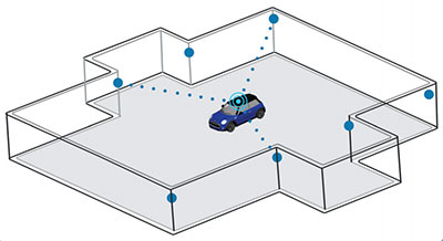
    The GPS-alternative technique matches measurements from a sensor to a map to provide navigation information. With repeatable measurements, almost any map may be used to navigate. Common maps used for navigation include terrain height, gravity, magnetic fields, Wi-Fi RSS and more. The inertial navigation system often plays a critical role in the accuracy of these methods, and increased INS accuracy plays a synergistic role in an overall map-matching navigation system.

    WHEEL-MOUNTED IMUS

    In today’s automobiles, MEMS gyroscopes and accelerometers provide essential measurements for enhancing stability and control. Both types of sensors have significant noise at low frequencies, limiting the measurement accuracy, particularly in low-dynamic conditions. Further, uncompensated accelerometer tilt causes large bias to acceleration estimates. For gyroscopes, physical rotation of the sensor can remove the constant part of the gyro errors and reduce low-frequency noise. In ground vehicles, such rotation occurs conveniently in wheels.

    When inertial sensors are attached to the wheel, both types of sensors provide information on the rotation, gyroscopes naturally and accelerometers via specific force measurement. As a result of carouseling, accurate wheel heading, roll and pitch estimation can be estimated with high resolution, and the result is nearly bias-free. Combining the wheel orientation to distance traveled via known radius enables classic dead-reckoning mechanization (assuming zero slip) and other vehicle dynamics monitoring systems (considering wheel slip as unknown to be solved).

    Authors Jussi Collin of JC Inertial Oy, Finland, and Oleg Mezentsev, Pacific Inertial Systems Inc., Canada, provided details of wheel-mounted inertial system hardware and algorithms and showed test results for several system configurations and applications. They discussed future system improvements — in particular, system miniaturization and an energy-harvesting development progress for next-generation inertial systems.

    They have designed a wheel-mountable sensor system that contains MEMS sensors, battery, Bluetooth module and electronics to run computations and navigation algorithms on board. It operates in several programmable modes:

    • Computes navigation parameters real time and sends them via Bluetooth to an onboard computer (can be any other integrated system, data logger or a tablet).
    • Sends real-time raw data to an onboard computer.
    • Records high-rate raw sensor data (up to 2 kHz) to an embedded micro-SD card.

    The onboard computer is a MEMS-array IMU with 48 gyro and accelerometer channels, with a BT receiving and sync controller, data storage and Wi-Fi interface. They can connect up to four such units to one onboard computer and have all their data in sync with the in-cabin inertial data. All of this data can be used for navigation, wheel dynamics measurements or road quality monitoring applications.

  • SBG’s Horizon IMU equips for harsh-environment hydrography

    SBG’s Horizon IMU equips for harsh-environment hydrography

    The Horizon fiberoptic gyro (FOG) inertial measurement unit (IMU) now forms part of SBG Systems’ Navsight Marine Solution, dedicated to hydrographers. Navsight is available at different levels of accuracy to meet the various application requirements and can be connected to various external equipment such as echo-sounders, lidar, and so on.

    Photo: SBG Systems
    Photo: SBG Systems

    Navsight Marine Solution already offered two levels of performance with the Ekinox and Apogee IMUs. These MEMS-based IMUs address most of hydrographics markets whether shallow or deep water.

    The new Horizon IMU enables customers to deploy Navsight in the most demanding environments such as surveying highly dense areas (bridges, buildings, and so on) as well as applications where only a single antenna can be used.

    The Horizon IMU is based on a closed-loop FOG technology which enables ultra-low bias and noise levels. This technology allows robust and consistent performance even in low dynamics survey.

    Navsight solution is easy to install, as the sensor alignment and lever arms are automatically estimated and validated. Once connected to the Navsight processing unit, the web interface guides the user to configure the solution. A 3D view of the vessel shows the entered parameters so that the user can check the installation. The Navsight unit also integrates light emitting diode (LED) indicators for satellite availability, RTK corrections, and power. It comes with a rugged enclosure, or in a rack version for larger vessels.

    Completing the Navsight offer, Qinertia, SBG’s post-processing software, gives access to offline RTK corrections from more than 7,000 base stations located in 164 countries. Trajectory and orientation are then greatly improved by processing inertial data and raw GNSS observables in forward and backward directions. Computation takes less than 3 minutes for a 6-hour log thanks to the Forward and Backward calculation processed at the same time.

  • Horizon IMU adds choice to SBG’s Navsight Land/Air Solution

    Horizon IMU adds choice to SBG’s Navsight Land/Air Solution

    Photo: SBG Systems
    Photo: SBG Systems

    SBG Systems has released the Horizon IMU, a FOG-based high performance inertial measurement unit (IMU) designed for highly demanding surveying applications such as high-altitude data collection or mobile mapping in dense areas such as urban canyons.

    SBG Systems made the announcement at the International LiDAR Mapping Forum (ILMF) in Denver.

    The Horizon IMU joins the Ekinox and Apogee IMUs as options for the Navsight Land/Air Solution. The solution consists of a powerful and ready-to-use inertial navigation solution dedicated to surveyors for mobile data collection.

    The new Horizon IMU allows customers to bring the Navsight technology to the most demanding environments such as high-altitude surveying and highly dense areas, as well as application where only a single antenna can be used.

    The different levels of accuracy enable the solution to meet various application requirements and can be connected to various external equipment such as odometer, lidar and more. The Ekinox and Apogee MEMS-based IMUs address most surveying markets for camera or lidar motion compensation and data geo-referencing.

    The Horizon IMU is based on a closed-loop FOG technology which enables ultra-low bias and noise levels. This technology allows robust and consistent performance even in low dynamics survey.

    The Navsight solution is easy to install in a vehicle — the sensor alignment and lever arms are automatically estimated and validated. Once connected to the Navsight processing unit, the web interface guides the user to configure the solution.

    A 3D view of the vehicle shows the entered parameters so that the user can check the installation. By choosing the vehicle — a plane or a car, for example — the inner algorithms are automatically adjusted to the application.

    The Navsight unit also integrates LED indicators for satellite availability, real-time kinematic (RTK) corrections and power.

    Full INS/GNSS Post-Processing Software

    Completing the Navsight offer, Qinertia, the SBG post-processing software, gives access to offline RTK corrections from more than 7,000 base stations in 164 countries. The software delivers the highest level of accuracy without having to set up a base station. Trajectory and orientation are then greatly improved by processing inertial data and raw GNSS observables in forward and backward directions.

    Navsight is ITAR-free. All models are available for order. Ordering information and delivery time are available from SBG Systems representatives and authorized SBG Systems dealers.

  • CHC Navigation introduces Alpha3D mobile mapper

    CHC Navigation introduces Alpha3D mobile mapper

    Photo: CHC Navigation
    Photo: CHC Navigation

    CHC Navigation has launched the Alpha3D Mobile Mapping solution, which provides a unique combination of sensor technologies and the company’s core GNSS expertise.

    The Alpha3D is a high-performance, vehicle-independent mobile mapping solution that can capture mass data in continuously changing world environments, enabling geospatial professionals to get work done quickly and more accurately to increase their return on investment.

    The Alpha3D can be mounted on a variety of platforms, including different type of vehicles, trains, railway trolleys and boats. It rapidly and efficiently collects high density, accurate point clouds and powerful image data. It also adds extra information from additional sensors, such as a high-resolution camera, thermal camera, echo sounder or extra profiler.

    The Alpha3D combines high-performance hardware — including a long range, ultra-high speed, precise laser scanner, high-resolution HDR panoramic camera in combination with an advanced GNSS receiver and high-precision inertial measurement unit (IMU) — in one instrument in a light weight, compact yet rugged design, according to George Zhao, CEO of CHC Navigation.

    “All theses features keep Alpha3D as one of most innovative system in market today,” Zhao said.

    “With Alpha3D, users can collect more data faster and reduce time in the field more than 40% compared to traditional surveying instruments,” said Andrei Gobb, product manager of Mobile Mapping Solutions. “By combination of point clouds and high-resolution images, as well as information from additional sensors, there is no need to return to site for remeasurement.”


  • EU ‘GLAD-2’ develop low-cost nav for UAVs

    EU ‘GLAD-2’ develop low-cost nav for UAVs

    A European Union-funded initiative has developed a low-cost positioning and navigation system for unmanned aerial systems (UAS).

    Photo: GSA
    Photo: European GNSS Agency

    Using multiple antennas, the device is based on off-the-shelf components and advanced data-fusion algorithms. It fuses GNSS and inertial data to enable accurate and reliable navigation.

    The EU-funded Horizon 2020 GLAD-2 project developed the system. The work involved in-depth analysis of algorithms, hardware and software redesign, exhaustive refinement and repeated in-field testing.

    Researchers used low-cost GNSS receivers, together with advanced data fusion with an inertial measurement unit, and barometer data to enhance the attitude and position of UAS in harsh GNSS environments. The system also avoided the use of magnetometers, making it immune to magnetic fields, and removing the need for system calibration when the magnetic environment is modified.

    Photo: GSA
    Photo: European GNSS Agency

    Engineers selected different GNSS antennas and measured their performance according to technical and economic criteria. A multi-antenna approach enabled UAS to take accurate headings without suffering the usual problems inherent to magnetometers.

    “The inertial sensors provide an excellent dynamic response at very high data rates, while GNSS serves as an absolute reference to prevent drift. In addition, differential GNSS carrier phase measurements can be used to obtain great accuracy in orientation by using the multi-antenna configuration,” said project coordinator Esther López of Spanish technology company ACORDE.

    GLAD-2 achieved the commercialization of the low-cost navigation system, culminating in the European Conformity (CE) certification mark following the corresponding certification process. The CE mark indicates conformity with health, safety and environmental protection standards for products sold within the European Economic area.

    The result is a highly competitive product aimed at the low-cost sector of the navigation systems market. “Due to its flexibility, the system fulfils the needs of a wide range of users, not only in UAS, but also in terrestrial and maritime environments applications,” López said.

  • SBG Systems offers GNSS+inertial navigation for surveying, UAVs

    SBG Systems offers GNSS+inertial navigation for surveying, UAVs

    SBG Systems is launching the Navsight Land & Air Solution, high-performance inertial navigation designed to make surveyors’ mobile data collection easier, whether for mobile mapping, GIS or road inspection.

    SBG Systems will release the Navsight Land & Air Solution at the Intergeo show in Frankfurt, Germany, Oct. 16-18.

    The solution consists of an inertial measurement unit (IMU), available at two different performance levels, connected to Navsight, a rugged processing unit embedding fusion intelligence and a GNSS receiver. It also has connections for external equipment such as lidar, cameras or computer.

    Photo: SBG Systems
    Photo: SBG Systems

    The Navsight Land & Air Solution is the result of more than 10 years of experience in the mobile positioning industry, especially in the unmanned industry where position reliability is mandatory. SBG’s fusion algorithms allow the company to get the best performance from inertial, odometer and GNSS technologies; exclude false GNSS fixes; and improve the trajectory in complicated areas such as urban canyons, forests and tunnels.

    According to the company, the Navsight Land & Air Solution supports all GNSS constellations, real-time kinematic (RTK) and precise point positioning services such as Omnistar and TerraStar.

    SBG IMUs are easy to install, the company said. The sensor alignment and lever arms are automatically estimated and validated. Once connected to the Navsight processing unit, the web interface guides the user to configure the solution. A 3D view of the vehicle shows the entered parameters so that the user can check the installation. By choosing the vehicle, such as a plane or a car, the inner algorithms are automatically adjusted to the application. The Navsight unit also integrates LED indicators for satellite availability, RTK corrections and power.

    INS/GNSS Post-Processing Software. Qinertia, the SBG post-processing software, provides access to offline RTK corrections from more than 7,000 base stations in 164 countries. Trajectory and orientation are greatly improved by processing inertial data and raw GNSS observables in forward and backward directions.


  • Racelogic introduces VBOX indoor positioning system at ION GNSS+

    Racelogic introduces VBOX indoor positioning system at ION GNSS+

    VBOX indoor positioning beacon atop a car. (Photo: Racelogic)
    VBOX indoor positioning beacon atop a car. (Photo: Racelogic)

    Racelogic demonstrated a new VBOX solution for accurate position and velocity in the absence of any GNSS signals, such as indoors, at the ION GNSS+ exhibition.

    VBOX data acquisition systems are used for measuring the speed and position of a moving vehicle. Based on a range of high-performance GPS receivers, VBOX dataloggers can record high-accuracy GPS speed measurements, distance, acceleration, braking distance, heading, slip angle, lap times, position, cornering forces and more.

    VBOX indoor positioning beacon in a bracket. (Photo: Racelogic)
    VBOX indoor positioning beacon in a bracket. (Photo: Racelogic)

    The new VBOX Indoor Positioning System consists of a network of fixed beacons communicating with a small receiver mounted on the roof of the vehicle, which is connected to an existing VBOX. The receiver computes its position 100 times a second to around 5 centimeters real-mean-squared (RMS) accuracy. The system can be used on its own or with an internal inertial measurement unit (IMU) to improve the velocity accuracy.

    Racelogic engineers worked closely with its VBOX customers to develop a solution that allows the same test equipment and software that has traditionally been limited to outdoor use to be used anywhere that satellites coverage is limited or completely unavailable, such as in a parking garage.

    (Image: Racelogic)
    Beacon placement. (Image: Racelogic)

    The VBOX seamlessly switches between outdoors and indoors, allowing testing to continue whatever the environment and VBOX users to make use of their original hardware and software applications.

    Racelogic will demonstrate the system at the ION GNSS+ exhibition at the Hyatt Regency in Miami, Sept. 26-27. Racelogic will also be showcasing its new, upgraded version of SatGen simulation software for the Labsat 3 Wideband simulator.


  • Aceinna launches open-source GNSS+IMU development kit for drones, robots

    Aceinna launches open-source GNSS+IMU development kit for drones, robots

    Photo: Aceinna
    Photo: Aceinna

    MEMS-based sensing solutions company Acienna released OpenIMU, a professionally supported, open-source GPS/GNSS-aided inertial navigation software stack for low-cost precise navigation applications.

    Integrating an inertial measurement unit (IMU)-based sensor network will greatly improve its navigation and self-location capabilities, Acienna said.

    It is aimed at developing autonomously guided vehicles for industrial applications, autonomous cars, factory or industrial robots, drones, remotely operated underwater vehicle or any kind of smart machine that needs to move fast or slow, on land, in the air or in water.

    “Our breakthrough open-source software for INS/GPS algorithm development is the first professional grade open-source navigation stack running on a low-cost IMU,” said Mike Horton, CTO of Aceinna. “Not only will this kit save developers time and money, it is simple to use and does not require a Ph.D.”

    OpenIMU enables advanced, easy-to-deploy localization and navigation algorithm solutions for a fraction of the time and cost of traditional methods, Aceinna said.

    OpenIMU’s combination of open-source software and low-cost hardware enables rapid development of advanced solutions for drones, robotics, and autonomous applications. Its extensible software-infrastructure provides all the code needed for algorithm development.

    The freely downloadable stack includes:

    • FreeRTOS-based data collection and sampling engine
    • Performance-tuned, real-time, navigation-grade GPS/INS Kalman filter library
    • Free IDE/compiler tool chain based on Visual Studio Code
    • JTAG debugging for debugging code loaded on IMU
    • Data logging, graphing, Allen Variance plots and maps
    • Extensive documentation
    • Robust simulation environment with advanced sensor error models

    To install OpenIMU stack now, follow the directions. Several ready-to-install free GPS/INS and IMU applications are available at Aceinna’s Navigation app store.

    The OpenIMU Development hardware development kit includes JTAG-pod, precision mount fixture, EVB and an OpenIMU300 module.

    The OpenIMU module features Aceinna’s 5 deg/Hr, 9-Axis gyro, accelerometer, and magnetometer sensor suite with an onboard 180-MHz ARM Coretex floating-point CPU.

    The IMU is delivered in a 24 x 37 x 9.5 millimeter module that operates at 2.7-5.5 VDC.

    The OpenIMU Development kit is available for immediate delivery.

  • STATS GPS provides coaches with instant performance feedback

    Image: STATSports
    Image: STATSports

    Sports data company STATSports is offering STATS GPS shirts to provide real-time GPS intelligence to athletes and coaches.

    Wearing STATS GPS shirts, teams can monitor player metrics such as accelerations/decelerations, energy expenditure and count of zone entries, as well as time, distance and power thresholds.

    The system uses a 50-Hz sampling frequency. It allows practitioners to monitor up to 100 players in real time and post session with more than 300 GPS, inertial measurement unit (IMU) and HR-derived metrics, the company said.

    The shirts feature an embedded medical-grade ECG sensor that’s fully integrated with the GPS units, allowing for seamless real-time analysis with the STATS Dynamix online portal.

    Customizable reports can include information on imbalance, cardiovascular metrics and running, explosive and brake symmetry.

  • Honeywell brings military precision navigation capabilities to commercial markets

    Honeywell has produced a new inertial navigation unit that provides accurate navigation for customers across a broad range of industries including agriculture, robotics and autonomous vehicles, without compromising on size, cost or performance.

    The HGuideN580 inertial navigation technology improves accuracy in urban and rural environments. (Photo: Honeywell)

    The HGuide n580 is the first Honeywell-produced, industrial-focused navigation solution that uses both precision inertial measurement unit technology and GNSS to improve location accuracy even when facing natural and manmade obstacles.

    “The blend of inertial and satellite navigation capabilities provided by the HGuide n580 is especially important where precision is required in demanding environments — for example, autonomous cars traveling in cities, where our technology can extend the accuracy and performance of navigational systems while keeping passengers safe,” said Chris Lund, senior director, Navigation and Sensors, Honeywell Aerospace. “Honeywell’s history and expertise in navigation technology enables customers to implement this new wave of advanced technology into their own applications and operations.”

    Roughly the size of a deck of cards, the HGuide n580 gives Honeywell’s industrial customers the capabilities needed to navigate accurately in areas with limited satellite coverage, such as densely populated cities where tall buildings, underground tunnels, and multi-layer freeway stacks or bridges often create challenges to traditional GPS navigation.

    For a GPS unit to function properly, it requires a strong signal connection between the unit on the ground and multiple satellites in the sky to accurately orient its position. City infrastructure such as buildings and tunnels can temporarily block the signal between GPS unit receivers and satellites, creating urban canyons.

    With the HGuide n580 integrated system, Honeywell’s inertial measurement unit technology combines with GPS to act as a backup solution, which means the loss of GPS signal caused by an urban canyon does not result in a complete loss of navigation.

    To learn more about the new HGuide n580 solution and Honeywell’s other commercially available navigation technologies, visit the Honeywell Aerospace website.

  • 2018 Inertial Buyers Guide

    2018 Inertial Buyers Guide

    VectorNav Technologies

    VectorNav designs and manufactures three different product types:

    • Inertial measurement unit / altitude heading reference System (IMU/AHRS)
    • GPS-aided inertial navigation system (GPS/INS)
    • GPS/INS with built-in GPS-compass (dual GNSS/INS).

    Each product type is offered in two performance categories, Industrial and Tactical Grade, which is an indication of the quality of the IMU core.

    Product Models

    VectorNav product models

    Key Product Features

    The VectorNav VN-300

    Industrial Series:

    • High-performance in SWaP-C optimized packaging
    • 5˚/hr typical in-run gyro bias stability
    • 0.3˚ RMS heading, 0.1˚ pitch & roll
    • Miniaturized surface mount (OEM) and rugged packaging
    • Serial TTL, SPI and USB communication interfaces
    • < 30 grams

    Tactical Series:

    • The VectorNav VN-310.

      Tactical-grade performance in ruggedized enclosures

    • < 1˚/hr in-run gyro bias stability
    • < 2 mrad attitude performance
    • IP68-rated enclosure designed to meet DO-160G
    • Support for external GPS/GNSS or IMUs
    • < 200 grams

    All VectorNav products:

    • incorporate VectorNav’s robust inertial navigation algorithms
    • are individually calibrated across full temperature range (–40 C to +85 C)
    • share a common communication protocol across all products
    • offer sync-in and sync-out functionality and GPS PPS
    • ship worldwide on short lead times (1–2 business days)
    • are supported directly by VectorNav’s team of applications engineers, business and production teams, and domestic and international representatives
    • are produced at VectorNav’s AS9100 certified facility
    • are made in the U.S. and ITAR-free.

    www.vectornav.com
    [email protected]
    10501 Markison Road
    Dallas, TX 75218 USA


    NovAtel

    PwrPak7D-E1

    The PwrPak7D-E1.

    The PwrPak7D-E1 is a robust, high-precision receiver that has multi-frequency, dual-antenna inputs and provides GNSS multi-constellation heading and position data. These capabilities make the PwrPak7D-E1 suitable for ground vehicle, marine or aircraft-based systems. NovAtel’s Synchronous Position, Attitude and Navigation (SPAN) technology brings together GNSS positioning and inertial navigation to provide an exceptional 3D navigation solution that is stable and continuously available. The PwrPak7D-E1 has a powerful OEM7 GNSS engine, integrated Epson G320N micro electromechanical (MEMS) inertial measurement unit (IMU), built-in Wi-Fi and 16 GB of internal storage.

    Key Product Features

    • SPAN-enabled enclosure featuring NovAtel’s tightly coupled GNSS+INS engine
    • Enhanced connection options including serial, USB, CAN and Ethernet
    • 555-channel, all-constellation, multi-frequency positioning solution
    • Multi-channel L-band supports TerraStar correction services
    • Onboard NTRIP client and server support
    • Multiple communication interfaces for easy integration and installation
    • Built-in Wi-Fi support
    • 16 GB of internal storage
    • ALIGN heading solution

    Signal Tracking

    Primary RF

    • GPS (L1 C/A, L1C, L2C, L2P, L5)
    • GLONASS (L1 C/A, L2 C/A, L2P, L3, L5)
    • BeiDou (B1, B2)
    • Galileo (E1, E5 AltBOC, E5a, E5b)
    • NavIC/IRNSS (L5)
    • SBAS (L1, L5)
    • QZSS (L1 C/A, L1C, L2C, L5)
    • L-Band (up to 5 channels)

    Secondary RF

    • GPS (L1 C/A, L1C, L2C, L2P, L5)
    • GLONASS (L1 C/A, L2 C/A, L2P, L3, L5
    • BeiDou (B1, B2)
    • Galileo (E1, E5 AltBOC, E5a, E5b)
    • NavIC/IRNSS (L5)
    • QZSS (L1 C/A, L1C, L2C, L5)

    www.novatel.com
    [email protected]

  • LORD Sensing inertial sensors designed for dynamic environments

    LORD Sensing inertial sensors designed for dynamic environments

    LORD Sensing MicroStrain has launched a new line of rugged inertial sensors, which the company said will fill a void in the marketplace.

    “The sensors respond to a market need for a sensing solution that offers better attitude and positioning accuracy and dynamic response in locations such as on the boom of an excavator or frame of a wheel loader,” said Chris Arnold, LORD Sensing product manager. “Customers are replacing traditional rotary and linear position sensors that provide less rich data on machine position and motion.”

    Designed for use in demanding environments for dynamic inclination and positioning, the MV5-AR inertial sensors are designed for off-highway and military vehicles; marine and mobile robot applications; and the autonomous vehicle market.

    The rugged, compact, state-of-the-art inertial sensors utilize LORD Corporation’s proven fifth-generation high-performance industrial-grade solid-state six-degrees-of-freedom (6-DOF) micro-electromechanical (MEMS) accelerometer and gyro inertial sensor technology.

    Already successfully deployed on ground robots and heavy-machinery, intended applications include autosteer and terrain compensation; dynamic incline detection (roll, pitch, rotation); vehicle stability and leveling; platform control, alignment and stabilization; operator feedback; and precision navigation.

    The MV5-AR model has a compact and rugged reinforced PBT housing fully sealed for immersion, pressure wash (IP67, IP69K) as well as a rugged, reliable molded-in AMPSEAL 16 connector. Each sensor is fully calibrated and temperature compensated, the company said.

    The MV5-AR models offer:

    • Low-cost, compact size that is among the smallest form factor in its class.
    • Full 360-degree measurement range about all axes; it can be mounted in any orientation.
    • Full accuracy over the entire operational temperature range of -40°C to 85°C.
    • CAN J1939 communication.
    • Auto-adaptive extended Kalman filter for optimal dynamic accuracy.
    • The MV5-AR provides inertial and slope J1939 messages in its standard configuration. Customized CAN protocols and messages are available.

    LORD Sensing has also expanded its GX5 portfolio to offer the 3DM-CX5 inertial sensor. With compact chassis or board mount option for embedded applications, the CV5 and CX5 are interchangeable with the same mounting footprint and communication protocol. Each sensor is fully calibrated and temperature compensated. Models offer:

    • Low-cost, compact size and full 360-degree measurement range about all axes.
    • Full accuracy over the entire operational temperature range of -40°C to 85°C.
    • Auto-adaptive extended Kalman filter for optimal dynamic accuracy and on-vehicle performance.