Tag: INS

  • Advanced Navigation launches Boreas D70 digital fiber-optic gyroscope

    Advanced Navigation launches Boreas D70 digital fiber-optic gyroscope

    Photo: Advanced Navigation
    Photo: Advanced Navigation

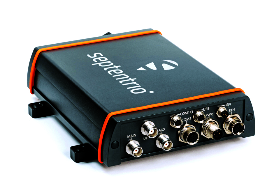
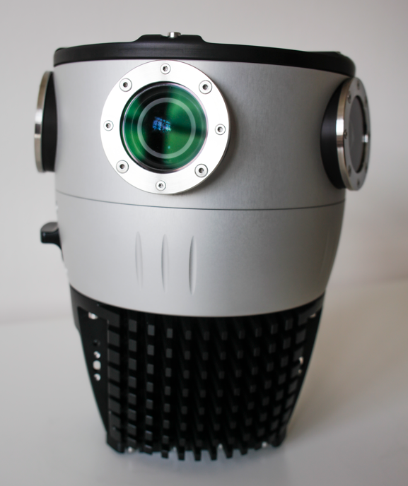
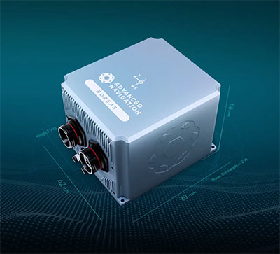
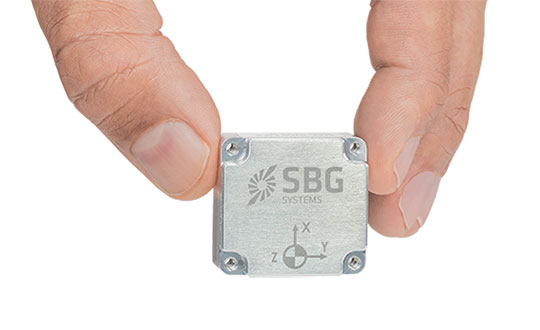
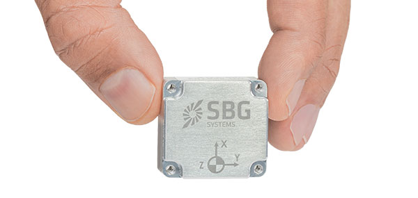
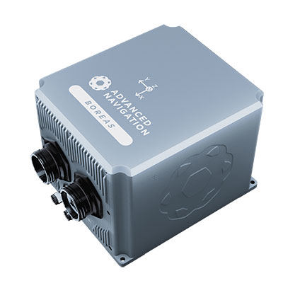
    Advanced Navigation has announced the Boreas D70, a fiber-optic gyroscope (FOG) inertial navigation system (INS).

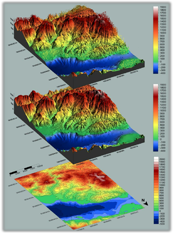
    The D70 is the latest release in the Boreas digital FOG (DFOG) series, offering a new performance grade with superior accuracy, exceptional stability and reliability. The technology is suited to surveying, mapping and navigation across subsea, marine, land and air applications.

    “We are thrilled to expand the Boreas series with the D70. It’s a system that will provide additional flexibility in the Boreas family, making ultra-high accuracy inertial navigation far more affordable than with previous FOG INS systems,” said Xavier Orr, CEO and co-founder of Advanced Navigation. “This patented technology opens the possibility for adopting FOG INS systems across a much broader range of vehicular applications, particularly autonomous vehicles and aircraft where weight and size are at a premium.”

    Boreas D70 combines closed-loop DFOG and accelerometer technologies with a dual-antenna real-time kinematic (RTK) GNSS receiver. These are coupled with Advanced Navigation’s artificial-intelligence-based fusion algorithm to deliver accurate and precise navigation.

    The system features ultra-fast gyrocompassing, acquiring and maintaining an accurate heading under demanding conditions. While the D70 does contain a GNSS receiver, it is not required for gyrocompass operation.

    Based on the company’s DFOG technology, the D70 delivers a 40% reduction in size, weight, power and cost (SWaP-C) when compared to systems of similar performance.

    • 0.01° roll and pitch
    • 0.1° secant latitude heading (gyrocompass)
    • 0.01°/hour bias instability
    • 10 mm position accuracy

    The Boreas Series

    The Boreas DFOG series features ultra-fast gyrocompassing and can acquire heading, either stationary or dynamically, in less than two minutes. The gyrocompassing allows the system to determine a highly accurate heading without any reliance on magnetic heading or GNSS.

    The technology stems from Advanced Navigation’s artificial intelligence sensor-fusion algorithm allowing the system to extract significantly more information from the data. It is designed for control applications, with a high level of health monitoring and instability prevention to ensure stable and reliable data.

    Advanced Navigation designed Boreas from the ground up for reliability and availability. The hardware and software are designed and tested to international safety standards and have been environmentally tested to MIL-STD-810. The system achieves a mean time between failure (MTBF) of more than 70,000 hours.

    Additional features of the Boreas D70 include Ethernet, CAN and NMEA protocols, as well as disciplined timing via a PTP server and 1 PPS. An embedded web interface provides full access to all of the device’s internal functions and data. Internal storage allows for up to 1 year of data logging.

    About DFOG Technology

    DFOG is patented technology, which has been developed over 25 years involving two research institutions. DFOG was created to meet the demand for smaller and more cost-effective FOGs, while increasing reliability and accuracy.

    The first generation of FOG, made available in 1976, used analog signals and analog-signal processing. The second generation was developed in 1994 and is still used to this day. It improved upon the first generation with a hybrid approach using an analog signal in the coil with digital signal processing.

    In 2021, FOG evolved into DFOG. This third generation of FOG sets itself apart by being completely digital, providing higher performance and reliability while enabling a 40% reduction in SWaP-C.

    To achieve this, three different yet complementary technologies have been developed to improve the capabilities of FOG.

    Digital Modulation Techniques. DFOG uses a specially developed digital modulation technique passing spread spectrum signals through the coil. The new digital modulation technique introduced in DFOG technology allows in-run variable errors in the coil to be measured and removed from the measurements. This makes DFOG significantly more stable and reliable than traditional FOGs. It also allows a smaller FOG with less coil length to achieve the accuracy of one with a longer coil.

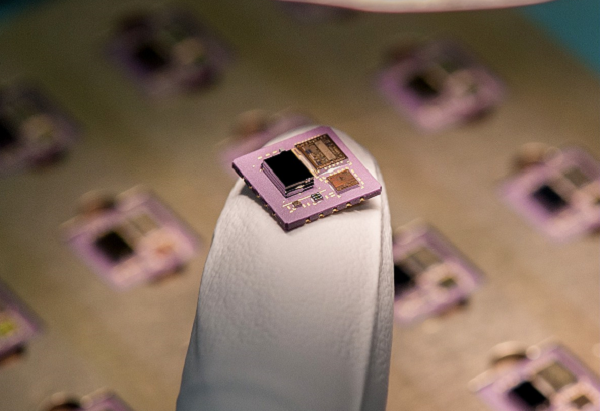
    Revolutionary Optical Chip. By integrating five sensitive components into a single chip and removing all the fiber splices, the size, weight and power are reduced considerably while significantly improving reliability and performance.

    Specially Designed Optical Coil. DFOG employs a specially designed closed-loop optical coil, developed to take full advantage of the digital modulation techniques. The design allows for optimum sensing of in-run variable coil errors using the new digital modulation technique. It also provides a very high level of protection for the optical components from shock and vibration.

  • Continuous evolution: What is new with GNSS receivers?

    Continuous evolution: What is new with GNSS receivers?

    GNSS receivers face the same old challenges (extremely weak received signal, orbit and satellite clock errors, ionospheric and tropospheric delays, multipath, dilution of precision, urban canyons, etc.) and new ones (increased interference). However, compared with just a few years ago, they benefit from new signals, many more satellites, a panoply of options for corrections, and improved integration with inertial navigation systems (INS).

    For example, pole-tilt compensation is quickly becoming standard. This feature enables users to locate dangerous or hard-to-reach points by measuring them at an angle with just the tip of the pole to which the receiver is attached.

    Pole-tilt compensation also makes surveying and mapping easier by removing, in many situations, the need to use total stations or offsets. Together with improvements in work processes, this makes GNSS receivers more user friendly. This is particularly welcome now that more surveyors are retiring than there are new surveyors entering the profession.

    The greater accuracy of GNSS receivers enabled by the increase in the number and quality of satellites, signals, corrections services and integration of GNSS with other sensors is also increasing the number of use cases, especially at the high end of the accuracy requirements, such as lane-level vehicle navigation. (Next month’s cover story will center on this year’s Google Smartphone Decimeter Challenge contest, in which competing teams aim to bring smartphone location down to the decimeter or even centimeter resolution using raw location measurements from Android smartphones. This could enable services that require lane-level accuracy, such as estimated time of arrival when using a high-occupancy vehicle lane.)

    This month’s cover story highlights what has changed “inside the box” to improve the accuracy and resilience of GNSS receivers for surveying, mapping and a variety of other applications. Read the success stories from five different companies below.

    Swift Navigation: Driving safety for consumers

    CHC Navigation: Making receivers user-friendly

    Trimble: Positioning engine optimized for fusion

    u-blox: Disruption leads to wide adoption

    Septentrio’s Stellar 2022

    Testing positioning algorithms with Kaggle

    Photo: CHC Navigation
    Photo: CHC Navigation
  • Launchpad: Adjustable drones, mobile mapping camera

    Launchpad: Adjustable drones, mobile mapping camera

    A roundup of recent products in the GNSS and inertial positioning industry from the July 2022 issue of GPS World magazine.


    OEM

    RTK Receiver

    Hybrid high-precision GNSS

    Photo: PP Solutions
    Photo: PP Solutions

    The handheld RTAP2U is a hybrid high-precision, dual-frequency GNSS receiver. It can receive and process GPS, GLONASS, BeiDou, Galileo and QZSS signals. Its user-friendly web interface accesses and configures signal reception, skyplot, data collection, stop-and-go surveying, map display and more. With u-blox’s ZED F9P module, RTAP2U provides 2 cm or better accuracy within a few seconds. A firmware upgrade can provide precise point positioning (PPP) and real-time kinematic (RTK) capability.

    PP-Solution, ppsoln.com

    Marine Receiver

    L-band corrections aid bathymetry, dredging

    Photo: Septentrio
    Photo: Septentrio

    The AsteRx-U3 Marine GNSS receiver offers accurate positioning near shore and offshore via centimeter-level real-time kinematic (RTK) or the built-in Fugro precise point positioning (PPP) sub-decimeter subscription service, delivered either over NTRIP internet or L-band satellite. Corrections delivered over L-band allow dredging, bathymetry or marine construction projects even in areas where there is no internet service. The AsteRx-U3 Marine receiver, enclosed in an IP68-rated housing, offers a dedicated L-band demodulator with a separate L-band RF input, which allows for the use of dedicated antennas for excellent reception of L-band signals even at high latitudes.

    Septentrio, septentrio.com

    Navigation System

    For air, land and sea vehicles and equipment

    Photo: Honeywell
    Photo: Honeywell

    The HGuide o360 is a compact single-card, all-attitude GNSS/inertial navigation system (INS) that delivers accurate and robust position and attitude even in GNSS-challenged or denied environments to industrial and autonomous applications. The HGuide o360 contains a multi-frequency, multi-constellation, real-time kinematic (RTK) GNSS receiver with dual antennas, Honeywell’s i300 inertial measurement unit (IMU) technology, and a high-grade calibrated magnetometer. It is designed for platforms that require high-performance navigation data in an ultra-low size, weight and power (SWAP) package.

    Honeywell, honeywell.com

    Inertial Navigation System

    Offers optimal heading performance and resistance to vibration

    Photo: SBG Systems
    Photo: SBG Systems

    The Quanta Micro GNSS-aided inertial navigation system (INS) offers a high level of navigation performance despite its low size, weight, power and cost (SWAP-C). It brings direct georeferencing to UAV and land-based surveying. Quanta Micro leverages a survey-grade inertial measurement unit (IMU) for optimal heading performance in single-antenna applications, and high immunity to vibrating environments. An optional secondary antenna enables fast heading initialization in low dynamic applications.

    SBG Systems, sbg-systems.com

    Utility Time Server

    Solution for power plants and substations

    Photo: Microchip Technologies
    Photo: Microchip Technology

    The GridTime 3000 GNSS time server is a software-configurable solution for utilities, providing redundancy, security and resiliency to protect against surges, adverse weather and cyberattacks. It generates precise time and frequency signals to synchronize analog and digital communication systems. The resilient timing platform incorporates multiple timing inputs for protection in the event of a GNSS signal disruption caused by severe weather, environmental disturbances or signal jamming or spoofing.

    Microchip Technology, www.microchip.com


    UAV

    UAV Mapping Workflow

    For high-precision mapping missions

    Photo: Auterion
    Photo: Auterion

    The Auterion OS serves enterprises that need component and payload flexibility, alongside a centralized and streamlined software workflow. Features include availability of precise mapping data in real time, automated processing for fast decision-making, standardization across Auterion-powered vehicles, connectivity that enables automated end-to-end workflows with no need for manual data transfer, and integration with third-party data-processing software such as Esri Site Scan or Propeller.

    Auterion, auterion.com

    Lidar Scanner

    Designed to meet the need for highly accurate data

    Photo: YellowScan
    Photo: YellowScan

    The YellowScan Vx20 lidar is the most accurate, fully integrated system of YellowScan’s product range. It can fly up to 330 feet (100 meters) while maintaining high accuracy throughout the point cloud. The Vx20 series is designed for applications that require sharp, accurate descriptions. Its Applanix APX-20UAV GNSS/inertial sensor provides precision of 1 cm and accuracy of 2.5 cm. With battery, the lidar scanner weighs 6.25 pounds (2.84 kg). It can be integrated with either multirotor or helicopter drones.

    YellowScan, yellowscan-lidar.com

    Expandable-wing drone

    Stretches to seven feet and carries heavy loads

    Photo: WingXpand
    Photo: WingXpand

    The WingXpand seven-foot expandable-wing drone folds to fit in a backpack. Its U.S.-made patented design combines the small size of a quadcopter with the horsepower of an airplane. The drone expands in less than 2 minutes and weighs less than 10 pounds. It can carry high-resolution cameras and other modular payloads such as a real-time pattern analysis system. More than 10 WingXpand UAS can fit in a public safety vehicle, more than 30 in a pickup, and 250 on a standard airlift pallet. WingXpand maximizes capability, efficiency and safety for the military and public safety officials. It also can be used by farmers, surveyors and inspectors.

    WingXpand, wingxpand.com

    Drone Package

    Capable of centimeter-level positioning

    Photo: ComNav
    Photo: ComNav

    The E300 drone package includes the E300 real-time kinematic (RTK) drone, flight-control software and an optional camera. It is suitable for topographic survey, urban construction, forestry investigation, emergency rescue, 3D modeling, mining and surveying. The drone is embedded with a high-precision K8 GNSS module that supports GPS L1/L2/L5, BeiDou B1/B2/B3/B1C/B2a, GLONASS L1/L2, Galileo E1/E5-a/E5-b/AltBOC/E6 and QZSS L1/L2/L5. With its intelligent recognition algorithms, the E300 can capture high-resolution images consistently even in complex environments.

    ComNav Technology, comnav.com

    Adjustable Drone

    Switches from horizontal to vertical takeoff

    Photo: Tekever
    Photo: Tekever

    The AR3 unmanned aerial system (UAS) now has a “hot-swappable” vertical-takeoff-and-landing (VTOL) capability, able to switch from horizontal launch to vertical. It also now has integrated synthetic aperture radar (SAR). The AR3 is a shipborne UAS that supports multiple types of maritime and land-based missions up to 16 hours. With the upgrade, the AR3 becomes more operationally flexible. The newly added SAR provides the AR3 with a vastly greater operational range, and the ability to effectively detect, recognize and identify targets under any weather condition. Covering more than 20,000 square nautical miles per mission, the new AR3 is suitable for wide-area surveillance missions.

    Tekever, tekever.com


    SURVEYING

    Rugged Tablet

    Provides enhanced heading and positioning

    Photo: ComNav Technology
    Photo: ComNav Technology

    The P300 is a high-precision, in-cab Android tablet designed for precision agriculture, autonomous driving and machine control. Embedded with the K8 OEM module, the P300 tracks GPS, BeiDou, BeiDou-3, GLONASS, Galileo and QZSS signals to achieve centimeter-level accuracy. It provides enhanced heading and positioning performance for everyday field use. The P300 series is available as the P300 Plus (10.1-inch) and P300 Mini (8-inch).

    ComNav Technology, comnav.com

    Advanced GIS

    Deployment option provides greater security, lower cost

    Photo: Hexagon
    Photo: Hexagon

    Intergraph G/Technology, an advanced utility geographic information system (GIS), enables utility companies to plan, design and document networks. It acts as a definitive source of reliable, location-based information that can be shared with users and systems across an organization. Available on the Oracle Cloud Marketplace, G/Technology provides utility operators with a scalable, secure and highly available GIS solution with reduced start-up costs and needed infrastructure. Running G/Technology on Oracle Cloud Infrastructure eases initial system deployment, enhances performance and automates scalability, availability and cybersecurity protection, ensuring the system is always up to date with the latest features and enhancements.

    Hexagon, hexagon.com

    Mobile Mapping Camera

    Provides photogrammetry at highway speeds

    Photo:
    Photo: Mosaic

    The Mosaic X mobile mapping camera captures extremely accurate photos and 360° videos, while simultaneously creating photorealistic 3D photogrammetry models, without the use of lidar. It can achieve 1-cm accuracy on road surfaces. The built-in CPU and GPU allow users to operate the camera and capture data without the need for a computer within the vehicle. Meticulous mechanical engineering and design ensure reliable and dependable use in harsh conditions such as moisture, mechanical shock and extreme temperatures. It can create high-quality 3D models, 3D reconstructions, and dense point clouds without the use of lidar. It comes with an AUX port to connect with external GNSS devices or lidar.

    Mosaic, mosaic51.com

  • Complementary PNT Takes Center Stage

    Complementary PNT Takes Center Stage

    Of the 60 exhibitors at the Institute of Navigation’s Joint Navigation Conference (JNC) in San Diego this year, 16 make inertial navigation systems (INS). Many of the other exhibitors integrate INS with GNSS receivers or make simulators to test those integrations. Several exhibitors make a variety of other navigation systems, using active and passive optical sensors, wheel encoders and RF systems that map beacons of opportunity. Only seven manufacturers of GNSS receivers were present.

    That’s because the conference — which took place June 6-9 and focused on technical advances in positioning, navigation and timing (PNT) — was hosted by ION’s Military Division for the Departments of Defense (DOD) and Homeland Security. “From an operational perspective,” said the conference program, it focused on “advances in battlefield applications of GPS; critical strengths and weaknesses of field navigation devices; warfighter PNT requirements and solutions; and navigation warfare.” In other words, it was mostly on how to navigate in environments in which the use of GNSS is challenged or denied due to jamming.

    The conference program told the story of the GNSS/PNT community’s interests and concerns. Several sessions were on complementary PNT using terrestrial RF signals of opportunity, IMUs, geophysical fields (including gravity and Earth’s magnetic field), celestial objects, ground vision and new commercial sources of space-based PNT, such as satellites in low Earth orbit (LEO).

    Other environments in which reliance on GNSS is hard or impossible — such as urban canyons, deep inside buildings, underground and underwater — pose the same navigation challenges to both military and civilian applications. Likewise, jamming is a threat to both. Therefore, several sessions focused on critical infrastructure, demonstrating that the concerns about GNSS vulnerabilities are not just military ones.

    Hence the presence among the exhibitors of three manufacturers of atomic clocks, which continue to shrink in size, weight, power and cost (SWaP-C) and are used to assure holdover — that is, the time period required to keep networks synchronized when their primary timing source, usually GNSS, is disrupted or temporarily unavailable. Networks affected include cellphone providers, radio and television broadcasters, financial networks, and the biggest network of all, the Internet.

    The JNC “experienced record attendance in both conference participants and exhibitors, hosting more than 1,000 attendees,” Lisa Beaty, ION executive director, told me. She attributed the increase to “the importance of PNT in the nation’s critical infrastructure, current innovation, programmatic funding, and the desire by the DOD community to collaborate and reconvene.” She confidently anticipates additional growth next year.

    I am equally confident that much of the cutting-edge technology on display at this conference will find its way into civilian applications in the next few years. Whether in war or in urban canyons, GNSS navigation faces some of the same challenges.

  • Simplifying the lidar survey requires unity of hardware and software

    Simplifying the lidar survey requires unity of hardware and software

    From OxTS 

    OxTS manufactures inertial navigation systems (INS) and proprietary software on which survey professionals have come to rely. Our devices, the Survey+ and the xNAV650, output highly accurate position, heading and pitch/roll measurements. An advanced navigation engine combines streams of data from onboard inertial measurement units (IMUs) and GNSS receivers. This data can then be used in a multitude of applications including lidar survey, mobile mapping and open road positioning.

    Surveying, especially with a lidar sensor, can be a complicated art. There are many factors to consider even before you begin. However, system manufacturers involved in the survey industry, such as OxTS, are taking steps to simplify lidar survey.

    The end goal for many lidar surveyors is to create an accurate point cloud. However, to produce the best possible results, the hardware and software involved must be working together in unison.

    Hardware = lidar sensor and INS
    Software = georeferencing, post-process and configuration

    In this article, we have picked out a few of our favorite developments on the topic of simplifying lidar survey.

    Research and Development

    OxTS invests substantially in research and development to ensure that our hardware and software developments meet the ever-evolving demands of the survey industry. Many of the improvements generally center around improving accuracy, clarity of results and user experience. However, general industry demands also drive some development.

    For example, the increasing use of drones in surveying has increased demand for smaller and lighter INS hardware. Whilst developing smaller and lighter hardware is therefore important it cannot be to the detriment of reliability and accuracy. The xNAV650 was born from this industry demand.

    Although development of the xNAV650 was primarily driven by the needs of the survey industry (smaller/lighter hardware), other improvements OxTS has made to the software portfolio has focused on improving user experience.

    Photo:xNAV650 and Survey+ inertial navigation systems. (Photo: OxTS)
    xNAV650 and Survey+ inertial navigation systems. (Photo: OxTS)

    Precision Time Protocol (PTP)

    One of the major advances in OxTS INS technology over the past 12 months is PTP. The drive to include PTP capability on all OxTS Survey INS devices was the intention to help surveyors simplify the lidar survey set-up process.

    When using compatible lidar sensors, such as those from Hesai and Ouster with an OxTS INS, surveyors no longer need to build complex wiring solutions. A simple ethernet ‘plug-and-play’ process is all that is required.

    The images below show a traditional PPS wiring set-up vs PTP:

    A traditional PPS wiring set-up vs PTP. (Image: OxTS)
    A traditional PPS wiring set-up vs PTP. (Image: OxTS)

    Software

    To get the desired outcome, an accurate georeferenced point cloud, from any lidar survey in a timely manner the software must be simple and straightforward to use. As the saying goes “complexity is the enemy of execution,” and this is what drives software development at OxTS.

    Once the lidar and INS are plugged in and ready to survey, configuration should be straightforward. A simple configuration wizard, such as the one available in NAVsuite (OxTS’ complimentary software toolbox) should structure the set-up process so that nothing is missed.

    NAVconfig – OxTS’ INS configuration software. (Image: OxTS)
    NAVconfig – OxTS’ INS configuration software. (Image: OxTS)

    The latest NAVsuite update (version 3.3) included a new PTP graphical user interface (GUI) to simplify survey set-up even further.

    Other tools are included within NAVsuite that allow users to analyze, troubleshoot and post-process their INS data. Read the NAVsuite for Survey and Mapping infosheet to find out more about these.

    OxTS Georeferencer

    OxTS Georeferencer. (Image: OxTS)
    OxTS Georeferencer. (Image: OxTS)

    Since its launch approximately two years ago, OxTS Georeferencer has gone through some major changes. The first version included compatibility with the Velodyne VLP-16 lidar sensor. This meant that users of the VLP-16 had a quick and simple way to georeference the lidar data.

    Over the course of the next 24 months, multiple new sensors have been introduced. Sensors from Hesai, Ouster, Livox and new Velodyne devices are now available, giving users more choice than ever before when it comes to choosing the hardware to do their job. Visit the OxTS Georeferencer product page for a complete list of available sensors.

    Furthermore, as well as the integration of new sensors, we have introduced a raft of new features to improve the user experience for professional lidar surveyors. These include:

    • a 3D hardware setup viewer to enable quick and intuitive survey configuration
    • multiple processing options that allow users to view and process only the areas of the point cloud that are of interest therefore minimizing the data size
    • the ability for users to process data in a range of coordinate systems including, local coordinates, ECEF, LLA (latitude, longitude and altitude)
    • processing advances that enable users to process data faster than ever before.

    Data-Driven Boresight Calibration

    One of the most challenging parts of the lidar survey set-up process is aligning the coordinate frames of the lidar and INS devices. Failure to align these with sufficient accuracy can lead to blurring and double-vision in point clouds.

    Many surveyors try to do this by eye, or by developing expensive CAD models, however there is a simpler, quicker and more cost-effective way – using data.

    Built into OxTS’ lidar georeferencing software OxTS Georeferencer, there is an optional boresight calibration tool. It requires the surveyor to survey two static “targets” (see the images below) from multiple distances and angles. The data is then calibrated, and the angle displacement calculated to a tenth of a degree.

    OxTS Georeferencer includes an optional boresight calibration tool. (Photos: OxTS)
    OxTS Georeferencer includes an optional boresight calibration tool. (Photos: OxTS)

    Once the initial boresight calibration has taken place, if the setup is not altered in any way, the coordinate frame alignment will be valid for any future survey.

    The Future

    In the coming weeks and months, the development of new hardware and software features will further streamline the survey process.

  • Safran develops inertial micro-sensor strategy

    Safran develops inertial micro-sensor strategy

    An example of a MEMS. (Photo: Safran Colibrys)
    An example of a MEMS. (Photo: Safran Colibrys)

    Safran Electronics & Defense is taking a major step forward in its inertial navigation strategy by grouping two subsidiaries, Safran Colibrys (Switzerland) and the recently acquired Sensonor (Norway,) under a single banner, Safran Sensing Technologies.

    The similarities in expertise, market position, customers and technologies result in clear synergy between these two companies, which produce accelerometers, gyrometers and inertial measurement units (IMUs). The creation of Safran Sensing Technologies shows Safran’s commitment to developing its micro-sensor business through these two companies.

    The STIM380H inertial measurement unit. (Photo: Sensonor)
    The STIM380H inertial measurement unit. (Photo: Sensonor)

    The goal is to jointly offer a wider and comprehensive range of inertial technologies including vibrating sensors, optics and micro-electromechanical system (MEMS) for applications in aeronautics, defense, space and other industries.

    The two subsidiaries have already delivered more than 20 million MEMS sensors to the aeronautics, defense, space, transport, mobility and industry sectors. For example, MEMS are used in the control accelerometers of automobile airbags, in high temperature accelerometers for guiding drill heads, and in seismic sensors measuring the structural health of buildings or civil engineering works. They are also used in IMUs for civil, military and space vehicles.

    This change is part of a broader Safran Electronics & Defense strategy designed to strengthen the company’s position in the positioning, navigation and timing (PNT) market.

    The two entities have been renamed Safran Sensing Technologies Norway AS and Safran Sensing Technologies Switzerland SA, respectively.

  • SBG Systems launches Quanta Micro INS

    SBG Systems launches Quanta Micro INS

    Photo: SBG Systems
    Photo: SBG Systems

    SBG Systems has announced a new inertial navigation system (INS) named Quanta Micro, completing its Quanta product line.

    The Quanta Micro GNSS-aided INS offers a unique combination of navigation performance and low size, weight, power and cost (SWAP-C).

    Quanta Micro leverages a survey-grade inertial measurement unit (IMU) for optimal heading performance in single antenna applications, and high immunity to vibrating environments. An optional secondary antenna enables fast heading initialization in low dynamic applications.

    Main Features

    • Accuracy: 0.015° roll/pitch, 0.035° heading, 1 cm position (PPK)
    • Integrates a survey-grade IMU: 0.8°/h gyro bias instability
    • Versatile INS/GNSS to suit land, air or marine applications
    • Highly tested and calibrated from -40°C to 85°C
    • Robust to vibrating environments
    • Quad-constellation multi-band RTK GNSS receiver
    • Smooth post-processing workflow with Qinertia software
    • Major size reduction with no compromise on performance.
  • Advanced Navigation launches Boreas digital FOG

    Advanced Navigation launches Boreas digital FOG

    Photo: Advanced Navigation
    Photo: Advanced Navigation

    Advanced Navigation has launched a new fiber-optic gyroscope inertial navigation system (INS), named Boreas. It is an ultra-high accuracy, strategic-grade INS, offering a reduction in size, weight, power and cost. Boreas is the first product to be released based on Advanced Navigation’s new DFOG (digital fiber-optic gyroscope) technology, which is the culmination of 25 years of development involving two research institutions.

    The Boreas is targeted at applications requiring always-available, ultra-high accuracy orientation and navigation including marine, surveying, subsea, aerospace, robotics and space.

    “Boreas is the first product on the market to offer our patent-pending DFOG technology,” said Advanced Navigation CEO Xavier Orr. “DFOG represents a step-change for fiber-optic gyroscopes. With Boreas’ ultra-high-accuracy and strategic-grade performance combined with the reduction of size, weight, power and cost by 40%, we will be able to enable new industries and applications that were never possible before.”

    The Boreas delivers strategic-grade bias stability of 0.001 deg/hr. This allows it to achieve ultra-high roll/pitch accuracy of 0.005 degrees and heading accuracy of 0.006 degrees. Boreas allows for full independence from GPS with dead-reckoning accuracy of 0.01% distance traveled with an odometer or Doppler velocity log.

    The Boreas features ultra-fast gyro compassing, taking only 2 minutes to acquire heading in both stationary environments or on the move. Gyro compassing allows the system to determine a highly accurate heading of 0.01 degrees secant latitude without relying on magnetic heading or GPS.

    The Boreas contains Advanced Navigation’s sensor-fusion algorithm, which is more intelligent than the typical extended Kalman filter. The algorithm is able to extract significantly more information from the data by making use of human-inspired artificial intelligence. It was designed for control applications, with a high level of health monitoring and instability prevention to ensure stable and reliable data.

    Advanced Navigation designed Boreas from the ground up for reliability and availability. Both the hardware and software are designed and tested to safety standards, and it has been environmentally tested to mil standards.

    The system is designed for a mean time between failures of 500,000 hours. Additional features include Ethernet, CAN and NMEA protocols, as well as a disciplined timing server providing PTP. An embedded web interface provides full access to all of the device’s internal functions and data. Internal storage allows for up to one year of data logging.

  • OxTS releases Georeferencer 2.0 with lidar data

    OxTS releases Georeferencer 2.0 with lidar data

    Screenshot: OxTS
    Screenshot: OxTS

    OxTS Georeferencer 2.0 is now available, introducing several key improvements, particularly for professional lidar surveyors.

    Version 1, introduced almost two years ago, has since been upgraded with integration of 30 new lidar sensors, as well as providing multiple user-experience enhancements.

    Surveyors can use Georeferenceer alongside any OxTS inertial navigation system (INS) to quickly and easily georeference lidar data from multiple sensors to create precise 3D point clouds.

    Version 2.0 highlights

    Global coordinates. OxTS Georeferencer 2.0 users can now process data in a range of coordinate systems. These include local coordinates, ECEF and LLA (latitude, longitude and altitude).

    New processing options. Users can maximize the usability of their point clouds and minimize data size through a range of processing options, including:

    • filter points by position uncertainty keeping every point within a specified accuracy
    • maximize the accuracy of the data while minimizing data size with a Voxel sampling algorithm
    • filter points by intensity, azimuth and elevation angle of the lidar
    • ilter points by speed and range from a vehicle.

    Improvements in map file creation. OxTS Georeferencer 2.0 can add the direction from which each point is surveyed into the point cloud, allowing mesh surfaces to be easily reconstructed.

    Furthermore, OxTS Georeferencer 2.0 gives surveyors the ability to add point-normal information into the point cloud and view the vehicle trajectory as a point cloud.

    Processing advances. Users benefit from better performance due to revisions of the OxTS Georeferencer processing algorithms. With version 2.0, users can process point clouds faster than before and take advantage of improved precision and consistency of the boresight calibration feature, which now utilizes target dimensions.

  • SBG Systems introduces its first tactical-grade IMU

    SBG Systems introduces its first tactical-grade IMU

    SBG Systems is introducing the Pulse-40 inertial measurement unit (IMU), a tactical-grade IMU designed for high performance in harsh conditions, but miniaturized for applications where precision and robustness matter in all conditions.

    Use cases include warfare systems, satellite communications, robotics, lidar devices, gimbals, cameras and inertial navigation systems (INS).

    The Pulse-40 IMU provides six-degrees-of-freedom. It integrates micro-electromechanical (MEMS) three-axes accelerometers and gyroscopes in a unique redundant design that allows the device size to shrink while pushing performance to its maximum.

    Photo: SBG Systems
    The Pulse-40 on a development board. (Photo: SBG Systems)

    Among the performance specifications, the Pulse-40 features excellent gyro and accelerometer bias instability of 0.8°/h and 6 µg respectively, enabling long dead-reckoning and maintaining excellent heading performance. With sensors featuring extremely low vibration rectification error (VRE), the Pulse-40 is able to sustain high vibration environments, up to 10 g root-mean-squared.

    An embedded continuous built-in-test ensures data reliability during operation, a key parameter for critical applications. The Pulse-40 requires no periodic maintenance. An intensive qualification process — including accelerated aging — guarantees that the sensor behavior is stable over time.

    Photo: SBG Systems
    Photo: SBG Systems

    Main Features

    • Size, weight and power (SWaP) design: 12 grams, 0.3W Power consumption
    • Ultra-low noise gyro (0.08°/√h) and excellent gyro bias instability (0.8°/h)
    • High-precision accelerometers (6 µg)
    • Low vibration rectification error: shocks and vibrations MIL-STD 810 qualified
    • High bandwidth (480Hz) and high data rate (2KHz)
    • Highly tested and calibrated from –40° C to 85° C
    • No export restrictions

    Research Result

    SBG Systems’ sensor calibration and validation tools, initially based on a single axis motion simulator with a temperature chamber, have evolved over the years and are now based on 100% automated, multi-axis motion simulators with temperature chambers. The high level of automation mitigates human-error risk and ensures that all the delivered products meet their specifications. Its  INS are the result of extensive research in signal processing, micro-electronics, calibration algorithms and sensor qualification, the company said.

    With very low gyro noise and bias instability, the navigation performance is maximized in GNSS-disturbed or -denied environments. The Pulse-40 is export license free and ITAR free.

  • SBG Systems provides major firmware update for its INS

    SBG Systems provides major firmware update for its INS

    Image: SBG Systems
    Image: SBG Systems

    SBG Systems has released a major firmware update for all its high-performance inertial navigation systems (INS), including its Ekinox, Apogee, Navsight and Quanta brand sensors.

    Developed in collaboration with customers, firmware 4.0 provides new features and is designed to make integration easier for system designers. It aims to provide improvements in these areas:

    System accuracy and robustness

    • Enhanced heading in a single antenna allows for easier UAV survey operations.
    • Improved GNSS antenna auto lever arm calibration provides a faster and easier system setup.

    Easier system integration

    • New PTP and NTP features for time synchronization eliminate the need and cost of an external timing module.
    • An integrated NTRIP client eases access to NRTK/VRS correction services.
    • A logged RTCM raw stream eases post-processing in SBG Systems’ post-processing software Qinertia using the user’s NRTK/VRS data.
    • A new Access Rights Management System sets up specific user roles.
    • Two serial outputs have been added on Navsight and Quanta for advanced survey setups.
    • REST API has been introduced for power users and integrators.

    Learn more and download the firmware 4.0 on the SBG Systems website.

  • Inertial Labs explains lidar, GPS-aided INS and data management

    Inertial Labs explains lidar, GPS-aided INS and data management

    A new blog offered by Inertial Labs discusses the scope of work to turn lidar point-cloud data collection into actionable deliverables. The blog, “Providing Actionable LiDAR Point Cloud Deliverables and the Inertial Labs RESEPI” by Luke Wilson, is also available as a downloadable PDF.

    A digital terrain model, a digital surface model, and a digital elevation model (from top). (Image: Inertial Labs)
    A digital terrain model, a digital surface model, and a digital elevation model (from top). (Image: Inertial Labs)

    The blog introduces lidar and creation of point clouds, then discusses the use of GPS-aided inertial navigation systems (INS). “A lidar point cloud is the product of sensor fusion across a GPS-aided INS and a lidar scanner. Each sensor plays a critical role in how a lidar payload functions and the applicability of its point cloud output,” explains Wilson.

    Wilson describes complications with converting datum reference frames, both traditional and reference ellipsoid such as WGS84. He also discusses projected coordinate systems. He concludes with analysis of the data using point classification — the foundation to create models including digital terrain, surface and elevation models (DTM, DSM and DEM respectively).

    Finally, Wilson explains how Inertial Labs’ RESEPI is a quick and efficient way to generate models of an environment, including in fields such as construction and utility management.

    RESEPI stands for REmote SEnsing Payload Instrument, Inertial Labs’ complete multiplatform, multisensor lidar and RGB payload solution for such remote sensing applications.

    Read the full blog.