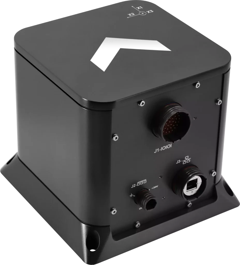
Exail has unveiled the Advans Vega SL, a new high-precision inertial navigation system that maintains navigation continuity across amphibious operations.
In contested littoral environments, maintaining reliable navigation across the sea-to-land transition remains a persistent challenge for amphibious forces. In the event of GNSS jamming, spoofing or signal unavailability, the Advans Vega SL operates independently of any external signal from vessel departure to shore, ensuring forces maintain continuous positioning and fire control readiness without reconfiguration at any stage.
The Advans Vega SL INS. (Credit: Exail)
As a single, self-contained solution covering both maritime and land phases, it also removes the integration constraints associated with multi-system architectures, which typically require reconfiguration or handover at the water-to-land transition.
With 0.05° RMS heading accuracy in the maritime phase and 0.5 mils RMS on land, the Advans Vega SL system maintains positioning continuity in GNSS-denied environments without reconfiguration.
“GNSS signal denial is now an operational assumption in any amphibious and littoral combat planning,” said Yann Le Balc’h, business development manager for land defense, Exail. “The Advans Vega SL removes satellite dependency at the most exposed phase of an amphibious operation, giving forces the autonomy to project ashore on their own terms.”
Drawing on Exail’s fiber-optic gyroscope technology, the Advans Vega SL delivers 0.05° RMS heading accuracy in the maritime phase and 0.5 mils RMS on land — the highest navigation precision achieved to date in a system designed for the full sea-to-land transition. This performance level is rooted in decades of navigation expertise across land and naval operations, now brought to bear on a capability requirement that has become increasingly critical in modern amphibious warfare.
With navigation systems in service with more than 70 navies and land forces worldwide, Exail is a recognized supplier for defense forces requiring sovereign, signal-independent positioning capability across all operational domains.
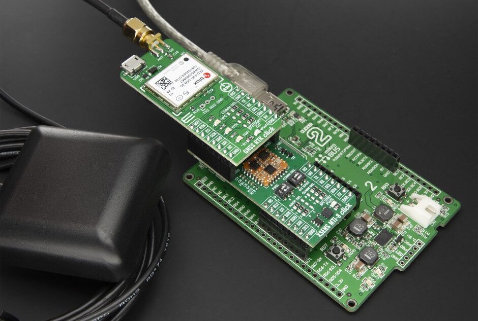
XSens MTi-8 Click is a new compact add-on board designed for RTK-supported high-accuracy positioning and orientation tracking in demanding outdoor embedded applications. It is based on the MTI-8-5A, an RTK-enhanced GNSS/INS module from Xsens that combines GNSS positioning with advanced inertial sensing and real-time sensor fusion.
The compact Click add-on boards enable developers to rapidly provide proof-of-concept, then prototype and code new embedded projects.
Key Features
Centimeter-level precision: Features real-time kinematic (RTK) support, delivering position accuracy down to 1 cm + 1 ppm CEP
High-speed sensor fusion: Runs the Xsens’ sensor fusion algorithm with output data rates up to 100 Hz, providing high-speed dead-reckoning and orientation data even during rapid movements
Advanced inertial sensing: Integrates a high-range gyroscope, accelerometer, and magnetometer, offering roll/pitch accuracy of 0.5° RMS and yaw accuracy of 1° RMS (with GNSS aiding)
Interface options: Offers flexible system integration through UART, SPI, or I2C interfaces, along with a USB Type-C port for easy configuration and testing.
Suitable applications
Self-driving platforms and delivery robots that require centimeter-level navigation in outdoor environments
Autonomous tractors and crop-monitoring drones where precise path-following is essential
High-end drones and robotic systems that depend on accurate roll, pitch, and yaw data for stability
Mobile mapping systems and surveying equipment that demand high-reliability motion tracking and positioning.
Collaboration focused on enabling plug-and-play, GPS-denied navigation capabilities for next-generation maritime platforms
Anello Photonics and Mythos AI are accelerating deployment of resilient, plug-and-play navigation solutions for the maritime sector. The collaboration brings together Anello’s advanced inertial sensing technology and Mythos AI’s intelligent autonomy software to address the growing need for resilient navigation in GPS-challenged environments.
Anello is creator of the Silicon Photonics Optical Gyroscope (SiPhOG). By combining SiPhOG-based inertial navigation with advanced sensor fusion and AI-driven collaborative autonomy, Anello and Mythos AI are delivering a fully integrated, plug-and-play solution that maintains performance when satellite signals are degraded or unavailable. It is designed to drop seamlessly into both next-generation and legacy maritime platforms. A multi-mission open systems architecture enables scalable deployment across defense, commercial and hybrid maritime operations.
Strategic focus on maritime autonomy and USVs
The initiative is particularly relevant to the rapidly evolving unmanned surface vehicle (USV) market. As USVs take on expanded roles in offshore energy, maritime security, hydrography, environmental monitoring and defense missions, complete end-to-end dependable navigation is essential to safe and effective operations.
A resilient, GPS-independent navigation capability enables:
greater operational assurance in GPS-denied or contested maritime environments
enhanced autonomy and mission continuity during signal disruptions
reduced integration complexity for OEMs and system integrators
scalability across a broad range of vessel sizes and mission profiles.
Anello and Mythos AI will collaborate with OEMs, integrators and end users to align the solution with evolving operational and regulatory demands.
Advanced Navigation has released a product for navigating underground mines, based on its technology demonstration in October 2025.
Chimera Land is a 3D laser velocity sensor (LVS) designed to solve the primary challenge for underground mining: maintaining precise vehicle positioning in deep, dark, and unmapped environments where GPS cannot reach.
When fused with an Advanced Navigation inertial navigation system (INS), Chimera Land allows underground vehicles to maintain stable navigation over extended distances and time. Instead of needing to “ask” an external beacon or satellite for its location, the sensor uses specialized lasers to measure a vehicle’s ground-relative 3D velocity with high accuracy. By feeding this precise data into the vehicle’s INS, the sensor eliminates the drift that typically comes with standalone INS.
This integration uses AdNav Intelligence, the company’s proprietary software. Drawing on adaptive algorithms, the fusion engine dynamically weights the input from each sensor, adjusting reliance in real time based on their reliability scores, environmental conditions, and operational context.
The result is a resilient, high-performance, infrastructure-light positioning solution that excels in the high-dust, zero-light conditions typical of underground mines.
Chimera Land was demonstrated in Europe’s deepest underground mine as part of BHP’s Deep Mining Call. When integrated with Advanced Navigation’s high-performance Boreas D90 INS, the solution achieved a position accuracy of 99.9% of distance traveled. Crucially, this performance was maintained without relying on any fixed positioning infrastructure, pre-existing maps, or external aiding.
Key performance benchmarks:
Precision at depth. The system delivered a final position error of 15.9m over a 22.9km transit (approx. 52 ft over 14 miles) at 1.4km underground.
INS drift reduction. Chimera Land actively reduced the drift rate to a mere 0.07% per distance traveled.
Repeatable accuracy. Validated across five separate runs, the system consistently hit an accuracy of better than 0.1%.
Infrastructure-light. Enables full vehicle autonomy even where fixed networks and infrastructure end.
As mines move deeper and into more hostile geological frontiers, the cost of installing fixed infrastructure becomes prohibitive. Chimera Land is engineered to maintain high-confidence estimation in total darkness, heavy dust, and high-vibration mining environments.
It allows for “infrastructure-lite” operations across the value chain.
Autonomous haulage systems (AHS). Enables continuous high-speed tramming in development areas without the need for pre-surveyed beacons.
High-Precision machine guidance. Provides the sub-decimeter velocity accuracy required for automated drill rig alignment and robotic scaling.
Dynamic Fleet Management. Real-time, sovereign localization allows for precise asset tracking and ore reconciliation, even in the deepest “dead zones.
Predictive collision avoidance. High-fidelity 3D velocity data improves the “time-to-collision” calculations for safety systems, reducing nuisance alarms.
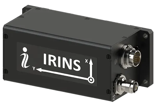
Inertial Labs, a Viavi Solutions Inc. company, has announced IRINS, a low Earth orbit (LEO)-aided inertial navigation system (INS) designed to allow full operation across land, air and sea in GNSS-denied, -degraded and -disrupted space operating environment .
Combining the capabilities of an INS, an altitude and heading reference system (AHRS) and a LEO PNT receiver, this platform marks a major milestone in Viavi’s portfolio for assured positioning, navigation and timing by bringing together the INS capabilities of inertial labs and the timing expertise of Jackson Labs.
The IRINS embedded system has been developed to counter the exponentially rising number of spoofing and jamming attacks that have affected military and critical infrastructure. Now, resilient LEO-based PNT and inertial navigation are available within a fully integrated system from a single vendor.
The system combines an INS, an AHRS and the GNSS-independent STL-2600 LEO Iridium receiver module. These capabilities enable the system to calculate altitude, position, velocity and time data, as well as minimize bias from causing drift. To help detect and eliminate attack signals, the device additionally integrates a GNSS receiver with a controlled reception pattern antenna (CRPA) port.
“The IRINS is the first fruit borne of VIAVI’s visionary strategy to mitigate vulnerabilities in positioning, navigation and timing, bringing together resilient satellite-based timing with tactical-grade IMUs to deliver the most precise PNT for GNSS-denied environments,” said Jamie Marraccini, vice president, Inertial Labs Products, Viavi. “By tightly coupling inertial sensing, LEO-based timing and navigation and anti-jam GNSS technologies into a single platform, the IRINS provides unmatched continuity, accuracy and trust for operations in contested and denied environments.”
“Assured access to PNT is critical for operations in contested environments,” said Maynard Porter, Director, Government PNT Business, Iridium. “Integrating Iridium PNT alongside VIAVI’s INS and AHRS provides users with an exceptionally resilient source of time and location data to maintain operational effectiveness when GNSS signals are disrupted.”
The IRINS is certified for IP67 and MIL-STD-810G environmental requirements. It is based on the company’s fully calibrated tactical-grade MEMS 3-axis accelerometer, gyroscope and clock. These are combined with embedded barometers, magnetometers and an optional onboard air-data computer as part of its AHRS.
Satellite communication is provided through the company’s STL-2600 receiver, which links to the Iridium LEO constellation. All capabilities are housed within a compact 126.5 × 49.3 × 53.3 mm enclosure.
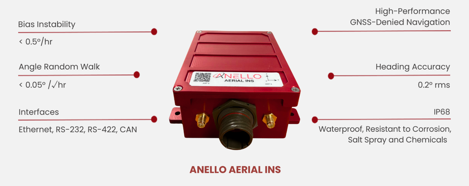
Anello Photonics has launched the Anello Aerial inertial navigation system (INS), a compact, high-performance inertial navigation system built around the company’s Silicon Photonics Optical Gyroscope technology and integrated with multi-band GNSS receivers.
Anello made the announcement at CES 2026, taking place this week in Las Vegas.
The Anello Aerial INS is built for demanding aerial platforms — including BVLOS UAS, maritime/shipborne VTOL UAS, ISR/special-mission aircraft, heavy-lift and cargo drones, and other autonomous aerial vehicles. The system is powered by an advanced EKF-based sensor fusion engine and ANELLO flight-profile-tuned algorithms, consistently delivering >98% navigation accuracy without the need for cameras or fiber-optic cables.
The Anello Aerial INS delivers <0.5 deg/hr unaided heading drift, maintaining accurate navigation and control through high-dynamics and GNSS jamming, spoofing, or occlusion. Anello’s navigation solutions are built to deliver assured performance in fully GNSS-denied environments — whether operating over water or desert corridors, in night or low-light missions, or through fog and cloud cover — maintaining precise guidance without GPS and enhancing warfighters’ effectiveness and survivability.
“Customers flying real missions need resilient navigation when GPS isn’t reliable,” said Mario Paniccia, co-founder and CEO of Anello Photonics. “By combining our SiPhOGs with our airborne-optimized sensor-fusion algorithms and integrated multi-band GNSS, the Anello Aerial INS delivers accurate navigation solutions in a cost-effective SWaP-friendly package. This allows UAVs to hold course through GPS jamming, multipath, spoofing, or outages using only Anello without the need for cameras or fiber-optic cables and allows the warfighter to complete their mission safely and successfully.”
ANELLO’s full product portfolio has been developed in close collaboration with customers and verified through comprehensive integration and mission-platform testing.
The Anello Aerial INS is available for evaluation today with production shipments beginning in the second quarter of this year. Evaluation kits include the Anello Aerial INS, cabling, drivers for PX4/ArduPilot, and a quick-start integration guide.
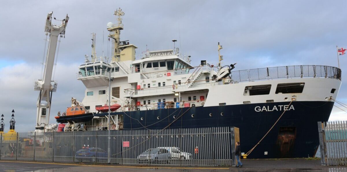
CPI Electron Device Business – TMD Technologies Division has successfully completed sea trials of its cquantum-hybrid inertial navigation system (INS) aboard the THV Galatea, operated by Trinity House, the General Lighthouse Authority for England, Wales, the Channel Islands and Gibraltar.
This milestone shows that quantum-enabled sensing hardware can operate stably in maritime conditions, with the potential to provide resilient positioning without continuous reliance on GNSS.
Research indicates that a 24-hour GNSS outage could cost the UK economy £1.4 billion through cascading effects on logistics, transportation and critical infrastructure, underscoring the need for GNSS-independent solutions. By proving that quantum sensors can operate in operational conditions aboard a working vessel, CPI TMD is advancing technologies that reduce reliance on satellite navigation and improve resilience across maritime, defense and commercial sectors.
The Harlequin System: Quantum-Enhanced INS
The Harlequin system is a quantum-classical hybrid INS designed to extend GNSS holdover — the ability to maintain accurate position when satellite signals are unavailable or unreliable. Developed under an Innovate UK funded project, with partners from industry and academia, including the University of Strathclyde, and Joseph Cotter’s group at Imperial College London, Harlequin integrates classic INS components (a precise clock, a ring laser gyroscope, and a MEMS accelerometer) with CPI TMD’s gMOT-based quantum accelerometer.
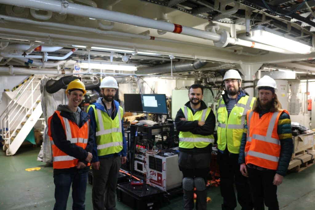
Onboard team for the sea trial. (Photo: CPI TMD)
The gMOT cold atom source, developed by CPI TMD, the University of Strathclyde and Kelvin Nanotechnology, is a grating-based magneto-optical trap that provides a source of ultra-cold atoms that forms the basis of a portable, rugged quantum sensor.
Conventional INS technology accumulates errors over time, causing position estimates to drift. By integrating its cold-atom accelerometer technology with classical INS technology, Harlequin leverages quantum-enhanced sensing to perform periodic drift corrections, extending the period over which a vessel can maintain accurate position in the absence of satellite-derived timing and positioning.
Real-world trials: Operating around a working vessel
The Harlequin trial demonstrates that quantum sensors can operate reliably outside the lab, functioning in the harsh conditions of real-world maritime operations—a crucial validation step toward field-deployable systems.
The sea trial took place aboard the THV Galatea, which is not a scientific test vessel but an operational ship with a demanding day job: keeping shipping routes safe by ensuring buoys and lights are correctly placed and maintained, surveying the seabed for hazards, marking wrecks, and supporting marine-infrastructure projects such as cables and pipelines.
The Harlequin system had to be loaded, tested and unloaded around the Galatea’s regular operational schedule, adding complexity to the trial and underscoring the system’s ability to integrate into real-world maritime workflows.
Next Steps: System Upgrades and Second Trial
Data gathered during the trial will inform a program of system upgrades aimed at improving performance and enhancing suitability for long-term shipboard operation. A second field trial is planned for the end of 2026 to validate improvements and bring it closer to operational readiness.
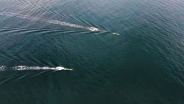
Nortek’s DVL 333 Surface, designed specifically for uncrewed surface vessels (USVs), enables USVs to maintain position or navigate when GNSS is lost.
Uncrewed surface vessels (USVs), often called sea drones, help monitor, map and secure the world’s oceans, performing tasks and surveys for less expense and risk than traditional crewed vessels. USVs are used in environmental monitoring, offshore inspection, subsea infrastructure protection, and defense missions such as intelligence, surveillance and reconnaissance (ISR).
USVs require reliable navigation and positioning information, particularly when performing autonomous operations. This information typically comes from GNSS.
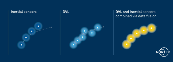
But during GNSS outages, USV operators are turning to alternative sensors for positioning. Without GNSS, a sole inertial navigation system (INS) on a vessel quickly drifts outside of acceptable levels when performing dead-reckoning navigation. By adding a Doppler Velocity Log (DVL) to the USV, operators can perform long-distance, dead-reckoning-based positioning with much lower drift.
USVs using INS in the absence of GNSS achieve improved accuracy with the addition of a DVL, which limits drift inherent to INS-only navigation. (Image: Nortek)
In subsea navigation systems, DVLs provide vehicle velocity information using acoustic returns from the seabed. Because DVLs offer an accurate velocity estimate with no drift, combining a DVL with an INS constrains the drift that would accumulate with an INS alone. Using a DVL allows USVs to maintain position or even navigate without requiring GNSS information, enabling fully autonomous navigation independent of potentially vulnerable signals.
However, deploying DVLs on surface vessels introduces its own set of engineering and operational challenges. Conventional DVLs typically feature protruding transducer heads that are not flush with a vessel’s hull — challenging on smaller or high-speed vessels.
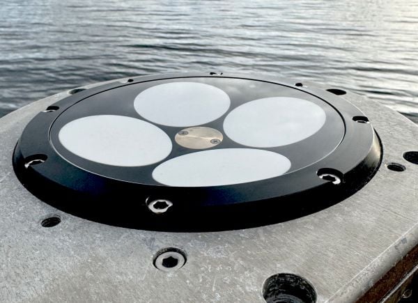
The DVL 333 Surface. (Photo: Nortek)
The compact Nortek DVL 333 Surface is designed for flush-hull installation, minimizing drag and protrusion below the hull line. It features a concave, fluid-filled transducer cavity sealed with an acoustic window, allowing for full control of sound velocity and eliminating the need for a hull-mounted speed-of-sound sensor.
When paired with a high-grade INS, the DVL 333 Surface delivers accurate position updates even during GNSS outages or interference. Its 300-meter bottom-track range supports fully autonomous operation in coastal waters, while a water-track mode extends functionality in deeper environments where the bottom is out of range. The DVL333 Surface can also be upgraded to Nortek’s VM Operations vessel-mounted ADCP system. For ease of maintenance, an optional type-certified sea valve allows in-water servicing without dry-docking.
Validating capabilities in the field
The capabilities of the DVL 333 Surface were demonstrated during field trials in the Oslofjord, an inlet in Norway. The test site presented conditions representative of complex coastal environments, where depth can vary significantly over short distances, and the seabed composition ranges from soft sediment to rock. Unlike uniform test sites with flat, sandy bottoms, the Oslofjord provides a realistic proving ground for challenging navigation scenarios.
“Our goal was to demonstrate that a surface vessel can maintain precise positional accuracy even during a complete GNSS blackout, and to do so in truly challenging coastal conditions,” said Torstein Pedersen, Nortek.
Nortek’s DVL 333 Surface installed in a fairing ready for testing in the Oslofjord. (Photo: Nortek)
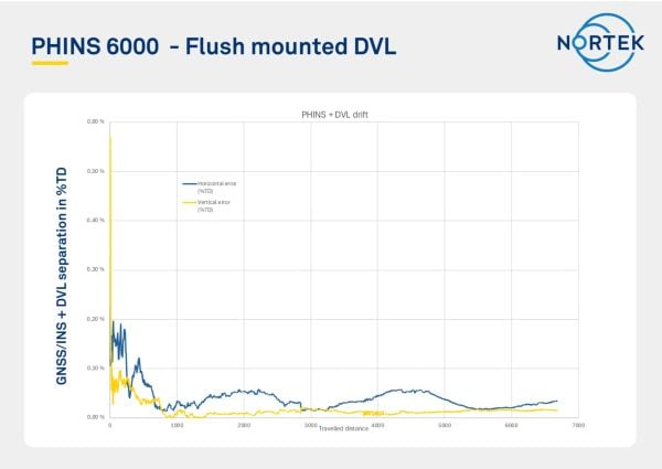
The navigation tests were carried out using a DVL 333 Surface integrated with an Exail PHINS 6000 INS. Although the trial track was relatively short, the system’s performance quickly stabilized, achieving a stable, long-term accuracy of approximately 0.05% of distance traveled (for instance, 50 cm error each 1 km traveled). When bottom track was disabled (simulating operation outside of the DVL 333 Surface’s 300 m bottom track range) and only water track was used with the PHINS INS, the horizontal position error remained within 8 meters over a three-hour run, with the DVL operating solely in water-track mode. In this mode, the INS estimates background currents, which were accurately estimated as weak, stationary currents.
“We were particularly impressed with the performance of the system when using just water track mode,” Pedersen said. “The Exail INS was able to use the water track information to estimate currents and correct for them in the navigation, which is not an easy task to do with accuracy over extended periods. This performance is critical for open water navigation.”
These results confirm that the DVL 333 Surface delivers reliable navigation performance in variable bottom conditions and without a direct speed-of-sound measurement. More importantly, they demonstrate the availability of a commercially available DVL that overcomes the challenges typically faced when adapting subsurface systems for surface platforms.
Positional error as a function of distance traveled, showing long-term accuracy settling below 0.05% over a transit distance of >6 km. (Image: Nortek)
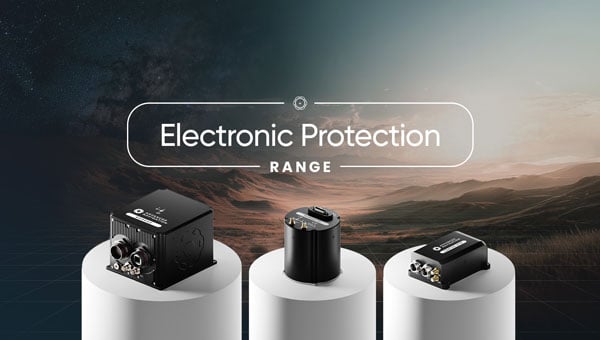
Advanced Navigation, a global leader in assured positioning, navigation and timing (PNT) and autonomous systems, has introduced a line of defense-ready inertial navigation systems (INS) featuring integrated electronic protection (EP) capabilities.
The systems are designed to counter electromagnetic warfare threats and ensure mission continuity amid a global surge in GPS jamming and spoofing attacks.
The electronic protection range includes:
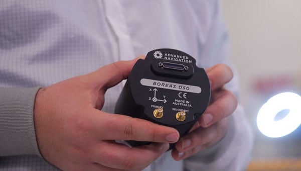
Boreas D Series, including the Boreas D50, D70 and D90 fiber-optic gyroscope (FOG)-based inertial navigation systems. Engineered for high-threat operational theaters, the Boreas D series supports multiple vehicle types and links to battlefield management systems and health and usage monitoring systems.
Certus Evo, an ultra-high accuracy MEMS GPS/inertial navigation system. The compact Certus Evo is designed for applications requiring navigation, stabilization and pointing under high-dynamics conditions.
The rollout builds on Advanced Navigation’s announcement to establish PNT Centers of Excellence (COE) across the United Kingdom, United States and Europe to address the operational needs of NATO forces.
Advanced Navigation’s Boreas D50 is engineered for high-threat scenarios. (Credit: Advanced Navigation)
Maximilian Doemling, chief product officer at Advanced Navigation, said countering signal jamming and spoofing requires solutions that are several steps ahead.
“This means embedding electronic protection into the foundation of every system,” Doemling said. “Our new electronic protection range takes our proven inertial navigation technology and combines it with advanced capabilities to detect and neutralize interference in real time.”
The systems provide real-time detection of GPS interference, cryptographic validation to identify spoofing and adaptive filtering to sustain positioning integrity. A built-in spectrum analyzer provides real-time monitoring of the radio frequency spectrum with configurable notch filters.
The electronic protection range incorporates dual-antenna, multi-band GPS receivers supporting up to three frequency bands for improved satellite visibility in high-interference zones.
The systems are engineered for integration into new and legacy defense platforms including combat vehicles, unmanned ground vehicles, artillery, counter-unmanned aircraft systems, radar pointing systems, intelligence, surveillance and reconnaissance payloads, unmanned aerial vehicles, unmanned surface vehicles and autonomous underwater systems.
In September 2024, a coalition of U.S. aviation and maritime stakeholders raised concerns over the surge in GPS jamming and spoofing incidents affecting civilian airspace and international shipping lanes. The Federal Communications Commission announced plans to initiate a formal inquiry into alternative and redundant positioning, navigation and timing systems.
Australia has established the Joint PNT Directorate, now at initial operating capability. In the U.K., the government is working to implement a framework for greater positioning, navigation and timing resilience.
Advanced Navigation backs its solutions with a three-year warranty. All Advanced Navigation solutions are free of International Traffic in Arms Regulations restrictions.
The Boreas D50, Boreas D70, Boreas D90 and Certus Evo are available for shipment.
Vatn Systems has released INStinct, an inertial navigation system (INS) designed to provide GPS-free navigation for maritime operations.
The defense technology company, which manufactures autonomous underwater vehicles (AUVs) for the U.S. military and commercial clients, said the system uses technology from ANELLO Photonics to deliver navigation capabilities in GPS-denied environments at lower cost than existing systems.
The system features a modular design that allows users to configure it based on mission requirements. It can be equipped with various inertial measurement units, including ANELLO’s X3 IMU, which uses Silicon Photonics Optical Gyroscope technology. The X3 IMU is designed to withstand shock and vibration in maritime conditions.
“Inertial navigation is the cornerstone of autonomy at sea,” said Nelson Mills, CEO and co-founder of Vatn Systems. “With INStinct, we’ve created a navigation solution that meets the needs of both our own vehicles and third-party platforms, offering reliability, accuracy, and adaptability. ANELLO’s IMU technology allows us to offer an INS with FOG performance at a fraction of the traditional cost. The launch of INStinct marks another milestone in our broader strategy to own the full tech stack for underwater vehicles.”
“The integration of our technology and our ANELLO X3 IMU into Vatn’s platforms and INS marks a pivotal advancement in our mission to transform autonomous underwater navigation,” said Dr. Mario Paniccia, CEO and co-founder of ANELLO Photonics.”Our technology has been rigorously field-tested across land, air, and sea environments, and we are thrilled to collaborate with Vatn to offer an underwater navigation solution. This partnership highlights our commitment to delivering next-generation navigation solutions that empower accurate and more efficient underwater operations.”
The system supports integration with Doppler velocity logs and includes maritime-specific algorithms. Housing configurations range from original equipment manufacturer specifications to depth-rated enclosures.
Vatn Systems said it plans to deliver vehicles equipped with INStinct to customers by the end of 2025.
Advanced Navigation is moving forward with plans to establish international positioning, navigation and timing (PNT) Centers of Excellence, with the UK location selection process currently underway.
The company is evaluating potential sites based on access to technical talent, logistics capabilities and proximity to major international airports. The final UK center location will be announced in late 2025, with additional global centers confirmed in early 2026.
Over the past year, Advanced Navigation has doubled its workforce and significantly expanded manufacturing capacity to address surging defense sector demand. The international COE network represents the next phase of the company’s growth strategy, positioning it to double its team again within 12 months.
“In an era of increasing complexity and contested environments, the ability to navigate with absolute certainty is becoming the world’s most critical strategic asset,” the company stated.
Building Supply Chain Resilience
To complement its Australian operations and establish robust onshore supply chains meeting local standards and security requirements, Advanced Navigation plans to partner with regional specialists in critical PNT sensing technologies, including:
Inertial sensing (optical gyroscopes and MEMS)
Vision-based sensing
Lidar and radar sensing
Acoustic Doppler velocity log sensing
The company emphasizes that navigation’s future depends on integrating diverse, adaptable sensor suites rather than relying on single technologies. Through its multi-sensor approach centered on inertial systems, the company aims to deliver resilience even in severe GPS-contested environments.
The expansion will accelerate innovation cycles, strengthen quality assurance and create opportunities for partners and research institutions across America and Europe to collaborate on breakthrough technologies.
Strengthening NATO Capabilities
The strategic expansion directly addresses NATO forces’ evolving operational needs. By establishing presence within U.S. and European industrial landscapes, Advanced Navigation aims to bolster critical infrastructure resilience while creating collaboration opportunities and jobs.
Beyond scaling production, the centers will focus on enabling seamless interoperability across NATO’s land, sea and air platforms, reducing integration time and costs for member nations. The COE network positions the company to power the next generation of autonomous systems and alternative PNT solutions worldwide.
Advanced Navigation said the Boreas D90 FOG INS represents the type of technology that will be developed and manufactured at these new facilities.
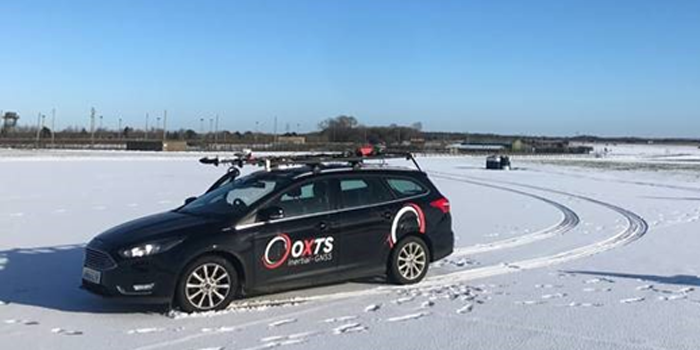
Mobile mapping is helping accelerate the progression of some of the most difficult engineering challenges on the planet, including those around autonomous driving and advanced surveying techniques, such as lidar.
The complexity of those challenges means that the outputs from a mobile mapping inertial navigation system (INS) must be as accurate as possible. A high-performing INS will make the most of any available GNSS signals, with the aim of providing centimeter-level accuracy even in areas where GNSS performs poorly, for instance in urban canyons. It also offers important data on pitch, roll and heading, which maintains the integrity of survey data even as the vehicle moves across large areas.
With such a wide variety of INS devices on the market, it can be difficult to narrow down the best option. It is important to establish criteria that will aid in evaluating the different INS propositions out there for mobile mapping projects.
Image: OxTS
1) How tightly integrated are the inertial measurement unit (IMU) and GNSS data?
INS is an essential element in providing accurate location data in as many environments as possible. Therefore, it is important to know how effectively the data from the IMU supports the GNSS data. In technical terms, this means evaluating whether the sensors are tightly integrated at all, and if so, how well.
The reason GNSS struggles in urban canyons and under tree canopies is that it is unable to get the six satellite signals necessary for a real-time kinematic (RTK) lock. In this situation, the GNSS will give readings that may be incorrect, as it is essentially trying to solve an equation without having all the numbers.
A tightly integrated GNSS and INS data stream will select the most reliable signals and use those to determine the position of the vehicle. If the data streams are not tightly integrated, then the INS’ ability to counteract GNSS issues is limited. Without accurate positioning, data scans will lose accuracy and even become completely incoherent the longer the user scans — making them unreliable at best, and unusable at worst.
2) Trading off accuracy and cost
Although accuracy is vital in mobile mapping, some INS devices will provide data that is far more accurate than the given job requires. Because greater accuracy equals greater cost, users may be paying more than necessary.
With that being said, the scale of accuracy and cost is not linear. An INS half the price of the most expensive one on the market will not be half as accurate. Look at each offering carefully to see what it includes and decide what level of accuracy and features are vital to the task. Eliminating unnecessary levels of precision or additional software features that are not needed is an effective way to make some savings.
3) How rugged is the device?
Mobile mapping vehicles will likely be out in the dry, wet, hot, cold, mud and snow. These vehicles will almost certainly be used consistently for long periods of time. Thus, it is essential to know that none of these conditions will stop the INS from working at peak effectiveness. Look for the IP rating (IP65 is essential for being weatherproof and protecting against shocks and dust) and ask what the average lifespan of the product is.
Image: OxTS
4) Can the device be properly calibrated?
Any INS is only as good as its calibration. Without calibration, the sensors in any INS can become misaligned and therefore provide inaccurate readings. Talk to vendors about their calibration processes — do they work to a nationally recognized standard of calibration like ISO 17025? Do their calibrations account for variations in temperature or humidity?
It is also worth considering how often sensors need recalibration. Recalibration is a chargeable service from most vendors, meaning the more the device needs recalibrating, the more the user will have to pay. This could also lead to delays if the user must send units abroad to have them recalibrated.