Tag: Institute of Navigation

  • And ION’s prestigious awards go to…

    And ION’s prestigious awards go to…

    The Institute of Navigation (ION)’s Satellite Division presented two prestigious awards Sept. 20 at the ION GNSS+ Conference in Miami.

    Peter Teunissen receives the prestigious 2019 Johannes Kepler Award from ION's Satellite Division. (Photo: ION)
    Peter Teunissen receives the prestigious 2019 Johannes Kepler Award from ION’s Satellite Division. (Photo: ION)

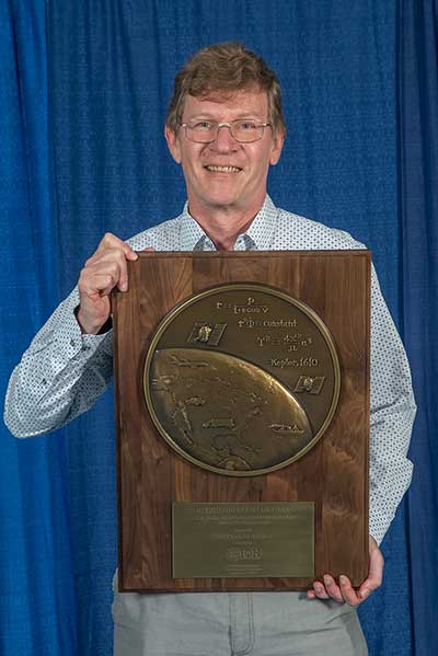
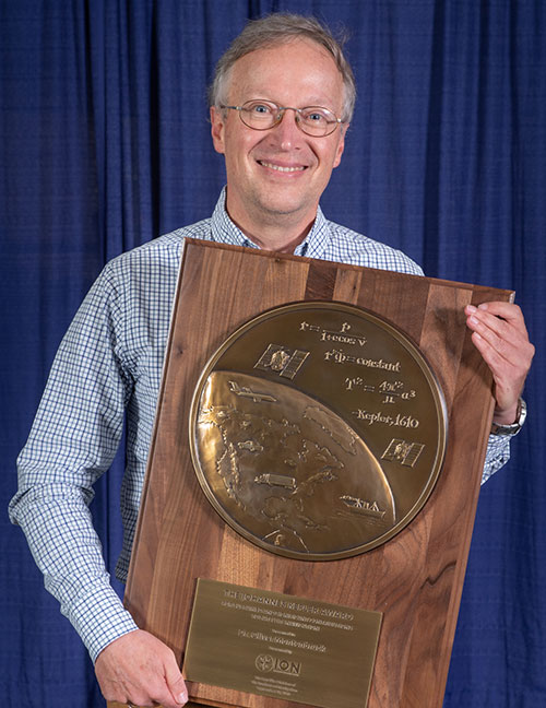
    Peter Teunissen was honored with the career-highlight Johannes Kepler Award. The Johannes Kepler Award recognizes and honors an individual for sustained and significant contributions to the development of satellite navigation. It is the highest honor bestowed by the ION’s Satellite Division.

    Teunissen was recognized for his influential and groundbreaking contributions to the algorithmic foundations of satellite navigation, and for sustained dedication to the global education of the next generation of navigation engineers.

    Teunissen invented the Least Squares Ambiguity Decorrelation Adjustment (LAMBDA) method, the worldwide standard for ambiguity resolution, which revolutionized high precision GNSS positioning capabilities. LAMBDA has thus become an indispensable tool that is most widely used in land, air and space navigation; positioning and attitude determination; differential and network processing; and in surveying and geodesy. He also extended the method to MC-LAMBDA, a multivariate constrained resolution method for optimal GNSS attitude determination.

    Among others, Teunissen laid the mathematical and algorithmic foundation of reliability theory, which enables a proper understanding of the quality of different integer ambiguity resolution methods and a rigorous characterization of their failure rates, which even led to the development of an optimal test for ambiguity validation.

    His findings are particularly important for multi-GNSS processing, which require a proper understanding of individual system characteristics and their respective contributions to achieve navigation solutions of the highest precision and integrity.

    Teunissen has made contributions in the field of precise point positioning, the exploitation of triple-frequency observation, and the joint use of new GNSS such as Galileo, BeiDou and QZSS. Pioneering work in this area include the early setup of multi-GNSS receiver test beds in the Asia-Pacific area; the discovery and proper handling of mixed-receiver inter-satellite-type biases, which were vital to fully exploit ambiguity resolution in the regional, BeiDou-2 system; and the first demonstrations of mixed GPS/Galileo/IRNSS/QZSS L5 processing for precise positioning applications.

    Teunissen has made significant contributions to educating future generations. He is currently a Professor of Satellite Navigation at Delft University of Technology, The Netherlands and Curtin University, Australia.

    He received his Ph.D. at Delft University of Technology in Mathematical and Physical Geodesy. He holds several honorary professorships and fellowships of numerous international organizations, including Australia’s prestigious Federation Fellowship of the Australian Research Council.

    He has published more than 300 papers, seven books, is co-editor and author of the Handbook of Global Navigation Satellite Systems, and is a member of 13 editorial boards.

    He is a regular contributor to ION and ION programs. He is a Fellow of the ION, the RIN and the Royal Netherlands Academy of Sciences.

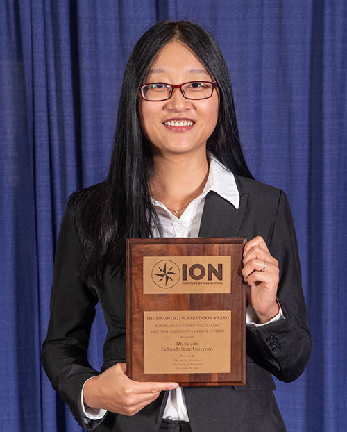
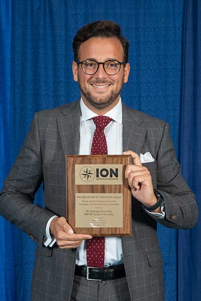
    Advanced RAIM topic earns Diaz the Parkinson Award

    Santiago Perea Diaz receives the 2019 Bradford W. Parkinson Award from ION's Satellite Division. (Photo: ION)
    Santiago Perea Diaz receives the 2019 Bradford W. Parkinson Award from ION’s Satellite Division. (Photo: ION)

    The Bradford W. Parkinson Award recognizes an outstanding graduate student in GNSS. It is presented in honor of Parkinson for his leadership in establishing the U.S. GPS and for his work on behalf of ION’s Satellite Division.

    Santiago Perea Diaz was recognized for graduate student excellence in GNSS in his thesis, “Design of an Integrity Support Message for Offline Advanced RAIM.”

    Any graduate student who is a member of the ION and is completing a degree program with an emphasis in GNSS technology, applications, or policy is eligible for the award.

  • Acutronic discusses role in inertial test industry at ION JNC 2019

    Acutronic President & CEO Mark Tatkow offers an overview of the company at the Institute of Navigation’s 2019 Joint Navigation Conference in Long Beach, California.

  • Live from the 2019 ION Joint Navigation Conference and Esri User Conference

    Live from the 2019 ION Joint Navigation Conference and Esri User Conference

    The GPS World staff reported live from the Institute of Navigation’s (ION) 2019 Joint Navigation Conference, which took place July 8-11 in Long Beach, California, and the Esri 2019 User Conference, which took place July 8-12 in San Diego. Check out news, photos and videos from the shows.

    Esri User Conference

    July 8-12 // San Diego

    NEWS

    Jane Goodall Institute releases StoryMap highlighting chimp habitat conservation (7/24/19)
    NASA Disasters Program aids with disaster relief efforts (7/24/19)
    Trimble launches usage-based service plan for Catalyst GNSS receiver (7/11/19)
    Esri, Jane Goodall Institute partner to protect ecosystems (7/9/19)

    VIDEOS


    ION Joint Navigation Conference

    July 8-12 // Long Beach, California

    NEWS

    KVH launches TACNAV 3D inertial navigation system (7/10/19)

    VIDEOS

  • ION honors award winners at ITM/PTTI meeting

    ION honors award winners at ITM/PTTI meeting

    ION logoThe Institute of Navigation (ION) presented its Annual Awards during the ION International Technical Meeting (ITM) and Precise Time and Time Interval Systems and Applications (PTTI) meeting held Jan. 28-31 in Reston, Virginia.

    The ION Annual Awards Program is sponsored by The Institute of Navigation to recognize individuals making significant contributions or demonstrating outstanding performance relating to the art and science of navigation.

    Seebany Datta-Barua received the Per Enge Early Achievement Award for outstanding contributions to the understanding of the dynamics of the ionosphere and its impacts on satellite-based navigation integrity. The Early Achievement Award is presented in recognition of outstanding contributions made early in one’s career.

    Major Clifford Lucas received the Superior Achievement Award for the organization and execution of advanced training scenarios, increasing an aircrew’s joint readiness to navigate and employ in contested and degraded environments. The Superior Achievement Award is presented to an individual demonstrating outstanding accomplishments as a practicing navigator.

    Robert L. Tjoelker received the Distinguished PTTI Service Award for systems engineering and technical leadership in the successful delivery of major PTTI systems to NASA’s Deep Space
    Network, including trapped-ion atomic clocks. The Distinguished PTTI Service Award is presented to recognize outstanding contributions related to the management of PTTI systems.

    Kimia Shamaei and Dr. Zaher (Zak) M. Kassas received the Dr. Samuel M. Burka Award for their paper “LTE Receiver Design and Multipath Analysis for Navigation in Urban Environments,” published in the Winter 2018 issue of NAVIGATION, Journal of The Institute of Navigation, Vol. 65, No. 4, pp. 655-675. The Dr. Samuel M. Burka Award recognizes outstanding achievement in the preparation of a paper advancing the art and science of positioning, navigation and timing.

    Chris G. Bartone received the Captain P. V. H. Weems Award for sustained contributions in research, applications and teaching in the areas of electronic navigation, GNSS and antenna technologies. The Captain P. V. H. Weems Award is presented to individuals for continuing contributions to the art and science of navigation.

    Marek K. Ziebart received the Tycho Brahe Award for outstanding innovation and leadership in the area of high-precision, physics-based radiation for modeling for spacecraft orbit dynamics. The Tycho Brahe Award is given in recognition of outstanding contributions to the science of space navigation, guidance and control.

    Karl W. Shallberg received the Norman P. Hays Award for significant contributions to the FAA’s Wide Area Augmentation System, technical leadership in reference receiver development and anomaly/interference mitigation, and critical support to DOT’s Adjacent Band Compatibility study.
    The Norman P. Hays Award is given in recognition of outstanding encouragement, inspiration and support contributing to the advancement of navigation.

    Marco Falcone received the Thomas L. Thurlow Award for engineering contributions and leadership integral to the design of equipment used for navigation — the Galileo satnav system. The Thomas L. Thurlow Award recognizes outstanding contributions to the science of navigation.

    John Raquet received the Distinguished Service Award for extraordinary service to The Institute of Navigation. The Distinguished Service Award recognizes extraordinary service to The Institute of Navigation.

    The Institute of Navigation is a not-for-profit professional organization dedicated to advancing Positioning, Navigation and Timing (PNT). The Institute is a national organization with a worldwide membership.

  • Graduate student Yu Jiao receives ION’s Parkinson Award

    Graduate student Yu Jiao receives ION’s Parkinson Award

    The Institute of Navigation presents Yu Jiao with the Parkinson Award at ION GNSS+ 2018. (Photo: ION)
    The Institute of Navigation presents Yu Jiao with the Parkinson Award at ION GNSS+ 2018. (Photo: ION)

    Yu Jiao was recognized for graduate student excellence in GNSS by the Institute of Navigation’s (ION) Satellite Division on Sept. 28 at the ION GNSS+ Conference in Miami. She received the Bradford W. Parkinson Award for her thesis, “Low-Latitude Ionospheric Scintillation Signal Simulation, Characterization and Detection on GPS Signals.”

    Jiao received her Ph.D. at Colorado State University, with Jade Morton as her advisor. She graduated this past year and is now employed as a GNSS engineer at Intel.

    The Bradford W. Parkinson Award is granted annually to recognize an outstanding graduate student in GNSS, and is presented in honor of Bradford W. Parkinson for his leadership in establishing the U.S. Global Positioning System and for his work on behalf of the Satellite Division of the Institute of Navigation.

    Any graduate student who is a member of the ION and is completing a degree program with an emphasis in GNSS technology, applications or policy is eligible for the award.

  • Oliver Montenbruck honored with ION’s Kepler Award

    Oliver Montenbruck honored with ION’s Kepler Award

    The Institute of Navigation presents Dr. Oliver Montenbruck with prestigious Johannes Kepler Award at the ION GNSS+ 2018 Conference. (Photo: ION)
    The Institute of Navigation presents Dr. Oliver Montenbruck with prestigious Johannes Kepler Award at the ION GNSS+ 2018 Conference. (Photo: ION)

    The Institute of Navigation’s (ION) Satellite Division presented Oliver Montenbruck with its Johannes Kepler Award on Sept. 28 at the ION GNSS+ Conference in Miami. The Kepler Award recognizes and honors an individual for sustained and significant contributions to the development of satellite navigation. It is the highest honor bestowed by the ION’s Satellite Division.

    Montenbruck was honored for his pioneering contributions to GPS for navigation of space vehicles, the advancement of multi-GNSS understanding, and tracking networks to support scientific and societal benefit.

    He is head of the GNSS Technology and Navigation Group at DLR’s German Space Operations Center and an affiliated professor for GNSS at the Technical University of Munich. His research activities have been devoted to spaceborne GNSS applications, where he made contributions in the fields of receiver technology, autonomous navigation systems, spacecraft formation flying and precise orbit determination.

    These range from development of the first meter-level autonomous navigation system for micro-satellites based on Kalman-filtered GPS observations, to detailed modeling of user spacecraft antenna phase-center variations, non-gravitational forces and ambiguity fixing techniques that support GNSS-based POD precision to the 1-centimeter level in support of space geodesy.

    His unique expertise in the field has resulted in numerous consultancy tasks for national and European space industry and agencies. Focusing on the new satellite navigation systems, he has pioneered the advancement of monitoring networks, characterization of new navigation signals, GNSS performance assessment and multi-GNSS processing.

    A GPS World Leader

    In 2014, Montenbruck was honored with the GPS World Leadership Award, Products Category, for “Bringing SatNav Future into View: A Platform for Early Familiarization with New Constellations” (see his remarks here.) He also has authored several articles for the magazine, including:

    He pioneered the expansion of global monitoring networks for new and modernized GNSS, initiating the Cooperative Network for GNSS Observation (CONGO), which has been a primary source of information for early assessment of Galileo, BeiDou, GPS L2C and L5 signals. His leadership and research have contributed to a thorough understanding of new GNSS constellations, enabled the full exploitation of new signals, advanced satellite technology and made multi-GNSS available to a wider community.

    Montenbruck is an active member ION and past member of council. He serves on the IGS Governing Board and key working groups. Within the International GNSS Service (IGS), Montenbruck chairs the Multi-GNSS Working Group and coordinates the performance of the Multi-GNSS Project (MGEX).

    Montenbruck is widely recognized for his frequently cited textbooks, ~100 publications in peer-reviewed journals, more than 250 conference papers and the Springer Handbook of Global Navigation Satellite Systems, which he co-edited and authored/co-authored. He is a recipient of the ION’s Tycho Brahe Award and the DLR Senior Scientist Award as well as the GPS World Leadership Award.

    Montenbruck received his Ph.D. in 1991 and Habilitation in 2006 from the Technical University of Munich. He has supervised more than 25 master and a dozen Ph.D. theses, and served on defense committees at several international universities. As a visiting scientist, he conducted joint research projects at various international institutions, including the University of Texas at Austin, the European Space Agency, and the University of Bern.

  • ION JNC early bird registration deadline is June 15

    ION JNC early bird registration deadline is June 15

    The Institute of Navigation’s (ION’s) Joint Navigation Conference (JNC) 2018 early bird registration deadline is Friday, June 15.

    The JNC, sponsored by the Military Division of the Institute of Navigation, will be held July 9-11 in a U.S. only, For Official Use Only (FOUO) environment at the Hyatt Regency Long Beach in Long Beach, California. The U.S.-only classified sessions will be held July 12 at The Aerospace Corporation.

    According to ION, early registration can save $200 on conference registration fees by entering a reservation confirmation number from the Hyatt Regency Long Beach at the start of the registration process. Attendees will need a valid hotel confirmation number to claim the discount during registration.

    Registration can be completed here.

    Attendance Restricted

    Conference attendance for both FOUO U.S. only (July 9-11) and U.S.-only classified sessions (July 12) will be screened by the Joint Navigation Warfare Center and will be restricted to U.S. only.

    Admission to the classified session will be limited to the capacity of the room and will be allocated on a first-come, first-served basis, to those who submitted visit requests in advance. Attendees requiring onsite security validation will be processed on a space-available basis. You are encouraged to submit your visit request early.

  • ION names winners of 8th annual Autonomous Snowplow Competition

    ION names winners of 8th annual Autonomous Snowplow Competition

    The winner’s of ION’s 8th annual Autonomous Snowplow Competition was team “Snow Squirrel” from the University of Minnesota. Photo courtesy of ION.

    The Institute of Navigation’s (ION) Satellite Division held its 8th annual Autonomous Snowplow Competition Jan. 25-28 at Rice Park in St. Paul, Minnesota.

    The ION Autonomous Snowplow Competition, held in cooperation with the ION North Star Section, is an international event open to college and university students, as well as the general public. According to ION, the competition challenges teams to design, build and operate a fully autonomous snowplow using state-of-the-art navigation and control technologies.

    Eleven teams entered the competition, and eight of those teams successfully completed all the phases of the competition. Each team used a variety of navigation systems, including lira, optical navigation systems, inertial instruments, magnetic sensors, ultra wide-band radio reflectors, visual odometry, GNSS and differential GPS, to rapidly and accurately clear a designated path of snow.

    Teams were judged based upon their cumulative scores earned throughout the competition phases, including presentations and dynamic vehicle events.

    The first place team was the University of Minnesota’s “Snow Squirrel” team. The team was awarded $7,000 and a Golden Snow Globe Award, and is invited to present during the ION GNSS+ 2018 conference Sept. 24-38 in Miami. The second place team was the Dunwoody College of Technology’s “Wendigo 2018” team, which was awarded $4,000 and a Silver Snow Globe Award. Finally, the third place team was North Dakota State University’s “Thundar 3.0” team, which received $2,000 and a Bronze Snow Globe Award.

  • ION announces annual award winners

    The Institute of Navigation (ION) presented its Annual Awards during the ION International Technical Meeting (ITM) and Precise Time and Time Interval Systems and Applications (PTTI) meeting in Reston, Virginia, Jan. 29-Feb. 1.

    The ION Annual Awards Program is sponsored by The Institute of Navigation to recognize individuals making significant contributions or demonstrating outstanding performance relating to the art and science of navigation.

    Zheng Yao received the Early Achievement Award for his pioneering contributions in developing new GNSS signals and multiplexing techniques; and advancing the Chinese BeiDou Navigation Satellite Systems (BDS) signal design. The Early Achievement Award is presented in recognition of outstanding contributions made early in one’s career.

    Captain Gregory DuBose received the Superior Achievement Award for sustained performance in combat operations in Afghanistan, Iraq and Syria; and assistance in the recovery of a downed B-1 crew in Montana. The Superior Achievement Award is presented to an individual demonstrating outstanding accomplishments as a practicing navigator.

    William Bollwerk received the Distinguished PTTI Service Award for service to the Department of Defense and country in promoting the importance of time, and educating policymakers and mission operators to ensure understanding of time in critical operations. The Distinguished PTTI Service Award is presented to recognize outstanding contributions related to the management of PTTI systems.

    Luke B. Winternitz, William A. Bamford, Samuel R. Price, J. Russell Carpenter, Anne C. Long and Mitra Farahmand received the Samuel M. Burka Award for their paper “Global Positioning System Navigation above 76,000 KM for NASA’s Magnetospheric Multiscale Mission” published in the Summer 2017 issue of NAVIGATION, Journal of The Institute of Navigation, Vol. 64, No. 2, pp. 289-300. The Samuel M. Burka Award recognizes outstanding achievement in the preparation of a paper contributing to the advancement of the art and science of positioning, navigation and timing.

    Professor Allison Kealy received the Captain P. V. H. Weems Award for sustained contributions to advancing the art and science of navigation, and promoting and expanding the use of PNT among worldwide science and engineering communities. The Captain P. V. H. Weems Award is presented to individuals for continuing contributions to the art and science of navigation.

    David A. Turner received the Norman P. Hays Award for his role in the formation of the International Committee on GNSS (ICG) and the development of globally recognized principles of GNSS compatibility, interoperability and transparency. The Norman P. Hays Award is given in recognition of outstanding encouragement, inspiration and support contributing to the advancement of navigation.

    Yang Gao received the Thomas L. Thurlow Award for significant contributions and leadership in the development and application of Precise Point Positioning (PPP) and high-precision GNSS technology. The Thomas L. Thurlow Award recognizes outstanding contributions to the science of navigation.

  • Korea will launch its own satellite positioning system

    Korea will build its own navigation satellite system by 2034, providing independent positioning and navigation signals over an area spanning a 1,000-kilometer radius from the country’s capital, Seoul.

    The Ministry of Science and information and communications technology (ICT) announced that it would finalize a plan for the Korean Positioning System (KPS) at a Space Committee meeting on Feb. 5.

    According to a preliminary statement from the Ministry of Science and ICT, the KPS initiative will develop a ground test in 2021, core satellite navigation technology by 2022 and begin actual satellite production in 2024. The system will comprise a total of seven navigation satellites, three of them geostationary above the Korean Peninsula.

    Figure from the 2016 paper shows a conceptual view of real-time WADGPS operation. The reference station transmits observation data at 1 Hz frequency to the master station. The master station is operated in real time and creates correction information and basic integrity information thereby configuring a message. A message is sent to the satellite communication simulation device according to its own transmission protocol. The satellite communication simulation device performs broadcasting of WADGPS correction information into the L1 band. A message created in every sec is coded with reserved GPS PRN C/A code and modulated with L1 frequency. Since additional correction information transmission medium such as geostationary orbit satellite or pseudolite is not considered in this study, radio frequency (RF) signals are created using simulation devices and performance was verified while connecting the signal with user receivers via cable. Additionally, a commercial communication network was used to transfer correction messages in order to verify user performance, which is located remotely. (Image: Korean Journal of Positioning, Navigation, and Timing)
    Figure from the 2016 paper shows a conceptual view of real-time WADGPS operation. The reference station transmits observation data at 1 Hz frequency to the master station. The master station is operated in real time and creates correction information and basic integrity information thereby configuring a message. A message is sent to the satellite communication simulation device according to its own transmission protocol. The satellite communication simulation device performs broadcasting of WADGPS correction information into the L1 band. A message created in every sec is coded with reserved GPS PRN C/A code and modulated with L1 frequency. Since additional correction information transmission medium such as geostationary orbit satellite or pseudolite is not considered in this study, radio frequency (RF) signals are created using simulation devices and performance was verified while connecting the signal with user receivers via cable. Additionally, a commercial communication network was used to transfer correction messages in order to verify user performance, which is located remotely. (Image: Korean Journal of Positioning, Navigation, and Timing)

    Korea currently relies on the U.S. GPS system, which has suffered repeated local area jamming emanating from North Korea.

    “As the GPS becomes a necessity in everyday life, broken signals for any reason can set off a nationwide chaos,” said an official for satellite navigation at the Korea Aerospace Research Institute (KARI).

    Officials stated the the KPS will also improve  available un-aided accuracy of GPS in its service area from about 10 meters now to less than one meter.

    “Advanced nations are trying to secure strong GPS capabilities by sending up satellites to prevent a chaos that can take place while they depend on other nations’ satellites,” stated the KARI spokesperson.

    The initiative appears to be separate from the Korean Wide Area Differential GPS System, whose development was the subject of a 2011 paper presented at the Institute of Navigation (ION) International Technical Meeting. The abstract for that paper stated:

    “[The] project is scheduled for 2010 to 2014 under the contract with the Ministry of Land, Transport and Maritime affairs (MLTM). After that, Korea will launch a geostationary multifunctional satellite with a navigation payload which will be broadcasting augmenting signals for GPS.”

    In March 2016, the Korean Journal of Positioning, Navigation, and Timing published a paper titled “Performance Analysis of WADGPS System for Improving Positioning Accuracy,” by Hyoungmin So , Jaegyu Jang, Kihoon Lee, unpyo Park and Kiwon Song. Its conclusion section stated:

    “In this paper, configuration of observation reference stations and master station and initial experiment results were presented to verify accuracy correction performance of the WADGPS. The wide area correction algorithm was implemented using eight reference stations and one master station. For the initial performance verification, static and dynamic experiments were conducted. The experiment result showed that the static experiment had a horizontal accuracy performance with a level of 1 m (95 percent). In the dynamic experiment using a vehicle, performance degradation occurred compared to that of static experiment. The reason for this was due to the measured value error at the user receiver caused by multipath and visibility limitation. In summary, the implementation and performance of the algorithm of early stage were verified. For the future study, user operation characteristics will be considered and additional performance analysis on created correction information will be conducted.”

  • GPS World advisor honored with ION award

    Terry Moore

    Shortly after GPS World’s 2017 Leadership Awards ceremony during ION GNSS+ week, the Institute of Navigation rolled out its own distinguished panel of award recipients at a conference luncheon.

    ION’s Satellite Division presented Terry Moore with the Johannes Kepler Award, its highest honor. It is perhaps a bit of editorial license to call Terry Moore “one of our own,” but he has been an advisor to the magazine for lo, these 17 years or more. During that time his technical papers have formed the basis for several feature articles, and he has guided many of his students and colleagues to authorship in these pages.

    Director of the Nottingham Geospatial Institute (NGI) at the University of Nottingham, where he has long served as professor and dean, he is also a consultant and advisor to European and UK government organizations and industry. He did extensive work on the introduction and implementation of WGS 84 as the standard reference system for air and marine navigation, developed software tools for coordinate transformations and map projections, and pioneered the use of raw GPS code- and carrier-phase data from low-cost receivers.

    He is the founding director of the GNSS Research and Applications Centre of Excellence, which targets knowledge transfer between the NGI and business. He has a long career of volunteer service for both ION and the Royal Institute of Navigation. In this as in other things he exemplifies the best of the scientific community, or of any community for that matter.

    Among his articles for the magazine are “Not Just a Fairy Tale: A Hansel and Gretel Approach to Cooperative Vehicle Positioning,” 2014; “Network RTK for Intelligent Vehicles,” 2013; “Aiding Indoor Pedestrian Navigation with Building Heading,” 2011; “Integrating Computer Vision and Inertial Navigation for Pedestrian Navigation,” 2011; “Assessing Network RTK Wireless Delivery,” 2009; “Ubiquitous Positioning: Anyone, Anything: Anytime, Anywhere,” 2007; and “Simulation GPS in Urban Traffic Environments,” 2005.

    I was privileged to serve as in-house editor for many if not all of these articles. A learning experience that could have been more so had I applied myself harder. Story of my life.

    Nowhere to be found in the curriculum vitae of this Ph.D. in space geodesy are his performance as Commander Bond in “GNSS Murder, Mystery and Mayhem at the Mansion,” where he drank a mean martini, shaken not stirred, nor his regular appearances as vocalist at the NavtechGPS Open Mic Night, most recently dueting on “Paradise by the Dashboard Lights.”

    All of us at the magazine join in congratulating Terry on this well-deserved honor!