Tag: IoT

  • Altair selects Rohde & Schwarz for testing new IoT chipsets

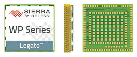
    Modules featuring Altair’s ALT1250 CAT-M1/NB1 chipset will be demonstrated at Mobile World Congress.

    Altair Semiconductor, a provider of LTE chipsets, has selected Rohde & Schwarz as its partner for test equipment for its dual-mode CAT-M1/NB1 internet of things (IoT) ALT1250 chipset, as well as its next-generation IoT chipsets.

    The ALT1250 is a highly integrated dual-mode CAT-M1/NB-IoT chipset with GNSS. Modules with ALT1250 inside are the world’s smallest, and may be as small as 100 millimeters square in area.

    The ALT1250 includes GNSS location positioning, a wideband RF front-end supporting all commercial LTE bands within a single hardware design, a multi-layered and hardware-based security framework, an internal application subsystem and packaging that enables standard, low-cost PCB manufacturing.

    The Rohde & Schwarz R&S CMW500 test platform offers the most validated CAT-M1/NB-IoT protocol conformance tests. It allows manufacturers and test houses to use a single instrument to verify that chipsets, modules and devices comply with GCF and PTCRB standards, and specific network operator requirements.

    The test equipment will be used for protocol testing as well as RF, RRM performance and carrier tests.

    Rohde & Schwarz is a global manufacturer of wireless communications and EMC test and measurement equipment and plans to develop new testing protocols for Altair’s next generations of cellular IoT chipsets.

    “Our ALT1250 chipset is already forming the foundation for multiple current and emerging IoT applications,” said Ilan Reingold, VP of business development and marketing for Altair. “The choice of Rohde & Schwarz is part of our commitment to the highest quality of advanced validation and performance testing for our game-changing products.”

    “This announcement confirms the commitment of Rohde & Schwarz to the wireless industry to provide innovative test tools and solutions that allow the testing and certification of cellular IoT devices,” said Anton Messmer, vice president, mobile radio testers, for Rohde & Schwarz. “We are pleased to have been selected by Altair and are looking forward to supporting them in the development of highly integrated chipsets in conformance with 3GPP Release-13 standards for CAT-M1 and NB-IoT, and beyond.”

    Altair will be demonstrating partner modules based on ALT1250 at Mobile World Congress (MWC) in Barcelona, Spain, Feb. 26 to March 1 at Altair meeting rooms in Hall 2, Stands 2B2Ex and 2B4Ex.

    Rohde & Schwarz will showcase CAT-M1/NB-IoT test solutions with the R&S CMW500 at MWC in hall 6, booth 6C40.

  • Hoopo to provide low-power geolocation for IoT

    A new company, hoopo, has launched to supply an innovative, accurate geolocation solution for low-power wide area (LPWA) networks. The solution would improve precision for low-power Internet of Things (IoT) asset tracking.

    Hoopo’s geolocation enables companies to locate their valuable assets without the significant cost or battery consumption that can be associated with GPS. hoopo’s IoT solutions help companies precisely track specific assets in areas such as shipping ports, airports, car dealer lots, cattle ranches and other asset-dense areas.

    Hoopo has received $1.5 million in funding to further grow its business from a group of investors, including the initial investors in Mobileye; Israeli investor Zohar Gilon; and Ben Marcus, CEO of AirMap.

    The need to understand and quantify asset location is quickly becoming a requirement for the enterprise and industrial IoT. However, the accuracy of today’s low-power geolocation isn’t precise enough to deliver on the full promise of the IoT.

    LPWA networks are becoming the driving force behind smart city and other IoT applications because of their low-cost, low-power consumption, and high-coverage capabilities in rural and urban environments. The long battery life of LPWA devices allows businesses to deploy a maintenance-free device in the field for several years.

    “Hoopo is addressing a real business need of companies around the world: cost-effective, yet precise, tracking of their valuable assets with longevity of battery life up to 10 years in the field,” said Ittay Hayut, CEO of hoopo. “LPWA checks off all of the boxes companies need in terms of cost and coverage, and hoopo’s solutions work alongside these LPWA networks to help businesses keep their assets safe, anytime and anywhere.”

    Hoopo’s solutions are based on a patent-pending triangulation method that uses LPWA data transmissions to generate a precise location. The solutions suite includes low-cost LPWA gateways and devices, as well as a platform for management and real-time notifications. Companies can receive on-demand geolocation, establish geofences, receive movement alerts, and more, ensuring the protection of their valuable assets.

    “Hoopo’s geolocation technology reveals new business verticals that were limited or impossible when using existing technologies because of their high-cost and significant power consumption,” said Menashe Terem, CEO at Tri-logical, a provider of tracking and management solutions.

    “Early applications such as asset tracking are just the beginning of what advances in geolocation will enable,” said Eli Fogel, former CTO at Intel and hoopo investor. “Just as the advent of GPS launched a wealth of applications that no one ever thought of before, such as location-based advertising, there are future applications that this next generation of geolocation technology will enable. We’re excited to see what new applications emerge as customers embrace these new precision location capabilities.”

    Hoopo is displaying at Mobile World Congress in Barcelona Feb. 26-March 1 in Hall 5, Stand 5D81.

  • OriginGPS creates IoT-connected baseball

    OriginGPS teamed with Friendly Technologies, an internet of things (IoT) and device management company, and Humavox, a wireless charging expert, to create an IoT-connected baseball in six weeks.

    Friendly’s IoT platform interfaces the OriginIoT (cellular IoT) system to enable communication, management and a graphical user interface, while Humavox’s compact Wi-Fi-charging bowl re-energizes the system.

    The demonstration — developed in six weeks without a single line of embedded code or RF engineering — was showcased at CTIA Mobile World Congress 2017, in San Francisco Sept. 12–14.

    The OriginIoT effectively resolves inherent costly issues to IoT developments — namely long project cycles and required embedded software expertise. It expedites development cycles, and eliminates the need for embedded coding and RF engineering, resulting in substantial cuts in development resources, the companies said. With OriginGPS’ cellular-GNSS integrated in the IoT cellular system, the smart baseball is a proof of concept for rapid and accessible IoT development.

    Friendly’s One-IoTTM platform enables service providers to manage the data and configuration of millions of devices on a single platform, accelerating deployment and streamlining IoT service management, while cutting operational costs.

  • VIA’s IoT module built on Snapdragon platform

    VIA’s IoT module built on Snapdragon platform

    VIA Technologies has launched of the VIA SOM-9X20 system-on-module (SoM) powered by the Qualcomm Snapdragon 820 embedded platform.

    The VIA SOM-9X20 module

    The VIA SOM-9X20 is designed to make the power of Snapdragon available in an ultra-compact SoM that will help developers quickly create new commercial internet of things (IoT) systems, scenarios and use cases.

    The VIA SOM-9X20 is an ultra-compact SoM that harnesses the performance and low power consumption of the Snapdragon 820 embedded platform to provide a flexible solution for enabling the rapid development of a variety of enterprise IoT and embedded system applications ranging from human-machine interface, surveillance and digital signage to robotics, cameras and video conferencing, the company said.

    The module provides a full set of advanced wireless connectivity features including GPS.

    “Combining cutting-edge computing, graphics, and video capabilities with advanced wireless connectivity and low power consumption, the Snapdragon 820 meets the exacting performance and power efficiency requirements of next-generation Enterprise IoT and embedded devices,” said Richard Brown, vice president of international marketing, VIA Technologies. “The VIA SOM-9X20 is designed to enable our customers to accelerate the development of groundbreaking new products with stunning 4K video capabilities for rapidly emerging applications such as machine intelligence, computer vision, and augmented and virtual reality.”

    “The Snapdragon 820 embedded platform provides the performance, energy efficiency, and connectivity required in cutting-edge Enterprise IoT devices,” said Jeffery Torrance, vice president, business development, Qualcomm Technologies. “We are delighted that VIA is making the power of Snapdragon available in an ultra-compact SoM that will help developers quickly create new and exciting commercial IoT systems, scenarios, and use cases.”

    The VIA SOM-9X20 module measures 8.2 x 4.5 centimeters and features 64-GB eMMC Flash memory and 4-GB LPDDR4 SDRAM on board. It offers rich I/O and display expansion options through its MXM 3.0 314-pin connector, including USB 3.0, USB 2.0, HDMI 2.0, SDIO, PCIe, MIPI CSI, MIPI DSI and multi-function pins for UART, I2C, SPI and GPIO.

    The module also provides a full set of advanced wireless connectivity features including GPS, BT 4.1 and Wi-Fi 802.11 a/b/g/n/ac through an integrated combo module featuring two antenna connectors. A multi-I/O evaluation carrier board is available to accelerate system development. Customers can also utilize VIA’s extensive technical support and design assistance services to develop a custom baseboard.

    The VIA SOM-9X20 comes with a BSP that features Android 7.1.1 as well as the VIA Smart Embedded Tool Kit comprising a number of APIs, including Watchdog Timer for safeguarding against system crashes, GPIO access, RTC for auto-power on and a sample app.

    A full set of hardware and software customization services that speed up time to commercialization and minimize development costs is available. A full turnkey development service can also be provided for interested customers.

  • Telit, Husqvarna roboticize for park sustainability

    Mower-maker Husqvarna has installed a wireless sensor device co-developed by Telit and Wireless System Integration (WSI) in its city robotic mower pilot program. Cities are using the Husqvarna mowers to collect data about the environment, the quality of air, water, and levels of light and sound, while maintaining the cities’ green spaces, saving time and money, reducing emission and noise pollution.

    A Husqvarna robotic mower patrols a lawn along Prince’s Street in Edinburgh, Scotland. Equipped with a GPS-enabled Telit module, it gathers real-time sensor data on the city’s green space environmental conditions.

    In parks in seven cities — Edinburgh and London in the United Kingdom, Gothenburg and Stockholm in Sweden, Almere and Leeuwarden in the Netherlands and San Francisco in the United States — mowers autonomously cut the grass daily and collect real-time data on UV radiation, air quality, ambient noise, luminosity and vibration.

    The sensor box, designed by Telit, is mounted on top of the mower, uses the robot’s main battery for power supply, and recharges whenever the robot returns to its base. The sensor box transmits the data using Telit’s HE910-G cellular module which includes a GPS L1 receiver with reported 3-meter accuracy to acquire mower position.

    Telit HE910 cellular module has GPS option.

    Geofencing is enabled for the mower as well as location-based alarms to disable it should it be moved without authorization. To ensure public safety, sensors detect any nearby objects, including people and animals, causing machines to turn away.

    Telit’s global Internet-of-Things (IoT) connectivity data plans and platform seamlessly connect, manage and deliver the environmental data in a ready-to-use format.

    Environmental Gains. One of the biggest roadblocks to reach the United Nations Sustainable Development Goals is the lack of data. Cities need better environmental data to improve health and create cities people want to live in. The project measures the environmental gains and potential time savings of mowing public lawns with robotic mowers. The test will measure the reduction of noise pollution as well as direct emissions when replacing petrol-powered products with battery driven robotics.

    In cooperation with Husqvarna, Quantified Planet, an organization that links innovation to science, receives the data and publishes it for citizens to review. The cities can then analyze the environmental data sent by the robots and implement programs to improve the health of its citizens, based on these insights.

    “This new data can provide insights and innovation on how to develop and improve sustainable open green spaces which impact the citizens living nearby,” said Maja Brisvall, CEO, Quantified Planet.

    “The need for green spaces is growing more and more in urban areas. The pilot program affords the possibility to increase sustainability and productivity in professional landscaping for urban areas,” said Pavel Hajman, president of the Husqvarna division.

    “Cities are using IoT to become more sustainable and efficient,” added Yosi Fait, Interim CEO, Telit. “Through this collaboration we have been demonstrating again our sensor-to-cloud capabilities, cutting our customers’ time to market through our integrated lines of products and services as well through our professional services team’s significant IoT knowhow.”

  • New LTE tracker platform connects and locates objects

    New LTE tracker platform connects and locates objects

    LTE chipmaker Sequans Communications S.A. and semiconductor company STMicroelectronics have introduced CLOE, an LTE-connected tracker platform based on the integration of Sequans and ST technologies.

    An acronym of Connecting and Locating Objects Everywhere, CLOE combines the Internet-of-Things (IoT) technologies of two industry manufacturers into one comprehensive platform that simplifies the development of LTE-based IoT tracker devices for the full range of vertical markets, including logistics, consumer electronics and automotive.

    Specifically designed and optimized for OEMs and ODMs to add IoT tracking capability to their product offerings, CLOE integrates Sequans’ Monarch LTE Cat M1/NB1 chip and ST’s Teseo III GNSS chip for communications and satellite-based tracking performance.

    “CLOE targets multiple vertical markets with best-in-class performance for all of the important tracking measures: battery life, location accuracy, reachability, mobility and reporting periodicity,” said Antonio Radaelli, infotainment BU director at STMicroelectronics. “’Componentizing’ ST’s navigation technology and Sequans’ LTE modem technology makes CLOE an ideal platform to build trackers of all types — anything a developer can think of.”

    “The tight integration of ST’s latest-generation Teseo chip with our Monarch LTE chip results in a power-optimized, cost-effective, all-in-one solution to speed new IoT tracker devices to market in a very short time,” said Danny Kedar, vice president of Sequans’ IoT business unit. “CLOE delivers ultra reliable LTE connectivity with ultra-low-power consumption, and high performance GNSS and accelerometer performance, including lowest time to first fix.”

    CLOE Key Features

    • Turnkey cellular tracker solution for OEMs and ODMs, anywhere in the world
    • Chipset integrates PMU, LTE, GNSS, memories and MCU
    • First-to-market, operator-certified
    • LTE Cat M1/NB1 dual-category
    • Covers all worldwide LTE bands with a single hardware design
    • High GNSS accuracy and short time to first fix
    • Support for autonomous or server-based Assisted GPS (AGPS) for optimal time to fix
    • Designed to address multiple track & trace segments, including
      • Logistics
      • Consumer electronics
      • Automotive
    • Optimized for low power consumption and cost
    • Modular design includes GNSS, cellular connectivity, MEMS; can be expanded to include other sensors, Bluetooth and/or Wi-Fi.

    CLOE is designed and optimized for production based on a full bill of materials (BOM) that includes LTE, GNSS, accelerometer, power supply, battery management, LED and button management. The modular design enables copy/paste and optimizes BOM cost. CLOE is easily customizable.

  • Taoglas launches RF filter division for IoT, mobile apps

    Taoglas is launching a new RF Filter division specifically developed for Internet of Things (IoT) and mobile applications.

    Taoglas, a provider of IoT and M2M antenna products, made the announcement at at Mobile World Congress Americas this week.

    Taoglas aims to provide high-quality, small-form-factor, cost-effective and easy-to-implement RF filters.

    The new filter division will feature a range of off-the-shelf filters for a variety of applications, including filters for emerging license-free bands used for IoT, L1/L2 and L1/L5 GNSS applications.

    Taoglas can also work with customers to develop custom filter solutions.

    “Today’s mobile and IoT applications require high-performance RF filters, in a form factor and cost that makes sense for our customers,” said Dermot O’Shea, co-CEO at Taoglas. “We’ve seen the frustrations our own engineers have had in quickly sourcing reliable components for active antenna and electronic designs. Taoglas is eliminating that frustration with its own filter division, applying the same principles for success that we’ve demonstrated with our antenna business.”

    The filters are manufactured in Taoglas’ purpose-built production facilities in Taiwan, and shipped immediately anywhere worldwide. Support is available from any Taoglas location globally. Filters are available through regular Taoglas sales and distribution channels.

  • Sierra Wireless offers LPWA module with GNSS

    Sierra Wireless offers LPWA module with GNSS

    Sierra Wireless, a provider of fully integrated device-to-cloud solutions for the Internet of Things (IoT), is offering global, dual-mode low-power wide-area (LPWA) cellular modules. The AirPrime WP77 smart wireless modules simplify LPWA deployments for customers developing products that need to connect to multiple networks where different LPWA technologies are supported.

    The Sierra Wireless AirPrime WP Series.

    The WP series simplifies development for secure telematics and gateway applications, providing a dedicated application CPU core running the Linux-based open source Legato application framework.

    With integrated GNSS for tracking and location-based services, low-power modes and a comprehensive set of interfaces for connecting sensors and companion chips, including Wi-Fi and Bluetooth, customers can develop multi-service platforms for the transportation market, and use the WP77 for applications requiring low throughput and optimized power performance.

    The WP77 supports both LTE-M (Cat-M1) and NB-IoT (Cat-NB1) with optional 2G fallback, allowing customers to deploy the same device with multiple network operators worldwide. For those deploying in regions where 4G LTE coverage is not as widely available, 2G fallback ensures their devices stay connected to the network.

    ABI Research forecasts that cellular LPWA network technologies will begin to see rapid growth from 2018 onward as carriers upgrade their networks in 2017, however, carriers have varying plans and timelines for LTE-M and NB-IoT.

    “A module with dual-mode, global coverage will be very attractive for global equipment manufacturers, especially for applications such as telematics, metering, and location tracking, which we expect will lead the way for LPWA volume deployments,” said Dan Shey, managing director and vice president at ABI Research.

    With the commercialization of LTE-M and NB-IoT LPWA technologies, cellular is now a superior option for many IoT applications that were previously restricted to short-range technologies due to cost and battery life. LPWA technologies combine lower cost, broader coverage and better battery life with globally available and secure cellular networks and will connect millions more things to the Internet.

    “With the AirPrime WP77 modules, IoT developers have everything they need in a single module to quickly build low-power connected products that can be deployed anywhere in the world,” said Dan Schieler, senior vice president and general manager, Embedded Solutions, Sierra Wireless. “The integrated open source Legato platform and AirVantage cloud provide our customers with a proven device-to-cloud architecture to design innovative LPWA solutions that extend the IoT into new applications.”

  • Sprint certifies Telit module for its LTE Cat 1 network

    Sprint has announced that Telit is to start commercial deliveries of its LE910C1-NSLTE Cat 1 module upon conclusion of Sprint certification, expected this month. The product is an embedded industrial Internet of Things (IoT) LTE module delivering up to 10 Mbps download and 5 Mbps upload speeds.

    Because of pin-to-pin compatibility with both CDMA and EV-DO versions of Sprint certified xE910 modules, Telit integration support, powerful development tools and resources, the new Cat 1 module allows Sprint IoT customers to realize significant reduction in time to market and savings for both new projects as well as upgrades from 2G and 3G to LTE.

    The module will primarily be used for IoT applications, enabling cellular data communication in devices used in warehouse management, remote monitoring and control, robotics, traffic control, logistic services, supply chain management, fleet management and telemedicine.

    “We are excited to certify this module because Telit is a world-class leader in the IoT,” said Mo Nasser, director of product development and marketing at Sprint. “Having this module commercially available and Sprint certified allows us to expand the number of applications we can provide new customers and has the added benefit of simplifying migration of current IoT customers to LTE.”

    The Telit LE910C1-NS single-mode module operates in multiple bands including LTE B2, B4, B5, B12, B25 and B26. Features include a high-speed USB 2.0 port, industrial operating temperature range (-40°C to +85°C) and advanced power-saving modes (3GPP Release 12).

    “We’re certain that supplying Sprint customers with this module will open doors to numerous new application areas requiring the longevity and speeds of LTE with the reliability and coverage of the Sprint nationwide network,” said Manish Watwani, vice president of global product marketing at Telit. “We believe that our technology is cutting-edge, enabling Sprint to continue delivering world-class customer experience in the IoT space.”

  • Taoglas launches street-view-ready GPS performance certification services

    Taoglas launches street-view-ready GPS performance certification services

    Taoglas, a provider of Internet of Things (IoT) and GNSS antenna products, has released two new GPS certification testing services for Google and its device partners. The services are required for devices to meet Google’s new Street View auto-ready standard.

    Auto-ready certification distinguishes 360-degree cameras that deliver accurately positioned 360 video, even at high speeds. Taoglas worked with Google to develop the performance requirements, as well as the test methodology used to establish a basic minimum level of GPS receiver performance.

    The services are available at any of Taoglas’ design centers and labs in the United States, Ireland, Germany and Taiwan.

    Compact wireless devices such as digital cameras with built-in GPS receiver systems contain complex electronic systems that can emit unwanted RF signals that can impact radio receiver performance. The effect of this RF noise can be combated with critical design decisions like the antenna, low noise amplifier, filters, and transmission line choice and implementation.

    Taoglas’ new services will help device manufacturers objectively measure real-world performance to understand any GPS performance issues with their products. With this information, product manufacturers will know if their performance is optimized and will meet or exceed user expectation for the application at hand, as well as how it compares with their competitors.

    “Google Street View provides people with a 360-degree view of the world, and to enable these services, we require highly accurate location data,” said Charles Armstrong, product manager at Google. “By working with Taoglas to establish a standardized compliance process, we’re helping device manufacturers understand our requirements for GPS performance and quickly deliver products that match and exceed those high performance standards.”

    Taoglas is offering two levels of certification testing:

    Street View Auto-Ready Conformance Testing (GSA.31) provides a quick verification of minimum performance (in a pass/fail manner) required to achieve Street View certification. Taoglas uses its GPS constellation simulator and anechoic chamber to verify that radiated tracking and acquisition sensitivity meet a minimum performance standard at 15-degree intervals in one hemisphere.

    From these test results, manufacturers will be able to clearly see if the device’s GPS is performing adequately for basic location capabilities. The condensed period needed to run this test provides device manufacturers the best value to answer the question, “Is the GPS working optimally?”

    A street view image of Guatemala. (Credit: Google)

    Street View Auto-Ready Performance Testing (GSA.32) provides an absolute level of testing to assess the GPS receiver performance according to the optional Google Street View Assessment test procedures.

    Taoglas uses its GPS constellation simulator and anechoic chamber to measure radiated tracking and acquisition sensitivity at 15-degree intervals in one hemisphere. These optional tests provide more insight into how well a device performs, providing absolute receive sensitivity performance data.

    Testing results for both services include suggestions on next steps to resolve identified issues.

    “This partnership with Google to deliver GPS testing solutions for Google Street View compliance is an excellent example of how we’re working successfully with the world’s biggest companies to delivering high-quality, reliable antenna solutions,” said Dermot O’Shea, co-CEO of Taoglas. “By certifying their products through Taoglas, device manufacturers will also be able to take advantage of Taoglas’ deep RF expertise, achieving success quickly and reducing time to market.”

    “Street view” of the Ambrym Volcano, Vanuatu. (Credit: Google)
  • GSA launches 2017 GNSS Market Report

    GSA launches 2017 GNSS Market Report

    GNSSMarketReport2017-coverWith an in-depth look at market opportunities and trends across eight market segments, the European GNSS Agency’s (GSA’s) annual GNSS Market Report serves as a key resource for navigating the fast-evolving world of satellite navigation technology and GNSS applications.

    The fifth edition, the 2017 GNSS Market Report, was released May 10 by Carlo des Dorides, executive director for the GSA, at the European Navigation Conference held in Lausanne Switzerland.

    According to the new report, the growing demand for precise location information, in combination with the ongoing evolution of GNSS technology, means that today’s GNSS market is bigger than ever.

    According to the 5th edition of the GSA’s popular GNSS Market Report:

    • The global GNSS market is expected to grow from 5.8 billion devices in use in 2017 to an estimated 8 billion by 2020.
    • The GNSS downstream market is expected to produce over € 70 billion in revenue annually in 2025. When the revenue created by added-value services is included, this number could more than double.
    • The global GNSS downstream market is forecast to grow by more than 6 % annually between 2015 and 2020. Following the declaration of Galileo Initial Services in 2016, chipset and receiver manufacturers and application developers are leveraging Galileo signals, and a number of Galileo-ready devices are already on the market.
    • By 2025, the installed base of GNSS devices in drones will reach 70 mln, more than twice the sum of other professional market segments combined.

    Regularly referenced by policy-makers and business leaders around the world, the GNSS Market Report serves as the go-to resource for an in-depth look at GNSS market opportunities and trends across an array of essential market segments.

    “Providing in-depth information on today’s GNSS market opportunities and a data-driven forecast of its evolution through to 2025, this edition is a must-read for anyone looking to successfully navigate this promising market,” des Dorides said.

    The GNSS Market Report takes a comprehensive look at the global GNSS market, providing a thorough analysis per market segment (Location-Based Services, Road Transportation, Aviation, Maritime, Rail, Agriculture, Surveying and Timing & Synchronisation), region and application type, including information on shipments, revenues and installed device base.

    The 2017 edition includes such new features as:

    • An expanded section on macro-trends like the Internet of Things (IoT), Smart Cities and Big Data.
    • Segment-specific user perspectives, with an emphasis on the increasingly stringent demands of today’s GNSS users.
    • The unique added-value that European GNSS (EGNOS and Galileo) brings to each segment and how Galileo is already enhancing the functioning of many applications.
    • A special feature on the important role that GNSS plays in the growing market of drones (i.e., UAVs/Remotely Piloted Aircraft Systems).

    The full 100-page report is available for download free of charge.

    Methodology

    The GSA GNSS Market Report is compiled by the GSA and the European Commission and was produced using the GSA’s systematic Marketing Monitoring and Forecasting Process.

    The underlying market model uses advanced forecasting techniques applied to a wide range of input data, assumptions, and scenarios to forecast the size of the GNSS market in terms of shipments, revenue, and installed base of receivers.

    Historical values are anchored to actual data in order to ensure a high level of accuracy. Assumptions are confronted with expert opinions in each market segment and application and model results are cross-checked against the most recent market research reports from independent sources before being validated through an iterative consultation process involving pertinent sector experts and stakeholders.

  • Antenova reveals chip antennas for new NB-IoT standard

    Antenova reveals chip antennas for new NB-IoT standard

    Antenova's new NB-IoT antenna "Latona."
    Antenova’s new NB-IoT antenna “Latona.”

    Antenova Ltd., manufacturer of antennas and RF antenna modules for machine-to-machine and the Internet of Things (IoT), has developed a new antenna for the new narrow-band IoT (NB-IoT) standard that was ratified in 2016. The company showcased the antenna at Embedded World in Nuremberg in March.

    The antenna is small, measuring 20 x 11 x 1.6 mm, and is built to a novel design that allows it to perform well within a device while being easy to integrate onto a small printed circuit board (PCB).

    The new chip antenna in the company’s lamiiANT antenna family is named Latona (part no. SR4C033)

    Narrow-band IoT is the latest mobile broadband standard. It uses the 3GPP licensed network spectrum, which is secure and free from interference, and offers the combined advantages of low power, long range and the ability to penetrate walls and metal barriers.

    “Narrow Band IoT will be good for connecting devices in locations where the signal distance is in kilometers and for locations in basements and underground.” explains Antenova’s CEO, Colin Newman. “It could be the enabler for some of the IoT applications that are emerging that are not suited to the established telecoms networks, where the data throughput is quite low and infrequent. We see these antennas being used for smart metering, agricultural technologies, building automation and smart city applications with lighting, waste bins and parking spaces.”

    As with all of Antenova’s embedded antennas, the NB-IoT antennas are designed for quick and easy integration onto a host PCB.

    Samples of Latona areavailable to order. Antenova provides full design, testing and tuning services for customers who are adding wireless capabilities to their IoT devices and other electronic products.