The U.S. Army Corps of Engineers, St. Louis District, has contracted with Aero-Graphics for photogrammetric and lidar surveying and mapping for the next five years. Aero-Graphics is a 56-year-old geospatial services company headquartered in Salt Lake City, Utah.
The $16 million contract is an indefinite delivery indefinite quantity (IDIQ), firm-fixed-price contract.
The services requested are for photogrammetric mapping and related surveys, as well as the preparation of maps for advance planning, design, real property, construction, land-use and land-type monitoring, and analysis for various projects.
“Being awarded the USACE St. Louis District contract is an honor, especially because we will support the Center of Expertise for Photogrammetric Mapping,” said Casey Francis, Aero-Graphics co-president. “Their focus on geospatial rapid response and technical proficiency is directly aligned with Aero-Graphics’ unique process. Our entire team looks forward to supporting this exciting contract.”
Francis added, “Our mantra is ‘agile responses to ever-changing environments.’ We look forward to demonstrating our unique abilities to the St. Louis District, enabling them to accomplish their mission of securing our nation, energizing our economy, and reducing disaster risk.”
New business development specialist hired
Angela Arriaga
In other company news, Aero-Graphics appointed Angela Arriaga as its new business development specialist. In her role, Arriaga will be responsible for expanding the company’s client base.
Arriaga comes to Aero-Graphics with more than 10 years of experience in geospatial, aviation, processing and surveying. “Angela has a strong background in operations management in lidar and ortho imagery,” Francis said.
“Aero-Graphics has always been a staple in this industry with an outstanding reputation and a commitment to excellence,” Arriaga said. “It’s exciting to be a part of this incredible team. The leadership is fully committed to professionalism, passion and enthusiasm for the work. I am looking forward to help continue its expansion and the success of our customers.”
This image shows the effect of increased elevation on surface area and obstacle avoidance. (Image: Advanced Navigation)
By Simon Harris, Advanced Navigation
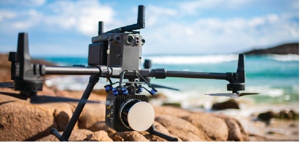
Lidar-based surveying is increasing in demand across a range of industries. Recent market analyses indicate that lidar surveying is a multi-billion dollar industry that is expected to deliver sustained growth for years to come. As lidar technology matures and performance increases, its range of use is broadening into surveying more complex and difficult terrain or at speeds and in environments previously unsuited to such technology. Naturally, increasing diversity and performance brings about demands for greater reliability, speed and accuracy whilst remaining within physical and regulatory limitations.
Keeping pace with market demands in UAV and rail sector lidar surveying is increasingly challenging and requires an evolving synthesis between the acquisition and processing of lidar and GNSS-INS georeferencing data. Companies such as Cordel and its subsidiary Nextcore are taking advantage of the latest technologies to develop systems that are setting new benchmarks in these sectors.
Benefits of Altitude, Faster Lidar and Precision INS
UAV lidar surveying is capable of high-resolution surveys of complex terrain, vegetated areas and in light conditions that may be unsuitable to photogrammetry. These qualities make it a preferred option in many applications. However, it must remain cost-competitive with alternative solutions to become widely adopted by the surveying industry.
Typical UAV lidar surveying is performed at ~40m AGL. This altitude commonly presents collision risks with terrain and vegetation and imposes limits where the topography changes dramatically, such as voids that increase AGL beyond acceptable limits. Higher altitude surveying, therefore, offers obvious advantages, but also deeply challenges lidar sensors and the INS. Any mismatch in operational performance and accuracy between these inevitably degrades survey quality and severely limits use of the system.
Nextcore accepted the challenge and set about developing a viable solution that could maintain a point cloud density of 200-500 points per m2 from a target altitude of 70 m. This equates to generating lidar point cloud data at millions of points per second. Achieving this required a GNSS-INS that provided suitably precise georeferencing data. Because survey data is derived from a source that is in constant motion in 3D space, the capability of the GNSS-INS is paramount in producing a digital twin of value and is critical to mission success.
After testing and evaluating various INSs from different manufacturers, Nextcore coupled its lidar with Advanced Navigation’s MEMs-based Certus Evo INS, which provides near-FOG performance and has a drift rate of 0.2 degrees/hour. This combination yielded exceptional results that allowed them to vastly extend the altitude ceiling to 120m while retaining consistent, accurate survey data.
“Operation at this altitude not only reduces the risk of collisions with trees, it enables surveyors to cover larger areas, greatly improving the solution’s efficiency,” said Ashley Cox, founder and COO of Nextcore.
Higher altitudes tend to increase the lidar swath width. The typical swath width at ~50m altitude is ~120m, depending on actual altitude and the resulting angle of incidence of lidar toward the edges of the swath. At 120m, a reliable swath width of 180m was achieved. This is a 50% increase over previous, equating to approximately 33% fewer flight-lines to survey a given area — a notable boost for productivity and efficiency to surveyors.
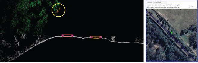
Example of rail track lidar showing encroaching vegetation, with associated map and location information. The yellow circle in the lidar data shows vegetation that is starting to intrude into the train’s path. (Images: Advanced Navigation)
Payload minimization also was a critical aspect in the search for an INS, as surveyors are always seeking longer flying time. This only can be achieved with a lighter technology stack payload. The team used an OEM version of the INS for a smaller form factor that could be integrated within a single ruggedized housing. This allows a design with greater strength, weather resistance and efficient payload setup.
“The industry is constantly seeking lighter payloads for longer flight times and to fit on smaller, safer UAVs,” Cox said. “Regulatory restrictions challenge the industry to meet certain specifications. The same is true for UAV lidar. We hit a ceiling. We need to be able to improve on that, although what we’re achieving now is a real game changer.”
The resulting survey material contains lidar point cloud data and the geo-referencing data from the INS. All data processing is performed post-flight to ensure the highest possible accuracy. PPK is used for correction of GNSS-INS position, roll, pitch and heading data. The processed INS data is then combined with the processed point cloud data to provide absolute position to the point cloud. This system realized consistent 30~40mm precision at 120m AGL. Nextcore has integrated the lidar and INS processing platforms to automate the synthesis of data sets, reducing the survey completion time. Depending on the survey’s size and complexity, this solution can process survey data into a 3D map within 30 minutes of mission completion.
Nextcore used a Certus Evo GNSS receiver, which internally uses the u-blox ZED-F9P chip. It logs GPS L1, L2, GLONASS L1, L2, Galileo GalE1, E5, and BeiDou B1, B2 frequencies at 8 Hz. It used the Kinematica correction service running a PPK filter.
Lidar sensors have become light enough to mount on UAVs (Photo: Advanced Navigation)
Scanning Rail Corridors Super Fast
Aerial surveying is not the only environment to present challenges to lidar and INS.
Train-mounted lidar for automated track and rail corridor surveying is another burgeoning market. This application typically uses lidar and position data to detect and identify areas of the railway that require maintenance and, perhaps more importantly, preventive maintenance. Rail surveying presents unique demands, including operating at speeds of 160km/h (100mp/h) or more, maintaining position accuracy during GNSS outages and variable environmental conditions.
Land-based surveying provides flexibility for selecting an INS compared to aerial applications, as size and weight are usually irrelevant. Rail surveying also requires an INS that provides the necessary performance while tolerating vibration and erratic movement from junctions, points and signals, and be absolutely dependable in GNSS-denied situations. Cox’s team found that the greater accuracy and better drift stability of FOG INS over MEMS provided an ideal platform for generating reliable and accurate paths of train trajectory.
Cordel tested Advanced Navigation’s Boreas digital FOG INS as a potential solution. Testing was carried out using cars as a simulation, travelling complex routes in two directions then overlaying the lidar point clouds to check for discrepancies or unsynchronized areas. The results provided the confidence to put the Boreas into service.
Railways typically traverse deep cuttings, lengthy tunnels and other environments that disrupt GNSS. It is mission-critical that the INS can apply dead reckoning the instant GNSS is disrupted and maintain accurate position for the entirety of the outage. Reliable path and location data during GNSS disruptions is central to the viability of automated rail surveying. Blind spots or zones of unreliable route data cannot be tolerated by rail operators from safety, track availability and financial perspectives.
The Cordel AI lidar analysis system can be “tuned” to the required metrics and is capable of self-learning. The AI enables the system to pre-emptively identify and flag areas of concern before they become an actual problem or hazard. Examples include measuring track gauge and alignment, ballast distribution and coverage, and clearance between potential hazards to the train. The entire route is logged, creating a “Google map” of the railway that maintains a historical record of survey data each time the track is used.
Clients can then view a representation of the lidar data to get a clear understanding of any issues and how to respond before sending personnel or assets to a location. This enables intervention before safety is compromised or remedial works become large-scale and disruptive. As a result, rail service providers can maintain safer railways, deliver more reliable services, and minimize operating costs.
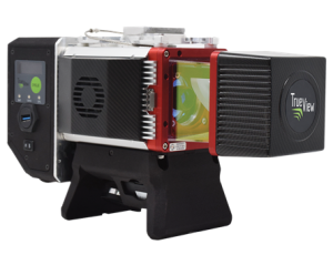
GeoCue, a U.S. LiDAR data technology company, has announced its latest True View 3D Imaging Systems (3DIS) product, the True View 645/650. Combined with GeoCue’s integrated data processing software suite, True View EVO, all GeoCue 3DIS products include the full post-processing software workflow, including direct integration with Applanix POSPac.
The survey-grade True View EVO supports the direct creation of many standard project deliverables including ground classified point clouds, surface models, contours, Digital Elevation Models (DEMs), volumetric analysis, wire extraction and similar products without the need for additional third-party software.
According to GeoCue CEO Frank Darmayan, the newest True View 645/650 includes a Riegl mini VUX3-UAV laser scanner and dual mapping cameras. This system delivers colorized LIDAR deliverables with accuracy better than 3cm RMSE for the True View 645, and better than 2cm for the True View 650.
The mini VUX-3UAV, a 360° rotating mirror scanner, increases the scanner frequency to 300 kHz and offers a unique mode where the 200,000 pulse per second scan rate is focused in a 120° cross-track field of view, providing significantly increased point densities in aerial mapping applications.
Both lightweight, compact airborne laser scanners are easily installed on various UAV platforms or small survey aircraft and helicopters. They are adapted to high-density point corridor mapping applications, day or night, under leaf-on and leaf-off conditions or with dense vegetation to provide reliable results.
“Nowadays, it is critical to obtain the highest data quality for the majority of aerial survey projects,” said Andrei Gorb, product manager of CHC Navigation’s Mapping and Geospatial Division.
Combining with industrial-grade GNSS receivers and high-precision inertial measurement units (IMUs), the AA1400 and AA2400 provide 2 to 5 cm survey-grade accuracy. They also integrate Riegl’s VUX lidars with waveform-lidar technology, allowing echo digitization and online waveform processing.
“Multi-target resolution is the basis for penetrating even dense foliage,” Gorb said. “The continuously rotating polygonal mirror wheel enables scanning speed of up to 400 lines per second, allowing for effective coverage of large areas when used from fast drones or aircraft.”
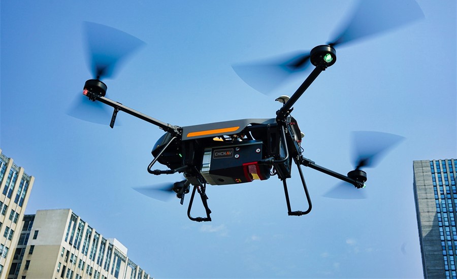
The BB4 UAV equipped with the AA2400 scanner for the city mapping task. (Photo: CHCNAV)
Their built-in premium Riegl VUX-120 and VUX-240 lidar sensors feature a high-speed data acquisition rate of up to 1.8 MHz and a scan speed up to 400 lines per second. This provides a linear accuracy of 1cm to 2 cm on long-range scanning, suitable for fixed-wing UAV corridor mapping.
CHCNAV offers several external cameras for add-ons to the AlphaAir. Setups can include nadir or nadir and oblique cameras from Sony or PhaseOne. By obtaining high-resolution geo-referenced and oblique imagery, more applications can be supported, increasing the return on investment for the client.
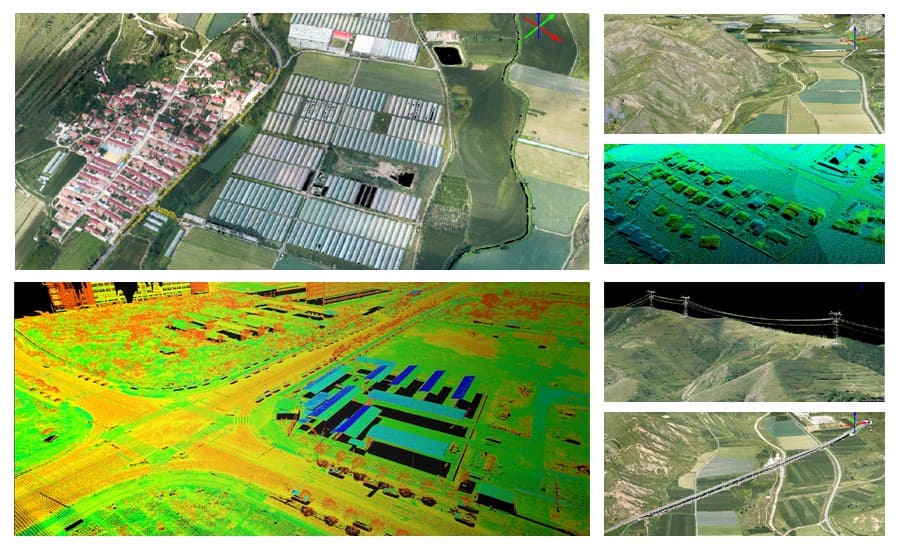
The scanning results of the AA1400 and 2400 lidar series. (Photo: CHCNAV)
The one-click connection of the AlphaPort to the power source and camera makes the installation of the AA1400 and AA2400 quick and easy, eliminating the need for additional accessories and time for camera calibration. The AA1400 and AA2400 reduce the risk of cable damage caused by aircraft vibration and acceleration during takeoff and landing.
CHCNAV provides a full range of solutions that allows a complete lidar solution to be added to the users’ geomatic services. The software suite includes CoCapture UAV field application for fully automated reality capture and real-time mission tracking, and the CoPre desktop software for semi-automated point cloud processing.
The AA1400 and AA2400 lidar series solutions are available worldwide today through the CHCNAV distribution network.
Lidar sensors that used to cost tens of thousands of dollars now cost only hundreds of dollars. With prices significantly decreasing, 3D sensors are more accessible than ever before. Now, what was once a niche technology exclusively for autonomous vehicles is being deployed globally to make places safer and smarter. Additionally, the industry is continuing to grow: market analysis firm Yolé estimates that the lidar industry will be worth nearly $4 billion by 2025, a 19% CAGR between 2020 and 2025.
While decreasing sensor prices are a critical factor in the proliferation of lidar, an arguably more significant development is the development of robust perception software that can track, identify and monitor with far greater accuracy and efficiency than ever before.
Effective 3D sensors, from lidar to radar and 3D cameras, require both hardware and software components. The hardware is critical to capturing data with high resolution and accuracy, while the software processes and comprehends the data, making them actionable. Essentially, software is the “brain” of sensors. Lidar, without equally strong perception software, is like an iPhone without iOS — inoperable and just a piece of machinery.
Today, at the confluence of these factors, we are beginning to see a proliferation of 3D perception applications beyond autonomous driving. Cities, security and retail are a few key sectors where I predict we will continue to see advancements over the next few years.
Making Cities Smarter
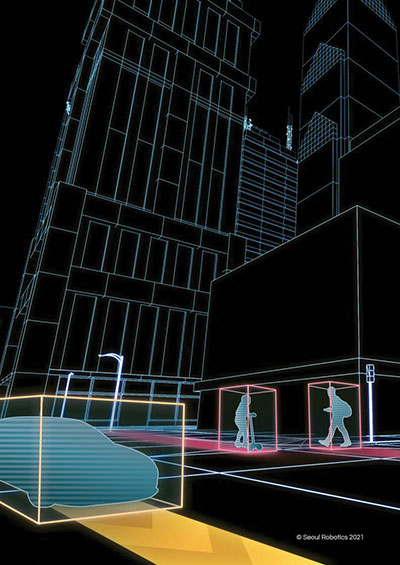
The steep drop in the cost of lidar sensors has made 3D sensors more accessible than ever. (Image: Seoul Robotics)
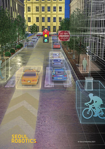
Today’s cities have a variety of challenges to address, from decreasing traffic collisions to reducing congestion, and we are witnessing municipalities leveraging lidar to collect critical insights into city safety and efficiency.
However, why are they turning to 3D solutions, specifically? Because they can capture the data necessary to make actionable changes. 3D sensors were developed to quickly track and analyze city surroundings for autonomous vehicles, so they are an effective way to ensure that vehicles are not veering into opposing lanes or traversing crosswalks already occupied by pedestrians.
Cities also adopt 3D applications because they can often address multiple challenges with one system. For example, a city may install a lidar system on an intersection to detect traffic violations, but the system can also capture data about pedestrian safety and traffic flow. These multi-benefit solutions are ultimately more cost-effective for cities because they eliminate the need to install multiple different solutions to solve these problems.
Creating Safer Spaces
Companies are turning to 3D data to create safer and more secure environments. (Image: Seoul Robotics)
From airports to museums, from stadiums to music venues, the market for 3D-based security solutions is vast. While each of these environments is unique in how it operates, they all rely on technology to ensure that areas are secure, visitors do not enter prohibited areas, and crowds are seamlessly moving through the space.
3D perception helps address these challenges by creating “zones” that can alert security systems if someone enters. Additionally, because 3D sensors can detect and track various objects, including humans, they are increasingly becoming a popular solution for crowd control. They can help venues monitor and address foot traffic, such as with security lines, and they can be valuable in the event of an emergency to ensure that an area is clear.
Beyond the tangible benefits 3D sensors bring to different venues, companies are turning to 3D data to create safer and more secure environments because they are more accurate and anonymous. Unlike traditional camera-based systems such as CCTV, which are often prone to false positives, 3D data are incredibly accurate and precise, so they are less likely to set off alarms unnecessarily. Additionally, 3D data do not include biometric information, so they address privacy concerns while still ensuring that areas are secure.
Building 3D Retail Environments
By implementing 3D-based solutions into a physical retail environment, companies can better understand how shoppers are moving through and spending their time in stores. They can glean insights into key metrics, such as:
How long are people in line?
What areas of the store are receiving the most traffic?
With what products are people engaging most frequently?
As one example, Mercedes-Benz has integrated 3D sensors into its showrooms in Korea, gaining fascinating insights into customer behavior. For example, they’ve discovered that nearly 60% of customers spend their time looking at the trunk space of SUVs, and that red is the most popular color.
As these solutions continue to become more sophisticated and accessible, we should expect to see them in more areas of our everyday lives. The future of 3D perception is exciting, and it will ensure safer, smarter and more efficient spaces — improving the quality of life.
HanBin Lee is CEO of Seoul Robotics, a 3D perception company specializing in lidar.
“The tasks of paleontologists and classical historians and archaeologists are remarkably similar — to excavate, decipher and bring to life the tantalizing remnants of a time we will never see.” — Adrienne Mayor
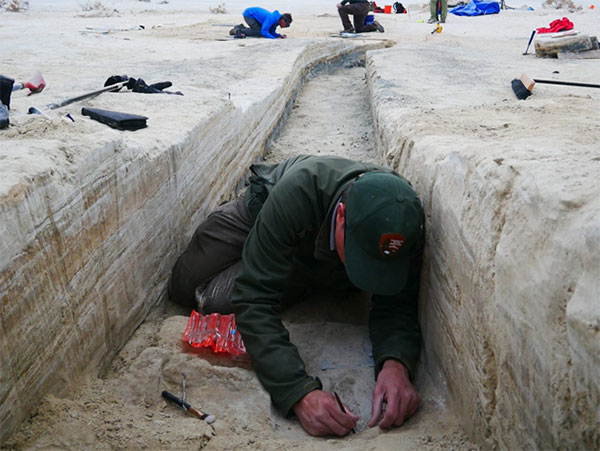
Heatwaves rose up from the dusty, dry, cracked ground. Tiny black flies buzzed around the team’s eyes and faces. The only shade was under a canopy erected across the shallow open trench where half a dozen people gently brushed away the layers. Dirt is time; the deeper one digs, the further back in time one goes.
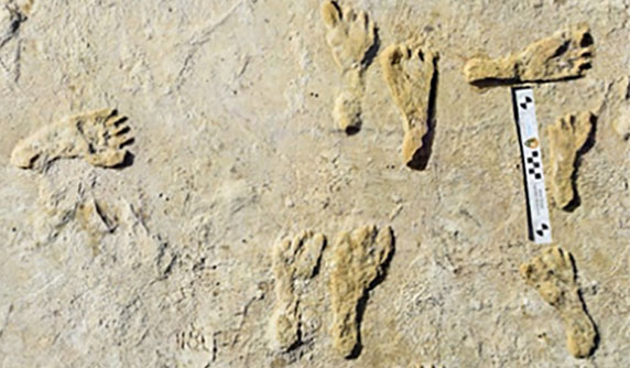
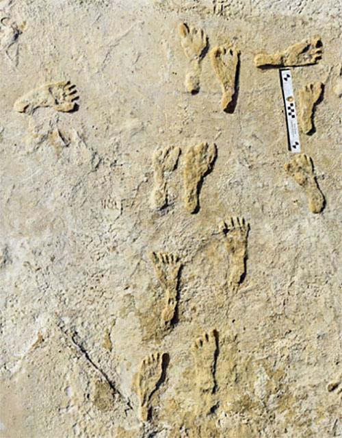
A layer 23,000 years old is exposed at nearly two feet down, revealing footprints of a female and a toddler. It tells a story of her mile-long journey through the soft clay mud. Roaming nearby was a giant sloth and a herd of mammoths. This discovery forces science to re-adjust the timeline of humans living on the North American continent, pushing it further back into the Pleistocene era at least 10,000 years.
Discoveries like this are the treasures archeologists seek. Archaeologists are scientists — part treasure hunters and part storytellers. They add context to history.
A trench dug into the brown gypsum soil on a lake playa in White Sands National Park reveals more human footprints below the surface. (Photo: National Park Service)
Ground-Penetrating Radar
Advanced technologies are aiding new discoveries of the past. Even though the footprints were buried beneath two feet of dirt, they were discovered without physically seeing them. Ground-penetrating radar (GPR) made the discovery possible. GPR has made significant advancements in recent years, along with improvements in other types of remote sensing applications.
The resolution of GPR has improved along with the depths that GPR can detect objects. Computers can process the GPR data into 3D images providing a depth profile of the scanned area. This is how the footprints were detected.
White Sands has the largest collection of fossilized human footprints. (Photo: National Park Service)
In addition to GPR, the researchers used magnetometers that verify disturbances in the sediment, which can also be imaged in 3D, albeit with a much lower resolution.
“The sediment itself has a memory that records the effects of the animal’s weight and momentum in a beautiful way. It gives us a way to understand the biomechanics of extinct fauna that we never had before,” said Thomas Urban, the Cornell University research scientist who led the team making the discovery.
Usually, archeological findings are of bones and artifacts. Fossilized “ghost” footprints of humans and other creatures brings them to life, providing glimpses of the living past.
Under ideal conditions, GPR can reach depths of 30 meters (98 feet). The accuracy and range of GPR depend on sediment type, moisture content and other geologic morphologies. Underlying GPR technology and magnetometry are robust geospatial information systems (GIS) that preserve a digital record of the discovery, allowing for further geospatial analyses. Advances in machine learning will improve future detection.
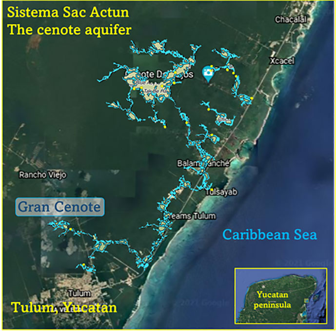
Elsewhere in the Americas, a project has been ongoing in Mexico since the 1990s using GPR to map the cenotes and underground aquifers used by the Mayans. A 215-mile-long underground water cave system — the longest in the world — has been mapped in the Yucatan peninsula. Divers exploring these cenotes found remains of Ice Age animals, including a sabertooth tigers and mammoths.
Map: William Tewelow
Lidar and ALS
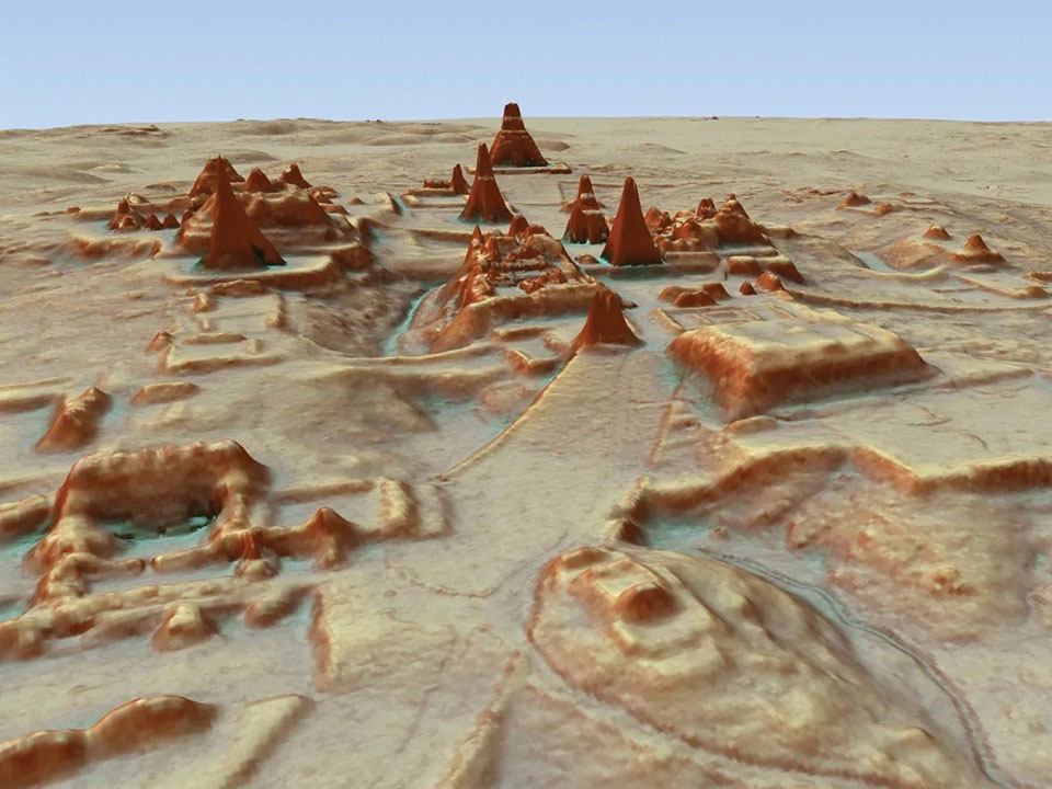
Lidar (light detection and ranging) is making even more discoveries possible with the help of artificial intelligence and machine learning. For instance, in the jungles of Guatemala, lidar revealed the unknown ancient Mayan city of Tikal.
Lidar is an active sensor that measures ground height. Using an airborne laser scanning (ALS) system mounted to a plane, helicopter or UAV, the lidar device’s laser beams scan the landscape. The system calculates the time it takes for the beam to reach an object on the ground and bounce back.
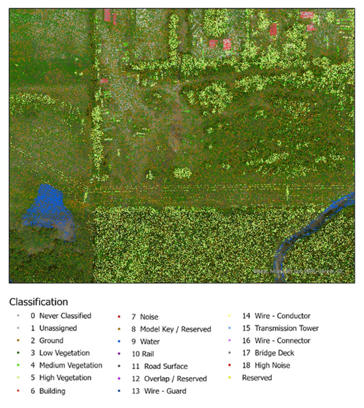
The result generates one point for each ground object the laser touches, calculating the distance the beam traveled. Billions of points are collected during a scan. Geospatial archeologists then process the collected points into a point cloud (Figure 1). Selecting only points classified as ground and water, the points are converted to a raster image, and archeologists are provided a perspective of the bare earth under tree canopy and vegetation (Figure 2).
In this way, lidar serves as a non-destructive way to identify earthwork formations, even in dense jungle.
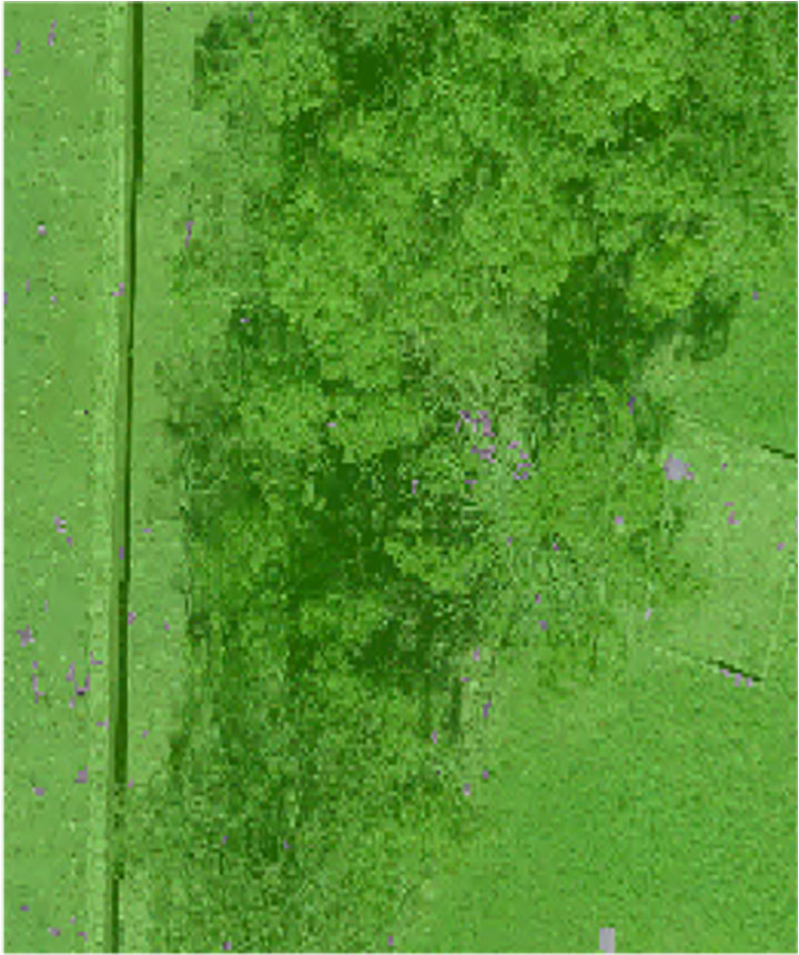
Figure 2. Lidar points are converted to a raster providing a bare-earth representation of the landscape. (Image: Stephanie Clark)
Figure 3. Pixel-derived object-based classification, developed using machine learning, identifies unmarked headstones from UAV-collected imagery. (Image: Stephanie Clark)
Object-Based Imagery Analysis
The challenge with lidar and imagery is the sheer volume of data, beyond the scope of what a human can manually review. Because of how faint archaeological features can be, the search often requires manipulating imagery datasets by combining multispectral bands, and then merging them with topographical data. To assist this huge endeavor, artificial intelligence is applied to pixel-based classification and object-based imagery analysis (OBIA) to highlight areas of interest for further study.
Dylan Davis, a Ph.D. candidate at Pennsylvania State University, spearheaded the use of OBIA for finding earthworks such as circular mounds, stone walls,and roadways in Beaufort, South Carolina. He took advantage of high-resolution NOAA imagery taken of the coast before the hurricane season of 2008. Using artificial intelligence for object-based imagery analysis, 160 previously undetected mound features were found.
Raster comparison: Sea Pines Shell Ring, Hilton Head Island, South Carolina. Credit: Dylan S. Davis, Matthew C. Sanger & Carl P. Lipo (2018): “Automated mound detection using lidar and object-based image analysis in Beaufort County, South Carolina,” Southeastern Archaeology [https://doi.org/10.1080/0734578X.2018.1482186]On the local level, archeologists apply the same approach to finding headstones in unmarked cemeteries. A pixel-defined object-based classification system helped one researcher automatically identify potential headstones in a densely vegetated cemetery.
The technology used for OBIA is also used for visual-inertial odometry (VIO). NASA is experimenting with VIO techniques to help astronauts navigate the lunar surface (see NASA’s Artemis program will need lunar spatial reference system). For Artemis, VIO will use the Moon’s craters as a reference system to derive an accurate position.
Virtual 3D Worlds
Perhaps one of the most significant uses of technology for archaeological research and exploration is the use of virtual 3D immersive worlds. Exploring ancient worlds as they might have looked gives archaeologists additional insights and the public a chance to experience their discoveries, connecting us with history.
The mile-long journey of a young female carrying a toddler across an Ice Age landscape 23,000 years ago seems so distant, yet so familiar to any parent. The image breathes life into our common ancestry. Through the power of GIS and modern technologies, she walked right into the 21st century.
“The man who knows and dwells in history adds a new dimension to his existence…He lives in all time; the ages are his, all live alike to him.” — William Flinders Petrie
Special thanks to Stephanie Clark, a geospatial archeologist with Integrated Environmental Solutions, LLC, of Phenix City, Alabama. Stephanie provided technical advice and collaboration, and the lidar studies for Figures 1, 2 and 3.
William Tewelow is a senior aeronautical information specialist for the Federal Aviation Administration. He is a 2016 graduate of the FAA’s management fellowship Program for Emerging Leaders and a mentor with the FAA’s National Mentor Program. He served on special assignment to the U.S. Department of Transportation and led a national strategic geospatial initiative under the authority of the White House Open Data Partnership.
Tewelow is a designated Geographic Information Systems Professionals (GISP), with degrees in geographic information technology and Intelligence Studies. he is currently earning his master’s degree in organizational leadership with a focus on performance management.
Tewelow retired from the U.S. Navy after serving 23 years as a geospatial and imagery intelligence specialist, a naval aviator, a meteorologist and a tactical oceanographer earning three achievement medals. He was among the first in the nation to earn a Geospatial Specialist Certification from the U.S. Department of Labor while working at NASA Stennis Space Center. He is married, enjoys traveling, connecting people, and solving problems, and is interested in new technology. His favorite quote is, “A man’s mind changed by a new idea can never go back to its original dimension.” ~ Oliver Wendell Holmes
GPS and airborne light detection and ranging (lidar) have revolutionized archaeology. In just a little more than a decade, dozens of previously hidden cities and settlements have been discovered under heavy tree canopy and in other terrain. Many of the sites are in difficult-to-access areas, such as high atop mountains, in vast deserts, or enclosed in thick, nearly impenetrable foliage. Many were only the stuff of legend.
Others are right under our feet. In 2018, early settlements were uncovered in New England, including now-abandoned walls, roads and building foundations.
With the development of lidar, archaeologists gained perhaps their most powerful tool since carbon dating. Lidar began as a million-dollar classified technology. Now lidar units are small enough to attach to unmanned aerial vehicles (UAVs).
Lidar devices send more than 100,000 laser pulses to the ground every second and use their return times to calculate precise elevation data that allow researchers to build three-dimensional maps of a landscape, while GPS receivers provide its coordinates. Lidar fly-overs have revealed ancient cities, temples, causeways, irrigation systems and other structures, which are then ground-truthed by excavation teams.
“Lidar has completely changed the way we survey ancient Maya cities and what we can know about them, and it is a thousand times better than [what we used] before,” Francisco Estrada-Belli told GPS World. Estrada-Belli is a research professor at Tulane University’s Middle American Research Institute.
The application of lidar to archaeology began in 2009, when NASA sponsored a remote-sensing project that showed lidar’s usefulness below the forest canopy. The project revealed the surprisingly vast scope of Caracol, the largest Mayan archaeological site in Belize. Urban Caracol maintained a population of more than 100,000 people with an immense agricultural field system and elaborate city planning.
Since then, lidar has been used the world over to uncover buried secrets from early Roman fortifications in Italy to landscape changes from World War I. Just this August, lidar unearthed sobering evidence of a massacre by Nazi Germany in Poland during World War II.
Image: F. Estada-Belli/Pacunam Lidar InitiativePhoto:
A landmark project in Guatemala illustrates the benefits of lidar. The ancient city of Tikal was one of the best-mapped regions of the Mayan world, but the Pacunam Lidar Initiative quintupled the amount of mapping done in 50 years in a single summer, with 61,000 structures found in an 810-square-mile area invisible to the naked eye because of overgrown vegetation. What experts had mistaken for unusable swampland, for instance, had actually been farmland, crisscrossed with canals. The area may have been home to a population of up to 10 million people. Results were published in Science in 2018.
Under a new agreement, Lidar USA — a developer of geomatics solutions — will include Hesai Technology Co. Ltd., 3D lidar sensors in its product lineup. Hesai Technology announced the agreement at the Commercial UAV Expo 2021 in Las Vegas, Sept. 7-9.
The Pandar128 lidar unit. (Photo: Hesai)
Under the terms of the agreement, Lidar USA will leverage its marketing and sales expertise to distribute Hesai sensors across the United States, Canada and Mexico.
“Hesai’s product portfolio has the sensors we have all long awaited — bridging the gap between sensors made for automotive navigation and those made for precision measurement,” said Lidar USA CEO Jeff Fagerman. “Users will enjoy the affordability of the former and results of the latter.”
Hesai’s lidar units offer superior performance and reliability to ensure robust detection under different operating and environmental conditions, the company stated in a press release. Hesai’s XT sensors, embedded with proprietary lidar application-specific integrated circuits (ASICs), deliver performance advantages while maintaining a compact form factor and low cost.
The XT sensors are lightweight and draw less power, enabling longer operation for airborne applications. The XT’s precision and accuracy allows for fine detail capture.
PandarQT, a short-range sensor for blindspot detection, has a large vertical field-of-view of 104.2°. The Pandar series lidars — Pandar128, Pandar64 and Pandar40P — deliver long detection range, high resolution and high point density for optimized perception results.
“Lidars are increasingly being adopted for different end markets and applications,” said David Li, Hesai’s CEO. “We’re excited to partner with an industry leader like Lidar USA, whose strong foothold in North America will help expand access to sensors across different segments.”
New flagship offering can be mounted on a light manned aircraft or switched to different types of UAV platforms
Photo: YellowScan
YellowScan, a designer of UAV lidar solutions, has launched the YellowScan Explorer. The Explorer can be mounted on a light manned aircraft or switched to different types of UAV platforms. The compact, versatile, long-range platform allows users to tackle a wide range of projects and mission profiles.
The Explorer’s high-power laser scanner can catch points up to 600 meters away, yet its low weight (2.3 Kg without battery) provides users with an integratable system. Combining Explorer with YellowScan’s full suite of software solutions to extract and process point cloud data provides users with a highly accurate set of tools for surveying, forestry, environmental research, archaeology, industrial inspection, civil engineering and mining.
The Explorer comes with an Applanix APX-20 UAV GNSS/inertial solution, precision of 2.6 cm and accuracy of 2.2 cm. Flight operation speed is 5 m/s to 35 m/s and it is capable of above-ground-level (AGL) altitude up to 300 m. Designed to be mounted on fixed-wing UAV, multi-rotor UAV or manned aircraft (light plane and helicopter), Explorer can enable a large variety of mission profiles.
YellowScan launched the Explorer during Commercial UAV Expo 2021 in Las Vegas, Sept. 7-9.
“We have been working on Explorer for the last three years, building on everything we have learned and achieved to date from a hardware, software and component integration perspective,” said Nassim Doukkali, R&D project manager, YellowScan. “One of the elements we are most proud of is the laser scanner, which has been designed according our specific specifications. With a maximum range of 600 m, the Explorer has exceeded YellowScan’s initial expectations.”
In 2017, YellowScan took part in a research project called FRELON (“French long range lidar”), funded by the European Regional Development Fund. The goal was to develop a new standard for long-range lidar by bringing together innovative specialists like YellowScan to collaborate directly with Airbus Defense and Space, Delair, M3 Systems and utility end-users EDF, RTE, Enedis and SNCF to develop the next-generation solution to meet their requirements.
“We are proud to finally release Explorer,” said Tristan Allouis, CTO, YellowScan. “This is our answer to the market’s need for a single long-range, yet compact, lidar unit that can be mounted on light manned aircraft and various UAV platforms.”
Velodyne Lidar will display its lidar sensors and software at the IAA Mobility trade show, which takes place Sep. 7-12 in Munich.
Showcased are:
Velarray H800, a solid-state lidar sensor architected for automotive grade performance. With combined long-range perception and a broad field of view, the sensor is designed for safe navigation and collision avoidance in ADAS and autonomous mobility applications.
Velarray M1600, a solid-state lidar sensor designed to serve mobile robotic applications, enables touchless mobile and last-mile delivery robots to operate autonomously and safely, without human intervention.
Velabit, Velodyne’s smallest sensor, designed for versatility and affordability to 3D lidar perception.
Velodyne Lidar’s Intelligent Infrastructure Solution addresses the pressing need for smart city systems that can help improve road safety and prevent traffic accidents. The solution creates a real-time 3D map of roads and intersections, providing precise traffic monitoring and analytics that is not possible with other types of sensors like cameras or radar.
Partners Using Velodyne
NI, developer of automated test and automated measurement systems, is co-exhibiting at the Velodyne booth. NI is showing simulations optimized for Velodyne’s lidar sensors that can be used in developing and testing advanced driver assistance systems (ADAS) and autonomous vehicle (AV) capabilities.
NI will demonstrate how its monoDrive AV simulation software is using Velodyne’s lidar technology to create digital twins and is providing validated physics-based sensor models for Velodyne lidar sensors.
Seoul Robotics, an Automated with Velodyne partner, is demonstrating at the Velodyne booth its AI perception engine for Velodyne’s lidar sensors. The engine provides real-time object detection, classification, tracking and prediction for autonomous systems.
The AI engine can power self-driving cars as well as smart-city applications and advanced parameter monitoring systems for facilities. Seoul Robotics’ SENSR perception software includes an AI engine that is fully optimized to utilize Velodyne’s portfolio of lidar sensors, including the Puck, Ultra Puck and Alpha Prime.
NV5 Geospatial has launched Trim Optimization, a predictive modeling platform that enables electric utilities to enhance vegetation management programs with risk-based assessments.
Using information from existing lidar and historical data, utilities can leverage Trim Optimization to prioritize tree-trimming activities by taking into account the risk posed by individual trees and other operational constraints.
“Trees are to blame for a large percentage of outages, and vegetation management is the single biggest cost for electric utilities. Yet, utilities have only started to look at proactive, risk-based management programs, rather than the traditional cycle-based ones,” said Ian Berdie, vice president of innovation for NV5 Geospatial. “NV5 Geospatial’s Trim Optimization platform will help utilities improve grid reliability through better decision making, while also saving them money through greater efficiency and the ability to target areas that have the most potential for problems.”
Vegetation is one of the largest sources of outages, accounting for more than half, according to a recent survey, “Geospatial Analytics, Resilience and Extreme Weather Readiness.” The majority of respondents also noted that they use data to analyze risk, but budget constraints often prevent them from investing in the data they need.
The trim optimization platform takes a phased approach to identify relative risk to target vegetation management work where it will have the most impact. With extensive expertise, NV5 Geospatial first identifies several attributes associated with vegetation-caused outages that can be modeled from high-density lidar and provide a relative risk score.
Utility-specific data, such as historic tree failures information or other factors, can be analyzed to enhance results further.
The final risk scores will provide a quantitative assessment of combined risk, enabling utilities to develop work plans that prioritize vegetation management mitigation efforts and result in greater operational efficiency.
NV5 is holding a webinar on Trim Optimization on Aug. 25. Register here.
AsteRx SBi3 enables highly accurate and reliable 3D mapping solutions based on sensor fusion with lidar
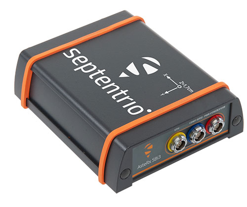
The AsteRx-SBi3 Pro+ in a rugged housing. (Photo: Septentrio)
Septentrio, a leader in high-precision GNSS/INS positioning solutions, and XenomatiX, provider of true solid-state lidar technology for autonomous applications and road management solutions, are starting a partnership enabling high-quality lidar solutions.
XenomatiX will be using the compact and robust GNSS/INS receiver from Septentrio, AsteRx SBi3 Pro+, to provide analysis of pavement conditions geolocated with millimeter accuracy.
Septentrio’s high-quality GNSS/INS will be a part of Xenomatix’ road lidar XenoTrack, used by road surveyors and road management companies. Septentrio’s AsteRx SBi3, a high-performance RTK GNSS/INS receiver with a dual-antenna setup, ensures centimeter-accurate geotagging of the XenoTrack point-cloud frames for relative and global millimeter accuracy over large distances.
Moreover, the GNSS/inertial measurement unit (IMU) integration algorithm enables dead reckoning — continuous positioning in environments of low satellite visibility where GNSS outages occur.
While traditional road scanning based on laser profilers rely solely on extremely accurate GNSS/inertial navigation system (INS) to stitch consecutive profiles together, the XenoTrack captures a 3D topography of an entire area in a single shot. The XenomatiX sensor-fusion algorithms combine visual SLAM techniques with GNSS, IMU and CAN to obtain a seamless map of the road shape.
Septentrio’s proprietary GNSS+ technology plays a key role in delivering the accuracy and reliability needed for XenoTrack. The company’s AIM+ advanced interference mitigation technology ensures robust positioning even in the presence of jammers, which may be aboard vehicles trying to avoid road tolling. When the sky is obstructed for an extended period, the built-in RAIM+ integrity algorithm serves as an indicator of when it is best to give priority to other sensor inputs to maintain a high-quality solution.
XenomatiX offers a complete mapping system as well as services including data from the XenoTrack sensor, camera and real-time kinematic GNSS/INS receiver with dual antenna in an easy-to-install solution on a standard vehicle.


![<b>Raster comparison: Sea Pines Shell Ring, Hilton Head Island, South Carolina. </b>Credit: Dylan S. Davis, Matthew C. Sanger & Carl P. Lipo (2018): Automated mound detection using lidar and object-based image analysis in Beaufort County, South Carolina, Southeastern Archaeology [https://doi.org/10.1080/0734578X.2018.1482186]](https://stage.globalpositioningnews.com/wp-content/uploads/2021/11/Davis-SC-mounds-HiltonHead.jpg)