Tag: NASA

  • ESA Aims to Map Sea Surfaces with GNSS Radio Occultation

    ESA Aims to Map Sea Surfaces with GNSS Radio Occultation

    The International Space Station. (Photo: ESA)
    The International Space Station. (Photo: ESA)

    Feature from the European Space Agency

    A new concept that involves mounting an instrument on the International Space Station and taking advantage of signals from navigation satellites could provide measurements of sea-surface height and information about features related to ocean currents, benefiting science and ocean forecasting.

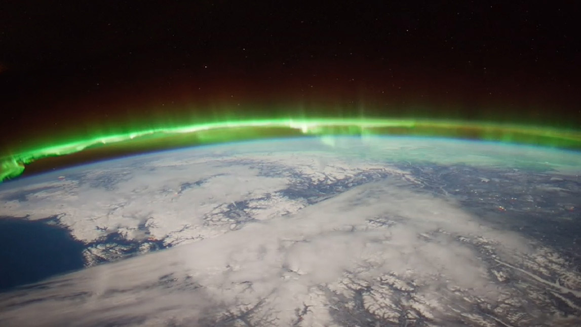
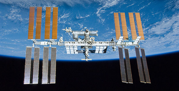
    We have all seen the beautiful photographs of our planet taken by astronauts, but orbiting Earth 16 times a day just 400 km above, the Space Station also offers a platform from which to measure certain variables related to climate change.

    So, in 2011 the European Space Agency (ESA) called for proposals to explore how the Space Station could be used to make scientifically valid observations of Earth. After reviewing and assessing numerous proposals, the result is to further develop the GEROS-ISS mission concept.

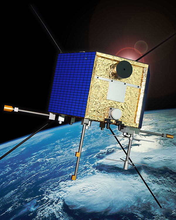
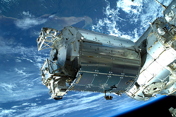
    Jason Hatton, GEROS-ISS project coordinator, said, “The concept is still going through feasibility studies, but the aim is to launch the experiment towards the end of 2019. It would be carried to the Space Station on a cargo vehicle and installed on ESA’s Columbus space laboratory using a robotic arm, after which GEROS-ISS would run for at least a year.”

    GEROS-ISS stands for GNSS reflectometry, radio occultation and scatterometry on board the ISS. GPS and Galileo satellites send a continual stream of microwave signals to Earth for navigation purposes, but these signals also bounce off the surface and back into space.

    The idea is to install an instrument with an antenna on the Space Station that would capture signals directly from these satellites as well as signals that are reflected or scattered from Earth. This process could be used to calculate the height of the sea surface, and to measure waves — or “roughness” — that can then be used to work out the speed of surface winds.

    Sea-surface_height_cm-W
    Variations in sea-surface height (cm) obtained by merging multiple altimeter measurements. GEROS-ISS would be able to observe this variability so that maps covering latitudes 51° N to 51° S can be produced every four days. (Photo: ESA)

    GEROS-ISS is primarily an experiment to demonstrate new ways of observing Earth. However, if taken beyond the testing phase this new approach would complement measurements from satellites carrying altimeters such as CryoSat and Sentinel-3, and satellites carrying wind scatterometers such as MetOp.

    Importantly, it is the first concept to assess the potential of spaceborne GNSS reflectometry to determine and map ocean height at scales of 10–100 km or longer in less than four days. Current satellite altimeters, in comparison, offer global maps at scales of around 80 km, which are produced from multiple datasets every 10 days.

    A system based on GEROS-ISS would, therefore, complement existing satellite systems, helping to map ocean variability at finer spatial and temporal scales over a range of seas in tropical and temperate regions. It would also refine our understanding of how well the concept would work for measuring the roughness of the ocean surface.

    In this respect, the development of GEROS-ISS benefits from experience gained with the UK’s TechDemoSat-1, which also measures ocean-surface roughness using a similar technique. It is also hoped that NASA’s upcoming CYGNSS constellation of mini satellites will help pave the way for GEROS-ISS.

    In addition, GEROS-ISS uses a technique called radio occultation whereby the antenna receives signals that are refracted as they pass through the atmosphere. This can be used to generate vertical profiles of atmospheric humidity, pressure and temperature, as does the GRAS instrument on the MetOp satellites, for example.

    Europe’s Columbus space laboratory, photographed by ESA astronaut Luca Parmitano during his spacewalk on July 9, 2013.
    GEROS-ISS will be installed on the upper balcony of ESA’s Columbus space laboratory, which provides mechanical interface plates as well as power, command and data links to the ISS systems. (Photo: ESA, taken by ESA astronaut Luca Parmitano during his spacewalk on July 9, 2013. )

    “It is very flexible, combining different mission concepts and applications in one: GNSS-reflectometry to determine sea-surface height, scatterometry to measure sea-surface roughness and radio occultation for atmospheric studies,” said Jens Wickert who leads the science team that proposed GEROS-ISS.

    ESA engineer Manuel Martin-Neira noted, “The original concept actually goes back over 20 years and has matured considerably through numerous studies and campaigns, however, it has never been duly tested from space.”

    “Being able to use the International Space Station in this way means that we can quickly validate innovative observing techniques without having to build an entire satellite, and we expect this to lead to new opportunities for science,” added Michael Kern, ESA’s GEROS-ISS mission scientist.

    The GEROS-ISS feasibility studies are being carried out through ESA’s General Studies Programme.


    Editor’s Note: GPS World discussed the use of GPS for radio occultation in its March 1994 Innovation column, “Monitoring the Earth’s Atmosphere with GPS,” by Rob Kursinski.

  • NASA’s James L. Green to Headline ION GNSS+ 2015

    NASA’s James L. Green to Headline ION GNSS+ 2015

    James L. Green, director of Planetary Science for NASA.
    James L. Green, director of Planetary Science for NASA.

    James L. Green, director of Planetary Science for NASA, will take the audience on a journey navigating through the solar system at The Institute of Navigation’s ION GNSS+ 2015 Conference.

    Green’s keynote address will show new worlds and new discoveries through the eyes of NASA’s planetary spacecraft. The conference takes place Sept. 14-18 at the Tampa Convention Center in Tampa, Florida.

    At NASA, Green is responsible for solar system exploration including astrobiology research. Under his leadership, a number of recent planetary science mission events have been successfully completed, including the New Horizons space probe which is scheduled to reach Pluto on July 14, Messenger orbit insertion at Mercury, the launch of Juno to Jupiter, the launch of Grail A and B to the Moon and subsequent orbit insertion, Dawn’s encounter with Vesta, and the landing of the Mars Science Laboratory and Curiosity rover on Mars. He has published more than 100 scientific papers on the magnetosphere of Earth and Jupiter. He has also contributed more than 50 technical articles on various aspects of data systems and networks.

    Green received his Ph.D. in physics from the University of Iowa in 1979 and has worked at NASA’s Marshall Space Flight Center and Goddard Space Flight Center before becoming the director of the Planetary Science Division at NASA Headquarters in 2006. In 1988 he received the Arthur S. Flemming award given for outstanding individual performance in the federal government and was awarded Japan’s Kotani Prize in 1996 in recognition of his international science data management activities

    Sponsored by the ION’s Satellite Division, ION GNSS+ is the world’s largest international technical meeting and showcase of GNSS technology, products and services and brings together international leaders in GNSS and related positioning, navigation and timing fields to present advances, introduce new technologies, update current policy, demonstrate products and exchange ideas.

  • NASA, USGS Begin Work on Landsat 9 for Land Imaging

    NASA and the U.S. Geological Survey have started work on Landsat 9, an upgraded rebuild of the Landsat 8 spacecraft launched in 2013, to extend the Landsat program’s decades-long observations of Earth’s land cover. (Image Credit: NASA)
    NASA and the U.S. Geological Survey have started work on Landsat 9, an upgraded rebuild of the Landsat 8 spacecraft launched in 2013, to extend the Landsat program’s decades-long observations of Earth’s land cover. (Image Credit: NASA)

    News from NASA.

    NASA and the U.S. Geological Survey (USGS) have started work on Landsat 9, planned to launch in 2023, which will extend the Earth-observing program’s record of land images to half a century.

    The Landsat program has provided accurate measurements of Earth’s land cover since 1972. With data from Landsat satellites, ecologists have tracked deforestation in South America, water managers have monitored irrigation of farmland in the American West, and researchers have watched the growth of cities worldwide. With the help of the program’s open archive, firefighters have assessed the severity of wildfires and scientists have mapped the retreat of mountain glaciers.

    The president’s fiscal year 2016 budget calls for initiation of a Landsat 9 spacecraft as an upgraded rebuild of Landsat 8, as well as development of a low-cost thermal infrared (TIR) free-flying satellite for launch in 2019 to reduce the risk of a data gap in this important measurement. The TIR free flyer will ensure data continuity by flying in formation with Landsat 8. The budget also calls for the exploration of technology and systems innovations to provide more cost effective and advanced capabilities in future land-imaging missions beyond Landsat 9, such as finding ways to miniaturize instruments to be launched on smaller, less expensive satellites.

    “Moving out on Landsat 9 is a high priority for NASA and USGS as part of a sustainable land imaging program that will serve the nation into the future as the current Landsat program has done for decades,” said John Grunsfeld, associate administrator for science at NASA Headquarters, Washington. “Continuing the critical observations made by the Landsat satellites is important now and their value will only grow in the future, given the long term environmental changes we are seeing on planet Earth.”

    Because an important part of the land imaging program is to provide consistent long-term observations, this mission will largely replicate its predecessor Landsat 8. The mission will carry two instruments, one that captures views of the planet in visible, near infrared and shortwave-infrared light, and another that measures the thermal infrared radiation, or heat, of Earth’s surfaces. These instruments have sensors with moderate resolution and the ability to detect more variation in intensity than the first seven satellites in the Landsat program.

    The Landsat 9 mission is a partnership between NASA and the USGS. NASA will build, launch, perform the initial check-out and commissioning of the satellite; USGS will operate Landsat 9 and process, archive, and freely distribute the mission’s data.

    “Landsat is a remarkably successful partnership,” said Sarah Ryker, USGS deputy associate director for climate and land use change, Reston, Virginia. “Last year the White House found that GPS, weather satellites, and Landsat are the three most critical types of Earth-orbiting assets for civil applications, because they’re used by many economic sectors and fields of research. Having Landsat 9 in progress, and a long-term commitment to sustainable land imaging, is great for natural resource science and for data-driven industries such as precision agriculture and insurance.”

    NASA’s Goddard Space Flight Center in Greenbelt, Md., will lead development of the Landsat 9 flight segment. Goddard will also build the Thermal Infrared Sensor (TIRS), which will be similar to the TIRS that the center built for Landsat 8. The new improved TIRS will have a five-year design lifetime, compared to the three-year design lifetime of the sensor on Landsat 8.

    “This is good news for Goddard, and it’s great news for the Landsat community to get the next mission going,” said Del Jenstrom, the Landsat 9 project manager at NASA Goddard. “It will provide data consistent with, or better than, Landsat 8.”

    With decades of observations, scientists can tease out subtle changes in ecosystems, the effects of climate change on permafrost, changes in farming technologies, and many other activities that alter the landscape.

    “With a launch in 2023, Landsat 9 would propel the program past 50 years of collecting global land cover data,” said Jeffrey Masek, Landsat 9 Project Scientist at Goddard. “That’s the hallmark of Landsat: the longer the satellites view the Earth, the more phenomena you can observe and understand. We see changing areas of irrigated agriculture worldwide, systemic conversion of forest to pasture — activities where either human pressures or natural environmental pressures are causing the shifts in land use over decades.”

    “We have recognized for the first time that we’re not just going to do one more, then stop, but that Landsat is actually a long-term monitoring activity, like the weather satellites, that should go on in perpetuity,” Masek said.

    NASA uses the vantage point of space to increase our understanding of our home planet, improve lives, and safeguard our future. NASA develops new ways to observe and study Earth’s interconnected natural systems with long-term data records. The agency freely shares this unique knowledge and works with institutions around the world to gain new insights into how our planet is changing.

    NASA provides more information on NASA’s Earth science activities. For more information on the Landsat program, visit this NASA page and this USGS page.

  • Langley’s Ionosphere Research Focus of CBC Report

    Langley’s Ionosphere Research Focus of CBC Report

    Richard Langley describes the ionosphere study to CBC News reporter Shawn Fowler.
    Richard Langley describes the ionosphere study to CBC News reporter Shane Fowler. (Screen capture from CBC News video)

    CBC News interviewed GPS World Innovation Editor Richard Langley about his ionosphere interference research project with NASA, reported on earlier this week.

    Langley, a professor at the University of New Brunswick, is working with the Jet Propulsion Laboratory in California to better understand how the ionosphere is disturbed by a variety of phenomena including solar outbursts and other natural hazards such as tsunamis. They are using the signals from GPS satellites to probe the ionosphere with the signals being picked up by receivers both on the ground and in low-Earth-orbiting satellites. The research could help find ways to mitigate ionospheric interference to GPS signals themselves as well as to other types of radio communications.

    “GPS satellites are much higher than the ionosphere,” Langley told CBC News reporter Shane Fowler. “So the signals from the satellites have to come down through the ionosphere to receivers on or near the Earth’s surface. And as they come down through the ionosphere they get a little distorted. When you see auroras in the sky, that’s when you can tell the ionosphere is a bit disturbed. The average consumer may not notice these variances, but high-precision applications, like for scientific applications, we actually always see the effect of the ionosphere.”

    Screen capture from CBC news video.
    Screen capture from CBC news video.

    The research could also help develop early-detection systems for tsunamis. “The energy from that water displacement actually propagates up all the way into the atmosphere, all the way to the ionosphere,” Langley told CBC. “It basically moves around the electrons up there and GPS signals coming down from the satellites, through the ionosphere, pick up those small variations. It has the potential to save a lot of lives.”

    Solar flares can also affect GPS signals. The Carrington Event, a solar storm in 1859, knocked out some of Earth’s telegraph systems. “The effect on the Earth’s magnetic field was so strong that currents were set up,” Langley told the CBC. “Those currents were so strong that telegraphs could run without batteries. There was enough current from this disturbance that it could run the telegraphs. And in some cases there was too much and rumour has it started small fires. Luckily we haven’t had one of those again; it seems to be a one-in-100-year, or a one-in-a-200-year, event.”

  • Study of Atmospheric ‘Froth’ May Help GPS Communications

    Editor’s note: GPS World Innovation editor Richard Langley has co-authored a study, described below, exploring how irregularities in Earth’s upper atmosphere can distort GPS signals, an important step toward mitigation.

    Source: GPS world staff
    The Aurora Borealis viewed by the crew of Expedition 30 on board the International Space Station. The sequence of shots was taken on February 7, 2012 from 09:54:04 to 10:03:59 GMT, on a pass from the North Pacific Ocean, west of Canada, to southwestern Illinois. Image Credit: NASA/JSC

    News from the Jet Propulsion Laboratory

    When you don’t know how to get to an unfamiliar place, you probably rely on a smartphone or other device with a GPS module for guidance. You may not realize that, especially at high latitudes on our planet, signals traveling between GPS satellites and your device can get distorted in Earth’s upper atmosphere.

    Researchers at NASA’s Jet Propulsion Laboratory (JPL), Pasadena, Calif., in collaboration with the University of New Brunswick in Canada, are studying irregularities in the ionosphere, a part of the atmosphere centered about 217 miles (350 kilometers) above the ground that defines the boundary between Earth and space. The ionosphere is a shell of charged particles (electrons and ions), called plasma, that is produced by solar radiation and energetic particle impact.

    The new study, published in the journal Geophysical Research Letters, compares turbulence in the auroral region to that at higher latitudes, and gains insights that could have implications for the mitigation of disturbances in the ionosphere. Auroras are spectacular multicolored lights in the sky that mainly occur when energetic particles driven from the magnetosphere, the protective magnetic bubble that surrounds Earth, crash into the ionosphere below it. The auroral zones are narrow oval-shaped bands over high latitudes outside the polar caps, which are regions around Earth’s magnetic poles. This study focused on the atmosphere above the Northern Hemisphere.

    “We want to explore the near-Earth plasma and find out how big plasma irregularities need to be to interfere with navigation signals broadcast by GPS,” said Esayas Shume. Shume is a researcher at JPL and the California Institute of Technology in Pasadena, and lead author of the study.

    If you think of the ionosphere as a fluid, the irregularities comprise regions of lower density (bubbles) in the neighborhood of high-density ionization areas, creating the effect of clumps of more and less intense ionization. This “froth” can interfere with radio signals including those from GPS and aircraft, particularly at high latitudes.

    The size of the irregularities in the plasma gives researchers clues about their cause, which help predict when and where they will occur. More turbulence means a bigger disturbance to radio signals.

    “One of the key findings is that there are different kinds of irregularities in the auroral zone compared to the polar cap,” said Anthony Mannucci, supervisor of the ionospheric and atmospheric remote sensing group at JPL. “We found that the effects on radio signals will be different in these two locations.”

    The researchers found that abnormalities above the Arctic polar cap are of a smaller scale — about 0.62 to 5 miles (1 to 8 kilometers) — than in the auroral region, where they are 0.62 to 25 miles (1 to 40 kilometers) in diameter.

    Why the difference? As Shume explains, the polar cap is connected to solar wind particles and electric fields in interplanetary space. On the other hand, the region of auroras is connected to the energetic particles in Earth’s magnetosphere, in which magnetic field lines close around Earth. These are crucial details that explain the different dynamics of the two regions.

    Source: GPS world staff
    CAScade, Smallsat and IOnospheric Polar Explorer (CASSIOPE) is a made-in-Canada small satellite from the Canadian Space Agency. It is comprised of three working elements that use the first multi-purpose small satellite platform from the Canadian Small Satellite Bus Program. Image Credit: Canadian Space Agency

    To look at irregularities in the ionosphere, researchers used data from the Canadian Space Agency satellite Cascade Smallsat and Ionospheric Polar Explorer (CASSIOPE), which launched in September 2013. The satellite covers the entire region of high latitudes, making it a useful tool for exploring the ionosphere.

    The data come from one of the instruments on CASSIOPE that looks at GPS signals as they skim the ionosphere. The instrument was conceived by researchers at the University of New Brunswick.

    “It’s the first time this kind of imaging has been done from space,” said Attila Komjathy, JPL principal investigator and co-author of the study. “No one has observed these dimensional scales of the ionosphere before.”

    The research has numerous applications. For instance, aircraft flying over the North Pole rely on solid communications with the ground; if they lose these signals, they may be required to change their flight paths, Mannucci said. Radio telescopes may also experience distortion from the ionosphere; understanding the effects could lead to more accurate measurements for astronomy.

    “It causes a lot of economic impact when these irregularities flare up and get bigger,” he said.

    NASA’s Deep Space Network, which tracks and communicates with spacecraft, is affected by the ionosphere. Komjathy and colleagues also work on mitigating and correcting for these distortions for the DSN. They can use GPS to measure the delay in signals caused by the ionosphere and then relay that information to spacecraft navigators who are using the DSN’s tracking data.

    “By understanding the magnitude of the interference, spacecraft navigators can subtract the distortion from the ionosphere to get more accurate spacecraft locations,” Mannucci said.

    Other authors on the study were Richard B. Langley of the Geodetic Research Laboratory, University of New Brunswick, Fredericton, New Brunswick, Canada; and Olga Verkhoglyadova and Mark D. Butala of JPL. Funding for the research came from NASA’s Science Mission Directorate in Washington. JPL, a division of the California Institute of Technology in Pasadena, manages the Deep Space Network for NASA.

  • Proteus Launches Daily Satellite-Based Water Quality Monitoring Service

    Proteus FZC, a provider of satellite-derived mapping and classification services, is now offering a daily water quality monitoring service for the Arabian Gulf. Derived from NASA satellite data, the new service provides daily online access to reports on six water quality parameters at 250-meter to 1-kilometer spatial resolution.

    “We can further improve the accuracy of the standard NASA data by calibrating each data set to local water conditions,” said Proteus CEO David Critchley. “The easy-to-read reports are available online or can be delivered in PDF formats via email.”

    Proteus now offers the daily service for organizations responsible for monitoring and maintaining the condition of coastal and offshore waters — environmental agencies, energy producers, desalination operators, marine engineering firms, and dredging companies.

    “If an offshore infrastructure construction project is responsible for excessive water turbidity, the engineering company has to remediate the problem quickly,” Critchley said. “Likewise, desalination and power plants need to take precautionary actions if too much suspended sediment or sudden algal blooms are spotted near their operations.”

     The daily water quality reports are derived from processed data collected by the MODIS (Moderate Resolution Imaging Spectroradiometer) sensors which fly aboard the orbiting NASA Terra and Aqua satellites.

    “The sensors typically provide water quality details to a depth of three meters, depending on water column clarity,” said Critchley

    The daily water quality reports provide the following information:

    • Total suspended sediments (mg/L) at 250-meter resolution
    • Chlorophyll-a content (mg/m3) at 1-km resolution
    • Sea surface temperature (degrees C) at 1-km resolution
    • Turbidity or fluorescence line height (mW/cm2/µm/sr) at 1-km resolution
    • Diffuse attenuation coefficient (m-1 at 490 nm) at 1-km resolution
    • True color composite (image) at 250-meter resolution

    The 250-meter resolution is suitable for marine monitoring because it enables data collection for the entire gulf region several times per day. When the regional 250-meter resolution MODIS-derived product reveals a water quality anomaly or if increased spatial detail is required, Proteus water quality customers have the option of requesting higher resolution reports processed from other satellites that can map events in more detail.

    “We will soon expand the daily water quality monitoring service to ice-free oceans, seas and large lakes worldwide,” Critchley said.

  • NASA Seeks GNSS Remote Sensing Innovations

    NASA is soliciting research on remote sensing techniques that use GNSS for studying the Earth’s environment.

    Specifically, the announcement says NASA “seeks innovative approaches to the development of Global Navigation Satellite System (GNSS) remote sensing techniques and algorithms to study the Earth’s environment from the ionosphere to Earth’s interior.” The announcement says NASA is seeking to emphasize the use of reflected GNSS signals for the characterization of the Earth’s surface and mitigation of natural hazards.

    Notices of Intent are requested by January 20, 2015, and the due date for proposals is March 20, 2015.

    NASA solicits research through the release of various research announcements in a wide range of science and technology disciplines. NASA uses a peer review process to evaluate and select research proposals submitted in response to these research announcements. NASA says that researchers can help achieve national research objectives by submitting research proposals and conducting awarded research. Visit the announcement page for details.

  • Slideshow: 2014 Esri User Conference

    GPS World is at the 2014 Esri User Conference, being held July 14-18 in San Diego. Check out our slideshow for key photos from the first day of the conference. Follow tweets from GPS World and Geospatial Solutions for live updates from the conference.


  • FOSS4G Europe Conference Set for July

    The FOSS4G (Free and Open Source for Geospatial) Europe Conference, Europe’s largest ever event on free geospatial and location-based software, will be held at Jacobs University in Bremen, Germany, from July 15 through 17, 2014. Also at this conference, the winners of the NASA World Wind Europa Challenge will present their innovative apps to the public.

    More than 500 delegates are expected. The FOSS4G-Europe conference not only attracts software developers and open-source service companies, but also industry and governmental agencies, who increasingly recognize the value and cost savings potential of open-source software. “We are proud and excited to have the honour of organizing the first pan-European FOSS4G,” said Conference Chair Prof. Dr. Peter Baumann, head of the Large-Scale Scientific Information Systems (L-SIS) Research Group at Jacobs. Adds Organizing Committee Chair and L-SIS group member Susanne Ebrecht, “This event actually will contribute to bridging gaps between open-source and commercial software worlds.” The main financial support is coming from the transatlantic Big Geo Data initiative, EarthServer, funded by the European Commission. Additionally, sponsors are being invited from industry, government, and other organizations.

    FOSS4G is a conference series held under the auspices of OSGeo, a worldwide acting, independent, nonprofit legal entity established to support the collaborative development of open source geospatial software and promote its widespread use. Its international Board of Directors is elected by OSGeo Charter Members, one of whom is Prof. Dr. Peter Baumann. Following an outstandingly successful FOSS4G-CEE, for Central and Eastern Europe, in Bucharest in the summer of 2013, it was decided to widen the scope to a pan-European event next year. With more than 500 participants, this will be the largest event of its kind in history, only surpassed by the global FOSS4G conference. As part of this activity network, continental FOSS4G events are being held in Africa, Asia, and Latin America.

    The NASA World Wind Europa Challenge is an annual programming competition organized by NASA, Patrick Hogan, and Prof. Maria Brovelli, University Como, Italy. The challenge is to develop solutions that serve the spatial data needs of the European Community and respond to the INSPIRE Directive. Solutions sought will use NASA’s World Wind, an open-source virtual globe like Google Earth. Data used should relate to INSPIRE, the Infrastructure for Spatial Information in Europe. Examples of applications include a wildfire management tool, a tool for urban management, and tools for weather display and climate research.

    The term free and open-source software denotes computer programs that, together with their blueprint (called the program’s source code), can be distributed without ownership limitations and can be modified and improved by anybody. This prevents from software vendor dependencies and typically leverages resources from developer communities whose passion it is to continuously improve freely available software. As universities frequently are engaged in open-source projects, it is not uncommon that such projects actually define the state of the art. Prominent examples include the Apache Web server and the rasdaman array database system.

  • Ford Studies Space Robots for Connected Vehicle Communications

    Ford is studying communications between space robots and Earth to enhance future applications of the connected-car communications protocol. The research furthers the company’s commitment to the development of connected vehicle communications to help reduce traffic congestion and aid in the advancement of emergency vehicle communication methods, Ford said.

    Ford has launched a three-year research partnership with the telematics department of St. Petersburg Polytechnic University in Russia in its association with that country’s space industry. The goal is to analyze space-based robotic communications systems for vehicle mesh networks to aid in mobility solutions.

    The development of connected vehicle communications has the potential to reduce traffic accidents and ease congestion by enabling vehicles to communicate with each other, and to communicate with buildings, traffic lights, the cloud and other systems to deliver a message or detect and respond to imminent collision warnings.


    Webinar: The Connected Vehicle

    All major international car-makers are installing telematics units, sending a signal that wireless information and connectivity is here to stay in the vehicle, and location will be a big part of the growth. To learn more about the rapid changes in the connected vehicle field, tune in to our September 19 webinar, hosted by Wireless LBS editor Janice Partyka. Registration is free.


    “Ford has been committed to the research and development of connected vehicle communications for more than a decade,” said Paul Mascarenas, chief technical officer and vice president, Ford research and innovation. “Our participation in this research can aid in the development of next-generation Ford driver-assist technologies. These technologies will globally benefit Ford customers, other road users and the environment.”

    Emergency Situations. One promising development from Ford’s research project with St. Petersburg Polytechnic University is the advancement in emergency vehicle communication methods. Ford is analyzing how emergency messages should be sent to ensure delivery if network failures were to occur, identifying the systems and methods that provide redundancy in case of primary delivery failure.

    For example, if an accident were to cause vehicle-to-cloud communications (V2C) to be broken, a vehicle may still have access to a vehicle-to-vehicle (V2V) communications network. An emergency signal message could potentially be sent through V2V to a vehicle nearby, and then between vehicles and infrastructures until it reached EMS.

    “The research of fallback options and robust message networks is important,” said Oleg Gusikhin, technical leader in systems analytics for Ford. “If one network is down, alternatives need to be identified and strengthened to reliably propagate messages between networks.”

    Space Telematics. Telematics — the long-distance transmission of digital information — developed for use on space stations provide excellent potential for improving the reliability of future vehicle-to-cloud, vehicle-to-infrastructure, vehicle-to-vehicle and other forms of communication (V2X). The communications blend multiple networking technologies including dedicated short-range communication (DSRC), cellular LTE wireless broadband and mesh networking to ensure robust and reliable connectivity for optimum signal strength for critical messages.

    Using the knowledge accrued from analyzing the space robots, Ford engineers could then develop an algorithm that is integrated into the V2X system resulting in a message that would route through the appropriate network depending on the level of its importance. An emergency message, for example, may be communicated through the faster mesh network, whereas an entertainment-related message would route through a vehicle-to-infrastructure application, an embedded device or a brought-in device network.

    “We are analyzing the data to research which networks are the most robust and reliable for certain types of messages, as well as fallback options if networks were to fail in a particular scenario,” said Oleg Gusikhin, technical leader in systems analytics for Ford. “In a crash, for example, a vehicle could have the option to communicate an emergency though a DSRC, LTE or a mesh network based on the type of signal, speed and robustness required to reach emergency responders as quickly as possible.”

    The specific space robots leveraged for Ford’s telematics analysis include the JUSTIN Humanoid, EUROBOT Ground Prototype and NASA Robonaut R2.

    Here is a video showing how Ford is studying space robot communications.

    Findings from this work could potentially enhance Ford’s wireless communication technologies and Blueprint for Mobility. Ford’s Blueprint for Mobility details the company’s vision on how to tackle the issues of mobility in an increasingly crowded and urbanized planet between now and 2025.

  • URISA Announces 2012 GIS Hall of Fame Inductees

    URISA (Urban and Regional Information Systems Association) announced their 2012 GIS Hall of Fame inductees. URISA established the GIS Hall of Fame in 2005 to recognize and honor the most esteemed leaders of the geospatial community. To be considered for the GIS Hall of Fame, an individual’s or an organization’s record of contribution to the advancement of the industry demonstrates creative thinking and actions, vision and innovation, inspiring leadership, perseverance, and community mindedness. Hall of Fame inductees are individuals or organizations whose contributions and accomplishments have moved the geospatial industry and user community in a better, stronger direction.

    This year, the GIS Hall of Fame Nomination Committee, composed of URISA Past Presidents, proposed five federal agencies that have made substantial contributions to the GIS community and profession. The URISA Board of Directors unanimously approved each nominee.  URISA is pleased to announce the 2012 GIS Hall of Fame inductees:

    • National Aeronautics and Space Administration
    • Natural Resources Canada
    • Statistics Canada
    • United States Census Bureau
    • United States Geological Survey

    Representatives from each agency will be in attendance at URISA’s 50th Annual Conference in Portland, Oregon, where each will be inducted into the URISA GIS Hall of Fame during the Awards Ceremony on Wednesday, October 3, 2012.

    “The United States Geological Survey (USGS) is thrilled to be receiving this award from URISA and is immensely proud of the many USGS employees who have pioneered the application of GIS in the programs we carry out on behalf of the U.S. Department of the Interior and the citizens of our Nation”. — Mark DeMulder, Director, USGS National Geospatial Program

    “NASA is honored by this recognition from a leader in the use of geospatial data and tools across sectors.  This honor is truly a tribute to the many people who design and operate the Earth-observing satellite missions, process and deliver the data, and analyze the measurements to benefit all humankind.” — Michael H. Freilich, Director of the NASA Earth Science Division

    “Statistics Canada is honored to be recognized by the URISA GIS Hall of Fame for its leadership role in advancing GIS technology for the production and dissemination of statistical data in Canada. The Agency is most proud of its staff who have partnered with organizations in Canada and internationally to develop and adopt innovative GIS solutions to meet increasing and evolving user needs.” — Rosemary Bender, Assistant Chief Statistician, Informatics and Methodology, Statistics Canada

    “The U.S. Census Bureau is honored to be inducted into the URISA GIS Hall of Fame, which recognizes the achievements of Census Bureau staff for its technological innovations for making GIS data available to the nation.” —  Thomas L. Mesenbourg, Acting Director, Census Bureau

    “Natural Resources Canada is proud to be recognized for its scientific and technological accomplishments in geomatics. This honour is a reflection of the dedication and professionalism of our staff and partners who have advanced geomatics innovation in Canada and beyond.” —  The Honourable Joe Oliver, P.C., M.P., Minister, Natural Resources Canada

    The 2012 inductees will join the following esteemed members of URISA’s GIS Hall of Fame, each of which is profiled online:

    • 2005 Inductees: Edgar Horwood, Ian McHarg, Roger Tomlinson, Jack Dangermond, Nancy Tosta, and the Harvard Lab
    • 2006 Inductee: Gary Hunter
    • 2007 Inductees: Don Cooke and Michael Goodchild
    • 2009 Inductees: Will Craig and Carl Reed
    • 2010 Inductee: C. Dana Tomlin
    • 2011 Inductees: William Huxhold and Barry Wellar
  • JPL Team Uses GPS for Tsunami Early Warning


    Led by Dr. Attila Komjathy, who received his Ph.D. from the University of New Brunswick in 1997, a team from NASA’s Jet Propulsion Laboratory has demonstrated a technique that has the potential to significantly improve tsunami monitoring and warning.

    The technique uses data from multiple Global Positioning System receivers on the ground to measure small perturbations in the ionosphere’s electron density caused by a tsunami.

    The changing sea level of a tsunami, even far from a coast, generates waves in the atmosphere that make it all the way up to the ionosphere, some 350 kilometres or so above the sea surface. Here, they disturb the electrons that affect the propagation of GPS signals. The disturbance is so small that ordinary GPS receivers do not notice the passage of the waves. However, with advanced software processing of the data collected by specialized receivers used, for example, by surveyors and geodesists, the waves can be visualized and used to track the progress of the tsunami.

    The JPL team has dramatically demonstrated their technique for the devastating tsunami associated with last year’s massive offshore Japanese earthquake. They used data from the more than 1,000 receivers of Japan’s permanent GPS monitoring network. The propagating ionospheric waves can be clearly seen in a video the team has posted to YouTube.

    The video can also be downloaded from the GGE website.

    An earlier report on NASA’s tsunami-detection work can be found here.

    NASA is investing in research to obtain real-time GPS measurements from around the world so that researchers can integrate this technology into a global tsunami warning system. Additional potential applications might include the remote sensing of ionospheric perturbations generated by other natural hazards such as earthquakes and volcanic eruptions and human-made events such as nuclear tests.

    Dr. Komjathy was one of the first to investigate the use of GPS signals to study the ionosphere. His pioneering Ph.D. research under Prof. Richard Langley was awarded a Gold Medal from the Governor General of Canada.