The Business section from the January 2014 issue (Download the PDF). Includes: 2014 Receiver Survey Addendum (for the full survey, click here); FAA Selects Six Sites for UAV Research; NovAtel Supplies Reference Receivers for IRNSS Ground Segment; SkyTraq Seeks Crowdfunding for GPS/BeiDou Development Board; Hemisphere GNSS Names Chuck Joseph President and CEO; Honda Joins Google Alliance to Develop GPS Solutions; Garmin Launches New Outdoor Series; Saelig Introduces Low-Cost SMD Antennas; Events
Tag: NovAtel
-
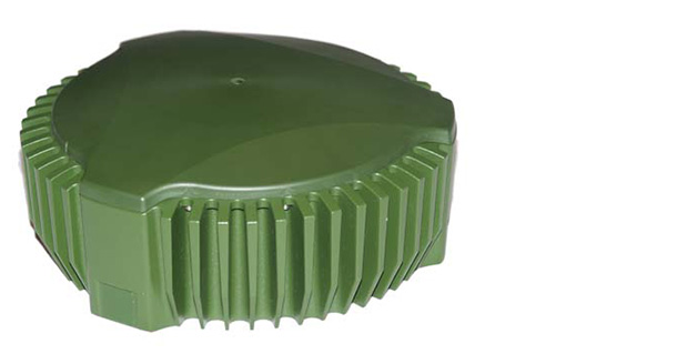
Canadian Army to Test NovAtel’s GAJT GPS Anti-Jam Antenna
NovAtel’s GAJT-700ML anti-jamming antenna. Public Works and Government Services Canada (PWGSC) has selected NovAtel’s GAJT-700ML antenna for testing on Canadian Army armored vehicles. The GAJT-700ML, developed in Calgary at NovAtel’s global headquarters, is a single-unit GPS anti-jam antenna system for land vehicles.
The testing is being conducted through PWGSC’s Build in Canada Innovation Program (BCIP).
NovAtel was selected to participate under the BCIP’s “safety and security” priority area. PWGSC will procure a number of GAJT-700MLs on behalf of the Department of National Defense (DND). The Directorate of Land Requirements (DLR) — with the assistance of the Quality Engineering Test Establishment (QETE) and the Land Force Trials and Evaluation Unit (LFTEU) — will oversee all testing on DND’s behalf.
Field testing, centered on battlefield days, is expected to take place in early March of 2014 at 4th Canadian Division Support Garrison Petawawa. The battlefield days will analyze the performance of GAJT on the Artillery Observation Post Variants (OPV) of the Light Armored Vehicle III (LAV III) in operational conditions to confirm the suitability and robustness of GAJT-700ML for this role. The process is expected to be completed by the end of March.
“NovAtel has worked closely with Canadian and Allied defence agencies to test the resilience of the GAJT-700ML in challenging jamming environments,” said Jason Hamilton, vice president, Marketing and Product Management. “The BCIP program provides an opportunity to expand this testing to incorporate end user soldier feedback on the installation and operational effectiveness of GAJT during battlefield usage of the LAV OPV. This invaluable feedback will be used by NovAtel to further drive product innovation in support of Canada and its Allied partners.”
“The Canadian Army requires accurate, secure and reliable access to Global Positioning Systems to conduct operations throughout the full spectrum of conflict in all potential theatres of operation,” said Colonel Andrew Jayne, Director Land Requirements. “With the ever-increasing demands on the electromagnetic spectrum and threat of harmful interference, technologies which contribute to the assurance of position and timing information are a critical enabler of Army and Canadian Armed Forces operations in today and tomorrow’s operating environment.”
GAJT is a null-forming technology that negates jammers, ensuring the satellite signals necessary to compute position and time are always available. Three categories of GAJT are manufactured by NovAtel:
- GAJT-700ML: for use with military land vehicles, networks and timing infrastructure
- GAJT-700MS: for marine vessels, from small boats to capital ships
- GAJT-AE: for use with an external antenna in size and weight constrained applications
The BCIP was created by the Government of Canada to strengthen Canadian innovation. The program offers procurement and testing of pre-commercialized products and services, at a late stage of development. The BCIP:
- Bridges the “pre-commercialization gap”
- Supports Canadian suppliers by connecting innovators and government users and by testing innovations
- Provides real-world evaluation of pre-commercial goods and services
- Improves the efficiency and effectiveness of government operations
-
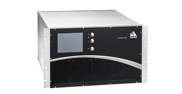
NovAtel Supplies Reference Receivers for IRNSS Ground Segment
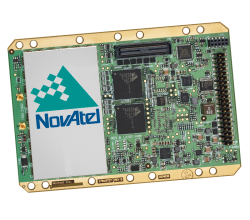
The NovAtel G-III reference receiver. NovAtel Inc., a manufacturer of GNSS precise positioning technology, has announced an agreement with the Indian Space Research Organisation (ISRO) to supply reference receiver products for use in the Indian Regional Navigation Satellite System (IRNSS) ground segment.
India-based Elcome Technologies Pvt. Limited, a sister company to NovAtel in the Hexagon Group of Companies, will provide local integration, training and technical support services for the NovAtel receivers.
These receivers are based on NovAtel’s G-III reference receiver platform, the same platform used for the Third Generation WAAS Reference Receiver (WAAS G-III), which will monitor the GPS signals for the FAA’s modernized Wide Area Augmentation System network.
-

NovAtel Launches Correct OEM Positioning Solution
NovAtel Correct. NovAtel, Inc., OEM provider of high-precision GNSS positioning products, has launched its NovAtel Correct positioning technology. NovAtel Correct optimally combines data from multiple GNSS satellite constellations with corrections from a variety of sources, to deliver the best position solution possible.
NovAtel Correct provides integrators with the opportunity to choose pricing and subscription options that best match their OEM business objectives. Delivery of correction data is available via satellite or Internet, depending on the requirements of the application. With NovAtel in control of the entire positioning solution, future innovation including seamless integration with all positioning modes and correction types is assured.
Designed for NovAtel’s OEM6 high-precision receivers, the NovAtel Correct precise point positioning (PPP) solution delivers decimeter-level accuracy worldwide. L-band delivered PPP corrections from TerraStar are supported by NovAtel Correct without users having to add base-station infrastructure. Developers of land, airborne and near shore applications can purchase subscriptions to TerraStar’s correction service directly through NovAtel.
“For a number of reasons, many of our customers have been eager for an end-to-end NovAtel OEM positioning service,” said Jason Hamilton, VP, Marketing for NovAtel. “NovAtel Correct rounds out our product and service offering and gives customers one-stop shopping for receivers, antennas and correction services.”
Satellite and NTRIP-based solutions will be available for OEM6 products in Q1 2014 for all applications requiring decimetre-level positioning.
NovAtel OEM628 triple-frequency + L-Band GNSS receiver. -
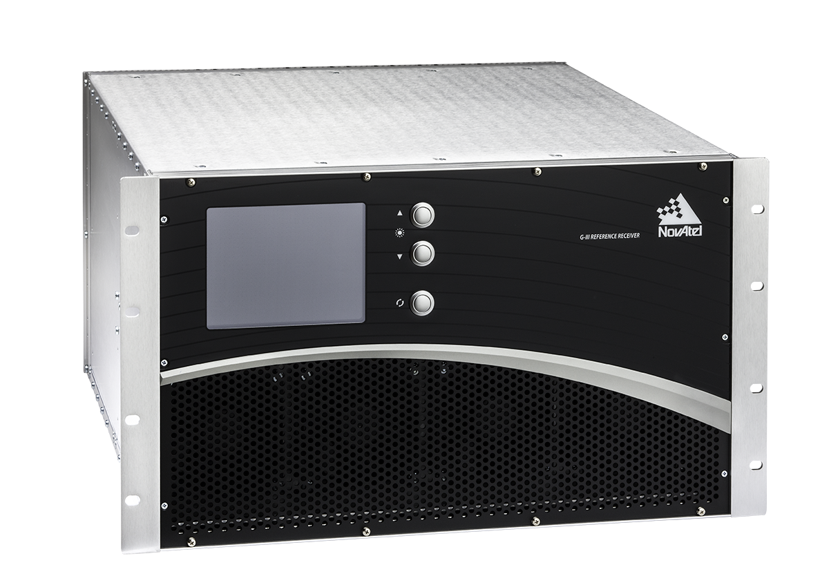
NovAtel Awarded Contract to Supply WAAS Receivers for FAA System
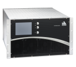
NovAtel’s WAAS G-III receiver. NovAtel, an OEM provider of high-precision GNSS positioning products, has been contracted by the Federal Aviation Administration (FAA) to produce and deliver 176 Wide Area Augmentation System (WAAS) third-generation reference receivers (G-III).
The contract includes engineering support for the receiver as well as support for the current generation reference receiver (G-II), Geostationary Earth Orbit Uplink Subsystem – Type 1 (GUST) receiver, and Signal Generator (SIGGEN).
The third-generation WAAS program is a technology refresh of the highly successful, currently operating second generation WAAS Satellite-Based Augmentation System (SBAS). WAAS provides integrity monitoring, correction data, and increased satellite availability to users of GPS within its coverage area. The integrity monitoring features of the WAAS allow the use of GPS L1 C/A for safety-of-life applications and in particular for the civil aviation industry. The third-generation WAAS will monitor and augment the modernized GPS L5 signal, allowing aviation receivers to operate in two protected aviation frequency bands with assured integrity.
NovAtel’s WAAS G-II receiver. NovAtel’s reference receivers and uplink station equipment have been a central element of the WAAS since its inception. The G-III reference receiver uses fully updated hardware and tracks all GPS signals including the legacy GPS L1 C/A, L2P(Y) (semi-codeless), and the modernized L2C, L5, L1C signals as well as the WAAS L1 C/A and L5 signals.
The WAAS G-III reference receiver provides a rich set of range measurement data, signal integrity metrics, and logs for processing by the system’s data communication processor. The receiver architecture is designed to facilitate future expansion and reconfiguration to support the evolving needs of WAAS and other SBAS systems worldwide, including multi-constellation augmentation systems.
“We have a long relationship with the FAA and have worked very closely with the WAAS program team to develop a third-generation ground reference receiver that carries over the pedigree of our first and second generation products, while adding features and processing capacity required for the modernized system,” said Jason Hamilton, director of marketing for NovAtel. “The WAAS G-III was designed and tested specifically for ground reference networks requiring reliable continuous operation, high-longevity components, and DO-178B design assurance.”
-
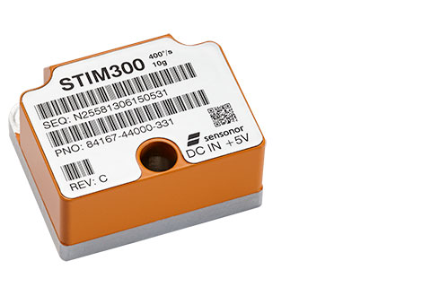
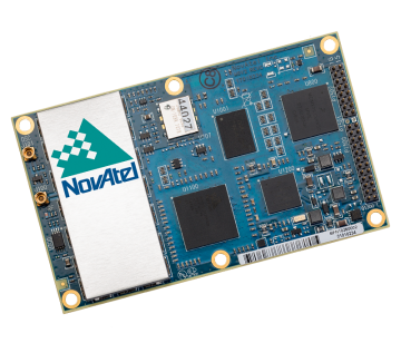
NovAtel Offers Commercial Tactical-Grade MEMS IMU
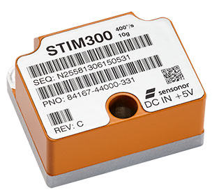
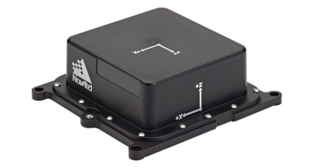
NovAtel OEM-IMU-STIM300. NovAtel has added Sensonor’s commercially exportable OEM-IMU-STIM300 to its SPAN GNSS + INS line of positioning products. The OEM-IMU-STIM300 is a Micro Electromechanical System (MEMS) Inertial Measurement Unit (IMU) that integrates with NovAtel’s OEM6 receiver technology to provide a powerful 3D continuous position, velocity and attitude solution, the company said.
The distinguishing characteristic of the OEM-IMU-STIM300 is its small form factor with tactical-grade performance capabilities. “As an OEM supplier, our customers come to us with a wide range of application demands. The addition of the OEM-IMU-STIM300 to our SPAN portfolio enables us to provide a cost-effective solution for weight and space constrained environments without having to compromise performance in any way,” said Jason Hamilton, NovAtel director of marketing.
NovAtel’s proprietary MEMS Interface Card (MIC) integrates the OEM-IMU-STIM300 with NovAtel’s OEM6 receiver products for full SPAN navigation capabilities. The product will be available as an integrated single-enclosure SPAN solution (SPAN-IGM-S1), enclosed standalone IMU (IMU-IGM-S1) for use with external SPAN-enabled receivers, and as an OEM component (OEM-IMU-STIM300).
OEM-IMU-STIM300 is available for delivery in September, followed by SPAN-IGM-S1 and IMU-IGM-S1 in November 2013.
-
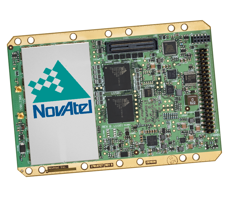
Two Products Added to NovAtel’s OEM6 Receiver Line
NovAtel has announced two new GNSS receivers: The OEM638 high precision receiver card and the ProPak6 enclosed receiver. The two products incorporate NovAtel’s most advanced GNSS technology, the company said.
Novatel OEM638. Photo: NovAtel The most advanced card within NovAtel’s OEM6 GNSS receiver family, the OEM638 tracks all existing and planned constellations including GPS, BeiDou, GLONASS, Galileo and QZSS. By providing flexible positioning options, from standalone meter-level to AdVanceRTK centimeter-level accuracy, the OEM638 offers the flexibility to meet a wide range of positioning requirements. A powerful API, 4-GB on-board data storage, wide input voltage and a host of interface options simplifies integration, decreasing time to market and overall system costs, NovAtel said.
“With the addition of the OEM638 GNSS receiver card, NovAtel’s OEM6 product line offers an even wider range of positioning options on our standardized technology platform. With three compact form factors to choose from, the OEM6 product line gives us the ability to meet the unique size, weight and performance requirements of our customers,” said Jason Hamilton, director of marketing for NovAtel.
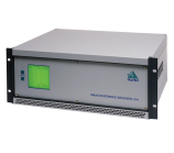
The ProPak6 is NovAtel’s most sophisticated GNSS enclosure product, offering meter-level to centimeter-level positioning in a rugged, water resistant IP67 housing. Standardized software and hardware connections, including multiple RS-232/RS-422 serial ports, CAN Bus, USB host and device, as well as Bluetooth, Wi-Fi, and optional cellular radio, speeds time to market and maximizes user capabilities, the company said. The ProPak6 is designed for reference station, timing, and general position applications.
NovAtel ProPak6. Photo: NovAtel “Our ProPak6 provides a powerful enclosure option for integrators looking for positioning flexibility, multiple communication options and Ethernet support for remote configuration and access of data logs,” Hamilton said. “It was designed to simplify the integration process, by accelerating time to market and ensuring maximum return on investment. ”
The OEM638 and ProPak6 will be available to order July 26, with shipments beginning in August.
-
NovAtel SPAN-CPT Receiver Supports OEM6 GNSS Platform
NovAtel’s single-box SPAN-CPT GNSS/INS receiver now supports the company’s next-generation OEM6 GNSS technology platform. The OEM6 GNSS engine significantly improves positioning performance through its support of GPS and GLONASS, all-in-view satellite tracking and intelligent measurement selection, the company said.
“We kept the design of the enhanced SPAN-CPT identical to our legacy product to ensure a seamless upgrade process for our customers who would like to take advantage of the improved positioning capabilities,” said Jason Hamilton, NovAtel director of marketing. “The enhanced SPAN-CPT is fully backwards compatible with the previous generation of product. It retains the same compact form factor with identical pin-out and log structure.”
As with the previous generation product, the upgraded SPAN-CPT integrates NovAtel’s precision receiver technology with fiber optic gyro and MEMS accelerometer inertial components from KVH Industries in one compact unit. The tight-coupling of the GNSS and INS technologies optimizes the raw GNSS and IMU data, delivering a superior position, velocity and attitude solution, NovAtel said. Comprised entirely of commercial components, the SPAN-CPT minimizes the operational complexities of working across international boundaries.
Production of the OEM6 supported SPAN-CPT begins June 1.
-
New Series of SPAN MEMS IMU Products Introduced by NovAtel
NovAtel Inc. has announced a new SPAN-IGM series of Micro Electromechanical Systems (MEMS) inertial sensor products, including the IMU-IGM-A1 MEMS enclosure and the SPAN-IGM-A1 GNSS/INS enclosure.
The IMU-IGM-A1 is a small, rugged enclosure that houses a MEMS inertial sensor. The IMU-IGM-A1 can be configured from the factory as an integrated GNSS + Inertial Navigation System (INS) or as a standalone IMU sensor for pairing with a customer’s existing NovAtel SPAN enabled OEM6 receiver. Featuring regulated 10-30 VDC input and a dedicated wheel sensor input to enhance GNSS outage bridging capabilities, the IMU-IGM-A1 delivers a 200 hertz navigation solution and raw measurement output.
“The IMU-IGM-A1 is the smallest, lightest IMU enclosure in our SPAN GNSS/INS product portfolio,” said Jason Hamilton, director of marketing for NovAtel. “It provides NovAtel customers with the ability to leverage our powerful SPAN technology in new applications that are size and weight constrained but still require highly precise position, velocity, roll, pitch, and heading.”
The SPAN-IGM-A1 combines NovAtel’s OEM615 GNSS receiver card with a MEMS inertial sensor in a single enclosure. By integrating the MEMS IMU with NovAtel’s tightly coupled OEM6 GNSS/INS SPAN engine, advanced positioning options such as AdVance RTK, ALIGN heading technology and RAIM are available to maximize performance.
Shipments of the new IMU-IGM-A1 enclosure and the SPAN-IGM-A1 GNSS/INS integrated enclosure commence early Q2 2013.
-
NovAtel Releases SMART6-L Integrated GNSS High-Accuracy Antenna
NovAtel’s new SMART6-L GNSS antenna integrates its OEM6 engine with Pinwheel antenna technology. Tracking L1 and L2 GPS + GLONASS, the SMART6-L delivers scalable performance, from single-frequency GL1DE smoothing performance to centimeter-level accuracy using dual frequency real-time kinematic tracking. Optional L-band tracking improves positioning accuracy outside of L1 SBAS coverage areas.
The SMART6-L is designed for manual guidance and auto-steer agriculture applications that benefit from ultra-smooth positioning and high pass-to-pass accuracy. The dual-frequency GL1DE firmware enhances the absolute accuracy of the GL1DE position, creating a robust solution and mitigating the effects of high ionospheric activity, NovAtel said. The design of the SMART6-L interface maximizes flexibility with NMEA 0183 compatible RS-232 serial ports and a NMEA2000 compatible CAN port. One PPS output, an event mark input, and three daylight readable status LEDs are also provided. Built-in magnets simplify mounting although fixed mounting options are also available.
The SMART6-L is available for order starting March 18, with product shipments commencing April 15.
-
PLAN Group Tracks Galileo Satellites for Positioning in Canada
by James T. Curran, Mark Petovello, and Gérard Lachapelle
Within a day of their initial activation over central Europe on March 12, Galileo satellites were visible over North America. The PLAN Group of the University of Calgary was successful in capturing and processing the signals from these satellites as they emerged. Galileo PRN 11, 12, and 19 were found and tracked on E1B/C. The PLAN software GSNRx was also able to track simultaneously GPS L1 and GLONASS L1 and produce combined position solutions.
Examining the Galileo navigation message transmitted on the E1B signal, it was found that the satellite health status is flagged as E1BHS=3 meaning Signal Component currently in Test, and the data validity status is flagged as E1BDVS=1 meaning Working without Guarantee. Current Galileo-ready commercial receivers may automatically discard measurements from a satellites broadcasting such messages. Parsing the received words in the I/NAV message, it was noted that more 50 percent of them were of type 0, although all words (types 0 to 10) were decoded at some point during the test.
Data was collected using a roof-mounted NovAtel 702GG antenna and an in-house two-channel digitizing front-end clocked by a high quality OCXO and also a three-channel National Instruments front-end for post-processing. The two-channel intermediate frequency data was streamed live to a laptop computer for real-time processing with GSNRx. Two RF channels were processed, the first centered at 1574.0 MHz with an IF bandwidth of 10.0 MHz, for the GPS L1 C/A and Galileo E1B/C signals and the second centered at 1602.0 MHz again with a bandwidth of 10.0 MHz, for the GLONASS L1 OF signals. The GPS and GLONASS signals were tracked using a Kalman-filter-based tracking strategy while the Galileo signals were tracked using a specialized data-pilot algorithm.
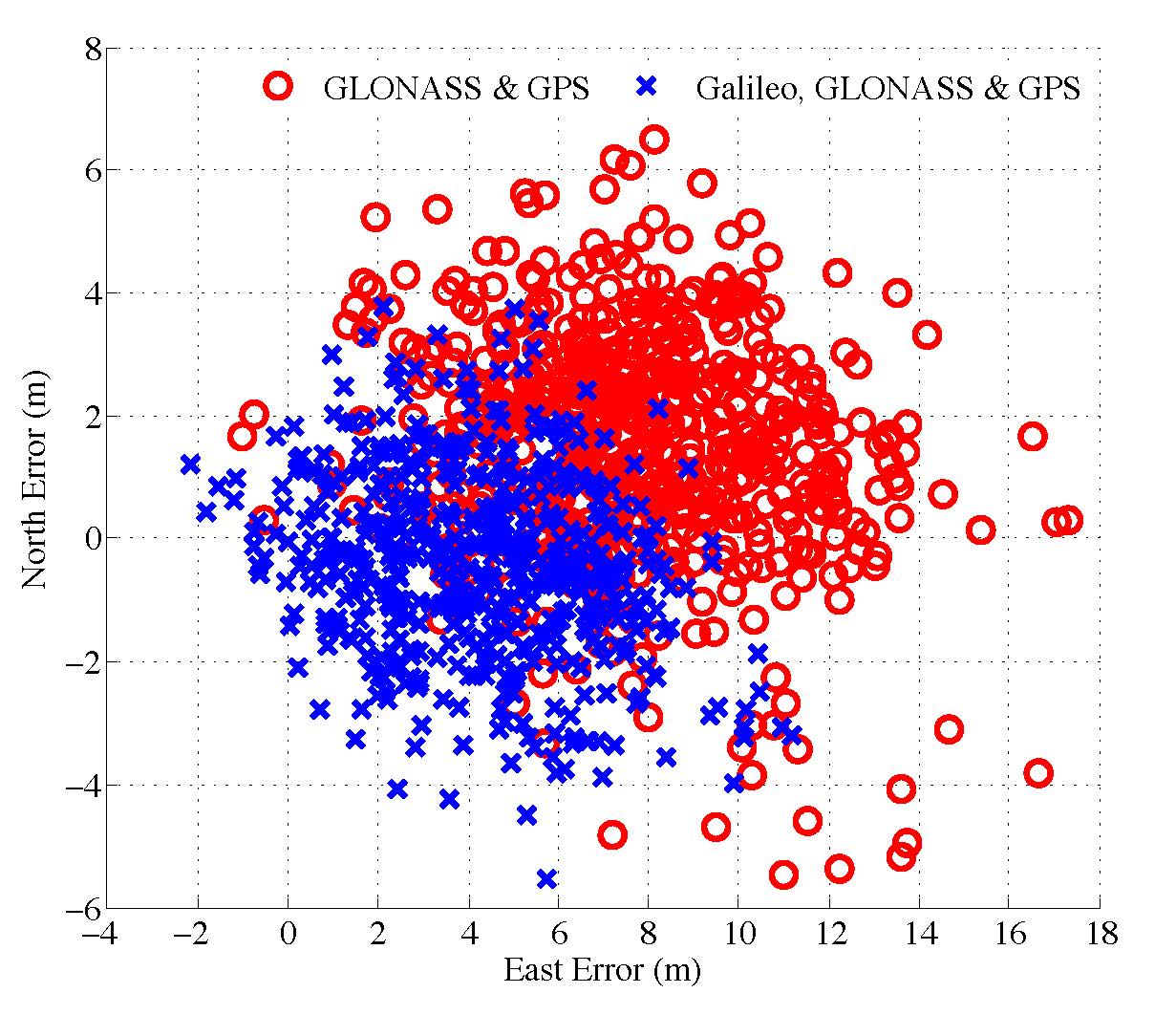
Figure 1. Scatter plot of the north and east position Pseudorange and Doppler observations were extracted from the tracking strategies at a rate of 2 Hz. A 2D horizontal plot of the combined GPS & GLONASS and the combined Galileo, GLONASS & GPS single-frequency single-point solutions is presented in Figure 1.
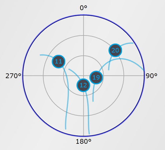
Figure 2: Skyplot of the Galileo satellites. The pseudorange residuals are plotted against time for each PRN tracked from each of the three systems in Figure 3. It is apparent that the addition of the three Galileo observations contributes to a reduction in bias and standard deviation in the horizontal directions, showing an excellent functioning of the Galileo satellites and PLAN Group equipment and software.
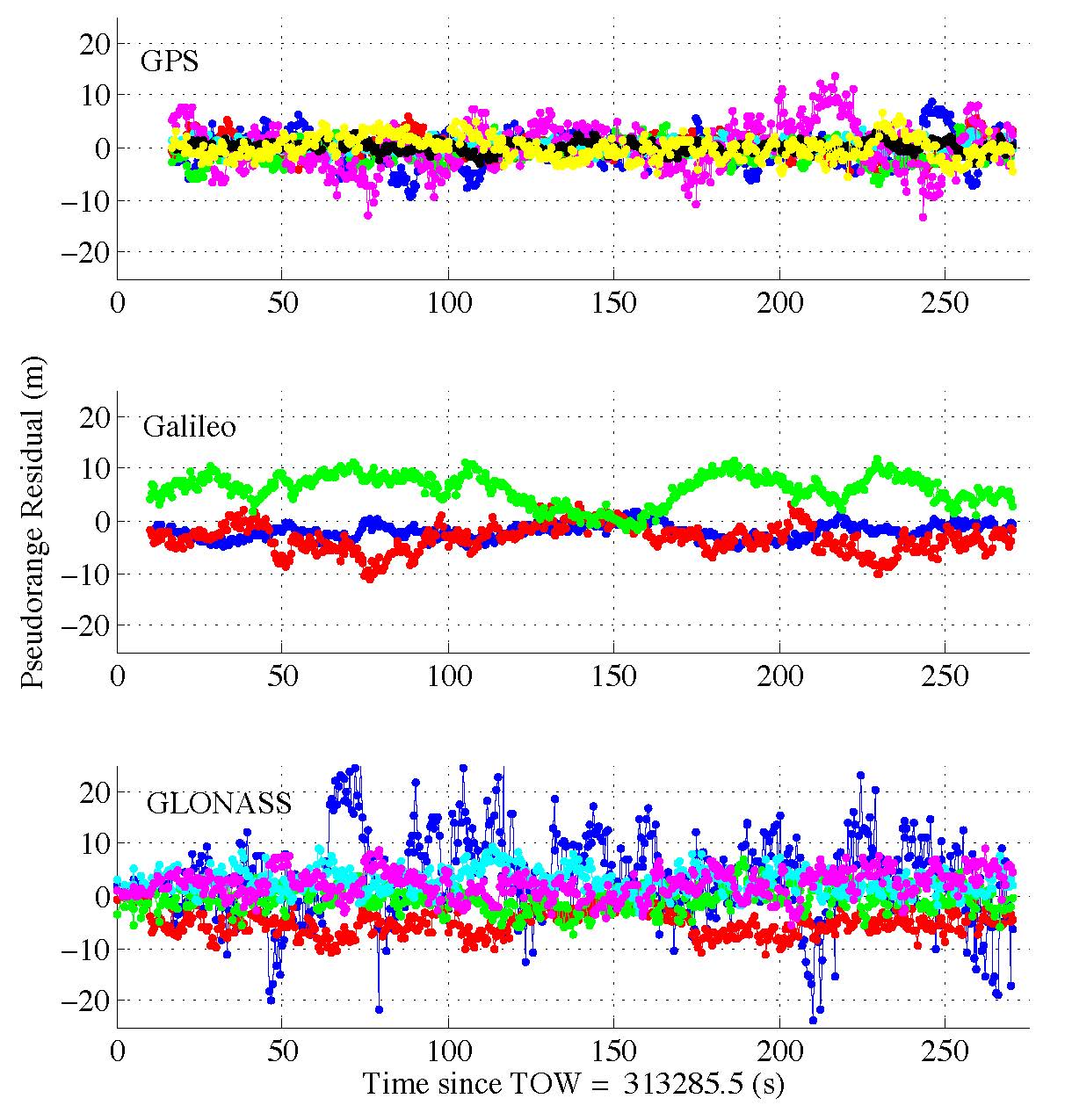
Figure 3. Pseudorange residuals are plotted against time for each PRN tracked from each of the three systems. 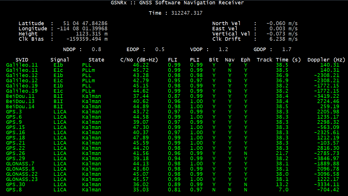
Figure 4. A screenshot of the receiver processing the data. Contact: Dr. James T. Curran
Email: James.T.Curran at ucalgary.ca