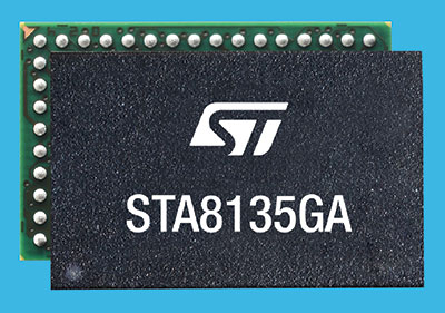
STMicroelectronics has introduced an automotive satellite-navigation chip designed to deliver high-quality position data needed by advanced driving systems.
Joining ST’s Teseo V family, the STA8135GA automotive-qualified GNSS receiver integrates a triple-band positioning measurement engine. It also provides standard multi-band position-velocity-time (PVT) and dead reckoning.
The STA8135GA’s triple-band enables the receiver to efficiently acquire and track the largest number of satellites in multiple constellations simultaneously for superior performance in difficult conditions such as in urban canyons and under tree cover.
Triple band has historically been used in professional applications such as surveying, mapping and precision agriculture that demand millimeter accuracy with minimal reliance on correction data, usually available on larger and more expensive modules than ST’s single-chip STA8135GA.
The compact STA8135GA will help driver-assistance systems make accurate decisions about the road ahead. The multi-constellation receiver delivers raw information for the host system to run any precise-positioning algorithm, such as PPP/RTK (precise point positioning/real-time kinematic). The receiver can track satellites in the GPS, GLONASS, BeiDou, Galileo, QZSS and NAVIC/IRNSS constellations.
The STA8135GA also integrates separate low-dropout voltage regulators on chip to supply the analog circuitry, digital core and input/output transceivers, simplifying selection of the external power supply.
The STA8135GA also enhances the performance of in-dash navigation systems, telematics equipment, smart antennas, V2X communication systems, marine navigation systems, drones, and other vehicles.
“The high precision and single-chip integration delivered by the STA8135GA satellite receiver enables the creation of reliable and affordable navigation systems that enable vehicles to be safer and more context aware,” said Luca Celant, general manager, ADAS, ASIC and Audio Division, Automotive and Discrete Group, STMicroelectronics. “Our unique in-house design resources and processes for high-yield manufacturing are among the critical capabilities that have made this industry-first device possible.”
The STA8135GA is housed in a 7 x 11 x 1.2 BGA package. Samples are available now and full qualification AEC-Q100 and Start Of Production are scheduled for the first quarter of 2022.
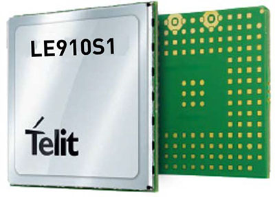
Telit, a global enabler of the internet of things (IoT), has launched the LE910S1-ELG, a new LTE Cat 1 module designed for IoT applications in Latin America (LATAM) that need a combination of performance, affordability, voice support and 2G fallback in a compact form factor.
With an embedded GNSS receiver, the cost-optimized LE910S1-ELG is suitable for tracking applications such as fleet management, stolen-vehicle tracking and recovery, and other mobile IoT applications that need to maintain a reliable connection when moving around in a country, region or multiple regions.
The LE910S1-ELG is the latest member of Telit’s flagship xE910 module family, whose unified form factor and electrical and programming interfaces spanning 2G, 3G and 4G products enables developers to implement a “design once, use anywhere” strategy. The module supports LTE Cat 1 with single-antenna reception, providing downlink speeds of up to 10 Mbps and uplink speeds up to 5 Mbps. Its streamlined configuration, compared to LTE Cat 1 devices with two antennas, helps significantly reduce cost and complexity.
Supporting 2G fallback, the LE910S1-ELG is suitable for applications that require full mobility throughout the LATAM regions, including areas that have not upgraded to 4G yet. It also supports both circuit-switched voice and VoLTE for those applications that require making phone calls, such as healthcare mobile personal emergency response systems (mPERS), connected elevators, alarm systems and more. The power-saving embedded GNSS receiver enables the use of GNSS positioning even when the cellular modem is switched off.
“The LE910S1-ELG is a great option for migrating customers that use legacy 2G and 3G modules in Latin America, especially where nationwide LTE-M and NB-IoT coverage does not yet exist,” said Marco Stracuzzi, head of product marketing, Telit. “Our all-in-one cellular and GNSS module covers all LATAM 4G and 2G bands, as well as mainstream bands used in Europe and Asia, which makes it well-suited particularly for high-performance tracking across intercontinental deployments.”
The LE910S1-ELG is sampling now, and will be commercially available during the first quarter of 2022.
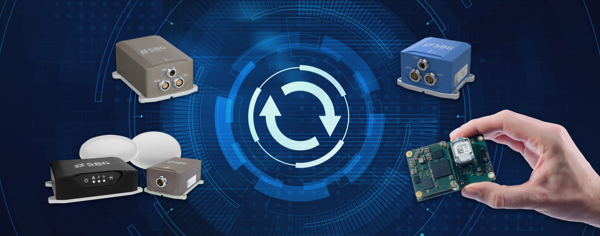
SBG Systems has released a major firmware update for all its high-performance inertial navigation systems (INS), including its Ekinox, Apogee, Navsight and Quanta brand sensors.
Developed in collaboration with customers, firmware 4.0 provides new features and is designed to make integration easier for system designers. It aims to provide improvements in these areas:
System accuracy and robustness
Enhanced heading in a single antenna allows for easier UAV survey operations.
Improved GNSS antenna auto lever arm calibration provides a faster and easier system setup.
Easier system integration
New PTP and NTP features for time synchronization eliminate the need and cost of an external timing module.
An integrated NTRIP client eases access to NRTK/VRS correction services.
A logged RTCM raw stream eases post-processing in SBG Systems’ post-processing software Qinertia using the user’s NRTK/VRS data.
A new Access Rights Management System sets up specific user roles.
Two serial outputs have been added on Navsight and Quanta for advanced survey setups.
REST API has been introduced for power users and integrators.
Russia’s recent threat that it could blow up all the GPS satellites with its new anti-satellite technology (ASAT) should come as no shock to those following space-related events. In the past, China shot down one of its own low-Earth-orbit satellites (LEOS) using a medium-range ballistic missile, and the United States used a modified antiballistic missile to shoot down one of its own spy satellites.
Blowing up satellites, solar flares, ever-increasing hazards from “space junk” and thousands of new satellites in the launch queue all make space a congested and increasingly dangerous place.
Locata Corporation and Ursa Navigation Solutions Inc. (UrsaNav) have announced a technology partnership specifically aimed at providing resilient PNT (positioning, navigation and timing) solutions to national governmental and commercial interests globally. Combining Locata’s high-accuracy local-area and UrsaNav’s very wide-area PNT produces a potent solution that lessens any nations’ dependency on easily disrupted and increasingly vulnerable space-based signals.
Locata has for many years been delivering proven centimeter-level positioning and picosecond-level timing to demanding users including the U.S. Air Force, NASA and globally significant commercial partners. Professional users in demanding industries such as ports, mining, the military, aviation, automotive, logistics, indoor positioning and high-accuracy timing depend on Locata systems every day.
UrsaNav’s eLoran and LFPhoenix technologies provide nanosecond-level timing, meter-level positioning, and short-message-service-like data transmissions at distances often exceeding 1,000 miles over land and 1,800 miles over water. Its two-way low-frequency time and frequency transfer (TWLFTFT) service is embedded in the PNT signal, providing a wireless timing synchronization conduit between any set of transmission sites.
When UTC-synchronized time is injected into any transmission site (node), such as from USNO/NIST, NPL or BIPM, it can then be securely networked to every other node in view. UrsaNav’s patented encryption techniques can be applied to the entire signal or any component.
Combining these proven technologies enables development of national-level terrestrial positioning and timing systems that are resilient, sovereign-controlled, and flexible enough to meet both long haul backbone and local high-accuracy critical infrastructure needs, the companies said, adding that over-reliance on space can be mitigated with built-in failover capability and overlapping coverage.
Many publicly available reports show both Locata and UrsaNav technologies have been tested by the United States and the United Kingdom under extreme GPS jamming and spoofing conditions, and yet they continued to provide the PNT their users require.
The MarRINav Report — funded by the European Space Agency (ESA) and researched over several years by eight top UK/EU bodies — recommended eLoran (UrsaNav) and Locata as terrestrial technologies for protection of UK shipping, ports and other key critical-infrastructure sectors.
The partners agree that a system-of-systems approach for resilient PNT must include a GNSS component, a fiber component, and a robust terrestrial wireless component that can be used to distribute solid PNT over nationally controlled radio frequencies.
The interlocking terrestrial capabilities developed by Locata and UrsaNav are unique in the PNT industry, are easily integrated with other PNT solutions, and can operate in standalone, interleaved, or layered modes — the very definition of a system-of-systems approach. Together, they can provide the core technology platform for purely national or cooperative international PNT services.
Tallysman Wireless Inc. has added the TW7976 to its surface mount line of antennas. The TW7976 covers GPS/QZSS-L1/L2, QZSS-L6, GLONASS-G1/G2, Galileo-E1/E6, and BeiDou-B1/B3, as well as L-band correction signals.
The addition of L6 and E6 coverage supports the Galileo High Accuracy Service (HAS) and the QZSS Centimeter Level Augmentation Service (CLAS) correction signals. Regional augmentation services such as WAAS (North America), EGNOS (Europe), MSAS (Japan), GAGAN (India) and high-precision L-band correction services are also supported.
The TW7976 features a patented Tallysman Accutenna, which provides multi-constellation and multi-frequency support. Accutenna technology offers an excellent axial ratio that mitigates multipath signals and produces clean code and phase measurements. Accutenna antennas enable high-precision techniques, such as real-time kinematic (RTK) and precise point positioning (PPP), which provide accurate and precise position estimates (< 0.1 m).
Another key feature of the TW7976 is a deep pre-filter that attenuates out-of-band signals. This is crucial in challenging urban environments where near-band and inter-modulated signal interference from LTE and other cellular bands is common.
The surface-mounted TW7976 weighs 180 grams, is IP67-rated, and supports direct screw, magnet or adhesive-tape attachment. The TW7976 is ideal for many applications, including autonomous vehicle navigation (land, rail, sea, and air) and high-precision automotive and agricultural positioning.
“Original equipment manufacturer (OEM)” is a widely used but poorly defined term. In general, it refers to a manufacturer that provides components or sub-assemblies to another one for use in the latter’s end products. In the GNSS industry, the purchasers of OEM boards typically are manufacturers of products that require positioning or navigation capabilities, such as guidance systems for tractors, UAVs or automobiles. Sometimes, such manufacturers integrate the OEM GNSS receivers with other sensors, such as inertial measurement units and lidar devices. Often, the OEM also will provide technical support to the integrator.
Much of the OEM business is not visible to the end user of the equipment that contains OEM components, let alone to the casual observer, because those components are “inside the box,” such as a guidance system, and “the box,” in turn, is under the hood or in some other hidden place. There is almost never a sticker on the outside analogous to the one that says “Intel inside” on many computers to distinguish the Intel CPU inside from, say, an AMD processor. Furthermore, OEM sales are typically obscured by confidentiality provisions in OEM licensing agreements that also address issues of branding, payment, quality assurance, and the timing of deliveries.
Integrators can choose from a wide variety of OEM GNSS boards depending on their intended use; the environment in which they will operate; their performance requirements; and their size, weight, power consumption and (of course) cost. OEM GNSS boards range from development kits that assist users to integrate GNSS into their product design to differential, multi-frequency, and, increasingly, multi-constellation boards.
In the following pages, six GNSS OEM manufacturers address these questions:
How do you define OEM?
What distinguishes your latest generation of OEM receiver boards from previous ones?
What are the markets for your GNSS OEM receiver boards? Which ones are growing the most?
Additionally, each one showcases a product.
JAVAD GNSS Ready for Lift-Off
JAVAD GNSS has been transitioning to a new position in the market since the passing in May 2020 of its founder, president and CEO Javad Ashjaee, a giant of the GNSS industry. For several decades, the company eschewed mass production for such markets as the automobile industry and cellular phones, choosing instead to focus primarily on high-accuracy surveying applications.
“Our founder really loved the surveying market, created a lot of technology, and drove the rest of the industry through the evolutionary process to where it is today,” said Tom Hunter, the company’s chief sales officer. “You can see a little bit of JAVAD GNSS in just about any GNSS-based land survey product on the market today.”
At the heart of each of JAVAD GNSS’ OEM boards is a proprietary ASIC. The boards it sells are the same ones it uses in its own reference stations, land survey products and marine systems, Hunter said. Aerospace is a key focus, an industry that requires very high accuracy, precision and reliability despite operating in environments of extreme shock, vibration, acceleration and temperatures.
Photo: Javad GNSS
“Our successes have been in working with many of the companies that build these very large launch vehicles used to carry heavy payloads into orbit,” Hunter said. “Our customers are companies such as Orbital, Northrop Grumman and SpaceX.” Those heavy-duty launch vehicles, he pointed out, must also follow a pre-described flight path. “You don’t want to start another world war because another country sees something heading its way.”
Tracing All Components. JAVAD GNSS’ boards “have complete component traceability,” Hunter said. The company does not buy any of its components from brokers. “We have to buy either directly from the manufacturer or from the manufacturers’ designated distributor, and it has full part traceability in our own factory in San Jose, California.” Should a component ever fail, the company could quickly trace when and where it was made. “That’s very important when we’re dealing with customers such as NASA, the Air Force or Boeing, because the safety of flight depends upon the performance and the quality of the product.”
The company will soon supply a receiver that will spend about four and a half to five years in orbit on a cluster of small low-Earth-orbit satellites, Hunter said. (See “JAVAD Board Guides ESA Vega Mission” below.)
To make sure none of its products are exported illegally from the United States, JAVAD GNSS also traces where each one ends up. “We know where every one of those boards is.”
JAVAD GNSS must guarantee its aerospace customers, which have invested millions of dollars in designing their systems, that each model of its devices will remain exactly the same. Hence, it bought from some manufacturers their entire inventory of certain components, in case they discontinued making them, and certifies each
JAVAD GNSS’ products are more expensive than those from other manufacturers because they are better, Hunter claimed. “We use really high-performance, temperature-compensated oscillators in our boards to make sure we have precise timing. We use a custom ASIC that we designed and built. Our receivers have 864 channels, so they can receive just about anything broadcast in the L-band.” The company constantly upgrades its devices to match modernization of the signal structures.
“I can remember when the rest of the industry was saying, ‘You have a 12-channel GPS receiver? You’re nuts! I mean, who uses that much information?’,” Hunter recalled. “Today, we’re using every signal that comes out of GPS, whether it be L1, L2, L5, L1C, and the same thing with all of the GNSS constellations.” For example, when Japan will begin to broadcast its new QZSS signal soon, “we’re ready not only to find it, but to track it, decode it, and utilize it for position and timing solutions.” Anti-jamming and in-band interference rejection are standard in JAVAD GNSS’ products, while those from other manufacturers require external filtering or different types of antennas, Hunter pointed out.
New Leaders and Markets
After Javad Ashjaee — JAVAD GNSS’ founder, president and CEO — died in May 2020, Tom Hunter, who co-founded Ashtech with Ashjaee in 1987, returned to the company after a five-year retirement.
“He left the company with an awful lot of technology, a lot of patents, and a lot of people who knew how to design and build products, not only for today, but for the future,” Hunter explained. “They needed some guidance.”
So, in January, Nedda Ashjaee — Javad Ashjaee’s daughter and his close collaborator for the previous 25 years — and the board of directors asked Hunter to rejoin the company. “They said that they wanted me to help them make sure that we can be on a path where we can use our core technologies and enter into new market segments and new marketplaces.”
Hunter added, “We made some changes to how we introduce surveying products into the marketplace.” The company no longer sells its products directly to end users. Rather, it goes through a new process and channel for getting products into the marketplace. It also brought on board a new chief technology officer this summer who will be driving engineering efforts. “We are becoming market driven. And to do that we needed to expand our marketing, sales and engineering capabilities. We are changing every aspect of the company,” Hunter said.
JAVAD GNSS actually consists of two companies in San Jose: JAVAD GNSS, which designs, markets and sells products, and JAVAD GNSS EMS, which manufactures them. It also has a presence in Moscow — the company hired many engineers following the collapse of the Soviet Union, many of whom had worked on GLONASS. “Javad looked at that as an opportunity to hire them and use them to develop a multiple constellation receiver,” Hunter recalled. However, as a subcontractor for U.S. government projects, it is much easier for JAVAD GNSS to operate on U.S. soil with engineers who are U.S. citizens. “We’re expanding our San Jose operation to include on-site engineering development, not only in RF, but also in digital signal-processing software.” The company will continue to receive schematics from its Russian subsidiary. “Instead of exporting technology, we’re importing it.”
JAVAD GNSS is now moving into markets that did not interest Javad Ashjaee. It recently launched new products in the machine control, marine navigation and accurate heading markets, as well as the agricultural and construction markets, with integrated sensors that can be readily installed on various machines. Other GNSS manufacturers have been producing such devices for decades, Hunter acknowledges. However, he adds, “ours will be able to use multiple sources not only for satellite- and terrestrial-based corrections, but a combination of those.”
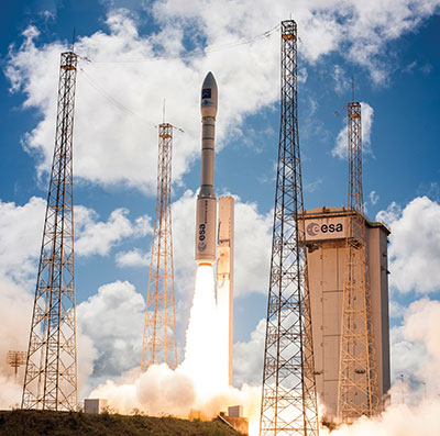
A JAVAD OEM GNSS board is at the heart of the navigation system of the Vega space vehicle developed by the European Space Agency to launch small satellites into low Earth orbit. It provides great flexibility of mission at an affordable cost and represents the European solution for space accessibility. (Photo: Avio, Italy)
JAVAD Board Guides ESA Vega Mission
AJAVAD OEM GNSS board is at the heart of the navigation system of the Vega space vehicle developed by the European Space Agency (ESA). ESA developed Vega to launch small satellites into low Earth orbit. It provides great flexibility of mission at an affordable cost and represents the European solution for space accessibility.
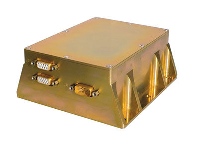
The JAVAD OEM GNSS board is embedded in the gle/RGU/G2T/HDA/MB1 for space missions. (Photo: GreenLake Engineering)
The JAVAD OEM GNSS board is embedded in the gle/RGU/G2T/HDA/MB1 — a cost-effective, high-performance, compact and rugged GNSS receiver specifically designed and environmentally qualified. Installed on the upper stage of the VEGA launcher, it allows accurate trajectory verification during the entire flight mission.
ESA’s initial request was for a GNSS unit built with commercial off-the-shelf components, thus maintaining low costs, but which could still operate in the extreme vibration and shock conditions typical of a space launcher. After an initial feasibility analysis, GreenLake Engineering — a subsidiary of Instrumentation Devices — developed the unit mechanically and electronically to satisfy ESA technical specifications. Its biggest challenge was to pass ESA’s extensive qualification and quality process.
For many years, Instrumentation Devices (based in Como, Italy) and JAVAD GNSS have been partners. Instrumentation Devices sub-contracted for the Vega project with Avio (based in Colleferro, near Rome), which is the prime contractor with ESA. Avio is an international group that designs and produces space launchers and both liquid and solid propulsion systems for space transportation.
ESA supervised the project and is responsible for all activities relating to flight safety and qualification of the equipment installed on board. JAVAD GNSS supported GreenLake Engineering with the integration and low-level configuration of the OEM board for this challenging application.
A Massey Ferguson tractor guided by a NovAtel GNSS OEM receiver. (Photo: Hexagon | NovAtel)
GNSS Makers Share Insights
OEMs Discuss Their Boards, Markets and Company Growth
Five prominent GNSS original equipment manufacturers discuss their current products and future markets.
How do you define OEM?
While all six manufacturers agree on the general definition of OEM given above, they focus on different aspects. OEM customers of JAVAD GNSS “require reliable, accurate and stable high precision measurements for positioning and timing,” Hunter said.
The performance of OEM products from Hexagon | NovAtel reflects on its customers and itself, Gerein said. “Our OEM receiver cards are selected, valued and relied upon as the core positioning elements in many applications across vertical markets. We offer full rebranding options with custom logos, colors and industrial designs to seamlessly integrate our technology into their offerings.”
At Trimble, OEM customers “combine Trimble’s GNSS technology with their domain expertise to deliver solutions to the end customer,” Norse said.
For Hemisphere GNSS, OEM clients can range “from a tinker/maker hobbyist working with GNSS, to a large multinational organization designing navigation solutions for global clients,” Burnell said, but the company looks at all of them “in the same light.” Additionally, “Some OEM clients have all the tools they need already built into the Hemisphere products, while others come to us looking for advanced or custom features to help set their products apart in the market.”
Septentrio has a worldwide support team that assists its OEM clients “in all the stages of their integration process, from validation to product release,” Freulon said.
What distinguishes your latest generation of OEM receiver boards from previous ones?
Septentrio’s most recent OEM receiver boards integrate the latest Septentrio GNSS and INS technology and algorithms. AsteRx-m3 OEM receiver boards use all GNSS constellations, can track all available satellites, and can be used as a base station to deliver RTK corrections or as a rover with a single or dual antenna.
Improvements include lower power consumption, increased security with secure boot, and greater resilience with anti-jamming and anti-spoofing. Its new receiver boards, Freulon said, “are backward compatible with extended capabilities of the latest GNSS signals and several variants of the inertial navigation system.” Upcoming software releases will include Galileo’s free High Accuracy Service (HAS) as well as OSNMA, the latest anti-spoofing mechanism.
Trimble’s latest generation of OEM GNSS boards are based on Trimble Maxwell 7 technology, which features the company’s seventh-generation baseband GNSS ASIC (application-specific integrated circuit). Trimble designed the Maxwell family of products to maximize the quality of observables derived from available signals transmitted from all GNSS constellations as well as satellite-based augmentation systems, Norse explained. This results in stronger signals, greater availability, reduced power consumption, advanced multipath mitigation and protection against spoofing.
The boards also run Trimble’s ProPoint positioning engine, which improves performance in challenging environments such as tunnels, urban canyons and tree canopies and provides continuous RTK using a base station or Trimble RTX correction services delivered via cellular or satellite connections.
JAVAD GNSS’ latest OEM products are “more cost effective” and integrate an IMU with an 874-channel multi-GNSS band module with up to 200Hz positioning and data output. “All are still proudly made in the United States,” Hunter said.
NovAtel’s OEM7 receiver boards feature added options for interference robustness and situational awareness “to help protect the user’s GNSS signals from an increasingly crowded RF spectrum and growing jamming and spoofing threats,” Gerein said. The company enhanced the sensor fusion capabilities with SPAN GNSS+INS technology, enabling a deeply coupled integration with IMUs that strengthens positioning through GNSS interruptions and allows the rapid reacquisition of signals post-outages. The boards are compatible with PPP TerraStar Correction Services “for precise positioning anywhere in the world.”
Hemisphere GNSS’ Phantom and Vega series of OEM board products can track all L-band GNSS signals, enabling the company’s OEM clients to upgrade the capabilities of their integrations and “tap into the performance of multi-GNSS, multi-frequency RTK and Atlas PPP solutions,” Burnell said.
The boards consume less power than the previous generation and introduce Hemisphere’s Cygnus automatic interference mitigation technology, which monitors the GNSS signal bands for interference and automatically deploys filters “with no need for integrators or users to understand signal theory,” Burnell explained. Cygnus, which turns off the filters when the interference fades away, is “automatic interference mitigation for the masses.”
What are your markets for your GNSS OEM receiver boards? Which ones are growing the most?
NovAtel said its receiver cards are highly configurable and integrate easily across a wide range of markets, including survey, mobile mapping, agriculture, defense, marine and autonomous platforms for both on- and off-road applications.
In particular, the company’s OEM7 cards “uniquely support the defense market and their requirements for increased protection against jamming and spoofing in mission-critical applications.” The cards also “meet the positioning availability and increasingly rigid product quality standards required in agriculture, automotive and autonomous system markets.”
Trimble lists precision agriculture, construction, mining, forestry, autonomous vehicles, port automation, distribution centers and mobile mapping among the uses of its GNSS OEM receiver boards. “We are seeing growth in markets where reliable, robust and high-precision positioning is required for a solution such as autonomous platforms,” Norse said.
Septentrio reports growing demand for its mosaic GNSS modules “due to their small footprint and impressive performance.” OEM boards, Freulon said, “remain very popular for applications where a quick integration is needed or where ultimate performance is expected.”
However, the most important markets for its OEM boards remain “UAV, together with industrial-grade automations in agriculture, construction or logistics.”
Septentrio sees an increase in “the number of positioning and mapping systems that require the ultimate performance of our receivers, especially when combined with other sensors,” Freulon said. In particular, he cites the performance of its single- and dual-antenna AsteRx-m3 receiver boards and of the AsteRx3i INS boards, which “provide a solution which combines industrial-grade IMU and GNSS all on a single OEM board, greatly simplifying the integration process in systems where both positioning and orientation are needed.”
Hemisphere GNSS, which has a significant OEM presence in the agriculture, marine, survey and GIS markets, reports seeing growth in several markets. “We have seen significant growth in all aspects of autonomous integrations, from ground vehicles for on-road or off-road, to in-flight applications with UAVs, to maritime applications focusing on dynamic positioning in both nearshore and offshore environments,” Burnell said. “There is a recognition that using precision navigation equipment benefits everyone and protects our environment through efficiencies of operation, either in resource management or by improved operational capacity.”
JAVAD GNSS lists maritime positioning and docking, timing, launch vehicle positioning and range safety, autonomous vehicle testing, in orbit positioning and drone guidance among the markets for its OEM receiver boards, with space-related applications the fastest growing market.
OEM7700. (Photo: Hemisphere GNSS)
Briefly describe one of your GNSS OEM receiver boards.
The OEM7700 receiver card from NovAtel is used in agricultural auto-steering applications. “The OEM7700 can receive all GNSS constellations across all frequencies, enabling a highly available position,” Gerein said. “When combined with TerraStar corrections and our SPAN GNSS+INS technology for sensor fusion applications, the OEM7700 ensures highly precise positioning scalable from meter- to centimeter-level accuracy.”
OEM7700 receiver boards help the company’s agriculture customers “solve the positioning challenge of repeatable pass-to-pass accuracy for auto-steering,” Gerein said. Plus, the card meets their strict environmental requirements for agriculture vehicles.
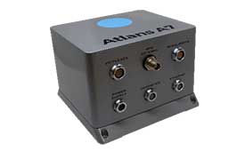
Photo: iXblue
Septentrio’s OEM client iXblue uses the company’s AsteRx OEM boards inside its Atlans A7 positioning and orientation system. “Atlans A7 was developed in close cooperation with Septentrio and is designed to provide continuous and accurate positioning in urban environments,” Freulon said.
Atlans A7 combines iXblue’s inertial navigation system (INS), which is based on a fiber-optic gyroscope (FOG), with Septentrio’s multi-frequency GNSS receiver technologies. To develop this INS-GNSS mobile mapping solution, experts from iXblue and Septentrio worked closely with the aim to develop a smart coupling method that combines the advantages of the two companies’ technologies. The same smart coupling technique is also applied in the post-processing software for an optimal result. The main advantage of Atlans A7 is to maintain a high heading precision in any circumstance, which “allows precise georeferencing for both land and air applications and drastically limits the drift during GNSS outages,” Freulon said.
AX940. (Photo: Trimble)
At Trimble, Norse cites the case of an agribusiness company that wanted to make its robotic tractors able to drive autonomously, requiring centimeter-level positioning and orientation at high update rates in challenging environments. The company chose the Trimble AX940i because of its “combination of GNSS and inertial technology in an easy-to-install smart antenna.” The Trimble ProPoint engine tightly couples the onboard IMU sensor data with the GNSS observations to provide up to 100-Hz outputs utilizing the NMEA-2000 standard or other interfaces. Additionally, Trimble VRS Now service provides instant access to RTK corrections and an operator can use the built-in Wi-Fi to configure and monitor the receiver from nearby.
The HydroBoard II flotation platform contains the RiverSurveyor M9 acoustic device, which measures the flow rates of rivers, streams and irrigation canals. (Image: Hemisphere GNSS)
Hemisphere GNSS’ Phantom 34 RTK receiver and antenna is employed by SonTek in its RiverSurveyor M9 product used by water districts and the U.S. Geological Survey to help monitor and manage water resources. The M9 is one in a series of SonTek products focused on determining flow rates for rivers, streams and irrigation canals. It consists of a small flotation platform with an acoustic doppler current profiler that measures the flow rate of the water column underneath it, a data telemetry system, and the Phantom 34 RTK to pinpoint the data collected.
The platform is floated from shore to shore across a channel using a tether, measuring along the way. “Using RTK simplifies collecting measurements as the survey will have continuous velocity profile measurements the entire way across the waterway,” Burnell said.
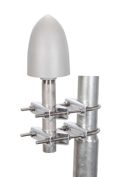
The GP-L1-32-T-MNT GPS timing antenna with mount included, RHCP polarized, 1.571 to 1.61 GHz. (Photo: RadioWaves)
RadioWaves, an Infinite Electronics brand and a manufacturer of high-quality microwave antennas and accessories, has released a new series of GPS/GNSS timing antennas that cover L1 and L5 GPS bands.
The new series of GPS/GNSS timing antennas provide axial ratio and higher accuracy for the reception of satellite timing signals and reference frequencies for enhanced phase synchronization in precision network deployments.
The high gain, low noise figure of 2 dB and high out-of-band rejection provided by these antennas allows for the use of longer and cost-effective cables for easy and flexible installs. They also feature a VSWR less than 1.8:1 and are compatible with several existing mounting brackets. In addition, thee fully ruggedized, weather-sealed antennas are IP67 compliant for use in outdoor and marine environments.
The antennas come equipped with built-in surge protection and support a wide range of GNSS including GPS, GLONASS, BeiDou and Galileo, as well as Iridium. Increased position accuracy in densely populated urban areas, flexible installation, and improved system security make RadioWaves’ latest antenna offering a valuable system component, the company said.
Models include
GP-L1-L5-40-N, an L1+L5 GPS timing antenna, 1.166 to 1.218 GHz and 1.559 to 1.606 GHz
GP-L1-32-T, a L1 GPS timing antenna, RHCP polarized, 1.574 to 1.61 GHz
GP-L1-32-T-MNT, an L1 GPS timing antenna with mount included, RHCP Polarized, 1.571 to 1.61 GHz.
A roundup of recent products in the GNSS and inertial positioning industry from the November 2021 issue of GPS World magazine.
OEM
Simulator
Designed for desktop convenience
Photo: Orolia
The BroadSim Solo has a compact form factor designed to fit comfortably at a typical desk or workstation. It shares the same Skydel simulation engine that runs on a standard BroadSim, BroadSim Anechoic and BroadSim Wavefront. It supports advanced scenario creation features and the benefits provided by a software-defined architecture such as high dynamics, a 1000-Hz iteration update rate and ultra-low latency of 5 ms. Nearly all civilian GNSS signals can be generated through the Solo’s single RF output (one frequency band at a time), along with jamming or spoofing signals, and GPS AES M-code.
Series offers GNSS, 5G NR, and wifi-6E combination
Photo: 2J Antennas
The Stellar series of antennas is designed for a large suite of devices with a focus on GNSS, sub-6 GHz, 5G NR, 4G LTE, 3G, 2G and WiFi-6E technologies. The series is suitable for law enforcement, medical transportation, fire rescue and other mission-critical applications. The series includes single or up to 9-in-1 configuration choices within the range of 617 MHz to 7125 MHz frequency bands. The patent-pending technology reduces the antenna footprint by 55% while implementing a new double trifilar design and longitudinal resonances for MIMO/ARRAY configurations that traditionally have more complex size restrictions (such as B71 band/600 MHz). Each antenna configuration uses symmetrical or asymmetrical resonators for negative sections of the antenna, resulting in maximum performance at low and mid frequencies.
The full-band GNSS HC990E embedded helical antenna is designed for precise positioning, covering the GPS/QZSS-L1/L2/L5, QZSS-L6, GLONASS-G1/G2/G3, Galileo-E1/E5a/E5b/E6, BeiDou-B1/B2/B2a/B3, and NavIC-L5 frequency bands, including the satellite-based augmentation system (SBAS) available in the region of operation [WAAS (North America), EGNOS (Europe), MSAS (Japan), or GAGAN (India)], as well as L-band correction services. The HC990E embedded helical antenna is designed and built for high-accuracy positioning. It is packaged in a very light and compact form factor, making it suitable for a wide variety of applications, especially lightweight UAV navigation. The HC990E is 60-mm wide and 25-mm tall, weighing 12 grams. It features a precision-tuned helical element that provides an excellent axial ratio and operates without the requirement of a ground plane. The HC990E also features a low-current, low-noise amplifier (LNA) and pre-filter to prevent harmonic interference from high-amplitude signals, such as 700 MHz band LTE and other nearby in-band cellular signals.
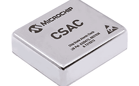
The SA65 chip-scale atomic clock (CSAC) provides precise timing accuracy and stability in extreme environments. Designed for military and industrial systems, it features ultra-high precision and low power consumption. The SA65 CSAC delivers higher performance than the previous SA.45s CSAC, including double the frequency stability over a wider temperature range and faster warm-up from cold temperatures. It has an operating temperature range of –40° C to 80° C and a storage temperature range of –55° C to 105° C. The warm-up time of two minutes at –40° C is 33% faster than that of the SA.45s. These performance improvements benefit designers of highly portable solutions for military applications such as assured positioning, navigation and timing (A-PNT) and C5ISR (command, control, communications, computers, cyber, intelligence, surveillance and reconnaissance).
Samsung Electronics is offering a new processor for wearables, the Exynos W920. The new processor integrates an LTE modem and is built with an advanced 5-nanometer (nm) extreme ultraviolet process node, offering powerful yet efficient performance demanded by next-generation wearable devices. The Exynos W920 is embedded with a GNSS L1 receiver (GPS, GLONASS, BeiDou, Galileo) for tracking speed, distance and elevation during outdoor activities. It also has a 4G LTE Cat. 4 modem. It has two Arm Cortex-A55 cores for high-performing, power-efficient processing and an Arm Mali-G68 GPU with CPU performance improved by 20% and 10 times better graphics performance than its predecessor. The Exynos W920 supports a new unified wearable platform that Samsung built jointly with Google, and will be first applied to the upcoming Galaxy Watch model.
The Arrow Gold+ and Arrow 100+ expand upon the features of the Arrow Gold and Arrow 100. The Arrow Gold+ has a battery life 3.5 hours longer, for a total of 11 hours of field autonomy. It supports concurrent use of BeiDou B3 and GPS L5 signals when using RTK corrections, and the upcoming Galileo E6 High-Accuracy Service (HAS). The Arrow 100+ has a battery life 6 hours longer than the Arrow 100, for a total of 18 hours of field autonomy. It also supports Atlas H50 (Basic) service subscriptions, which provide 30-50 cm positioning accuracy worldwide when no SBAS or RTK network is available. Both the Arrow Gold+ and Arrow 100+ use Eos Bridge to connect with external sensors — multiple mobile devices can connect to a single Arrow GNSS receiver via Bluetooth.
EagleView’s high-resolution ortho and oblique imagery now can be converted into 3D mesh layers with Skyline’s PhotoMesh and viewed, edited and analyzed on Skyline’s TerraExplorer platform. EagleView customers will be able to use Skyline’s TerraExplorer web-based GIS viewer and editor to see, analyze and share their imagery in an immersive environment. Accurately measuring distance, area and volume is now easier than ever, which is critical for planning and zoning to verify regulations or estimate the costs of flattening a site. With floodplain analysis, disaster management can identify flood risks before they happen, and with viewshed calculations E911 can pre-plan for high-profile events. Other key analytic features for customers include the ability to analyze shade, view contour and slope maps, and view in underground mode. The additional 3D Mesh capability is available as an add-on to any new Reveal Essentials+ Property or Neighborhood image capture.
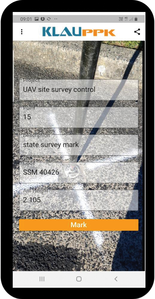
The KlauPPK Phone App, designed for use on drones with KlauPPK hardware and software, enables users to collect ground survey points with a name, description, feature code and antenna height like a traditional survey controller. The app sends the information to the operator’s computer for processing with the raw GNSS data logged in the KlauPPK unit on the pole. After post processing, the accurate survey data can be brought into CAD software to create points and line strings. The app takes a photo of the point being captured, and metadata is collected in the project. Users can place ground control points or check points, pick up as-built data like roads and utilities, and perform basic surveying. The system is compatible with the hybrid PPP/PPK MakeItAccurate post-processing service.
TerraLens 9.3 is a real-time software development toolkit for geospatial visualization. This release improves performance for 3D visualization for large viewports and multi-domain visualization features for command-and-control applications. It is significantly faster to enhance situational awareness. With increased multithreading in its map handling, TerraLens can load and display vector, raster and elevation formats smoothly without pre-processing, suitable for applications with disk size constraints or customers with a short turn-around time. A pre-processing option is still included. Improved data culling ensures only visible items will be rendered — especially noticeable when displaying large numbers of dynamic tracks and objects. New tools and features including support for OGC 3D Tiles for cityscapes, and a new API to control resolution of terrain mesh. Elevation warnings can now be displayed.
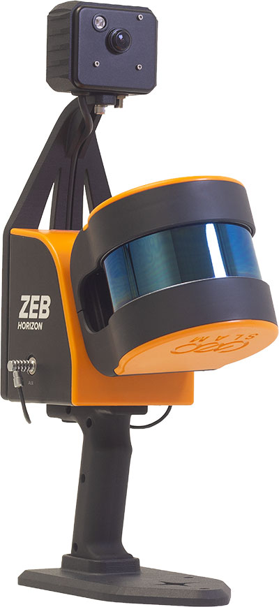
The ZEB Vision 16MP panoramic camera is now available for pre-order. Suitable for any ZEB Horizon, the new camera provides better colorization, image walkthroughs and point-cloud measurements using optional Draw software. Further updates mean GeoSLAM customers now can take a ZEB Horizon from handheld to UAV usage to get a more complete picture of projects. ZEB Horizon is compatible with the DJI Matrice 300 UAV.
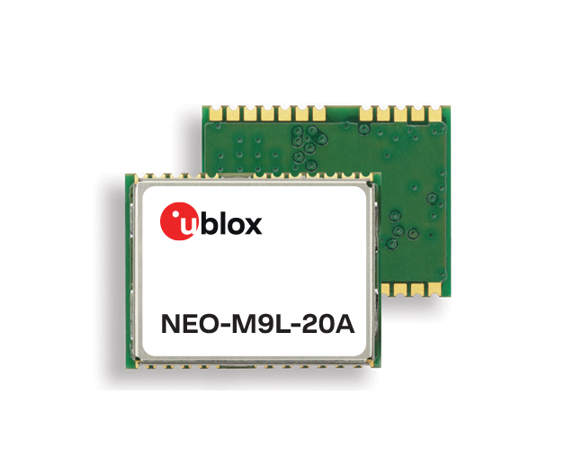
A new series of automotive-grade positioning modules are operational up to 105° C (221° F). The NEO-M9L modules and the M9140-KA-DR chip are built on the u-blox M9 GNSS platform and use dead-reckoning techniques to provide accurate position data when satellite signals are compromised or unavailable. The NEO-M9L-20A and NEO-M9L-01A modules, as well as the M9140-KA-DR chip, are specially designed for first-mount automotive solutions. The NEO-M9L-01A variant offers an extended operational temperature range up to 105° C, making it suitable for integration on the roof, behind the windscreen, or inside hot electronics control units. Applications include integrated navigation systems such as in-vehicle infotainment (IVI) and head units, integrated telematics control units and V2X.
Provides positioning accuracy in tunnels, parking garages
Photo: SkyTraq
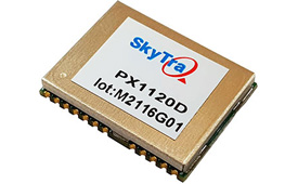
The PX1120D GNSS/inertial measurement unit (IMU) is suitable for both automotive pre-installation and aftermarket. The robust dead-reckoning module integrates a six-axis IMU and a concurrent quad-GNSS chipset. It receives signals from GPS, GLONASS, Galileo and BeiDou, as well as QZSS. The sensor-fusion module maximizes positioning accuracy in challenging environments, providing continuous navigation in tunnels and underground parking lots. For automotive pre-installation applications where vehicle wheel-tick signals are available, the PX1120D provides wheel-tick sensor fusion with automotive dead-reckoning. In aftermarket applications where wheel-tick signals are unavailable, the PX1120D provides an untethered dead-reckoning sensor-fusion solution. A single PX1120D module provides both automotive and untethered dead-reckoning functionality, simplifying logistics. It is suitable for infotainment systems, telematics control units, vehicle tracking, and advanced driver-assistance systems.
The Trooper Max 5G FR1 antenna platform is a 5G configurable and low-profile antenna platform for intelligent transportation and public safety applications. Configurable and optimized for multiband applications, the platform includes an option to add land mobile radio connectivity through an external whip port. With a slender shark-fin form factor, the Trooper Max is recommended for installation on public safety fleets. It is compatible with cellular routers supporting 600-MHz to 6-GHz frequencies. It also covers Wi-Fi 6 frequency ranges.
Version 7.9 of the CompassTrac fleet and asset management solution provides winter fleets with more detailed spreader controller information and greater insight through enhanced dashboard and reporting functions. Features include integration of numerous spreader controllers for granular, pre-wet and liquid materials; a snow-fighting dashboard consolidating key performance indicators; and a snow materials report that delivers historical reporting of granular, pre-wet and direct liquid material application rates and totals, including air and road temperature (where available). The fleet-management solution integrates GNSS, GIS and wireless networks, enabling end users to view the real-time locations and status of vehicles, people, and other high-value assets for full situational awareness.
New departure scheduling charts route, wind, tides
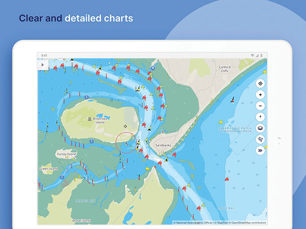
Photo: Savvy Navvy
Smartphone app Savvy Navvy now allows boaters to plan better by visually showing the best time to depart given wind and tidal implications, leading to more informed and cost-saving decisions for journeys. By comparing passage times, as well as weather and tide information, boaters can immediately make crucial decisions based on safety, comfort, time and cost. Savvy Navvy is available on Android, iOS, PC and Mac and can be used on an unlimited number of devices simultaneously. It charts, weather, tide, marina details and passage planning with full tidal vectors. Active GPS tracking shows vessel position and enables boaters to instantly check course over ground (COG) and speed over ground (SOG). The app uses UKHO, NOAA and other official hydrographic charts from around the globe, as well as tide data from 8,000 tidal stations.
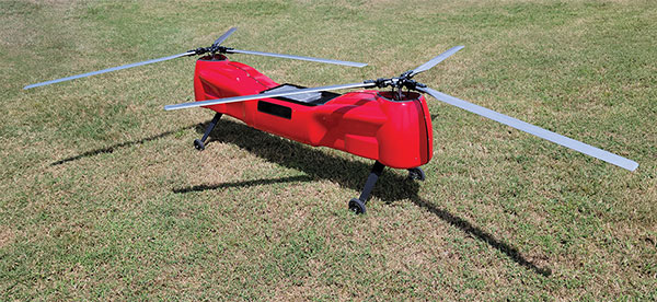
The Anzen EG-1250 provides a heavy lift, multi-drop, long endurance and flexible platform, expanding the services and operational support offerings from UAS Global Services. With an endurance of six hours, the EG-1250 can carry 75 pounds, cruise at 65 knots, in any weather day or night. The EG stands for an electric and gas dual-engine configuration, with the secondary engine able to power the aircraft or act as a power boost for the primary Skypower rotary SP-180 SRE engine. The Anzen EG-1250 is auto-rotation capable and offers an optional safety parachute system. The flexible platform can support industries such as maritime, agriculture, oil and gas, utility, cargo delivery and intelligence, surveillance and reconnaissance (ISR).
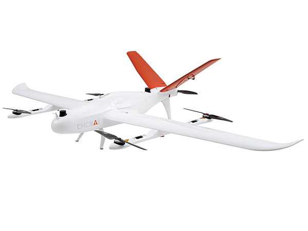
The P330 Pro is a high-performance vertical takeoff and landing (VTOL) fixed-wing UAS for aerial surveying and mapping. It provides high accuracy, long endurance and multiple payloads. It features a 100-Hz differential module, which allows aerial mapping operations at the centimeter level, and a flight endurance with payload reaching more than 150 minutes. The P330 Pro can be used to conduct small- and large-scale aerial surveys with extreme data quality, and is an alternative to manned aircraft for surveying and mapping, mining, construction and infrastructure, environmental monitoring and agriculture.
Capability expansion enables M300 for data capture
Photo: Skycatch
Flight1x software now provides data-capture capabilities for the DJI Matrice 300. The Skycatch High Precision Package provides mining operations with cloud or edge-based data processing that enables viewing terrain in 4D, automated RTK/PPK industrial drone management, and fast edge processing with data visibility in minutes. Built on technology adopted by large mining companies, Flight1x includes purpose-built flight automation software for the M300, leveraging DJI’s L1 and P1 sensors. Flight1x is part of the Skycatch High Precision Package, which provides mining operations with cloud or edge-based data processing that enables viewing terrain in 4D, automated RTK/PPK industrial drone management, and fast edge processing with data visibility in minutes.
Offers 5G and artificial intelligence capabilities
Photo: Qualcomm
The Flight RB5 5G platform is designed to accelerate development of commercial, enterprise and industrial drones. Powered by the Qualcomm QRB5165 processor, it condenses multiple complex technologies into a tightly integrated drone system. With 5G and Wi-Fi 6 connectivity, the platform enhances critical flying abilities beyond visual line-of-sight to support safer, more reliable flight. High-performance computing provides power efficiency for artificial intelligence and machine learning, enabling fully autonomous drones. A secure processing unit supports cybersecurity protections. New camera capabilities deliver premium image capabilities and performance. The Flight RB5 5G drone reference design is available through ModalAI. Use cases include mapping, inspection, film and entertainment, defense, security and emergency response, and delivery.
Spirent GNSS Foresight lets operators know where and when unmanned vehicles, air taxis and drones can operate safely and dependably beyond visual line of sight, especially in urban areas where buildings frequently obstruct GNSS signals. The cloud-based solution can produce forecasts using data from any of the world’s satellite constellations, and is of particular interest to the aviation, UAS and automotive industries. Spirent GNSS Foresight’s ability to accurately predict where and when autonomous systems will perform enables users to scale operations or services by expanding operational areas, reducing the number of system disengagements, and providing a greater level of safety and reliability assurance when reducing — or ultimately removing — human involvement in the driving or piloting task.
Harxon is offering two new GNSS antennas for intelligent connected vehicles (ICV). ICVs are equipped with advanced sensors, controllers, actuators and other devices. They are enabled for intelligent information exchanges between the vehicle and everything (car, road, people, cloud), technology known as V2X.
The Harxon HX-AUST002. (Photo: Harxon)
The Harxon HX-AULT002. (Photo: Harxon)
The ICV antennas connect autos with GNSS, 5G, Wi-Fi, ultra-wideband and more. Both highly integrated high-performance multiband automotive antennas provide swift, reliable connectivity to meet the increasing demands of seamless communication experience for intelligent transportation system (ITS) applications.
The integrated antennas support dedicated short-range (DSRC) and cellar vehicle-to-everything (C-V2X) communication. The antennas embed a premium GNSS antenna with high gain for consistent and reliable precise positioning service. They also allow for multiple input and output of data to achieve swift internet download speed in 5G networks.
HX-AULT002. (Photo: Harxon)
The Harxon HX-AUST002 is designed to connect unmanned passenger vehicles to networks, clouds, other vehicles, and ITS roadside infrastructure.
The Harxon HX-AULT002 is designed for unmanned commercial vehicles, including short-distance delivery vehicles, mainline logistic heavy-duty trucks, and intercity shuttle buses.
The versatile antennas are suitable for integration in on-board units (OBU), intelligent roadside units, chipsets and Tier 1 automobiles.
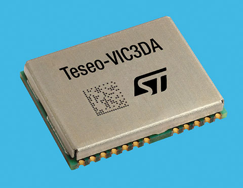
STMicroelectronics has introduced the Teseo-VIC3DA, the latest member of the Teseo module family, designed for vehicle positioning.
Teseo-VIC3DA combines ST’s high-performing Automotive Teseo III GNSS IC with the automotive 6-axis MEMS inertial measurement unit (IMU) and dead reckoning software to create a convenient, automotive-qualified navigation module. The module enables competitively priced in-car navigation, fleet-management, and insurance-monitoring applications.
The automotive Teseo III GNSS IC at the heart of the system is proven in high-end systems and is already highly regarded for its accuracy and efficiency. With multi-constellation awareness, Teseo III offers robust positioning capabilities by simultaneously receiving signals from GPS, Galileo, GLONASS, BeiDou and QZSS constellations.
The ST 6-axis automotive-grade MEMS IC introduces super-high-resolution motion tracking in advanced vehicle navigation and telematics applications.
With the combination of ST’s Teseo III, IMU and dead reckoning, the Teseo-VIC3DA ensures extremely accurate positioning performance in critical environments such as tunnels, beneath structures such as bridges or multi-level highways, in covered areas such as underground parking lots, and in urban canyons between tall buildings.
The Teseo-VIC3DA module operates from 3.3V, helping to simplify system integration, and has a standby mode that draws just 17 µA to minimize demand on the vehicle’s electrical supply. Containing a highly accurate integrated temperature compensated crystal oscillator, the module achieves excellent accuracy of 1.5 m circular error probability for typical automotive use cases. In addition, a dedicated real-time clock oscillator helps ensure fast time to first fix.
Coming with firmware pre-loaded onto built-in flash memory, the Teseo-VIC3DA can be updated with new firmware as necessary using the free Teseo-Suite software. Teseo-VIC3DA can provide up to 30Hz dead-reckoning fix-rate and has very low latency to reduce the UART-channel jitter. Teseo-VIC3DA can autonomously work with and without odometer information.
The Teseo-VIC3DA is tested and certified by ST according to the EU’s Radio Equipment Directive, applicable ETSI standards, and EN safety standards, helping customers achieve mandatory product-level approvals quickly and efficiently. A standalone, USB-powered evaluation platform, EVB-VIC3DA, is available to jump-start development.
The Teseo-VIC3DA is in production now and supplied in a 16 x 12.2 x 2.42 mm 24-pin LCC package.
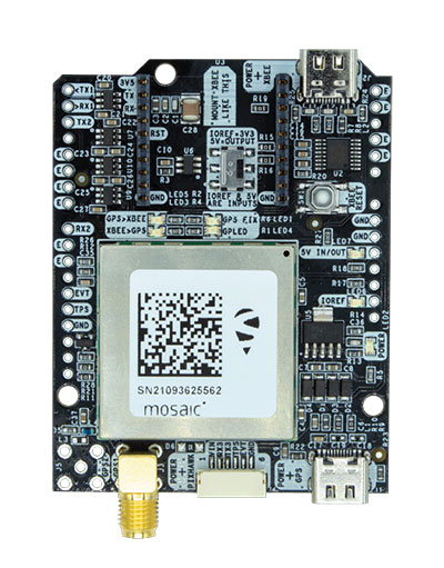
The mosaic-X5 and mosaic-H modules are being integrated into ArduSimple’s new evaluation kits, making resilient cm-level positioning easily accessible for testing and prototyping
With these new kits, ArduSimple brings to market triple-band real-time kinematic (RTK) GPS/GNSS as a plug-and-play solution for the most popular development platforms such as Arduino, STM Nucleo, Raspberry Pi, Ardupilot and Nvidia Jetson.
ArduSimple enables developers of robotics, UAVs and autonomous systems to easily try out mosaic, a unique module offering the latest high-performance GNSS positioning technology.
“The mosaic module complements the ArduSimple RTK product portfolio with a higher-end solution for the most demanding applications,” said Marc Castillo, senior consultant at ArduSimple. “Triple-band GNSS brings extra reliability to the RTK solution and removes the headache of transitioning from L2 to L5 band. This, combined with its feature-rich software, will allow our customers to accelerate even more their time-to-market.”
In addition to triple-band GNSS, mosaic module offers unmatched resilience to radio interference. This is especially important in robotic devices where electronic components, such as cameras and servos, are located close to the GPS/GNSS receiver, often interfering with GPS signals, which are weak, and causing positioning degradation. High-accuracy positioning is delivered at a uniquely high update-rate by mosaic-X5 in single antenna mode. Meanwhile, the board which mounts mosaic-H offers all-in functionality with dual-antenna mode for accurate GNSS heading.
“By partnering with ArduSimple we are bringing mosaic to emerging markets where its outstanding performance makes a difference. Mosaic makes accurate positioning so much easier to integrate and use, while giving a competitive edge to new products,” said Gustavo Lopez, market access manager at Septentrio. “ArduSimple is a great partner because they are known in the industry for offering user-friendly and affordable evaluation kits for RTK positioning, complemented by software tools, making integration and rapid prototyping easy.”
The SimpleRTK3B board, which allows evaluation of the mosaic GNSS module, is now available for purchase via the ArduSimple web shop. For more information about mosaic or other Septentrio products visit septentrio.com or contact Septentrio.
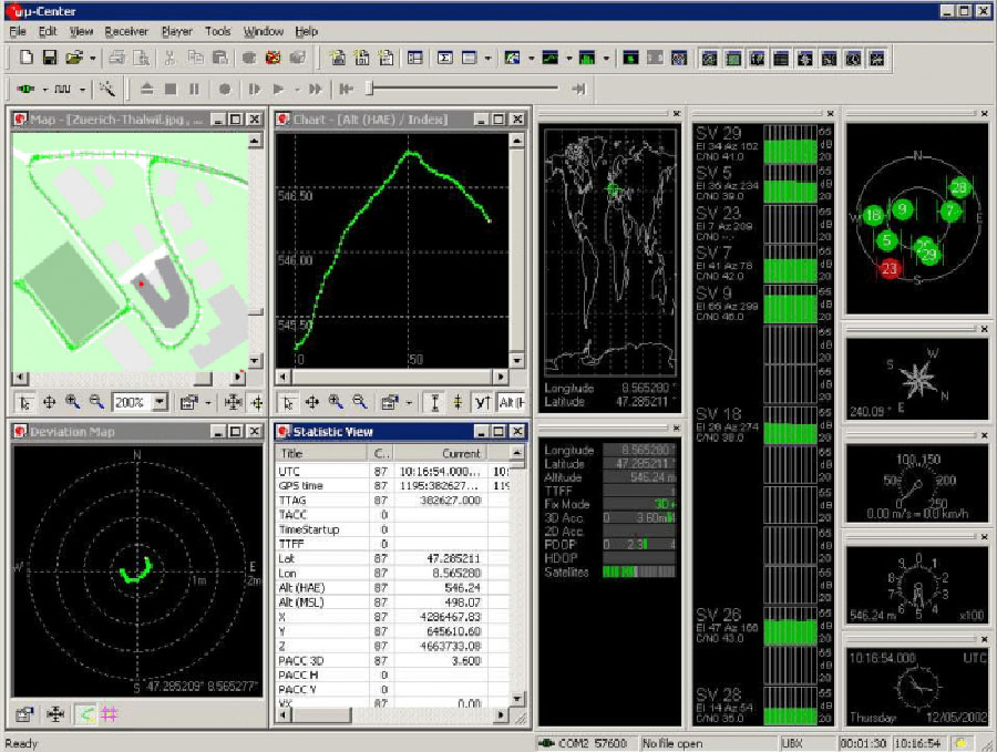
U‑blox has launched its new GNSS evaluation software, u-center 2. The software, which runs on Microsoft Windows, offers anyone working with 10th-generation (M10) u‑blox GNSS technology a highly intuitive interface to configure GNSS products, evaluate their performance, improve the quality of their software, and experience the performance boost achieved using GNSS-related services.
U-center 2 is the successor to the u-center GNSS evaluation software, which has been used by design engineers for almost two decades to develop GNSS receiver applications. Compatible with u‑blox M10 GNSS technology, u-center 2 is designed to offer improved performance over its predecessor, as well as new features that simplify configuration, evaluation and software development of GNSS-based solutions.
Screenshot: U-blox
U-center 2 provides personalized workspaces with adaptive window elements offering a choice of views to observe static and dynamic behavior of the connected GNSS receiver. The built-in log player, which accepts log files from the previous version of the software, features easy message- and time-based navigation and lets users set the playback speed, making development of end products more efficient. Automatic updates ensure that the software includes the latest features with minimal user effort.
U-center 2 simplifies the evaluation of GNSS-related location services such as AssistNow, through which GNSS receivers gain access to GNSS aiding data, enhancing startup performance, and saving power.
Predecessor u‑center will continue to be the go-to solution for GNSS solutions based on earlier technology platforms.
“We are confident that users will immediately recognize how easy u-center 2 makes it to set up and evaluate the latest generations of our GNSS chips and modules,” said Bernd Heidtmann, product manager, Product Strategy for Standard Precision GNSS, u‑blox. “With its fresh and minimalist user interface, the upcoming quick product configuration designed for key use cases, and optimized data logging, u-center 2 will raise the benchmark for GNSS evaluation tools in terms of performance and user experience.”