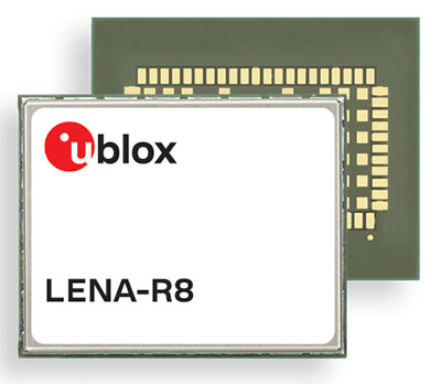
U‑blox has added a GNSS receiver module to its cellular LTE Cat 1 portfolio. The GNSS receiver in the LENA-R8 is based on the u‑blox M10 platform.
U-blox also introduced the LARA-R6, its smallest LTE Cat 1 module with global coverage. Together, the modules comprise five certified global, multi-regional and regional product variants, simplifying logistics for product developers and increasing design flexibility.
Both modules offer device makers facing imminent 2G and 3G network sunsets a future-proof migration path to 4G technology for data-streaming applications.
Additionally, they offer MQTT Anywhere and MQTT Flex connectivity via u‑blox’s Thingstream platform out of the box, thereby enabling low-power, low-cost connectivity with globally ubiquitous, seamless roaming.
Tracking and Telematics
The LENA-R8 standard-grade module series targets customers in the tracking and telematics markets seeking to minimize costs associated to their bill of material and data charges. The compact module balances cost and performance with single Rx antenna and primarily targets customer deployments in the Europe, Middle East, Africa, Asia, and South America regions.
The LENA-R8 supports a broad range of frequency bands with 2G fallback, providing maximum roaming coverage for global tracking applications using a single stock keeping unit (SKU).
A variant of the LENA-R8 series comes with an ultra-low power u‑blox M10 GNSS receiver for high performance asset tracking applications, reducing integration effort and time to market. Making no compromises in terms of GNSS performance, the module can concurrently receive up to four GNSS constellations for maximum position availability.
CellLocate Support
All variants of the LARA-R6 and LENA-R8 family support CellLocate, u‑blox’s cellular network-based location service, for coarse positioning data even in the absence of GNSS signals.
Engineering samples will be available in February.
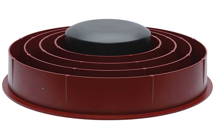
Case New Holland (CNH) has selected the Tallysman Wireless VeraChoke antenna for modernization of its high-precision European GNSS real-time kinematic (RTK) network.
“The objective of the GNSS antenna update is to enable the tracking of all GNSS constellations and signals, thus improving the robustness, convergence time, and accuracy of positioning within CNH’s European RTK network,” said Michiel Jochims, CNH Industrial RTK manager EMEA. “At this stage, with only 25 stations updated, we are delighted to observe a significant performance improvement. We look forward to continuing the network update and bringing enhanced positioning to all of our European customers.”
The VeraChoke antenna provides excellent multipath suppression and repeatability of PCV and group delay variation (GDV), making it suitable for GNSS reference networks, explained Temo Wubbena, CEO of Geo++. “After detailed analysis, we have recommended Tallysman’s VeraChoke antenna to CNH Industrial.” Geo++ is supporting the upgrade of CNH Industrial’s European RTK network.
The patented VeraChoke has a very tight phase center variation (PCV), strong multipath mitigation and excellent performance across the full GNSS spectrum. Its PCV and phase center offsets (PCOs) are repeatable from unit to unit, making suitable for network RTK applications.
A roundup of recent products in the GNSS and inertial positioning industry from the January 2022 issue of GPS World magazine.
Surveying
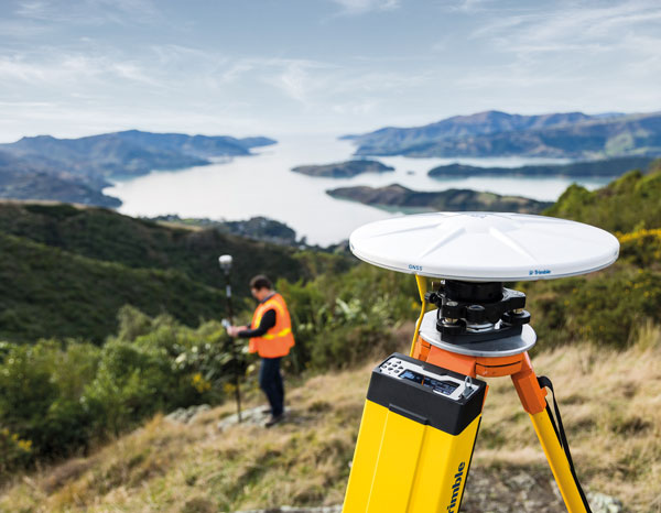
Base Station
Receives all available GNSS signals
Photo: Trimble
The Trimble R750 GNSS modular receiver is a connected base station for use in civil construction, geospatial and agricultural applications. The R750 provides high-accuracy base-station performance, giving contractors, surveyors and farmers more reliable and precise positioning in the field. The R750 also can be used to broadcast real-time kinematic (RTK) corrections for a wide range of applications, including seismic surveying, monitoring, civil construction, precision agriculture and more. Access to all available satellite signals provides improved performance and reliability when used with a Trimble ProPoint GNSS rover. ProPoint gives users improved performance in challenging GNSS conditions, with improved signal management.
Trimble, trimble.com
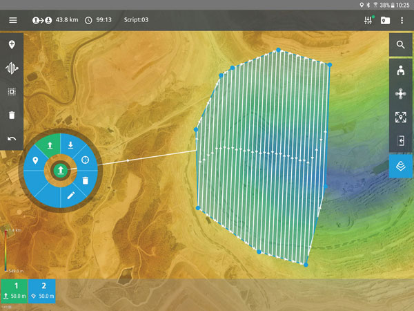
Flight Planning
Updated for safer UAV surveying
Photo: Microdrones
The mdCockpit app was designed for professional drone users to make it easy to plan, monitor, change and control flights from an Android tablet. The updates in version 2021.3 include features that improve flight safety and give more options for surveying with an aim to deliver a premier solution for planning, monitoring, adjusting, analyzing and controlling professional drone flight missions from a tablet. Updates include an improved flight editor, flight data collection and drone configuration. Drone pilots can download mdCockpit through the Google Play store.
Microdrones, microdrones.com
OEM
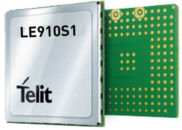
LTE Module
With 2G fallback for Latin America
Photo: Telit
The LE910S1-ELG LTE Cat 1 module is designed for internet of things (IoT) applications in Latin America that need a combination of performance, affordability and voice support in a compact form factor. It provides 2G fallback, making it suitable for areas that have not upgraded to 4G. With an embedded GNSS receiver, the cost-optimized LE910S1-ELG is suitable for tracking applications such as fleet management, stolen-vehicle tracking and recovery, and other mobile IoT applications that need to maintain a reliable connection when moving around in a country, region or multiple regions. The power-saving embedded GNSS receiver enables the use of GNSS positioning even when the cellular modem is switched off.
Telit, telit.com
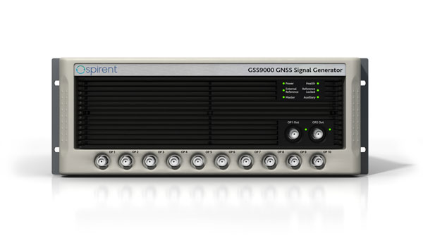
Flex Power
Capability now on constellation simulator
Photo: Spirent
A new positioning, navigation and timing (PNT) test capability commonly referred to as programmable power — or flex power — is available on the Spirent GSS9000 constellation simulator and can be applied to existing scenarios. Flex power is the reallocation of transmit power among individual signals in GPS satellites, providing a countermeasure against GPS jamming. Spirent simulators fully support programmable power for M-code, Y-code and C/A (coarse acquisition) code.
Spirent, spirent.com
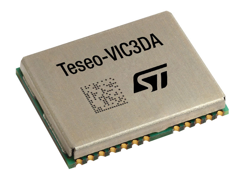
GNSS Module
Automotive qualified with INS and dead reckoning
Photo: STMicroelectronics
The Teseo-VIC3DA is the latest member of the Teseo module family, designed for vehicle positioning. It combines the Teseo III GNSS integrated circuit with the 6-axis MEMS inertial measurement unit (IMU) and dead-reckoning software to provide super-high-resolution motion tracking for advanced vehicle navigation and telematics applications. Teseo III offers robust positioning capabilities by simultaneously receiving signals from GPS, Galileo, GLONASS, BeiDou and QZSS constellations. The module enables competitively priced in-car navigation, fleet management and insurance-monitoring applications.
STMicroelectronics, st.com
PNT Platform
Protects critical infrastructure from GNSS vulnerabilities
Photo: ADVA
The scalable aPNT+ platform meets the latest guidelines for resilient positioning, navigation and timing (PNT), providing end-to-end control and timing network visibility for robust protection against the catastrophic risks that PNT disruption poses to national security and essential assets such as power grids. Even without GPS or GNSS timing, the solution provides an intelligent, end-to-end self-recovery system designed around a three-fold framework, integrating multi-layer detection, multi-source backup and multi-level fault-tolerant mitigation.
ADVA, adva.com
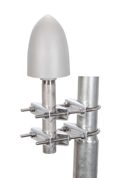
Timing Antennas
IP67-compliant for outdoor and marine environments
Photo: RadioWaves
A new series of GPS/GNSS timing antennas cover the L1 and L5 GPS bands, providing axial ratio and higher accuracy for the reception of satellite timing signals and reference frequencies for enhanced phase synchronization in precision network deployments. Their high gain, low noise figure of 2-dB and high out-of-band rejection allows for use of longer and cost-effective cables for easy and flexible installations. Built-in surge protection supports a wide range of GNSS including GPS, GLONASS, BeiDou and Galileo, as well as Iridium.
RadioWaves, radiowaves.com
Mapping
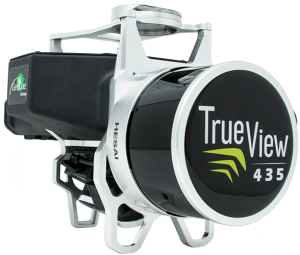
Imaging System
Designed for utility and infrastructure mapping
Photo: Geocue
True View 435 is an economical platform for utility-grade mapping, with superior ground-capturing capabilities for lightly vegetated areas. The next-generation compact 3D imaging system has the sensitivity needed for infrastructure mapping. Its position and orientation system is the Applanix APX-15, achieving accuracy of better than 5 cm RMSE and precision of better than 5 cm at 1 sigma.
GeoCue, geocue.com
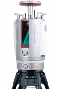
Long-Range Scanner
Includes integrated GNSS receiver
Photo: Riegl
The VZ-2000i long-range 3D laser scanning system combines user friendliness with fast, accurate data acquisition. The flexible system includes an integrated GNSS unit for a high-accuracy real-time kinematic (RTK) solution. Other peripherals and accessories include a SIM card slot for 3G/4G LTE, WLAN, LAN, USB and other ports. A new processing architecture enables execution of different background tasks onboard in parallel to the simultaneous acquisition of scan data and image data, such as point-cloud registration, georeferencing and orientation via an integrated inertial measurement unit.
RIEGL, riegl.com
Transportation
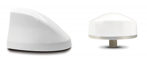
Vehicle Antennas
Designed for Intelligent connected cars and trucks
Photo: Harxon
Two new GNSS antennas are designed for vehicles equipped with advanced sensors, controllers, actuators and other devices. They are enabled for intelligent information exchanges between the vehicle and everything (V2X), connecting autos with GNSS, 5G, Wi-Fi, ultra-wideband and more. The integrated antennas support dedicated short-range (DSRC) and cellular vehicle-to-everything (C-V2X) communication, embedding a premium GNSS antenna with high gain for consistent and reliable precise positioning service. They also allow for multiple input and output of data to achieve swift internet download speed in 5G networks.
Harxon, harxon.com
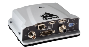
NVIDIA AV Support
Receiver now supported on autonomous platform
Photo: NovAtel
The PwrPak7-E1 GNSS receiver is now supported on the NVIDIA Drive Hyperion autonomous vehicle (AV) development platform. Selected for its robustness and precise position output, the PwrPak7-E1 will be offered with NVIDIA’s autonomous driving test fleets worldwide. Drive Hyperion is a fully operational, production-validated and open AV platform that reduces the time and cost required to outfit vehicles with autonomous driving and artificial intelligence (AI) features. The PwrPak7-E1 also is now compatible with NVIDIA’s DriveWorks v4 software release.
Hexagon | NovAtel, novatel.com
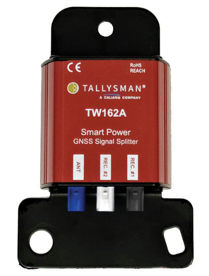
Splitter
Provides signals to two GNSS receivers
Photo: Tallysman
The TW162A automotive-grade smart power GNSS signal splitter supports the full GNSS spectrum: GPS/QZSS-L1/L2/L5, QZSS-L6, GLONASS-G1/G2/G3, Galileo-E1/E5a/E5b/E6, BeiDou-B1/B2/B2a/B3 and L-band correction service frequency band. It offers fail-over and fault-identification features. The splitter accepts power from all attached GNSS receivers; if one receiver fails, the next attached receiver automatically provides power to the splitter and antenna. If the antenna fails and does not draw current, all connected receivers will sense a current draw lower than 1 mA, indicating an antenna fault. The TW162A offers high performance in terms of noise figure, isolation and linearity.
Tallysman, tallysman.com
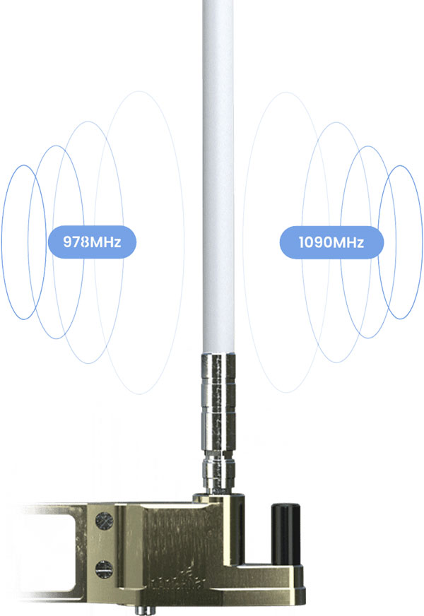
ADS-B Receiver
Enhances airport situational awareness
Photo: uAvionix
The pingStation 3 integrates 978 MHz and 1090 MHz ADS-B receivers, a GPS receiver, an antenna and a power-over-Ethernet (POE) interface into an easy-to-install, rugged weatherproof enclosure. With a selection of non-proprietary and industry-standard data interfaces, such as JSON and ASTERIX CAT 021, pingStation 3 is designed to integrate into a multitude of end-user applications, including airport displays, UAS Ground Control Stations (GCS), Unmanned Traffic Management (UTM) Solutions, and Flight Information Displays (FID). When paired with the VTU-20 airport vehicle ADS-B transmitter, pingStation 3 improves the situational awareness of ATCs and the safety of airport operations by reducing the risk of runway incursions.
uAvionix, uavionix.com
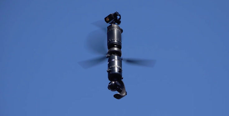
UAV
Defense UAS
Flexible UAV and control software combined
Photo: Ascent AeroSystems
Ascent AeroSystems’ Spirit coaxial unmanned aerial system (UAS) offers a versatile and durable system for mission-critical operations. With a modular, plug-and-play payload design, the Spirit’s open architecture allows operators to add or upgrade software to unlock new operating capabilities without the need to design or develop a new aircraft. Autonodyne’s additive software solution allows the Spirit to perform autonomous tasks either individually or as a team with multiple vehicles, from a single operator and control station.
Ascent AeroSystems, ascentaerosystems.com
Autonodyne, autonodyne.com
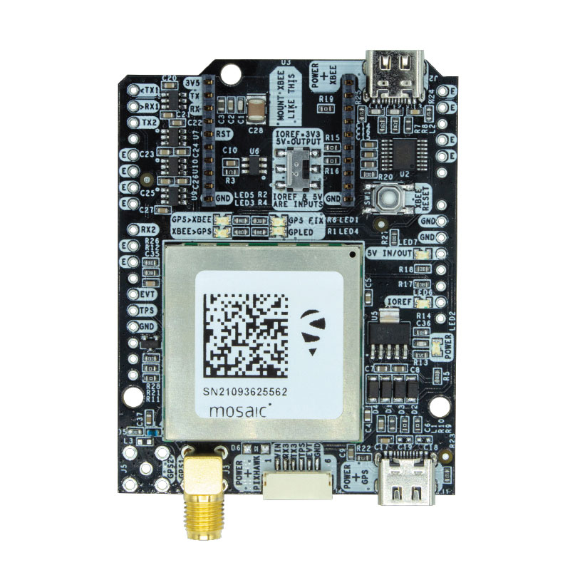
Evaluation Kits
Now include mosaic Septentrio modules
Photo: ArduSimple
Two Septentrio modules are being integrated into ArduSimple’s new evaluation kits — the mosaic-X5 GNSS module and the mosaic-H heading module. The new kits make resilient centimeter-level positioning easily accessible for testing and prototyping. ArduSimple’s kits provide triple-band real-time kinematic (RTK) GPS/GNSS as a plug-and-play solution for the most popular development platforms such as Arduino, STM Nucleo, Raspberry Pi, Ardupilot and Nvidia Jetson. It enables developers of robotics, UAVs and autonomous systems to try out mosaic, a unique module offering the latest high-performance GNSS positioning technology.
Septentrio, septentrio.com; ArduSimple, ardusimple.com
Geospatial Data
Drones as a service
Photo: Beagle
A drone network solution offers on-demand imagery to customers in Germany at resolutions up to 50 times higher than available from commercial satellite data providers. The Beagle M drone and sensors can deliver image data at 1-cm per pixel many times faster than satellites and regardless of cloud coverage. The company’s charging hangars enable quick flights. After completing an autonomous inspection flight (up to 200 km on a single charge), the drone returns to its hangar where it charges for its next mission. The drone takes just 90 minutes to become fully charged, and can then advance to its next mission without any physical contact between operator and aircraft.
Beagle Systems, beaglesystems.com
Hemisphere GNSS has announced another Vega heading and positioning OEM board using the Lyra II and Aquila chipsets.
The Vega 60 GNSS board fits industry-standard 46 x 71 mm form factors with a 60-pin connector. It can be used to replace more expensive and lesser abled 60-pin boards with either single- or dual-antenna capabilities.
Hemisphere’s Lyra II and Aquila application-specific integrated circuit (ASIC) designs provide the ability to simultaneously track and process more than 1,100 channels from all GNSS constellations and signals including GPS, GLONASS, Galileo, BeiDou, QZSS, NavIC, SBAS and L-band. The ASIC technology offers Vega 60 scalable access to every modern GNSS signal available.
Cygnus interference mitigation technology is also a standard feature, providing built-in digital filtering capabilities and spectrum analysis. This provides enhanced anti-jamming as well as interference detection and mitigation.
“We are excited for the opportunity to introduce our Vega 60 board,” said Miles Ware, director of marketing at Hemisphere. “Vega 60 brings our industry-leading heading and position solutions to an OEM board footprint with very few affordable upgrade paths.”
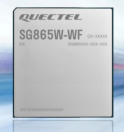
Quectel Wireless Solutions has launched the SG865W-WF, a new generation of flagship Android smart module. The module is equipped with Qualcomm’s QCS8250 system-on-chip (SoC), which offers powerful performance and rich multimedia functions to meet industrial and consumer artificial intelligence IoT (AIoT) scenarios.
Quectel made the announcement at the Consumer Electronics Show (CES) taking place this week in Las Vegas.
With various peripheral interfaces such as dual USB, multiple PCIe and UART, the product can seamlessly integrate with cellular and GNSS modules such as Quectel’s EC20 LTE module, and the RG500Q 5G module, allowing customer terminals to be connected flexibly to 4G/5G networks and achieve faster and more accurate positioning.
The SG865W-WF module will accelerate the efficient deployment of high-end AIoT applications such as video conferencing, cloud gaming, digital signage, unmanned aerial vehicles (UAVs), robots and smart retail.
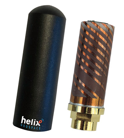
Helix builds precision GNSS antennas that enable product designers to create small, accurate positioning, navigation and timing (PNT) synchronization products that defend against vulnerabilities and threats. Helix is also developing its antennas to provide navigation for autonomous vehicles.
Helix’s patented DielectriX antennas are targeted initially to receive PNT signals from GNSS (GPS, Galileo, GLONASS, Beidou) constellations, and the Satelles STL (Satellite Time and Location) signals delivered over the Iridium constellation as well as Iridium’s voice and data network.
Future antenna variants will support low-Earth orbit (LEO) PNT services being planned and built by private companies, as well as government agencies, the company said.
DielectriX antennas discriminate true satellite signals from multipath signals, interference and jamming, delivering high performance in a compact and rugged form factor. Helix’s customers include defense, automotive, aerospace and critical infrastructure companies.
Helix previously raised £2.5 million from UKI2S and angel investors, and has participated in Wayra UK’s Intelligent Mobility Accelerator programme and Seraphim Capital’s Space Camp Mission 6. Helix also received additional grant funding for advanced antenna development from the European Space Agency, and for anti-jamming/spoofing technology from UKI2S.
For navigation and control of any robotic or autonomous outdoor system, GNSS and inertial navigation systems (INS) are key components. Inevitably, the question arises: Should you build your own custom solution or integrate an available GNSS/INS combined solution? What would give you the best performance, while keeping the total cost of ownership (TCO) to a minimum? The TCO is also known as the “long-term price” and is defined as the purchase price plus the costs of operation over time.
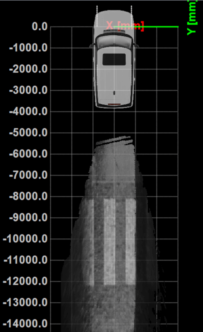
Xenomatix is a company offering automotive solutions based on lidar technology. With eight years of innovative experience, Xenomatix has installed a pre-integrated GNSS/INS receiver on its latest lidar product, achieving high GNSS/INS performance with minimal TCO.
In an integrated INS/GNSS receiver, the GNSS receiver provides positioning with centimeter-level accuracy. The other component is a micro-electromechanical inertial measurement unit (MEMS IMU), which measures 3D orientation in terms of heading, pitch and roll angles with sub-degree precision. For its latest product XenoTrack, Xenomatix chose an INS called XenoAsterx based on the AsteRx SBi3 from Septentrio, which it integrated alongside its lidar to collect road-quality data to the smallest detail.
From an in-house solution to a pre-integrated system
Three years ago, when Xenomatix started developing its new lidar road-inspection system, the company had a GPS receiver, an IMU and an odometer as accompanying sensors. The company wanted to expand into new markets of road inspection in accordance with international standards, and so it needed to improve its components to take the overall performance of its system to the next level with RTK high-accuracy positioning.
To achieve this, while saving time and costs, Xenomatix acquired an AsteRx SBi3 INS/GNSS receiver, which allowed it to focus on its core lidar technology and sensor-fusion algorithms.
This off-the-shelf INS/GNSS solution provided all the high-accuracy positioning and orientation information Xenomatix needed, while eliminating most costs of development, maintenance and support. The new receiver allowed them to drive for miles, without any offset in positioning, something impossible with the previous GPS receiver.
The unique technology from Xenomatix stitches images by using lidar point-cloud overlays. However, when the car is moving fast, this overlay is smaller. The pre-calibrated GNSS/INS extends system performance by allowing stitching even when driving at higher speeds.
“If we start driving and we stitch the road for tens of kilometers and we come back to the same starting point, then we see an offset of only a few millimeters,” said Filip Geuens, CEO, Xenomatix. “This is for us the strongest proof of accuracy and reliability of the GNSS sensor.“
Why pre-integrated GNSS/INS offers better value
The pre-integrated GNSS/INS allows XenoTrack to collect road data even at higher speeds. (Credit: Septentrio)
A pre-integrated GNSS/INS solution — versatile enough to fit into virtually any autonomous or mapping system — offers the best value in the long run for the following reasons.
Better performance. The manufacturer of a GNSS/INS solution specializes in fusing the GNSS receiver and the INS in an optimal way. To accomplish this, the sensors are synchronized and their output run through a sophisticated Kalman filter algorithm. The fused device is then fine-tuned for optimal operation under various conditions. Finally, it is extensively tested and validated.
While being used by numerous customers and in varying applications, the GNSS/INS solution proves itself on various levels such as accuracy and robustness. This results in superior performance, even in the most demanding environments.
After installing the AsteRx SBi3 GNSS/INS system, XenoTrack was able to extend its functionality to inspect longer distances of roads at higher speeds. The AsteRx SBi3 operates reliably, even in challenging environments, such as when driving near high cliffs or under bridges.
Less development time and lower costs. When building a system, the development time is usually about one year employing two full-time GNSS/INS specialists. Hardware components need to be integrated and synchronized, while various interfaces and the Kalman filter need to be implemented. Additional features may be developed, such as velocity input as well as tools for validation, before the intricate step of performance fine-tuning. Finally, additional testing efforts are needed for verification and validation of the device.
On the other hand, a pre-integrated GNSS/INS system with easily accessible interfaces and flexible configuration ensures quick installation, meaning the product is ready within weeks.
Lower maintenance costs and support. Certain high quality pre-integrated GNSS/INS receivers are future-proof — ready to use new GNSS satellite signals and services as soon as they become available. An example of such upcoming service is the Galileo OSNMA anti-spoofing authentication.
Some receiver manufacturers such as Septentrio also offer continuous product improvement in the form of free firmware updates. A system developed in-house, on the other hand, needs continuous investment to maintain its competitive edge.
When issues occur, Septentrio also offers local worldwide support, with experienced application engineers ready to solve GNSS, INS or coupling issues that could halt the production process. For example, when Xenomatix discovered that its GNSS/INS was not working optimally in a certain environment, the company called Septentrio. Within days application engineering experts who analyzed the logged data found the source of the issue and proposed a solution.
Focus on core technology. When the budget is limited, choices need to be made about where to focus the efforts. When a company saves on GNSS/INS development, more can be invested in core technology. This means avoiding any lost-opportunity costs and optimizing margins.
Building your own is not always the best option
Acquiring a pre-integrated GNSS/INS receiver allowed Xenomatix to have a superior and affordable product with a competitive edge. AsteRx SBi3 increased the performance of the XenoTrack mapping system, while a short integration period allowed a faster time-to-market.
Xenomatix also benefited from low maintenance costs, keeping overall TCO to a minimum. Since the company was not spending time developing a custom GNSS/INS system, it could focus fully on its core technology. This allowed Xenomatix to take its business to the next level at a high pace.
Award-winning technology
In November 2021, the XenoTrack road scanner, with AsteRx SBi3 inside, was announced a winner of the IRF Global Road Achievement Award for its innovative road scanning and surveying solutions.
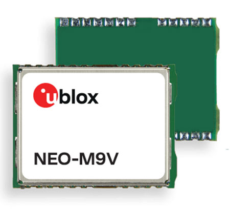
U‑blox has announced the NEO-M9V module, its first GNSS positioning receiver to offer both untethered dead reckoning (UDR) and automotive dead reckoning (ADR).
The NEO-M9V is suitable for fleet management and micro-mobility applications that require reliable meter-level positioning accuracy even in challenging GNSS signal environments such as urban canyons.
Using inertial sensor measurements, UDR offers a smooth navigation experience in dense urban environments by bridging gaps in GNSS signal coverage and mitigating the impact of multipath effects caused by GNSS signals that bounce off buildings. ADR further increases positioning accuracy in demanding environments by including the vehicle speed in the sensor-fusion algorithm.
Offering both UDR and ADR on the same module delivers maximum positioning performance and design flexibility, u-blox said. The NEO-M9V also features dynamic models optimized for both cars and e-scooters.
NEO-M9V is based on the u‑blox M9 GNSS technology platform. Its ability to track up to four GNSS constellations maximizes the number of GNSS satellites within its line of sight at any given moment. Integrated SAW and low-noise amplifier filters offer excellent interference mitigation for a robust solution. Compatibility with the NEO form factor reduces migration efforts for customers upgrading existing designs.
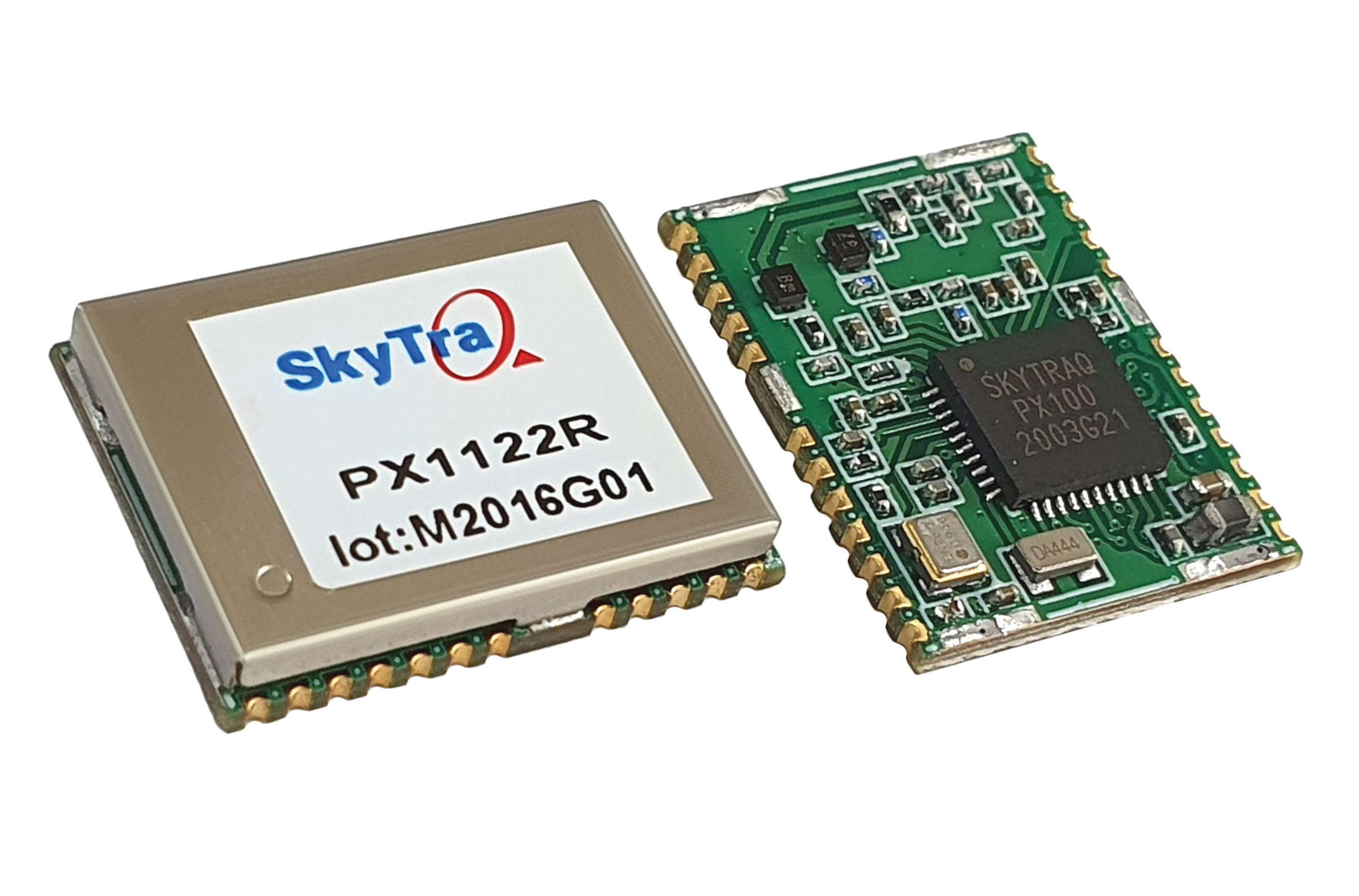
SkyTraq Technology, a fabless semiconductor company, develops GPS/GNSS chipsets and modules for meter-level accuracy vehicle navigation and tracking applications and for centimeter-level accuracy real-time kinematic (RTK) surveying and precision guidance applications.
Photo: SkyTraq
The company’s chipset design is driven by market trends, said Oliver Huang, the company’s general manager. He explained the company has moved from single-frequency to dual-frequency devices.
SkyTraq’s chipset is designed to be common hardware for different target applications enabled by customized software. Traditionally, in the automotive market, vehicle navigation systems have relied on fusing GNSS receivers with dead-reckoning technology that uses micro-electromechanical (MEMS) inertial measurement units (IMUs) and wheel-tick data.
“We are now seeing more aftermarket vehicle tracking applications that take advantage of superior GNSS/DR performance using untethered dead-reckoning technology that uses sensor fusion of GNSS receiver and MEMS IMUs without the need for wheel-tick data,” Huang said. “GNSS receivers with decimeter or better accuracy, combined with dead-reckoning that uses low drift IMUs, will be important in emerging autonomous vehicle applications.”
SkyTraq’s PX100 chipset for L1 meter-level accuracy applications and centimeter-level accuracy RTK applications uses L1 and L1/L2 signals from all four major GNSS constellations (GPS, GLONASS, Galileo and BeiDou).
Because of the trend toward high-precision, which requires good carrier-phase raw measurement data, the biggest challenge in receiver design is with the antenna, Huang explained. “Using an advanced semiconductor process, one can have low power, small size chipsets taking advantage of all the available GNSS signals, yet there is no small antenna capable of producing high-quality carrier phase data for high-precision GNSS applications. So far, we have only seen bulky RTK antennas capable of generating high-precision results.”
Swiss company u-blox designs and manufactures GNSS receivers used in the automotive market, including driverless cars, and for micro-mobility devices, such as the Bird scooter.
In deep urban canyons, the biggest challenge for positioning cars is achieving sufficient accuracy despite multipath, said Aravinthan Athmanathan, product manager for the company’s Automotive GNSS line of receivers. “The challenge for autonomous driving is reliable lane-accurate positioning and integrity.”
The company develops its own dead-reckoning algorithms, which use data from an inertial measurement unit (IMU) and wheel speed sensors. “We also provide dual output, so the end customer can choose whether to use GNSS only or a sensor-fused solution,” said Athmanathan. This is especially challenging at the sub-meter accuracy level.
Different Uses, Different Sensors
Different automotive use cases require different GNSS receivers. To meet this challenge, u-blox offers the NEO-M9L for standard precision and the ZED-F9K for high precision, depending on the customer’s needs. Additionally, it is investing a lot “in functionally safe GNSS and in being the GNSS enabler for car manufacturers,” said Karin Steinhauser, the company’s senior marketing communications manager.
For navigation with meter-level accuracy, the NEO-M9L is integrated with dead-reckoning technology and sensor fusion, using algorithms that process sensor data from the IMU and from wheel-speed sensors. It can provide reliable location data in challenging environments, such as urban canyons, where multipath becomes an issue, or tunnels, where GNSS signals are partially or totally denied, Steinhauser said. Additionally, the NEO-M9L can operate in temperatures of up to 105° C, making it suitable for integration on the roof, behind the windscreen, or inside hot electronic control units. The NEO-M9L addresses the use cases in urban environments for both navigation and systems, such as Europe’s eCall, that provide an automated message to emergency services following a road crash, including the precise location of the accident.
The ZED-F9K, on the other hand, is well suited for use cases at the higher levels of advanced driver assist systems (ADAS) defined by the Society of Automotive Engineers (SAE), which require decimeter-level accuracy. “At L3 and above, you need correction services with integrity to allow for trustworthy and reliable GNSS positioning,” Steinhauser said. “We have partnerships with Bosch on projects to develop functionally safe GNSS solutions based on a ISO26262-certified version of u-blox generation 9 GNSS technology.” The ZED-F9K is a multi-band receiver that uses GPS signals on L1-L2 and Galileo signals on E5b. “We also have a special set of features adequate for the ADAS and the autonomous driving features,” Athmanathan said.
Image: 3alexd/E+/Getty Images
Bottlenecks
One of the factors limiting how quickly u-blox can roll out solutions based on the ISO 26262 standard (titled “Road vehicles – Functional safety”) is that highly autonomous systems require more integration work by the customers, said Alex Ngi, the company’s product manager for High Precision GNSS. “The first systems are now available.” Another hurdle, he pointed out, is the legal framework for deploying autonomous driving systems. “The regulations about how things need to be tested, and the liabilities for when systems fail, affect how quickly these systems can get adopted.”
GNSS can be used as a complementary technology to enable absolute positioning for systems that fuse data streams from cameras and lidars, such as those used for ADAS level 2 applications. “Fusing all this is computationally intensive and requires high processing power, such as NVIDIA GPUs, which tend to be very hot systems. We see a lot of requirements for very high-temperature GNSS receivers, because our receivers are often co-located with these hot systems.”
Of course, u-blox does not simply hand its modules to Bosch and car manufacturers and say, “You take it from here.” Design and integration is an iterative process. “We bring in the GNSS know-how and integration support and Bosch brings in the functional safe automotive development know-how,” Ngi said.
Dead Reckoning and Map Matching
For the automotive market, u-blox has more than 20 years of experience with dead reckoning. “The sensor-fusion solution receives data from both the GNSS and the IMU, and we provide the complete final solution,” Athmanathan explained.
The system also aids the receiver by providing it external map data. “If you’re driving your car northbound and the GNSS receiver tells you that it’s headed in the opposite direction, or that you’ve jumped over to the lane to the other side of the highway, clearly that cannot be right,” Ngi said. “Map matching relies on simple messages that come into our receivers to give us positive feedback on our measurements.”
For non-automotive applications, u-blox makes the ZED-F9R. It is used, for example, in robotic lawnmowers, very common in Asia and Europe, which require centimeter-level accuracies. “That’s why it focuses on delivering corrections using SPARTN, which can be a continent-wide data stream,” Ngi said. “We also make the design so that it’s very easy to integrate and enables the designers to easily pass the corrections to their receivers fully encrypted. This way, the value of the data is delivered to the lawnmower without exposing it to the system designer, so that we don’t need to go check every design to see whether somebody is leaking secured correction services.”
By the end of November, according to u-blox, updates of the ZED-F9P multi-band GNSS receiver will include decryption of the SPARTN correction data and a 95-percentile protection level. The protection level increases the trust non-safety-critical applications can place in its position output. By continuously outputting the upper bound of the maximum likely positioning error, referred to as the protection level, the receiver lets autonomous applications, such as UAVs or robotic lawnmowers, make efficient real time path planning, increasing the quality of their operations.
Guiding eScooters and EVs
In some places, Ngi pointed out, e-scooters are required to use a bike lane, which might be only two or three feet wide and may not be along the side of a building as it would be on a sidewalk. “The ZED-F9R is a much more flexible solution than camera systems that only know sidewalks or bike lanes.” Bird uses it to throttle driving speeds to match speed limits, which change from one location to another. “It is also much more scalable for them as opposed to such solutions as using UWB [ultra-wideband] beacons to fence off different areas, which are not really scalable for a company that wants to deploy solutions to hundreds of cities.”
Xpeng Motors, a manufacturer of smart electric vehicles, uses u-blox F9 GNSS receivers, which use signals from all four GNSS constellations, in its P7 super-long-range sports electric vehicle sedan. The vehicle uses ADAS for navigation-guided driving, automated parking and autonomous driving. For instance, once a navigation destination is set on a specific highway, the P7 will follow the route guidance to execute autonomous lane changing, switch to high-speed routes, and select the optimal route in real-time.
A roundup of recent products in the GNSS and inertial positioning industry from the December 2021 issue of GPS World magazine.
OEM
Satellite-cell terminal
With built-in GPS receiver
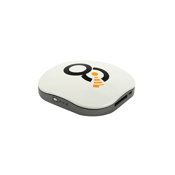
Photo: OQ
OQ Technology’s dual-mode satellite-cellular IoT modem and tracker is a plug-and-play, small, low-cost and low-power solution that can collect data from more than 1,000 sensors. It has a built-in GPS receiver and supports 5G NB-IoT, GSM, LTE-M and bi-directional satellite links. The flexible, robust and programmable dual-mode terminal has pre-paid data packages suitable for remotely monitoring and controlling fixed and mobile assets in industries such as transportation, oil and gas, utilities, and maritime.
Provides mission-critical, extended length GPS over fiber
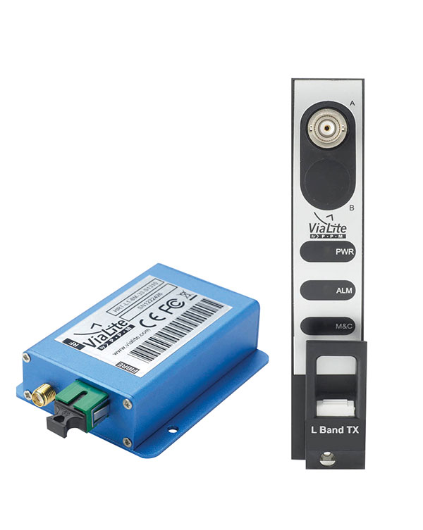
Photo: ViaLite
ViaLite’s GPS over Fiber Extension Kit for Microchip/Microsemi GPS timing servers provides mission-critical GPS timing and synchronization for systems requiring extremely accurate clock signals. Standard transmission distances for the extension kit can be up to 10 km, while solutions are available for distances as long as 50 km. The ViaLite kit was chosen for its unique performance with Microsemi’s S650 timing server. The ViaLite GPS link is designed to provide a remote GPS/GNSS signal or derived timing reference to equipment located where no signal is available, such as inside buildings or tunnels. By using optical fiber instead of traditional coaxial cable, extreme distances are possible with no radio frequency loss and zero introduction of noise.
The RELY-MIL-TIME-SERVER, which complies with MIL-STD-810G and MIL-STD-461G, embeds the latest timing, networking and security technology in a single SWaP platform. The all-in-one rugged edge computing device acts as a high-performance master clock and serves secure accurate timing distribution (PTP, NTP, GNSS). The timing feature is combined with high-bandwidth and high-availability Ethernet switching and L2/L3 cybersecurity services in a unique commercial-off-the-shelf device. At its heart is a Xilinx Ultrascale+ MPSoC device powered by SoC-e hardware IP cores for PTP and high-availability low-latency Ethernet networking.
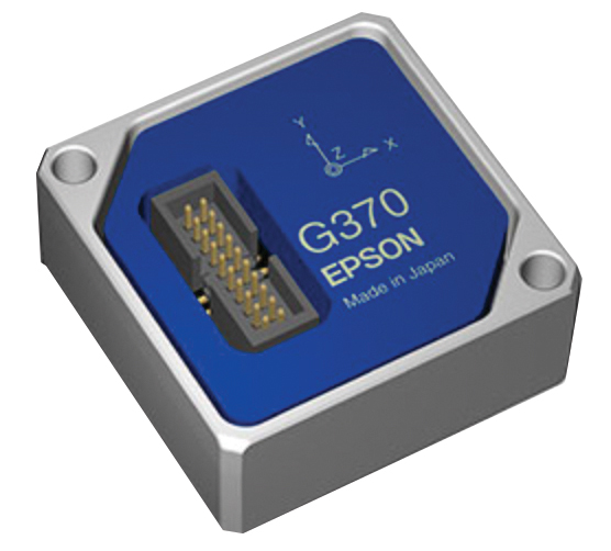
The M-G370PDS0 inertial measurement unit (IMU) is equipped with a high-performance six-axis sensor. It has an angle random walk (short-term variation in output) of 0.03°/√h, which is half that of its predecessor, and can more accurately detect very slight changes in the attitude of equipment and systems, since they do not get lost in sensor noise. The small size, light weight and low power consumption will help customers make their own products smaller and lighter. It also maintains compatibility with earlier products (the M-G370/365/364/354), making performance upgrades easy.
The OSA 5400 SyncModule enables technology suppliers to integrate precise synchronization into their hardware. Its M.2 form factor can add timing capabilities to switches, routers, open compute servers and other IT devices. The SyncModule provides GNSS, precision time protocol (PTP) and network time protocol (NTP) engines as well as comprehensive PTP and GNSS monitoring and assurance functionality. It can enable assured sub-microsecond timing in public and private networks as well as critical infrastructure. Featuring multiple interface options for easy integration, the OSA 5400 SyncModule comes with an open API. It also can be managed by ADVA’s proven Ensemble Sync Director management system.
Running on Microsoft Windows, u-center 2 offers anyone working with 10th-generation (M10) u-blox GNSS technology a highly intuitive interface to configure GNSS products, evaluate their performance, improve the quality of their software, and experience the performance boost achieved using GNSS-related services. The software is the successor to the u-center GNSS evaluation software, which has been used by design engineers for almost two decades to develop GNSS receiver applications. Compatible with u-blox M10 GNSS technology, u-center 2 is designed to offer improved performance over its predecessor. New features in u-center 2 simplify configuration, evaluation and software development of GNSS-based solutions. It is free for download.
The MEA-1227-SM is a GNSS/L1 and L2 low-profile screw-mount antenna. It has high performance suitable for maintaining constant network connectivity. The MEA-1227-SM covers all GPS/GLO/BEI/ QZSS/Galileo/SBAS/L1L2 standard frequencies. It is designed for telematics systems, remote surveillance, asset tracking and any internet of things (IoT) system applications. This screw mount antenna is easy to install, with a low profile suitable for challenging installations. It has a IP67-rated housing and anti-rotation mounting.
The Cowboy e-bike solution provides riders with high-performance, real-time GNSS accuracy, enabling them to map their own paths and those of the cities in which they live. It uses smart road-companion applications to ensure riders get precise information, regardless of the route they travel. The positioning component uses Taoglas’ Accura GVLB258.A, a multi-band GNSS L1/L5, high-performance stacked patch antenna, in conjunction with u-blox’s SAM-M8Q GNSS positioning module. The combination allows for extremely low power and high accuracy. The solutions works with “micromobility” services offered by Cowboy, such as Easy Rider for theft detection, bike insurance and crash detection notifications.
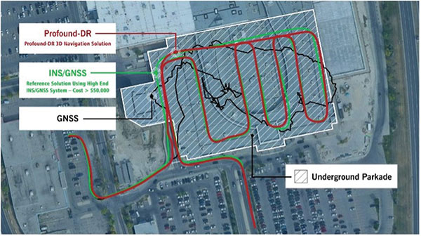
Instant decimeter-level accuracy with automotive sensors
Photo: Profound Positioning
The Profound-IVT (instant vehicle tracking) provides cost-effective vehicle navigation. Based on a firmware library, and rapidly adaptable to any navigation platform, IVT combines precise point GNSS positioning (PPP), dead reckoning and radar technologies in an integrated solution to provide decimeter-level positioning accuracy plus orientation and velocity. IVT performs in tunnels, dense urban environments, multi-level highway junctions and parking garages. With errors <1% of distance travelled, resolution is extremely rapid. Base stations are not required and there are no operating range limitations. Applications include driver assistance, mobility and taxi, autonomous vehicles, geofencing, fleet tracking, insurance, driving and safety management, and connected driving.
Off-the-shelf map data through the HxGN Content Program
Photo: Hexagon
Metro HD city data is a new offering of ultra-high-resolution 2D and 3D digital twins of major cities. Metro HD expands the data stack to include high-definition true orthophotos, obliques, digital terrain models, lidar point clouds, 3D building models (LOD2), 3D meshes and land-use maps. Cities captured in 2021 include Munich, Cologne, Vienna, Milan, Amsterdam, Stockholm, Tokyo, Dallas, New York, Stuttgart and Frankfurt. More cities will be added in early 2022. The program uses a hybrid urban mapping sensor, the Leica CityMapper-2, that concurrently collects lidar and aerial imagery. The derived products, based on the strength of each subsystem, result in superior accuracy and temporal consistency across all three data dimensions.
Bad Elf LLC and Laser Tech are providing an integrated laser offset workflow for acquiring high-accuracy field data in GNSS-challenged environments. The new workflow integrates Bad Elf and LTI hardware in collaboration with ArcGIS technology from Esri. The Bad Elf Flex GNSS receiver connects to any LTI TruPulse rangefinder over a wired or Bluetooth connection to deliver high-accuracy location data to Esri ArcGIS Field Maps. Field workers can now efficiently complete position and height data collection in access-limited situations, saving time, money and effort. The Bad Elf app workflow runs on Android and iOS.
Geo-genie is a cloud-based collaborative and professional mapping and surveying platform enabling customization and creation of geocentric information systems. Teamed with Handheld’s Algiz RT8 rugged field tablet, it streamlines work and allows non-professionals to perform accurate geodetic mapping, guiding and monitoring of their data collection. The platform enables organizations to have an advanced, professional surveying and GIS platform with customized procedural workflows, management of user hierarchies, and integration with other organizational information systems. Geo-genie can connect with professional surveying equipment, such as GPS and total stations, and integrates data into a cloud-based central database with no restriction for specific data-collection hardware.
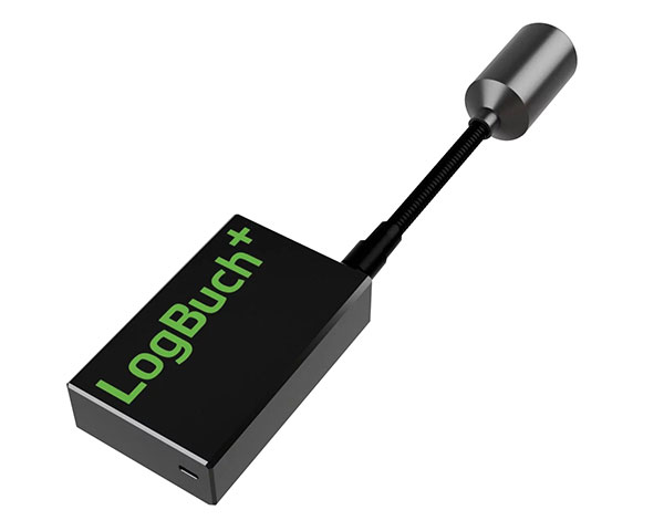
The wireless GNSS amplifier LogBuch+ increases the accuracy of location data with the cloud-based LogBuch application. The app enables voice-based digital mapping via a smartphone app, such as for the maintenance of trees. The compact device receives satellite signals on several radio frequencies, delivering significantly more precise data than a smartphone alone. Foresters can carry the GNSS amplifier in a pocket and digitally mark trees for felling using the LogBuch app.
The YellowScan Explorer lidar can be mounted on a light manned aircraft or helicopter, as well as a UAV platform such as the DJI M300. This versatility allows the end user to tackle a wide range of projects with the same unit. It uses an Applanix APX-20UAV GNSS/inertial solution and has a precision of 2.6 cm and an accuracy of 2.2 cm. Its high-power laser scanner can catch points up to 600 meters away. Flight operation speed is 5–35 m/s; it is capable of above-ground-level altitude up to 300 m. The low-weight unit (2.3 kg without battery) can be combined with YellowScan’s suite of software to extract and process point cloud data for surveying, forestry, environmental research, archaeology, industrial inspection, civil engineering and mining sectors.
The DJI Mavic 3 improves on its predecessor with better sensors, a dual-camera system, omnidirectional obstacle sensing, smarter flight modes and longer flight times. A powerful positioning algorithm improves hovering precision with signals from GPS, GLONASS and BeiDou satellites, enabling the drone to lock onto multiple satellite signals faster. The increased positioning precision also makes the drone less likely to drift in the air and more stable when shooting long exposures and time lapses. The Advanced Pilot Assistance System (APAS) 5.0 combines inputs from six fish-eye vision sensors and two wide-angle sensors to sense obstacles in all directions and plan safe flight routes.
Conduct missions, manage fleets and view video feeds
Photo: SkyGrid
SkyGrid’s autonomous remote UAV operations solution enables drone operators to remotely conduct missions, control flights, manage fleets and view live video feeds. Using artificial intelligence and airspace-related data feeds, SkyGrid enables safe remote operations, whether conducting routine inspections or generating optimal flight paths. Advanced route generation capabilities create the safest route for each drone based on the flight plan, environmental conditions, the vehicle’s performance, and the mission criteria with minimum on-site support required. SkyGrid Launch allows video feeds from drones to be consolidated to a remote central location, such as a ground station.
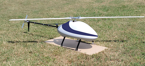
The Sicura EG-1100 is a heavy-lift, long endurance, single-rotor helicopter. Now in its third generation, the helicopter can haul 15 pounds. It cruises at 55 knots. The EG-1100 is available in both electric and gas engine configurations, with an endurance at 3.5 hours on gasoline and 1 hour on electric power. The new gas engine is the high-performing and efficient Skypower 110, tuned to the craft’s internally developed chassis and rotor blades. It offers stable performance in challenging environmental conditions, exceptionally stable flight and immediate flight response for image capture and lidar operations. Multiple payload sets can be carried in one flight.
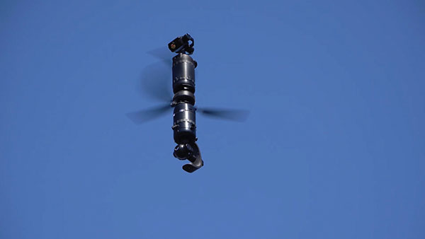
The Spirit dual-rotor coaxial unmanned aerial system (UAS) is a versatile and durable system for mission-critical operations. Combined with a fully modular, plug-and-play payload design, the Spirit’s open architecture allows operators to easily add or upgrade software to unlock new operating capabilities without the need to design or develop a new aircraft. It has an all-weather airframe. With nearly 10 pounds available for batteries and payloads, Spirit sets the new standard for performance in its weight class. Setup is quick and easy, allowing for takeoff from any type of terrain. The highly streamlined all-weather airframe has a top speed of 60 miles per hour and can operate in high winds. Payloads and batteries can be mounted or stacked on the top or bottom point.
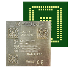
Nestwave is collaborating with Sequans to deliver accurate and efficient GNSS positioning for low-power internet of things tracking
The Nestwave IP provides the latest Sequans LTE-M/NB-IoT platform with geolocation. (Photo: Sequans)
Nestwave has announced that its technology has been selected by Sequans Communications S.A., provider of 5G/4G cellular internet of things (IoT) connectivity solutions. Specifically, Nestwave’s technology will add GNSS positioning to the Sequans Monarch 2 LTE-M/NB-IoT platform.
Integrated into the Sequans Monarch 2 GM02SP module, the Nestwave GNSS solution offers Sequans’ IoT customers accurate positioning with ultra-low-power consumption while minimizing component count, cost and size by removing the need for an external positioning chipset.
This makes the Sequans platform suitable for a wide variety of intermittent, power-limited tracking use cases including personal trackers, parcel and pallet location, and fleet trackers, as well as car, bike and scooter location and theft recovery. Cosmo Connected, a leader in urban mobility solutions, has already adopted the Monarch 2 GM02SP solution to reduce the cost and power consumption of its tracker products.
Nestwave’s technology allows geolocation to be added to existing IoT chipsets by implementing a GNSS receiver using the chip’s existing radio and computing capabilities. This eliminates the need for an external GNSS chipset and product redesign.
“Nestwave’s technology provides the smallest, most power efficient, and lowest component count solutions for IoT geolocation,” said Nestwave CEO Ambroise Popper. “Our strategic partnership with Sequans addresses the challenge of integrating accurate geolocation into compact, often battery-powered, low-cost IoT nodes and allows Sequans customers to benefit from higher performing, lower cost tracking solutions.”
“Leveraging Nestwave’s innovative technology to provide low-power GNSS on Monarch 2 widens its capabilities and makes many types of IoT tracker use cases more affordable because there is no need for additional positioning chips or modules,” said Georges Karam, Sequans CEO.
Nestwave IP has been integrated into a variety of chip architectures and on various DSP/CPU cores. In combination with Nestwave cloud services, this IP enables a very short time-to-first-fix, which allows for much lower power consumption in tracking use cases, without compromising on sensitivity or accuracy. The company’s technology roadmap includes the addition of 5G/4G cellular-based hybrid location functionality and solutions that will improve the accuracy of indoor tracking.