Latest advancement from Skydel uses software-defined advantages to deliver real-time performance
The Skydel Real-Time Performance graphs illustrate the software-defined engine’s low latency during a GNSS simulation. (Screenshot: Orolia)
Orolia has announced the launch of its Real-Time Performance capability, which achieves an ultra-low latency of five milliseconds. The feature will be standard on all Skydel-powered GNSS simulators.
Skydel is a software-defined simulation engine that powers Orolia’s advanced GNSS simulators including its BroadSim (available via Orolia Defense & Security) and GSG product lines.
“Skydel is known by users for its intuitive nature and ability to be quickly redeployed for a variety of projects,” said Tim Erbes, director of engineering for Orolia Defense & Security. “Delivering Real-Time Performance with latency as low as five milliseconds further shows that Orolia is a market leader empowering our customers by exceeding their expectations.”
Skydel’s software-defined architecture is designed to meet the demanding GNSS simulation testing requirements in the automotive, military, space and other high-tech industries. Skydel also supports hardware-in-the-loop simulations without sacrificing ultra-low latency and high-end performance.
The user interface has a sophisticated dashboard showing Real-Time Performance graphs. The tool enables users to grade the simulator’s performance, interpret data, diagnose inefficiencies, and optimize scenarios on the fly. In a video tutorial, Orolia demonstrates how the simulation engine processes data and how easy it is to read the graphs through its visualization and precise indications. As the system reaches its limits, it remains stable and fully operational, preserving the integrity of the simulation.
Erbes said the Real-Time Performance graphs not only instill confidence in the simulator, but also allow for better integration in the testbed.
“For example, instead of just hoping their hardware-in-the-loop configuration is working, users can view the real-time data and see that low latency is being maintained,” he said. “This feature provides enhanced visibility not only into the performance of the simulation, but also into the reliability of the hardware-in-the-loop integration, resulting in a more robust solution. This is critical when generating complex environments with high dynamics, jamming, spoofing, repeating, and alternative PNT sensors.”
There is a lot of UAV action taking place this month. An anti-drone defensive system is being trialed by the U.S. Department of Homeland Security (DHS). DJI drones get the green light again for use by government agencies. The U.S. Navy/Boeing refuel an F/A-18 aircraft using a drone, and the Mars helicopter drone has a non-fatal in-flight problem.
DJI drones cleared for government use
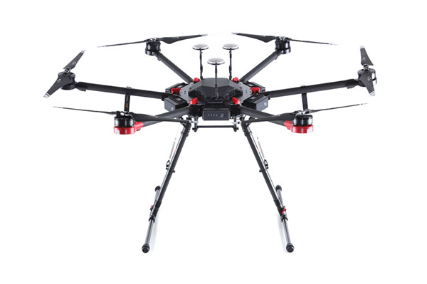
There’s good news for operators who might have been scared away from using drones manufactured by Chinese company DJI. Two “government” models have now been cleared by the Pentagon for use by agencies who had previously been instructed to cease and desist operating them. The Matrice 600 Pro and the Mavic Pro government models were cleared, because “no malicious code or intent” was found. These types of drone are now “recommended for use by government entities and forces working with U.S. services.”
DJI Matrice 600 Pro (Photo: DJI)
The drones have been modified from standard models to provide a customized control application, prevent automatic software updates being applied without user approval, and implement an operational control-zone capability.
The U.S. Interior Department was behind the modifications, with the objective of resuming use of its grounded fleet of more than 500 DJI drones. They may need them again soon for forest-fire monitoring — it’s the season again. Allegations of potential “sharing of data” with the Chinese government were previously investigated and apparently debunked by Booz Allen Hamilton, in a report released in June 2020. Now the Pentagon seems to affirm these earlier findings.
Nevertheless, DJI remains on the Commerce Department’s don’t-buy list, and the Justice Department has banned agencies from buying foreign drones that could be vulnerable to tampering with data, or otherwise might be a threat to the U.S.
DHS trials anti-drone system
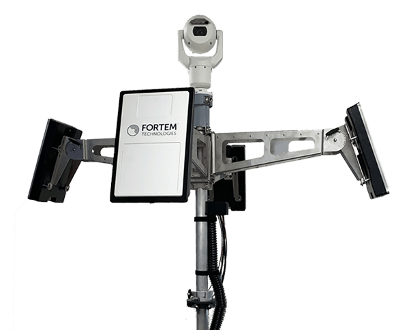
In recent “bad-drone” incidents, people have tried to smuggle contraband into prisons, flown into landing flight paths at airports, and even successfully inflicted significant damage on oil storage facilities in Saudi Arabia — never mind a failed assassination attempt in Venezuela. And with illegal immigration and drug smuggling becoming crisis issues, DHS has decided that its probably time to build a level of protection at U.S. borders. A trial is now scheduled at the quieter and more orderly Canadian border so that DHS can fully focus on evaluating the Fortem SkyDome system.
TrueView radar detects and calculates the location and trajectory of hundreds of airborne objects quickly and accurately. (Photo: Fortem Technologies)
Bad actors attacking a facility using a drone, sometimes with explosives strapped to it, have set their target as a waypoint and switched off the radio control link. The drone then carries on to its target, without fear of radio “sniffer” detection systems picking it up and jamming the control link.
Fortem built a drone defense system that uses radar for “RF silent drone” detection. Not only does the Fortem SkyDome system detect unwanted intruder drones, but it also can send out a DroneHunter UAV which hones in on and fires a net to capture, immobilize and bring back the offending drone so the defenders can investigate the attack.
Boeing UAV refuels F-18 fighter aircraft
Boeing is engaged in development of an unmanned tanker vehicle for the U.S. Navy. The company has built and flown the first test drone, known as Stingray MQ-25 T1. Boeing has another seven unmanned refueling tankers on order. T1 is the first test article for the program. Following a number of successful initial handling, control and envelope extension test flights — including several with the Navy refueling pod installed under the T1 left wing — fuel was loaded, and on June 4, a Navy F/A-18 Super Hornet fighter aircraft accompanied the T1 into the air on another test flight.
T1 Stingray refuels a Navy F/A-18. (Photo: U.S. Navy/Boeing)
The F/A-18 flew close to and maneuvered around the drone for some time, and when the pilot and test managers concluded that both were in joint, controlled, stable flight, the MQ-25 was commanded to extend the refueling pod hose and drogue. The F/A-18 normally refuels in the air from another F/A-18 configured with the same refueling pod and refueling boom, so the actual transfer of fuel which then took place was somewhat commonplace for the F-18 pilot, save that the slipstream buffet was probably less significant. Nevertheless, this was the very first time that a Navy aircraft has been refueled by an unmanned aircraft.
After further MQ-25 T1 test flights, the tanker-drone will be transported to Norfolk, Virginia, for deck handling trials aboard a U.S. Navy carrier later in the year. The MQ-25 Stingray is planned to take over this airborne refueling work which is currently handled by other F/A-18s, freeing up the fighter aircraft for operational fighter missions.
Mars drone flight experiences navigation anomaly
On May 25, the Mars drone Integrity had been commanded to take its sixth longer, higher flight. Like a good little tech package on the end of a 220-million-mile distant signal, Integrity did as it was told. However, after around 490 feet in the Mars atmosphere, Integrity started to change speed and dramatically oscillate back and forth. Even so, the UAV managed to complete the transit to within about 16 feet of the new intended parking spot.
NASA analyzed the data sent back from the drone through the Perseverance rover. NASA discovered that the flow of images from the navigation camera had been disrupted by a missing image, and the time-stamps for the images had become incorrect.
Integrity sits safely on Mars following an in-flight anomaly. (Photo: NASA)
Integrity’s navigation system is fed by an inertial measurement unit with images from the nav camera, so the time-stamp discrepancies between what the camera was saying and what the IMU was saying gave it an unforeseen issue to resolve. The resultant bucking in flight was an effort to resolve the data time differences. Images are not used in the landing phase, so the oscillations ceased as the rover descended, and the landing was as graceful as usual.
Fortunately, it appears that Integrity has not been damaged, and NASA is working to send the little drone on further scouting missions for its companion rover. NASA’s website indicates that the drone should have flown again on June 6, but right now there doesn’t seem to be any further evidence that a flight did or did not take place.
Summary
The testing that the Pentagon has done on a couple of models of DJI drones appears to have cleared them of possible malfeasance, but otherwise the report is classified. I wonder what secret science DOD used to detect/eliminate possible illicit communications with China by the drones? And it’s high time everyone realized that these “drone -thingies” can also be used to hurt us — as new technology in the hands of people who do not wish us well almost always can.
This month I discovered that Navy F/A-18s could fly further by hanging refueling pods on other F/A-18s, thereby taking the tanking aircraft out of the regular training and combat rotation. I’m glad we’ve got a drone alternative coming that must cost a lot less and also will free up fighting assets.
Finally, it doesn’t seem that we have to worry the Mars helicopter is too broken to keep seeking the best route for the rover. There were enough margins in the navigation algorithms that the little guy didn’t wreck when the image processing hiccupped. Let’s get flying again, NASA!
While GPS will always be an integral and irreplaceable part of positioning, navigation and timing (PNT) technology, assured PNT must take a layered approach for true resiliency.
A GPS World webinar sponsored by Spirent Federal Systems will explore this topic. Registration is now open for the free webinar, which will be held June 24.
Join experts from Spirent and Northrop Grumman as they examine
the future of inertial navigation in assured PNT and GPS augmentation
EGI-Modernization
coherent GNSS and inertial sensor emulation
exploring and simulating emerging alternative space-based PNT RF signals.
Expert presentations will be followed by a question-and-answer session; questions will be accepted both before and during the webinar.
To register for the webinar, visit this link. Registration is free.
Date: Thursday, June 24, 2021 Time: 1 p.m. EDT / 10 a.m. PDT / 7 p.m. (1900h) Central European Time Duration: 60 minutes + extra time for Q&A Sponsored content by: Spirent Federal
Jennifer Smith joined Spirent Federal in 2004. Jen has responsibilities in business development as well as in general operations. She has experience in project management and contract negotiations.
Smith has a B.A. and a J.D. and is a member of the Utah Bar Association.
Naveen Joshi leads the Strategy and Business Development for Northrop Grumman’s Navigation and Integrated Cockpit business. He sets product strategy, shapes technology roadmaps, and advises Northrop Grumman leaders on the application of PNT technologies. His previous roles at Northrop include program director, program manager, engineering manager and various roles in engineering.
Outside of Northrop Grumman, Joshi held roles in management consulting and eCommerce, and ran an entrepreneurial venture.
Joshi earned a bachelor’s degree in computer science from Cornell University and an MBA from UCLA’s Anderson School of Management.
Mark Holbrow’s 30-year professional career has concentrated on the innovative design, development, and successful commercialization of electronic test equipment.
In his current role, he is responsible for the technical team management, new product design, and future direction of Spirent’s portfolio of world-leading positioning, navigation, and time (PNT) test solutions.
Holbrow has a passion for the sometimes overlooked discipline of “test methodology” and thoroughly enjoys the technical and business development demands required to identify, and innovatively solve, complex test challenges.
Roger Hart joined Spirent Federal in 2015. Roger has responsibilities in engineering development and support, sales and customer training. He has worked in development of spacecraft navigation systems, including GPS, for civil, NASA and defense applications since 1986.
Hart has a Bachelor of Arts in physics and Master of Science in mechanical engineering (space track) from Utah State University.
To register for the webinar, visit this link. Registration is free.
Geoflex, a geolocation company, won the Jury Award of SPRING 50, a competition of deep tech startups that took place on May 20 in Paris-Saclay, the largest French research cluster, located south of Paris.
Geoflex is a cloud service operator that enhances GPS/GNSS-based applications to provide 4-centimeter positioning on land, at sea and in the air.
Geoflex was initially selected among the 10 most promising companies within the 50 startups promoted at the event. All 10 startups founders were subsequently showcasing their companies in a 4 minutes pitch, and Geoflex’s CEO Romain Legros won this last leg of the competition.
Geoflex’s hyper-geolocation service has been available globally since 2018. The service, which corrects inherent GNSS inaccuracies, is provided in real time or in post processing. It works across all types of GNSS hardware receivers and includes correction data for all constellations: GPS, GLONASS, Galileo and BeiDou and for all their frequencies.
The technology was initially developed by the French space agency CNES in a 12-year research project. It is protected by seven patents licensed to Geoflex, which continues co-development of the technology with the CNES.
Geoflex also has developed a positioning engine that includes sensor fusion with other technologies such as inertial, optical and communications. A hardware development kit is available.
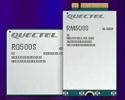
Quectel Wireless Solutions, a global supplier of modules for the internet of things (IoT), has announced the release of two new 5G New Radio (NR) module series, the RG500S and RM500S.
Based on the new Qualcomm 315 5G IoT Modem-RF System, both modules can support customers in building dedicated 5G devices for a variety of verticals including industrial IoT, retail, smart energy, private 5G networks, and many others.
The RG500S and RM500S both integrate a multi-constellation GNSS receiver, which simplifies the product design and provides accurate positioning services for users.
Utilizing the powerful Qualcomm 315 5G IoT modem, the RG500S and RM500S support extended-life software maintenance, helping create long-lasting IoT devices for the duration of their life span. Offering seamless integration, the RM500S is pin-to-pin compatible with Quectel’s LTE Cat 4 module EM05, Cat 6 module EM06, Cat 12 modules EM12-G/EM12xR-GL, Cat 16 module EM160R-GL and 5G module RM500Q, which provides more competitive 5G solutions to the IoT market. These features will help accelerate the 5G IoT market in the industrial and consumer IoT segments with use cases across robotics, automation, intelligent manufacturing, energy distribution, precision agriculture, construction, and mining.
Photo: Quectel
The RG500S and RM500S modules support 5G NR sub-6GHz bands in stand-alone mode offering backward compatibility with LTE networks. With network slicing in stand-alone mode, the two modules are able to offer end-to-end traffic isolation for critical traffic, guaranteed data rates and bandwidth, and lower latency than in non-standalone mode, which meets the demands of ultra-reliability and service-level agreements of typical industrial and enterprise scenarios.
The two modules are embedded with rich interfaces and incorporate high-speed USB 3.0/3.1, PCIe 3.0, U(SIM), RGMII and more, making them suitable for diversified industrial and consumer 5G applications such as industrial routers, robots, automation, intelligent manufacturing, smart cities, energy distribution, precision agriculture, construction and mining.
“Quectel has long been collaborating with Qualcomm Technologies to support the enablement of the 5G market in IoT,” said Patrick Qian, CEO, Quectel. “Based on the latest Qualcomm 315 5G IoT modem, the RG500S and RM500S are able to offer greater possibilities for the industrial and commercial IoT verticals. Features such as high performance and low latency as well as extended life software maintenance address the existing IoT market needs and can power a range of new 5G IoT use cases.”
“The Qualcomm 315 5G IoT modem solution was introduced to stimulate and scale the 5G IoT industry and enable the transitions needed to make 5G for IoT a reality. This solution is pin-to-pin compatible with legacy modules, which can accelerate device development and commercialization and promote growth and expansion in the 5G IoT industry. Integrating Qualcomm Technologies’ purpose-built modem into Quectel’s RG500S and RM500S modules will help deliver 5G to the IoT industry across industrial and enterprise applications,” said Jeffery Torrance, senior vice president, product management, Qualcomm Technologies.
Javad GNSS has launched its TRE-3S GNSS OEM board. It measures 100 x 80 mm, weighs 87 g and tracks 874 channels with all-in-view satellite tracking. At the heart of the board is the company’s new Triumph-3 chip.
The board also includes numerous features to protect against interference and improve the signal output. These features include spectrum data output, spoofing detection, advanced multipath reduction, in-band interference rejection, GLONASS .2-mm dynamic calibration, heading determination, attitude determination and fast acquisition channels.
The TRE-3S receives:
GPS L1/L2/L2C/L5
Galileo E1/E5A/E5B/AltBoc/E6
GLONASS L1/L2/L3
BeiDou B1/B1C/B2/B3
QZSS L1/L2/L5/L6 (L61/L62)
SBAS L1/L5
The board has a 20-Hz update and real-time kinematic (RTK) rate for real-time positioning and raw data (code and carrier).
Optional features include tracking QZSS L6 (LEX) and IRNSS L5/S-band, and a data update rate and RTK rate of 100 Hz. Finally, a conformal coating can be provided.
Javad GNSS is offering a special in which customers who purchase the board can receive a second board and an evaluation kit for free. This way, customers can use one board for system integration in the field, and the other with the evaluation kit in the office or lab for testing and development.
For full specifications of the TRE-3S, see this page.
The M9708CWT-UFL from Maxtena is an active multi-frequency, high-accuracy, GNSS antenna for the L1/L2/L5 GPS, Galileo, Beidou and GLONASS bands. The antenna is designed for applications requiring greater accuracy than L1-only antennas can provide.
The antenna’s excellent radiation pattern, exceptional out-of-band rejection, minimal group delay variation, and low noise figure ensures optimal performance of GNSS systems, according to Maxtena.
The M9708CWT-UFL is designed for applications requiring minimal integration effort or for retrofitting existing products. The antenna is mounted on the inside of the application’s housing, allowing it to be hidden. The antenna element is custom tuned to the enclosure.
Features of the M9708CWT-UFL:
Low profile design
Concurrent GNSS reception on:
L1: GPS, GLONASS, Galileo, Beidou
L2: GPS L2C, Galileo E5B, and GLONASS L3OC
L5: GPS L5, Galileo E5A
Small form factor
GIS, RTK and other high-accuracy GNSS applications
Low power consumption
Minimal phase-center variation over azimuth and elevation
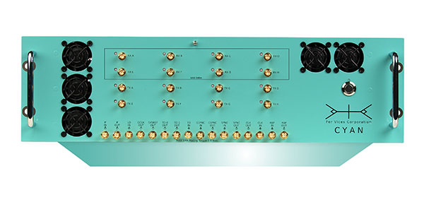
Per Vices Corp. has launched an upgraded version of its high-performance software-defined radio (SDR) platform Cyan EC (extended channel).
Cyan EC enables up to 64 digital signal processing (DSP) channels across 16 physical SMA ports. This extension allows Cyan EC users to break up the one large bandwidth physical chain into multiple digital channels, allowing the radio platform to do the multiplexing.
By providing additional digital chains, which are coherently superimposed into a single physical channel, the computational complexity required to address wide bandwidths is further reduced, and allows for processing over multiple cores on a single host system or across multiple host systems concurrently.
“We are excited that customers have already used and integrated our platform into their products,” said Victor Wollesen, CEO of Per Vices Corp “The additional processing capability provided by this option allows our customers to improve performance and implement more advanced applications using existing computational resources. I believe Cyan EC is the highest channel count software-defined radio commercially available.”
The Cyan EC product option enables engineers and system integrators to realize the benefits of both the high-bandwidth SDR and having more independent channels to ease the complexity associated with processing the high amount of data by breaking it up into separate channels. This further helps to achieve better spurious-free dynamic range (SFDR), sensitivity and signal-to-noise ratio (SNR) while continuing to offer a high throughput SDR solution.
Cyan EC benefits engineers and integrators across different markets including GNSS/GPS, radar systems, magnetic resonance imaging (MRI) receivers and exciters, and spectrum monitoring, as well as test and measurement.
A Top Canadian Defense Company
Image: Canadian Defence Review
Per Vices Corp. has been named one of the Top Defence Companies in Canada for 2021 by Canadian Defence Review, a defense and military magazine. A new inclusion to the list for 2021, Per Vices specializes in software-defined radio (SDR) solutions that are integrated into radar, GNSS/GPS, satellite, aerospace and communications systems.
The company is growing and expanding its operations and product line to satisfy the stringent and advanced requirements of its clients and their applications.
“We are incredibly honoured to be added to this list,” said Brandon Malatest, COO, Per Vices Corp. “This shows recognition and support for high performance manufacturers and companies that are bringing innovative solutions to the table, both within Canada and internationally. We offer the best software defined radio solutions commercially available and work closely with our customers to solve challenges for mission critical applications.”
The 100 companies, which must have manufacturing, R&D or service operations in Canada, are evaluated by Canadian Defence Review editorial staff and independent advisors. They are ranked on factors such as economic impact to the country, research and development initiatives, innovation, contribution to the nation’s security, and contract wins. The list is used to showcase Canadian technological innovation and its defence industry.
A roundup of recent products in the GNSS and inertial positioning industry from the May 2021 issue of GPS World magazine.
OEM
GNSS/LTE Antenna
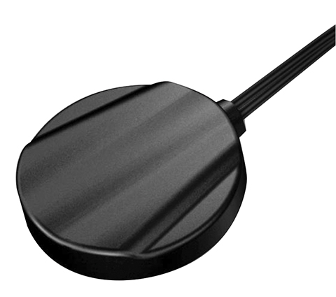
Low profile for covert installations
Photo: Maxtena
The MEA-GNSS-LTE-MM is a two-in-one low-profile antenna solution that combines GNSS and LTE antennas in one. It is suitable for asset tracking as well as industrial and internet of things (IoT) applications. The antenna offers an ultra-low profile rugged IP67-rated design with a magnet mounting and customizable cables and connector options. The small size makes it a desirable solution for covert installations.
The NCS Nova GNSS simulator now fully supports the simulation of Galileo Open Service (OS) signal improvements based on the new Galileo OS SIS ICD V2.0. The NCS Nova GNSS simulator is a high-end, powerful and easy-to-use satellite navigation testing and R&D device, the company said. It is fully capable of multi-constellation and multi-frequency simulations for a wide range of GNSS applications. It provides multiple GNSS frequencies in one box. A key enhancement to the NCS Nova GNSS simulator is comprehensive support of new Galileo OS signal message improvements on E1B. By enabling real-time simulation of the Galileo OS message improvements, the NCS Nova GNSS Simulator expands the user’s Galileo signal capability.
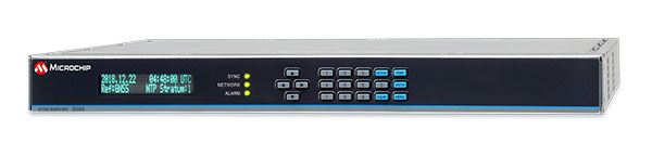
The SyncServer S600 Series network time server and instrument is now integrated with BlueSky technology signal-anomaly detection software. With the upgrade, the SyncServer S600 Series now provides GPS jamming and spoofing detection and protection, in combination with local radio-frequency data-logging and analysis. The Stratum 1 instrument continuously monitors local GPS constellation health and examines GPS and local RF signal integrity to assure validity. If an anomaly is detected, the solution sends an alarm and, if necessary, the SyncServer instrument can be shifted to alternative time sources or an internal oscillator. This protects ongoing timing outputs while ensuring only minimal, predictable timing degradation to vital network and business operations in applications ranging from banking and stock trading to electric utilities and aerospace and defense.
Microchip Technology, microchip.com
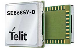
L1+L5 receiver
Provides fast updates, multipath resistance
Photo: Telit
The SE868SY-D is a multi-frequency, high-precision GNSS receiver module for applications that require high accuracy, fast updates, multi-constellation support and multipath resistance. At 11 x 11 mm, the SE868SY-D accommodates ultra-compact devices and internet of things (IoT) trackers. Available now, the high-precision SE868SY-D module is Telit’s first multi-frequency, multi-constellation GNSS receiver module, featuring an ultra-sensitive -167 dBm (tracking) RF front end. By using both the L1 and L5 bands, the SE868SY-D supplies a higher location accuracy than single-frequency devices, even in high-multipath environments such as urban canyons.
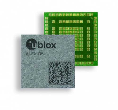
The ALEX-R5 miniature cellular module integrates low-power wide-area connectivity and GNSS technology into an ultra-small system-in-package (SiP) form factor. It is based on the secure UBX-R5 LTE-M/NB-IoT chipset platform with out-of-the-box Secure Cloud functionality and the u‑blox M8 GNSS chip for location accuracy. It has a 14 × 14-mm footprint and 23-dBm cellular transmission power, enabling devices to operate effectively in all signal conditions. A dedicated GNSS antenna interface enables independent, simultaneous operation of the u‑blox M8 GNSS chip. The ALEX-R5 is suitable for wearables and connected medical devices.
The TSC5 is a rugged, lightweight field data controller for land construction and surveying. Its backlit alphanumeric keypad is usable while wearing gloves. The battery provides all-day power on a single charge, with an optional external battery nearly doubling the power for extended use. It has a lightweight, ergonomic design and is suitable for rugged environments, with resistance to shock, dust and water. Running on the Android 10 operating system, the TSC5 is fully integrated with Trimble Access 2021 Field Software and Siteworks Software as well as Trimble Forensics Capture. The EM100 Empower module provides GNSS connectivity.
INSITE is a comprehensive cloud-based platform that enables users to more efficiently manage geospatial data, from acquisition to delivery. With applications designed for electric utilities, telecommunications and governments, INSITE provides tools to support the entire geospatial data lifecycle — project tracking, data collection and delivery, quality control, on-demand reporting, analytics and enterprise integration. INSITE enables users to import, search, analyze, manage, integrate and export all types of geospatial data and multimedia. As a cloud-based platform, INSITE improves speed and efficiency, minimizes storage expenses and supports greater collaboration.
The Surfsight AI-12 camera solution is designed to help improve fleet safety through its continuous recording and advanced machine vision (MV) and artificial intelligence (AI) technology. Offered by Lytx, it integrates with Geotab’s telematics platform to provide fleets with insight into driver behavior through a combination of MV+AI, sensors, and live video streaming. The Surfsight AI-12 provides distracted driving detection, audio and visual alerts and the ability to connect auxiliary cameras. Its MV+AI technology can help identify risky driving behaviors including smoking, eating and drinking, handheld device use, unbelted driver and distracted driver. When connected with Geotab’s GO9 device, it can also capture video evidence of sudden acceleration, sharp turns and harsh braking. Through access to these insights, fleet managers can help prevent avoidable accidents and reduce the likelihood of driver or pedestrian injury, insurance claims, maintenance costs and downtime.
Suitable for rolling stock, automotive and heavy-duty applications
Photo: Eurotech
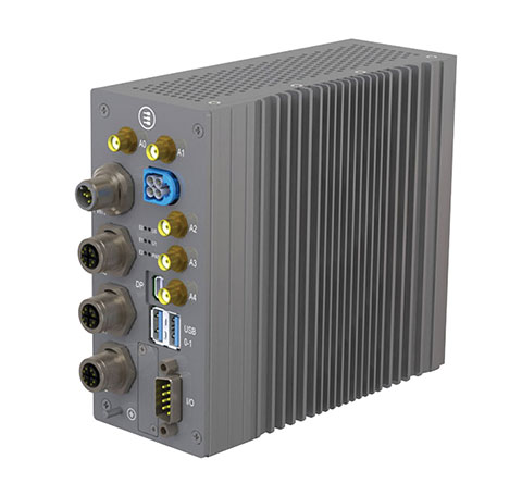
The BoltGPU 10-31 is a GPU-accelerated subsystem for machine vision and artificial intelligence (AI) applications at the edge and on vehicles. The BoltGPU 10-31 provides multi-constellation GNSS with untethered dead reckoning for geolocation. A factory option for high-precision real-time kinematic (RTK) GNSS is available. It also has Wi-Fi 6, Bluetooth 5.1 and option for LTE cellular. It is powered by NVIDIA Jetson Xavier NX and combines a 6-core, high-performance ARM CPU with a 384-core GPU and 48 Tensor Cores, offering power efficiency and accelerated computing. The rugged, fanless unit allows for simultaneous execution of neural models and the processing of multiple high-resolution, high-frame-rate sensors, even in harsh environments.
High-frequency change management for map platforms
Screenshot: Carmera
Carmera’s Change-as-a-Service (CaaS) uses consumer-grade cameras from its fleet partners and customer vehicles to detect and log changes, reducing the cost of map maintenance. With a network of commercial fleet–mounted visual probes, it overcomes the problem of GPS canyons in urban areas using a blended algorithm to localize its auto-based probes with pinpoint accuracy. CaaS is designed to be an add-on to existing map systems (both HD and SD), and will identify, analyze and localize both road inventory changes and traffic-impacting events, such as construction. A live sandbox has launched in the San Francisco-Silicon Valley area for companies to test the CaaS technology on real urban and suburban streets.
Parkopedia is designed to address challenges in navigating indoor parking facilities: system blackouts, finding a vehicle within large parking facilities, and locating services such as EV charging stations. Parkopedia provides indoor maps based on high-definition 3D models of indoor parking facilities for in-vehicle navigation. Parkopedia technology can also be used for automated valet parking. Its proprietary SLAM system integrates lidar, IMU, GNSS and high-resolution imagery.
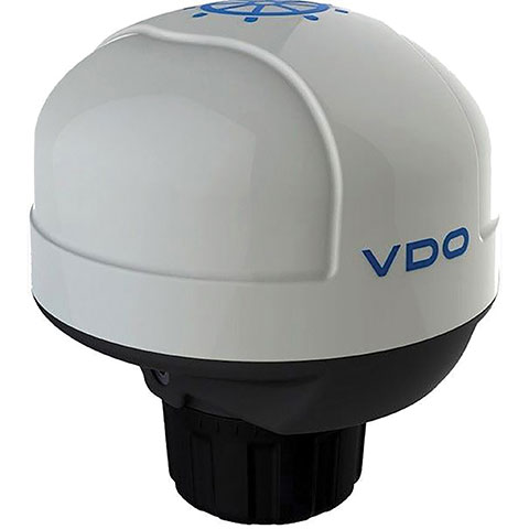
The Acqualink NavSensor can be used with any multifunction N2K-networked multifunction display. Its GPS receiver module provides position, speed and vector data, and UTC time. The inertial sensor delivers pitch and roll data. An integrated fluxgate compass with a +/- 40° tilt angle delivers course heading and the information needed by a networked autopilot to stay on course. Built-in barometer and air temperature sensors offer indicators of impending weather changes. The radome has an IPX6 extended protection rating. It is powered by the NMEA network and operates between –4° and 158° F.
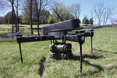
The Periscope tactical-grade UAV provides efficiencies in flight time, endurance and payload capacity. Designed for military and other federal government customers, the high-performance UAVs accomplish mission-critical tasks with speeds of up to 100 mph. They are optimized for specific mission requirements including tactical resupply, remote communications, and enhanced C4ISR. In September, Periscope Aviation won a contract to deliver prototype Tactical Resupply Unmanned Aircraft Systems (TRUAS), which the U.S. Marine Corps will field test at Yuma Proving Grounds this year. The UAVs will fly 60–90 pounds of cargo to locations 10–20 kilometers away, delivering supplies such as food, water, fuel and ammunition to marines on the front line.
The Fixar 007 is a vertical takeoff and landing commercial drone with primary application in the mapping and surveying, monitoring, mining, oil and gas, energy and agricultural sectors. The intuitive approach to working with its ground control station simplifies use (flight preparation is estimated to take only 5 minutes). With inertial orientation, the Fixar 007 can work stably under magnetic anomalies and in the event of satellite loss. A wide range of modifications is available. The Fixar 007 uses a closed, specially designed hardware and software system that guarantees security of information. The applications and UAV use a special communication protocol that eliminates control interception.
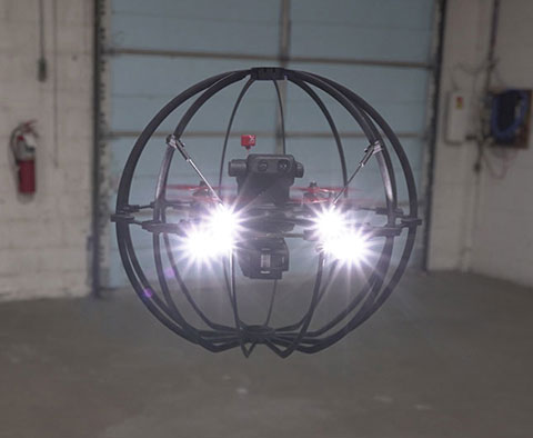
Skycopter is a ready-to-fly UAV designed to work in extreme conditions and tight spaces. The drone is enclosed and protected by an external ultra-light and ultra-resistant cage to ensure safety and avoid damage to inspected structures and to the airframe itself. The Skycopter‘s tiltable camera can record 1920 x 1080 video at 60 FPS while sending latency-free images to the ground in 5.8 GHz for first-person view on a display or (optional) high-definition goggles. It uses an ultra-bright LED system for applications in complete darkness. The Skyloc real-time location and monitoring system provides control and tracking with high accuracy in indoor scenarios or where GPS is not available.
The non-ITAR status greatly increases the marketability of the SDI500/SDI505 IMUs to international customers. Plus, Emcore releases new SDI170 IMU and is awarded defense contract.
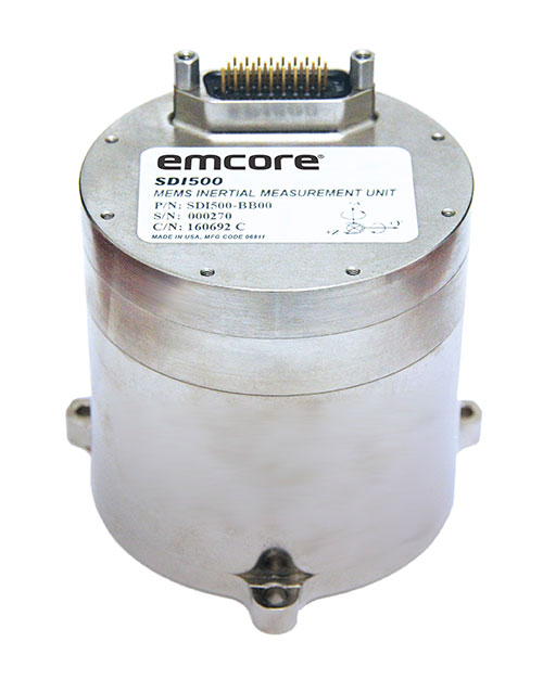
Emcore’s dual-use SDI500/SDI505 Revision F inertial measurement units (IMUs) have received a determination that they are not subject to the International Traffic in Arms Regulations (ITAR) administered by the U.S. Department of State. Emcore has likewise determined that its SDN500 inertial navigation system (INS) is not subject to ITAR.
The determination of non-ITAR status is expected to dramatically increase the size of the market that Emcore can address with its quartz micro-electro-mechanical systems (QMEMs) IMU and INS devices.
Photo: Emcore
Ranked Top in Trade Study. The SDI500/505 IMU was ranked first in overall accuracy, reported Emcore, in a U.S. military-commissioned trade study of 19 IMUs being evaluated as an alternative to the Honeywell HG1700 for various weapons systems.
The objective of the third-party independent study was to deliver a comprehensive report to the government and make a recommendation supported by clear and compelling technical, financial, and other relevant data collected regarding the most advantageous IMU products and services available in the market today. 19 IMUs of various technologies, complexity, cost, and developmental status, from leading manufacturers, were evaluated in short and long flyout simulations against the HG1700.
The dual-use non-ITAR SDI500/505 IMUs are designed to achieve the demanding performance levels required in sophisticated systems, including weapons guidance and targeting, commercial and defense fixed-wing aircraft and helicopters, unmanned autonomous vehicles (UAVs), and a wide variety of other high-precision commercial, industrial, marine, defense and space applications. They leverage quartz MEMS technology to deliver angle random walk (ARW) values of 0.02°/√hr with 1°/hr bias stability.
Defense Contract Award. In March, Emcore was awarded a development contract valued at $1.1 million by a major U.S. prime contractor to design and manufacture a high-end IMU for tactical intelligence and reconnaissance systems. The prototype phase has been successfully completed and as part of the contract in this follow-on phase, Emcore will deliver initial production units that will be used for proof of manufacturing and system level qualification.
The custom IMU will be based on Emcore’s proprietary closed-loop fiber-optic gyro (FOG) technology that delivers proven CSWaP (cost, size, weight and power) and performance advantages over other FOGs and competing technologies. It is designed to deliver the highest level of performance in Emcore’s tactical IMU product line, exceeding Emcore’s EN-300. Emcore’s FOG IMU technology delivers ten times the bias performance of legacy systems in compact form-, fit- and function-compatible packages.
New SDI170 IMU. Emcore also launched a replacement IMU. The new SDI170 quartz MEMS tactical-grade IMU is designed as a form-, fit- and function-compatible replacement for the HG1700-AG58 ring-laser gyroscope (RLG) IMU, but with superior overall performance, versatility and a significantly higher mean time between failures (MTBF) rating over ruggedized environments.
The SDI170 IMU is suitable for continuous-use applications with no wear-out components and delivers highly linear accelerometer performance and longer life compared to the HG1700 IMU. It is not ITAR controlled and has completed extensive internal and external customer testing to confirm compatibility to replace legacy products.
The unit is designed for a wide range of high-precision, integrated commercial and defense applications including aircraft Attitude Heading Reference Systems (AHRS), GPS-aided navigation, ground surveying, mobile mapping, ROVs, autonomous vehicles, tactical weapons, and stabilization platforms.
Non-ITAR Determination. As a result of this Commodity Jurisdiction (CJ) determination concluded by the U.S. Department of State, EMCORE’s SDI500/SDI505 Revision F commercial off-the-shelf (COTS) offerings were confirmed to be subject to the Export Administration Regulations (EAR) administered by the Department of Commerce (DOC). EAR classification typically results in fewer export-related restrictions and requirements. For this reason, this CJ determination for the SDI500/SDI505 will greatly increase the marketability of these IMUs to international customers.
The SDN500 is Emcore’s most advanced QMEMS INS/GPS tactical-grade system, combining the latest generation quartz gyros and accelerometers from the SDI500/SDI505, with high-speed signal processing and a 48-channel coarse/acquisition code GPS receiver into a powerful, tightly coupled guidance and navigation system.
“We would like to thank the U.S. Department of State for its evaluation of our commodity jurisdiction request and conclusion that our dual-use SDI500/SDI505 IMUs are not subject to ITAR,” said David Hoyh, Emcore’s director of sales and marketing for navigation products. “The determination of EAR status under the DOC enables more customers worldwide to benefit from these important, high-precision Emcore products.”
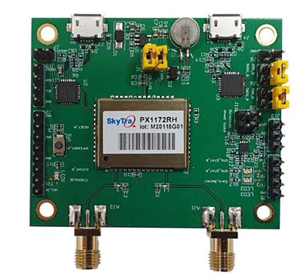
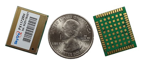
SkyTraq is offering a new multi-band, multi-GNSS receiver module for real-time kinematic (RTK) positioning and heading applications, suitable for autonomous vehicles. The PX1172RH surface-mount receiver measures 17 x 22 mm, about the size of a postage stamp.
With dual-antenna input, the PX1172RH receiver delivers sub-degree heading and pitch or heading and roll angles on top of centimeter-level positioning under both dynamic and static conditions. This removes the dependency on vehicle movement to initialize an inertial measurement unit (IMU) for attitude determination.
The PX1172RH is unaffected by magnetic surroundings and does not require calibration. It offers higher heading reliability and performance than magnetic heading sensors or single-antenna GPS sensors.
Photo: Skytraq
The PX1172RH works with dual-frequency GPS/QZSS L1/L2, GLONASS L1/L2, Galileo E1/E5 and BDS B1/B2 GNSS signals concurrently to enable robust positioning and heading performance under challenging partial-sky environments and to provide RTK convergence in seconds. The PX1172RH is suitable for autonomous precision-guidance applications.
A PX1172RH sample, datasheet and evaluation boards will be available in May, with mass production scheduled for June.
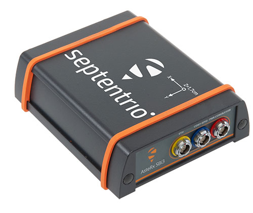
By expanding its GNSS/INS product family, Septentrio starts offering more application-specific positioning and orientation solutions
Septentrio, a leader in high-precision GNSS positioning solutions, has launched the AsteRx-i3 — a new product line of high-performance GNSS plus inertial navigation system (INS) receivers.
The AsteRx-i3 product family brings to market an array of next-generation receivers from plug-and-play navigation solutions to feature-rich receivers with raw measurement access. OEM boards are available for rapid integration as well as ruggedized receivers enclosed in a waterproof IP68 housing.
The variety of products in the AsteRx-i3 line accommodates the specific needs of applications that require high-accuracy positioning together with 3D orientation, heading, pitch and roll angles.
The AsteRx-i3 Pro+ in a rugged housing. (Photo: Septentrio)
“Using our off-the-shelf GNSS/INS systems allows our customers to focus their efforts on core technology and to reduce their products’ time-to-market,” said Danilo Sabbatini, product manager at Septentrio. “With this new generation of products, we aim to satisfy specific needs of various customers. Instead of releasing a single general-purpose product, we bring several dedicated solutions for fastest and easiest integration into systems that require robotic navigation or sensor fusion.”
AsteRx-i3 Pro+ receivers support either single- or dual-antenna modes. The single-antenna mode is suitable for compact and light-weight configurations. The dual-antenna mode reduces the need for movement during IMU initialization, allowing fully informed navigation from mission start.
The AsteRx-i3 product line includes five new GNSS/INS receivers.
The Pro receivers offer high accuracy positioning with 3D orientation and dead-reckoning functionality for fastest and easiest plug-and-play integrations.
The Pro+ are the most versatile receivers providing integrated positioning and orientation along with raw measurements, in single- or dual-antenna configurations, suitable for applications with sensor fusion. One of the receivers offers an off-board inertial measurement unit (IMU), which can be mounted exactly at the alignment point of interest.