Hyper Precise Location (HPL), a real-time kinematics (RTK) service, is now available via Verizon ThingSpace to customers and application developers in more than 100 U.S. markets. When paired with Verizon’s 5G Edge capabilities, HPL provides precise positioning data for emerging cellular-vehicle-to-everything (C-V2X) technology, which is necessary for certain safety applications.
Verizon recently teamed with automakers to demonstrate vehicle-pedestrian safety scenarios made possible through HPL, 5G Edge and C-V2X.
HPL is software as a service (SaaS) that provides a stream of real-time GNSS correction data to device receivers, enabling location accuracy within 1-2 centimeters, for users on 5G and 4G networks. This can enable high-scale, low-cost, centimeter-level location capabilities for industries such as automotive, HD mapping, robotics, construction, and smart agriculture (AgriTech). Designed and deployed in a privacy-protective manner, HPL does not store or share user location data.
HPL embraces open delivery standards including RTCM for its data streams, with others to be added on a rolling basis. IoT devices using HPL can be accessed and managed through a user API and the ThingSpace IoT management platform. Support resources on ThingSpace will detail API integration, coverage availability, and more.
“Hyper Precise Location stands to boost or enable next-gen technologies across industries, from intelligent-driving to drone delivery to highly automated operations within construction, agriculture, and much more,” said TJ Fox, SVP of Industrial IoT and automotive for Verizon Business. “HPL’s fast expanding coverage area, API friendliness, privacy protection, and use of open-delivery standards make it ideal for developers and customers demanding precision and flexibility.”
In August, Verizon announced it is also developing HPL next-gen road safety and highly advanced driving solutions through partnerships with location and mapping expert HERE Technologies (HERE) and Renovo, the automotive software company. HPL can also support other emerging technologies that depend on high-level location accuracy, such as delivery drones, and advanced IoT applications, such as infrastructure monitoring, critical asset tracking, and high value shipping.
U-blox is partnering with ArduSimple, a Spanish company seeking to facilitate the adoption of centimeter-level GNSS technology for mass-market applications.
The companies partnered to develop the SimpleRTK2B single-board computer (SBC). The device, which is built around up to three u-blox ZED-F9P high-precision GNSS receivers, simplifies the development of centimeter-level positioning solutions supporting real-time kinematics (RTK), making the technology accessible to broader audiences.
The SimpleRTK2B-SBC was developed to make RTK technology as close to plug-and-play as possible. In addition to working as a stand-alone solution, customers can program their own applications with the company’s microPython API.
The SimpleRTK2B-SBC delivers mechanical integration with centimeter position on three axes (heading, pitch and roll), outputting on NMEA, RTCM, RS232 and CANBus interfaces via Ethernet, Bluetooth, Wi-Fi and 2G/3G/4G communication. It offers configurable input/output and an inertial measurement unit.
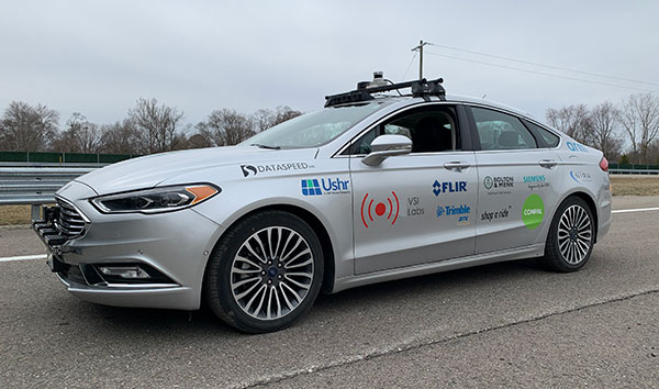
Trimble to provide reliable in-lane positioning for the year-long research program
Trimble and VSI Labs have formed an alliance, with Trimble serving as the GNSS precise positioning supplier for VSI’s autonomous research vehicle program. The alliance officially kicked off in March at Destination ACM, a long-distance driving event for VSI’s research vehicle that continues with additional events throughout the year.
The collaboration provides the opportunity to showcase Trimble RTX technology as the trusted precise-positioning correction source for car manufacturers and their suppliers. Coupled with Trimble’s inertial positioning, Trimble RTX plays a pivotal role in a vehicle’s ability to maintain accurate and reliable lane-discipline during autonomous driving.
Destination ACM launched from VSI’s Minneapolis headquarters en route to the American Center for Mobility’s (ACM) test center in southeast Michigan where a day of testing and demonstration took place March 26.
“The integration of Trimble’s precise RTX positioning is a key element of VSI’s technology stack for advanced driver assistance systems (ADAS) and autonomous vehicle (AV) applications,” said Stephen Ruff, general manager of Trimble’s On-Road Autonomy Division. “VSI Labs is a leading researcher of best-in-class technologies critical to autonomous vehicle development.”
Suitable for on-road driving applications, Trimble RTX corrections operate on a single, global network. Drivers are not subject to the coverage outages that can exist when relying on local positioning systems — requiring line-of-sight to a positioning source or radio/cellular/internet connections.
When occasional obstructions are present, such as a bridge, tunnel or deep urban or rural canyon, Trimble augments its precise GNSS positioning with inertial technology to maintain continuous positioning and orientation while on the road.
Trimble’s innovative GNSS positioning is being used on the road today by a number of automotive OEMs and Tier 1 suppliers to improve the functional safety and performance of ADAS for passenger vehicles. Consumers have logged more than 7 million miles using Trimble RTX for lane-level positioning to date.
“VSI Labs is thrilled to have Trimble’s RTX technology on board,” said Phil Magney, founder and president of VSI. “Trimble’s positioning capabilities allow us to really expand our applied research on the safety and performance of autonomous and ADAS driving solutions.”
Trimble GNSS positioning technology will be used in the VSI research vehicle during each of the quarterly Destination ACM events, the Drive World Conference in Silicon Valley in August, the VSI 2021 “Drive South,” and other events this year.
For more about autonomous vehicles, see our June issue.
Inertial Labs has released a new generation of GPS-aided inertial navigation systems (INS) for applications such as UAVs, helicopters and lidar surveys.
The company also has released two new inertial measurement units (IMUs) for measuring angular rates and accelerations for motionless and dynamic applications.
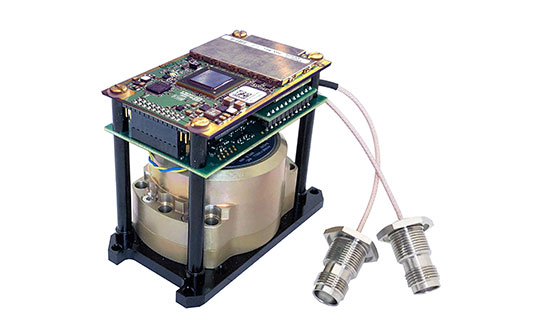
INS-DH-OEM
The INS-DH-OEM. (Photo: Inertial Labs)
The high-accuracy INS-DH-OEM is designed for easy integration into custom enclosures and higher order integrated system applications. It combines the HoneywellHG4930 inertial measurement unit (IMU) into a GPS-aided INS to provide high-accuracy orientation, position, velocity and timing for land and aerial systems.
Consisting of three axes each of high-precision accelerometers and gyroscopes, the accuracy of the HG4930 plays a key role in the exceptional performance of the INS-DH-OEM. With input from the IMU, the INS-DH-OEM has a pitch-and-roll accuracy of 0.015 degrees real-mean-squared (RMS) for dynamic applications, and a pitch-and-roll accuracy of 0.01 degrees for motionless applications.
Another key factor for the INS-DH-OEM is its use of the NovAtelOEM7720 dual-antenna GNSS receiver. The OEM7720 is an all-constellation, multi-frequency heading and positioning solution with TerraStar PPP correction services and advanced interference mitigation features.
With aiding data from the OEM7720, the INS-DH-OEM features a 2-meter baseline heading accuracy of 0.05 degrees RMS for both static and dynamic applications. As a result, the INS-DH-OEM is a high-performance solution in line-of-sight and beyond line-of-sight antenna-pointing applications.
A reliable solution in varying environments, the OEM7720 ensures that the INS-DH-OEM is outputting the most accurate GNSS-aided data by supporting GPS, GLONASS, BeiDou, Galileo, NavIC (IRNSS), and QZSS constellations.
The INS-DH-OEM can be applied in a wide range of aerial applications such as remote sensing, flight control and photogrammetry in which the INS-DH-OEM provides accurate positioning, navigation and timing (PNT) data for multi-rotor drones, fixed-wing drones and other UAVs performing these tasks. This data is paramount in the accuracy of these applications’ deliverables such as point clouds, orthomosaics and photogrammetric plots.
Weighing 280 grams and measuring 85.7 x 62.5 x 52.0 mm, the INS-DH-OEM is a lightweight, compact system that can be fitted with custom enclosures or integrated into higher order systems such as lidar payloads. It is compatible with scanners from many lidar manufacturers: Livox, Velodyne, Ouster and Quanergy. This adaptability, coupled with top-of-the-line subcomponents and Inertial Labs’ sensor-fusion expertise, make the INS-DH-OEM the suitable for UAVs, UGVs, antenna pointing, and many more applications.
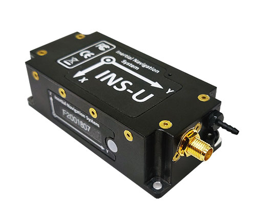
INS-U
The INS-U. (Photo: Inertial Labs)
The new INS-U GPS-aided INS with air data computer (ADC) output signal is based on a u-blox module.
The INS-U a fully integrated INS, attitude and heading reference system (AHRS), IMU and air data computer high-performance strapdown system that determines position, navigation and timing information for any device on which it is mounted.
The INS-U utilizes a single antenna, multi-constellation U-Blox GNSS receiver. With access to GPS, GLONASS, Galileo, QZSS, and BeiDou, the INS-U can be used in a variety of GPS-enabled environments and is protected against spoofing and jamming. Additionally, the INS-U is comprised of two barometers, a miniature gyro-compensated fluxgate compass, and tri-axis temperature calibrated advanced MEMS accelerometers and gyroscopes. These high-performance sensors, along with Inertial Labs’ new on-board sensor fusion filter, state of the art guidance and navigation algorithms, provide accurate position, velocity, and orientation of the device under measure.
Perhaps the most defining feature of the INS-U is its embedded ADC. An essential avionics component for modern UAV applications, an ADC outputs static & dynamic pressure, pressure altitude, calibrated & true airspeed, true angle of attack, rate of climb, and wind speed of the device under measure. This data, combined with inertial reference information, provides UAVs with accurate information about the unit and its relation to its environment.
By using data from an INS, AHRS, IMU and ADC, the INS-U provides a complete navigation solution for UAV and Helicopter applications. The unit can use time-of-flight aiding data from a ground station for long term GNSS-denied conditions as well as external position and heading so it can still output accurate PNT information regardless of the environment.
The INS-U is a lightweight and compact solution with dimensions of 82 x 40 x 26 mm and a weight of less than 200 grams. This, along with an IP67 environmental enclosure, ensures that the INS-U can meet the environmental requirements and size and weight restrictions of a wide range of applications.
IMU-NAV-100
The IMU-NAV-100. (Photo: Inertial Labs)
The IMU-NAV-100 is a tactical grade IMU for wide range of higher order integrated system applications.
The newest addition to the Inertial Labs Advanced MEMS sensor-based family, the IMU-NAV-100, is now the best performing IMU that Inertial Labs offers. The IMU-NAV-100 is a fully integrated inertial solution that measures linear accelerations, angular rates, and pitch and roll with high accuracy utilizing three-axis high-grade MEMS accelerometers and three-axis tactical grade MEMS gyroscopes.
The IMU-NAV-100 features continuous built-in test, configurable communications protocols, electromagnetic interference protection, and flexible input power requirements which allow it to be easily integrated in a variety of higher order systems.
The IMU-NAV-100 line contains two options to accommodate a variety of projects.
The IMU-NAV-100-S is best for projects that require high performance stabilization for antenna and line-of-sight stabilization systems, motion control sensors, and platform orientation and stabilization systems. With a gyroscope angular random walk of 0.04 deg/√hr, the IMU-NAV-100-S is specialized to provide accurate data for stabilization applications.
The IMU-NAV-100-A is best used in a variety of systems such as GPS-aided INS, AHRS, and motion reference units. Regardless of the application, the IMU-NAV-100 is the company’s best performing IMU to date, providing a pitch-and-roll accuracy of 0.03 deg RMS. Fully calibrated, temperature compensated, and mathematically aligned to an orthogonal coordinate system, the IMU contains up to 0.5 deg/hr bias in-run stability gyroscopes and 0.003 mg bias in-run stability accelerometers with very low noise and high reliability.
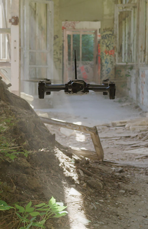
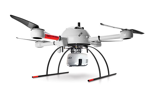
Every ounce counts on a drone. While a larger ground plane on a GNSS patch antenna improves its performance, the additional size increases weight — an unacceptable tradeoff.
The antenna’s location on the drone is another factor. It must be distant from motors and other electronic components that generate interference, which undermines positional accuracy. But remote locations are often off-limits because the antenna’s weight in those spots would disrupt the delicate balance drones require.
Drone-maker Parrot took these factors into consideration when choosing a GNSS antenna for its ANAFI USA drone. Although it weighs just 500 grams, ANAFI USA is designed to operate in winds up to 53 km/h.
To meet these challenges, Parrot chose the Taoglas DSGP.1575.15.4.A.02, a passive patch antenna that supports GPS L1 and Galileo E1. At 3.3 grams and 4 mm high, with a 15-mm2 footprint, the DSGP.1575 is designed for ultra-compact devices.
Key customers
High GNSS accuracy and reliability are critical for Parrot customers such as the French military, which recently ordered 300 ANAFI USA drones for reconnaissance and intelligence missions by its conventional and special forces.
Manufactured in the United States, ANAFI USA has also been selected by U.S. federal government partner organizations as part of the Blue sUAS project — the only UAV from a non-American drone manufacturer to be commercialized on the GSA Schedule, the buying platform of the U.S. military and civilian government agencies.
Police departments, federal agencies and firefighters in the United States and other countries also use ANAFI USA. The drone is also used for surveying, inspection and other commercial enterprises.
Tuned on a 50×50 mm ground plane, the DSGP.1575 operates at 1575.42 MHz with a 2.59 dBi gain. It uses ceramic materials — suitable for UAV applications because drones spend most of their time flying parallel with the horizon, a position in which ceramic antennas collect sufficient GNSS signals to meet performance requirements.
The DSGP.1575’s light weight and energy efficiency enable the ANAFI USA to carry bigger payloads and fly longer, up to 32 minutes compared to the consumer model’s 25 minutes.
“We chose Taoglas because of the quality of their antennas and their ability to tune an existing antenna in the mechanics of the product and to make it on a large scale for mass production,” said Meryam Abou El Anouar, Parrot technical leader for RF and Connectivity. “They are also known for their great experience with the GNSS propagation specificities as multipaths, so that is helpful when you try to achieve good GNSS accuracy.”
Taoglas provided Parrot with design and testing support in its design centers, as well as making regular visits to Parrot’s facility in Paris.
“Our engineering team managed to carry out tests at antenna and system levels,” said Baha Badran, Taoglas Global Antenna Technology director. “This includes passive antenna testing, in-chamber active antenna testing and GPS field testing of the drone. Each of these tests was carried out to ensure optimum GPS system performance was achieved, to give the highest possible positional accuracy for such an application.”
The support also helped Parrot minimize the cost and lead time for bringing the ANAFI USA to market.
Hexagon AB has acquired CADLM SAS, a company focused on computer-aided engineering (CAE) with artificial intelligence (AI) and machine learning. These technologies enable simulation in product-development processes and lifecycles.
Founded in 1989, France-based CADLM develops computational design and optimization methods for industrial products and processes. Since 2014, CADLM has been developing AI and machine learning solutions. Its ODYSSEE software platform applies AI and machine learning to real-world sensor data and physics-based simulation data to produce accurate, predictive models of a product at efficient computing power levels.
The combination enables faster, more efficient simulations of dynamic, multi-physics phenomena — such as automotive crash and safety — that fully characterize and understand real-world product behavior. This insight enables engineers to explore the design more extensively and interactively, and improve next-generation products without prohibitive computing cost or time.
Ola Rollén, CEO, Hexagon
Use of the digital twin beyond the early design phase enables manufacturers to leverage image recognition, predictive simulation and fault prediction to address challenges such as downtime, throughput, quality and flexibility throughout the manufacturing process.
“The convergence of CAE with advances in data management, AI, machine-learning and an increasingly connected manufacturing lifecycle is transforming the industry’s ability to address increasingly complex design challenges with rapid innovation and increased productivity,” said Hexagon President and CEO Ola Rollén. “CADLM’s AI knowledge and technology further strengthen our smart manufacturing solutions portfolio, putting data to work beyond the early design phase to improve product design innovation, manufacturing productivity, product quality and environmental sustainability through reductions in material waste.”
CADLM will operate as part of Hexagon’s Manufacturing Intelligence division. The acquisition has no significant impact on Hexagon’s earnings. Completion of the transaction (closing) is subject to normal closing conditions.
New atomic clock technology will improve GNSS location accuracy, as well as addressing the scalability of other quantum technologies being developed
Nanofabrication experts Kelvin Nanotechnology have teamed up with product design specialist Wideblue, the University of Strathclyde and the University of Birmingham on a UK Research and Innovation (UKRI) project funded by the Industrial Strategy Challenge Fund to develop innovative techniques in the miniaturisation of optical atomic clocks.
The new clock technology will help improve GNSS location accuracy, as well as addressing the scalability of other quantum technologies being developed by the academic partners.
“Small, low cost atomic clocks will be essential as we develop a resilient position, navigation and timing (PNT) infrastructure to support our financial, power distribution and communications services,” said Roger McKinlay, challenge director – Quantum Technologies at UKRI.
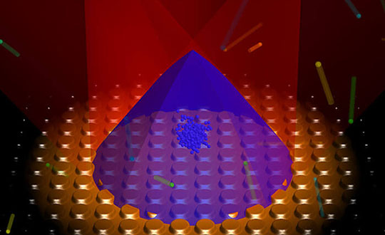
Cold atomic samples have led to profound advancements in precision metrology by measuring the frequency separation of discrete atomic energy levels. These atomic clocks are the ultimate timekeepers, with the state-of-the-art instruments providing a timing accuracy that it would neither gain nor lose a second in over 30 million years.
Because of the high level of accuracy in these instruments, atomic clocks are used to coordinate systems that require extreme precision, such as GNSS. Each satellite network contains multiple atomic clocks that contribute precision timing data, which is decoded to provide location data by effectively synchronizing each receivers’ atomic clocks with those of the satellite.
“The project is a feasibility study which aims to facilitate the miniaturization of state-of-the-art atomic clocks.” said Russell Overend, managing director of Wideblue. “To achieve such high timing resolution, the atomic clock makes use of ultra-narrow transitions in strontium atoms, providing orders of magnitude better performance than their rubidium counterparts due to narrower atomic features. In simple terms, the narrower the atomic transition the more accurate the atomic clock.
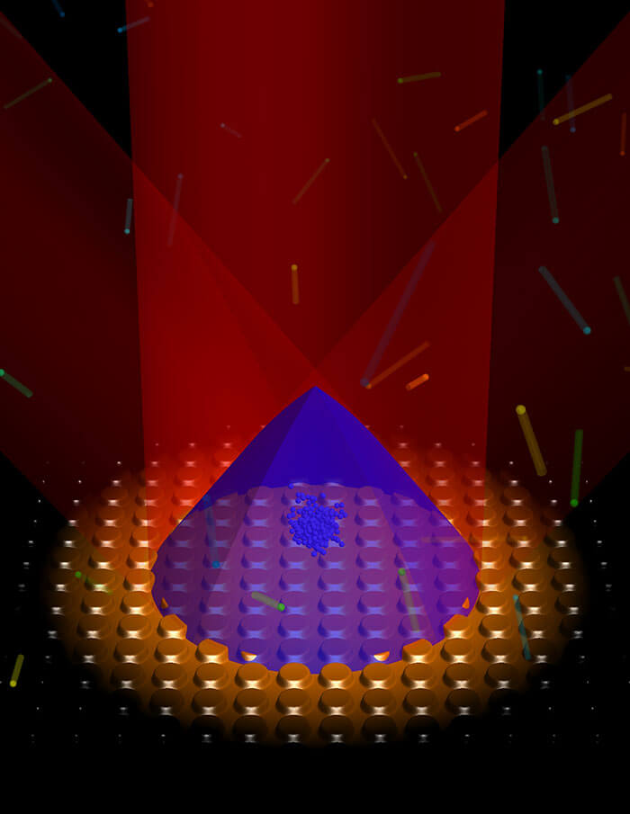
At Strathclyde, cold atom clock experiments are aided by expertise in grating magneto-optical traps (gMOTs), illustrated here. (Image: Aidan Arnold, University of Strathclyde)
An important factor in cold atomic clock technology is grating magneto-optical traps (gMOTs). With gMOTs, diffraction gratings split and steer an incoming beam into a tripod of diffracted beams, allowing trapping in the four-beam overlap volume.
Wideblue will develop the optical system that will deliver the laser light onto the gMOT chip. Kelvin Nanotechnology will manufacture the gMOT and compact collimation optics designed by Wideblue. The University of Strathclyde will design the gMOT chip, and the University of Birmingham will perform the testing of the prototype optical system.
“Atomic clocks are an integral component in modern technology and impact our daily routines from computing and financial transactions to the navigation systems we use in our phones and cars,” said James McGilligan, Kelvin Nanotechnology, “As state-of-the-art atomic clocks push new boundaries in precision measurement, we face a new challenge of bringing this complex and large physical apparatus into a compact and user-friendly system where we can make the largest societal and economic impact.
“Our current collaboration with Wideblue and our academic partners aims to address the scalability of one such atomic clock by reducing the optical constraints into scalable micro-fabricated components as a critical step to bringing laboratory performance out into real world applications,” McGilligan said.
“With support from the Quantum Technologies Challenge in UKRI — part of the UK National Quantum Technologies Programme — we are ensuring that the UK economy and society will benefit from the next generation of quantum devices and be quantum ready,” McKinlay said.
Positioning company u‑blox has acquired full ownership of Sapcorda Services GmbH, a joint venture formed by u‑blox, Bosch, Geo++ and Mitsubishi Electric in 2017.
Sapcorda — SAfe and Precise CORrection DAta — provides advanced GNSS augmentation services for the high-precision GNSS mass market. The joint venture was formed by the four companies to bring scalable, affordable and high-quality GNSS positioning solutions to industrial, automotive and consumer applications.
Relevant industrial applications include autonomous vehicles, such as unmanned aerial vehicles (UAV) and unmanned ground vehicles (UGV), machine automation, surveying, monitoring and other advanced navigation applications.
Within the automotive sector, applications include automated driving and advanced driver-assistance systems (ADAS), lane-accurate navigation, telematics and vehicle-to-everything (V2X) communication.
Sapcorda Services GmbH is a GNSS service provider focusing on the emerging high-precision GNSS mass markets. The company has designed its technology and service offerings to serve high-volume automotive, industrial and consumer markets.
Sapcorda developed its advanced SAPA service based on open formats, and has specifically tailored it for industrial and automotive markets. It uses real-time kinematic (RTK) and precise point positioning (PPP).
Launched in January 2020 in the U.S. and Europe, SAPA Services have been expanded to full coverage of the contiguous U.S. and 32 countries in Europe. Distribution of the service via an additional geostationary satellite L-band signal also has been announced.
“We appreciate the support and cooperation of all the joint venture shareholders. As a part of u‑blox, I see enormous potential for our technology,” said Botho Graf zu Eulenburg, CEO of Sapcorda.
The acquisition of Sapcorda expands u‑blox’s suite of location services complementing its existing data services, including its assistance data and communication service offerings. Sapcorda has focused on establishing a platform from which to bring GNSS augmentation services to the mass market by delivering on robustness, reliability and end-to-end security as it relates to performance.
Full ownership of Sapcorda will also enable u‑blox to serve customers more efficiently, the company said, by streamlining certain processes, including reducing implementation time to market and simplifying the integration process for customers.
“The acquisition of Sapcorda reinforces our position as a leader driving innovation in the most advanced areas of GNSS positioning technology,” said Thomas Seiler, CEO of u‑blox. “It represents another step forward in the execution of our strategy, which is to deliver value to our customers by means of a comprehensive ‘silicon-to-cloud’ set of solutions and offerings.”
Sapcorda operates in Europe and in the U.S. with offices in Berlin and Hanover in Germany and in Scottsdale, Arizona, in the U.S.
Avalanches can be a danger for skiers as well as for the resort towns that welcome them. For protection, towns erect steel fences to act as barriers along the ski slopes. But before these snow barriers can be built, steep rock faces and cliffs need to be surveyed.
Darnuzer Ingenieure AG, a Swiss-based surveying and mapping company, uses a drone with a built-in high-performance GPS receiver to survey these harsh areas in hours.
“Drones have made mapping workflows faster, safer and more efficient,” said Septentrio’s senior market access manager Gustavo Lopez. “GNSS technology has led to the evolution of post-processing kinematic (PPK) methods, which help make the photogrammetry process efficient and accurate.”
Every year, thousands of tourists visit Davos in the Swiss Alps. To protect the town and the skiers, avalanche barriers were built along the steep slopes. To plan the work along the uneven rock face, a detailed 3D reconstruction of the area was needed, but getting to the survey site would be a rock-climbing feat.
Darnuzer Ingenieure used the WingtraOne fixed-winged drone, which features a top-quality camera and a Septentrio high-performance GNSS receiver. A single surveyor took the drone to the rocky Parsenn slope during the summer season, capturing ground images — without snow — that were needed for the 3D model.
WingtraOne PPK enabled high-precision mapping without the need for ground control points. During the flight, each image was accurately time-stamped and raw GNSS data from the Septentrio AsteRx-m2 receiver was carefully logged.
Even in this mountainous region, where peaks obstruct the sky, the receiver delivered continuous positioning. The GNSS data was processed by the GeoTagZ software library, which used corrections from a nearby base station to generate real-time kinematic (RTK) centimeter-level positioning.
The GeoTagZ software library incorporated Septentrio’s core GNSS algorithms to assure the best positioning performance. Accurate positioning was then synchronized with the images in the next step of the post-processing workflow.
It only took Wingtra a few days to integrate the GeoTagZ library into its WingtraHub software package. Integration of GeoTagZ into WingtraHub simplifies mapping jobs for customers like Darnuzer Ingenieure.
“The beauty of this solution is that the drone benefits from the receiver’s high-quality raw measurements without the need for a real-time corrections link for accuracy,” Lopez said. “The quality of the measurements comes from the technology built into Septentrio’s receivers, which is designed to be resilient to radio frequency interference and multipath. In post-processing, the GeoTagZ software enables the most accurate positioning, thanks to its high-performance RTK engine.”
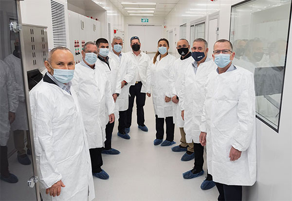
The inauguration of the Navigation Technologies Center took place in March. (Photo: IAI)
The new center will focus on developing and producing navigation systems for the battlefield, and plans to implement a co-developed, non-GPS accurate navigation technology
A Navigation Technology Center dedicated to developing and producing non-GPS navigation systems has been launched by Israel’s Ministry of Defense (IMOD) and Israel Aerospace Industries (IAI).
In the new center, IAI will develop and manufacture highly accurate inertial sensors for production of next-generation navigation systems, and will significantly increase their performance and capabilities. The sensors will be implemented in operational systems within Israel’s defense systems, enabling Israel to continue to address challenges of the modern battlefield.
The technology to be developed at the center is based on years of research and collaboration between the Directorate of Defense Research & Development (DDR&D) and IAI.
The center was established at the Tamam Division of IAI’s Systems Missiles and Space Group, which specializes in electro-optics and navigation. IAI has served as the inertial navigation system (INS) house of the State of Israel since 1964. Tamman is based in Yahud, a suburb of Tel Aviv.
“In launching the new compound, DDR&D demonstrates our position at the forefront of technology and its contribution to Israel’s technological independence,” said Brig. Gen. Yaniv Rotem, chief of research and development at DDR&D. “The extensive know-how and experience accumulated at DDR&D and Tamam, our partners, allowed us to challenge ourselves with this new endeavor and accomplish something impressive. The follow-up program is just as challenging, and we plan to work diligently until we prove the new capability in the various applications and in collaboration with IDF units.”
“Our partnership with IMOD DDR&D dates back many years,” said Avi Elisha, Tamam general manager. “We work together to achieve the ongoing enhancement of the innovative navigation systems for Israel. The new center we launched will allow highly accurate navigation capabilities with IAI’s unique technologies. Only a handful of countries have this technology, which is a game-changer in the field of inertial navigation.”
The Institute of Navigation (ION) is hosting a webinar April 20 on “GNSS interference mitigation: A measurement and position domain assessment.”
The webinar takes place at 11 a.m. EDT and is presented by Daniele Borio and Ciro Gioia, authors of a paper on the topic.
Summary
Modern GNSS receivers have to withstand significant levels of interference in order to operate under harsh conditions, such as in the presence of jamming and of other Radio Frequency (RF) threats. A possibility is to implement pre-correlation interference mitigation techniques that operate directly on the samples provided by the receiver front-end. The speakers’ paper provides an assessment of five interference mitigation techniques at the measurement and position level.
The analysis focuses on the adaptive notch filter (ANF) and on four robust interference mitigation (RIM) techniques. Several data collections were performed in the presence of jamming, and the data were used for the analysis that shows that RIM techniques do not introduce biases at both the measurement and position level. While the ANF delays pseudorange measurements, the biases introduced are predominantly common to all the observations with a negligible impact on a single point positioning (SPP) solution.
A roundup of recent products in the GNSS and inertial positioning industry from the April 2021 issue of GPS World magazine.
OEM
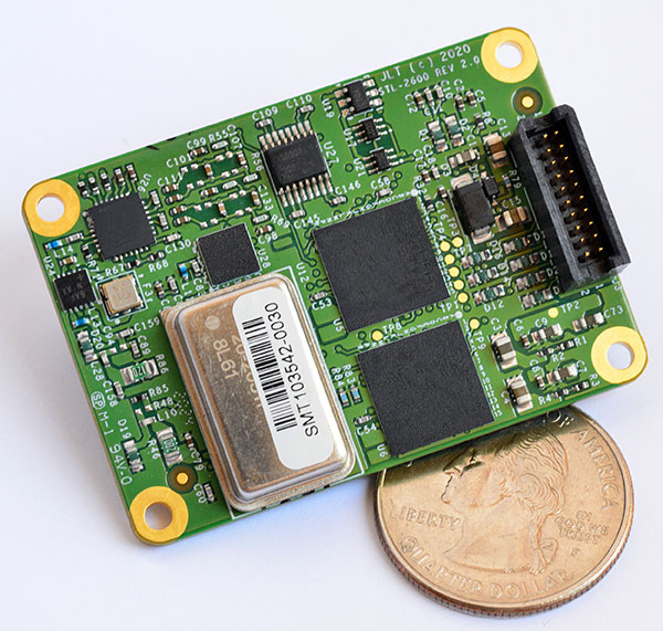
STL receiver
For Satellite Timing and Location service
Photo: JLT
The STL-2600 Satellite Timing and Location (STL) commercial receiver was designed in partnership with Satelles Inc., the STL service provider. The STL-2600 provides a GNSS-independent, low-cost capability to generate UTC nanosecond timing and meters-accurate positioning anywhere in the world. The STL signal has 30-db (1,000 times) higher power compared to GPS signals, allowing the receiver to operate deep indoors independent of any GPS/GNSS signal. It is also useful in marine applications where GNSS signals are regularly denied or manipulated and for stationary high-accuracy timing applications such as 5G. It can be directly connected to JLT’s GPS Transcoder products for glueless retrofit capability of existing customer legacy GPS-only receiver systems to Galileo, GLONASS, BeiDou, QZSS and SBAS as well as adding the STL and optional atomic holdover capability to these legacy systems.
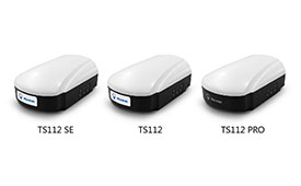
The TS112 family of smart antennas is designed for demanding applications such as agricultural machine autosteering systems that require high positioning accuracy. They offer scalable positioning solutions with increased GNSS availability, reliability and accuracy. Each of the three models embeds Harxon X-Survey four-in-one technology. The high-gain and wide beamwidth multi-constellation GNSS antennas integrate 4G, Bluetooth and Wi-Fi in a compact unit. They feature multi-point feeding technology, ensuring high phase-center stability and real-time kinematic (RTK) centimeter-level positioning accuracy. They integrate a high-precision GNSS module with multi-band GNSS receiver and Harxon’s four-in-one multifunctional GNSS antenna in a compact housing.
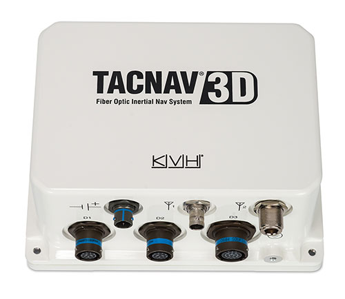
The TACNAV 3D tactical navigation system is now available with the P-1775 inertial measurement unit (IMU) featuring KVH’s new photonic integrated chip (PIC) technology. PIC technology features an integrated planar optical chip that replaces individual fiber-optic components to simplify production while maintaining or improving accuracy and performance. KVH’s IMUs with PIC technology are designed to deliver improved bias stability and greater accuracy. The fiber-optic gyro (FOG)-based TACNAV 3D tactical navigation system provides an assured positioning, navigation and timing (A-PNT) solution with an embedded GNSS and optional chip-scale atomic clock (CSAC).
IoTeX has selected Nordic Semiconductor’s nRF9160 low-power System-in-Package (SiP) with integrated LTE-M/NB-IoT modem and GPS receiver to provide the cellular internet of things (IoT) connectivity for its Pebble Tracker. The Pebble Tracker provides trusted location, environment and motion-tracking data for global asset tracking and industrial supply chain applications. Critical features strengthen security from hacking and data corruption, meeting the demand of applications that require strong data security and integrity protection throughout the supply chain. There are two versions of Pebble Tracker. The first targets blockchain and IoT developers, while a second commercial version is designed for the asset tracking and industrial supply chain markets. The product combines an environmental sensor, a motion sensor (gyroscope and accelerometer), and an ambient light sensor. It enables cellular network connectivity and integrated GPS support in a global version supporting precise, long-range tracking of asset data using established cellular infrastructure.
Enables transmission of corrections via the internet
Emlid Caster is an easy way to transmit corrections between real-time kinematic (RTK)-capable devices via the internet. Emlid Caster has a simple interface. Users can create their personal mount point and connect one base and up to five rovers. It works not only with Emlid products but any other device supporting NTRIP. For example, users can pass RTK corrections to the DJI Phantom 4 RTK drone from the Reach RS2 receiver as a base station. Emlid Caster is free and available worldwide. Once signed up, personal NTRIP credentials are generated automatically for a base and a rover.
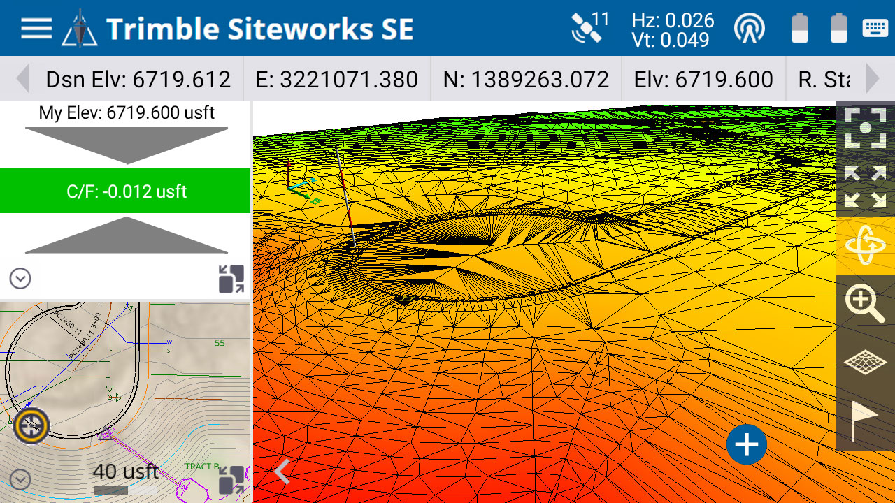
The Trimble Siteworks SE Starter Edition. (Screenshot: Trimble)
The Trimble Siteworks SE Starter Edition is an entry-level construction surveying software program. With the program and a construction GNSS receiver, a supervisor, foreman, grade checker or site engineer can easily check a grade, slope or alignment and navigate the project more accurately and in less time than with traditional survey methods. It also can give more personnel on the jobsite access to survey technology, enabling more productive and efficient field crews. Trimble Siteworks SE Software is a simplified version of Trimble Siteworks Software, intended for users who do not require a full feature set and are interested in a lower-cost version to connect to GNSS only. Contractors can easily upgrade to the full version.
The Leica CityMapper-2L configuration is designed for airborne urban mapping projects at low altitude operation. Lower flying heights can be required by air traffic control (ATC) restrictions and in areas with low cloud cover. It features a 71-mm focal length at nadir, suitable for 5-cm ground sample distance (GSD) data acquisition at flying heights of 940-m above ground level. The new lenses offer similar coverage and productivity for a specific GSD as existing configurations for standard and high-flying heights, while significantly expanding the operation envelope. The CityMapper-2 hybrid airborne sensor combines oblique imaging and a lidar in one system. The sensor efficiently creates digital twins of cities. The system includes two 150 MP nadir cameras (RGB and NIR), four 150 MP oblique cameras and a 2-MHz linear-mode lidar sensor.
Full-waveform flash data for autonomous vehicle development
Photo: LeddarTech
Leddar PixSet is a publicly available sensor dataset for advanced driver assistance and autonomous driving research and development. The dataset includes full-waveform data from LeddarTech’s Leddar Pixell, a 3D solid-state flash lidar sensor. LeddarTech is offering these datasets free of charge for academic and research purposes. It allows academic and engineering research teams specializing in advanced driver-assistance systems (ADAS) and autonomous driving technology to use existing sets of sensor data to test and develop advanced software and to run simulations without having to assemble new sensor suites and collect their own dataset. An instrumented vehicle was utilized in the development of the dataset. The various scenes were recorded in high-density urban and suburban environments as well as on the highway.
The mdLiDAR1000HR aaS drone lidar survey package is designed for professionals responsible for geospatial data collection, such as corridor mapping, mining (volume calculation), construction site monitoring, recording environmental changes over time, forestry, contour mapping, archaeology and cultural heritage, and more. The drone lidar system has a 90° field of view for both scanned points and imagery. It repeatedly provides a precision of 1.6 cm (.052 feet) when flown at 40 m (130 ft) at a speed of 8 m/s (18 mph). It integrates the Velodyne Puck Lite lidar sensor.
The fixed-wing eBee Ag drone can provide a complete assessment of a farm and crops faster than traditional field scouting. With its dual-purpose Duet M camera, eBee Ag captures accurate RGB and multispectral data that enable farmers to effectively assess crop health and help catch early indicators of pests, diseases and weed infestations that threaten crop yields. It features real-time kinematic (RTK) functionality for greater mapping precision. With its available RTK, the drone can achieve absolute accuracy down to 2.5 cm (1.0 inches) with RGB. Highly accurate index maps allow farmers to understand each acre while managing problematic areas field-wide.
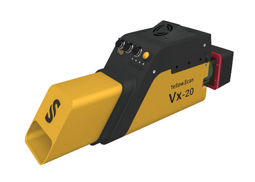
The Vx15-300 and Vx20-300 UAV lidar solutions are new additions to Yellowscan’s Vx product series. A new terrain software module allows users to automatically classify grounds from off-ground, as well as export various digital elevation models. Both integrate the Riegl Mini-VUX 3 airborne laser scanner (1.55 kg / 3.4 lbs), designed specifically for integration with UAVs. The scanner offers a selectable 100-kHz, 200-kHz and 300-kHz laser-pulse repetition rate (PRR). At 300-kHz PRR, the sensor provides up to 100,000 measurements per second at 120° field of view, and thus a dense point pattern on the ground for UAV-based applications that require the acquisition of small objects.
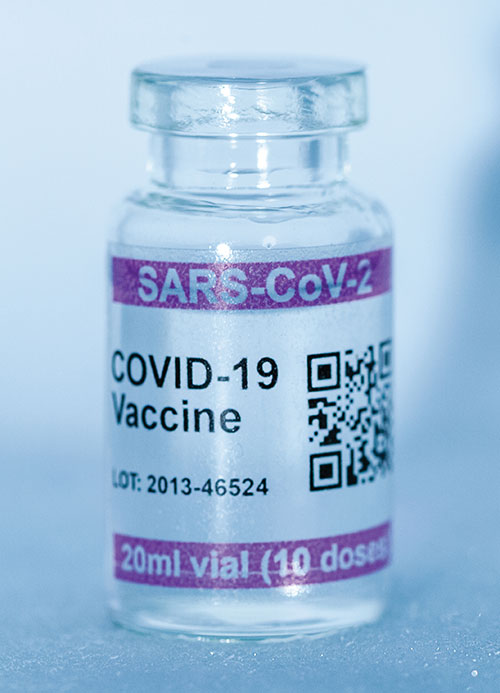
Cryo-Vacc containers use helium — a fraction of the weight of nitrogen — to provide safe transportation of vaccines at the required extremely low temperatures and for periods of up to 30 days, without the need for any power supply. Now in prototype, the containers work with both air and ground transportation. A temperature range of -150°C to 8°C, makes it versatile for a range of vaccines — including those for COVID-19 — that need to be transported for up to 25 days or longer in transit, where access to an external power source is not possible. Combined with cold-chain monitoring and asset tracking technology from Beyond Wireless (a World Health Organization-certified provider), Cryo-Vacc can provide accurate temperature readings of vaccines in transit, as well as GPS-based tracking to ensure the custody chain can be audited.
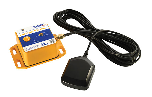
The tamper-proof MSR175plus GPS data logger records potentially damaging shock events as well as the associated ambient conditions with the exact geographic position via its GPS/GNSS receiver. It contains two 3-axis-acceleration sensors (±15 g/±200 g), a temperature sensor (-20 to +65° C), a humidity sensor (0 to 100% relative humidity), air pressure sensing (0 to 2000 mbar), and an ambient light sensor (0 to 65,000 lux). It helps ensure compliance with transport specifications and provides irrefutable data for identifying damage liability for help with insurance claims. An external connector is ready for a cable-connected antenna. The removable, rechargeable 2400 mAh LiPo-battery enables recording for up to 8 weeks (at least one year without GPS-based tracking).