Tag: OEM

  • Tersus introduces compact GNSS board with full constellation tracking

    Tersus introduces compact GNSS board with full constellation tracking

    Photo: Tersus GNSS
    Photo: Tersus GNSS

    Tersus GNSS Inc. has released the BX40C RTK board to support its series of GNSS boards and provide highly accurate and fast positioning services.

    Powered by the company’s new ExtremeRTK GNSS technology, the BX40C board can support multi-constellation and multi-frequency all-in-view satellite tracking.

    The Tersus BX40C is a compact GNSS real-time kinematic (RTK) board with full constellation tracking for providing centimeter-level accuracy positioning. It can be integrated with autopilots and inertial navigation units to meet various developing requirements. It is suitable for high-precision positioning, navigation and mapping.

    “Tersus has been proud of its BX-series RTK boards, and today we added a new member to the series by launching the new BX40C board,” said Xiaohua Wen, founder and CEO of Tersus GNSS. “The BX40C is with enhanced positioning accuracy and constellation tracking, even in harsh environments, the BX40C board can still control deviation within 3-centimeter in surveying and mapping applications. It supports 576 channels and can achieve centimeter-level position accuracy easily. We are excited to see how BX40C strengthens our product portfolio and technology competence to make a great effort in this industry.”

    The BX40C board supports multiple constellations and frequencies to improve the continuity and reliability of the RTK solution — even in harsh environments. In-built 4GB memory makes data collection easy, the company said. It is compatible with other GNSS boards in the market via flexible interfaces, smart hardware design and commonly used log/command formats.

  • Sonardyne chosen for Brazilian geoscience research vessels

    Sonardyne chosen for Brazilian geoscience research vessels

    Sonardyne logoBrazilian geoscience services company OceanPact Geociências has chosen deep-water positioning technology from Sonardyne Brasil Ltda. to support its geophysical, geotechnical and environmental research operations across the region.

    Ranger 2 ultra-short baseline (USBL) systems have been installed on board OceanPact’s research vessel Seward Johnson and RSV Austral Abrolhos to precisely track the location of underwater equipment and sensor packages deployed from the ships, including seabed corers, towed sensors and data loggers. Both vessels are currently on hire to Brazilian oil major Petrobras.

    Ranger 2 USBL is a popular choice for conducting research at sea as operations can start as soon as a vessel arrives on location. This helps maximise valuable ship time. It has the capability to track multiple underwater targets simultaneously to beyond 11 kilometers, works in shallow or deep water and is able to remotely configure and communicate with compatible instruments. This operational flexibility was a key factor in OceanPact’s investment decision.

    “This order from OceanPact further embeds Ranger 2’s reputation in the region. For those wanting accuracy and versatility, it’s proven itself time and again while also meeting the toughest specifications from oil and gas, science and survey companies,” Andre Moura, sales and applications manager at Sonardyne Brasil Ltda.

  • U.S. Air Force’s 2 SOPS performs first GPS III maneuver

    U.S. Air Force’s 2 SOPS performs first GPS III maneuver

    By Airman 1st Class Jonathan Whitely, 50th Space Wing Public Affairs

    News from Schriever Air Force Base

    The 2nd Space Operations Squadron performed the first station keeping maneuver on a GPS III satellite to Satellite Vehicle Number 75 on May 14 at the Schriever Air Force Base in Colorado.

    The maneuver set a new standard for how GPS maneuvers should be conducted for the squadron that provides precision, navigation and timing signals to billions of users around the world.

    A station keeping maneuver is performed to keep vehicles in their node (or parking spots in orbit) and involves burning the satellite’s thrusters and changing the vehicles speed at a particular point in its orbit. This causes the orbit to change, in turn, keeping the vehicle in the ideal position to provide coverage.

    “All operational GPS vehicles are assigned nodes, when all nodes are filled with healthy vehicles there is good global GPS coverage,” said 1st Lt. Michael Gallagher, GPS subsystems analyst. “When new vehicles are launched they typically aren’t launched directly into their final node. This means that the 2 SOPS analysis flight must perform a re-phase maneuver to put a vehicle in its node.”

    The maneuver required GPS III’s signal to be turned off. Turning off the navigation signal while performing the maneuver prevents users from receiving inaccuracies generated by a change in satellite velocity.

    “This was a new process that we could learn from as it was the first station keeping [maneuver] performed for the newest generation of GPS satellites,” said Senior Airman Harrison Sherwood, 2 SOPS satellite systems operator, who sent the commands to the satellite during the maneuver. “[Since] this was the first [maneuver] of the newest generation satellites, it was a bit of a guinea pig for future maneuvers.”

    Johnathon Caldwell, Lockheed Martin Space vice president of navigation systems, right, presents Lt. Col. Stephen Toth, 2nd Space Operations Squadron commander, with a GPS III model satellite as a token of appreciation for the 2nd SOPS critical mission in space at Schriever Air Force Base, Colorado, July 29, 2019. The squadron performed its first station keeping maneuver on a GPS III satellite May 14, 2020, at Schriever AFB. (Photo: U.S. Air Force/1st Class Jonathan Whitely)
    Johnathon Caldwell, Lockheed Martin Space vice president of navigation systems, right, presents Lt. Col. Stephen Toth, 2nd Space Operations Squadron commander, with a GPS III model satellite as a token of appreciation for the 2nd SOPS critical mission in space at Schriever Air Force Base, Colorado, July 29, 2019. The squadron performed its first station keeping maneuver on a GPS III satellite May 14, 2020, at Schriever AFB. (Photo: U.S. Air Force/1st Class Jonathan Whitely)

    However, the unit was able to complete the maneuver flawlessly. The maneuver was completed in a special mission area and there were no changes to the normal operations floor.

    “This maneuver had no effect on the rest of the [GPS satellite] constellation,” Gallagher said. “SVN-45 was in the node SVN-75 was being placed into, so there was no decrease in GPS signal quality as a result of this maneuver.”

    This procedure was also the first of its kind to be performed with the 2nd SOPS Architecture Evolution Plan, which all active satellites in the program are operated. Since GPS III vehicles are fully integrated into the program with this maneuver, all maintenance is conducted through AEP.

    “Station keeping maneuvers are essential to satellite operations and must be done for regular maintenance,” said 2nd Lt. Tyler Gorman, 2nd SOPS navigation payload engineer. “This activity helped validate a nominal maintenance activity for a new generation of vehicles.”

    The unit plans to continue to use this new method and program for future GPS satellites that are being launched and need to be re-phased into their operation slots. The next satellite that will need a station maneuver performed is SVN-76, which is scheduled to launch in the next few months.

    “GPS maintenance requires a coordinated effort to ensure our worldwide service is preserved,” Gorman said. “That means careful planning and execution from our analysts in 2 SOPS, our satellite system operator and the operational support from Lockheed Martin and the Aerospace Corporation.”

  • New Septentrio products to integrate Sapcorda GNSS corrections

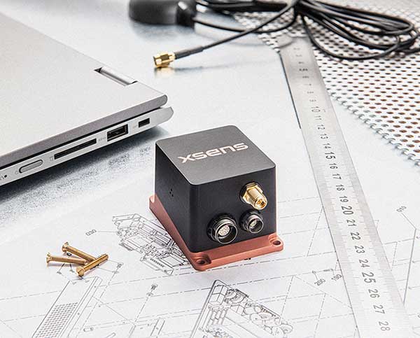
    Septentrio has entered into a commercial agreement with Sapcorda, a global provider of sub-decimeter GNSS corrections.

    Through the collaboration with Sapcorda, Septentrio will pioneer an no-hassle corrections integration into a new line of products for the high-accuracy industrial market.

    These new products will consist of Sapcorda’s SAPA Premium corrections integrated directly into Septentrio’s latest GNSS receiver technology. The result is sub-decimeter accuracy, which is available to users right out of the box. This significantly simplifies the user’s GNSS receiver set-up process and eliminates the hassle of corrections service subscription and maintenance.

    Such GNSS receivers acquire corrections via internet as well as via satellite broadcast and deliver reliable, broadly available sub-decimeter positioning to high-volume industrial applications.

    Sapcorda integration program

    Sapcorda release its SAPA augmentation service integration program on May 14, following the launch of its SAPA Premium service. The integration program targets companies integrating GNSS chips or receivers and looking to enable their systems to perform in high-accuracy mode.

    The program offers step by step service integration and proof of concept guidance for upgrading the integrators’ GNSS systems to deliver down to centimeter-level positioning accuracy.

    The program also includes the offering of free service data, used to validate positioning performance on the target application. The program participants also receive commercial support for introducing the correction data on their marketed products.

    The SAPA service is delivered using optimized data format and can be integrated by modern or traditional high-accuracy receivers compatible with open standards such as SPARTN and RTCM.

    Sapcorda’s SAPA services are designed to bring high-precision GNSS positioning to mass market, as well as general industrial and automotive applications. The correction data stream is optimized for homogeneous performance and end-to-end data security with continental coverage in the United States and Europe.

    The service data transmission also provides unmatched low bandwidth consumption, with broadcast transmission via direct IP connection or geostationary satellite signal (L-band).

    Sapcorda was established in 2017 to provide an open approach to a safe, broadly available and scalable corrections service. By adding Sapcorda’s SAPA service to its corrections portfolio, Septentrio begins offering sub-decimeter accuracy with quick convergence time anywhere in the U.S. and Europe.

    Autonomous vehicles, robots

    “This collaboration allows both companies to bring innovative solutions, inspired by the growing market of autonomous vehicles and robots, to the high-accuracy industrial markets,” said Jan van Hees, business development director at Septentrio. “By integrating Sapcorda’s SAPA service into our products, we are completely removing the hassle of managing corrections for the customers. This means faster set-up times and worry-free, always-on high-accuracy positioning throughout the whole receiver lifetime.”

    “At Sapcorda our focus is on providing a high-accuracy service suitable for demanding applications where both performance and safety is critical. This includes land robots, UAVs, logistic applications and autonomous vehicles,” said Botho Graf zu Eulenburg, CEO at Sapcorda. “Septentrio’s field-proven high-precision GNSS receivers and their focus on reliability and robustness aligns perfectly with our mission and the capabilities of our SAPA services.”

    This broadens the range of Septentrio’s existing GNSS solutions, allowing the company to serve a wide range of customers with various requirements in terms of accuracy, operation location and scalability. Read Septentrio demystifies GNSS corrections for more about GNSS corrections and correction methods such as Sapcorda SAPA (PPP-RTK) service.

  • Quectel publishes white paper on challenges faced by eMobility providers

    Quectel publishes white paper on challenges faced by eMobility providers

    Photo: Quectel
    Photo: Quectel

    Quectel Wireless Solutions has published a new white paper titled “Why GNSS for eMobility must balance precision, price, power and packaging.”

    According to Quectel, this paper details the challenges eMobility providers face in enabling vehicles such as eScooters and eBikes to be located in deep urban canyons. The white paper also examines why accurate location data will be vital in enabling the ride-sharing industry to comply with regulation to restrict eMobility usage on sidewalks and other areas, Quectel said.

    The report also details drive test data conducted on an eScooter in San Francisco. The data demonstrates the enhanced accuracy offered by L1 and L5 plus dead reckoning capability.

    Finally, the white paper discusses how the Quectel LC79D is enabling the eMobility industry to harness the fusion of different sensors in a very small footprint at low incremental cost with unparalleled accuracy, the company added.

    “eMobility providers face substantial challenges when dealing with location in deep urban environments,” said Mark Murray, vice president of sales for GNSS and automotive at Quectel. “First and foremost, customers need to be able to find the vehicle and cities need to have the assurances that these eBikes and eScooters are operated in mutually agreed locations.”

  • Xsens embeds RTK capability in latest commercial motion sensors

    Xsens embeds RTK capability in latest commercial motion sensors

    The MTi-680G GNSS/INS module. (Photo: Xsens)
    The MTi-680G GNSS/INS module. (Photo: Xsens)

    Xsens, manufacturer of motion-tracking modules, has launched real-time-kinematic (RTK)-compatible motion trackers. The development is designed to bring centimeter-accurate positioning within reach of a new generation of affordable commercial devices.

    The RTK extension to conventional satellite positioning signals reduces the maximum positioning error from around ±1 meter in standard commercial GNSS receivers to typically ±2 centimeters. Companies developing innovative new products in non-military markets such as smart farming, autonomous vehicles and coastal maritime equipment have been keen to take advantage of high-precision RTK capability to enable new applications and more automated functions, according to an Xsens press release.

    The MTi-680G is a new product in the Xsens MTi 600-series. The MTi-680G, an integrated GNSS/inertial navigation system (INS) module, features an integrated RTK GNSS receiver, as well as providing synchronized 3D attitude (tilt, inclination) and heading outputs.

    The new MTi-680G also features upgraded firmware that substantially accelerates the module’s internal signal processing compared to non-RTK modules. Synchronizing the global position coordinates with the module’s attitude, heading and velocity outputs, the MTi-680G can provide a comprehensive positioning and navigation output for any carrier device, including of devices such as drones that move at high speed, at a maximum output data rate of 400 Hz.

    The RTK-enabled module also offers these features:

    • Precise factory calibration of every production unit
    • High immunity to magnetic interference
    • Adaptive firmware operation to optimize performance in various types of scenario
    • Easy-to-use, free MT Software Suite developer tools to accelerate integration into end-product designs
    • Out-of-the-box operation with Xsens’ MTi development kits

    “Centimeter-accurate positioning at an affordable price for commercial applications — this is the promise of the new RTK-compatible MTi-680G product,” said Boele de Bie, Xsens CEO. “From seed-sowing agricultural robots to autonomous cargo ships, a whole new generation of applications is now possible thanks to the centimeter-level accuracy of the MTi-680G’s position measurements.”

    The MTi-680G is available for sampling now.

  • Tallysman extends warranty for housed GNSS antennas purchased after Jan. 1

    Tallysman extends warranty for housed GNSS antennas purchased after Jan. 1

    Photo: Tallysman
    Photo: Tallysman

    Tallysman Wireless has extended the standard warranty from one to three years for all housed GNSS antennas and radio-frequency accessory products purchased after Jan. 1.

    The warranty comes about as a result of very low observed failure rates over the company’s 10-year history and its ongoing quality initiatives.

    Tallysman Wireless is a leader in the GNSS antenna design and manufacturing industry. Tallysman offers a wide range of GNSS antenna elements, which includes accurate, low-profile ceramic patch (Accutenna), lightweight helical, high-efficiency Alfred loop (VeroStar) and precise cross dipole (VeraPhase and VeraChoke) technology antennas. All housed versions of these antennas are covered in the new standard three-year warranty.

    Also included in the warranty period is the Tallysman line of radio-frequency accessories that includes low-noise inline amplifiers; compact, low-loss signal splitters; and power-regulated bias tees.

    The standard warranty does not cover environmental hazards, such as lightning strikes, and abuse, such as physically damaged housings, ripped connectors and cables, normal corrosion, and wear and tear.

  • Septentrio strengthens inertial GNSS portfolio with AsteRx-i D UAS

    Septentrio strengthens inertial GNSS portfolio with AsteRx-i D UAS

    A new high-performance compact GPS/GNSS receiver with an on-board IMU sensor, tailored to the needs of UAV applications

    Septentrio has released a new GNSS/INS receiver, the AsteRx-i D UAS. This multi-frequency receiver combines reliable centimeter-level positioning with 3D orientation, enabling automated navigation of aerial drones and robots.

    GNSS signals received include the American GPS, European Galileo, Russian GLONASS, Chinese BeiDou, Japan’s QZSS and India’s NavIC.

    With a high-performance IMU (inertial measurement unit) from Analog Devices integrated directly into the receiver board, AsteRx-i D UAS is compact and lightweight. Aboard the drone, its small form-factor combined with exceptionally low power consumption results in extended battery life and longer flight times.

    “With this product we introduce into our inertial-GNSS portfolio an IMU which allows us to reduce the weight and power consumption of our UAS boards while making them easier to integrate. These are all key elements for a successful UAV platform.”

    AsteRx-i D UAS is the first commercial product resulting from Septentrio’s collaboration with Analog Devices, delivering robust positioning and attitude (heading, pitch and roll) in demanding industrial environments. Both single-antenna and dual-antenna versions are available.

    The single-antenna version provides a lightweight solution optimizing the system SWaP (size, weight and power). The dual-antenna version is designed for machines that need reliable heading directly from the start.

    AsteRx-i D UAS comes with Septentrio’s Advanced Interference Mitigation (AIM+) technology. In aerial drones, where many electronics are crammed into a small space, neighboring devices can emit electromagnetic radiation, interfering with GNSS signals. AIM+ offers protection against such interference resulting in faster set-up times and robust continuous operation.

    The on-board IMU from Analog Devices is exceptionally robust against mechanical vibrations. This IMU combined with Septentrio’s anti-shock LOCK+ technology makes AsteRx-i D UAS resilient against impact during takeoff and landing.

    The AsteRx-i D UAS evaluation kit is now available in Septentrio’s online shop, which offers direct access to the company’s latest GNSS technology. For more information, contact [email protected].

    Related insight articles: Revolutionizing Precision Ag: drones with high-performance GPS+INS


    Featured image: Septentrio

  • Microchip offers phase noise analyzer for precision oscillator characterization

    Microchip offers phase noise analyzer for precision oscillator characterization

    Next-generation phase noise instrument combines timing technologies in a smaller, higher performance measurement instrument

    Photo: Microchip Technology
    Photo: Microchip Technology

    To help research and manufacturing engineers make precise and accurate measurement of frequency signals, including those generated by atomic clocks and other high-performance frequency reference modules and subsystems, Microchip Technology Inc. has announced the availability of the new 53100A Phase Noise Analyzer, a next-generation phase noise test instrument.

    The 53100A Phase Noise Analyzer is designed for engineers and scientists who rely on precise and accurate measurement of frequency signals generated for 5G networks, data centers, commercial and military aircraft systems, space vehicles, communication satellites and metrology applications.

    Capable of measuring radio frequency (RF) signals up to 200 MHz, the new test instrument rapidly acquires frequency signals and characterizes the phase noise, jitter, Allan deviation (ADEV) and time deviation (TDEV) quickly and precisely. All attributes of a frequency reference can be completely characterized with a single instrument within minutes.

    The 53100A Phase Noise Analyzer enables a variety of configurations by allowing up to three separate devices to be tested simultaneously using a single reference, enabling higher capacity for stability measurements. At 344 x 215 x 91mm (13.5 x 8.5 x 3.6 inches), the phase noise test instrument is small enough for integration into manufacturing automated test equipment (ATE) systems, yet powerful enough for laboratory-grade metrology. Its interface provides backward compatibility with Microchip’s 51xxA test sets’ command and data stream, reducing the need to redesign existing ATE infrastructure.

    The 53100A Phase Noise Analyzer provides flexibility by allowing an input reference device to be connected through the front panel at a different nominal frequency than the device under test — allowing a single reference to characterize a variety of oscillator products. Rubidium frequency standards such as Microchip’s 8040C-LN or a quartz oscillator such as Microchip’s 1000C Ovenized Crystal Oscillator (OCXO) could be used as a reference as well as other manufacturers’ precise oscillators.

    The 53100A Phase Noise Analyzer is available now. Microchip supports the 53100A Phase Noise Analyzer with technical support services as well as an extended warranty.

  • Fibocom modules complete first data call on China’s 5G standalone network

    Fibocom modules complete first data call on China’s 5G standalone network

    Fibocom’s 5G modules FG150 and FM150 have completed the first data call and end-to-end data transmission services under China Mobile’s Standalone-Structured 5G network. The download rate exceeds 100 Mbps.

    Fibocom is a leading provider of cellular embedded wireless module solutions for the internet of things (IoT).

    Fibocom FG150 and FM150 5G modules are the first 5G modules based on the Qualcomm SDX55 platform to offer the data-transmission services under the SA-structured 5G network in China, Fibocom said. Its IoT wireless modules incorporate GNSS receivers that receive GPS, GLONASS, Galileo and Beidou signals.

    See a test video here:

    “Wireless modules are essential for communication between IoT terminals and the base stations. As the world’s leading IoT wireless module solution provider, we are proud that our 5G modules have achieved another R&D milestone in the industry,” said Tiger Ying, CEO of Fibocom. “The completion of the first data call under SA-Structured 5G network is a significant step towards realization of all the three 5G features (eMBB, uRLLC, mMTC) in IoT industry and helps our customers to accelerate the large-scale deployment of 5G industry applications.”

    The test was run on the Fibocom FM150 5G module with China Mobile’s 5G SIM card under the n41 network frequency band in the Shenzhen Mobile 5G Joint Innovation Center.

    The Fibocom FM150 5G module has been successfully registered on the 5G SA network and established the PDU session. In the 5G SA communication process, the establishment of the PDU session is a symbolic link for successful dialing.

    Photo: Fibocom
    Photo: Fibocom

    Fibocom FG150 and FM150 5G modules support both 5G SA and NSA network architectures, providing an integrated multi-network solution that is compatible with the global 5G Sub 6 and millimeter-wave bands. Fibocom 5G modules are compatible with both LTE and WCDMA standards, reducing customers’ investment in the early stages of 5G deployment and helping customers to switch their older product lines to 5G product lines quickly.

    Fibocom’s 5G modules have global coverage, accelerating scale deployment of the 5G IoT applications. Applications include: 4K/8K video live broadcast, cloud office (ACPC), drone, robot, AR/VR, 5G virtual dress mirror, 5G cloud game, 5G digital signature, 5G wireless gateway, 5G CPE, 5G SD-WAN, smart grid, telemedicine, connected cars, intelligent transportation system, autonomous driving, smart homes and smart cities.

  • Anti-jam technology gets smaller with NovAtel system

    Anti-jam technology gets smaller with NovAtel system

    Photo: NovAtel
    Photo: NovAtel

    Hexagon | NovAtel launched the GAJT-410ML GPS anti-jam system in 2019. The compact design of the new, smaller version of NovAtel’s GPS Anti-Jam Technology (GAJT) can be rapidly integrated into space-constrained military vehicles (see photo). The system is easy to use while protecting GPS-based navigation and precise timing receivers (including M-code) from intentional jamming and accidental interference, according to NovAtel.

    Spoofing, or the ability to give false data to a receiver, is a different challenge from jamming, with potentially even graver consequences. The GAJT portfolio provides protection from both jamming and spoofing to best defend military systems.

    Spoofing Detection. As a trusted partner for guidance, navigation and control, NovAtel is developing robust spoofing detection technology that will be available in the company’s product portfolio soon. The additional spoofing information empowers users to make informed decisions about the radio frequency environment they are operating in, alerting them if malicious actors are present. This provides actionable intelligence as part of a layered approach to defend against jamming and spoofing.

    NAVWAR Support. NovAtel OEM components and military off-the-shelf items are engineered to deliver precise, assured positioning and timing. Deep GNSS expertise and lean manufacturing capabilities enable the effective delivery of high-performance products in large volumes with minimal production and delivery times. This approach is combined with a high level of support to achieve low product return rates.

  • Parker LORD launches all-in-one RTK system

    Parker LORD launches all-in-one RTK system

    Photo: Parker LORD
    Photo: Parker LORD

    Parker LORD has launched the 3DM-GQ7 dual-antenna RTK inertial navigation system with multiple integrated aiding sensors and support for external aiding.

    It has two integrated real-time kinematic (RTK)-capable multi-band multi-constellation GNSS receivers, integrated barometric pressure sensor, magnetometer, and hardware support for wheel odometry. It also has an application programming interface (API) for external sensor measurements.

    The 3DM-GQ7 offers advanced sensor fusion for accurate measurements in challenging environments. It provides seamless operation during temporary GNSS signal outages and online tracking of inertial measurement unit (IMU) error sources for superior dead-reckoning.

    An optional network RTK receiver, the 3DM-RTK, allows users to connect and communicate to the company’s SensorCloud RTK Connection network. This makes for an all-in-one solution (GNSS-INS + RTK + SensorCloud RTK).

    3DM-GQ7 Features

    • High quality position, velocity and attitude estimates at rates up to 1 kHz
    • 2-cm position accuracy (in good conditions with RTK corrections available)
    • 0.1 degree roll/pitch accuracy; 0.25 degree heading accuracy with dual-antenna GNSS, depending on conditions
    • All-in-one system solution (GNSS-INS + RTK + SensorCloud RTK)
    • Applications include drones, autonomous vehicles and legged robots