Tag: OEM

  • Launchpad: Tracking drones, mapping water

    A roundup of recent products in the GNSS and inertial positioning industry from the September 2018 issue of  GPS World magazine.

    OEM

    Reference receiver

    For real-time networks (RTN)

    Photo: Trimble
    Photo: Trimble

    The Trimble Alloy GNSS reference receiver is designed for continuously operating reference stations (CORS). It offers 672 channels and constellation tracking of GPS, GLONASS, BeiDou, Galileo, QZSS, IRNSS and SBAS for robust and reliable reference data. With an IP68 rating for protection against dust and moisture, the Alloy performs in rugged environments to meet the demands of professionals in earth science, surveying, construction, mapping and agriculture. The Alloy allows RTN owners and operators to track and log all current and planned GNSS and deliver absolute position monitoring, as well as centimeter-level accuracy in real time with Trimble RTX precise point positioning technology. Featuring a four-line OLED screen, the receiver displays key information without the need to scroll through multiple menus. Other features include dual hot-swappable batteries, multiple power inputs and serial ports, Wi-Fi connectivity and remote access options.

    Trimble, www.trimble.com
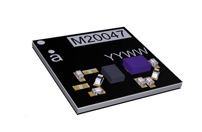
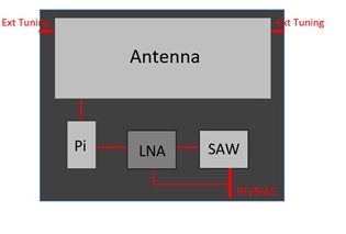
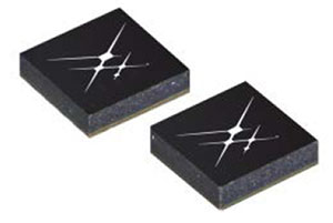
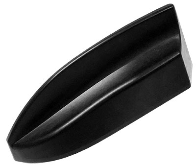
    GNSS antenna

    Designed for precision positioning

    Photo: Tallysman
    Photo: Tallysman

    The TW7875 magnetic-mount GNSS antenna is designed for precision dual-frequency positioning. It is capable of receiving GPS L1/L5, GLONASS G1, BeiDou B1, Galileo E1/E5a and NavIC L5. It employs Tallysman’s Accutenna technology, which provides superior multipath signal rejection due to its low axial ratio across the full bandwidth. It also provides a linear phase response and tight phase-center variation. It is designed for precision agriculture, autonomous vehicles and other precision applications. The TW7875 is housed in a magnetic-mount IP67-rated housing, but can also be mounted with screws or adhesive tape. The embedded version, Model TW3875, has a wide selection of connectors and custom cable lengths, and can be custom tuned by Tallysman to ensure optimum performance within the customer’s enclosure.

    Tallysman, www.tallysman.com
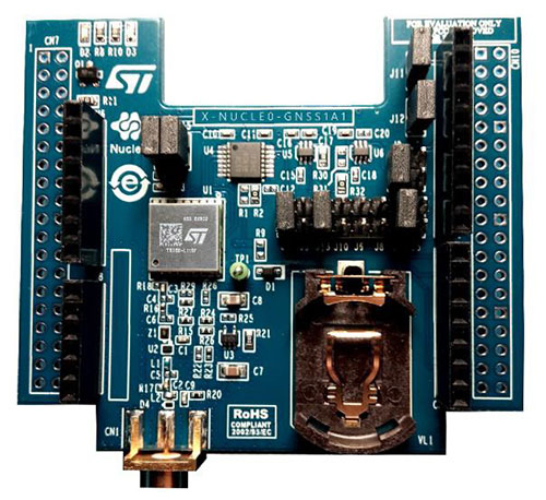
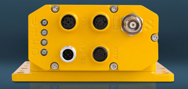
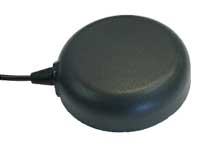
    GNSS+INS

    Combined in Small Package

    Photo: NovAtel
    Photo: NovAtel

    The SPAN CPT7 provides tightly coupled GNSS+INS navigation technology in a rugged, compact unit. Commercially exportable and designed for integration into a wide variety of applications, it delivers assured positioning anywhere. SPAN technology tightly couples GNSS and inertial navigation system (INS) measurements. The system enables continuous, robust positioning and fast reacquisition in challenging navigation environments where GNSS signals may be unreliable or unavailable for short periods. Dual antennas deliver instant alignment. NovAtel’s OEM7 Interference Toolkit (ITK) provides interference detection and mitigation, with the spectrum analysis function allowing integrators to identify interference within the GNSS frequency bands and implement digital filters to eliminate the problem.

    NovAtel, novatel.com

    Inertial measurement

    COTS device with 6-degrees of freedom

    Photo: Northrop Grumman
    Photo: Northrop Grumman

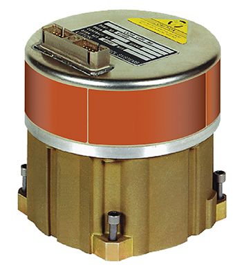
    The commercial-off-the-shelf (COTS) LN-200C is a compact and lightweight six-degrees-of-freedom inertial measurement unit (IMU) that can be used for instrument stabilization, motion compensation and navigation in commercial, aerospace and industrial applications. Based on fiber-optic gyro (FOG) technology, the LN-200C IMU’s hermetic seal and lack of moving parts help to ensure low noise and extended operational life. The LN-200C can serve as a drop-in replacement for applications that don’t require the full operational range of the original LN-200 and that can benefit from the expedited licensing and global ease of use offered by the LN-200C.

    Northrop Grumman, www.northropgrumman.com


    TRANSPORTATION

    C-V2X testing

    Global Certification Forum (GCF) protocol conformance tests available

    Photo: Rohde & Schwarz
    Photo: Rohde & Schwarz

    The Rohde & Schwarz CMW500 wideband radio communication tester and SMBV100A GNSS simulator have been expanded to support Global Certification Forum (GCF) protocol conformance tests for C-V2X device certification. Utilizing the Qualcomm 9150 C-V2X chipset from Qualcomm Technologies, the R&S CMW500 acting as an LTE network simulator allows automakers to test C-V2X direct communications (PC5) according to GCF Work Item 281. The new R&S CMW-KK550 test package includes the 3GPP Protocol Conformance tests from LTE-V2V GCF Work Item 281 and LTE-V2X GCF Work Item 282. The R&S CMW-KU514 C-V2X software package on the R&S CMW500 is used to verify data transmission and reception over the PC5 interface in ideal, faded and congested channel conditions. Together, both packages enable Rohde & Schwarz to support C-V2X device testing through all protocol layers.

    Rohde & Schwarz, www.rohde-schwarz.com

    GNSS + LTE + WI-FI antennas

    Protected against hazards that threaten vehicles

    Photo: Airgain
    Photo: Airgain

    The Multimax FV family is available in a range of configurations, supporting multi-constellation GNSS. The antennas also support up to dual MIMO LTE (including Band 14 for the FirstNet public safety network), 3×3 MIMO Wi-Fi or 2×2 MIMO Wi-Fi. With a small footprint and a strong, bolt-mount aluminum base, the Multimax FV family provides protection against natural hazards threatening vehicles, including vibration, ice, salt, car washes and tree sweeps. The high-gain antennas deliver a large cellular footprint alongside high-rejection GNSS technology (GPS, GLONASS, Galileo and BeiDou).

    Airgain, www.airgain.com


    UAV

    BVLOS situational awareness

    For Beyond Visual Line-of-Sight (BVLOS) flight operations

    Arctic UAV has adopted Kongsberg Geospatial’s IRIS UAS Airspace Awareness application for BVLOS operations within Canada’s Arctic. IRIS provides simultaneous monitoring of multiple drones. It offers real-time calculation of aircraft separation and communications line-of-sight, real-time visualization of track and weather data.

    Kongsberg Geospatial, www.kongsberggeospatial.com

    Arctic UAV, www.arcticuav.ca

    Marine anti-drone system

    For superyacht, maritime and port industries

    Photo: Martek Marine
    Photo: Martek Marine

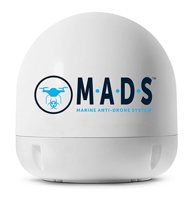
    M.A.D.S detects and identifies commercial drones within a 5+ kilometer range, providing GPS positioning of both drone and pilot together with the drone’s speed and heading. Once a drone threat is established, the system enables a 500-meter electronic exclusion zone to be created around the yacht. Should the drone approach this exclusion zone, its control/video signal is blocked, initiating a fail-safe mode and forcing a landing or return to operator.

    Martek Marine, www.martek-marine.com

    Drone tracking

    Operates on the Wave Relay mobile ad hoc network (MANET)

    The Auto-Tracking Antenna System is a portable ground-to-air antenna for tracking aircraft, including drones. Defense customers can use it for better airborne communications relay and full-motion video camera/sensor data transmission. It can be assembled and deployed in less than 15 minutes.

    Persistent Systems, www.persistentsystems.com


    SURVEY & MAPPING

    Updated software

    For surveying with drones

    Image: Virtual Surveyor
    Image: Virtual Surveyor

    Version 6 of Virtual Surveyor drone surveying software offers a faster, more efficient workflow and better user experience in a more stable platform than previous versions. Along with new capabilities is an improved licensing system and an extended free application. The software generates an interactive onscreen environment through orthophotos and digital surface models generated from a UAV, where the surveyor selects survey points and breaklines to define the topography. It enables land surveyors to complement traditional fieldwork with UAV imagery to generate highly accurate topographic products.

    Virtual Surveyor, www.virtual-surveyor.com

    Forestry platform

    Offers geospatial analytics

    Foresights is a risk management and geospatial analytics platform designed to help clients manage forestry assets quickly, effectively and accurately. Foresights identifies areas of new or potential risk, and delivers operations tracking and forest damage management services. It combines satellite imagery, topography maps, soil maps, meteorological data and near real-time ground input from operational teams to deliver optimized insights. It can detect damage as small as 0.1 hectare (0.25 acre) from pests, disease and drought.

    PlanetWatchers, planetwatchers.com

    Cloud ecosystem

    Integrates four EOS products

    Image: EOS
    Image: EOS

    EOS Platform provides a powerful toolset for geospatial analysts — offering search, analysis, storing and visualization of large amounts of geospatial data. Image data obtained from LandViewer or uploaded from a user’s computer is stored in cloud-based EOS Storage and is instantly available for remote-sensing analysis or image processing. EOS Processing offers 16 workflows that run online, including raster tools, remote sensing analytics, photogrammetry and proprietary feature extraction algorithms designed by EOS engineers and data scientists to address the main challenges of agriculture, forestry, oil, gas, retail, city planning, defense and other industries.

    Earth Observing System, eos.com

    Surface water book

    Highlights analysis of data sets

    Cover: Esri
    Cover: Esri

    The Esri book GIS for Surface Water: Using the National Hydrography Dataset by Jeff Simley details how to use geographic information system (GIS) technology to visualize and analyze data sets. Simley is an award-winning cartographer and the former lead of the hydrography program at the United States Geological Survey (USGS). The book examines the complexities of surface water systems and shows readers how to use the Esri ArcGIS software with government water data sets to better study and manage the United States’ vast water system.

    Esri, www.esri.com

    Bathymetry store

    Specializes in online shallow-water data

    EOMAP has opened a commercial online store for global shallow-water bathymetry derived from satellite data. At the store, EOStore Bathymetry, customers can search for and request high-quality data. Satellite-derived bathymetry (SDB) is a valuable tool for the surveying, planning and management of coastal and offshore sites. SDB can provide shallow-water bathymetric data worldwide without the need for a physical presence in the area of interest. EOMAP developed the bathymetry store in response to industry feedback. EOStore Bathymetry offers different horizontal spatial resolutions of the bathymetric grid of 2 to 15 meters, making the data suitable for surveying as well as planning and modeling purposes.

    EOMAP, www.eomap.com

  • Antenova ships tiny GNSS active antenna module

    Antenova ships tiny GNSS active antenna module

    Antenova is shipping its ultra-small GNSS active antenna module for tiny positioning devices, the RADIONOVA M20047-1. The antenna module includes a low noise amplifier (LNA) and surface acoustic wave (SAW) filter for better positioning from difficult locations.

    Antenova Ltd. is a manufacturer of antennas and RF antenna modules for connected devices and the internet of things.

    The RADIONOVA M20047-1 is designed for small consumer devices such as smartwatches. (Photo: Antenova)
    The RADIONOVA M20047-1 is designed for small consumer devices such as smartwatches. (Photo: Antenova)

    The RADIONOVA M20047-1 is an active antenna module for GNSS applications in the 1559-1609 MHz satellite bands using GPS, GLONASS, Galileo or BeiDou.

    The M20047-1 antenna module comprises an SMD antenna with built-in active components: an LNA filter and SAW to boost antenna performance — so designers will not need to add these — contained in a compact FR4 part with low power consumption, measuring 7.0 x 7.0 x 0.9 millimeters and weighing less than 2 grams.

    The onboard LNA and SAW filter act to boost the signal to the GNSS processor in environments where there is a restricted view of the sky or where line-of-sight to the horizon is difficult, the company said.

    Architecture of the Antenova antenna. (Image: Antenova)
    Architecture of the Antenova antenna. (Image: Antenova)

    Antenova has also added an external matching feature to compensate for any de-tuning of the antenna caused by proximity to other components, such as a plastic case or a battery.

    The clear-out area required by the antenna module is only 7.0  x 5.0 millimeters. This, with its tiny size, makes the M20047-1 suitable for small positioning devices where space on the PCB is tight, such as wearable devices, asset tracking devices, sports cameras and equipment and smartwatches.

    The M20047-1 is an alternative to Antenova’s Sinica antenna (part no. SR4G008), which Antenova also recommends for accurate positioning.

    The M20047-1 was first announced at the Consumer Electronics Show in Las Vegas in January.

    Antenova’s antennas are specifically designed for easy integration. The datasheet and evaluation kit for the M20047-1 are available from www.antenova.com. Antenova also provides full engineering support, antenna testing, tuning and integration for its customers.

  • TomTom and STMicroelectronics to offer geolocation tools and services

    TomTom and STMicroelectronics to offer geolocation tools and services

    STMicroelectronics and TomTom are offering a package of development geolocation tools in the STM32 Open Development Environment.

    The tools connect directly to TomTom Maps APIs (Application Programming Interfaces) for location, tracking and mapping data services, accelerating product development, and reducing time-to-market and development costs for developers, the companies said.

    The X-NUCLEO-GNSS1A1 expansion board is based on the Teseo-LIV3F tiny GNSS module. (Photo: STMicroelectronics)

    The development package consists of an STM32 Discovery host board for 2G/3G cellular-to-cloud connectivity, a GNSS expansion board based on ST’s Teseo satellite navigation technology, and a software Function Pack that connects an internet-of-things (IoT) node via a cellular network to a range of TomTom Maps APIs.

    With this hardware and software package and a TomTom developer account, developers can quickly add location-based services to their IoT and smart city applications.

    Among these services are the translation of GPS coordinates into a street address inside a map (Reverse Geocoding), retrieval of nearby point of interests, and the production of accurate navigation directions.

    “We have combined TomTom’s industry-leading location-based and mapmaking technologies with ST’s unrivaled combination of silicon and system expertise to create a unique offering that provides easy access to TomTom’s Maps APIs to empower developers to create groundbreaking, location-aware applications faster and more efficiently,” said Anders Truelsen, managing director of TomTom’s Enterprise Business Unit.

    “Supporting our efforts to facilitate location-based product development, our collaboration with TomTom has built on each company’s strengths to assemble a tailored package of hardware and software tools that is already fully integrated with TomTom cloud services, around the popular STM32 development ecosystem,” said Alessandro Cremonesi, group vice president at STMicroelectronics. “These tools enable native STM32-based location services to accelerate application development of Geo-IoT solutions for fleet management, item tracking, and many other services that depend on fast, accurate location detection.”

    In addition to the STM32 family of Arm Cortex-M core microcontrollers, the development tools leverage ST’s market-proven multi-constellation Teseo positioning-receiver technology to perform all positioning operations including tracking, acquisition, navigation and data output.

  • 2018 State of the GNSS Industry Report

    2018 State of the GNSS Industry Report

    Trends, Obstacles and Opportunities

    Cover: Toria/Shutterstock.com
    Cover: Toria/Shutterstock.com

    Conducted online in July 2018, the GPS World State of the GNSS Industry survey compiled detailed answers to 30 key questions from 273 respondents, spread across six continents.

    Prominent insights gained, and outlined in these pages: the PNT sector is booming, as opportunities outnumber obstacles; well-trained engineers are at a premium; and the Internet of Things is the newest market driver, perhaps the most powerful yet.


    Insights from the Report

    Opportunities for growth in the GNSS industry

    Wireless and consumer emerge as key players for growth

    GPS World report: Survey sector favors multi-GNSS

    GPS World survey: UAVs on a roll to dominance

    Information key to managing amid complex change for GNSS OEMs

    Inertial navigation emerges as winning co-star for transportation sector

    The current state of the Defense, Security and Government PNT sector

    GPS World survey: Capturing the world with maps

  • Information key to managing amid complex change for GNSS OEMs

    Information key to managing amid complex change for GNSS OEMs

    OEMs’ Global Economic Outlook

    Irv Leveson, principal, Leveson Consulting
    Irv Leveson, principal,
    Leveson Consulting

    There’s a saying that “Time stops everything from happening at once” — but what if it doesn’t?

    What if we are in a world in which the U.S. is borrowing growth from the future by increasing debt, China has slowing growth and risky finances, many developing and southern European countries have combinations of economic malaise, recession, high and rising debt and/or double-digit inflation, the U.S. is in disruptive trade negotiations and Britannia waves the rules?

    With the widespread influence of GNSS and the many technologies with which it is now associated or integrated, attention is increasingly turning to the prospects for and nature of applications, where the platform is the message.

    At the same time, economic, political and technological developments are leading to pressing issues in the areas of spectrum management, spoofing and jamming, cybersecurity, privacy, net neutrality, spectrum competition, national security export controls, product liability, space debris and crowding and militarization of space.

    This environment places unprecedented demands on management attention and agility.

    The structure of industries is being transformed. Mergers and acquisitions are reminiscent of the U.S. consolidation of the 1960s, which led to increasing market power among large corporations until economic weakness and new technologies disrupted the leaders.

    This time the changes are taking place on a much more global scale, but nevertheless are becoming large enough to influence markets and competition in location-based sectors and other industries.

    Describe the market for GNSS products/services in your industry sector as of today. (Source: GPS World 2018 State of the Industry survey)
    Describe the market for GNSS products/services in your industry sector as of today. (Source: GPS World 2018 State of the Industry survey)

    Market Intelligence. Executives will need good market intelligence and foresight to keep ahead of fast-developing technology trends in research and development and shifting markets.

    Despite opportunities from renewed economic growth, decisions regarding capital spending and research and development face not only the usual uncertainties about economic paths, interest rates and markets but also an additional extraordinary range of risks across the globe. These range from military and economic warfare, terrorism and hostage taking to financial excesses to appropriation of intellectual property and state subsidies by competing nations.

    In the U.S., where politics is highly polarized, upcoming congressional and presidential elections will certainly lead to large, unexpected changes. U.S. policies could be extended or reversed, depending on election outcomes, in the areas of taxation, regulation, and levels of defense spending, with implications for modernization of GPS satellites, ground systems and military user equipment.

    What is your business outlook for 2019? (Source: GPS World 2018 State of the Industry survey)
    What is your business outlook for 2019? (Source: GPS World 2018 State of the Industry survey)

    Population Factor. The workplace will have to adjust to further slow population growth. With half of baby boomers yet to retire, job opportunities will continue to be above normal, but so will losses of some skills. The availability of scientific and engineering personnel also will be affected by immigration policies for a long time. In addition, tight labor markets mean issues of labor quality as well as skill.

    Moreover, social and political issues in the workplace are becoming more contentious around race relations, gender equality, sexual harassment, privacy and fairness, with some tech employees pressing companies to reject some types of government business.

    Europe. In the U.K., choice of a hard Brexit could be disruptive for many years despite some possible long-range benefits. There is no getting around the need to renegotiate vast numbers of restrictions, policies and standards. A “soft Brexit” does not appear likely to yield the hoped-for economic benefits of separation and will not fully reduce the costs of the rift.

    The European Union faces the challenge of paying for Galileo and other defense and space programs as well as costly social programs without the contributions of the U.K. At the same time, increased populism is leading to unexpected changes in governments and policies that can reduce cooperation among nations.

    Currency. A strong dollar and rising interest rates in advanced countries can create problems for emerging economies. Trade and currency fluctuations complicate supplier decisions about pricing and the location of production.

    The leaders of China and Russia are entrenched, and in the absence of major economic disruptions they will be able to carry out policies without periodic reversals. China’s ascendancy in technology, including in GNSS and space, will increasingly challenge the West.

    Trade. Politics and economics are joined at the hip, and no less so when it comes to trade. The question at the moment is whether tough trade negotiation tactics will devolve into a sustained trade war, undoing the benefits of the U.S. tax cuts and bringing economic harm to the rest of the world.

    The international Monetary Fund warns that: “Our modeling suggests that if current trade policy threats are realized and business confidence falls as a result, global output could be about 0.5 percent below current projections by 2020.” While some see trade tensions, nationalism and populism as the start of an effort to renegotiate the world order, for now developments are likely to be much less far-reaching.

    While the U.S. economy is currently strong and likely to remain so for a while, risks have been building and economic and financial cycles have not been repealed. Budget pressures from future economic and political reversals can stall spending on defense, space and GNSS, defer GNSS capabilities and stretch deployment schedules.

    All this means turbulence and air pockets down the road. Fasten your seatbelt. FY 2019 is about to take off.


    For more results from the 2018 State of the GNSS Industry, see this page.


    Irv Leveson is an economist with extensive experience examining GNSS markets, applications, benefits and policies. His public studies include: “The Economic Benefits of GPS.” He recently led a National Geodetic Survey study.

  • Hemisphere GNSS completes acquisition of Outback Guidance business from AgJunction

    Hemisphere GNSS completes acquisition of Outback Guidance business from AgJunction

    Hemisphere GNSS has closed its definitive agreement to purchase all of the assets of the Outback Guidance business from AgJunction Inc., along with a new technology licensing agreement.

    The new Hemisphere GNSS logo.

    The acquisition aligns well with Hemisphere’s continued push into the global agriculture market, the company said. In addition to the included IP (intellectual property) licenses for business into the dealer channel, a second license was finalized to allow agriculture steering solutions sales into OEM (original equipment manufacturer), VAR (value-added reseller), and all other segments of the agriculture supply chain.

    Hemisphere has assumed ownership of the Outback assets, including a global sales channel, infrastructure and trademarks. Additionally, licenses to IP and related technology have been executed. Also included are two product development, sales and support facilities, including personnel, located in Hiawatha, Kansas, and Winnipeg, Manitoba, Canada.

    “Outback’s highly knowledgeable personnel and dealer network will provide us with a key piece of the agriculture supply chain that perfectly complements Hemisphere’s current global agriculture strategy,” said Farlin Halsey, president and chief executive officer of Hemisphere GNSS.

    Jeffrey Farrar will lead the Outback business as general manager. Before joining Hemisphere, Farrar was vice president of sales for AgJunction and served in a capacity of director and senior management-level positions for both sales and marketing for AgJunction and Hemisphere GPS. “Jeffrey’s previous leadership and history with the Outback business makes him the ideal person to direct the future growth of this business,” Halsey said.

    “Outback has always been a household name in the agriculture space associated with simplicity, performance, and value, and we intend to keep it that way,” Farrar said. “I look forward to ensuring that the Outback business thrives and that the solution and technology offerings are maintained and supported, as we look to refresh and update product lineups. We are committed to helping and supporting our dealer network, farmers, and growers alike to ensure they continue feeding the world.”

    The addition of Outback represents Hemisphere’s continued effort to make significant investments to expand its presence in the global agricultural market. Hemisphere has seen successful revenues and wide-reaching positive feedback in recent years with its OEM-focused agriculture products. Hemisphere seeks to further integrate its high-precision GNSS positioning technology via systems and services offered by the Outback dealer network.

    The Outback channels of communication including customer support, sales and website, will remain as they currently operate. The Outback dealer network will not see any interruption during this transition period.

  • Skyworks launches new GNSS LNA front-end modules

    Skyworks launches new GNSS LNA front-end modules

    Image: Skyworks
    Image: Skyworks

    Skyworks has unveiled two new GNSS low-noise amplifier (LNA) front-end modules. The SKY65933-11 and SKY65943-11 both integrate Skyworks’ proprietary TC-SAW filters.

    The modules are designed specifically for internet of things (IoT) applications including smartwatches, action cameras, drones, asset trackers and personal navigation devices. athey are designed for wireless module and IoT device manufacturers, providing a turnkey GNSS connectivity solution in a compact form factor.

    Both solutions offer:

    • integrated pre- and post-filter, LNA and matching to reduce PCB area versus a discrete implementation
    • single DC supply for design flexibility and simplicity
    • multi-GNSS compatibility to cover GPS, GLONASS, GALILEO, COMPASS (BeiDou) and QZSS receiver applications in the 1559-1606 MHz frequency range
    • extremely low leakage current (1 uA max) benefitting battery-powered IoT devices
    • highly manufacturable and low-cost surface-mount technology (SMT) in a 2.5 x 2.5 mm multi-chip module (MCM) package.

    SKY65933-11:

    • Fully integrates all functional blocks, no external components required
    • Supply range: 1.5 to 2.85 V
    • Package: 16L 2.5 x 2.5 mm

    SKY65943-11:

    • Exceptional out-of-band rejection and P1dB compression point
    • Supply range: 1.62 to 3.3 V
    • Package: 10L 2.5 x 2.5 mm
  • Swift ​​Navigation ​​announces full BeiDou and Galileo support for ​​Piksi Multi

    Swift ​​Navigation ​​announces full BeiDou and Galileo support for ​​Piksi Multi

    The Piksi Multi GNSS receiver. (Photo: Swift Navigation)
    The Piksi Multi GNSS receiver. (Photo: Swift Navigation)

    Swift ​​Navigation has upgraded the firmware to ​​its flagship product — the Piksi Multi GNSS ​​receiver. This marks the sixth major release to Piksi Multi since it was launched in February 2017.

    The upgrade is available free of charge to Swift customers. ​​

    The firmware release also enhances Duro, the ruggedized version of the Piksi Multi receiver housed in a military-grade, weatherproof enclosure for long-term outdoor deployments.

    Swift ​​Navigation is a ​​San ​​Francisco-based ​​tech ​​firm building centimeter-accurate ​​GNSS ​​technology and a cloud-based corrections service​​ to ​​power ​​a ​​world ​​of ​​autonomous ​​vehicles, the company said. ​​

    The Duro enclosure. (Photo: Swift Navigation)
    The Duro enclosure. (Photo: Swift Navigation)

    Firmware Release 2.0 for Piksi Multi and Duro supports two additional major satellite constellations — the Chinese constellation (BeiDou B1/B2) which, once completed, will contain 37 satellites and the European Union-based constellation (Galileo E1/E5b), which will eventually consist of 30 satellites.

    Adding to the existing GPS, GLONASS and SBAS constellations already supported by Swift’s GNSS receivers means that users will have more access and visibility from satellite systems across the globe.

    Piksi Multi’s performance will further improve over time as the total of 136 satellites planned for these major constellations are fully deployed.

    The addition of BeiDou and Galileo constellations creates more robust positioning performance in a variety of challenging skyview environments and puts Piksi Multi on par with leading industry receivers costing up to ten times a much.

    With this 2.0 release, Piksi Multi is feature-complete, and Swift’s engineering team has delivered on planned product features on the Piksi Multi Product Summary.

    Firmware ​​Version ​​2.0 ​​Enhanced Receiver Performance Highlights

    MSM Messages 4-7. The ​​new ​​firmware ​​adds support for RTCM 3.2 Multi Signal Messages (MSM). Though Swift devices already support RTCM 3.1, the addition of MSM allows for another flavor of differential corrections supported by BeiDou and Galileo, while also supporting both GPS and GLONASS with MSM new messages. MSM also allows for interoperability with other existing third-party GNSS receivers for all modern signals and constellations.

    Fix Improvements. Firmware 2.0 provides Piksi Multi and Duro improvements on fixing in long base lines in poor atmospheric conditions, making the devices more resilient to Ionospheric effects during periods of high Ionospheric activity.

    Higher Baud Rate Support for UART. New baud rates were added including 460800 and 921600.

    Acquisition Improvements. Enhancements made allow Piksi Multi and Duro to power on to a usable signal more quickly and acquire satellites in start-up mode faster, by several seconds.

    “The growing Swift engineering team has been hard at work developing Piksi Multi to its full potential,” said Samir Kapoor, executive vice president of engineering and product at Swift Navigation. “With support for all modern satellite constellations and multiple performance improvements, Piksi Multi offers unmatched affordability, priced at ten times the savings yet on par with other leading GNSS receivers.”

    “Swift’s vision of making GNSS devices that are centimeter-accurate, with fast RTK convergence times and robust positioning performance all at highly-competitive prices has come to fruition,” Kapoor said. “With Piksi Multi feature complete, we look forward to adding to our line of products with additional offerings later this year.” ​

  • Three-axis gyro launched for optical image stabilization

    Three-axis gyro launched for optical image stabilization

    Photo: Gladiator Technologies
    Photo: Gladiator Technologies

    Gladiator Technologies has introduced a three-axis, inertial rate system gyroscope. The G300D gyro is 0.67 cubic inches, low power and high speed, making it suitable for image stabilization applications, the company said.

    The G300D has message timing under 150 microseconds and output data rates up to 8 kHz with external sync. A micro-electro-mechanical gyroscope, it has an ARW of <0.0028 degrees/sec/√Hz and an option for both 24 and 32-Bit LSB for exceptional resolution.

    Users can configure the G300D to their desired configuration using a software development kit or through software protocols to simplify the integration process.

    “The G300D, with a 250-Hz bandwidth, allows user to replace more complicated and expensive gyros for image stabilization applications,” said Rand Hulsing, chief scientist at Gladiator Technologies. “The three-axis package is also convenient for mounting in any orientation for tight space requirements.”

    “The G300D product is a good example of our SX-series architecture, which has enabled Gladiator to extend our sensor fusion technologies into high speed applications with message latency under 150 usec,” said Lee Dunbar, chief software architect at Gladiator Technologies. “This output offers minimal phase lag like an analog sensor by virtually eliminating typical signal processing and digital conversion overheads.”

    The G300D gyro is non-ITAR.

  • Rohde & Schwarz expands tester and simulator for V2X standard

    Rohde & Schwarz expands tester and simulator for V2X standard

    Rohde & Schwarz has expanded the capabilities of its R&S CMW500 wideband radio communication tester and R&S SMBV100A GNSS simulator to support Global Certification Forum (GCF) protocol conformance tests for C-V2X device certification.

    Utilizing the Qualcomm 9150 C-V2X chipset solution from Qualcomm Technologies Inc., a subsidiary of Qualcomm Incorporated, the R&S CMW500 acting as LTE network simulator now allows automakers to test C-V2X direct communications (PC5) according to GCF Work Item 281.

    3GPP Release 14 specifies the direct communications specifications for C-V2X PC5, which enables vehicle-to-vehicle (V2V), vehicle-to-pedestrian (V2P) and vehicle-to-infrastructure (V2I) safety applications, and does so without a mobile cellular subscription or network assistance and operates in ITS bands 46D (5.8 GHz) and 47 (5.9 GHz).

    The new R&S CMW-KK550 test package includes the 3GPP Protocol Conformance tests from LTE-V2V GCF Work Item 281 and LTE-V2X GCF Work Item 282. As recently announced, the R&S CMW-KU514 C-V2X software package on the R&S CMW500 is used to verify data transmission and reception over the PC5 interface in ideal, faded and congested channel conditions. Together, both packages enable Rohde & Schwarz to support C-V2X device testing through all protocol layers.

    C-V2X device testing is a significant step towards achieving the goal of having fully connected and autonomous vehicles to improve public safety and increase traffic efficiency.

    C-V2X, including direct communications for safety applications, nicely and synergistically complements network-based communications that deliver telematics services and various use cases for connected infotainment and over-the-air software updates.

    “C-V2X PC5 radio technology has quickly advanced to a pre-commercial stage, and Rohde & Schwarz is pleased to be the first test equipment vendor to offer a comprehensive C-V2X test suite,” said Anton Messmer, vice president of mobile radio testers at Rohde & Schwarz. “The automobile industry can now verify functionality and performance of C-V2X devices, as well as start device testing as per 3GPP protocol conformance tests.”

    “This expanded capability complements our support for European eCall and shows our long-standing support for automotive applications,” Messmer said. “Rohde & Schwarz is committed to providing industry-leading test platforms for C-V2X device performance testing and GCF device certification.”

  • Airgain offers 6-in-1 and 5-in-1 antennas with GNSS, LTE, Wi-Fi

    Airgain offers 6-in-1 and 5-in-1 antennas with GNSS, LTE, Wi-Fi

    Photo: Airgain
    Photo: Airgain

    Airgain Inc. has released its Multimax FV 6-in-1 and 5-in-1 antennas.

    The compact Multimax FV family is available in a range of configurations, supporting multi-constellation GNSS. The antennas also support up to dual MIMO LTE (including Band 14 for the FirstNet public safety network), 3×3 MIMO Wi-Fi or 2×2 MIMO Wi-Fi.

    Airgain is a provider of advanced antenna technologies used to enable high-performance wireless networking across a broad range of devices and markets, including connected home, enterprise, automotive and internet of things.

    With a small footprint and a strong, bolt-mount aluminum base, the Multimax FV family provides protection against natural hazards threatening vehicles, including vibration, ice, salt, car washes and tree sweeps.

    In addition, the elegant shark-fin design allows fleet owners to add style to their vehicles without compromising performance.

    The new products include high-gain antennas that deliver a larger cellular footprint alongside high rejection GNSS technology with coverage for multiple satellite systems including GPS, GLONASS, Galileo and BeiDou.

    “Not only does reliable connectivity matter to fleet owners, but also aesthetics and the antenna form factor,” said Reed Pangborn, Airgain’s vice president of Channel Sales for North America. “Our new Multimax FV family is uniquely designed to deliver in each of these key areas. Owners can rely on our commitment to providing class-leading performance across cellular, Wi-Fi and GNSS as well as our industry-best reliability, but all built into a new, sleeker design that complements today’s fleet vehicles.”

    The Multimax FV family of antennas can be ordered in either black or white and are available now.

  • UAVs used for disaster management, identifying threats

    UAVs made international headlines this month with an apparent attack on Venezuelan President Maduro in Caracas on Aug. 4 during his speech at a military parade.

    The attack seems to have been mounted by those operating two small six-rotor UAVs similar the DJI Matrice 600 — one was certainly carrying explosives because it was videoed exploding. These drones showed up somewhere near Maduro and disrupted not only the president’s speech, but also broke up the parade with participants running for cover.

    One drone seemed to collide with an apartment building, fell to the ground, and then fire broke out in an apartment on the first floor. Firefighters apparently disputed a drone explosion saying that a propane gas tank had exploded inside an apartment, but images show a significant hole blown in the wall below the apartment window.

    A number of discrepancies could suggest that the incident was staged, but there were injuries to several in the parade below where the first drone exploded, and the apartment fire was only 400 meters from Maduro’s review stand. The “apartment drone” appeared to behave as if control had been lost, possibly due to anti-drone jamming. Check out pictures, a video and a comprehensive analysis of these events on Bellingcat here.


    Zephyr-S launched for flight test. (Photo: Airbus)
    Zephyr-S launched for flight test. (Photo: Airbus)

    Meanwhile, on a more drone-positive note, the Airbus Zephyr S pseudo-satellite, solar-powered UAV achieved a world endurance record flight which was just 3 minutes short of 26 days, eclipsing a previous record of 14 days set by a Zephyr prototype. The ultra-lightweight UAV took off July 11 July and landed Aug. 6. This is likely the longest ever flight by an air-vehicle without refueling (balloons and spacecraft excepted).

    The Zephyr S is the first of three such vehicles built by Airbus for the U.K. Joint Forces Command. The Zephyr-S flies around 70,000 feet in the stratosphere, powered solely by sunlight, and is aimed at providing short turn-around, satellite-like communications and observation services for both commercial and military customers. The potential exists to support disaster monitoring of fires, earthquakes, oil spills and the like, and to connect almost everywhere in the world that doesn’t already have established communications.

    Following evaluation of the flight test results, further flights are planned from a new base at Wyndham airfield in Western Australia. The aircraft is extremely light and does not have an undercarriage, so it’s hand launched and retrieved under minimal wind conditions.


    Joe Lee and paramedics UAV pilot Scott Mcleod confer prior to a simulated medical rescue scenario. (Image: Kongsberg Geospatial)
    Joe Lee and paramedics UAV pilot Scott Mcleod confer before a simulated medical rescue scenario. (Image: Kongsberg Geospatial)

    Meanwhile, at a deserted airfield near Pembroke, Ontario, Canada, a simulated disaster exercise, led by a Royal Canadian Mounted Police (RCMP) incident commander and supported by personnel from Transport Canada and the National Research Council, was evaluating a new air traffic management system supplied by Kongsberg Geospatial from Ottawa.

    Integrating drones with disaster management air traffic is one aspect of the Emergency Operations Airspace Management System (EOAMS), a situational awareness system which provides first responders with situational awareness of the airspace around a disaster scene. The system integrates real-time data from a number of sensors, including 3D airborne radar, ground radar, ADS-B (Automatic Dependent Surveillance — Broadcast) sensors, video and GPS. Real-time information was presented to participants on regular computer displays and through a Microsoft HoloLens “mixed reality” visor.

    Drones were flown beyond visual line-of-sight (BVLOS) at up to 2 km away from the airfield while the trial emulated emergency scenarios including a plane crash, a medical emergency, and the protection of a VIP threatened by an approaching, unauthorized drone. Drones were operated by the RCMP and local paramedics.

    The EOAMS system displayed ground tracks and the identity of a variety of emergency aircraft, and emergency ground vehicles, and enabled safe flight of UAVs within the same airspace. Non-participating drones in the area of the disaster were also identified as possible threats to police and medical aircraft involved in the recovery efforts.

    The RCMP and paramedic pilots flew consumer-model drones including the DJI Mavic to test the system’s capacity to detect small drones. Position outputs from these drones were used to verify the accuracy of the EOAMS-displayed plots. A light aircraft was also used to simulate different airborne assets, including a water bomber.

    What was learned in the trials will be useful in further development of future emergency airspace management systems for use by first responders, police services and other government agencies in Canada.


    RoboTiCan, an Israeli start-up, has developed a unique way of dealing with unwelcome, unidentified drones that intrude into sensitive airspace. With ground-based radar detecting and tracking an incoming UAV, its large, robust drones use machine vision and artificial intelligence technologies to identify threats and then physically attack them.

    This video provides — complete with dramatic accompanying music — an insight into how their “Goshawk” drone engages, attacks and by brute force, disables smaller drones in flight.

    At first encounter, the Goshawk octocopter appears to also be disabled by an intentional collision with a small UAV, but subsequent encounters demonstrate how it hones in on, collides with, and disables its target and recovers to attack again.

    Compared to bird behavior, especially in the spring when nesting birds use similar tactics to defend their eggs or chicks, it does seem that its mode of operation could be very much like a hawk attacking smaller birds — hence its name.

    The Goshawk uses strong, fiber reinforced blades to enhance impact survival, while its smaller drone victims may have plastic props. Overall, it’s large, has multiple blades, seems to use an attack move just before impact, and it recovers well. So control algorithms appear to have been enhanced for collisions and recovery. Its targets seem to immediately lose lift and control before they hurtle towards ground impact.

    Not surprisingly, RoboTiCan appears to be positioning its marketing towards military customers, but combining this aggressive take-down capability with a high-quality drone detection/location system might also be a winner for civilian/government drone intrusion defense — Mr. Maduro, take note!


    To sum up, we have more bad press for UAVs being used as offensive weapons, interesting progress towards pseudo-satellites as Zephyr-S completes 26 days aloft in the stratosphere, another UTM (UAV Traffic Management) system trial aimed at better air traffic control for disasters, and another way to bring down unwanted drone threats.

    This last solution might be a better deterrent for negligent or intentional operators who stray into inadvisable airspace. The potential destruction of the drone might just get some recreational flyers to think twice and perhaps reduce these problems.