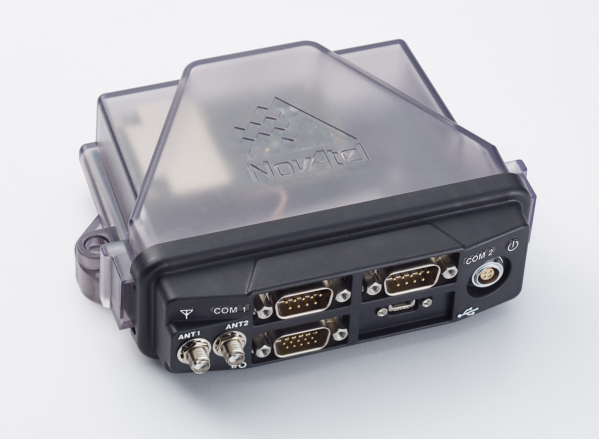
NovAtel Inc. announced a new initiative and engineering team to develop functionally safe GNSS positioning technology for fully autonomous applications. The company leverages its extensive experience developing safety-critical systems for the aviation industry to meet the future safety thresholds required for driverless cars and autonomous applications in agriculture, mining, and other government, military and commercial markets.
In early 2015, NovAtel formed a specialized Safety Critical Systems Group of engineers with backgrounds in functional safety as well as all aspects of GNSS and inertial navigation systems (INS) technology. The Safety Critical Systems Group is focused on creating positioning products that will meet the exceptional performance and safety requirements of autonomous vehicles at the necessary production volumes and at the required price point.
The company has extensive background working within safety critical requirements. Michael Ritter, president & CEO stated, “Aviation in North America relies on NovAtel technology to ensure safe navigation and landing.” Ritter added, “The Federal Aviation Administration’s WAAS, and other global Space Based Augmentation Systems (SBAS), have relied on certified NovAtel GNSS receivers for many years as the foundation of their systems. With full GNSS signal and constellation support needed to solve the performance criteria of autonomous driving, NovAtel is uniquely qualified to deliver the optimal solution that will keep us all safe as we drive the autonomous highways of the future.”
Jonathan Auld, Novatel’s director of Safety Critical Systems.
NovAtel manufactures high-precision GNSS receivers, antennas and subsystems, with expertise in sensor integration, specifically that of GNSS and INS. Through its TerraStar correction service, NovAtel also offers a global Precise Point Positioning (PPP) correction solution that is already designed for safety-of-life applications.
With work underway for more than a year, NovAtel plans to achieve ISO/TS 16949 compliance by the end of 2016. This is an early key milestone in the Safety Critical Systems Group’s path, to be followed by an ISO 26262 compliant product.
Jonathan Auld is director of Safety Critical Systems at NovAtel. He first joined the company in 2000 and has held positions as a GNSS test engineer, test group manager, director of technology development, and director of portfolio management.
AUVSI’s newly christened “Xponential” show drew together hundreds of commercial UAV products and services. (Photo: Joelle Harms, GPS World)
The Association for Unmanned Vehicle Systems International (AUVSI) hosted another big UAV show this month. Renamed Xponential, to denote the rapid growth in unmanned systems, the May 2-5 gathering in New Orleans was up to its billing — with 8,000 attendees from 55 countries, and 650 exhibitors.
The morning plenary sessions notably included a pitch from Amazon for a low-level, high-speed transit zone for delivery drones and associated tight operational controls. FAA Administrator Michael Huerta announced the formation of an industry advisory group to speed up integration of drones into the National Airspace and relaxation of rules to allow students to operate UAS for educational and research purposes.
However, there was much corridor discussion of the FAA’s intransigence as the introduction of regulations for drones continue to be delayed. The feeling seemed to be that other nations are already adapting quickly to accommodate drone applications in their airspace, while the FAA is felt to be holding back the development of a multi-billion-dollar industry in the U.S.
The Ernest N. Morial Convention Center is huge, with several large exhibit halls, and the AUVSI show floor used every bit of the space, filling it with booths and exhibits. Almost every company had something to announce about their growing business in unmanned aircraft systems (UAS), or in unmanned ground or water vehicles.
Global Hawk advancements
I’ve always been interested in Global Hawk and its ups and downs as it progressed through U.S. and European start-and-stop programs, so I was delighted when I got an invitation to talk with the Northrop-Grumman team at their booth.
Global Hawk (Photo: USAF)
With a declared operational ceiling of 50,000 feet and various payloads, Global Hawk is an ideal high-altitude reconnaissance platform. While the 2011–12 U.S. budget cuts threw a wrench into their programs with the U.S. military, Global Hawk found other places to demonstrate its capability — like over Japan’s crippled Fukushima Daiichi nuclear plant and with NASA flying into heavy weather.
X-47B UCAS
Things are now much better, with many systems in U.S. inventory, several operational bases around the world and with at least one Global Hawk airborne 24/7. With 34-hour endurance, store and forward capability and a huge 1,200-pound payload option, this UAS program is now really airborne. And anyone into UASs must have seen clips of the X-47B UCAS carrier landings and aerial refueling — hopefully this program will also soon extend past the demonstration phase.
UAS equipment suppliers
There were plenty of UAS equipment suppliers at the show. Here’s just a sample:
Embention has developed its UAS autopilot (Veronte Autopilot) so that it is certifiable to aviation hardware and software standards, anticipating equipment regulations similar to those for manned aircraft. It is Do178 and Do254 compliant.
Epiq Solutions has a large number of wireless solutions from cellular to 6 GHz.
VectorNav introduced the MEMS-based Tactical Series, including the VN-110inertial measurement unit and attitude heading reference system (IMU/AHRS), the VN-210 GPS-aided INS (GPS/INS), and the VN-310 dual-antenna GPS/INS.
Spectracom brought its new VersaSyn all-in-one time-and-frequency GPS master clock ND network time server to the show, for UAS on-board payload sync solutions. In addition, all the latest in GNSS simulation tools were on display at the Spectracom booth.
Freewave displayed a range of wireless solutions, including a long-range 900-MHz control and data link for UAS.
The Sensonor iMAR iNAT-M200.
Amimon again presented its “zero-latency” HD video-link system. Its Connex product is apparently becoming the standard for movie-making using drones, as well as for high-definition inspection applications.
Gladiator Technologies (LKD Aerospace) showed its extensive range of gyro, inertial and GPS/INS products.
Sensonor announced the integration of its STIM300 IMU within the iMAR iNAT-M200 inertial navigation system and for the iATTHEMO-C high-precision heading, attitude, position and velocity reference product.
KVH has partnered with Geodetics to provide high-performance positioning and navigation products for commercial applications requiring high levels of precision for unmanned platforms and ground navigation. The KVH 1750 IMU that Geodetics is integrating provides highly accurate six-degrees-of-freedom angular rate and acceleration data, contributing to a high-performance commercial off-the-shelf (COTS) solution.
Geodetics is integrating the KVH 1750 IMU into both a GPS-aided inertial navigation system (Geo-iNAV Advanced) and a high-accuracy relative navigation, positioning and orientation system (Geo-RelNAV). These COTS products are available for commercial applications such as manned and unmanned platforms for land, air and sea — surface or subsea — mobile mapping systems, photogrammetry and terrestrial navigation. Also featured at Exponential was Geodetics’ Geo-MMS Lidar Mobile Mapping System, which can achieve 10-25 centimeter point-cloud georeferencing when using real-time kinematic positioning.
Videos from the Xponential show floor
Three major GNSS OEM companies were also at the show:
Septentrio is apparently avoiding the need for ground control points for surveying. The ReProcessed Kinematic (RPK) GeoTagZ solution on the AsteRx-m UAS OEM board eliminates the need for a real-time fixed station datalink while still guaranteeing RTK centimeter-level accuracy. This simplifies set-up, reduces the power drain from the on-board radio, and eliminates the loss of data due to unreliable radio links — things that often plague UAV operations. GeoTagZ software uses GNSS data recorded by the receiver and combines it with the base station reference file to calculate centimeter-level RTK positions for georeferencing photographs taken by the UAV.
NovAtel came to AUVSI Exponential to meet the company’s many customers in the UAS business — a large number of different UAS applications integrate NovAtel OEM receivers on-board. With a great first quarter in the bag, NovAtel is also building a new, bigger facility not too far from its existing location in Calgary, Alberta, Canada. Its UAS business is holding steady, despite some cutbacks on existing military programs. NovAtel also announced its latest correction-service offering for Terrastar C (4 centimeter) and Terrastar A (40 centimeter).
Trimbleintroduced the MB-Two GNSS module, which delivers highly accurate GNSS-based heading plus pitch or roll in an advanced industry-standard form factor for system integrators. The MB-Two features an enhanced dual-core GNSS engine with 240 channels capable of tracking L1/L2 frequencies from the GPS, GLONASS, Galileo and BeiDou constellations. The GNSS engine supports Trimble RTX correction services, including CenterPoint RTX and RangePoint RTX, delivered worldwide via L-band satellite. The MB-Two is designed for a wide variety of applications such as unmanned vehicles, agriculture, automotive, marine and military systems.
UAV teams form, expand
PrecisionHawk announced teaming arrangements at AUVSI Xponential with Harris Corporation, Insitu and DJI. PrecisionHawk is in the business of providing highly accurate geospatial data to its customers for a number of different applications. Its software packages process aerial data into 2D or 3D products, include a library of on-demand analysis tools, and enable sharing and collaborating.
DJI has teamed up with PrecisionHawk to offer a complete agricultural analytics solution by linking DJI’s commercial-grade drone hardware to PrecisionHawk’s drone software platform, DataMapper.
The ADS-B tower with the Xtend antenna. (Photo: Harris Corp.)
At the same time, Harris and PrecisionHawk have expanded their existing relationship to provide the UAS industry with tools that will enhance operational and situational awareness for drone pilots. The two companies are also moving toward the deployment of a UAS airspace management system using technologies like PrecisionHawk’s LATAS platform.
Harris’ real-time surveillance database of manned and unmanned traffic is being built into the LATAS platform to give drone pilots a clear picture of their surroundings, while Harris is also integrating LATAS into its systems to provide visibility of drones that may be sharing the airspace to customers such as UAS test ranges and airports, and potentially to manned aircraft pilots.
Announcements from Insitu
Insitu announced a strategic alliance with PrecisionHawk to offer expanded aerial technology services across commercial and enterprise markets. The two industry leaders will offer small and large-scale services by integrating hardware and software platforms to deliver more comprehensive data capability to customers.
The companies will also leverage their participation in the FAA’s Pathfinder Program to collaborate on the research and test of new technologies to enable safe drone flight for extended and beyond-visual-line-of-sight (BVLOS) operations.
Insitu’s Flying Launch and Recovery System (FLARES).
Insitu made a number of other announcements at the Xponential show. Its FLARES launch and recovery system is an innovative solution for both launch and capture of the Insitu ScanEagle UAS. The huge quadcopter with a ScanEagle UAV hung underneath climbs to a few hundred feet, begins forward flight and the UAV is released and initiates independent powered flight.
For recovery, a cable attached to the ground is carried aloft by FLARES and tensioned by the hovering octocopter. ScanEagle then flies into the cable and is captured by a hook on the leading edge, and the UAS is recovered by ground operators. FLARES is designed to overcome use of the bulky ground catapult, which is normally used to launch ScanEagle.
Insitu also announced the formation of a separate business unit through which it will address the commercial market. The commercial unit will leverage the company’s 20-plus years of experience in unmanned systems to deliver value to the emerging unmanned commercial aerial data-collection market.
Insitu also recapped earlier activities off Alaska with Conoco-Philips in 2013 researching ice-flow and whale movements, and operations over the Paradise Fire in Washington’s Olympic National Park in September 2015. Flying in Olympic National Park, ScanEagle delivered more than 37 hours of real-time infrared video to fire incident personnel, which enabled them to pinpoint the fire’s perimeter and areas of intense heat. ScanEagle also assisted helicopter assets to evaluate water-drop locations.
Insitu is heavily involved with the FAA Pathfinder program and has been developing techniques for UAS beyond visual line of sight operations with BNSF Railway for track inspection. In its first day of operations, ScanEagle provided real-time video covering 64 miles of the 132-mile stretch of track that BNSF has designated for the exercise. ScanEagle is capable of flying for up to 24 hours at speeds of up to 80 knots.
In summary, Xponential 2016 was a huge conference with a large number of exhibitors representing a good cross-section of the UAS industry, including lots of suppliers from the navigation and guidance sector — actually, just too many to mention everyone. The exhibitors included start-up drone manufacturers and veterans alike, all seemingly motivated by the movement toward opening up airspace to commercial operations. This is an exploding industry in the U.S., but its still waiting for rules from the FAA under which to operate on a regular basis, while other countries are already soaking up market share of the emerging commercial drone business.
Sean McCormack, director of FOG/OEM sales for KVH Industries, talks with GPS World Contributing Editor Tony Murfin about the company’s line of inertial measurement units (IMUs) during the Association for Unmanned Systems International‘s Xponential show, held May 3-5 in New Orleans.
Trimble has introduced the MB-Two GNSS module, which delivers highly accurate GNSS-based heading plus pitch or roll in an advanced industry standard form-factor for system integrators.
The module’s embedded Z-Blade GNSS technology uses all available dual-frequency GNSS signals equally, without any constellation preference, to deliver fast and stable centimeter-accurate position and heading information, the company said.
The MB-Two is designed for a wide variety of applications such as unmanned, agriculture, automotive, marine and military systems.
The announcement was made at AUVSI’s Xponential 2016, the largest trade show for the unmanned systems and robotics industry.
“System integrators demand high performance, reliability and support for their positioning solutions,” said Elmar Lenz, general manager of Trimble’s Integrated Technologies Division. “The MB-Two is designed for easy integration and rugged dependability. The size, weight and power specifications of the unit make it the ideal choice for smaller unmanned platforms.”
The MB-Two features an enhanced dual-core GNSS engine with 240 channels capable of tracking L1/L2 frequencies from the GPS, GLONASS, Galileo and BeiDou constellations. The GNSS engine supports Trimble RTX correction services, including CenterPoint RTX and RangePoint RTX, delivered worldwide via L-Band satellite. The MB-Two combined with CenterPoint RTX delivers centimeter-level positioning without requiring a local base station or VRS network.
The Trimble MB-Two module is available now through the Trimble GNSS OEM international network of representatives and authorized dealers.
The compact FlexPak6 receiver houses NovAtel’s OEM628 triple-frequency plus L-band GNSS receiver board. It tracks all current and future GNSS constellations, with a highly configurable interface designed to meet current and future positioning and integration needs. The FlexPak6 is a GPS and GLONASS receiver that is also Galileo and Compass ready. Upgradable receiver firmware ensures easy updating to future signals. While multi-constellation tracking provides higher solution availability and reliability, its flexible communication interface broadens deployment options. It provides 100-Hz measurements for high dynamic applications. Signals tracked include L1, L2 and L2C and L5. It also has RT-2, ALIGN, GLIDE, RAIM firmware options.
Single- or dual-antenna receiver with latest algorithms
AsteRx-U dual-antenna receiver.
The AsteRx-U receiver incorporates the latest GNSS tracking and positioning algorithms, such as LOCK+ technology to maintain tracking during heavy vibration machine use and IONO+ technology to assure accuracy in regions of elevated ionospheric activity. Interference mitigation counteracts ambient and deliberate RF interference. The AsteRX-U is built around Septentrio’s latest application-specific integrated circuit (ASIC), the GReCo4, and incorporates built-in jamming detection and countermeasures, multipath rejection and fast acquisition. More than 500 hardware channels track all available constellations (GPS, GLONASS, Galileo, Beidou, IRNSS and QZSS).
For applications requiring both RTK and orientation
The Trimble BD935-INS delivers GNSS and inertial technology in an easy-to-integrate form factor for demanding conditions and applications such as lightweight robotic or unmanned vehicles. It features precision GNSS with an integrated 3D micro-electro-mechanical systems (MEMS) inertial sensor package, triple frequency for both GPS and GLONASS constellation, and dual frequency for BeiDou and Galileo. The compact module augments real-time precise positioning with 3D orientation. Connectivity and configuration allow system integrators and OEMs to add GNSS and attitude to specialized or custom hardware solutions. By integrating inertial sensors onto the GNSS module, users receive more robust performance in challenging environments. The module delivers fast and reliable real-time kinematic (RTK) initialization for 1–2 centimeter positioning. The integrated GNSS-inertial engine delivers high-accuracy GNSS and DGNSS positions in challenging environments such as urban canyons, tunnels and heavy canopy.
With its robust 555-channel engine, the new Leica Viva GS16 receiver is empowered by RTKplus to access all known and current signals while intelligently distinguishing which ones are the optimal combination to lock onto for accurate positioning adapting to any environmental conditions. There is also capacity for future signals, such as the full deployment of BeiDou and the expected progress of Galileo and QZSS. Thanks to SmartLink, the precise point-positioning technology, uninterrupted positioning continues even when local corrections services are unavailable due to obstructions or lack of cellular coverage. When no reference data is available, SmartLink continues to enable fully remote work. On a field tablet or controller, users can interact with immersive 3D models directly in the field, ensuring all data is collected and linked to the office.
SurphSLAM combines the new Surphaser 10 laser scanner and GeoSLAM’s new RealTime SLAM registration software. SurphSLAM can be used for extremely accurate high-resolution 3D mobile mapping without the need for GPS. The integration of technologies allows for the resulting point cloud to be registered and displayed in real time, facilitating the performance and speed of the survey. Surphaser scanners produce high-accuracy data sets with ultra-low noise levels. The combination of speed, low range noise, sub-millimeter accuracy and reduced size of the scanner make it suitable for a versatile mobile mapping system such as SurphSLAM. The custom-designed trolley is lightweight and collapsible.
OGC GeoPackage enables platform-independent data exchange
TerraGo Edge 3.9.3 features full support for OGC GeoPackage, a universal format for sharing maps and geographic data across mobile devices and platforms. TerraGo Edge enables users to import and export OGC GeoPackage as a SQLite database optimized for performance on iOS and Android devices. Release 3.9.3 closes the loop for a complete GeoPackage collaboration workflow by allowing Edge app users to import GeoPackage data from a mobile device, collect location-tagged field data, and roundtrip the information back to the GIS or other enterprise systems of record.
Open-source client extended with full galileo support
BNC on a Mac system for static real-time precise point positioning with Google Maps, such as for early warning of natural hazards.
Version 2.12 of the BKG NTRIP Client (BNC) real-time software for Windows, Linux and Mac now comes with complete command line interface and considerable post-processing functionality. RINEX Version 3 file editing and quality check with full support of Galileo, BeiDou and SBAS — besides GPS and GLONASS — are also among the new features. BNC version 2.12 allows simultaneous multi-station precise point positioning (PPP) for real-time displacement monitoring of entire reference station networks. Comparison of satellite orbit/clock files in SP3 format is another new feature, along with a large set of examples for various applications. BNC software was originally developed bythe Federal Agency for Cartography and Geodesy (BKG) and Czech Technical University.
The Leica GMX910 smart antenna is desgined for static, long-term projects requiring a high number of sensors. It can enable dynamic monitoring with up to 10-Hz data streaming and advanced multi-frequency, multi-constellation tracking. Starting with the basic GPS single-frequency receiver and adding multiple upgradable options, the antenna adapts to a wide range of GNSS monitoring applications, from complex manmade to natural structures. The smallest movements of bridges, dams or high-rise buildings are detected in real-time. The antenna supports multiple GNSS satellite systems and signals, tracking up to 555 channels. An IP67 rating against dust and water, extended temperature ranges and low power consumption enables installation of the device in remote areas and severe conditions.
For disaster monitoring, traffic patrol, security monitoring
The 25-gram HX-CH6601A GNSS helix antenna for UAV and geospatial applications receives GPS L1/L2, GLONASS L1/L2 and BeiDou B1/B2. It offers exceptional pattern control, polarization purity and high efficiency in a compact form factor. The antenna is equipped with a high-quality, durable IP65 sealed radome housing and terminated with a subminiature version A (SMA) connector, which has high gain and wide beam width to ensure the signal-receiving performance of satellites at a low-elevation angle.
The pingRX ADS-B (automatic dependent surveillance – broadcast) receiver requires 1/100th the power of conventional ADS-B receivers. It implements sense-and-avoid capabilities for small drones operating in the National Airspace. pingRX measures 32 x 15 x 3 millimeters, which is a fraction of the size of earlier units. It receives ADS-B information broadcast by other aircraft on two frequencies approved by the U.S. Federal Aviation Administration (978 MHz and 1090 MHz.) This allows the unit to detect commercial aircraft threats within a 100-statute-mile radius in real time.
Available as turn-key sUAS or as standalone gimbal
The U1 is a professional-grade unmanned aerial vehicle for the industrial survey and surveillance markets, as well as for cinematographers. Features include redundant flight control and battery systems, customized downlink with two high-definition (HD) video feeds, stability even at full zoom with a gyro-stabilized gimbal system, and remote camera control.
Car & Driver branded dash cam includes built-in GPS
The dash camera CDC-601 is equipped with built-in GPS and motion detection. Media shortcut keys allow the driver to manage settings and view their recordings. The camera automatically records when the driver starts the engine and shuts down when the ignition turns off. The 1080p high-definition camera has a 120-degree wide-angle lens, loop recording, time stamp and accident detection. An 8-GB card is included, but it can support up to a 32-GB card.
A science ROV being retrieved by an oceanographic research vessel.
The Rovins Nano is a new inertial navigation system for the offshore industry. Based on iXBlue’s fiber-optic gyroscope technology, the Rovins Nano is designed for for remotely operated underwater vehicle (ROV) pilots performing maintenance and construction operations. It offers the stability and accuracy of the inertial position, outputting true north, roll, pitch and rotation rates. It can directly transmit the ROV’s position with extreme accuracy because of its integrated INS algorithm capable of collecting acoustic data, regardless of the depth. Rovins Nano adapts itself to the user with easy configuration, installation and use. The goal is for the pilot to forget the existence of the product when maneuvering. Because of its compactness, lightness and open architecture with all third-party sensors, Rovins Nano is easy to integrate into existing ROVs.
New platform optimzed for transportation departments modernizing aging CORS installations
The Septentrio PolaRx5 GNSS receiver.
A new PolaRx5 Continuously Operating Reference Station (CORS) platform has been optimized for state departments of transportation (DOTs) and other real-time-kinematic (RTK) network operators. The PolaRx5 is powered by Septentrio’s AsteRx4 next-generation multi-frequency engine. It offers 544 hardware channels and supports all major satellite signals including GPS, GLONASS, Galileo and BeiDou, as well as regional satellite systems such as QZSS and IRNSS. Septentrio’s Advanced Interference Mitigation (AIM+) technology enables the PolaRx5 to filter out both intentional and unintentional sources of radio interference, from narrowband signals over high-powered pulsed signals to chirp jammers and Iridium transmitters. In addition, Septentrio’s patented APME+ multipath mitigation technology guarantees superior measurement quality by eliminating short-delay multipath errors without introduction of bias. The PolaRx5 leverages Septentrio’s web interface and built-in Wi-Fi and Bluetooth interfaces to give users complete control and visibility of the receiver. The user interface integrates into existing network management systems. The web browser provides secure access to all receiver settings and status, data storage and firmware upgrades as well as a built-in spectrum analyzer for system monitoring.
The Omata One speedometer displays essential information to cyclists in a classic form. The GPS computer inside the speedometer records with high precision so that cyclists can download their activity data to their preferred training applications or websites. On the outside, Omata One has a legible and mechanical analog movement that shows riders the speed, distance, ascent and time. The product displays only these four core pieces of information so the cyclist can focus on the ride. Omata plans to offer additional GPS speedometers for other sports.
Adds LTE, Wi-Fi and cloud-based diagnostics to older cars
Samsung Connect Auto plugs directly into a car’s OBD II port underneath the steering wheel. It uses real-time alerts to help users improve their driving behavior, including increased fuel efficiency, while offering a Wi-Fi connection for passengers. The connection is kept secure using Samsung KNOX , the company’s mobile security platform. The backbone of Samsung Connect Auto is KNOX security and Tizen OS for interoperability. Developers can leverage Tizen and Samsung’s software development kit (SDK) to further evolve additional services. Samsung also encourages safe driving behavior by using geofencing and driver rating algorithms. In the event of an accident, emergency alerts notify the driver’s contacts, and accident concierge services are provided. A “Find My Car” app also helps in locating a car in real time using LTE and GPS. Samsung Connect Auto will initially be available in the second quarter in the U.S., with AT&T the first wireless provider.
VectorNav’s new Tactical Series includes the VN-110 IMU/AHRS, the VN-210 GPS/INS and the VN-310 dual-antenna GPS/INS.
VectorNav Technologies, manufacturer of embedded navigation solutions, has introduced the Tactical Series, a next generation family of high-performance Inertial Navigation Systems (INS).
The announcement was made at AUVSI’s Xponential 2016, being held this week in New Orleans, Louisiana.
Built on a common tactical grade proprietary MEMS inertial sensing core, the Tactical Series includes the VN-110 inertial measurement unit and attitude heading reference system (IMU/AHRS), the VN-210 GPS-aided INS (GPS/INS), and the VN-310 dual-antenna GPS/INS.
The Tactical Series leverages VectorNav’s navigation algorithm expertise and extensive experience in integrating its industrial series products into a broad range of airborne, marine and ground-based platforms. As a result, the Tactical Series offers the same functionality and features as Industrial Series for integrators of SWaP-C (size, weight, power and cost) constrained manned and unmanned systems.
Designed and engineered at VectorNav’s headquarters in Dallas, Texas, the Tactical Series takes advantage of the latest developments in solid state MEMS technology to incorporate a 3-axis gyro with <1˚/hr in-run bias stability, leading to an attitude accuracy of 1 to 2 mrad. In addition to the improved IMU core, the Tactical Series enclosure is designed to DO-160G standards and rated IP68 for deployment in harsh and extreme environments.
“The Tactical Series is the culmination of many years of development effort and collaboration with systems integrators across a broad range of industries,” said VectorNav President John Brashear. “We have combined our digital filtering expertise and experience in solving the challenging navigation requirements of customers worldwide to develop what is truly a next generation navigation solution.”
The Tactical Series addresses navigation needs for a variety of unmanned applications and will be on display at VectorNav’s booth (#1043) at XPONENTIAL 2016 in New Orleans, May 3-5.
As the popularity of drones for personal use continues to increase,most of the people who have bought them are sensible folks who have registered their vehicles with the FAA (in the U.S.) and other authorities elsewhere. They respect the rules that have been laid down for them to operate — fly below 400 feet (recently increased by the FAA from 200 feet), don’t fly over populated areas or people, and especially stay away from airports and the departure and approach paths for regular aircraft.
So it’s especially troublesome for these law-abiding drone owners when a wildcat operator gets into the approach path at an airport — and it’s really bad if that airport happens to be one of the busiest in the U.S.
Unfortunately there are several examples. For instance, a Lufthansa A380 pilot recently reported that a drone passed approximately 200 feet above the huge A-380 aircraft he was flying while it was at 5,000 feet altitude on approach into LAX (Los Angeles airport). The FAA immediately got on the phone to the Los Angeles Police Department responsible for air support.
Just last week, an unmanned aerial vehicle (UAV) was reported to have struck a British Airways Airbus as it descended into London’s Heathrow Airport.
The increase in drones might be compared to an increase in the bird population, and a recent study concluded that the risk to the airspace caused by single, light-weight drones is probably quite low. The figures also seem to say that the probability of bird-strikes is very low — but tell that to Captain Sullenberger who landed a smaller A-320 in the Hudson River when both engines quit after ingesting geese just after take-off.
It seems that good airmanship and eyesight have so far avoided any drones being sucked into commercial aircraft engines — no thanks to a small number of irresponsible drone flyers who are tempting fate by intruding into “no-go” airspace.
Let’s get the FAA small UAV regulations published and give everyone clear rules by which even these people are required to fly their drones. So far, individual section 333 waivers have been granted by the FAA to known characters who apparently want to do things properly. Rules also presumably come with penalties, so we might have some deterrence and more control over wildcat operators.
Along the same lines, the FAA is researching a new approach which could detect drones and find their operators who fly near airports. The FAA has implemented a number of programs and tools to educate drone operators and make them aware of the dangers of encroaching on controlled airport airspace, but even so, such incidents continue to occur.
CACI International has therefore been awarded a Pathfinder contract by FAA to investigate technology that will allow the FAA to “identify rogue unmanned aircraft systems” near airports. The CACI solution aims to provide a proven way to passively detect, identify and track UAS/drones and locate their ground-based operators. So, hopefully we may soon have regulations along with a detection system for rule breakers, and we’ll then need an approach to administer penalties. Much better! But let’s pray in the meantime that we don’t have any drone/Sullenberger incidents.
The FAA has recently predicted sales of commercial UAS will increase from 600,000 in 2016 to 2.7 million by 2020, so we better get a handle on this soon. It’s even forecast that there could be a jump to 2.5 million commercial UAS sold in 2017 should the FAA get its small UAV regulations out and implemented this year, as the agency has announced.
Meanwhile, the FAA has turned to an industry/agency committee to ask if they could relax the FAA’s own rules for very small drones and under certain conditions allow them to fly over people. The committee — known as the Micro Unmanned Aircraft Systems (UAS) Aviation Rulemaking Committee (the “ARC”) — met and quickly published a report that came up with four categories of small UAV, Category 1 being less than 250 grams and requiring virtually no additional regulation. Basically, a 250 gram drone falling on a person is considered unlikely to hurt anyone. The other categories do need more restrictions, and manufacturers will need to do significant testing to qualify their drones to satisfy the new requirements.
The latest version of the Amazon delivery drone.
Amazon is also trying to do its part to warn people that a drone might be close overhead. The company recently filed a patent for propellers on drones that could emit warning noises in certain phases of flight. As Amazon progresses toward its plan to deliver parcels to homes, it’s looking to enhance the safety of its future drone-based delivery system.
The object of the patent is to have drone propellers alert people on the ground of the drone’s presence, possibly by broadcasting audible phrases such as “watch out.” Maybe a couple of holes in a propeller might even result in a whistling sound that people would begin to associate with an incoming drone?
DJI
Meanwhile, DJI in China remains one of the companies enjoying stratospheric growth as a result of this growing demand. DJI only really surfaced as a drone supplier in the last few years after the release of the Phantom quadcopter, but DJI has actually been around for 10 years. The founder studied in Hong Kong and became interested in flight control systems, which DJI went on to develop. The company started with 20 people based in Shenzhen where there is good access to high-tech talent, but they have now exceeded 5,000 employees. With R&D engineering centers in Asia, Europe and the U.S., DJI now claims to have captured 70 percent of the commercial drone market.
The DJI Phantom 4.
DJI’s focus is to provide drones that are easy to fly, with a great user interface, and then hang high-quality cameras and other sensors on these really maneuverable platforms. Their approach seems to be working — sales are currently growing by around 3-5 times a year, and they also claim to have a valuation of at least $10 billion US!
DJI tells us that its customers have taken 70 million photos, flown 125 million miles, and operated for 3.9 million hours, with applications including agriculture, search and rescue, sports and news broadcasting, real estate, tourism, wildlife monitoring, archaeology, surveying and mapping, education and dozens of others. DJI is also one of the first manufacturers to introduce geofencing using GPS to ensure operation only in areas that are permitted.
With a product range that not only has drones for commercial and industrial applications, but also includes flight control systems, still and video cameras and stabilized gimbals for airborne and handheld camera applications, DJI is very well placed to maintain its strong market position.
AUVSI Convention
Early next month, the Association for Unmanned Vehicle Systems International (AUVSI) holds its major annual convention in New Orleans, and GPS World will have a contingent of inquisitive people scouring the show floor for news items. So we will have lots more drone stories to tell.
Hemisphere GNSS is significantly expanding its strategic partnership with CPAC Systems, Gothenburg, Sweden, owned by the Volvo Group. After signing a large contract, Hemisphere will now be the sole source of GNSS positioning and heading systems to CPAC Systems.
Hemisphere’s technology is being used in the recently announced Co-Pilot series for Volvo Construction Equipment (Volvo CE) as part of Volvo CE’s industry-changing machine control solutions.
“We were extremely pleased to be chosen by CPAC for use of our GNSS technology,” said Chuck Joseph, Hemisphere GNSS President and CEO. “We are proud of the relationship we have developed with CPAC over the years. It is one of the most innovative companies in the industry and this latest, deeply integrated solution proves how well we collaborate to create value together. It is the very nature of this agreement that defines Hemisphere GNSS as a company, willing to work with and for our strategic partners. We see it as our responsibility to make certain we align ourselves and our business strategy with our OEM and integrator partners like CPAC.”
Initially offering its GNSS positioning and heading technology to CPAC to be used in marine applications, Hemisphere’s diverse cross-platform technology portfolio allows it to be applied in other areas where high-precision, high-accuracy GNSS is required.
“Over the years, Hemisphere GNSS has provided our company with top tier innovation, technology, and service,” said Richard Berkling, President of CPAC Systems. “Hemisphere GNSS’ long term strategy and awareness of their value-added contribution to our customer’s solutions are in perfect alignment with ours which is why we chose them as a partner for the GNSS technology. We look forward to executing this next major phase of our partnership with them.”
Q: What is the “killer app” for professional use of drones? What UAV market sector will most powerfully drive adoption and influence new regulations?
Jan Leyssens Product Manager, SeptentrioA: The mapping market is opening up. On construction and mining sites, surveyors walk between dozers and dump trucks to create digital terrain models, a time-consuming and dangerous job, which drones can do more efficiently and safely. These jobs are performed in non-public areas, without significant risks or privacy concerns, facilitating public acceptance. Subsequently the potentially larger inspection market will open up. Drones provide an easy, safe way to inspect wind turbines or other installations that are difficult or dangerous to reach.
Tony Murfin Contributing Editor, Professional OEM & UAV, GPS WorldA: The agriculture industry seeks even greater Improvements in crop yields. GNSS systems in the cabs of combines/harvesters have already helped significantly, but drone use for crop-growth monitoring, data collection and pesticide-prescription application is the big breakthrough — once rules for large-scale low-level drone flight over farmland are approved. Ag will push for published rules just as hard as the movies, real-estate and all types of aerial survey for construction and utilities.
Eric Gakstatter Contributing Editor, GIS & UAV, Geospatial SolutionsA: Amateur photographers and hobbyists are where the volume is. The world’s largest UAV manufacturer now exceeds $1B annual revenue. Its growth is being driven by the hobby market. Commercial use of UAVs is a very small piece of the worldwide UAV market. The UAV market will be very similar to the GPS receiver market, just not at the same scale. The volume in the UAV consumer market will drive the technology (sensors, motors, software) that will benefit commercial UAV manufacturers.
The VN-360 OEM GPS-Compass module provides an accurate, True North heading solution for systems integrators seeking a reliable alternative to magnetic-based sensors to improve the capabilities and performance of next-generation manned and unmanned systems. Unlike digital magnetometers that can be affected by ferrous materials, the VN-360 heading solution provides a cost-effective GPS-based alternative. With two onboard GNSS receivers, the VN-360 calculates the relative position between its two GNSS antennas to derive a heading solution an order of magnitude more accurate than a magnetic compass. It supports a variety of GNSS antennas that can be mounted on the host platform with a separation distance from a few centimeters to several meters. Applications include antenna pointing, multirotor UAVs and aerostats, automated agriculture, heavy machinery, ground robots, weapons training, warfare simulation and direct surveying.
The SDX software-defined GNSS simulator is now available in version 16.2. For real-time kinematic application, it is now possible to synchronize multiple simulators using a 10-MHz reference and pulse-per-second (PPS) signal. Users can modify pseudorange from the graphical user interface or the application program interface (API) in real time. Each satellite can be controlled individually or together. Trajectories can be imported from CSV files, and raw datalogging is improved. The navigation message can be changed in real time during the simulation. There is now an alternative to python API with the C++ open source API (other programming languages, such as C#, will be supported in the future.)
Designed for hydrographic tasks from shallow to deep water
The Apogee-M motion reference unit and the Apogee-U inertial navigation system (INS) are both made of titanium and have a depth rating of 200 meters. The Apogee Series is an accurate INS based on robust micro-electro-mechanical systems (MEMS) technology with a high degree of precision — 0.008 degrees in roll and pitch in real time — while delivering a robust and accurate heading from the continuous fusion of GNSS and IMU data. Apogee-M and Apogee-U are designed to mount close to the sonar head for hydrographic tasks in shallow or deep water. They provide a real-time heave accurate to 5 centimeters, which automatically detects the wave frequency and constantly adjusts to it. When wave frequency is erratic or in case of long-period swell, the delayed heave feature can allow survey in rough conditions with a more extensive calculation, resulting in a heave accurate to 2 cm displayed in real-time with a short delay. Apogee sensors can be paired with any survey-grade GNSS receiver or with one offered by SBG Systems.
The Piksi is a high-performance GPS receiver with real-time kinematic (RTK) functionality for centimeter-level relative positioning accuracy. Designed for integration into autonomous vehicles and portable surveying equipment, it has a fast position-solution update rate and low-power consumption in a small form factor. An open-source architecture with a high-performance digital signal processor on board and a flexible correlation accelerator make it suitable for GNSS research. Features include centimeter-accurate relative positioning (carrier-phase RTK); GPS, GLONASS, Galileo and SBAS signals; 50-Hz position/velocity/time solutions; and integrated patch antenna and external antenna input.
BYOD program offers a range of configurations for a variety of jobs
Anatum Field Solutions (AFS) has launched a nationwide Bring Your Own Device (BYOD) submeter GNSS and centimeter real-time kinematic (RTK ) GNSS receiver rental program. AFS rentals target high-accuracy users in GIS, UAV, environmental, engineering, surveying, agriculture, electric/gas/water utilities, pipeline, forestry, mining, transportation, construction, architecture and government markets. AFS offers all mobile GIS devices including Apple iOS, Android, Windows and Windows Mobile/EHH. It also stocks various GNSS receivers such as Eos Arrow (submeter and centimeter), SXBlue (submeter and centimeter), Trimble R1 (1 meter) and BadElf (1–3 meters) in a variety of configurations.
The FC-5000 field controller, with its 7-inch sunlight-readable display, is designed to provide operators a larger, more versatile and faster handheld computer for the modern construction site. The display has a capacitive touch interface — with finger, glove, small-tip stylus and water-capable options — that is optically bonded to increase visibility. With the press of a key, a user can change the orientation of the screen from portrait to landscape to increase visibility when viewing maps or drawings. The controller is compatible with all Topcon GNSS receivers and total stations, operating MAGNET Field, Site and Layout software. It has two built-in cameras: an 8-MP camera with autofocus and LED flash for field photography, and a 2-MP camera on the front for video meetings. Additional features include 64 GB of flash storage, an optional 4G LTE cellular modem, internal GPS navigation, Bluetooth and Wi-Fi, and a battery life of 10-plus hours.
Phantom 4 features obstacle avoidance, active tracking
The Phantom 4 quadcopter uses advanced computer vision and sensing technology to make professional aerial imaging easier. Its onboard intelligence makes piloting and shooting images easier through features such as its Obstacle Sensing System and ActiveTrack functionality. The Obstacle Sensing System features two forward-facing optical sensors that scan for obstacles and automatically direct the aircraft around impediments, reducing risk of collision, while ensuring flight direction remains constant. Obstacle avoidance also engages if the user triggers the drone’s “Return to Home” function to reduce the risk of collision when automatically flying back to its takeoff point. With ActiveTrack, the user can keep the camera centered on a subject. ActiveTrack allows users running the DJI Go app on iOS and Android devices to follow and keep the camera centered on the subject as it moves by tapping the subject on their smartphone or tablet.
The Pteryx UAV is a photomapping tool designed to help with photogrammetry, land property surveillance, environmental survey, search and rescue, precision agriculture, research, and in the energy sector. With a two-hour flight time, missions can be planned with the endurance reserve needed to overcome the large distances and worst-case changing weather conditions. Pteryx is designed to fly at speeds of about 50 km/h in light or medium wind speeds. The Pteryx can lift up to 1 kilogram of cargo: cameras, camcorders or other research equipment. The payload is housed in a roll-stabilized head on the front of the fuselage. The Pteryx can also accommodate a wide variety of sensors, which are installed in an easy to replace camera head. The Pteryx is delivered with a 16 MPx APS-C (crop sensor) daylight camera and wide lens, with other sensor options available.
The M2-D is a miniature stabilized gyro with electro optical (EO) and infrared imagers. The system is designed for mobile, marine and aerial unmanned applications. The M2-D is compact at 3 inches tall and 2 inches in diameter. The gimbal is fully gyro stabilized and packs sensor technologies previously only available in much larger payloads. The infrared FLIR brand pan-tilt-zoom thermal imaging camera has an optical telephoto zoom in a lightweight 160-gram payload. The high-resolution thermal imaging sensor with digital zoom integration lets users capture stable video in total darkness. For daytime operations, the gimbal has a full-color visual camera with optical 6x zoom to ~4 degrees. The optical zoom is then enhanced with digial zoom integration for stable long-range imaging.
Surveys large areas or objects to generate fast, precise data
Version 2 of the AibotX6 hexacopter features high-precision (HP) GNSS for surveyors. The system also can be installed in existing AibotX6 hexacopters. With Version 2, the precision and quality of surveying data is significantly improved with RTK technology based on the Leica Geosystems SmartNet correction data service. Post-processing is also possible. The new AibotX6 HP GNSS workflow guarantees precision of up to 2-centimeter position accuracy. Besides allowing the use of existing surveying hexacopters, continuing generation and processing of data can be done with the fully integrated software Aibotix AiProFlight. The Aibot X6 can carry a variety of sensors weighing up to 2 kilograms.
Integrates GNSS for challenging maritime positioning
The new DPS 432 combines full decimeter accuracy with high integrity and availability of GNSS data, supporting the safety and efficiency of offshore operations that rely on advanced dynamic positioning (DP) systems. It integrates signals from GPS, GLONASS, BeiDou and Galileo, and regional correction signals including SBAS and G4 services from Fugro, to ensure high flexibility for DP operations globally. Suited to complex operations, the system increases satellite availability, improves integrity monitoring and enables more precision under challenging signal tracking conditions. The DPS 432 features a sophisticated engine that runs in a safe mode protected from unintended user operations.
The aera 660 features a 5-inch capacitive touchscreen display that has been optimized for cockpits and various types of flying. It has a built-in GPS/GLONASS receiver and rich, interactive maps that can be viewed in portrait or landscape modes. Cost-effective database options along with Wi-Fi database updating capabilities allow customers to access up-to-date data, including daily U.S. fuel prices. Bluetooth supports the display of ADS-B in traffic and weather from a variety of sources, including the GDL 39/GDL 39 3D, Flight Stream and the GTX 345 ADS-B transponder. The aera 660 withstands the harshest environments, meeting stringent temperature tests and helicopter vibration standards. Depending on settings and external connections, pilots can receive up to four hours of battery life on a single charge.
GPS and GNSS have changed the world. Of that there can be no doubt. But in terms of sheer change, both qualitative and quantitative — we ain’t seen nothing yet.
We now witness the creation of an industry. This will be very disruptive. We’ve had change instituted by GNSS; we know what that looks like. We haven’t yet seen a true revolution.This is something entirely new, and there are many things about which we don’t yet have a clue .
What happens to that great American institution, the private car? The relationship between the individual and its four-wheeled extension?
And on the industrial side, do automakers disappear as OEMs — do they become Tier 1 suppliers to Google, Uber and Lyft?
Because of the massive impact of this particular rollout of GNSS-enabled capabilities, I am devoting this issue of the GNSS Design & Test e-newsletter to it, even though it is not in itself a system in space. It is the most radical transformation of life on Earth we have seen, driven by our systems in space.
The following are notes jotted during the Driverless Conference, March 23 in San Francisco.
“In the early 90s, when I was part of a government ride-sharing initiative, we used to talk about these new portable devices bringing data communication into … wherever we go. Now they’re here, and they’re well established. Very soon, this is going to change things, and enable many of the things we’ve only talked and dreamed about so far.” Thus spoke Steve Wollenberg of Automatiks, opening the conference.
“We’re at the confluence of great technological developments. We’re seeing great acceleration of all of them.”
Virtually all the speakers, all these driverless enthusiasts, really love cars. Some own up to collecting them, having multiples in their home garage(s). A bit wistfully, Wollenberg foresaw the new control technology taking over public roadways. “In ten years, racetracks may be the only place where you’re allowed to drive your own vehicle.”
Ride Share. “Four years is the entire lifetime of the ridesharing industry,” said Emily Castor of Lyft, who by virtue of her tenure there for that period, can be termed an industry veteran.
“We’ve seen a full-about turn in the regulatory environment. We see ride-sharing as the stepping stone to a world in which people no longer drive vehicles. Getting an autonomous vehicle on demand through a shared network will be much easier and cheaper than owning a private vehicle.”
Lyft talked with General Motors last year, and found a shared vision of shared use.
Amitai Bin-Nun from Securing America’s Future Energy (SAFE), a non-partisan advocacy organization with business leadership, introduced his organization’s broad mission: reducing U.S. petroleum dependence. Instability in parts of the world is fueled by petroleum dependence.
“This is a hard process. It takes a long time to overturn an established system.” A key obstacle is the lack of compelling new consumer experience, currently. Using connected and autonomous vehicles in a ride-sharing network is an opportunity to get this new experience, and drive the transformative process. Re-order the transportation system.
Mariel Devisa of Travelers Insurance announced that Travelers has launched a ride-share insurance product, live now in 16 states.
In two fairly conservative industries — automotive and insurance — with long-established partners and practices, the efforts to move and change are, frankly, surprising and faster than anticipated, according to moderator Wollenberg. “It’s a fun time.”
Freight and Fleets. Steve Boyd of Peloton made the case that trucking fleets can serve a critical role in pushing the technology forward, because some segments of the transportation industry move faster than others. Getting state approvals without having to go federal is the route pursued now, in terms of full-scale roadtesting of autonomous driving. That will enable early adoption heading into commercial pathways: freight-truck platooning and drafting. Volvo, Intel, Nokia, Denso, UPS and a number of other companies are closely involved.
Boyd announced a set of fleet trials this year, starting in Texas, “a very truck-friendly state.” Legislative approval for trials has passed or is pending in several other states, as many as a dozen. Prospective customers are already lined up in the freight space.
In Europe, an April 6 EU Platooning Challenge will take place in Rotterdam. The Netherlands is leading the EU in the current cycle to approve truck platooning by early 2018.
There’s “a platooning gap” developing between the U.S. and Europe, according to Boyd. Silicon Valley may lead on the technology, but if this is not matched by activity on the regulatory side, it will lose out to other areas that aggressively pursue approvals as well as technology.
Traditionally, the automotive and trucking OEM industries have been very competitive, but now they are seeing the necessity to collaborate to push the policy side forward. This is happening in the insurance industry, too. Competition will certainly still be there, but to enable vehicle-to-vehicle communication a broad measure of collaboration will be necessary.
The road environment today is very imperfect, with many thousands of fatalities and countless more serious injuries. Trucks drive too close together. Highway safety needs innovation and regulatory change in order to improve.
The Long Vision. An autonomous car can’t count on the ability of the driver to retake control of the vehicle in 5 or 10 seconds. So the vehicle needs to be able to take care of itself — fully. Therefore, an evolutionary approach to installing autonomous capabilities may not work.
Some initiatives, however, continue to bring services into the vehicle one by one, gradually. How engaged will the driver be, and in what timeframe? There’s debate, and a shift in thinking may currently be underway.
Traditionally, a 5- to 7-year product cycle in automotive starts when new features are introduced in upmarket vehicles. Examples: adaptive cruise control (to follow the car in front of you at a set distance), lane-keeping assistance. Gradually, these new features are installed in lower price-point models until they become standard throughout the line. With multiple products and product cycles, it will thus take multiple decades. 220 million vehicles are owned by households. An integrative approach to autonomy will take a long, long time.
There is a rising tide for autonomy may take a different approach: autonomy first, that is, full autonomy will take over the vehicle — and as many vehicles as possible.
(Something that no one has mentioned but I can’t help thinking: Given the longstanding and extremely virulent controversy in this country over private gun ownership… What does this bode for something shaping up as a massive social, structural change, not just a new technological wrinkle? What is more American than a gun? A car.
If you thought the Internet, or smartphones, or for heavensakes even GPS/GNSS have radically altered the world — again, we ain’t seen nothin’ yet.)
CAST GNSS/INS simulators generate high-fidelity GNSS RF signals along with the coherent digital inertial signals that allow for the precise stimulation of the next generation of GNSS/INS navigation equipment. CAST’s GNSS/INS systems provide the highly precise system performance that is required to aid in the integration and testing of the next-generation of GNSS navigation system technologies. The 35-year-old company’s business focus is supplying GNSS/INS simulators, GNSS/INS test equipment, and GPS/INS support services to government and military avionics laboratories, prime contractors, GNSS receiver manufacturers and system integrators.
The CAST-3000 fully supports integration testing of GPS/INS navigation systems where the inertial sensor and GPS receiver are either tightly or ultra-tightly coupled. The CAST-3000 produces GPS RF signals coincident with simulated IMU sensor data that provide dynamic testing in the laboratory environment for military and government applications. CAST has worked closely with both Honeywell and Northrop Grumman over the past two decades in the development of the CAST-3000, which
provides strapdown IMU measurement data synchronized with GPS RF data to the navigation system under test.
contains a mature avionic sensor simulation Barometric Altimeter model.
includes high rate inertial measurements with very high degree of fidelity to support testing of high-performance coupled systems.
simulates sensors to provide the necessary fully coordinated, dynamic vertical channel aiding needed to maintain Kalman filter stability of the navigation system.
includes years of development and refinement of the precise GPS/INS synchronization capability needed for simulation of aircraft dynamics.
includes a complete 6-DOF motion generation capability.
NavX-NCS Professional GNSS Simulator NavX-NCS Essential GNSS Simulator
The flexibility of the NavX-NCS Professional GNSS Simulator allows it to be configured with up to 108 channels and all of the following signals:
GPS L1/L2/L5 C/A and P-code and L2C
GLONASS G1/G2 standard and high-accuracy codes
Galileo E1/E5/E6 (BOC/CBOC/AltBOC)
BeiDou B1/B2/B3
SBAS L1/L5 (WAAS, EGNOS, MSAS, GAGAN, SDCM)
IRNSS L5/S-band
QZSS L1 and L1-SAIF
IMES
The user can assign signals freely to any of the RF modules fitted to the simulator. This allows the same hardware to be used in a range of different configurations.
Signals can be added by software license with no need to return the hardware for upgrade.
Up to four independent RF outputs can be fitted, enabling the user to simulate multiple antenna locations simultaneously (allowing simulation of multiple antennas on one vehicle, multiple vehicles simultaneously, a mixture of static locations and mobile vehicles, and multiple antenna elements for Controlled Reception Pattern Antenna [CRPA] testing).
The comprehensive and easy-to-use Control Center operating software allows the operator to quickly create realistic test scenarios for effective testing of user equipment.
IFEN also offers the NavX-NCS Essential GNSS Simulator, which is available with 21 or 42 channels and is capable of simulating GPS L1 (including SBAS L1), GLONASS G1, Galileo E1, BeiDou B1, QZSS L1 and IMES. The simulator is also supplied with Control Center operating software for comprehensive scenario generation.
LabSat 3 from Racelogic is a low cost, stand-alone, battery-powered, multi-constellation, RF record and replay device, designed to assist GNSS engineers in the development and testing of their products. By capturing live-sky RF signals, it enables repeatable and realistic testing to be carried out under controlled conditions, and is available as a record and replay, or replay only version; either one, two or three constellation types generate a single, dual or triple constellation file.
With standalone operation, LabSat 3 can be used in any outdoor location to create real-world scenarios for eventual replay back in the lab. As well as being able to simultaneously record or replay GPS, GLONASS, BeiDou, QZSS, Galileo and SBAS signals, it can log CAN bus, serial or digital data, embedded alongside the satellite information. This additional information can then be replayed alongside the GNSS output, with synchronization to within 60 nanoseconds. A 1 PPS signal can also be generated using the internal GPS receiver.
LabSat 3 can be used as a replay system out of the box with a set of 60 pre-recorded scenarios supplied as part of the package, recorded from various locations around the globe.
Additionally, SatGen software allows for scenario generation of user-defined trajectories, with precise control over velocity, heading, height and constellation profiles, giving the test engineer the ability to develop their product using simulations that would be difficult or impossible to record due to geographic location or safety constraints. NMEA and KML imports are supported.
New for 2016 is LabSat Real-Time, which allows for bench testing of GNSS devices where a current time stamp is required. SatGen V3 PC software generates a live signal stream to a LabSat RT unit which up converts the RF data from digital to analogue with less than one second latency. LabSat RT operates on any two of the three constellations of GPS, GLONASS and BeiDou.
Skydel brings a new generation of GNSS simulators to the market. With the SDX simulator, signals are modulated by the graphics processing unit (GPU) as opposed to dedicated FPGAs found in traditional simulators. This allows new possibilities, such as adding signals and constellations without resorting to additional hardware. This design offers many benefits:
The number of channels is defined by the GPU, eliminating the need to buy additional proprietary FPGA-based hardware whenever more channels are needed.
Price per simulated channel is greatly reduced by using powerful, mass-produced off-the-shelf hardware such as graphic cards and software-defined radios. Moreover, the same hardware can be repurposed for numerous applications.
Numerous hardware configurations provide flexibility ranging from single software-defined receiver (SDR) setups to racked instruments multi-element systems.
SDX can be distributed over many computers, GPUs and signal generators to expand its capabilities.
Turnkey or Software-Only Solutions
SDX users can reuse their own SDR with the software-only solution, or choose a turnkey solution that comes with all the required hardware and a preconfigured laptop or desktop. Skydel can customize turnkey solutions to meet special requirements.
SDX Key Features
Real-time signal generation for multiple GNSS constellations
Directional jammers
Multi-element antenna with better than 1 degree of phase offset
SDK for GNSS signal customization (injection and modification of navigation message and code)
Spectracom GSG-5/6 series simulators are easy-to-use, feature-rich and affordable, offering value compared to the limitations of testing from “live sky” signals. The Spectracom platform approach allows users to buy what they need today and upgrade later. The adaptability of the GNSS RF generation platform can extend it to applications for intelligent repeating and meaconing.
Test Solutions
Position accuracy and dynamic range/sensitivity
Simulate movements/trajectories anywhere on or above Earth
Sensitivity to GPS impairments: loss of satellites, multipath, atmospheric conditions, interference, jamming and spoofing
Conducted or over-the-air RF
GPS time-transfer accuracy
Effect of leap-second transition
Multi-constellation testing
Modernization signals/ frequencies
Keyless military SAASM and dual-frequency and survey-grade receiver testing
Application packages for RTK, A-GPS, CRPA (controlled radiation pattern antennas)
GSG-6 Series 64-channel multi-frequency, advanced GNSS simulator is powerful enough for any cutting-edge test program. GPS, GLONASS, Galileo, Beidou, QZSS and IRNSS signals are available across multiple frequencies. The GSG-6 is designed for military, research or professional applications.
GSG-5 Series 16-channel multi-constellation L1-band GNSS simulator is designed for commercial development/integration programs. If the user is developing commercial products with GNSS capability, the GSG-5 will shorten test programs with confidence.
GSG-51 single channel signal generator is designed for one purpose — fast, simple Go/No-Go manufacturing test and validation, ensuring the manufacturing line is operating at full capacity with confidence in quality.
Spirent Federal provides simulators that cover all price points, from high-end research and development, to integration/verification, to single-channel production testing.
GSS9000. The Spirent GSS9000 multi-frequency, multi-GNSS RF constellation simulator can simulate signals from all GNSS and regional navigation. The GSS9000 offers a four-fold increase in RF signal iteration rate (SIR) over Spirent’s GSS8000 simulator.
The GSS9000 SIR is 1000 Hz (1ms), enabling higher dynamic simulations with more accuracy and fidelity. It includes support for restricted and classified signals from the GPS and Galileo systems, as well as advanced capabilities for ultra-high dynamics. It can evaluate resilience of navigation systems to interference and spoofing attacks, and has the flexibility to reconfigure constellations, channels and frequencies between test runs or test cases.
Hardware changes can be made in the field, supported by the new on-board calibrator module. The GSS9000 is extensible and can support the widest range of carriers, ranging codes and data streams for the Galileo, GPS, GLONASS, and BeiDou systems, as well as regional/augmentation systems. Multi-antenna/multi-vehicle simulation for differential GNSS and attitude determination, and interference/jamming and spoofing testing, are also supported.
CRPA Test System. Spirent’s Controlled Reception Pattern Antenna (CRPA) Test System generates both GNSS and interference signals. Users can control multiple antenna elements. Null-steering and space/time adaptive CRPA testing are both supported by this comprehensive approach.
GSS6425. The Spirent GSS6425 RPS quickly and simply records complex real-world RF environments, capturing both GNSS signals and atmospheric/interference effects. These environments can then be replayed repeatedly to the hardware software under test, reducing project, travel and engineering costs.


 CAST GNSS/INS simulators generate high-fidelity GNSS RF signals along with the coherent digital inertial signals that allow for the precise stimulation of the next generation of GNSS/INS navigation equipment. CAST’s GNSS/INS systems provide the highly precise system performance that is required to aid in the integration and testing of the next-generation of GNSS navigation system technologies. The 35-year-old company’s business focus is supplying GNSS/INS simulators, GNSS/INS test equipment, and GPS/INS support services to government and military avionics laboratories, prime contractors, GNSS receiver manufacturers and system integrators.
 The flexibility of the NavX-NCS Professional GNSS Simulator allows it to be configured with up to 108 channels and all of the following signals:
 LabSat 3 from Racelogic is a low cost, stand-alone, battery-powered, multi-constellation, RF record and replay device, designed to assist GNSS engineers in the development and testing of their products. By capturing live-sky RF signals, it enables repeatable and realistic testing to be carried out under controlled conditions, and is available as a record and replay, or replay only version; either one, two or three constellation types generate a single, dual or triple constellation file.
 Skydel brings a new generation of GNSS simulators to the market. With the SDX simulator, signals are modulated by the graphics processing unit (GPU) as opposed to dedicated FPGAs found in traditional simulators. This allows new possibilities, such as adding signals and constellations without resorting to additional hardware. This design offers many benefits:
 Spectracom GSG-5/6 series simulators are easy-to-use, feature-rich and affordable, offering value compared to the limitations of testing from “live sky” signals. The Spectracom platform approach allows users to buy what they need today and upgrade later. The adaptability of the GNSS RF generation platform can extend it to applications for intelligent repeating and meaconing.
 Spirent Federal provides simulators that cover all price points, from high-end research and development, to integration/verification, to single-channel production testing.