Safran Electronics & Defense has acquired Syntony GNSS, a simulator and receiver company founded in 2015 in Toulouse, France. The acquisition is intended to strengthen Safron’s resilient PNT innovations.
Under the agreement, signed Feb. 13, Safran will take 100% of Syntony’s share capital, subject to customary regulatory approvals. Financial terms were not disclosed.
A European leader in GNSS solutions for underground environments, Syntony has developed unique expertise to ensure reliable positioning in contexts where satellite signals are unavailable.
Syntony’s technology addresses a major challenge of satellite navigation systems: the vulnerability of GNSS signals to physical obstacles, jamming and interference. To tackle this, Syntony has developed several critical technologies, including:
Controlled reception pattern antennas (CRPAs) that make GNSS receivers less sensitive to jamming and spoofing — essential for flight safety and the protection of sensitive infrastructure.
Software-defined radio (SDR), a digital radio that can change function (switching from FM to Wi-Fi or GPS) through a simple software update without changing hardware, allowing it to adapt to threats or to changes in received or transmitted signals. It offers compactness and scalability, particularly suited to embedded systems and the requirements of modern operational environments.
In addition, Syntony develops GNSS receivers for next-generation satellites, particularly for low Earth orbit (LEO) constellations, further strengthening Safran Electronics & Defense’s offering in the space-based PNT and New Space sectors.
Syntony employs nearly 70 people across Toulouse and Paris.
For Safran Electronics & Defense, this acquisition makes it possible to offer more comprehensive equipment that is also more compact and energy-efficient, while remaining adaptable to the constant evolution of signals. These gains in weight and power consumption are essential for future civilian and military platforms (drones and counter-drone systems, missiles, aircraft and low-orbit satellites).
“Is the GNSS community failing to exploit the potential of chip-scale atomic clocks (CSAC)?”
John Fischer
“Yes! And there are several CSAC suppliers, each with varying accuracies, power consumptions, and price points. These atomic clocks are no longer exotic scientific instruments but rather commercialized, proven devices that can be mounted on a circuit card at a reasonable cost. They offer extended holdover time in the absence of GNSS and help with spoofing detection by verifying the incoming signal. They provide exact frequency recovery on power-up (re-trace) for power saving modes. Defense, telecom, financial transactions, and autonomous navigation for cars and drones are all applications that can be made more resilient by these clocks.”
“Atomic clocks, including CSAC, are frequently used in GNSS timing applications, for example to keep accurate time during GNSS outages or to assist in identifying spoofing attacks targeting the time component. On the other hand, the long-term stability of atomic clocks is not particularly relevant in navigation applications where time is not the main output, and the additional cost, power consumption and size of CSAC are not justified.”
“Indeed. After the DARPA-NIST initiative and subsequent commercialization, affordable, accurate and stable chip-scale oscillators can be easily integrated into circuit boards providing additional measurements to PNT systems to improve positional vertical accuracy, as well as reliability and integrity. For example, in high-end mobile mapping systems operating in complex urban scenarios, their use helps detect GNSS outliers at a relatively negligible additional cost.”
“Could a new PNT constellation using LEO satellites fully replace the services provided by the four existing GNSS constellations?”
Mitch Narins
“From a pure capabilities standpoint, the answer is “Yes”. LEO constellations can provide the PNT performance metrics that users require. However, should this strategy be followed, it would lack the diverse, complementary solutions needed to ensure the safety, security, and efficiency of critical infrastructure. Many have recognized the need for resilient PNT solutions and identified system-of-systems approaches. Multiple satellite constellations — MEOs and LEOs (despite the number of platforms) — lack this needed resilience. A resilient system-of-systems should include satellites in multiple orbits and complementary ground-based PNT infrastructure, each providing needed performance and overall demonstrating resilience from diverse threats.”
— Mitch Narins Strategic Synergies
John Fischer
“In theory, yes. With a much stronger signal (antijam) that is encrypted (antijam), they counter GNSS’s two main vulnerabilities. However, with a paid service business model, it is difficult to compete with a free service. Moreover, large constellations are needed to overcome GDOP. OneWeb, Starlink, et al. already have launched and will continue to launch large constellations, so they must compete with these high bandwidth communications constellations that can provide accurate PNT as a side service and don’t have a GDOP limitation because of their size. Adoption of a single-purpose PNT system will be difficult.”
— John Fischer Orolia
Bernard Gruber
“Yes, it could. That said, as with any new product or technology, evolution of PNT capabilities will be dependent on competition, value or threats that undermine the current environment. Burgeoning systems such as Xona, Satelles or any number of augmentations utilizing “signal of interest” such as Starlink will rightly contribute to the evolution of enhanced PNT. Current advantages of LEO-based systems such as increased received power, decreased convergence time and numerical diversity are noteworthy, but replacing an investment of $100B+ government backed GNSS systems that adhere to well established policies and published ICDs is another.”
— Bernie Gruber Northrop Grumman
Jules McNeff
“As my colleagues above note, the answer is yes from a technical perspective. However, in practice, not so much. Even with software-defined receivers, issues of signal reception and processing, interface standards, comm/nav service prioritization, security, integration into complex systems, integrity assurance, etc. make use of such nav services in lieu of purpose-built GNSS services impractical.”
An exclusive interview with Dr. Michael O’Connor, CEO, Satelles. For more exclusive interviews from this cover story, click here.
How many Iridium satellites carry your system?
Mike O’Connor
Iridium has 66 active satellites. There are also several spares on orbit. The satellites were all launched between 2016 and 2018, so they are all relatively new. They cover the entire globe, 24 hours a day, seven days a week, so they have universal coverage.
How will your constellation grow?
Today, our Satellite Time and Location (STL) service is offered only over the Iridium satellites. There’s nothing else that we’re discussing publicly. It could expand over time to other satellites. The signal and the capability are flexible. In terms of how Iridium could change, that’s more for Iridium to discuss than us.
Who makes chipsets that can use your system? And how does that work?
We work with partners. For example, with Adtran (through their Oscilloquartz product line), Jackson Labs (now VIAVI Solutions), Orolia (now Safran Trusted 4D). Companies like that provide the solutions that are favored by critical infrastructure providers today. We provide them either reference designs or effectively referenced designs. They ultimately integrate our STL capability into their solutions. We help them to do that. They can use our reference designs or create their own custom designs based on our reference designs. So, that’s the model that we use.
Is the STL receiver on top of a traditional GNSS receiver and passing certain data to it?
STL is used in two ways. In some cases, users are trying to do positioning or timing in an environment where GNSS signals will not reach, such as indoors, or are otherwise unavailable. In those cases, it wouldn’t be overlaid with GNSS, it would just be a standalone solution.
In many other cases, the goal is having a solution that is resilient to an outage, interference, jamming, spoofing, those sorts of things. In that case, the receiver card that might be provided by one of our partner companies would have both GNSS and STL capabilities and would take the best of both worlds. If GPS is jammed or there’s interference, then the STL signal alone would be sufficient to do PNT. However, whenever both signals are available and can be authenticated, then it would use both and leverage the benefits of having two systems.
Does the location calculation take place in a GNSS chip or separately in the STL?
The chain to take measurements of the STL satellite signals is different. It’s not a single chip that’s measuring both satellites, it’s ultimately two chips that are making those measurements. Then how the position calculation and the integration of those signals is done is left to our partners. In some cases, it is proprietary to the partners that are doing that integration work. It can be integrated loosely or tightly.
When it’s just the STL chip, is that usually for timing purposes, or both timing and location?
Generally, an STL-only solution is best suited for timing. It’ll do timing at about 100 ns, depending on what kind of oscillator is being used and the exact configuration of the product.
What positional accuracies can you achieve?
Generally, in the 10 m to 20 m range, depending on the product configuration.
Most of the correction services refer to variables that are not relevant to your system.
That’s right. There are other techniques, such as integrating with other sensors, that can improve the accuracy. The primary uses for STL today are in delivering timing in environments where GNSS is not able to do so today, such as for national critical infrastructure. That’s been our commercial focus as a company.
Who currently uses the STL receivers? Which markets are you targeting first?
Most of our users are in the data center space. Stock exchanges around the world are also using our service as a source of resiliency, and now wireless infrastructure. So, think 5G infrastructure. As 5G networks are rolling out, they need about five to ten times more nodes to cover a geographic area than 4G networks. GNSS has been used for years to time 4G networks, but most 5G network sites — such as femtocells and picocells — are indoors or in places where GNSS is challenged. We deliver that timing service indoors, outdoors, everywhere. So, those are the three commercial markets where we have the highest adoption rates.
You still have plenty of room for expansion in that market before you must start thinking about expanding into other areas.
Yes, there’s plenty of room for expansion into those markets, so I wouldn’t say that they’re fully saturated. We are also looking into other opportunities. We’ve seen interest in the energy area. I think the industry is a little bit slower moving, but the need is ubiquitous, right? We all recognize that a black swan event in our society would really represent a bad day and we want to avoid that.
There are several companies across the industry that are trying to solve that important problem. Everyone involved in critical infrastructure that requires a timing reference — which is anything that is associated with a network activity — should have an alternative or augmentation to GNSS as a timing source. It’s great that we’re seeing tailwinds from the U.S. Government, from the European Union, and from others to try to encourage that adoption. However, there’s still a long way to go before we really feel that that’s been sufficiently covered.
What, if any, have been the major developments in the past year or so?
One of the most interesting things that has happened over the last year and a half has to do with our capability regarding STL. We’ve been demonstrating more publicly, and with more independent authorities, the capabilities, resiliency, and operational characteristics of our service.
For example, the JRC study.
It started with the U.S. Department of Transportation (DOT) a couple years ago, but there’s also been some work done by the Department of Homeland Security and with the National Institute of Standards and Technology (NIST). We’ve been working directly with NIST to do some validations, as well as with UK and European organizations. They have subjected STL to rigorous third-party, hands-off technology evaluations. They confirmed the timing accuracy specifications to UTC and validated the operational characteristics of STL, such as the resilience in the absence of GNSS, the ability to receive the signal indoors, and having global availability.
We’re delighted to see the third-party operational evaluation of things that we’ve known all along but are now being evaluated and confirmed by these government sources. Beyond that, of course, there are always going to be technology advancements, both with our company and with other companies.
The real focus of industry right now is on adoption. All the providers of these capabilities ultimately need adoption in industry to remain active and viable. These are good people trying to do the right thing to protect our society. There are many great technology solutions out there to do it. Hopefully, many of these solutions are adopted in the near term. That’s what our focus has been. Our focus has not been on squeezing an extra five nanoseconds out of performance, although, of course, we’re always doing that. I think the important focus of industry should be driving adoption. There are solutions available today, including ours, that are ready to go and are being proven operationally in use.
Can you say more about the study by the European Commission’s Joint Research Centre (JRC)?
If you look at the summary, all these technologies that were demonstrated worked. Both the DOT report and the JRC report effectively summarize that there are multiple technologies out there today that are ready to go.
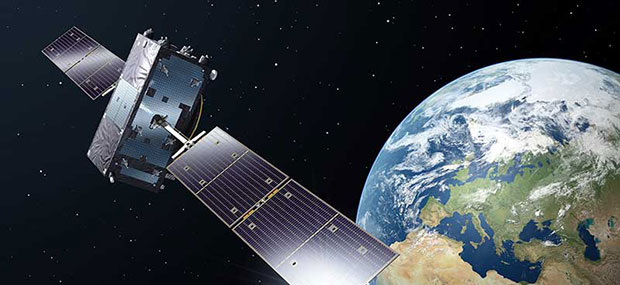
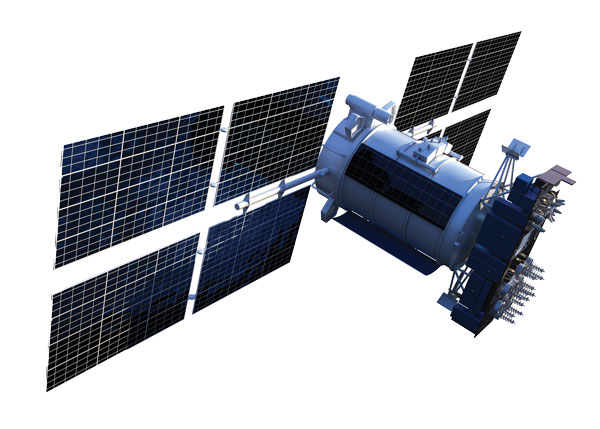
Xona is developing PULSAR – a high-performance positioning, navigation and timing (PNT) service enabled by a commercial constellation of dedicated LEO satellites.
“Our Skydel GNSS simulation engine will provide support for Xona’s PULSAR signals and satellite constellation to offer OEMs, developers, and integrators a unique tool that enables early testing and validation of Xona’s LEO PNT signal performance,” Pierre-Marie Le Véel, GNSS products director with Safran, said.
The PULSAR service aims to advance PNT security, resilience and accuracy capabilities by augmenting existing GNSS while also operating as an independent PNT constellation.
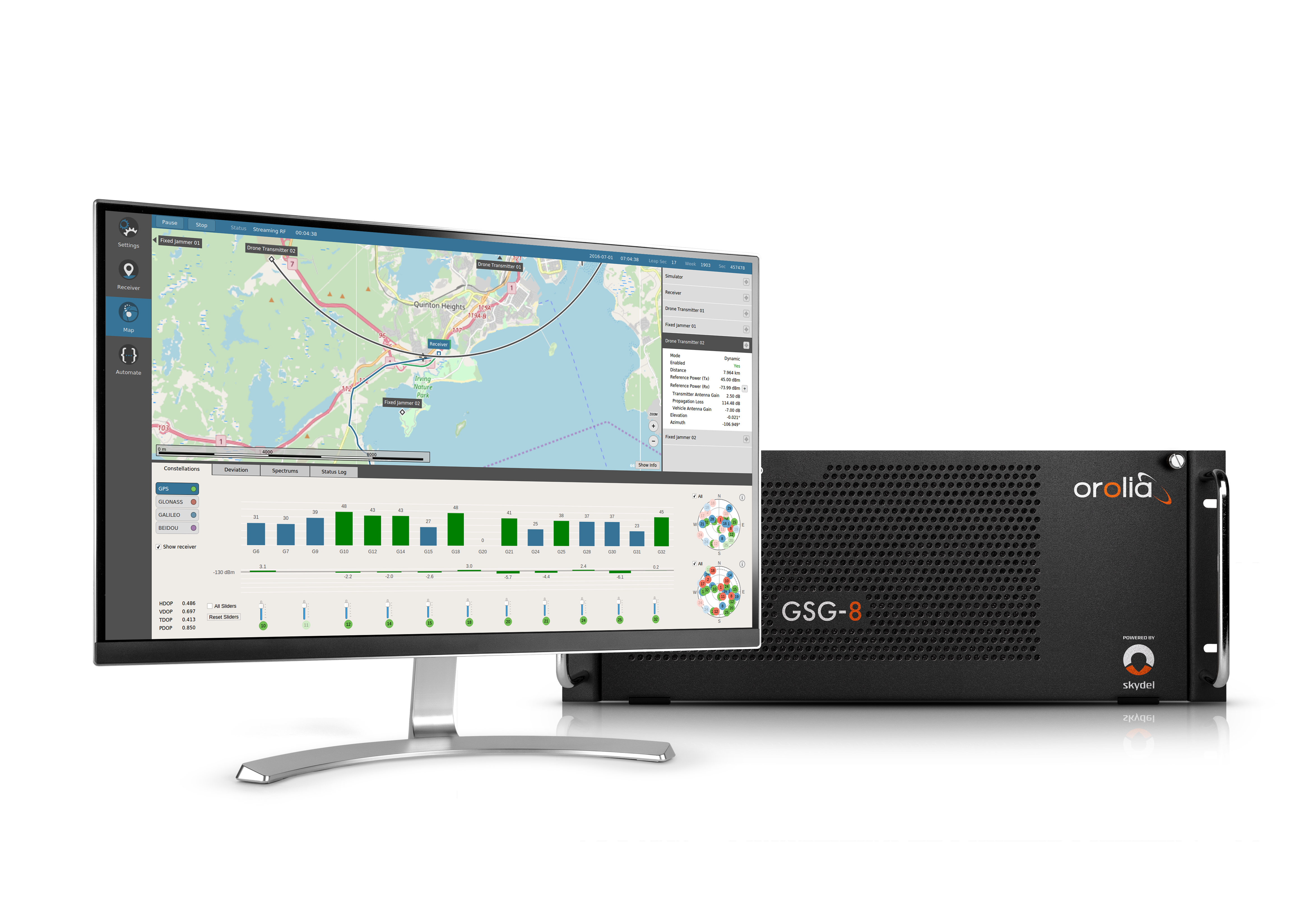
Skydel powers Safran’s advanced GNSS simulators such as GSG-8.
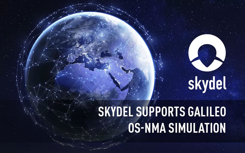
Orolia, a Safran Electronics and Defense company, announced its Skydel GNSS simulation engine will support Galileo Open Service Navigation Message Authentication (OSNMA) simulation in the form of two-phased and separate solutions. These solutions will be available to users who have purchased simulation access to the Galileo constellation, which will be available in the next few months.
OSNMA is an emerging authentication service that allows GNSS receivers to verify the authenticity of received data to protect against potential jamming or spoofing attacks that can result in service disruptions, denial incidents and more.
The first solution is well-suited for most receiver integrators that want to test the OSNMA capability of a GNSS receiver with the official test vectors from the European Union Agency for the Space Programme (EUSPA). This solution will support the available official test vectors sample data, which supports the verification of OSNMA functionality implementation.
The second option will provide full flexibility in the configuration of the scenario as well as the OSNMA authentication parameters. It will be suitable for advanced users that test receivers in a wide range of edge and corner cases.
Available later in 2023, this phase will include the following elements in Skydel: authentication of the Galileo E1 OS navigation message, a new Skydel engine supporting OSNMA SIS ICD 1.0, support for the timed efficient stream loss-tolerant authentication protocol, and useful crypto material for running user-programmable simulation test scenarios.
This feature will be ready for future software updates in accordance with the next phases recommended by EUPSA.
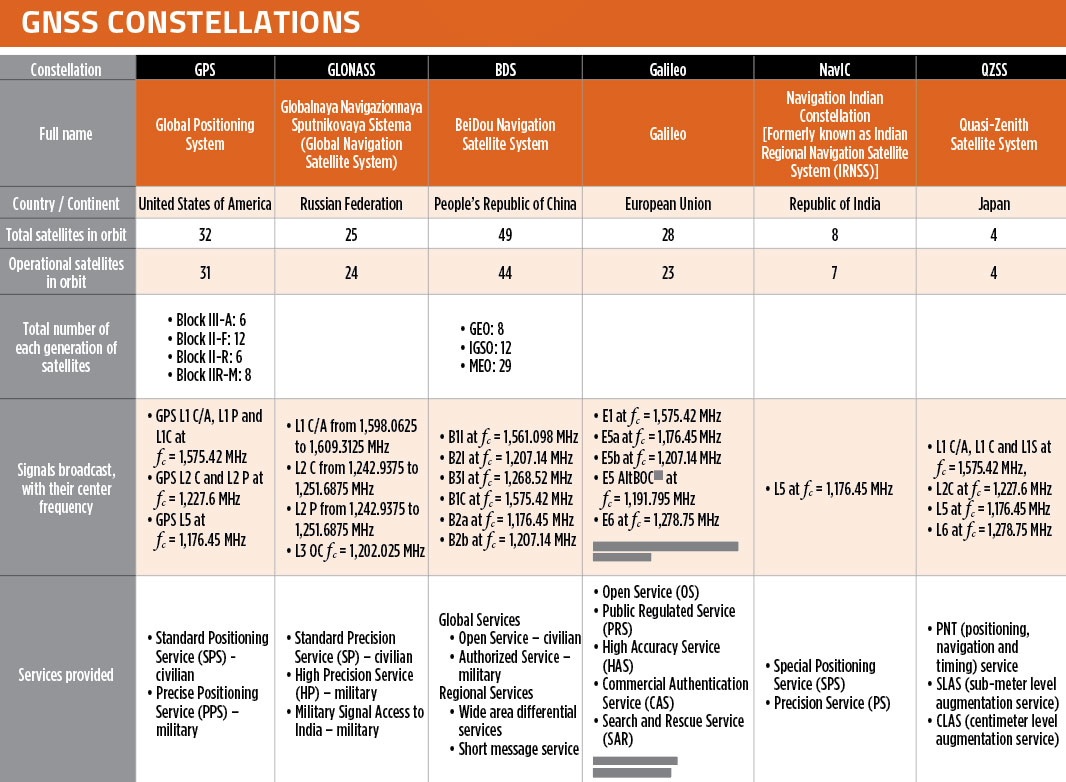
In our October 2021 issue, we celebrated the availability of four global navigation satellite system (GNSS) constellations. Below is the status (as of Feb. 23, 2023) of these four GNSS and their two regional cousins.
Many thanks to Mohamed Tamazin, Ph.D., Senior GNSS Architect for GNSS Simulation with Orolia — a Safran Electronics & Defense company, who provided or confirmed these data. While the data on GPS and Galileo are easily accessible, those for the other constellations are difficult, in some cases very difficult, to find.
What would be required for the United States to develop and deploy a GPS high-accuracy service analogous to Galileo’s HAS?
Ismael Colomina
“Galileo HAS is a particular implementation of a PPP-RTK service. U.S. companies are already providing similar fee-based services that are even more accurate than HAS. Therefore, there is no big technical challenge for the United States to provide a GPS HAS. Actually, the European Union already provides a HAS for GPS. It is more a question of strategy for GPS policy makers: which user segment to service with a HAS-like augmentation? What about other services analogous to Galileo’s OSNMA and the upcoming CAS [commercial authentication service] for resiliency purposes? In short, a HAS-like service would just require including it in the U.S. GNSS evolution roadmap.”
— Ismael Colomina GeoNumerics
John Fischer
“The challenge is probably more political than technical. The U.S. government usually refrains from competing with commercial services. The prevailing attitude in the United States is that the private sector is more efficient than the public sector. Maybe the most practical approach is for the government to provide the authentication mechanism and open access to the data required, then allow the private sector to offer services. There isn’t a pressing need for high-accuracy GPS for transportation — it needs resiliency/reliability. However, precision agriculture needs it, so maybe sponsorship from the Department of Agriculture would be more effective than from the Department of Transportation.”
— John Fischer Orolia
Mitch Narins
“When I saw this question, my first impression (as a systems engineer) was to ask ‘For whom? For what applications? For which services?’ (Positioning? Navigating? Time/frequency?) Many have concentrated on accuracy, competing in a GNSS Olympics to see who can achieve ‘the best’ position accuracy and precision (repeatability). Finally, (thanks to Logan Scott) integrity is being pushed beyond just SBAS and GBAS, and real civil authentication of signals is being pursued. I can promise nanometers/nanoseconds if I don’t have to prove it’s true. While we finally understand the need for zero trust, we must still address loss of service by establishing real complementary PNT.”
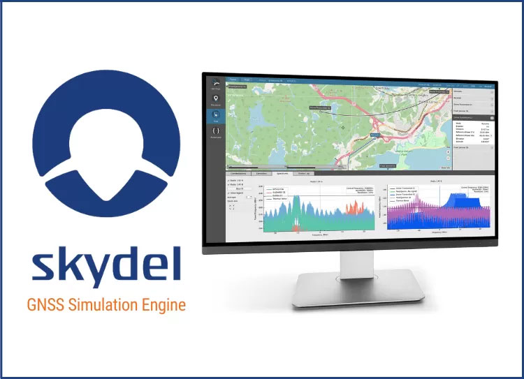
Orolia’s Skydel, its GNSS simulation software, can now generate more than 500 simulated satellite signals. This platform is suitable for GNSS users, experts and manufacturers, as well as users needing a low-Earth-orbit-capable simulation system.
Skydel contains a feature that includes multi-constellation and multi-frequency signal generation, remote control from user-defined scripts, and integrated interference generation.
“With more and more customers simulating multipath and jamming scenarios, and the need for more signals in more applications — even beyond traditional simulators — the need for high capacity has never been greater,” said Pierre-Marie Le Veel, Orolia’s simulation product director. “The Skydel engine opens the possibility for users to escalate to more than 1,000 signals and not be limited by hardware design.”
In addition to generating a high channel and satellite count, Skydel can also produce navigation warfare signals without any additional hardware.
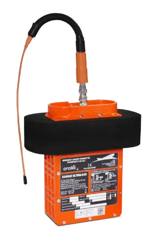
Airbus will install Orolia’s Ultima-DT emergency locator transmitter on its aircraft. (Photo: Airbus)
This fall, Orolia’s Ultima-DT was certified as an emergency locator transmitter with distress tracking (ELT-DT) by Cospas-Sarsat, an international humanitarian search-and-rescue system. Cospas-Sarsat uses space-based technology to detect and locate model 406 emergency beacons carried by ships, aircraft or individuals venturing into remote areas — often inaccessible by GNSS signals. The system consists of a network of satellites, ground stations, mission control centers and rescue coordination centers that work together when a 406 beacon is activated.
I spoke about the certification with Christian Belleux, director, Aviation & Defense Beacons for Orolia.
Matteo Luccio (ML): Has Orolia produced aviation safety products in the past?
Christian Belleux (CB): Orolia has been supplying emergency locator transmitters for aviation since 1995 on a very large number of platforms to OEMs and airlines for use on commercial aircraft — Airbus, Boeing, Embraer and Bombardier aircraft. Orolia is also participating in industry groups creating standards (Eurocae, RTCA, ARINC) or contributing to the progress of the Cospas-Sarsat search-and-rescue satellite system as a member of the Expert Working Group.
ML: What are the key challenges in making an aviation ELT?
CB: With new requirements for lithium batteries and new regulations introducing distress tracking, recent times have been rich in innovation. We were granted the first ETSO certification ever for an ELT-DT and the same product, the Ultima-DT, was also the first ELT to be certified for its lithium battery.
ML: What did Cospas-Sarsat certification of the ELT-DT entail?
CB: The ELT-DT is a new type of beacon with a new communication protocol. The labs performing the certification tests must be approved by Cospas-Sarsat before we can apply. Then the Cospas-Sarsat organization and infrastructure must be updated to receive and consider the new ELT-DT protocol. The Cospas-Sarsat certification of our ELT-DT means that it complies with the performance requirements described in Cospas-Sarsat standards and can communicate with the infrastructure.
ML: What is new about an ELT-DT?
CB: The principle of an ELT-DT is to activate in flight before a crash, as opposed to a legacy ELT that is activated by the shock of a crash. This means that the aircraft and the ELT-DT can analyze the health of the aircraft and its parameters, and activate if a catastrophic event is about to occur. Once activated, the ELT-DT transmits a high-rate distress signal that makes it possible to track the aircraft until it crashes. The ELT-DT contains its own GNSS receiver that is independent the aircraft’s navigation system.
ML: Did you cooperate closely with one or more avionics manufacturers to develop your device?
CB: Orolia was in very close contact with Airbus, which designed the avionics components.
ML: Do you already have contracts with airlines or aircraft manufacturers besides Airbus for the Ultima-DT?
CB: We have several contacts with aircraft manufacturers and airlines interested in the Ultima-DT.
ML: When will the first batch of the ELT-DT / Ultima-DT be operational?
CB: We started flight tests months ago at Airbus and delivered production units. Airbus soon will announce its first delivery of an aircraft equipped with the Ultima-DT.
New-generation aircraft ELT meets new European Union Aviation Safety Agency (EASA) and U.S. Federal Aviation Administration (FAA) requirements
Photo: Orolia
Orolia has received certifications for yet another survival emergency locator transmitter (ELT), the Ultima-S.
The news follows Orolia’s announcement that it had received certification for the Ultima-DT model, as well as a personal locator now shipping to the U.S. Army.
The Ultima-S is a new generation ELT installed in either the cabins or liferafts of aircraft. It relays accurate aircraft location information to search-and-rescue teams.
Once activated, a 406-MHz distress signal is transmitted and includes the ELT’s location thanks to the Ultima-S internal GNSS receiver. This built-in GNSS capability increases both probability and speed of detection of the distress signal.
“With these key certifications for the Ultima-S, Orolia brings a long-awaited solution to the industry,” said Jérôme Ramé, Orolia’s Aviation & Military Product Line Director. “We have developed strong partnerships with several of the leading aircraft manufacturers that will enable operators worldwide to benefit from the Ultima-S for both their linefit and retrofit needs, allowing fleet standardization.”
The Ultima-S provides free, global coverage service through the dedicated Cospas-Sarsat infrastructure while meeting the highest aviation safety standards. Orolia offers non-rechargeable lithium batteries compliant with the latest FAA and EASA special conditions standards, also known under TSO-C142b/DO227A. The Ultima-S also meets the most recent ELT performance and environmental standards through TSO-C126c.
“What makes the Ultima-S unique is a new feature called the Return Link Service (RLS),” said Ramé. “Through this capability, the user is automatically notified when the distress signal is detected and located by the Cospas-Sarsat ground infrastructure. The Ultima-S links directly to the European Galileo GNSS satellite constellation, providing the most reliable and timely information for reaching aircraft crew members in distress.”
In addition to being available on a linefit basis on major aircraft programs, Orolia has launched an exchange program to make retrofit activities easier for airlines, especially those upgrading to safer battery technology.
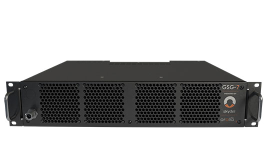
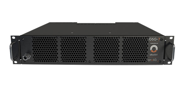
GSG-7 delivers the highest standard of GNSS signal testing in a cost-effective, easy-to-use, turnkey form factor supporting navigation and timing systems
Photo: Orolia
Orolia has released the GSG-7, its latest GNSS signal testing solution.
Orolia made the announcement at the ION GNSS+ conference, taking place this week in Denver.
Offered through the Orolia family of Skydel-based simulators, the GSG-7 features a small form factor, an internal RF combiner, high-end performance with a 1,000-Hz simulation iteration rate, real-time synchronization, hardware-in-the-loop (HIL) integration, powerful automation, and multi-constellation and multi-frequency simulations.
“The GSG-7 is redefining the essential and high capabilities in GNSS simulation with its ease of use, advanced simulation capabilities, reduced size, and competitive price,” said Lisa Perdue, simulation product line director. “Leveraging the powerful Skydel software and commercial-off-the-shelf (COTS) hardware, GSG-7 can accommodate almost any configuration to conduct system testing and simulation. The use of SDRs [software-defined receivers] means that maintenance and customization are not only easier, but more cost-effective than other options on the market.”
Powered by Orolia’s Skydel simulation engine, the GSG-7 can be programmed to simulate operations with all current GNSS signals, as well as future ones. Skydel’s architecture makes the GSG-7 future-proof by allowing new, incoming signals and updates to be implemented through software updates.
The GSG-7 simulator is suitable for development and integration projects that require high performance, all-in-view satellite signals, and an increased number of GNSS constellations.
“Capable of handling complex simulation scenarios, the GSG-7 has a simple, yet powerful application program interface (API) ensuring easy automation and integration into your test environment,” Perdue added. “Users can also benefit from advanced HIL capabilities that include zero-effective latency and built-in performance monitoring tools.”
GSG-7 Webinar
Orolia will host a product webinar on Oct. 6 to discuss the new GSG-7 in great detail. Topics will include: