Tag: OxTS

  • OxTS Launches Lightweight xNAV550 GNSS/INS

    OxTS Launches Lightweight xNAV550 GNSS/INS

    OxTS now offers the xNAV550 (left), and xOEM550.
    OxTS now offers the xNAV550 (left), and xOEM550.

    OxTS has released the xNAV550, its new compact and lightweight GNSS-aided inertial navigation system, along with an OEM board set version, the xOEM550.

    xNAV550. The xNAV550 is the latest model in the xNAV family and the first to offer a position accuracy of 2 cm, yet remains a compact GNSS-aided inertial navigation system at 425 grams. Suitable for all applications where size and weight as well as performance matter, it is designed for use on UAVs and in other weight-constrained applications.

    Featuring dual GNSS receivers and a custom-built inertial measurement unit, the xNAV550 constantly monitors position, orientation and velocity with high accuracy in real-time. Four gigabytes of on-board storage is available, automatically logging data for an added layer of protection. Data can be downloaded from the system and post-processed using OxTS’s advanced software, which is included as standard at no extra cost.

    Integrating the xNAV550 with cameras, laser scanners or other sensor arrays is easy using the NMEA outputs, OxTS said, with 1-PPS and event input triggers for synchronization and time stamping. These features and the convenience of the one-box solution ensure that the xNAV550 make it quick and easy to acquire accurate data required for direct georeferencing, the company said.

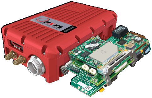
    xOEM550. The xOEM550 is designed for system integrators looking for a high-performance INS to build into a complete scanning and georeferencing system. Weighing 165 grams, it won’t add bulk to a system, and the free and distributable OxTS post-processing software enables system integrators to offer a turnkey solution at a competitive price, the company said.

    OxTS will be exhibiting at ILMF 2015 in Denver, Colo., Feb. 23-25. Stop by Booth #30 to take a look at the xNAV and xOEM systems or contact [email protected] for more information.

  • OxTS Offers Core Module for Inertial, GNSS

    OxTS Offers Core Module for Inertial, GNSS

    Oxford-Oxts-Core_hand Photo: Oxford Technical Solutions
    Oxford Technical Solutions’ xOEMcore. Photo: Oxford Technical Solutions

    The xOEMcore, now being offered by Oxford Technical Solutions (OxTS), is an inertial navigation system that can also serve as a framework for other positioning systems.

    The xOEMcore is a combined six-axis inertial measurement unit and navigation system with sensor fusion in one compact OEM module. In its base form, the xOEMcore measures and outputs raw accelerations and angular rates with small, high-grade MEMS gyros and accelerometers. With a simple upgrade, the xOEMcore is turned into a full inertial navigation system, able to take aiding data from external sources such as GNSS and blend it in the on-board Kalman filter. It is desgined for integration inside any solution that requires robust, high-performance position and orientation.

    xOEMcore provides continuity from one point to the next, so detecting unexpected measurements from other devices is easy, the company said. It has deterministic error growth for accuracy, a high update rate and low delay, enabling easier control of vehicles and robots.

    As a framework, the xOEMcore can be merged other technologies, such as GNSS and vision positioning. The xOEMcore solves conflicts between the two systems, removing timing mismatches, delays, jumps and inconsistencies.

    The xOEMcore is small, light and low power. The inertial sensors have low drift rates — less than 5-meters drift after 60 seconds can be achieved in real-time with only odometer aiding. Heading, roll and pitch can be accurate to 0.05 degrees, exceeding magnetic heading and vertical reference system performance.

    For a demonstration or for more informtion, contact [email protected]..


  • Oxford Technical Releases 6-Axis Inertial+

    Oxford Technical Solutions (OxTS) has rolled out its Inertial+, an inertial navigation system that can be used with an existing GPS receiver to improve position measurements, according to the company.

    The Inertial+ includes inertial sensors, processing engine, and algorithms. It is built around a 6-axis inertial measurement unit — including three angular rate sensors (gyros) and three servo-grade accelerometers — to measure position and velocity even when GPS is not available, OxTS said.

    Designed for surveying in an urban environment, the Inertial+ is able to ignore or correct jumps in the GPS measurements. In addition to position data when combined with a GPS receiver, the device will also produce measurements like roll, pitch, and heading. Data is read and output in NMEA format, and other formats are supported. By combining an Inertial+ with a high-accuracy real-time kinematic (RTK) GPS receiver, users can achieve 1 centimeter precision, 0.03 degrees roll/pitch accuracy, and low drift rates when GPS is not available, according to the company.