Tag: OxTS

  • Launchpad: Latest in OEMs, mapping, UAVs and more

    Launchpad: Latest in OEMs, mapping, UAVs and more

    Read a roundup of recent products in the GNSS and inertial positioning industry from the April 2025 issue of GPS World magazine.


    OEM

    INS
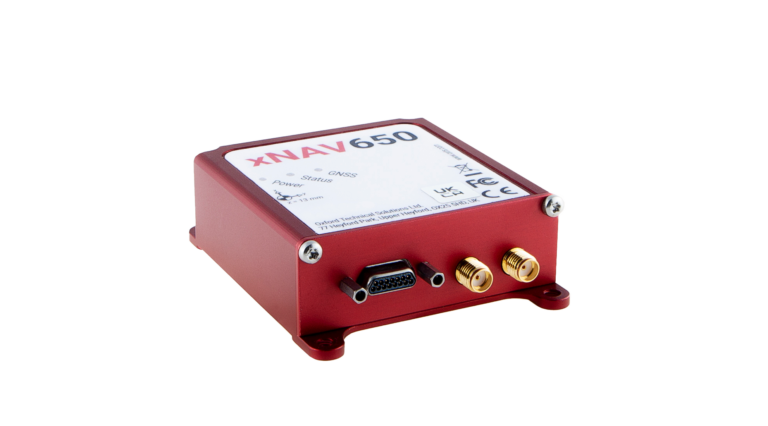
    With three additional GNSS receiver variants

    Photo: Topcon
    Photo: Topcon

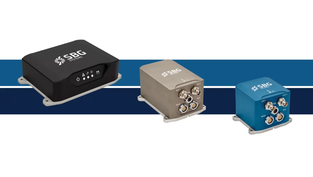
    SBG Systems has upgraded its inertial navigation systems — Ekinox, Apogee and Navsight — with new GNSS receiver options. The latest update introduces three additional GNSS receiver variants.

    These include:

    • Marinestar, which supports Fugro Marinestar, delivering precise point positioning (PPP) with centimeter-level accuracy via L-band corrections without requiring a base station. It is optimized for marine applications.
    • HAS Ready / NavIC, which includes Galileo E6 support for the upcoming Galileo High Accuracy Service (HAS), offering free decimeter-level PPP corrections globally. Additionally, it supports the Indian NavIC system.
    • Centimeter-Level Augmentation Service, which is tailored for users in Japan; this variant utilizes QZSS L6 signals to provide free PPP corrections without external services.

    All GNSS variants integrate seamlessly with SBG Systems’ antenna portfolio and Qinertia post-processing software. Users select the appropriate GNSS variant at purchase to match their operational requirements. These enhancements aim to provide versatile solutions across diverse industries while ensuring reliable performance.

    SBG Systems

    Receivers
    Can achieve centimeter-level accuracy

    Photo: STMicroelectronics
    Photo: STMicroelectronics

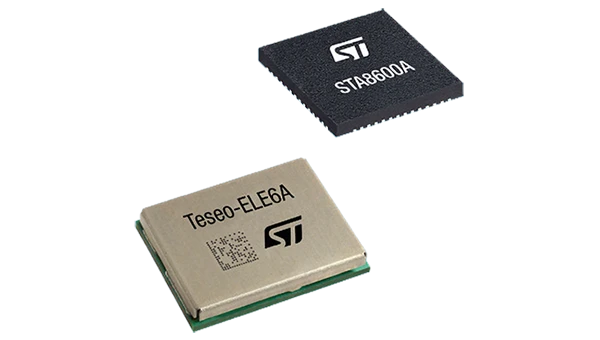
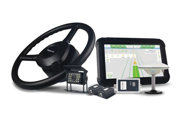
    The GNSS receivers in the Teseo VI family use multi-constellation and quad-band signal processing on a single chip, achieving centimeter-level accuracy for various applications. The Teseo VI family includes the STA8600A and STA8610A models. These receivers are designed for automotive applications such as advanced driver assistance systems and autonomous driving, as well as industrial uses, including asset tracking, mobile robots and precision agriculture.

    The Teseo VI+ variant can host enhanced positioning engines developed by third-party companies, providing real-time kinematics for centimeter position accuracy.

    STMicroelectronics

    GNSS Module
    Operates in challenging environments

    Photo: Quectel
    Photo: Quectel

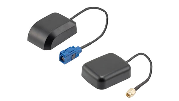
    The LG680P is a multi-constellation, quad-band GNSS module designed for high-precision positioning and to enhance signal quality and precision through concurrent reception of L1, L2 and L5 frequency bands. It supports Galileo E6, QZSS L6 and BDS B2b signals for precise point positioning, ensuring horizontal accuracy of up to 0.8 cm + 1 ppm without requiring local or broadband connectivity.

    To ensure signal integrity in environments with electromagnetic interference, the module features professional-grade anti-jamming technology, including built-in NIC algorithms that suppress narrow-band interference. It supports external active antennas for enhanced signal reception and positioning accuracy. It is ideal for applications such as autonomous lawnmowers, delivery robots, surveying equipment and precision agriculture. Quectel complements it with two external GNSS antennas: the YEGR001W8AH geodetic antenna and the YEGD006U1A compact patch antenna.

    Quectel

    Firmware Upgrade
    For SBG Systems’ MEMS-based INS

    Photo: SBG Systems
    Photo: SBG Systems

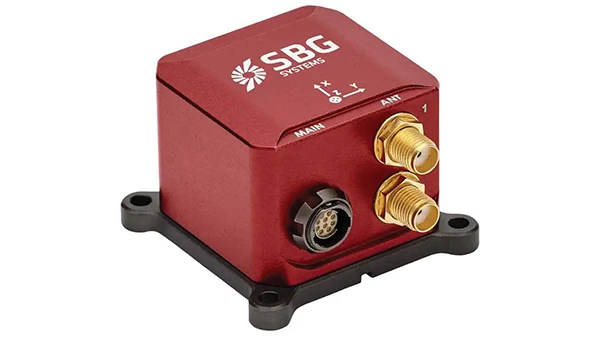
    The New Ellipse firmware upgrade for the Ellipse product line allows the system to now be used as an attitude and heading reference system or inertial navigation system. It is designed to enhance navigation, attitude and heave performance for stable and accurate positioning, even in challenging conditions.

    It introduces advanced GNSS-denied capabilities, featuring newly integrated flags that trigger when GNSS jamming or spoofing threats are detected. This allows users to reject or re-enable external sensors — such as GNSS — without resetting the filter. The user-friendly interface allows for fast and flexible configuration using simple command lines, enabling users to tailor the Ellipse to their specific needs and applications.

    SBG Systems

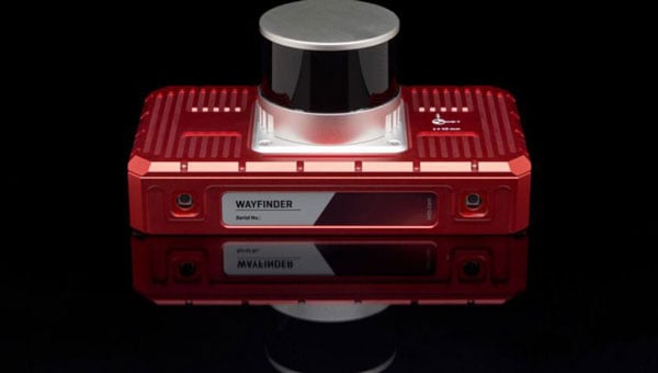
    Localization Solution
    Operates in GNSS-denied environments

    Photo: OxTS
    Photo: OxTS

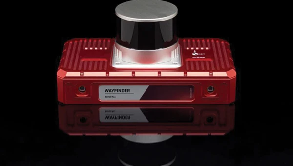
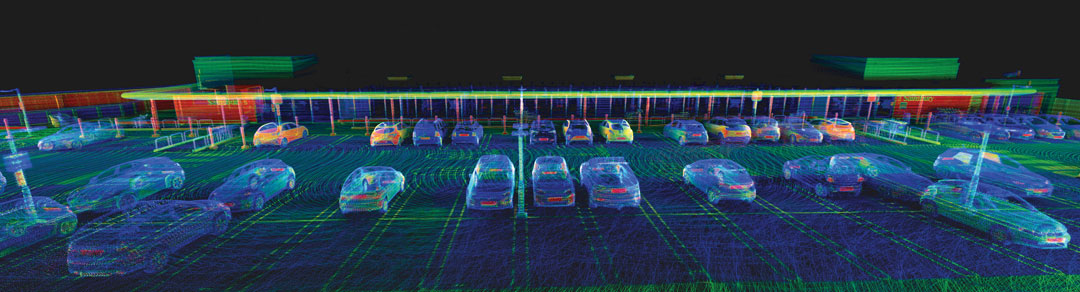
    WayFinder is a localization solution designed for GNSS-denied environments. It integrates a GNSS/INS system, onboard processor, lidar scanner and two cameras, enabling precise navigation in areas with limited satellite coverage. The system features Lidar Boost, a software technology that enhances GNSS/INS performance by processing lidar data to compensate for missing or inaccurate GNSS updates in real time. This ensures high-accuracy localization and seamless transitions between GNSS-supported and GNSS-denied environments.

    WayFinder enables precise navigation for autonomous vehicles in ports, mining and indoor automotive testing without fixed infrastructure. It also provides reliable positioning for surveyors in areas with limited GNSS coverage.
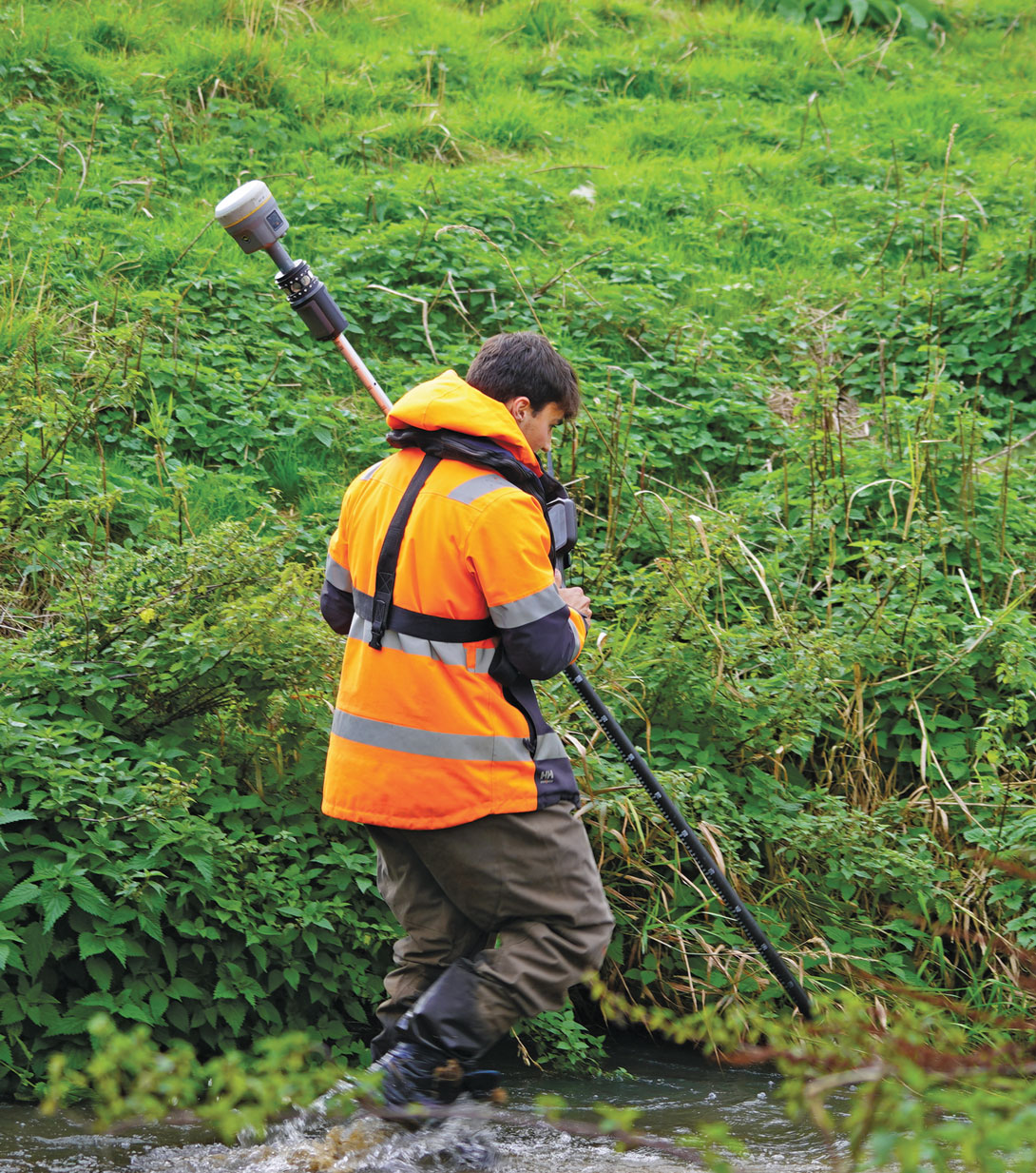
    OxTS

    Survey

    Smart Surveying
    Introduces topographic design tools

    Photo: Virtual Surveyor
    Photo: Virtual Surveyor

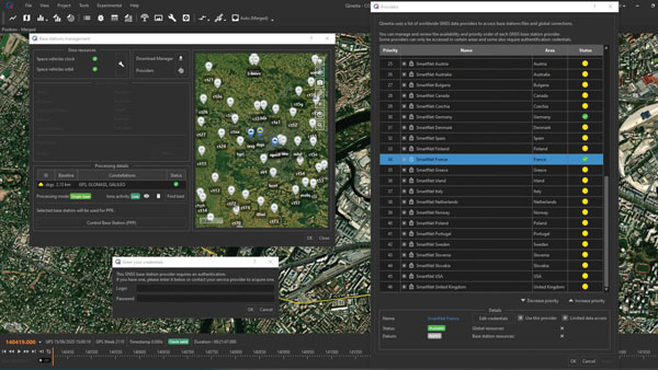
    Virtual Surveyor Version 10 introduces Basic Topographic Design tools, allowing users to document terrain changes such as graded roads, water ponds and building surfaces. The software now features four subscription plans — Valley, Ridge, Mountain and Peak.

    • Ridge plan: Focuses on surveying a single moment in time using one drone data set.
    • Mountain plan: Adds Timelines to compare surveys across different times, visualizing changes through Time Steps.
    • Peak plan: Includes advanced Topographic Design tools for planning future structures by creating new Time Steps. These tools allow users to design features such as roads or ponds directly on UAV-derived models, with automated alignment and volume calculations for cut-and-fill operations.

    Version 10 introduces drawing guides, available in the Ridge plan and above, enabling precise drawing of points at specific intervals or angles. Walk Mode, included in all plans, allows users to explore 3D terrain at ground level for better visualization. Timelines, featured in the Mountain and Peak plans, facilitate the comparison of multiple surveys conducted at different times and the integration of future designs. These improvements seek to streamline processes for engineering surveyors, supporting applications in construction, mining and water management.

    Virtual Surveyor

    Laser RTK
    With a laser range of up to 50 m

    Photo: ComNav Technology
    Photo: ComNav Technology

    The Jupiter Laser RTK integrates GNSS, auto-IMU, laser and dual camera systems into a single unit. It incorporates a precise green laser that remains visible even in bright daylight. This feature allows for precise measurements of points in hard-to-reach, signal-blocked or potentially hazardous locations. It also features a night vision camera, allowing users to see feature points even in low-light conditions. The RTK system’s laser range is up to 50 m, making it suitable for challenging surveying environments. It incorporates visual technology to offer surveyors an immersive experience during surveying and stakeout operations, improving working efficiency and productivity.

    ComNav Technology

    UAV

    UAV Software
    With new mapping capabilities

    Photo: AgEagle Aerial Systems
    Photo: AgEagle Aerial Systems

    Version 2.1.0 of AgEagle Aerial Systems’ eBee VISION application software introduces circular and grid mapping features, allowing users to generate 2D or 3D maps using external post-processing software for more comprehensive geospatial data.

    The eBee VISION 2.1.0 can continue missions in GNSS-denied environments and allows manual deactivation of GNSS to prevent jamming or spoofing. It implements the STANAG 4609 standard, the official format for motion imagery exchange within the NATO nations. This involves embedding UAV position and camera information into the videos recorded by the UAV and those broadcasted by the Ground Control Station. Its inclusion in the system seeks to enhance interoperability with third-party applications, which is key for military-grade UAVs.

    It offers enhanced control over the Silent Tactical Landing feature. Users can now manually adjust the landing position on the map, with the system providing range estimates to inform operators of the UAV’s reach. This functionality offers greater flexibility in mission planning and execution, particularly in tactical scenarios requiring precise landing control. The system is ideal for defense, public safety and utilities applications.

    AgEagle Aerial Systems

    ‘Drone-in-a-Box’ Solution
    Designed for vehicle-mounted deployments

    Photo: DJI
    Photo: DJI

    The DJI Dock 3 “drone-in-a-box” solution is designed for vehicle-mounted deployments and 24/7 remote operations in various environments. This system is compatible with the Matrice 4D and Matrice 4TD UAVs, which feature advanced cameras and IP-rated protection for challenging conditions. The UAVs are ideal for public safety, emergency response and infrastructure inspection.

    This system supports flexible deployment options, including vehicle-mounted setups optimized for emergency operations and long-distance inspections. It enables horizontal calibration and cloud-based dock location adjustments. Two docks can be mounted on a single vehicle to facilitate dual-UAV rotations for enhanced efficiency. In fixed deployments, the D-RTK 3 Relay Fixed Deployment Version can be added to improve video transmission and satellite connectivity.

    The Matrice 4D and 4TD UAVs have a wide-angle camera, medium tele camera, tele camera and laser range finder. The Matrice 4D features an advanced camera suite designed for high-precision mapping. The Matrice 4TD includes an infrared thermal camera for public safety and emergency response applications. The system includes a Flight Termination System to support regulatory compliance in strictly controlled airspace. This system can manually or automatically stop drone operations if necessary.

    DJI

    Software Upgrade
    Enables 24/7 BVLOS operations

    Photo: uAvionix
    Photo: uAvionix

    Casia G Release 4.0 is a software update that enables nighttime detection of aircraft, allowing 24/7 beyond visual line of sight (BVLOS) UAS operations. The update supports BVLOS flights up to 400 ft at night without requiring hardware modifications, offering detection of both cooperative and non-cooperative aircraft. The system detects aircraft at distances of up to 16.7 km with 360° coverage, ensuring safe nighttime operations. When multiple units are used, triangulation technology provides accurate range, altitude and satellite data for intruding aircraft. The update leverages existing hardware to detect navigation and anti-collision lights at night.

    uAvionix

    Marine Radar
    With W-band radar technology

    Photo: NavTech Radar
    Photo: NavTech Radar

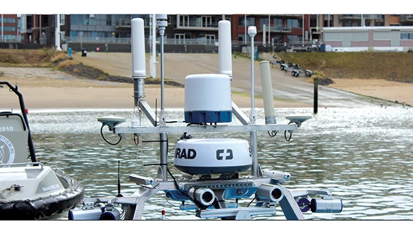
    The MAS10 is a 77 GHz FMCW marine radar system designed to enhance navigation safety in congested environments under all weather conditions. The ultra-high-definition W-band radar provides centimeter-level resolution, enabling vessels to detect and identify small hazards in heavily trafficked waterways.

    Unlike optical and infrared sensors, W-band radar technology penetrates fog, heavy rain and snow, ensuring reliable detection. It operates effectively in low-visibility scenarios, including complete darkness, intense sunlight and shadowed areas where cameras and lidar may struggle.

    NavTech Radar

    Mapping

    New 3D Scanners
    Available in two versions

    Photo: 3DMakerpro
    Photo: 3DMakerpro

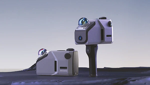
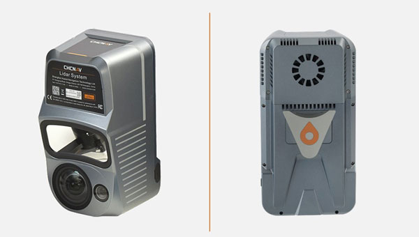
    The Eagle Series line of spatial 3D scanners feature lidar and imaging sensors and are designed for various applications, including reverse engineering, digital twinning, asset management, extended reality, precision mapping and 3D printing.

    The series offers scanning capabilities with a range of up to 140 m and precision within 2 cm at 10 m. The lightweight scanner is designed for portability, with a built-in battery providing up to one hour of continuous use.

    The scanners are available in Standard and Max versions. The Max model features four 48 MP cameras, enhancing scanning efficiency and producing vivid 8 K panoramic photos. With a point cloud frequency of 200,000 points per second, the Eagle Series is designed for applications requiring highly detailed spatial data.

    3DMakerpro

    Upgraded Mapping Package
    With Google Maps downloads

    Photo: Golden Software
    Photo: Golden Software

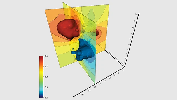
    Golden Software has upgraded its Surfer mapping and 3D visualization software. Users can now directly download georeferenced aerial and satellite imagery from Google Maps into projects. The latest version also improves 3D visualization tools, focusing on faster and more intuitive creation of visual models. Users can now colorize 3D drill hole intervals based on text keywords, making it easier to interpret subsurface data. Additionally, contour slices can now be added to the 3D view, offering a clearer representation of data layers.

    Golden Software has released a beta version (30.0.135) that introduces multiple light sources for improved 3D viewing and customizable legends for better map presentation. These updates are designed to streamline workflows for professionals in industries such as environmental consulting, resource exploration and geospatial analysis, simplifying the creation of professional-grade maps and models efficiently.

    Golden Software

  • OxTS launches GNSS-denied localization solution

    OxTS launches GNSS-denied localization solution

    OxTS has released WayFinder, a new localization solution designed for use in GNSS-denied environments. The system combines a GNSS/INS system, onboard processor, lidar scanner and two cameras to enable accurate positioning in areas with limited satellite coverage, such as urban canyons and underground tunnels.

    Precise localization data is crucial for various industries, including autonomous navigation, automotive testing and sensor data georeferencing. However, obtaining accurate positioning information in areas with weak or unavailable GNSS signals has been a persistent challenge. WayFinder is designed to operate with minimal setup, requiring only basic configuration before use. The system’s key feature is Lidar Boost, a new software technology that enhances GNSS/INS performance in environments with unreliable satellite signals.

    Lidar Boost employs advanced algorithms to process data from the integrated Lidar scanner, compensating for missing or erroneous GNSS updates in real time. This allows WayFinder to maintain high-accuracy localization in areas with limited satellite coverage and ensure smooth transitions between GNSS-supported and GNSS-denied environments.

    The system can be used across multiple sectors. In ports, it can provide precise localization for autonomous vehicles operating among stacked shipping containers. In mining, it can support navigation for both underground and surface vehicles. WayFinder also offers a solution for indoor automotive testing without the need for fixed infrastructure. Surveyors working in areas with intermittent GNSS coverage can also benefit from its positioning capabilities.

  • How OEM technology is enhancing precision applications

    How OEM technology is enhancing precision applications

    When a vehicle passes through a GNSS-denied area, its navigation system might be thrown off and report an incorrect position. Conversely, INS is inherently subject to drift — the steady accumulation of errors — and therefore must be periodically re-initialized by an external source, such as GNSS. (Photo: Safran Federal Systems)
    When a vehicle passes through a GNSS-denied area, its navigation system might be thrown off and report an incorrect position. Conversely, INS is inherently subject to drift — the steady accumulation of errors — and therefore must be periodically re-initialized by an external source, such as GNSS. (Photo: Safran Federal Systems)

    The term “original equipment manufacturer”  (OEM) is widely used, yet vaguely described. In general, an OEM product is one that a company creates and sells to be integrated into systems made by other manufacturers.

    In the GNSS industry, the purchasers of OEM products typically are manufacturers of products that require precise positioning or navigation capabilities, from precision agriculture, to surveying and mapping, to UAV missions. Often, manufacturers integrate the OEM GNSS receivers with other sensors, such as inertial measurement units (IMUs) and lidar devices.

    A large portion of the OEM business goes unnoticed by the end users of the equipment that utilizes OEM components. These components, such as a guidance system, are often hidden from view, due to being housed under a hood or elsewhere deep within the system.

    In the following case studies, OEM products complement GNSS in air, land and marine applications. Safran Federal Systems’ INS for land vehicle navigation and Septentrio’s AIM+ anti-jamming and anti-spoofing technology tackle land and air-based defense applications, while an OxTS IMU is used in a coral reef restoration project to accurately record ship motion.

    Land vehicle navigation in GNSS-denied environments
    Safran Federal Systems

    Ground vehicles in defense operations often navigate in challenging environments where traditional GPS signals are contested or unreliable. This includes dense urban areas, heavily forested regions, or any areas where enemies employ electronic warfare to disrupt GPS signals. Having a robust navigation system that can provide both the vehicle’s location in real time as well as its precise orientation and direction/heading is crucial for defense applications. An inertial navigation system (INS) can provide reliable position and heading data for short periods of time or distances without the aid of GPS satellite signals, allowing vehicles to stay on course and maintain awareness of their location.

    Precise location and navigation capabilities are essential for mission planning, execution and coordination with other units. Inaccurate navigation can lead to mission failure, unintended engagements, or even friendly fire incidents.

    Geonyx INS
    Geonyx INS

    Safran’s Solution

    Geonyx INS with incorporated M-Code capability
    Geonyx INS with incorporated M-Code capability

    Safran has developed the Geonyx INS, which provides route guidance in GNSS-denied environments. It incorporates hemispherical resonator gyroscope (HRG) technology and does not rely on external satellite signals for navigation and heading. Instead, it uses gyroscopes to detect changes in heading and accelerometers to detect changes in acceleration, then uses those data to calculate the vehicle’s position, orientation and velocity.

    The Geonyx will output coordinates of the vehicle’s current location as well as the data on its intended position to the vehicle’s battle management system (BMS). It can maintain an accuracy of a couple of meters after tens of miles of pure inertial navigation.

    Geonyx is a combat-proven INS solution for ground vehicles, augmenting battle management systems. It can achieve a heading accuracy as good as 0.5 mils thanks to Safran’s HRG Crystal technology. It has quick and flexible alignment, even in GNSS-denied environments.

    Safran is upgrading the Geonyx to incorporate M-Code capability. This enhancement offers a fully integrated solution to tackle the challenges of GPS-denied or spoofing environments, ensuring robust and reliable navigation even in the most demanding conditions.

    JammerTest in Bleik, Andøya, Norway. (Photo: David Jensen)
    JammerTest in Bleik, Andøya, Norway. (Photo: David Jensen)

    Resilient GNSS receiver
    Septentrio

    Around the world, there is an increasing demand for better resilience in positioning, navigation, and timing (PNT) systems. U.S. President Joe Biden has signed an executive order to enhance national resilience through PNT services. Geo-political tensions require a higher level of security for operations in areas of navigational warfare (NAVWAR) under contested GNSS conditions.

    In countries such as Finland, companies are seeking reliable receivers that can be connected in a network to identify sources of malicious interference. In numerous GNSS applications, such as reference networks, UAV surveillance, delivery and timing synchronization, the repercussions of PNT degradation or loss can be significant.

    Septentrio’s Solution

    Septentrio took part in the JammerTest 2023 event organized by the Norwegian government on the remote island of Andøya, where live interference testing was conducted in a controlled environment.

    While most of these test events are classified and their results cannot be shared publicly, the JammerTest represents one of the first public events of its kind where the sharing of results is encouraged.

    After five days of intensive testing in Norway, Septentrio’s AIM+ anti-jamming and anti-spoofing technology proved to work well under live interference conditions. Test results revealed that under real interference, receiver technology plays a key role, while antenna technology plays a supporting role. By testing the receiver under various types of spoofing attacks, it was shown that the best spoofing protection lies in having multiple anti-spoofing mechanisms working together.

    Detecting and Mitigating GNSS Jamming

    This test used a “cigarette lighter” jammer, which is commonly available for purchase online. It emits signals with power between 10 dBm and 15 dBm and can disrupt GPS L1 and L2 signals. Other jamming tests involved using jammers with signals 10 million times more powerful than GNSS signals.

    Over one day of intensive jamming tests, receivers with integrated AIM+ demonstrated 99.5% positioning availability under various forms of jamming from simple continuous narrow-band interference to the most complex wide-band transmissions.

    The Magic is in the Receiver

    For mission-critical applications, an anti-jam antenna can help achieve maximum resilience against RF interference. During the JammerTest, three receivers were tested under heavy multi-frequency wideband jamming in combination with antennas of varying sophistication. A receiver with a standard wideband helical antenna that did not have AIM+ anti-jamming technology immediately lost tracking of satellite signals during jamming. A receiver with the same antenna, but with AIM+, continued to track signals and deliver positioning. A receiver with AIM+ coupled with an anti-jam antenna displayed that the drop in signal quality is slightly less than with a standard antenna and the receiver continued to track signals and to deliver positioning.

    Tests with various anti-jam antennas showed an interference reduction of about 10 dB. While AIM+ plays a role in positioning availability under jamming, an antenna plays a supporting role and can improve the chances of getting positioning in cases where the jamming is still slightly stronger than the ability of the receiver to mitigate it. While anti-jam antennas can be effective in countering wide-band “white-noise” jamming, they are less effective for other types of jamming.

    Accurate and available PNT is key to successful industrial or critical operations in challenging environments. By regularly participating in live events such as the JammerTest, Septentrio anti-jamming and anti-spoofing technology is continuously being tested and improved to withstand the latest interference attacks. This technology also has been confirmed to be effective by users out in the field, who are using Septentrio receivers in places of malicious interference, such as near contested borders.

    Photo: Tunatura / iStock / Getty Images Plus / Getty Images
    Photo: Tunatura / iStock / Getty Images Plus / Getty Images

    INS Used for Coral Reef Restoration Project
    OxTS

    The Reef Restoration and Adaptation Program (RRAP) is an effort to help a significant ecosystem such as the Great Barrier Reef (GBR) survive climate change. Through its Cooling and Shading sub-program, RRAP’s goal is to determine whether localized cloud brightening — a technique that involves spraying droplets of sea salt into clouds to reflect sunlight and cool Earth — and/or fogging could be a temporary solution to alleviate stress on parts of the GBR during hot summer conditions, which might lead to bleaching.

    The Ordnance Survey team was tasked with consistently creating precisely georeferenced point clouds that could be utilized for identifying and classifying features. The GBR is a significant source of biogenic volatile organic compounds (BVOCs), which are likely to be impacted by ocean warming in potential climate change scenarios. In turn, these BVOC emissions can influence Earth’s radiation budget by contributing to the creation of secondary organic aerosols and cloud condensation nuclei, ultimately leading to cooling.

    Southern Cross University, an RRAP partner, sought an accurate method to record ship motion for this project. The team needed to measure various parameters such as velocity, acceleration, pitch/roll, angle rate, and ship heading. They approached Industrial Measurement Solutions (IMS) and OxTS to assist them in addressing this challenge. To achieve this accurately, they needed to integrate the measurements from their existing sonic anemometer, which records three-dimensional wind velocity, with the measurements from an IMU.

    OxTS Takes the Challenge

    Correcting wind speed for platform motion requires two high-resolution sensors to record data simultaneously: a sonic anemometer that records three-dimensional wind velocity, and an IMU that records the movement of the platform/ship. The sonic anemometer and the IMU are two very sensitive sensors, and many of the technology challenges the team faced involved setting them up correctly and getting them to work seamlessly together.

    Once the project team realized that they needed an IMU to measure the ship/platform motion, one of their collaborators at the time, Airborne Research Australia (ARA), suggested an OxTS xNAV650.

    After they had defined the project requirements, Southern Cross University contacted IMS who helped them navigate the commercial process.

    xNAV650 is a miniature INS that uses survey-grade dual-frequency GNSS receivers and custom MEMS IMU for centimeter-level position accuracy, precise orientation and true heading. It logs the navigation data on internal storage for downloading and viewing post-mission. It can be used in many applications, such as corridor mapping and precision agriculture.

    OxTS xNAV650 Inertial Navigation System. (Photo: OxTS)
    OxTS xNAV650 Inertial Navigation System. (Photo: OxTS)

    IMU in Action

    The xNAV650’s IMU allowed Southern Cross University to accurately measure the motion of the ship. The IMU was configured to “displace output” to the location of the 3D wind measurement instrument — the sonic anemometer. This allowed the project team to record the movement of the instrument directly, thus avoiding any additional complicated processing steps. Additionally, the IMU was configured to output a 1 pulse per second (PPS) signal via serial connection. This allowed the project team to connect the IMU to the sonic anemometer’s data logger to sync the time between the two instruments. This was vital on such a rapidly moving platform.

    Once installed, the xNAV650 device was able to measure ship motion accurately and at high time resolution
    (100 Hz), which was complementary to the team’s wind velocity and BVOC measurements. The PPS output option allowed for simultaneous measurement/recording, which would have otherwise needed to be corrected in post-calibration and would likely not have been as accurate.

    “We managed to accurately record ship motion for the entire length of our second voyage,” said Liz Deschaseaux, RRAP’s research fellow on BVOC emissions. “The reliability and accuracy of the xNAV650 has had a real impact on our ability to collect meaningful data.”

  • Surveying & Mapping: Overlapping technologies and professions

    Surveying & Mapping: Overlapping technologies and professions

    Wangjie Zhao, an employee of CHC Navigation. (Photo: CHC Navigation)
    Wangjie Zhao, an employee of CHC Navigation. (Photo: CHC Navigation)

    For decades, surveying — which consists largely of making measurements to determine the relative positions of points above, on or beneath Earth’s surface — had much higher accuracy than mapping for geographic information systems (GIS) — which is mostly based on aerial photogrammetry for base maps and field data collection of the locations of features. When I started in this field a quarter century ago, we typically classified GPS receivers as survey grade, resource grade or consumer grade, with “resource grade” referring to field data collection for GIS.

    Today, however, the accuracy of all receivers has greatly increased — thanks to improved chipsets, new GNSS constellations, and a plethora of corrections services — and those three categories are no longer relevant. Therefore, surveying and mapping are increasingly overlapping.

    For this cover story, I asked the same three questions about mapping and surveying to representatives of four companies. 

    CHC Navigation Rachel Wang, product manager of survey and engineering product line

    HexagonCraig Hill, VP marketing and services, surveying solutions, Leica Geosystems

    OxTSGeoff Besbrode, product marketing executive

    Trimble Chris Trevillian, director of product marketing, Geospatial Solutions

    Additionally, click below to read insights from:


    Surveying and mapping are increasingly overlapping. What are the remaining differences between them, in terms of accuracy requirements and challenges in the field?

    CHC Navigation
    While advances in technology such as lidar and photogrammetry are narrowing the gap, there are still notable differences between surveying and mapping. Surveying often requires centimeter- or even millimeter-level accuracy at specific points. In contrast, mapping focuses on collecting dense 3D data over large areas. Although the accuracy of mapping point clouds is steadily increasing, the integration of ground-based GNSS data collection with aerial imagery and lidar is becoming widespread. Mapping tends to be less labor-intensive and involves fewer safety risks in the field, but it requires a unique skill set, particularly in point cloud processing.

    Hexagon
    Traditionally, surveying and mapping differ primarily in their accuracy requirements and application scales; however, this paradigm is changing with mapping becoming increasingly accurate. Surveying focuses on high-precision geospatial data of specific points. From road, rail and tunnel construction to high-rise buildings, there is no substitution for the precision delivered by surveying equipment and procedures. In contrast, mapping focuses on larger areas.

    Recent advancements in sensor technology, including both airborne and mobile mapping systems such as the Leica CityMapper-2 and the Leica Pegasus TRK, have significantly improved the efficiency and precision of mapping, bringing it closer to the levels achievable with traditional surveying equipment.

    OxTS
    Surveying comes with a large overhead during the data collection process. It requires meticulous preparation and attention to detail to achieve high accuracy in the raw data. GNSS quality, lever arms, user operation, etc., can all cause problems later on. Getting any part of the process wrong can have major cost implications through having to redo the process.
    Mapping is focused on the act of aligning that data to datums and control points after the surveying process is completed but it also requires major attention to detail in aligning coordinate frames and origin points in order to avoid baking in any errors that lead to mistakes being made once the map data is handed over to a customer

    The problem is that if the surveying process wasn’t accurate, the mapping process will not have a solid foundation in the raw data to deliver accurate maps, so they are inherently tied to each other.

    Trimble
    Surveyors today have many tools in their toolbox, giving them flexibility across surveying and mapping applications. There are many highly accurate, easy-to-operate data capture systems to choose from these days, but challenges grow when combining and analyzing vast amounts of data from different sensors in the office to provide final deliverables. This has made field-to-finish software that delivers technological integration, workflow optimization and adaptability essential for the job.

    Mapping projects often require less accuracy, but a lot of advanced survey technology is entering the mapping domain (e.g., mobile mapping and laser scanning) because of easier field operations and increasing understanding of the value of rich data to asset management.

    The data were collected in and around a car park to prove how Lidar Inertial Odometry (LIO) can be used to retain accuracy for longer periods without GNSS updates. (Photo: OxTS)
    The data were collected in and around a car park to prove how Lidar Inertial Odometry (LIO) can be used to retain accuracy for longer periods without GNSS updates. (Photo: OxTS)

    What is your company’s niche in surveying/mapping?

    CHC Navigation
    CHC Navigation (CHCNAV) has been at the forefront of positioning and navigation for more than two decades, continually adapting to meet the diverse needs of the surveying and mapping industry. Our innovative solutions often lead the industry in providing end-to-end, integrated technology fusion — GNSS, inertial measurement unit (IMU) and imaging lidar — as a standard that empowers geospatial professionals worldwide. CHCNAV strives to provide accessible, value-added solutions from the start, positioning itself as a key technology enabler for the geospatial community.

    Hexagon
    Whether you are mapping an entire city or surveying a site for construction, capturing reliable and precise geospatial data is essential. Hexagon’s niche lies in its commitment to innovation, its extensive portfolio and the convergence of superior hardware, intelligent software solutions and expert services — enabling precise, efficient and scalable surveying and mapping for diverse needs. Our multitude of solutions, whether handheld, tripod-mounted, flying, or vehicle-mounted, are designed to collect data efficiently and safely from complex or dangerous environments — enabling the greatest accuracy and high-value deliverables.

    Furthermore, Hexagon is uniquely positioned with its robust suite of software solutions that work seamlessly with our hardware, such as Reality Cloud Studio, Leica Cyclone, Leica Captivate or Leica Infinity for collecting, processing, modeling, analyzing, and presenting data. We offer end-to-end solutions that not only provide high accuracy but also ensure productivity and ease of use.

    OxTS
    OxTS offers localization and georeferencing technology that can help accelerate the collection of high accuracy survey data, allowing more work to be completed in a given time frame without compromising on accuracy.

    Trimble
    Trimble is known for offering a wide range of highly accurate and reliable data capture sensors but our “niche” — our truly unique offering — is our ability to offer comprehensive solutions that make our customers more productive and their projects more streamlined. We do this through hardware and software solutions that enable highly efficient survey and mapping workflows that connect field and office operations. Our software helps transform the captured data into true information utilizing an increasing number of AI-powered tools while our cloud services allow customers to share the data with a variety of stakeholders, unlocking the transformational power of geospatial data.

    What is your latest surveying/mapping product? What are its key specs, markets and applications?

    Hexagon
    Among our surveying and mapping solutions, the Leica BLK ARC stands out with its flexibility to integrate with various robotic and mobile carriers. The BLK ARC provides autonomous laser scanning with static and dynamic scans, creating 3D digital twins and ensuring operator safety. Similarly, the Leica BLK2GO introduces an agile, handheld mobile scanning solution, capturing point clouds and images, with a user-friendly design. Both solutions are great allies for professionals requiring accurate, efficient, and versatile mobile scanning solutions.

    For those looking to offer wide-scale data-capturing capabilities and overcome capacity constraints, the Leica Pegasus TRK mobile mapping system stands out because it can gather extensive data quickly and accurately. Its high-resolution data capture, advanced lidar technology, and enriched 3D point cloud capabilities ensure detailed and comprehensive datasets. Building on this range of solutions, the autonomous flying laser scanner Leica BLK2FLY enhances surveying efficiency by capturing hard-to-reach areas and environments. Its user-friendly operations, advanced obstacle avoidance and seamless cloud-based data integration make it a valuable tool for enhanced productivity and safety in surveying work.

    CHC Navigation
    Our latest offering, the RS10, demonstrates the integration of surveying and mapping technologies by combining GNSS RTK, laser scanning and visual SLAM into a unified platform. The RS10 enhances traditional GNSS capabilities with V-lidar and SFix technologies. V-lidar enables non-contact offset measurements up to 15 m, ideal for rover applications. Meanwhile, SFix technology leverages laser and visual SLAM data to deliver 5 cm accuracy within one minute in environments with weak or absent GNSS signals. This breakthrough enables accurate GNSS measurements in challenging environments such as indoor spaces and urban canyons, bringing simplified workflows and increased productivity to professional surveying and mapping.

    OxTS
    OxTS recently released Lidar Inertial Odometry (LIO), which offers improved localization in GNSS-obstructed environments while maintaining a fully global frame output. It means that survey data can retain accuracy for longer in harsher GNSS environments but doesn’t give up the global reference to coordinate frames used by surveyors and does not require ground control points to be anchored to those coordinate frames.

    Trimble
    The newly released Trimble Business Center (TBC) v2024.00 delivers on its commitment to innovation by offering technological integration and workflow optimization, as well as adaptability and innovation for the ultimate field-to-finish workflow. A key highlight in the new release is the seamless integration of survey data delivery for pavement inspection within AgileAssets, which bridges the gap between Esri and Autodesk through feature services for more efficient pavement management.
    In addition, AI technologies provide enhanced point cloud classification and new feature extraction routines for game-changing analysis of aerial, terrestrial, mobile mapping and tunneling data. Collaboration also is greatly enhanced through Trimble Connect for seamless data integration across TBC and Trimble Access field software.

    Josh Humphriss, surveyor at Storm Geomatics Limited, surveys a stream with a Trimble GNSS system in Shipston-on-Stour, Warwickshire, England in 2022. (Photo: Michael Dix, Marketing Communications Manager, Trimble, Inc.)
    Josh Humphriss, surveyor at Storm Geomatics Limited, surveys a stream with a Trimble GNSS system in Shipston-on-Stour, Warwickshire, England in 2022. (Photo: Michael Dix, Marketing Communications Manager, Trimble, Inc.)

  • OxTS enhances autonomous vehicle validation solution

    OxTS enhances autonomous vehicle validation solution

    Image: OxTS
    Image: OxTS

    OxTS’ GNSS-aided inertial navigation systems (INS) are now supported on the NVIDIA DRIVE autonomous vehicle (AV) development platform. The software plug-in, developed in-house by OxTS using the NVIDIA DriveWorks SDK, runs on the NVIDIA DRIVE AGX Orin developer kit.

    The plug-in gives developers using NVIDIA DRIVE the ability to feed OxTS GNSS/INS data directly into the platform to access accurate reference localization data as ground truth and validate the performance of the other sensors or algorithms under test.

    A GNSS/INS is only one of several sensors required for an AV to operate. These sensors create a vast amount of data that must be synchronized, calibrated and centrally processed for the vehicle to operate safely. The OxTS GNSS/INS offers precision time protocol (PTP) time synchronization and can serve as the reference to calibrate all the other sensor data back for data analysis.

    The OxTS RT3000 series is the GNSS/INS device supported on the NVIDIA DRIVE platform. It is currently being used as an advanced driver assistance system (ADAS) and vehicle dynamics ground-truth reference system for automotive test and validation teams across the globe.

    The NVIDIA DRIVE platform is built on the DRIVE Orin system-on-a-chip and can process up to 254 trillion operations per second (TOPS) of sensor data from a variety of camera, lidar and radar devices.

  • OxTS introduces GNSS/IMU

    OxTS introduces GNSS/IMU

    Image: OxTS
    Image: OxTS

    OxTS has introduced the RT3000 v4 GNSS inertial measurement unit (IMU).

    By combining two survey-grade GNSS receivers with OxTS’ latest IMU10 inertial technology, the RT3000 v4 offers uninterrupted position, orientation and dynamics in challenging environments.

    The IMU will reach the desired specification within three minutes of low dynamic movements, which reduces the time and space required for high dynamic maneuvers before each data collection.

    Users can customize the INS with optional features and software integrations to create the ideal INS for individualized projects, including lidar surveying and mapping or positioning in GNSS-denied or challenged environments.

  • Launchpad: New GNSS receivers, antennas and PPK software

    Launchpad: New GNSS receivers, antennas and PPK software

    A roundup of recent products in the GNSS and inertial positioning industry from the November 2023 issue of GPS World magazine.


    SURVEYING & MAPPING

    Photo:

    MEMS IMU

    Suitable for rugged environments

    The TAC-440 MEMS inertial measurement unit (IMU) is designed for demanding, mission-critical, rugged environments in a wide variety of defense, commercial, industrial, and marine applications. The TAC-440 features 1°/hr gyro bias and 1 mg accelerometer bias stability with 0.05°/√hr angle random walk over a wide temperature range. The solid-state quartz sensors and hermetically sealed IMU construction provide reliable MTBF and storage life, EMCORE stated. The TAC-440 supports four data message synchronization methods with either input synchronization pulse capability or an output time of validity capability. The user can choose whether the synchronization pulse is internally generated and output as a time of validity of the output data or whether the TAC-440 software will identify the synchronization pulse input and synchronize the output data to the input pulse.
    EMCORE Corporation, emcore.com

    Image: CHCNAV

    RTK GNSS Tablet
    A rugged device designed for geospatial and mapping operations in the field

    The LT800H offers users robust outdoor performance, data security and centimeter-level accuracy for a variety of applications, including construction, environmental surveying and any industry in which Android tablets are used. Featuring a high-performance 1,408-channel GPS, GLONASS, Galileo and BeiDou module and a tracking GNSS helix antenna, the LT800H RTK Android tablet offers centimeter-to-decimeter positioning accuracy in challenging environments. It also comes equipped with a 4G modem to simplify connectivity to GNSS RTK network corrections. The technology also offers an eight-hour battery life, allowing users to collect data in the field uninterrupted.
    CHC Navigation, chcnav.comPhoto:

    PPK Software
    For land surveying, hydrography, airborne surveys, construction, and applications that require precise positioning

    The Qinertia 4 contains an enhanced geodesy engine that has an extensive selection of preconfigured coordinate reference systems (CRS) and transformations, making it a suitable solution for applications that use diverse geodetic data. To tackle the challenges of variable ionospheric activity, Qinertia 4 features an Ionoshield post-processed kinematic (PPK) mode. This feature compensates for ionospheric conditions and baseline distances, enabling users to perform PPK even for long baselines and/or harsh ionospheric conditions. This ensures surveyors can achieve centimeter accuracy even in regions with unpredictable ionospheric disturbances. Another addition to the Qinertia 4 is an extended network support for continuously operating reference stations (CORS). This feature gives users access to a network of 5,000 SmartNet CORS for reliable GNSS data processing. These base stations add to the network of base stations directly available in Qinertia, bringing the total to more than 10,000 bases in 164 countries.

    For data that cannot be processed using PPK, Qinertia 4 offers an alternative solution with its tightly coupled precise point positioning algorithm. This new processing mode, available for all users with active Qinertia maintenance, provides post-processing anywhere in the world without a base station, with a horizontal accuracy of 4 cm and a vertical accuracy of 8 cm.
    SBG Systems, sbg-systems.com

    Image: CHCNAV

    Airborne Lidar + RGB System
    Designed to enhance the details of aerial mapping operations

    The AlphaAir 10 (AA10) features a high-precision navigation algorithm that provides 5 mm repeated range accuracy and achieves absolute precision in the 2 cm to 5 cm range, even in complex environments. The AA10 is capable of long-range measurements of up to 800 m, rapid scanning at 500,000 points per second, and features a continuously rotating mirror that enables scanning speeds of 250 scans per second. The AA10 enables the creation of mesh models by generating high-quality point clouds. It is powered by a 45 MP orthographic internal camera that provides high-resolution image mapping textures for 3D model reconstruction with realistic point cloud colorization. The AA10 also supports automated reality capture and real-time data visualization accessible directly from the UAV controller. The AA10 lidar system is lightweight and compact, weighing 1.55 kg, and provides a 30 min operating time when integrated with UAVs such as the DJI M350. The system is also IP64-rated.
    CHC Navigation, chcnav.com

    Image: Emlid

    GNSS Receiver
    Designed for survey projects

    The Reach RS3 is a GNSS receiver that features inertial measurement unit (IMU) tilt compensation and a dual-band radio for enhanced compatibility with third-party receivers. The Reach RS3 enables users to survey at large tilt angles while maintaining survey-grade accuracy. The multi-band receiver works both as a base and a rover and comes factory calibrated. The receiver offers versatile options to get corrections from continuously operating reference stations (CORS), another Reach device, or a third-party base, so users can mix and match real-time-kinematic (RTK) receivers in a fleet. Its NTRIP connectivity enables corrections from CORS, NTRIP service, or a GNSS receiver using Emlid NTRIP Caster. When connected over NTRIP, Reach works on a baseline of more than 60 km in RTK and 100 km in post-processed kinematic.
    Emlid, emlid.com

    GNSS Receiver
    Includes Trimble ProPoint and delivers survey precision and productivity in the field

    The R580 GNSS receiver enables professionals in surveying, mapping and GIS, civil construction, and utilities to capture centimeter-level positioning. With the Trimble ProPoint GNSS engine embedded, users can measure points in challenging environments, such as under tree canopy or near buildings, while EVEREST Plus technology can identify and remove unwanted multipath signals for improved accuracy and data confidence. Using the Maxwell 7 chipset technology, the receiver provides fast processing, anti-spoofing capability and the ability to track all available GNSS constellations. The R580 supports Trimble RTX correction services for RTK-level precision without the use of a local base station or VRS network wherever correction sources are available. The receiver can be paired with all current mobile devices on a variety of operating systems and platforms —from a Trimble handheld or controller to a modern smartphone or tablet. It can also be mounted on a pole, vehicle or backpack.
    Trimble, trimble.com


    OEM

    Image: u-blox

    GNSS Module
    Supports L1/L5 GNSS bands from multiple constellations, including NavIC

    The NEO-F10N positioning module is based on the u-blox NEO form factor and is equipped with u-blox F10 dual-band GNSS technology. The NEO-F10N supports L1/L5 GNSS bands from multiple constellations — including NavIC — to provide meter-level position accuracy in urban areas. Its firmware is upgradeable and configurable to support several applications such as the vehicle telematics and micromobility markets or industrial applications requiring meter-level position accuracy. The NEO-F10N improves position accuracy in urban environments with its enhanced resilience against multipath interference. By leveraging signals from both the L1 and L5 bands, this module achieves better accuracy than using the L1 band alone. Users currently employing receivers based on modules such as the u-blox NEO-M8 and NEO-M9, can migrate to the new NEO-F10N generation. The module enhances accuracy, reduces power consumption, and offers an alternative solution to users who do not want to deploy dead reckoning set-ups.
    u-blox, u-blox.com

    Photo:

    Multi-Band GNSS Antenna
    Designed to enhance meter-level positioning solutions

    The ANN-MB5 is a multi-band (L1/L5/E5a/B2a) GNSS antenna that is optimized for the u-blox F10 platform and enables precise, reliable, and robust positioning, even in challenging environments. The antenna features concurrent reception of multiple navigation systems, including NavIC. The ANN-MB5 has a compact design with a magnetic base.
    u-blox, u-blox.com

    Image: OxTS

    INS
    A product for mobile mapping, autonomy, and more

    The xRED3000 inertial navigation system (INS) offers quad-constellation GNSS support for multiple applications. The INS weighs 20 g, making it suitable for aerial payloads. At 53.6 mm x 50.6 mm x 9.5 mm in size, it can be incorporated without drastically changing a user’s design. When in a GNSS-denied area, the xRED3000 provides a position accuracy of 0.5 m even after 60 seconds. It features gx/ix tight-coupling algorithms, which improve accuracy in urban canyons and speed up real-time kinematic reacquisition after temporary GNSS outages. The xRED3000 features lidar inertial odometry, which takes data from lidar in post-processing to reduce inertial measurement unit drift and improve accuracy in areas with poor or no GNSS signal. Additionally, embedded NTRIP makes it easier to get GNSS corrections.
    OxTS, oxts.com

    Photo:

    Triple Frequency GNSS Receiver
    Complete with a compact design for mobile applications

    The BD990 supports triple frequency for the GPS, GLONASS, BeiDou and Galileo constellations. The receiver offers quick and reliable real-time kinematic (RTK) initializations for centimeter positioning. It features Trimble Maxwell 7 technology, which provides 336 tracking channels, Trimble Everest Plus multipath mitigation, and advanced RF spectrum monitoring and analysis. With the option of utilizing OmniSTAR or RTX services, the BD990 delivers varying levels of performance down to centimeter-level without the use of a base station. The BD992 also supports dual antenna GNSS heading while the BD992-INS supports position and orientation at high update rates.
    Trimble, oemgnss.trimble.com


    MACHINE CONTROL

    Photo:

    Automated Steering System
    Designed for precision agriculture applications

    The SAgro150 automated steering system aims to provide farmers with an easy way to get started with auto-steering. With full-constellation tracking capability, the SAgro150 realizes ±2.5 cm auto-steering accuracy to maximize land use and yield while saving resources such as water and fertilizer. When compared to the first-generation SAgro100 system, the SAgro150 auto-steering system uses a single-antenna solution instead of a dual-antenna solution. It also features simpler integration options, only requiring a strong magnetic chuck to securely attach the antenna to the top of the tractor for satellite signal tracking. The new system also adopts dual gyroscope mode, enhancing the heading data reliability and compatibility with different tractors. The new system aids in applications such as rotary tillage, ridging, sowing and harvesting in straight line, curve, U-turn and more.
    SingularXYZ, singularxyz.com

    Photo: Septentrio

    Positioning and Heading Receiver
    Designed for multiple applications

    AsteRx SB3 Pro+ is a housed multi-frequency GNSS receiver that uses triple-band GNSS technology for reliable centimeter-level real-time kinematic (RTK) positioning and sub-degree heading. With flexibility to be used as a rover or a base station, AsteRx SB3 Pro+ also has an ultra-high update rate and logging functionality. Enclosed in a ruggedized IP68 housing, the device is suitable for harsh environments. The AsteRx SB3 Pro+ has a high update rate and low latency for fast moving vehicles or machine parts.
    Septentrio, septentrio.com

    Image: KP Performance Antennas

    GPS Antennas
    Offers enhanced navigation and tracking for automotive applications

    The KP Performance vehicle GPS antennas come equipped with a gain of 28 dB to capture weak signals, even in the most challenging environments. The antennas also feature high out-of-band rejection. By minimizing signal interference and multipath effects, the antennas provide good signal quality and stability. The features of the antennas enable more precise navigation and enhanced user experiences for personal vehicles, commercial fleets, or autonomous systems. The antennas have a IPX6- or IP66-rated waterproof and dustproof design for reliable operation in harsh conditions.
    KP Performance, kpperformance.com

  • INTERGEO 2023: OxTS

    INTERGEO 2023: OxTS

    GPS World Editor-in-Chief, Matteo Luccio, stopped by the OxTS booth to check out its latest release, the xRED3000, which made its debut at INTERGEO 2023.

  • OxTS introduces INS for land and air applications

    OxTS introduces INS for land and air applications

    Image: OxTS
    Image: OxTS

    OxTS has released the xRED3000, its lightest and smallest inertial navigation system (INS) suitable for land- and air-based applications.

    Combining two survey-grade GNSS receivers and OxTS’ latest IMU10 inertial technology, the xRED3000 is designed to be the GNSS/INS component for products requiring accurate localization, even in harsh environments.

    The xRED3000 uses OxTS lidar inertial odometry (LIO), which takes data from a lidar in post-processing to reduce IMU drift and improve accuracy in areas with poor or no GNSS signal such as urban canyons. The technology also provides a position accuracy of 0.5 m, even after 60 seconds of no GNSS signal.

    The INS is compatible with OxTS Georeferencer, a post-processing and calibration software that aims to improve the accuracy and clarity of user’s pointcloud data. It warms up to specification in three minutes, even with low-dynamic movement, increasing flight time for aerial applications and reducing the space needed for land-based warmups.

  • PNT by Other Means

    PNT by Other Means

    Image: Safran Federal Systems
    Image: Safran Federal Systems

    Advanced industrial societies are increasingly reliant on the fantastic capabilities of global navigation satellite systems (GNSS) — GPS, GLONASS, BeiDou and Galileo — and, therefore, increasingly vulnerable to their weaknesses. From providing our position on a map on our smartphone to timing financial transactions, cell phone base stations, and the internet; from steering tractors in the field to guiding first responders; from giving surveyors sub-centimeter accuracy to monitoring continental drift; from providing navigation to ship captains and airplane pilots, to enabling automated control of earth moving machinery, GNSS have become a critical infrastructure. Yet their well-known vulnerabilities — such as jamming, spoofing, multipath and occultation — continue to fuel the development of complementary sources of positioning, navigation and timing (PNT) data, especially for new and rapidly expanding user segments such as autonomous vehicles.

    In a January 2021 report, the U.S. Department of Transportation pointed out that “suitable and mature technologies are available to owners and operators of critical infrastructure to access complementary PNT services as a backup to GPS.”1

    Several new PNT systems are being developed and deployed that are partially or entirely independent of the four existing GNSS constellations. This cover story focuses on the following companies, products and services:

    • Safran Federal Systems (formerly Orolia Defense & Security) makes the VersaPNT, which fuses every available PNT source — including GNSS, inertial, and vision-based sensors and odometry. I spoke with Garrett Payne, Navigation Engineer.
    • Xona Space Systems is developing a PNT constellation consisting of 300 low-Earth orbit (LEO) satellites. It expects its service, called PULSAR, to provide all the services that legacy GNSS provide and more. I spoke with Jaime Jaramillo, Director of Commercial Services.
    • Spirent Federal Systems and Spirent Communications are helping Xona develop its system by providing simulation and testing. I spoke to Paul Crampton, Senior Solutions Architect, Spirent Federal Systems as well as Jan Ackermann, Director, Product Line Management and Adam Price, Vice President – PNT Simulation at Spirent Communications.
    • Oxford Technical Solutions develops navigation using inertial systems. I spoke with Paris Austin, Head of Product – New Technology.
    • Satelles has developed Satellite Time and Location (STL), a PNT system that piggybacks on the Iridium low-Earth orbit (LEO) satellites. It can be used as a standalone solution where GNSS signals will not reach, such as indoors, or are otherwise unavailable. I spoke with Dr. Michael O’Connor, CEO.
    • Locata has developed an alternative PNT (A-PNT) system that is completely independent from GNSS and is based on a network of local ground‐based transmitters called LocataLites. I spoke with Nunzio Gambale, founder, chairman, and CEO.

    Due to the limited space available in print, this article only uses a small portion of these interviews. For full transcripts of them (totaling more than 10,000 words) click here.

    1 Andrew Hansen et al., Complementary PNT and GPS Backup Technologies Demonstration Report, prepared for the Office of the Assistant Secretary for Research and Technology, Department of Transportation, January 2021, p. 195.


    Locata dish antenna pointed to the European Union’s Joint Research Center in Ispra, Italy, 44 km away, just under the setting sun. The Yagi antenna above is pointed to a cell tower in Como and used to connect the system for remote control and data logging. (Image: Locata)
    Locata dish antenna pointed to the European Union’s Joint Research Center in Ispra, Italy, 44 km away, just under the setting sun. The Yagi antenna above is pointed to a cell tower in Como and used to connect the system for remote control and data logging. (Image: Locata)

    Complementary PNT

    “Traditionally, augmentation to GNSS has been done through inertial navigation systems (INS),” Price said. “More recently, ground- and space-based augmentation systems have increased in usage. However, both technologies depend on the absolute positioning information provided by GNSS. They do not represent a true alternative PNT.”
    To facilitate the development of advanced and autonomous applications, Price suggested incorporating terrestrial sources of PNT as well as ones based on LEO, medium-Earth orbit (MEO) and geostationary equatorial orbit (GEO) satellites. This, he added, would also keep costs from becoming prohibitive. “LEO brings many benefits in comparison to MEO in just about every industry to which it can be applied,” Jaramillo said.

    While mass reliance on GNSS facilitates access to GNSS data and makes devices that use it increasingly cost-effective, over-reliance on a single sensor is risky, Austin pointed out.

    “That’s where complementary PNT comes in: if you can put your eggs in other baskets, so you have that resilience or redundancy, then you can continue your operation — be it survey, automotive or industrial — even if GNSS falls or is intermittently unavailable or unavailable for a long time,” Austin said.

    It has been said that “the only replacement for GNSS is another GNSS.” Inertial navigation, dead reckoning, lidar, and referencing local infrastructure that, in turn, has been globally referenced using GNSS, enable mobile platforms to maintain relative positioning during GNSS outages. However, absolute positioning will continue to require GNSS. “If you claim to be breaking free from GNSS you’re really saying, ‘I can navigate in this building, but I don’t know where this building is,’” Austin said.

    GNSS-INS Integration

    GNSS and INS have always been natural allies because they complement each other. The recent completion of the BeiDou and Galileo constellations, which has greatly increased the number of satellites in view, has made the requirement for six satellites at any one time for real-time kinematic (RTK) “a much more reasonable proposition,” Austin said. Coupled with the drop in the price of inertial measurement units (IMU), this has made it possible to “make a more cost-effective IMU than ever or spend the same and get a much better sensor than you ever could before,” he said. “Your period between the GNSS updates is also less noisy and you have less random walk and more stability.”
    It used to be that the performance of an accelerometer might far outweigh that of a gyroscope, resulting in excellent velocity but poor heading. “Now,” Austin said, “we can pick a much more complementary combination of sensors and manufacture and calibrate an IMU ourselves while using off-the-shelf gyroscopes and accelerometers. That allows us to make an IMU that is effectively not bottlenecked in any one major area.”

    Autonomous vehicles require decimeter accuracy to keep to their lane, while their absolute position is irrelevant to that task. It is, however, essential for map navigation and to know about infrastructure such as traffic signs and stoplights that may not be in a vehicle’s line of sight.

    “That’s where the global georeferencing comes in and where GNSS remains critical,” Austin said. “One of the key things we’re examining is GNSS-denied navigation: how we can improve our inertial navigation system via other aiding sources and what other aiding sensors can complement the IMU or inertial measurement unit to give you good navigation in all environments. Use GNSS when it’s good, don’t rely on it when it’s bad or completely absent.”
    Nowadays, car makers are increasingly moving their research and development tests from indoor, controlled environments to open roads. Therefore, “they are looking for a technology that allows them to keep doing those tests that they did on the proving ground, but in real world scenarios,” Austin said. “So, they rely on the INS data to be accurate all the time. In autonomy and survey, on the other hand, the INS is used actively to feed another sensor to either georeference or, in the case of autonomy, actively navigate the vehicle. So, that data being accurate is critical because an autonomous vehicle without accurate navigation cannot move effectively and would have to revert to manual operation.”

    Image: Xona Space Systems
    Image: Xona Space Systems

    New vs. Old

    Complementary PNT systems differ from legacy GNSS along several variables. One is coverage. For example, Satelles and Xona will provide global coverage, while Versa PNT and Locata are local. Another is encryption. Unlike GPS, which encrypts only its military SAASM/M-code signal, Xona’s PULSAR system will encrypt all its signals, Jaramillo said. “For autonomous applications, security is very important. If you’re riding in an autonomous car, you certainly don’t want somebody to be able to spoof the GNSS signal and veer it off course.”

    Additionally, the design of Xona’s constellation includes a combination of polar and inclined orbits, which will greatly improve coverage in the polar regions compared to current GNSS coverage. This is particularly important as climate change makes the arctic more accessible. “The idea of having a LEO-based constellation is to take advantage of what can be done in LEO for GNSS,” Jaramillo said. “If you want the most resilient time and position, you need to use a combination of everything.”

    Based on its architecture, Jaramillo said, Xona will provide better timing accuracy than GNSS does today. “Our satellites are designed to use GPS and Galileo signals, as well as inputs from ground stations, for timing reference and will share their time amongst themselves. We will average all these timing inputs and build a clock ensemble on the satellites. That enables much higher accuracies than just having a few single inputs.”

    Satelles’ STL service can either substitute for GNSS where the latter is unavailable or supplement it where it is available. When used as a supplement, “the goal is having a solution that is resilient to an outage, interference, jamming, spoofing, those sorts of things,” O’Connor said. “In that case, the receiver card that might be provided by one of our partner companies would have both GNSS and STL capabilities and would take the best of both worlds.” Depending on the product configuration, its locational accuracy is generally in the 10- to 20-meter range, O’Connor said.

    Orolia Defense & Security’s Versa PNT “is an all-in-one PNT solution that provides positioning, navigation, and very accurate timing,” Payne said. “Every type of sensor that you’re using for PNT has its strengths and weaknesses. That’s why we have a very accurate navigation filter solution that dynamically evaluates the sensor inputs.” In GNSS-degraded environments, the Versa’s software alerts users that GNSS signals are not reliable, automatically filters out those measurements, and navigates on the basis of the other sensors, such as an IMU, a speedometer, an odometer, or a camera.

    Locata’s system is completely independent of GNSS because it does not require atomic clocks. At its heart is the company’s TimeLoc technology, which generates network synchronization of less than a nanosecond, Gambale said. “TimeLoc,” Locata literature states, “synchronizes the co-located signals with other LocataLites as the signals are slewed until the single difference range between it and the other LocataLites is the geometric range. This internal correction process is accurate to millimeter level.” Applications of this system include indoor positioning for consumer devices such as mobile phones, industrial machine automation for warehousing and logistics, positioning first responders within buildings, and military applications in GPS-jammed environments.

    Constellations and Timelines

    How long will it take to develop and/or complete these complementary PNT systems?

    Xona is a start-up, and its timeline will depend on its success with investors.“We have basically locked down our signal and system architecture. Now, it’s a matter of building out the ground segment and launching satellites,” Jaramillo said.

    Xona’s current target is to launch its first satellites into operation by the beginning of 2025 and to achieve full operational capability by 2027. The company will roll out PULSAR in phases. “In our first phase, we’re going to offer timing services and GNSS augmentation that only require one satellite in view,” Jaramillo said. “Then, as we roll out to phase two, we’ll be able to start to offer positioning services in mid-latitudes with multiple satellites in view. Phase three will include high-performance PNT and enhancements globally.”

    Satelles’ STL is already on Iridium’s 66 active satellites, which are all relatively new, having been launched between 2016 and 2018, and cover the entire globe constantly. STL’s signal and capability are flexible, O’Connor said.

    Orolia Defense & Security is now evaluating UWB computer technology from different vendors and integrating it in the Versa’s software. “We will probably begin performing full field tests in the first quarter of 2024,” Payne said.

    Locata’s mission, Gambale said, “is to deliver technology advances which enable complete, independent sovereign control over PNT for companies, critical infrastructure systems, and in the future – entire nations. It’s designed for the many entities and nations which do not have – and can never afford – their own constellations”.

    “Our business model,” Gambale added, “is based on enabling others – from companies through to nations – to develop their systems and products based upon our core technology developments. We do not dictate how our technology will be deployed. Locata’s technology can be available to any suitably qualified partner, to fashion our core developments for their own use.”

    The Launch of a Falcon 9 rocket carrying Xona satellites. (Image: Xona Space Systems)
    The Launch of a Falcon 9 rocket carrying Xona satellites. (Image: Xona Space Systems)

    Business Model

    It is challenging for any new commercial entrant in the PNT field to challenge a free global service, such as GPS. While all these new services are the opposite of GPS, which is a gift from U.S. taxpayers to the world, their business models vary somewhat.

    “We are targeting both mass market applications and high-performance ones,” Jaramillo said. “For the mass market applications, our business model includes a lifetime fee: a customer pays a fee one time, and the service works for the life of the device. For higher performance applications that have more capabilities associated with them, there will be different tiers, each with different services.”

    These will include an integrity service that will verify that the signal has a certain level of performance thresholds, for use in critical applications. “If it drops below certain performance thresholds,” Jaramillo said, “we will flag that to the device so that it knows that, even though it is receiving a signal, it should not continue to use it due to signal degradation.”

    Receivers and Chipsets

    Predictably, these new ventures have spawned a web of alliances.

    The success of both Xona and Satelles will hinge in part on the availability of receivers for their signals. To manufacture them, Xona is “in discussions with just about every tier one manufacturer out there,” Jaramillo said. “We have a strong relationship with Hexagon | NovAtel. They have been supportive of us for a long time now and are very advanced in their development and support for our signals.” Additionally, Xona designed its signals “so that most receivers can support them with just a firmware upgrade.”

    Satelles is also working with partners, including Adtran (through their Oscilloquartz product line), Jackson Labs (now VIAVI Solutions), and Orolia (now Safran Trusted 4D). “Companies like that provide the solutions that are favored by critical infrastructure providers today,” O’Connor said. “They ultimately integrate our STL capability into their solutions. They can use our reference designs or create their own custom designs based on our reference designs.”
    Satelles uses a different process to take measurements of the STL satellite signals than legacy GNSS. “It’s not a single chip that’s measuring both satellites, it’s ultimately two chips that are making those measurements,” O’Connor explained. “Then, we leave it to our partners to determine how to perform the position calculation and the integration of those signals. It can be integrated loosely or tightly.”

    Markets and Applications

    The target markets and applications for these new PNT services also vary.

    The markets in which Satelles has the highest adoption rates are data centers, stock exchanges and 5G networks, said O’Connor. He pointed out that 5G networks need about five to 10 times more nodes to cover a geographic area than 4G networks.

    “GNSS has been used for years to time 4G networks, but most 5G network sites — such as femtocells and picocells — are indoors or in places where GNSS is challenged. We deliver that timing service indoors, outdoors, everywhere.” Generally, an STL-only solution is best suited for timing, O’Connor said. “It will do timing at about 100 ns, depending on what kind of oscillator is being used and the exact configuration of the product.”

    Orolia provides precise position, timing, and situational awareness for different applications. “Our systems can be used for ground, air and sea-based applications,” Payne said. “At Orolia Defense and Security we market to the U.S. government, defense organizations and contractors.” Beyond those arenas, however, its systems can be used “anywhere accurate position and/or timing is needed.”

    Versa PNT. (Image: Safran Defense & Security)
    Versa PNT. (Image: Safran Federal Systems)

    The Role of Simulation

    Simulation plays an important role in the development of new PNT systems. “Before the Xona constellation or any other emerging constellation has deployed any satellites, simulation is the only way for any potential end-user or receiver OEM to assess its benefits,” Ackermann said. “Before you can do live sky testing, a key part of enabling investment decisions — both for the end users as well as the receiver manufacturers, and everybody else — is to establish the benefits of an additional signal through simulation.”

    Then, new receivers must be validated to ensure they perform as intended. “The best way to do that is with a simulator,” Jaramillo said. “Spirent works with two levels of customers: first, the receiver manufacturers, then all the application vendors that use those receivers.”

    Spirent Communications did that for Xona’s system using its new SimXona simulator. “First, we did in-depth validation ourselves,” Ackermann said. “Then, we worked in a close partnership with Xona for them to certify that against their own developments. So, we followed a proven development approach. It’s just that, in this case, the signal comes out of a LEO.” Spirent Communications’ sister company Spirent Federal Systems also provided support to Xona, said Crampton.

    Validation and Adoption

    The European Commission’s Joint Research Centre in Ispra, Italy, recently conducted an eight-month test campaign to assess the performance of alternative PNT (A-PNT) demonstration platforms, including Satelles and Locata. According to the final report, released in March 2023, the demonstrations “showcased precise and robust timing and positioning services, in indoor and outdoor environments. [T]ime transfer technologies over different means were demonstrated, including over the air (OTA), fiber, and wired channels. The results … showed that all A-PNT platforms under evaluation demonstrated performances in compliance with the requirements set.”

    Satelles has also been working with the U.S. National Institute of Standards and Technology (NIST) to evaluate its system. “They have subjected STL to rigorous third-party, hands-off technology evaluations,” O’Connor said. “They confirmed the timing accuracy specifications to UTC and validated the operational characteristics of STL, such as the resilience in the absence of GNSS, the ability to receive the signal indoors, and having global availability.”

    The industry is now focused on adoption. “All the providers of these capabilities ultimately need adoption in industry to remain active and viable,” O’Connor said.

    With the recent completion of two new GNSS constellations, the growth in the number and variety of augmentation services, and the development and deployment of complementary PNT products and services, the geospatial industry is at an inflection point.

  • PNT by Other Means: Oxford Technical Solutions

    PNT by Other Means: Oxford Technical Solutions

    An exclusive interview with Paris Austin, Head of Product – New Technology, Oxford Technical Solutions. For more exclusive interviews from this cover story, click here.


    What are your title and role?

    I’m the head of product for core technology at OxTS. My role now is focused on R&D innovation. So, the research side, developing prototypes and taking new technology to market effectively. One of the key things we’re examining is GNSS-denied navigation: how we can improve our inertial navigation system via other aiding sources and what other aiding sensors can complement the IMU or inertial measurement unit to give you good navigation in all environments. Use GNSS when it’s good, don’t rely on it when it’s bad or completely absent.

    We rely increasingly on GNSS but are also increasingly aware of its weaknesses and vulnerabilities. What do you see as the main challenges?

    Excessive reliance on anything leads to people exploiting it, which is where the spoofing, the jamming, and the intentional denial come in. We all rely on technology nowadays to do all our menial tasks; then, if we lose the technology, we don’t have the skills to do the task ourselves and we’re in trouble. Reliance on a mass global scale on GNSS is a good and a bad thing. It is good for technology because costs come down. Access to GNSS data is increasingly easy and devices that use it are increasingly cost-effective. But if your commercial, industrial, or military operations rely too much on that one sensor, they can fall over. That’s where complementary PNT comes in: if you can put your eggs in other baskets, so that you have that resilience or redundancy, then you can continue your operation — be it survey, automotive or industrial — even if GNSS falls or is intermittently unavailable or unavailable for a long period of time.

    However, you can fully replace a GNSS only with another GNSS.

    You cannot replace GNSS with anything that has all the pros and none of the cons. You could use something like lidar or an IMU to navigate relative to where you started. However, you would not know where you are in the world without reference to a map, which would have been made with respect to GNSS global coordinates. The best thing you can do is use things with GNSS to plug the gaps or rely less on it periodically in the sense of having multiple updates per second and be able to at least start with a global reference, then navigate relative to that for a period of time and then get another global update. Then you can navigate in between either via dead reckoning or local infrastructure that is being referenced with respect to the global frame. That way, you can transition between GNSS and localized aiding without any dropouts in your operation or your functionality without relying on completely clean GNSS data all the time.

    As you say, you can’t replace it. If you do claim to be breaking free from GNSS you’re really playing a different game and just describing it in a way that sounds as good as GNSS, but in reality you’re saying, “I can navigate in this building but I don’t know where this building is” until you start saying, “Well, I’ve referenced it with respect to a survey point that used a GNSS survey pole.” At that point, you’re not breaking free from GNSS, you’re just using it differently.

    INS-GNSS integration has been around for a long time and the two technologies are natural partners because each one compensates for the other’s weaknesses. What have been some of the key recent developments in that integration?

    The addition of new GNSS constellations has helped a lot because you need four satellites for a position or time lock and six satellites to get RTK. What previously were 12 to 14 satellites from GPS and GLONASS visible at any one time have doubled with the addition of Galileo and BeiDou. So, your requirement for six satellites at any one time has become a much more reasonable proposition in terms of maintaining that position lock in the first place. Meanwhile, IMU sensors have been coming down in price. So, you can make a more cost-effective IMU than ever, or you can spend the same and get a much better sensor than you ever could before. Your period between the GNSS updates is also less noisy and you have less random walk and more stability.

    With less drift you can also go for longer periods without re-initializing your IMU.

    Yeah, exactly. Your dead reckoning period can go longer, while still taking advantage of tight coupling wherein you use the ambiguity area of the IMU to reduce the search area for the satellites. So, a better IMU means that you can use GNSS more readily when you go under a bridge or go through a tunnel. You can lock on to satellites quicker again because of the advancements that have been made with the IMU technology.

    What have been some of the key advances in IMU technology in the last five or ten years?

    With GNSS receivers, the market has become more competitive, there are now more options than ever before. People being disruptive in the space has allowed us to use lower cost sensors for the same performance or mix and match gyroscopes and accelerometers to get the best IMU complementary level. Previously, you may have had an accelerometer that far outweighed the performance level of the gyroscope. So, you would have very good velocity drift over time. But if you’re heading drifts, you still end up in the wrong place when you haven’t had GNSS for a while.

    So, that’s allowed us to pick a much more complementary combination of sensors and producing an IMU that we manufacture and calibrate ourselves, while using off-the-shelf gyroscopes and accelerometers. That allows us to make an IMU that is effectively not bottlenecked in any one major area. I think previously, with IMUs, you took what you could get and some of that technology was further ahead than other. So, it’s a good thing for us because the sensors that we’re getting do not cause single-source bottlenecks and we can achieve higher level of performance than we ever could, without having to significantly increase our prices.

    The way we’ve always seen it, either you add features or performance level and maintain the price, because the technology is maturing over time, or you disruptively lower your price with the same technology. On occasion, we have done that in the survey space. That’s where the performance level requirements are far tighter because people are moving from static survey using GNSS, where they’re used to millimeter-level surveys, into the mobile mapping space, where they still rely entirely on RTK GNSS.

    However, they also rely on high accuracy heading, pitch, and roll to georeference points from a lidar scan at a distance instead of only exactly where they are. Where new IMU technology has helped us is to get the better heading, pitch, and roll performance for georeferencing as well as reducing the drift while we dead reckon in a GNSS outage.

    What is the typical performance of IMU accelerometers and gyros these days?

    It boils down to what it gives us in terms of position drift or heading, pitch, and roll drift over 60 seconds. Real-time heading, pitch, and roll is heavily affected by gyroscope performance.

    How much more do you have to pay to get that increase in performance?

    There are definitely diminishing returns. When you look at some of the Applanix systems that have very good post-processing performance in terms of drift, you’re talking about something like $80,000 for a mobile mapping survey system that is maybe 50% better on roll and pitch in normal conditions, let alone an outage, vs. $30,000 to $40,000 for our top system, which is 0.03 roll and pitch, for example. If you go down to 0.015, you can pay double for the INS. Similarly, if you go the other way, and you go cheaper, you can probably get a .1 degree roll and pitch system for $1,000.

    So, it’s a very steep curve. The entry level systems are very disruptively low priced now but given the requirements for certain applications —particularly survey — that .1 degree means that you can never achieve centimeter-level point cloud georeferencing. And that’s where people are still justifying spending $80,000 or more on the INS. They also spend similar levels on their RIEGL lidar scanners and other profilers. So, it’s complementary to the quality of the other sensors. However, it really doesn’t make sense to spend $1,000s on your INS and then $80,000 on your lidar, because you’re going to be bottlenecking the point cloud that you get out of it at the end anyway.

    The same goes for autonomous vehicles, where people are now spending sub-$1,000 on their lidar or their camera, and they don’t want to spend $30,000 to $40,000 on their INS for a production level, autonomous vehicle. So, there needs to be that similar complementary pricing for sensors in that space, where you can offer an INS for hundreds of dollars, for example, that performs maybe only a percentage less than INSs do today.

    For an autonomous vehicle to stay in lane, it still needs these building blocks to be high accuracy, because they’ve only got 10s of centimeters with which to play. However, they are doing it from the point of view that they don’t care where they are in the global frame at that moment in time to stay in their lane, only where the lane markings are. However, they will care where they are in the global frame when they come to navigate off of a map that someone else has made and they’re looking for features within the map, for such things as traffic signs, stoplights, and things that are out of sight or occluded by traffic, so that they know if they’re approaching them and the camera is just blocked at that time. That’s where the global georeferencing comes in and where GNSS remains critical effectively. Right?

    It ranges price-wise. The top-end systems — Applanix and NovAtel — in the open road navigation sense, are not orders of magnitude better but you do end up paying double very quickly. If you look at the datasheet, positioning in open sky conditions is identical between a £1,000 power system and an £80,000 pound system. The differences all come in those drifts specs, or the heading, pitch, and roll specs that are being achieved, because the value really comes from the IMU being used at that point.

    Is most of the quality difference between these devices due to better machining, smarter electronics, or improved post-processing?

    Any one of them on their own will not get you a good navigation solution. Fundamentally, you can have a good real-time GNSS-only system that will work at a centimeter level if you just use, say, a u-blox receiver, which is less than $100. Adding a low-cost IMU can fill some gaps, but not particularly intelligently and you’ll get jumps and drop-outs or unrecoverable navigation. That’s when the algorithms come in to play in terms of intelligent filtering of bad data and when to fall back on one solution versus the other and when to blend the two.

    I was asking specifically within INS. When you’re talking about a $1,000 INS versus an $80,000 INS, how much of the improvement in performance is due to manufacturing, how much of it is due to smart electronics, and how much of it is due to algorithms or post processing?

    Most of it is probably down to the raw sensor quality and then the calibration of the sensors. An IMU calibration is important, in terms of compensating for bias and scale factor errors, but also for the misaligned angle of the sensors. So, you need to make sure that your accelerometers and your gyros are all mounted exactly orthogonal to each other. A $1,000 sensor is very unlikely to be calibrated to the same level as an $80,000 one. That’s probably because you’d get 10% more out of calibrating the $1,000 one but you might get three times the performance out of calibrating the $80,000 one. So, you have a lot more to get out of a high-end system in terms of unlocking the potential whereas the low-end sensors are probably already giving 80% to 90% of their potential out of the box, with no calibration at all.

    You affect such things as warmup time. A well-calibrated system will already be modeled accurately almost as soon as you power it on. If you don’t calibrate the system, you can still have a Kalman filter or something running in real time that can model the errors live. But it will mean that you won’t be at spec level performance as soon as you power up. When does it matter to you that you get the best data? Is it the instant you power up because you’re navigating an autonomous vehicle out of the parking garage? Or do you have 10 minutes before you need to take the data and use it for anything, and therefore you can take those 10 minutes to model the sensors live?

    You might save money on the electronics budget but spend it to pay the driver to do the warm-up procedure. You can reallocate where you spend your money. If you’re rolling out a fleet of 100 vehicles, though, you probably don’t want to have to have 100 drivers that are trained to do a warm-up procedure. So, you would spend the money on the electronics to have an INS that does not require a warm-up. That is an option that you can go with now. If you spend the extra you can get away from the warm-up procedure requirements, because things have been modeled during calibration instead of in real time.

    Your website focuses on three areas: automotive, autonomy, and surveying and mapping. Why those and what might be next in terms of markets or end user applications?

    Automotive is probably the bread-and-butter part of OxTS. For a long time, automotive users were looking for a test and validation device that could give them their ground truth data to validate onboard vehicle sensors. We were very much the golden truth sensor, making sure that the sensors they were putting into the production vehicles were fit for purpose and safe. So, if they claimed it had autonomous emergency braking, they used our sensor to say how far away it was from the target — for example, a pedestrian — when it made the vehicle stop. Did it break with the appropriate distance between them? They had a unit in each vehicle and got centimeter accuracy between them. That was very easy to do with GNSS. Because on a proving ground for automotive users, they always have RTK.

    Now the automotive world is moving into the urban environments and doing more open-road testing. So, the need for complementary PNT is more on their mind than ever. They are looking for a technology from us and our competitors that allows them to keep doing those tests that they did on the proving ground, but in real world scenarios. They may collect 1,000 hours of raw data and then only have an autonomous emergency breaking (AEB) event kick in three times in those 1,000 hours. They will then look at the OxTS data at that time and say something like, “Did the dashboard light come on and then did the brake kick in at the required time to avoid the collision?”

    So, they rely on the INS data to be accurate all the time. It cannot be that in 1,000 hours, if you get those three events, two of them do not meet the accuracy requirements to be your ground truth sensor. Because then they would basically say, well, we don’t know whether the AV kicks in at the right time on the open road. They would have to fall back to the proving ground testing to have any confidence. So, that’s where the automotive world is looking to use an INS to reference its onboard sensors.

    In autonomy and survey, on the other hand, the INS is used actively to feed another sensor to either georeference or, in the case of autonomy, actively navigate the vehicle. So, that data being accurate is critical because an autonomous vehicle without accurate navigation cannot move effectively and would have to revert to manual operation. There’s a lot to do with localization and perception and avoidance of obstructions and things like that.

    Timing synchronization is critical. People haven’t solved a way to synchronize multiple vehicles without using GNSS and PPS. Some people are using PTP to synchronize, but they’ll often have a GNSS receiver at the heart of it with the nanosecond-accurate time to be the actual synchronization time. And then everything else is a slave PTP device that operates off of that. So, if we did not give accurate timing, position and orientation, there is basically nothing that that vehicle could do to navigate other than navigating relative to where it was when it last had accurate INS time.

    Often, these vehicles will enter a kind of limp mode or stop completely and require user operation to get it to the next stage. It’s where you see the street drone-type small robots now, which will stop if a pedestrian walks in front of it, obviously, because it is a safety requirement. But also, if it doesn’t know where it is, like a Roomba operating inside, it cannot localize with respect to landmarks that it has in its map, it will just effectively try to re-localize off of random movements until it can orient itself. In that scenario, an INS or an IMU can help you reduce the number of times that you’re losing absolute localization. Where the autonomy side of things comes in for us is if we can offer the navigation quality, more of the time and to a high accuracy but for acceptable cost, then the sensor is a viable one to be put into the autonomous vehicle.

    In autonomy, our active and potential customers are looking to do everything for a very, very low cost base, because they know that they’re trying to reach consumers with these products rather than businesses. So, their value box is entirely within the algorithms that they’re selling. They’re trying to offer scalable solutions that could roll out to thousands or millions of vehicles around the world, with their algorithms at the center of them. That localization and perception stuff is where you see companies such as Nvidia getting involved, because they want to be at the heart of it. Then they say that they can support any sensor while not being tied to any one of them. However, their algorithm is always going to be there at the heart of it. They will have GNSS receivers they support, they will have IMUs, they will have cameras, lidar, and radar and all the other kinds of possible aiding sensors. But they will say that their algorithm will still function if you have any number of those being fed in at any time.

    So, autonomy relates to automotive in a sense, because you have autonomous passenger vehicles, but you also have autonomous heavy industry and autonomous survey, where people are flying drones autonomously or operating Spot autonomous dog robots, things like that, which can still be a survey application where you don’t want to have a human in the loop but you still need to navigate precisely. Someone may be sending a Spot dog robot into a deactivated nuclear reactor where they don’t want to send a human, but they still need to get to a very specific point within that power station and report back. They need to avoid obstructions, they need to georeference data they collect, and then take a reading from a specific object or sensor that’s inside and come back out safely. So, accurate navigation throughout the whole process is very important.

    I understand the role of OxTS in testing and development. However, are any of your systems going to be in any production vehicles?

    Many of the companies that are working on autonomous passenger vehicles are realizing that they are still a long, long way away.

    What about your presence in the auto market more broadly?

    They are used, but as separate components. You will have GNSS, IMU, radar, cameras, and lidar but the localization and perception will all be done by the OEM or by a tier one supplier to the OEM. So, they don’t want a third-party solution that is giving them a guarantee of their position because it’s a black box. They need to have traceability and complete insight as to what each sensor is saying so that they can build in redundancy and bring the vehicle safely to a stop if one of those systems is reporting poor data. For production vehicles, we are very much used as a validation tool in the development stage, but in terms of producing the production vehicle, they need to have that visibility of the inner workings of the system. Most INSs will not give you that insight as to how they arrived at their navigation output, because that is proprietary information. As a result, many automotive customers are looking to do that themselves. However, as I said, they’re realizing that it’s very difficult, and they’re quite a long way from navigating anywhere.

    Therefore, currently no OxTS products are in production vehicles.

    Not for passenger autonomy. However, they are used in some of the other autonomous spaces, such as heavy industry, that take place in private, fixed spaces such as mines, quarries, and ports where there is little interaction with the public. That is not only because the vehicle price point is much higher for some of these mining vehicles and heavy industry vehicles, but also because you don’t have to have your algorithm and perception capability deal with vehicles that are not autonomous or are driven by drivers that are not trained on health and safety in the area.

    In these private spaces, you can tune your systems to work with each other without having to worry about the pedestrians and the random vehicles for which you’ve not accounted in your perception algorithms. That’s where the divide comes at the moment. If there are untrained people in the area, then there’s a lot more to accommodate and that makes the proposition much more difficult.

    Are you at liberty to discuss any recent end user success story with your products?

    The Ordnance Survey in the UK has been using our INS to create 3D maps on which they can then use semantic segmentation to classify features within the environment and pull out all the relevant features within a survey of a city, for example. They’re blending the raw data from OxTS lidar and map data that they have to create high accuracy 3D maps that can be used to add that third dimension to the high accuracy 2D maps that have been their value proposition for the past few decades. They can say, “here are all the trees in the environment” or all the traffic signs or buildings or that kind of thing that you’re going to see in Google Earth imagery. They start to reach the realms of high accuracy map data. They’re looking to sell that map data to commercial entities to monetize it and use it on a nationwide level and then on a global level.

    If you have that map data, there’s a lot that you can do with it, in terms of intelligent decision making about routing a vehicle, or many other things, such as monitoring the heat output of buildings. In the EU, there are many directives around such things as carbon emissions. If you’re being more efficient with the heat output of your buildings, you can effectively say that you’re hitting your CO2 emissions reduction goals, by running whatever initiative to insulate buildings better and things like that. It always starts with, “Where was I when I saw this object or this building?” Therefore, I can georeference that building, I can color it by thermal imaging and things like that.

    They can start to produce 3D imagery that is colored by thermal output, they can do it by any other number of sensors as well, that can give them meta data that can allow them to sell the data to someone else. It makes what was previously a very big job very efficient. So, they can drive hundreds of kilometers in a day where previously it was a static survey that was done over the course of weeks on foot. It’s also changing the efficiency metric that they can deliver to their end users.

    Thank you very much!

  • Online Exclusive: PNT by Other Means

    Online Exclusive: PNT by Other Means

    Image: Safran Federal Systems
    Image: Safran Federal Systems

    Due to the limited space available in print, I was able to use only used a small portion of the interviews I conducted for our July cover story. For full transcripts of them (totaling more than 12,000 words) see below:

    • Safran Federal Systems (formerly Orolia Defense & Security) makes the VersaPNT, which fuses every available PNT source — including GNSS, inertial, and vision-based sensors and odometry. I spoke with spoke with Garrett Payne, Navigation Engineer.
    • Xona Space Systems is developing a PNT constellation consisting of 300 low-Earth orbit (LEO) satellites. It expects its service, called PULSAR, to provide all the services that legacy GNSS provide and more. I spoke with Jaime Jaramillo, Director of Commercial Services.
    • Spirent Federal Systems and Spirent Communications are helping Xona develop its system by providing simulation and testing. I spoke with Paul Crampton, Senior Solutions Architect, Spirent Federal Systems as well as Jan Ackermann, Director, Product Line Management and Adam Price, Vice President – PNT Simulation at Spirent Communications.
    • Oxford Technical Solutions develops navigation using inertial systems. I spoke with Paris Austin, Head of Product – New Technology.
    • Satelles has developed Satellite Time and Location (STL), a PNT system that piggybacks on the Iridium low-Earth orbit (LEO) satellites. It can be used as a standalone solution where GNSS signals will not reach, such as indoors, or are otherwise unavailable. I spoke with Dr. Michael O’Connor, CEO.
    • Locata has developed an alternative PNT (A-PNT) system that is completely independent from GNSS and is based on a network of local ground‐based transmitters called LocataLites. I spoke with Nunzio Gambale, founder, chairman, and CEO.