I was born in the UK, so I still have a soft spot for people and things going on there. I really enjoy those PBS Mystery dramas, and, of course, Downton Abbey. Where’s this going? you might ask. It’s basically to preface an overview of a GNSS outfit I know quite well, which operates out of Lancaster in northwest England.
Forsberg Services Ltd. (FSL) has been around as a consulting company since 1987, when Charles Forsberg began the company, developing marine engineering solutions and, beginning in 1999, also representing NovAtel OEM GPS in the UK and the Middle East.
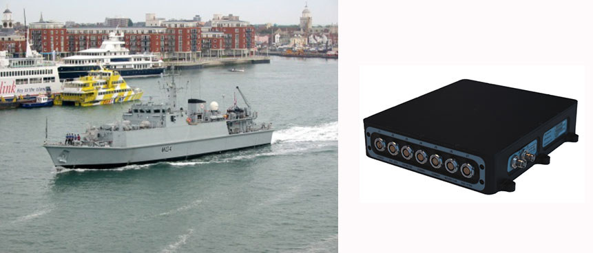
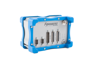
In 2002 the company was reconfigured as a navigation systems engineering company. With a number of successful programs underway in both the UK and Germany, FSL went on to open an office in Würzburg Germany, in 2002. At the same time, FSL won its first major naval contract with the CPUpak — an interconnect enclosure containing both SAASM and commercial CA-code receivers, which distributes GPS data to multiple systems. The CPUpak is now on several countries’ mine-countermeasure vessels (MCMV). It was also developed as an inertial navigation system as a key part of naval vessels’ air operations certification systems.
FSL is still privately owned, has 26 employees, and considers itself a “design house” for vehicle manufacturers, the marine industry, defense contractors, cellular operators, and television networks. It is an ISO9001-certified R&D partner to several blue-chip companies for navigation systems.
Today, its primary activities include:
- selling and supporting off-the-shelf FSL and NovAtel GNSS products and providing associated customer service,
- custom engineering solutions developed over very tight timescales,
- research into new and emerging markets and development to create new opportunities,
- managing production of FSL products and also for key customers.
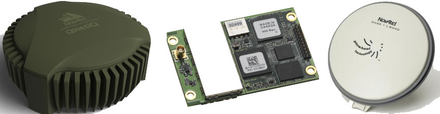
As NovAtel’s dealer in UK and Germany, FSL markets and services the full range of NovAtel OEM products, including the latest OEM6 GNSS receivers, Waypoint inertial and post-processing software, Antcom antennas, and Raven Starlink RF components.
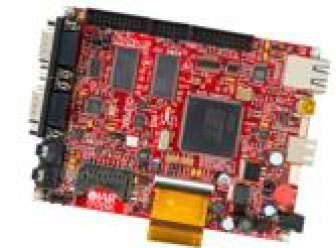
FSL has developed a number of key building blocks to enable further integration and production of various GNSS enclosures based on common hardware and software designs. This has allowed FSL to develop multiple systems in parallel and to expand the level of support provided through its dedicated team of engineers. The FSL-developed FS-D6 processor module and EDGE-WARE firmware it runs, along with the earlier FS-M4 microcontroller and FS-D5 DSP module, have become key building blocks that have enabled the creation of other products.
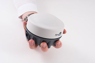
The ReACT smart antenna was first produced in 2011, and has been qualified to appropriate mil-spec standards for use on military vehicles, with RS232/422, USB, and CAN interfaces providing data outputs. The unit has a sturdy, waterproof enclosure for operating in harsh environments, with up to 5 serial, 3 USB and 2 CAN interface channels to hook up other sensors. Applications have included INS and dual-antenna heading reference for military vehicles; agriculture; reference navigation for optical navigation; and photogrammetry.
The MICROpod unit houses up to two GNSS receivers, and comes with a heading/attitude determination option. A MICROpod telecoms application involved supplying GNSS data to each radio network controller (RNC) to provide AGPS (assisted-GPS) data over the cellular network — the objective was to improve the start-up time for supporting emergency services. A less-expensive solution than installing separate GNSS receivers with each RNC, but certification to CE/FCC and IP67 was essential. The solution was the MICROpod eight serial ports along with firmware that made each RNC think it was connected to an independent receiver. Within the processor, the inbound commands and outbound data were managed to ensure that the system was serviced as expected. The whole project had extremely tight timescales — from contract award in August 2008, to first delivery on-site in the U.S. in November. The system was designed, developed, certified and passed test, all within three months! Around 400 systems are now installed across sites in the U.S. and around the world.
The unit has a sturdy IP65 enclosure, with up to 10 serial, 3 USB and 2 CAN interface channels to hook up other sensors. Other applications for MICROpod have included sub-10 nanosecond time synchronization of LIDAR, Earth observation/IR cameras, third-party INS, networked military vehicle/vessel navigation and data communications, pulse-train generation for coded equipment operations, and precision velocity measurement. Another variant has been customized and qualified for Train Control Network (TCN) applications.
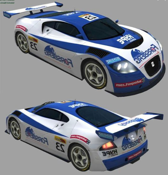
FSL has also dabbled in a couple of “glamorous” undertakings along the way, such as providing inertial/GPS dynamics measurement for the Red Bull World Series air races in Abu Dhabi, and also race-car inertial/GPS tracking and camera slaving for TV. A byproduct of the race-car project was a patent for a computer game using race data for vehicles that took part or could actually be played live during a Grand Prix on a particular circuit from a participating car.

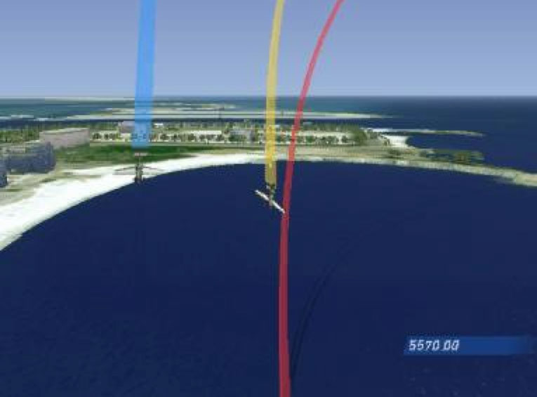
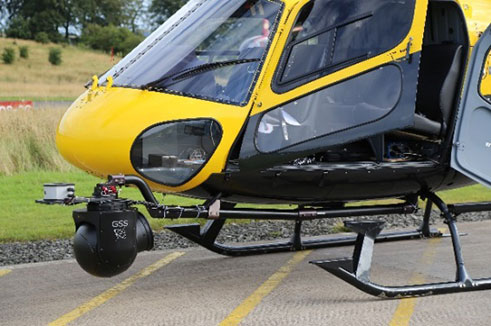
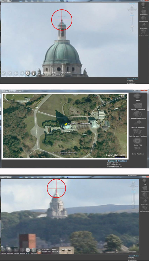
An interesting oblique photography application involved aircraft fitted with DSLR and video camera as well as other EO/IR sensors, their position and orientation measured by inertial navigation all feeding into FSL’s OPTOnav. A recent enhancement has been release of an in-flight bore-sight calibration. This is essential when navigation and camera choice may only be applicable for a single flight, and rapidly rendered results are necessary. The system works with a choice of cameras. For one project, an advanced GSS C516 compact five-axis gyro-stabilized platform and INS have been configured with Canon 1DC, Corona and Red Dragon cameras. The resultant ground positions are comfortably accurate to better than 1 meter at 500-meter range in real-time. This is despite GPS antenna often being fitted in less than ideal locations such as inside the cockpit of some aircraft.
The FSL OPTOnav product originated in 2006 as a piece of software installed on a rubber-tired gantry crane in a container port. The customer was experiencing problems of crane drivers being unable to see that they were drifting off course and moving outside of track, creating a safety risk. The crane is shaped like a staple, where the driver sits on one leg with the container in between the legs. As a result, the other leg cannot be seen clearly. This system is currently being enhanced so that it may utilize the latest technologies.
The software takes feeds from a GNSS receiver and from cameras. Using these inputs, a pattern and line-matching algorithm was developed to provide drivers with a centimeter-level indication of whether they were to the right or left of a safety line, along with the heading of the crane’s cameras to better than a 20th of a degree. This data was used to augment the GNSS in challenging areas, and unlike INS, simply doesn’t drift. During the development, a number of obstacles including shadows, reflections and obstructions were overcome.
This work leads to an RT version, which augments RTK GPS in obstructed sky locations, and a PP version, which supports precise point positioning aided GPS for applications such as photogrammetry. The system may be used to measure precise ranges to targets, and position is determined by triangulation. Simple, accurate and effective!
So, let’s recap. That’s project management of contracted hardware, software and production to very short timescales; sales and support of GNSS; inertial and optical navigation; and OEM products from NovAtel, Waypoint and Antcom. That’s lots of options — along with access to markets in UK, Germany and elsewhere, and specialist applications in photogrammetry, machine control, survey, telecommunications and systems integration. So, although Forsberg Services Ltd. may be one of many outfits around the world in the value-added reseller (VAR) game, it certainly has enough irons in the fire. And it has demonstrated the quick turn-around of a small, flexible organization with a track record of success — so Forsberg Services should anticipate a bright, growing and interesting future.
Tony Murfin
GNSS Aerospace