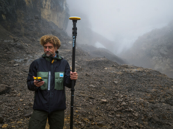
Data provides baseline measurement for tracking change at one of Earth’s last tropical ice fields in Puncak Jaya, Papua, Indonesia.
Trimble is supporting Project Pressure by providing advanced GNSS positioning technology and research funding for the nonprofit organization’s latest expedition to map the disappearing tropical glaciers of Puncak Jaya in Papua, Indonesia.
Project Pressure has released a centimeter-accurate, 3D model of the receding ice, created using Trimble positioning technology and drone-based photogrammetry. The model establishes a scientific baseline for calculating the rate of glacier recession and projecting the timeline of disappearance.
Puncak Jaya, the highest peak in Oceania and one of the Seven Summits, is expected to be the first of the seven continental peaks to lose its glaciers as global temperatures rise.
Puncak Jaya has the only snow in Indonesia. (Credit: Enda Kaban, CC BY-SA 4.0)
Local communities use the data to make informed choices about crop selection and prepare for expected water shortages caused by the loss of vital reservoirs.
This expedition marks the third successful outing in Project Pressure’s “Melting Topics”series, which focuses on mapping equatorial glaciers. Trimble provides its GNSS mapping technology and research funding from the Trimble Foundation Fund to support Project Pressure in gathering critical data in some of the world’s most remote and hostile environments.
“Mapping these glaciers before they disappear is of critical importance to establish a baseline to track the glacial regression and for the local communities to understand what is happening with their water source, allowing them to adapt to a changing climate,” said Eliot Jones, senior manager, strategy and partner development at Trimble. “Through a combination of precision technology, detailed project planning and rigorous science, the models created by Project Pressure are shared for scientific study and provide a visual reference for future generations.”
Precision under pressure in hostile terrain
Mapping glaciers at altitudes exceeding 4,800 meters (15,000 feet) presents extreme logistical and environmental challenges. Near-constant cloud cover and heavy rainfall in Papua often render satellite imagery unusable, making ground-based georeferencing essential.
The expedition team installed precise geolocation reference points directly on the glacial surface at multiple locations. Using the Trimble Catalyst DA2 GNSS system and Trimble TDC600 handheld, researchers captured the exact coordinates of those points with centimeter-level accuracy. Drone imagery was then processed against the Trimble coordinates to produce a scientifically reliable 3D model of the glacier.
“Trimble makes incredibly complex technology feel simple in the field,” said Klaus Thymann, scientist and lead explorer. “When you’re standing on a glacier in freezing conditions, wearing thick gloves and surrounded by clouds, you don’t have time to fight with equipment. With Trimble, I can capture centimeter-accurate readings and the interface is so intuitive that even someone with no prior training can help collect data. That kind of reliability and simplicity is critical when you’re working in some of the most remote and challenging environments in the world.”
This approach builds on methods developed during Project Pressure’s 2024 expedition to the Rwenzori Mountains in Uganda, which also used Trimble technology.
The lightweight Trimble Catalyst DA2 GNSS system was critical for the expedition, which required helicopter access to Basecamp, followed by a trek to the launch point.
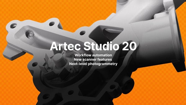
Artec 3D, a global 3D scanning lprovider, introduced its latest data capture and processing software, Artec Studio 20.
The all-in-one platform for 3D scanning, photogrammetry, reverse engineering and quality inspection now includes workflows that enable faster, fully automated data processing pipelines for digitization, design iteration and bulk product analysis.
The update includes enhancements across Artec’s scanner range. The Artec Spider II now features Live Scan Decimation, which produces high-detail, lightweight models for rapid prototyping and 3D modeling. The Artec Micro II adds support for HD Mode and 3-axis scanning, achieving higher resolution and more complete scans of small objects.
Refined masking in AI Photogrammetry produces ultra-realistic, artifact-free 3D models requiring minimal editing for computer-generated imagery, visual effects, forensics and other applications.
“Our last release turned Artec Studio into a complete package, with practically anything a user could need to capture a 3D model,” said Art Yukhin, CEO of Artec 3D. “Artec Studio 20 raises the bar in every way possible.”
Workflow automation
Users can customize workflows to their specific needs by queuing algorithms and processing captured data into 3D models with one click. The automation makes data processing up to 70% faster while allowing users to complete other tasks simultaneously.
Parameters can be adapted to different datasets within Artec Studio, but settings no longer need reconfiguration each time. Annual subscription holders can use scripting to set up workflows that import, process and export data to third-party software, enabling batch processing and fully autonomous file transfer.
Scanner upgrades
Artec Spider II now offers Real-time Fusion, previously exclusive to Artec Leo, which provides detailed live previews for reliable data capture. The newly integrated Autopilot streamlines the scanning process, particularly for new users. Improved reconstruction delivers more complete datasets for realistic, watertight models used in heritage preservation, education and medical applications.
The Artec Micro II desktop scanner now includes HD Mode, capturing four times more data points per scan. Three-axis integration provides greater surface coverage, allowing the scanner to capture complex, obscured areas and recreate complete objects.
The Artec Point industrial laser scanner features better visualization for twice-faster data capture. The wireless Artec Leo and long-range Artec Ray II benefit from a redesigned Fusion setting and workflow automation. Ray II users can now access Street View and panoramas through the updated app.
AI-powered photogrammetry
Refined masking in Artec Studio 20 produces realistic, artifact-free 3D models, while masking for texturing prevents objects from blurring with backgrounds.
Multi-camera support accelerates photogrammetry data capture and opens the software to various hardware combinations, including drones, smartphones, handycams and DSLR cameras. Sharp image prioritization ensures only the best frames from uploaded photos or videos are selected. GPU Memory Optimization customizes settings to individual hardware for peak efficiency.
Enhanced integration
New integration features make Artec Studio 20 more effective across applications. A new interface simplifies access to ZEISS Inspect advanced analysis tools and allows for scripting automation. Enhanced USD file support improves functionality for CGI and visual effects users. RCP file support adds compatibility with building information modeling platforms like Autodesk Revit.
Distance and intensity export filters optimize data for downstream processing. The software includes UI improvements with enhanced tools and scanning panels for more intuitive navigation and control.
AllTerra, a Trimble geospatial dealer, has joined the GeoCue distribution network. AllTerra will provide GeoCue’s full line of TrueView 3D imaging sensors, a UAV, lidar and photogrammetry solution. The technology enables fast, automated generation of true 3D colorized point clouds, oblique imagery and orthophotos from a single UAV flight.
AllTerra is also authorized to sell LP360 lidar and photogrammetry 3D point cloud software. LP360, an advanced desktop lidar software package, simplifies extracting information and generating deliverables in a GIS environment.
The company offers Trimble and Spectra Precision solutions in surveying, MGIS, marine, forensics, mobile mapping and infrastructure. Alltera also offers mobile/airborne lidar and photogrammetry solutions from GeoCue and Microdrones.
GeoCue has released the TrueView 535 imaging system for UAVs, and the TrueView 720, its fourth-generation Riegl integration. It also launched its LP360 software add-on called 3D Accuracy and the Accuracy Star hardware.
TrueView 535 is built on TrueView 515’s technology and consists of updated lidar sensors, adding a third return, increasing mapping abilities below canopy. An additional third nadir camera offers another point-of-view and improves photogrammetry quality. It also includes a longer, usable lidar range to increase flexibility.
TrueView 535. (Image: GeoCue)
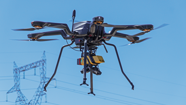
TrueView 720 is a fourth-generation Riegl VUX-120 with three laser beam orientations. It provides high point-density corridor mapping. Using the Riegl VUX-120 with three laser beam orientations (nadir, +10-degrees forward and –10-degrees backward) and three oblique/nadir cameras enables data collection from more surfaces in one flight path.
Trueview 720. (Image: GeoCue)
One application of TrueView 720 is scanning power lines. Users can capture the poles vertically, front and back. The extreme range of this system means it can be integrated with UAVs, airplanes or helicopters.
In addition to the two sensor payloads, GeoCue has launched its LP360 software add-on for processing and visualization — the 3D Accuracy and the Accuracy Star hardware.
Accuracy Star. (Image: GeoCue)
“When used together, Accuracy Star and the 3D Accuracy add-on provide automated horizontal and vertical checks,” said Darrick Wagg, vice president of customer success for GeoCue. “You can automatically find a 3D target on a drone dataset. The software will calculate the correction for any 3D target and provide a seamless workflow to apply the correction on the point cloud.”
These products are suitable for geospatial professionals.
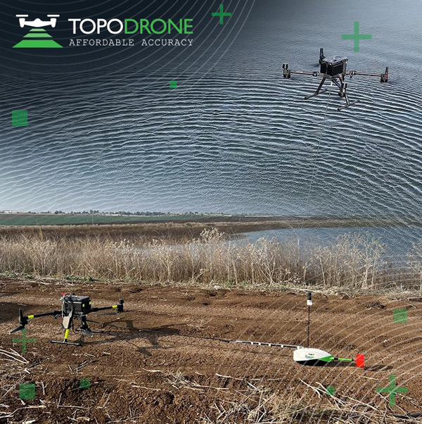
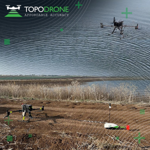
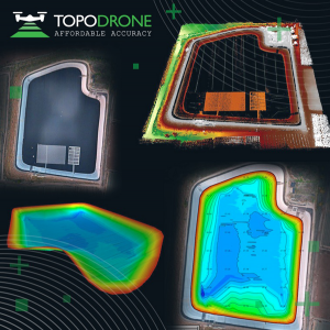
On Jan. 12, TOPODRONE used its synchronized lidar, airborne photogrammetry and bathymetric surveying methods to study a floating solar farm in Israel. This was completed upon request from the UAV service provider ERELIS, to help conduct a pilot project of reservoir surveying with a UAV for ETZ HADEKEL in northern Israel.
As the surface of the reservoir in Northern Israel is covered by solar panels, it is difficult to use standard methods of surveying from a boat. The goal of this study was to create 3D models, which can be used for high-precision assessments of sediment volumes, general monitoring of reservoir banks and visual monitoring.
Image: TOPODRONE
During this project, ERELIS performed two-stage UAV surveying to create the 3D model of the reservoir. In the first stage, aerial photogrammetry and lidar surveys were performed using a DJI M300 UAV. The UAV was equipped with the P61 TOPODRONE camera and a lidar high-resolution system to determine the location of obstacles. The lidar scanning provided accurate detection of cables in the water.
The second stage included an underwater bathymetric survey using the TOPODRONE AQUAMAPPER mounted to the DJI M300 UAV. The flight mission was planned and executed with the UgCS software by SPH Engineering.
All data collected from the study was processed by TOPODRONE Post Processing software. This generated a georeferenced orthophoto map, a 3D model of the relief and objects, a 3D model of the bottom of the reservoir and a model of contour lines and isobaths.
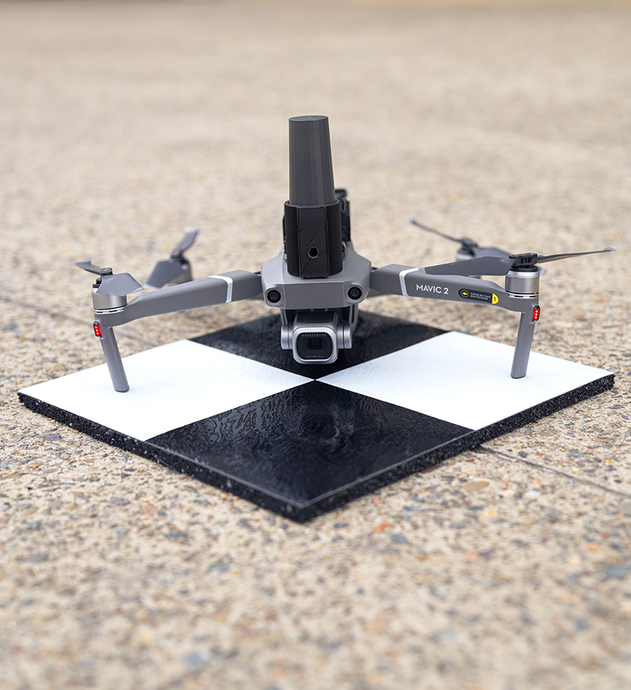
Position Partners has unveiled SmartSurveyor, which facilitates accurate, survey-grade aerial mapping and photogrammetry without the need for a connection between a camera shutter and a GNSS receiver.
The fully compact, handheld, aerial mapping survey rover is compatible with DJI Mavix 2 and 3 series and Phantom 4 Pro drones.
Image: Position Partners
The design is dissimilar to other drone mapping systems in that it works from a drone or smartphone and with two or more ground control points (GCPs) while using an ultra-matching technique.
Once data is captured by SmartSurveyor, all the photos and the GNSS file are uploaded to a PC and analyzed through the Agisoft UltraMatch workflow to confirm their accuracy before they are exported. Data can be managed in the cloud or on a local PC using software designed by MapSender.
Additionally, this mapping tool works in tandem with the AllDayRTK subscription GNSS network service so collected data can be uploaded to Tokara to remotely manage a project.
A roundup of recent products in the GNSS and inertial positioning industry from the July 2022 issue of GPS World magazine.
OEM
RTK Receiver
Hybrid high-precision GNSS
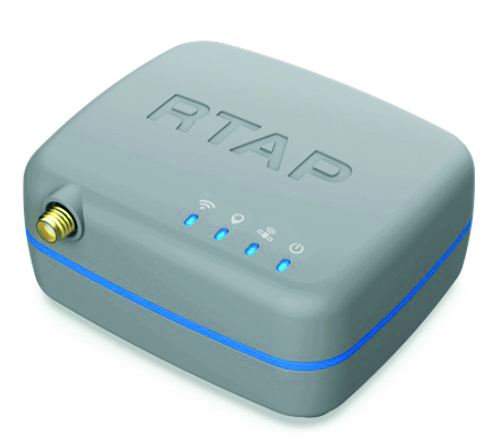
Photo: PP Solutions
The handheld RTAP2U is a hybrid high-precision, dual-frequency GNSS receiver. It can receive and process GPS, GLONASS, BeiDou, Galileo and QZSS signals. Its user-friendly web interface accesses and configures signal reception, skyplot, data collection, stop-and-go surveying, map display and more. With u-blox’s ZED F9P module, RTAP2U provides 2 cm or better accuracy within a few seconds. A firmware upgrade can provide precise point positioning (PPP) and real-time kinematic (RTK) capability.
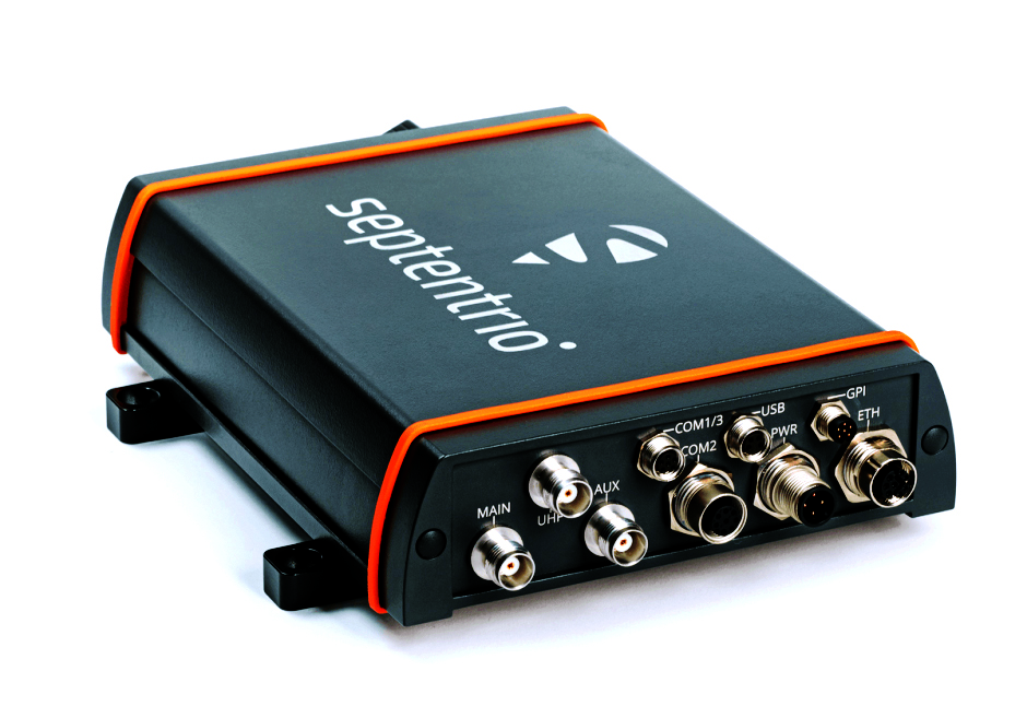
The AsteRx-U3 Marine GNSS receiver offers accurate positioning near shore and offshore via centimeter-level real-time kinematic (RTK) or the built-in Fugro precise point positioning (PPP) sub-decimeter subscription service, delivered either over NTRIP internet or L-band satellite. Corrections delivered over L-band allow dredging, bathymetry or marine construction projects even in areas where there is no internet service. The AsteRx-U3 Marine receiver, enclosed in an IP68-rated housing, offers a dedicated L-band demodulator with a separate L-band RF input, which allows for the use of dedicated antennas for excellent reception of L-band signals even at high latitudes.
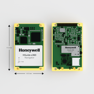
The HGuide o360 is a compact single-card, all-attitude GNSS/inertial navigation system (INS) that delivers accurate and robust position and attitude even in GNSS-challenged or denied environments to industrial and autonomous applications. The HGuide o360 contains a multi-frequency, multi-constellation, real-time kinematic (RTK) GNSS receiver with dual antennas, Honeywell’s i300 inertial measurement unit (IMU) technology, and a high-grade calibrated magnetometer. It is designed for platforms that require high-performance navigation data in an ultra-low size, weight and power (SWAP) package.
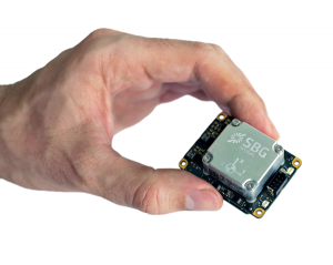
Offers optimal heading performance and resistance to vibration
Photo: SBG Systems
The Quanta Micro GNSS-aided inertial navigation system (INS) offers a high level of navigation performance despite its low size, weight, power and cost (SWAP-C). It brings direct georeferencing to UAV and land-based surveying. Quanta Micro leverages a survey-grade inertial measurement unit (IMU) for optimal heading performance in single-antenna applications, and high immunity to vibrating environments. An optional secondary antenna enables fast heading initialization in low dynamic applications.
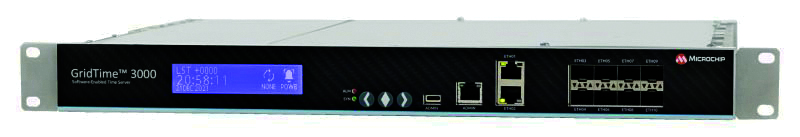
The GridTime 3000 GNSS time server is a software-configurable solution for utilities, providing redundancy, security and resiliency to protect against surges, adverse weather and cyberattacks. It generates precise time and frequency signals to synchronize analog and digital communication systems. The resilient timing platform incorporates multiple timing inputs for protection in the event of a GNSS signal disruption caused by severe weather, environmental disturbances or signal jamming or spoofing.
The Auterion OS serves enterprises that need component and payload flexibility, alongside a centralized and streamlined software workflow. Features include availability of precise mapping data in real time, automated processing for fast decision-making, standardization across Auterion-powered vehicles, connectivity that enables automated end-to-end workflows with no need for manual data transfer, and integration with third-party data-processing software such as Esri Site Scan or Propeller.
Designed to meet the need for highly accurate data
Photo: YellowScan
The YellowScan Vx20 lidar is the most accurate, fully integrated system of YellowScan’s product range. It can fly up to 330 feet (100 meters) while maintaining high accuracy throughout the point cloud. The Vx20 series is designed for applications that require sharp, accurate descriptions. Its Applanix APX-20UAV GNSS/inertial sensor provides precision of 1 cm and accuracy of 2.5 cm. With battery, the lidar scanner weighs 6.25 pounds (2.84 kg). It can be integrated with either multirotor or helicopter drones.
The WingXpand seven-foot expandable-wing drone folds to fit in a backpack. Its U.S.-made patented design combines the small size of a quadcopter with the horsepower of an airplane. The drone expands in less than 2 minutes and weighs less than 10 pounds. It can carry high-resolution cameras and other modular payloads such as a real-time pattern analysis system. More than 10 WingXpand UAS can fit in a public safety vehicle, more than 30 in a pickup, and 250 on a standard airlift pallet. WingXpand maximizes capability, efficiency and safety for the military and public safety officials. It also can be used by farmers, surveyors and inspectors.
The E300 drone package includes the E300 real-time kinematic (RTK) drone, flight-control software and an optional camera. It is suitable for topographic survey, urban construction, forestry investigation, emergency rescue, 3D modeling, mining and surveying. The drone is embedded with a high-precision K8 GNSS module that supports GPS L1/L2/L5, BeiDou B1/B2/B3/B1C/B2a, GLONASS L1/L2, Galileo E1/E5-a/E5-b/AltBOC/E6 and QZSS L1/L2/L5. With its intelligent recognition algorithms, the E300 can capture high-resolution images consistently even in complex environments.
The AR3 unmanned aerial system (UAS) now has a “hot-swappable” vertical-takeoff-and-landing (VTOL) capability, able to switch from horizontal launch to vertical. It also now has integrated synthetic aperture radar (SAR). The AR3 is a shipborne UAS that supports multiple types of maritime and land-based missions up to 16 hours. With the upgrade, the AR3 becomes more operationally flexible. The newly added SAR provides the AR3 with a vastly greater operational range, and the ability to effectively detect, recognize and identify targets under any weather condition. Covering more than 20,000 square nautical miles per mission, the new AR3 is suitable for wide-area surveillance missions.
The P300 is a high-precision, in-cab Android tablet designed for precision agriculture, autonomous driving and machine control. Embedded with the K8 OEM module, the P300 tracks GPS, BeiDou, BeiDou-3, GLONASS, Galileo and QZSS signals to achieve centimeter-level accuracy. It provides enhanced heading and positioning performance for everyday field use. The P300 series is available as the P300 Plus (10.1-inch) and P300 Mini (8-inch).
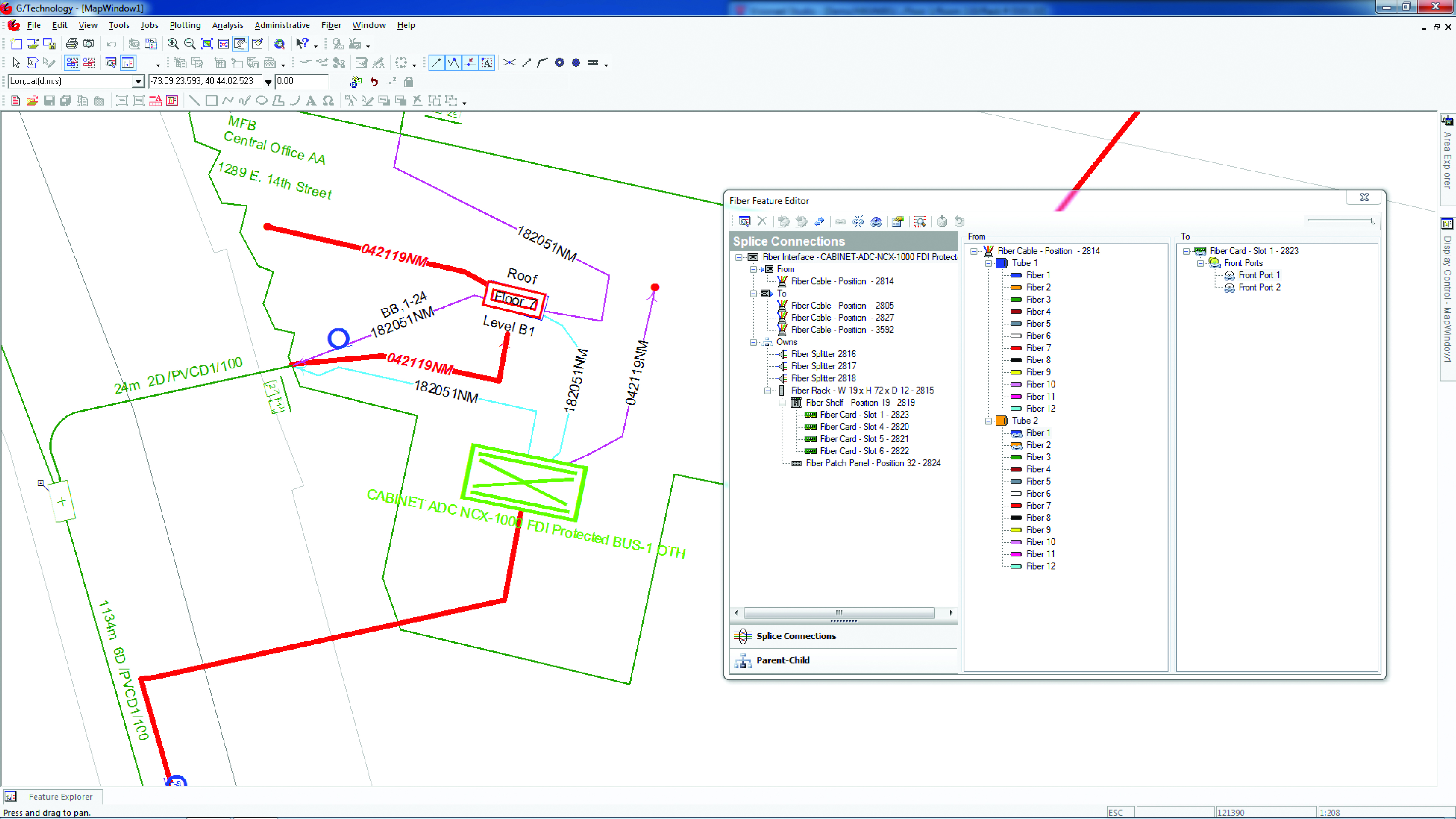
Intergraph G/Technology, an advanced utility geographic information system (GIS), enables utility companies to plan, design and document networks. It acts as a definitive source of reliable, location-based information that can be shared with users and systems across an organization. Available on the Oracle Cloud Marketplace, G/Technology provides utility operators with a scalable, secure and highly available GIS solution with reduced start-up costs and needed infrastructure. Running G/Technology on Oracle Cloud Infrastructure eases initial system deployment, enhances performance and automates scalability, availability and cybersecurity protection, ensuring the system is always up to date with the latest features and enhancements.
The Mosaic X mobile mapping camera captures extremely accurate photos and 360° videos, while simultaneously creating photorealistic 3D photogrammetry models, without the use of lidar. It can achieve 1-cm accuracy on road surfaces. The built-in CPU and GPU allow users to operate the camera and capture data without the need for a computer within the vehicle. Meticulous mechanical engineering and design ensure reliable and dependable use in harsh conditions such as moisture, mechanical shock and extreme temperatures. It can create high-quality 3D models, 3D reconstructions, and dense point clouds without the use of lidar. It comes with an AUX port to connect with external GNSS devices or lidar.
The U.S. Army Corps of Engineers, St. Louis District, has contracted with Aero-Graphics for photogrammetric and lidar surveying and mapping for the next five years. Aero-Graphics is a 56-year-old geospatial services company headquartered in Salt Lake City, Utah.
The $16 million contract is an indefinite delivery indefinite quantity (IDIQ), firm-fixed-price contract.
The services requested are for photogrammetric mapping and related surveys, as well as the preparation of maps for advance planning, design, real property, construction, land-use and land-type monitoring, and analysis for various projects.
“Being awarded the USACE St. Louis District contract is an honor, especially because we will support the Center of Expertise for Photogrammetric Mapping,” said Casey Francis, Aero-Graphics co-president. “Their focus on geospatial rapid response and technical proficiency is directly aligned with Aero-Graphics’ unique process. Our entire team looks forward to supporting this exciting contract.”
Francis added, “Our mantra is ‘agile responses to ever-changing environments.’ We look forward to demonstrating our unique abilities to the St. Louis District, enabling them to accomplish their mission of securing our nation, energizing our economy, and reducing disaster risk.”
New business development specialist hired
Angela Arriaga
In other company news, Aero-Graphics appointed Angela Arriaga as its new business development specialist. In her role, Arriaga will be responsible for expanding the company’s client base.
Arriaga comes to Aero-Graphics with more than 10 years of experience in geospatial, aviation, processing and surveying. “Angela has a strong background in operations management in lidar and ortho imagery,” Francis said.
“Aero-Graphics has always been a staple in this industry with an outstanding reputation and a commitment to excellence,” Arriaga said. “It’s exciting to be a part of this incredible team. The leadership is fully committed to professionalism, passion and enthusiasm for the work. I am looking forward to help continue its expansion and the success of our customers.”
Hexagon AB, a global leader in digital-reality solutions, has announced the following organizational changes to meet the fast-growing demand for real-time digital worlds.
Juergen Dold, employed with Hexagon since 1995 and most recently serving in a strategic leadership role across Hexagon’s Geosystems, Geospatial and Safety & Infrastructure divisions, will assume the role of executive vice president to lead key enterprise-wide initiatives.
Dold will oversee Hexagon’s focus on the content and platforms necessary to power and operate Smart Digital Reality applications and experiences that empower growth within Hexagon’s existing markets and offer rapid expansion into new market segments.
“Bringing together data sets of all types and formats where you can build, store and share digitalized objects and environments is our sweet spot.”
“Driving company strategy and growth in the metaverse ecosystem — the new digital reality that is emerging in both the professional and consumer markets — is key to Hexagon’s future,” said Hexagon President and CEO Ola Rollén. “Bringing together data sets of all types and formats where you can build, store and share digitalized objects and environments is our sweet spot.”
Dold’s focus will include advancing and expanding the market penetration of Hexagon’s HxDR ecosystem, which includes the HxDR digital reality platform and related business models. The platform allows the convergence and visualization of almost any geospatial or reality-capture data or file format for improved collaboration and decision making.
Artificial-intelligence-driven photogrammetry and point-cloud meshing of terrestrial and aerial data enables a geo “supermesh,” essentially creating the visual foundation for any smart digital reality. Such realities can be put to industry use, analyzing and interpreting infinite data inputs from the real or digital world to solve business problems.
The data can also be leveraged in the metaverse, described by many as the “quasi successor state” of the internet that focuses on social interaction.
Image: Thinkhubstudio/iStock/Getty Images Plus
“The metaverse isn’t a single place, but many digital-reality spaces and experiences that companies like Hexagon are working to make more accessible and immersive,” Rollén said. “Through virtual, mixed or augmented reality functionalities, we can provide a higher sense of presence and engagement.
“Additionally, by providing a connected space built from crowdsourced or professionally captured data, we can improve collaboration and productivity, especially for remote users and teams.
“The digital worlds and objects can be used in everything from filmmaking, gaming and tourism applications to architecture, real estate, land or utilities management, city services and more.”
Dold will continue to report directly to Rollén as a member of Hexagon’s executive management team.
Thomas Harring, president of Hexagon’s Geosystems division, and Steven Cost, president of Hexagon’s Safety, Infrastructure and Geospatial division, will join the Hexagon executive management team, reporting directly to Rollén.
Harring will also assume responsibilities for Hexagon’s Architecture, Engineering and Construction (AEC) business. This includes the software AEC business, which comprises the HxGN Smart Build portfolio previously managed under the PPM division and reported under IES, as well as Hexagon’s complementary sensor-software reality-capture and visualization solutions, such as the award-winning BLK line, already managed by the Geosystems division and reported under GES.
Hexagon’s financial reporting structure consisting of IES and GES will remain the same.
Trimble has opened its Call for Speakers for the Trimble Dimensions+ 2022 User Conference to be held November 7-9 at the Venetian Resort in Las Vegas.
The Dimensions+ User Conference will promote a variety of sessions highlighting groundbreaking technology that can be used to transform work and push for a sustainable future. Speakers will have the opportunity to share their industry experiences and insights with peers from around the globe. The conference will also provide an Offsite Experience where attendees can learn how professionals are using the latest technologies to create a safer, greener and more productive work environment.
Session topics will include autonomy; building design, construction and operation; civil engineering and infrastructure; forensics; forestry; local, state and federal government; land administration; mapping and GIS; marine construction; mobile mapping; monitoring; photogrammetry and remote sensing; scanning; surveying; utilities; sustainability and more.
Proposals for speakers will be accepted through March 31, 2022 and notifications of acceptance will be made in the following months. Proposals can be submitted here.
To register for the conference or learn about sponsorship opportunities, visit Trimble’s website.
Septentrio now offers Qinertia post-processing software from SBG Systems on AsteRx-i3 D Pro+, AsteRx-i3 S Pro+ and AsteRx SBi3 Pro+ receivers
Septentrio will now offer post-processing solutions for its GNSS/INS (inertial navigation system) receivers, using SBG Systems’ Qinertia software.
The AsteRx-i3 Pro+ receivers are fully compatible with Qinertia post-processing software, so no data manipulation is required before the post-processing step.
Land or aerial mapping applications, which do not have access to real-time GNSS corrections, benefit from post-processing software for higher positioning and orientation (heading, pitch and roll) accuracy. With the addition of post-processing, Septentrio GNSS/INS products cover the full mapping workflow.
“As a result of our cooperation with SBG Systems, Septentrio’s mapping customers who use GNSS/INS are benefiting from a quicker and more reliable workflow,” said Danilo Sabbatini, product manager at Septentrio. “The intuitive user interface of Qinertia software makes it easy for users to further improve their positioning and orientation accuracy in the post-processing step.”
In case of GNSS outage or correction link failure, post-processing recovers accuracy for recorded positioning and inertial data.
After the mission, Qinertia gives access to real-time kinematic (RTK) corrections from more than 8,000 base stations to deliver centimeter level accuracy. Trajectory and orientation are greatly improved by post processing GNSS and IMU data forward and backward. The Qinertia GNSS/INS post-processed kinematic (PPK) solution provides accuracy, reliability, advanced quality-control indicators, and a modern application programming interface (API).
Qinertia recently added an image geotagging feature, and specific outputs dedicated to photogrammetry.
Qinertia post-processing software will be used on Septentrio receivers. (Photo: SBG Systems)
Skyward, a Verizon company, has announced its integration with Pix4D, a photogrammetry software suite for drone mapping. The partnership gives customers the ability to turn drone data into 2D maps and 3D models.
Enterprises and drone pilots can now plan flights, receive FAA approval to fly in controlled airspace (LAANC), fly with Skyward’s InFlight ground control station, and process data using Pix4D from within the Skyward platform.
Skyward Mapping & Modeling, powered by Pix4D, enables customers to create, view, measure, and export 2D orthomosaic maps and 3D photogrammetric models right from Skyward’s web app. With the processing power of Pix4D, Skyward customers can get business-ready data sets through a seamless plan, fly, process workflow.