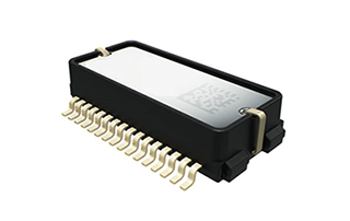
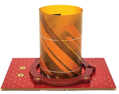
Murata has developed a new (micro-electro-mechanical systems (MEMS) six-degrees-of-freedom (6DoF) inertial sensor for GNSS positioning support, autonomous off-highway vehicles and dynamic inclination sensing. Murata’s new SCHA63T sensor is a single package 6DoF component. It can enable centimeter-level accuracy in machine dynamics and position sensing, and can assist in ensuring safe, robust and verified designs.
The sensor enables further advancement in technology and novel solutions for GNSS-based measurement instruments, advanced driver/operator assistance systems, and autonomous vehicles.
The product delivers highest performance available on the component level in the key parameters of bias stability and noise. Murata calibrates orthogonality of all measurement axes, which allows customers and system integrators to skip that critical process step.
A key focus area in product development for SCHA63T has been to ensure operation during high mechanical shock and vibration. Within the same product family, sensor variants are qualified according to the automotive AEC-Q100 standard. The SHCA63T sensor includes advanced self-diagnostic features and can achieve full compliance with ASIL-D (Automotive Safety Integrity Level-D).
The SCHA63T sensor features extensive failsafe functions and error bits for diagnostics. These include internal reference signal monitoring, checksum techniques for verifying communication, and signal saturation/over range detection.
The diagnostic feature of Murata’s three-axis accelerometer is the continuously operating self-test function, which monitors the sensor during measurement. This patented self-test function verifies the proper operation of the entire signal chain, from MEMS sensor element movement to signal conditioning circuitry for every measurement cycle. Even if the system using SCHA63T is not required to follow international functional safety standards, the provided design support documentation enables for customers a cost effective, robust and fast design process.
Murata, based in Japan, has more than 20 years of experience of providing inertial sensors for safety-critical automotive applications like electronic stability control.
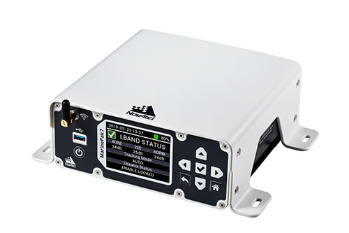
Hexagon | NovAtel is offering a new marine-certified GNSS receiver specially designed for nearshore applications. The MarinePak7 multi-constellation, multi-frequency receiver has been specifically engineered to receive Oceanix Correction Service from NovAtel, providing horizontal accuracy up to three centimeters (95%) in a marine environment.
With SPAN GNSS+INS technology capabilities, the MarinePak7 deeply couples GNSS and inertial measurement units (IMUs) for a 3D understanding of your position.
Delivering exceptional positioning, heading, attitude, velocity and heave measurements, the MarinePak7 is optimized to succeed in the demanding marine environment for nearshore applications.
An intuitive user interface reduces training and setup time, making it an ideal solution for use in demanding marine applications, including dredging, hydrographic survey, marine construction and nearshore renewable energy operations.
“The MarinePak7 is NovAtel’s first receiver designed specifically for a marine environment. It provides accurate and reliable positioning for nearshore marine operations using our GNSS technology and Oceanix Correction Service,” explained Hexagon | NovAtel marine segment portfolio manager David Russell. “This receiver was developed by a team of experienced marine engineers and incorporated feedback from existing NovAtel users to deliver a high-quality, all-in-one positioning solution for the nearshore marine market.”
Several optional features are available with the MarinePak7, including GNSS heading, interference mitigation and a UHF radio used to receive RTK corrections.
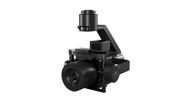
Phase One, a developer of digital imaging technologies, has announced the P3 Payload, a versatile solution designed for fast, efficient and safe inspection of critical infrastructure with an unmanned aerial vehicle (UAV).
The P3 Payload includes a Phase One iXM 100MP or 50MP camera, one of the RSM lens options, and a new gimbal with integrated rangefinder.
Available in the second quarter of 2021, the P3 Payload is offered in two configurations to meet a wide range of user requirements.
The P3 for the DJI M300 is plug-and-play, developed mainly for operators and service providers that already own, or are considering purchasing, a DJI M300.
The P3 MAVLink is ready for integration with drones based on the open-source MAVLink protocol, and suitable for bundling by OEMs and solution integrators.
“The P3 addresses the unmet need for a high-quality, integrated imaging solution for inspection of critical assets where capturing the details is of paramount importance,” said Michael Messerschmidt, portfolio director for drones and inspection. “The P3 Payload is designed specifically for aerial drone inspection of diverse infrastructure where every flight — and every shot — must count.”
The centerpiece of the payload is the customer’s choice of Phase One iXM 100MP or 50MP camera. Robust and waterproof, these sensors feature a dynamic range that guarantees sharp image collection in high-contrast or low-light environments. The variety of lens options ensures large surface areas can be captured with millimeter-level detail, even at safe distances from the asset. The new gimbal with the integrated laser rangefinder ensures precise and fast focusing on every shot, eliminating blurry and out-of-focus images.
The P3 Payload is suitable for these inspection applications:
High-value assets. Bridges, dams and energy facilities where the value of the structure itself is high and the demand for frequent, accurate and detailed data is critical.
High-risk assessment. Electric transmission lines, oil refineries and other complex sites where inherent danger requires high-resolution inspection from a distance that is safe for the structure, the drone and personnel.
Time-critical assets. Wind turbines, offshore oil rigs, and other facilities where inspection windows are limited, and every UAV flight must successfully capture the required information.
“We developed the P3 Payload for cost-effective, productive operation so that large surface areas can be covered in fewer images, significantly shortening the mission time,” Messerschmidt said. “More importantly, the P3 can be operated with minimal risk to the asset and ground crew.”
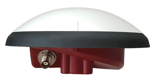
Tallysman Wireless is offering two new VeroStar marine antennas to its line of GNSS products. The VSP6037L-MAR supports the full GNSS spectrum and the VSP6337L-MAR supports GPS/QZSS-L1/L2/L5, GLONASS-G1/G2/G3, Galileo-E1/E5a/E5b, BeiDou-B1/B2/B2a, and NavIC-L5 signals. Both antennas support L-band correction signals.
Marine vessels often host both Iridium (1616–1626.5 MHz) and Inmarsat (uplink: 1626.5–1660.5 MHz) satellite communication antennas that transmit and receive signals. The VSP6037L-MAR and VSP6337L-MAR VeroStar marine antennas strongly attenuate interference from both signal sources, providing 75 dB to 85 dB of attenuation over Iridium and 85 dB to 95 dB over Inmarsat uplink, enabling clean GNSS signal reception and precise positioning.
Every VeroStar antenna features a robust pre-filter and a high-IP3 LNA architecture, minimizing de-sensing from high-level out-of-band signals, including 700 MHz LTE, while still providing a noise figure of only 1.8 dB.
VeroStar antennas provide the best-in-class low elevation angle tracking of the full GNSS spectrum and L-band correction signals. The wideband spherical antenna element enables VeroStar antennas to deliver ±2 mm phase centre variation (PCV), making them suitable for high-precision marine, positioning and machine control applications.
The VeroStar marine antennas are housed in a rugged and compact enclosure that supports 1-inch pipe thread or 5/8-inch-11 TPI mounting and provides a TNC antenna connector. The antennas have also obtained the stringent IEC 60945 and IEC 61108 marine certifications, making them suitable for challenging marine environments.
A train arrives at Tel Aviv University Station on the Israeli Railway in Tel Aviv. (Photo: svarshik/iStock Editorial/Getty Images Plus/Getty Images)
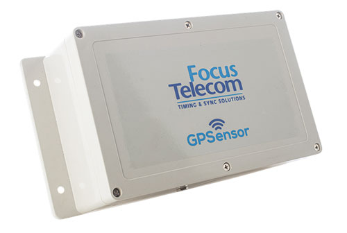
InfiniDome Ltd., a GPS security company, is joining with with Israeli partner Focus Telecom, in a new country-wide project with Israel Railways. The project involves deployment by Focus Telecom of GPS repeaters at more than 30 railway stations across Israel, providing accurate, location-based service indoors at all locations for a new Israel Railways ticketing app.
A critical component of the project is a monitoring service that detects and provides alerts of any GPS disruption or interference in real time, as they are identified. This is facilitated by infiniDome’s IoT GPSensors and its cloud-based GPS monitoring service, infiniCloud.
“Incorporating infiniDome’s proven resilient PNT capability to monitor and protect such a critical GPS service is a necessary enhancement for government designated critical infrastructures,” said Ehud Sharar, Focus Telecom CEO.
Photo: Focus Telecom
InfiniDome’s monitoring technology for critical assets detects and alerts operators of threats and disruptions of the essential GPS signals. These threats can originate from both malicious or natural causes.
“GPSensor IoT technology combined with our infiniCloud GPS security cloud assures real-time alerts about jamming attacks. All GPS signal data and its assured integrity are available as real time data so Israel Railways can react immediately and reduce downtime of the network,” said Omer Sharar, infiniDome CEO.
Israel Railways is the cornerstone of Israeli critical infrastructure. In 2018, Israel National Railway carried 68 million passengers. This same infiniDome GPS monitoring and protection technology is now available to defend critical infrastructure assets worldwide.
In the latest edition of this classroom textbook, Getting to Know ArcGIS Desktop 10.8 guides students and professionals through the fundamentals of making maps and analyzing data using the latest Esri ArcGIS Desktop software.
The comprehensive, hands-on tutorial, moves readers from basic GIS concepts to sophisticated GIS analysis. Readers gain practical knowledge about ArcGIS Desktop tools and functionality. Exercises address querying map data, making map layouts, symbolizing and labeling maps, setting map projections, creating and sharing web maps, building and editing geodatabases, and analyzing geospatial data.
Data for completing the exercises and a 180-day free trial of ArcGIS are also available for download.
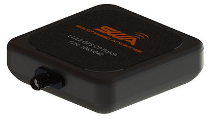
Southwest Antennas has introduced a high-performance GPS and GLONASS active L1/L2 patch antenna for high-accuracy location service, timing and navigation applications.
Part #1065-042 covers both the L1 and L2 bands, supporting military, commercial and industrial applications. For military users, the antenna supports the GPS P/Y code with +/-20-MHz bandwidth, allowing for increased accuracy, jam resistance and encryption for authorized military applications.
Photo: Southwest Antennas
The antenna’s built-in low-noise amplifier (LNA) and filters give it a total system active gain of +28 dB and out-of-band rejection of >50 dB (+50 MHz / -35 MHz of L1, +35 MHz / -45 MHz of L2). The specifications allow the antenna to operate in contested and congested radio frequency (RF) environments.
“Our goal is to empower radio operators who require high-accuracy GNSS solutions with more choices for deployment and mounting,” said Benjamin Culver, president and co-owner of Southwest Antennas. “Adding onto our existing line of GPS antennas and gooseneck mounting options, users now have more freedom of choice in antenna placement to help overcome reception issues in challenging environments.”
The low-profile radome allows the antenna to be easily tucked into pockets or modular lightweight load-carrying equipment (MOLLE) pouches and mounted on body armor, vests, rucksacks or other tactical gear. The custom black chrome SMA(f) RF connector ensures the antenna is waterproof, while allowing users to fully customize antenna placement on their gear and select their own cable type and length to suit their preference for mounting location away from their receiver.
For additional flexibility in mounting locations, part #1065-042 features a magnetic mount integrated flush into the antenna’s radome, allowing it to be secured and removed quickly from any ferromagnetic surface. This extends the antenna’s operational capabilities through the ability to remotely locate the antenna away from the attached radio system to enhance satellite acquisition speed and signal strength when operating in environments with poor sky views.
Applications include:
SAASM GPS, GLONASS, GNSS receivers, and other precision navigation receivers
Manpack and handheld radios, dismounted soldier-level communications
Small form-factor radios
Low-profile vehicle mounts and unmanned ground vehicles
In our 10th annual Simulator Buyers Guide, we feature simulator tools, devices and software from 10 prominent companies that aid GNSS receiver manufacturers in product design.
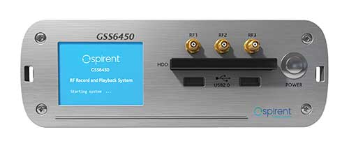
The GSS6450 RF record and playback system. (Photo: Spirent)
GSS9000, SimMNSA, CRPA test system, anechoic chamber testing, mid-range testing
Spirent Federal Systems provides PNT/GNSS test equipment that covers all applications, including research and development, integration/ verification, and production testing.
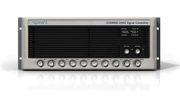
GSS9000. The GSS9000 Series Multi-Frequency, Multi-GNSS RF Constellation Simulator is Spirent’s most comprehensive simulation solution. It can simulate signals from all GNSS and regional navigation systems and has a recently-enhanced system iteration rate (SIR) of 2 kHz (0.5 ms), enabling higher dynamic simulations with more accuracy and fidelity. The GSS9000 supports restricted/classified signals, Alt RF, and other non-GNSS sensors. Users can evaluate the resilience of navigation systems to interference and spoofing attacks, and have the flexibility to reconfigure constellations, channels, and frequencies between test runs or test cases.
The GSS9000 Constellation Simulator. (Photo: Spirent)
SimMNSA. Spirent Federal has the first fully-approved MNSA M-code simulator. Authorized users of the GSS9000 series of simulators will be able to utilize the advanced capabilities of SimMNSA to create more robust solutions for their customers. SimMNSA has been granted security approval by the Global Positioning System Directorate.
CRPA Test System. Spirent’s Controlled Reception Pattern Antenna (CRPA) Test System generates both GNSS and interference signals. Users can control multiple antenna elements. Null-steering and space/ time adaptive CRPA testing are both supported by this comprehensive approach.
Anechoic Chamber Testing. Spirent’s GSS9790 Multi-Output, Multi-GNSS RF Constellation Wave-Front Simulator System is a development of the GSS9000. The GSS9790 provides the core element for GNSS applications that require a test system that can be used in both conducted (lab) and radiated (chamber) conditions.
Mid-Range Solutions. Spirent also offers solutions that cater to intermediate GPS/GNSS testing needs. The GSS7000 multi-constellation simulator provides an easy-to-use solution for GNSS testing that can grow with users’ requirements. The GSS6450 RF record and playback system enables repeated replay of a real-world GNSS/GPS test in the lab.
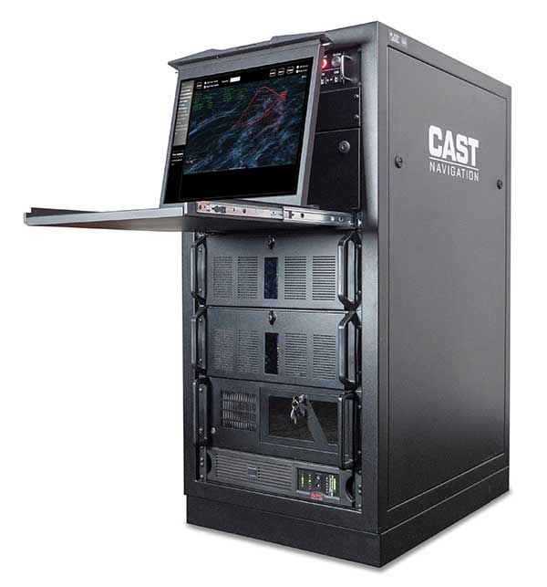
CAST-CRPA. The CAST-CRPA Simulation System produces a coherent wavefront of GPS RF signals to provide repeatable testing in the laboratory environment or anechoic chamber. The CAST CRPA system is configurable for any number of coherent outputs that users want.
With an intercard carrier-phase error of less than 1 millimeter, the CAST-CRPA Simulation System is extremely accurate.
The system generates a wavefront of GPS signals when its GPS RF generator cards are operated in a ganged configuration. Each generator card provides a set of GPS satellites coherent with the overall configuration. Several RF generator cards may be utilized together, ensuring phase coherence among the signal generator cards in each bank. The CRPA antenna, the antenna electronics and the GPS receiver can be tested as a unit with or without radiating signals.
CAST-CRPA features
Generates single coherent wavefront of GPS signals
Orolia advanced GNSS simulators offer a wide breadth and depth of simulation tools to test mission-critical positioning, navigation and timing (PNT) applications and scenarios. They are feature-rich and easy to use, providing a way to harden GPS/GNSS-based systems without the limitations of live-sky testing.
Skydel — Advanced Software-Defined Simulators
Skydel Simulation Engine. This flexible, high-performance simulator transmits GNSS digital signals in real time to many kinds of software-defined radios. Skydel uses graphics processing units (GPUs) to compute the digital GNSS signals of all simulated satellites, scaling from simple to complex use cases. Skydel simulates civil signals from global and regional navigation satellite systems, many kinds of GNSS receiver trajectories with high dynamics, and advanced jamming and spoofing. All Skydel models offer these features:
Easy configuration with intuitive UI and automation
Support for global constellations and frequencies
Support for jamming, spoofing and repeating, including jamming waveforms
Comprehensive API (Python, C#, C++, LabVIEW)
Advanced signal customization and scenario creation
Ability to integrate interference with no additional hardware
1000-Hz simulation iteration rate
IQ file generation and playback
Ability to record and export user interactions as Python script
GSG-8. This software-defined system GSG8 is a globally available hardware platform for aerospace and critical infrastructure applications. It will support future EU encrypted signals. The rack-mounted unit has the option of one to four RF outputs and is configurable.
BroadSim. Designed for military NAVWAR applications, the BroadSim software-defined simulator supports encrypted military codes (Y-code, M-AES and M-MNSA) and provides documentation and procedures for classified operations. BroadSim has two GPUs and four RF outputs. It runs on a custom Linux operating system, with RMF STIG support coming soon.
Skydel Anechoic. This simulator system for radiated over-the-air testing is designed for testing CRPA/multi-element antennas, antenna electronics and entire PNT systems in an anechoic chamber.
Skydel Wavefront. This GNSS simulator system for conducted wavefront testing is designed to test the jamming/spoofing resiliency of CRPA and multi-element antenna electronic systems, and for applications with high dynamics.
GSG 5/6 Scenario-Based Simulators. The GSG 5/6 enable testing of smart applications such as drones, the internet of things, connected cars and cellular. They provide a comprehensive set of pre-defined scenarios and the ability to create scenarios. They simulate all constellations and frequencies as well as movements and trajectories anywhere on or above Earth.
Application packages are available for real-time kinematic, eCall, high-velocity, jamming and sensors.
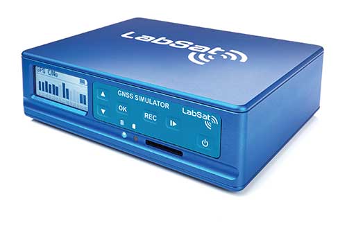
LabSat 3 Wideband. The LabSat 3 Wideband is a compact yet powerful multi-constellation and multi-frequency GNSS testing solution. The easy-to-use, one-touch record-and-replay function provides an efficient way to test and develop GNSS-based technology without the cost and limitations of live-sky signals.
It is lightweight and portable and makes it easy to collaborate with colleagues by sharing scenario files over the internet — making it a suitable testing partner for remote working. Additionally, the removeable solid-state drive (an SSD of up to 7 terabytes) and a two-hour runtime provided by an internal battery is ready for field testing in any environment.
LabSat 3 Wideband can record and replay up to three different channels at 56-MHz bandwidth across all major constellations and signals, including:
GPS: L1/L2/L5
Galileo: E1/E1a/E5a/E5b/E6
GLONASS: L1/L2/L3
BeiDou: B1/B2/B3
NavIC: L5/S-band
QZSS: L1/L2/L5
L-band correction services including SBAS
2x CAN and 4x digital input channels tightly synchronized with GNSS data
Future signal launches are also supported, including L2C, L5 and L1C
SatGen Simulation Software. SatGen software allows users to quickly create bespoke, accurate scenarios with their own time, location and trajectory that can be replayed via a LabSat GNSS simulator.
The latest version of SatGen can be used to create a single scenario containing all the upper and lower L-band signals for GPS, Galileo, GLONASS, BeiDou and NavIC.
High-end GNSS simulation solutions for R&D, integration and product testing
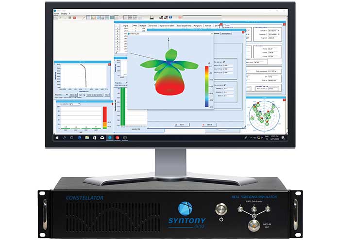
Constellator. Syntony’s GNSS simulator Constellator supports all constellation signals available and provides a high level of service in different ranges. It covers, in a single unit, a wide spectrum of use cases from entry-level with L1C/A up to very demanding configurations such as multifrequency and up to 660 L1C/A-equivalent signals. Extensively used in aeronautics, space and defense industries, Constellator answers complex requirements:
Standalone mode (on the ground and in space)
Multi-frequencies
All constellations and their signals, including BeiDou, Navic/IRNSS and QZSS
Hardware-in-the-loop (HIL) mode with zero effective latency and 1000-Hz update rate
CRPA generation capability
Capability to generate “Restricted Signals” through a dedicated interface, called PRN-Link
In the space industry, Constellator implements the advanced models (Earth gravity, drag, 3D ionospheric models, side lobes, etc.) needed to achieve accurate simulations for all kinds of orbits (from LEO to GEO and SSTO). Combined with other Syntony GNSS simulation products (interference generator, Echo recorder and player), Constellator can tackle challenging use cases such as testing of jamming, spoofing, multipath and multiple antennas. It is based on a software-defined radio, making it hardware-ready for future constellations, signals and codes. It is easily upgradeable and versatile.
GNSS Recorder and player. Echo is an ultra-high-fidelity GNSS record-and-playback solution that captures real-life signals and environments — for instance, from airplanes — and then replays them for R&D or production tests. Echo offers:
3 RF channels of 100-MHz bandwidth each (for the whole set of GNSS signals from all constellations)
16-bit resolution (I&Q)
From seven to more than 1,000 hours of record/replay capabilities depending on the configuration
The Echo platform allows full 16 bits of I/Q recording at 100 Mhz for three channels, simultaneously. As such, it provides the highest achievable record/replay fidelity. Echo-R can also record complex and very long realistic scenarios from a simulator. Echo-P can replay them with very high fidelity for long-run or production tests.
Please contact Remy Thellier (based in San Francisco) for North America at 415.599.9230, or contact the EMEA Sales team at: [email protected] syntony-gnss.com
+33.5.81.319.919
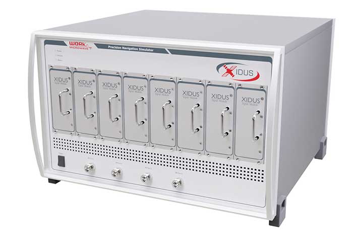
The advanced customization and configurability of Xidus enables users to perform rigorous and extensive testing of GNSS systems.
Test scenarios. Xidus meets all requirements regarding multi-GNSS, multi-frequency and multi-RF signal generation out of the box. Innovative Xidus signal extension and enhancement (SEE) technology allows users to integrate bespoke generation blocks into the signal generation path. In addition, Xidus’ advanced support capabilities allow remote support and updates, remote training and even remote scenario execution.
Easy hardware or software upgrades. Xidus has modular signal generation hardware that allows easy and robust field upgrades. New modules are automatically calibrated, allowing users to accomodate multiple concurrent navigation development projects.
Expert background. WORK Microwave has been designing and building GNSS simulators for more than 15 years. The Xidus hardware leverages WORK Microwave’s 35+ years of experience in the design and manufacturing of bespoke digital and analogue microwave products.
Xidus-Studio (Photo: Work Microwave)
Xidus-424 GNSS Simulator. The Xidus-424 has up to 128 LOS channels, 512 multipath channels and two RF outputs. It supports all GNSS frequencies and signals. It supports an update rate up to 100 Hz and has very wide dynamic power range configurability.
Xidus-648 GNSS Simulator. The Xidus-648 provides all the capabilities of the Xidus-424 plus additional features: up to 256 LOS channels, 1,024 multipath channels, four RF outputs and a 1000-Hz update rate.
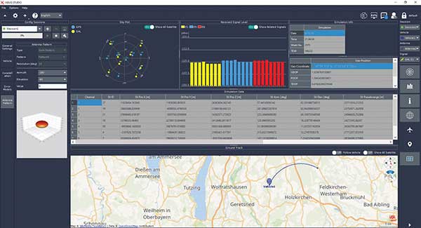
Xidus-Studio client software. The software provides everything for testing GNSS systems: different vehicle models with 6DOF, multiple vehicle simulation, spoofing and meaconing, multiple TX antenna patterns, multiple RX antenna patterns, industry-standard error models and runtime distortions on individual channels. Xidus-Studio also allows the design of bespoke satellite orbits ranging from LEO to GEO. Available on Linux and Windows.
Xidus Series. Connect up to four Xidus units to produce a simulator capable of mega-constellation simulation, with precise phase synchronization across units.
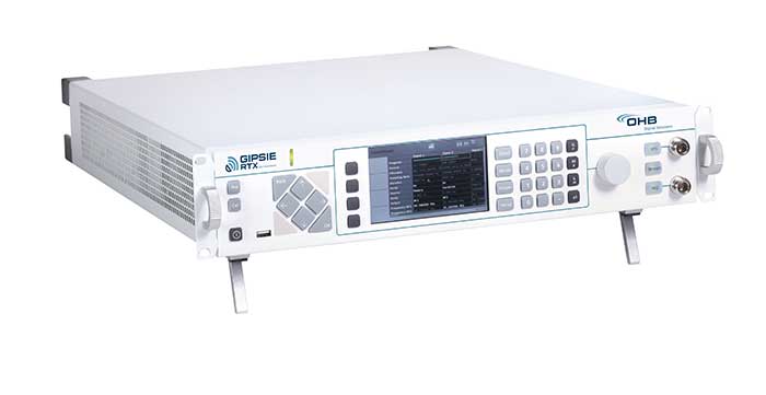
GIPSIE-RTX (GNSS Multisystem Performance Simulation Environment – Real Time Extension)
GIPSIE-RTX is a fully featured GNSS signal generator with real-time streaming functionality, including real-time control of the simulation environment. It consists of a high-quality signal simulator as the hardware platform and a flexible and powerful GNSS simulation environment.
The multi-system and multifrequency-capable GIPSIE-RTX simulates arbitrary satellite orbits using a sophisticated orbit integrator. It is able to model all error sources, delays and propagation effects. These include various models for satellite clocks, ionosphere and troposphere, multipath, signal power, antenna patterns and noise. In addition, multiple types of signal interference, like jamming and spoofing, can be defined. Customized navigation message formats and contents can be used to simulate future GNSS signal features.
Besides generating RF signals, GIPSIE-RTX is also capable of directly simulating digital signals, taking into account user-defined modeling of a radio-frequency front end. Comprehensive data logging of all intermediate results is available for detailed analyses.
GIPSIE-RTX provides a real-time input interface and thus supports hardware-in-the-loop (HIL) testing, such as for automotive applications.
GIPSIE-RTX Features
GIPSIE-RTX is a new compact multi-channel high performance platform for complex and versatile GNSS testing. Features include:
Highly reproducible scenarios
Modeling of all error sources, delays and propagation effects
Interference (jamming and spoofing) simulation
HIL simulation
Synchronization of multiple simulators for advanced testing (e.g., array antenna)
QA707 is the cutting edge solution for global threat GNSS awareness and management. It is a GNSS simulator specifically designed to test cyber-attacks and authentication, and includes the simulation of GNSS interference, deception, jamming, spoofing and advanced cyber-threats such as data and code level attacks.
The high flexibility in the creation of the scenarios and the definition of the type of attacker allow cyber-threat and vulnerability testing for several applications,These applications may include, for example, autonomous driving and vehicle tracking, aeronautics and high dynamics applications, space GNSS receivers and timing.
OSNMA support. The Galileo Open Service Navigation Message Authentication (OSNMA) simulation is an opportunity to test the new Galileo data protected service against a number of known vulnerabilities in GNSS applications. The OSNMA simulator is also available as a standalone tool, allowing the generation of OSNMA data that can be used with third party simulators.
PC-capable. QA707 runs on a standard PC. It is compatible with several third-party hardware RF up-converters, including National Instruments’ USRP. Additionally, it can support customer-specific hardware through the hardware API interface.
QA707 main features
Multi constellation (currently GPS L1, GALILEO E1, SBAS L1).
Galileo OSNMA
RF simulation, binary file dump, signal record and replay
Support to SDR platforms and open API for custom RF upconverters
Runtime streaming of scenario information over UDP (motion, channel data)
Data level cyber-attacks
Accurate spoofing signals control, trajectory spoofing, signal replay attacks
Narrow band, wide band, frequency modulated jamming
Integrity threats (on request): evil waveform, erroneous ephemerides, code/carrier divergence, low satellite signal power, excessive range acceleration
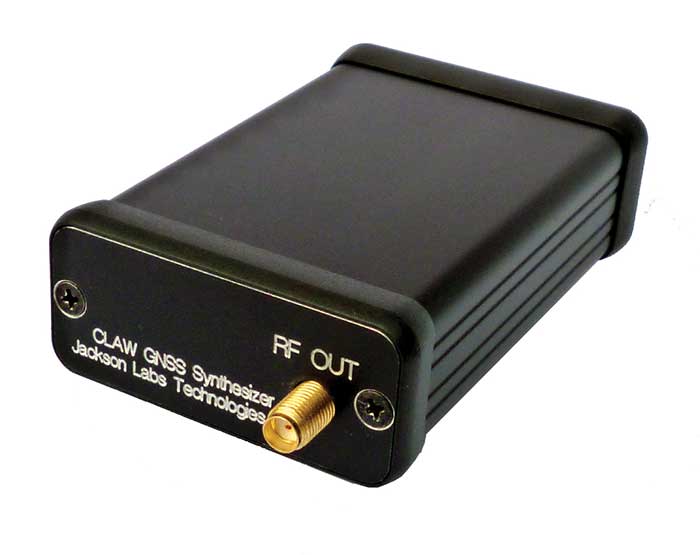
The 18-channel miniature full-constellation CLAW GPS Simulator is a fully self-contained, low size, weight, power and cost (SWaP-C) miniature GPS simulator. It is very popular in manufacturing environments as well as R&D applications that require consistent and repeatable local GNSS signals at low price points.
The CLAW simulator does not require external computers for processing and control — it works fully self-contained by simply applying power, and storing location/time/date data in internal non-volatile (NV) memory, or by storing complex vector data to simulate highly dynamic scenarios.
The CLAW also can be used to transcode NMEA or SCPI position/velocity/time (PVT) data into GPS RF signals. JLT offers an easy to use, highly configurable and cost-free SimCon Windows application program that is downloadable from the JLT website.
The SimCon application allows random scenario generation and is thus usable to simulate leap-second events, week 1023 rollover events, or any other GPS live-sky scenarios, including highly complex yet easy-to-create dynamic vector simulations.
For authorized U.S. government users, a version that does not have altitude and velocity limitations is popular for low-Earth-orbit (LEO) simulations. Multipath simulation allows use of the entire 18-channel simulator capability.
The unit can be field-upgraded with an easy to use in-field software upgrade feature. The CLAW is also very useful in GNSS receiver sensitivity testing for R&D or mass-production assembly lines as it allows accurate control of RF output power ranging from –100 dBm to less than –130 dBm with 0.1-dB resolution and typically better than 1-dB accuracy over the controllable power range.
The CLAW GPS Simulator also has a built-in RF signal generator with sweep, CW and random noise functions that are useful in simulating GNSS jamming scenarios, as well as GPS spoofing scenarios. The simulator comes in an FCC-certified metal desktop enclosure with numerous accessories.
For 2021, the CLAW firmware has been updated to allow live-sky almanac and ephemerides to be automatically uploaded from various externally connected GNSS receivers. This makes simulations using real-time live-sky constellations (such as used in simulating spoofing attacks) an easy task. A free firmware update is available from JLT.
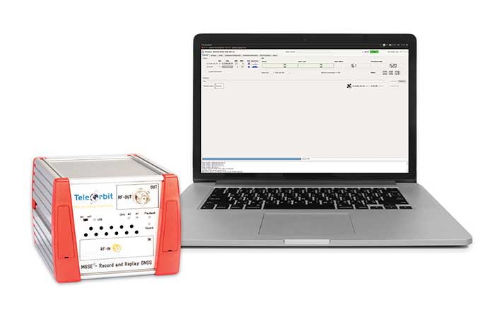
The MGSE product family creates a versatile GNSS test and simulation environment that improves the development, qualification and certification process of GNSS receivers within development phases and for the validation and certification in end-to-end tests.
MGSE enables mobile and stationary interference monitoring, such as for protecting critical infrastructures (based on MGSE REC), and can be used for interference mitigation if combined with TeleOrbit’s GNSSA-6E (six-element antenna array) or its GNSSA-DCP (dual circularly polarized antenna).
With MGSE REC-REP 2.0 users can, among other tasks, record Galileo PRS signals in a real user environment and replay them for Galileo PRS receiver testing. It is also possible to replay simulated GNSS signals.
MGSE SIM-REP supports the development of software-defined radios/receivers (SDR) or specialized algorithms by creating a simulation environment that provides the possibility and flexibility to use synthetically generated GNSS data and recorded real-world samples — both exactly reproducible.
For jamming and spoofing test and evaluation, TeleOrbit offers a sophisticated solution based on the MGSE simulation, recording and replaying product family.
Technical background. The multi-band RF front-end (MGSE REC) receives the GNSS RF signals in different frequency bands simultaneously to obtain digital IF data, which can be used for GNSS multi-system signal analysis and comparison.
MGSE REC also includes a reception board to receive and process the NavIC S-band signal in addition to other L-band frequencies.
The MGSE Replay Unit (MGSE REP) includes a flexible multi-band RF replay device that can stream simulated and recorded raw IF data to a digital baseband output or to an analog RF signal.
MGSE REP simultaneously supports up to two independent RF channels and up to four GNSS signals, such as L1, E1, B1, G1.
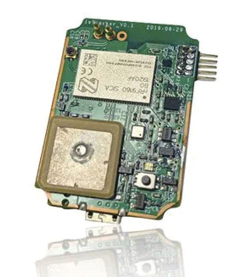
IoTeX has selected Nordic Semiconductor’s nRF9160 low-power System-in-Package (SiP) with integrated LTE-M/NB-IoT modem and GPS receiver to provide the cellular internet of things (IoT) connectivity for its Pebble Tracker.
The Pebble Tracker provides trusted location, environment and motion-tracking data for global asset tracking and industrial supply chain applications.
Critical features strengthen security from hacking and data corruption, meeting the demand of applications that require strong data security and integrity protection throughout the supply chain, the company said.
There are two versions of Pebble Tracker. The first targets blockchain and IoT developers, while a second commercial version is designed for the asset tracking and industrial supply chain markets.
The product combines an environmental sensor, a motion sensor (gyroscope and accelerometer) and an ambient light sensor. It enables cellular network connectivity and integrated GPS support in a global version supporting precise, long-range tracking of asset data using established cellular infrastructure.
The nRF9160 syncs with the IoTeX blockchain, enabling large-scale, decentralized asset-tracking applications. It sends environmental and GPS data securely across global cellular networks to blockchain-based backend services and applications. There, the data is used to determine whether smart contracts have been satisfactorily fulfilled. For example, the trusted tracker data can reveal if, when, and where an asset has been mishandled.
A roundup of recent products in the GNSS and inertial positioning industry from the March 2021 issue of GPS World magazine.
OEM
GNSS Receiver
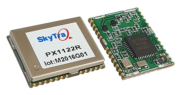
1-cm accurate multi-band receiver
Photo: SkyTraq
The PX1122R is a 12 x 16 millimeter multi-band real-time kinematic (RTK) receiver for centimeter-level-accuracy positioning applications. It uses GPS L1/L2C, Galileo E1/E5b, GLONASS L1/L2 and BeiDou B1I/B2I signals concurrently to maximize positioning availability even in difficult urban environments. A single-chip system-on-chip, the PX1122R is designed to deliver reliable positioning for autonomous unmanned ground or aerial vehicles, the internet of things, and traditional land surveying and precision farming applications. It has an RTK initialization time under 10 seconds and a maximum update rate of 10 Hz. Its update rate provides in-time positioning with a fast response time and improved guidance for fast-moving applications. Moving-base RTK for GNSS precise heading is also supported.
SkyTraq, www.skytraq.com.tw/homesite/
Iridium antennas
Available housed or embedded
Photo: Tallysman
The housed HC610 and embedded HC610E active Iridium antennas operate in receive-only mode and enable Iridium terminals to be installed tens of meters away from the antenna. The lightweight and compact helical antennas are designed to receive the Iridium Satellite Time and Location (STL) signals. Both antennas are light and compact and feature a precision-tuned helical element that provides an excellent axial ratio and operates without a ground plane. They feature a low-current, low-noise amplifier (LNA) and pre-filter to prevent harmonic interference from high-amplitude signals, such as 700-MHz band LTE and other nearby in-band cellular signals. The housed HC610 weighs 23 grams, is 33 x 54.2 mm, and features an IP67 robust, military-grade plastic enclosure, with a base-mounted male SMA connector and two screw holes for surface attachment. At 10 grams, the embedded HC610E is 27.5 x 38.7 mm and can be installed in a custom enclosure. It provides a base-mounted female MCX connector. An optional embedded helical mounting ring is available to attach the antenna to a flat surface.
Tallysman Wireless, tallysman.com
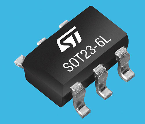
Receiver front end
Designed for portable receivers
Photo: STMicroelectronics
The BPF8089-01SC6 GNSS receiver front end integrates the impedance-matching and electrostatic discharge protection circuitry typically implemented using discrete components. It provides a 50-ohm matched interface between the receiver’s antenna and LNA, and is ready for plug-and-play with the company’s STA8089 and STA8090 LNAs. It is suitable for use in portable receivers for the GPS, Galileo, GLONASS, BeiDou and QZSS constellations, which can be used in applications such as consumer satellite navigation, radio base stations, drones and tracking of assets or livestock.
STMicroelectronics, st.com
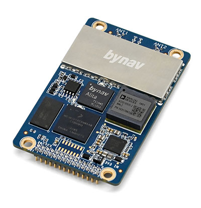
GNSS/INS board
Enhanced with an inertial measurement unit
Photo: Bynav
The Bynav A1 is a compact GNSS OEM board with a highly integrated tactical-grade inertial measurement unit (IMU) on board. With Bynav’s new-generation RTK algorithm engine and deeply coupled GNSS/INS algorithm engine, the A1 can provide continuous, reliable high-precision positioning, 3D attitude and velocity to applications such as autonomous driving, robotics, UAVs and mobile mapping. Weighing 25 g and measuring 46 x 71 millimeters, the credit-card-sized A1 is easy to integrate into any system while providing enhanced connection options including serial, Ethernet and CAN.
Bynav Technology, bynav.com
SURVEYING & MAPPING
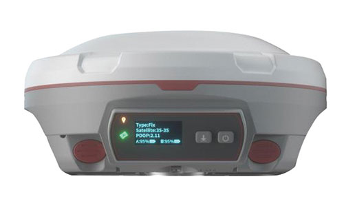
GNSS/IMU receiver
With tilt compensation
Photo: ComNav
The N5 IMU RTK receiver is user-friendly, with up to 60° tilt compensation ensuring quick measurement and precise position acquisition. A combination of high-end inertial measurement unit (IMU) and advanced GNSS real-time kinematic (RTK) technology, along with ComNav’s core algorithm, ensures high accuracy of less than 2.5 cm, making surveying and mapping in difficult environments easier. The N5 receives all current and future GNSS signals: GPS, GLONASS, BeiDou, Galileo and SBAS. The high-quality OLED display with sunlight readability provides clear viewing and allows users to handle all surveying operations on the screen. A 6800mAh Li-battery allows more than 15 hours of continuous work.
ComNav Technology, www.comnavtech.com
Point creation software
Imports/exports layout files
Photo: Topcon
Topcon Point Manager software is available as a plug-in for Autodesk AutoCAD and Autodesk Revit users in the United States and Canada. It automates point creation and imports and exports layout files to and from a robotic total station. Users will be able to access the solution as a plug-in component to their design package, creating multiple points on building information modeling (BIM) objects and 2D/3D drawings from within the Autodesk environments. Quality assurance and control efforts are improved with point and deviation reports, a likely reduction in on-site personnel, and avoidance of costly errors. Topcon MAGNET users can wirelessly send points to the field for layout, and completed layout files can be sent back to the office to update the model to match as-built conditions.
Topcon, topcon.com
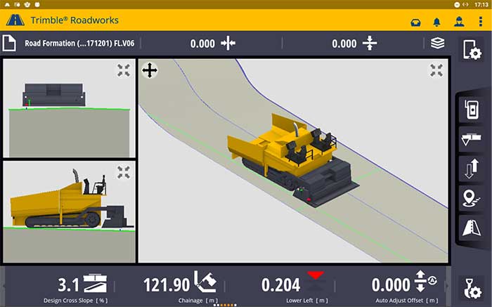
Paving control platform
Directly references design
Screenshot: Trimble
The Trimble Roadworks 3D Paving Control Platform is an accurate, automatic 3D screen control system. It can improve paving productivity and rideability by directly referencing the design rather than a surface or stringline to minimize asphalt usage, reduce waste and overruns, enabling users to finish projects on time and under budget. The Android-based application runs on the 10-inch touchscreen Trimble TD520 display. Operators can personalize the interface to match their workflows, and configurable views make it easier to see the right perspective. The software uses components from Trimble Earthworks, and users can download third-party applications.
Trimble, trimble.com
RTK Receiver
Out-of-the-box features
Photo: Emlid
The Reach RS2 is a full-featured multi-band RTK receiver. All of its features are available out of the box, along with a survey app for iOS and Android. The Reach RS2 tracks L1/L2 bands on GPS, GLONASS and BeiDou, and L1/L5 on Galileo, and acquires a fixed solution in seconds. It achieves centimeter-level precision for surveying, mapping and navigation, and maintains robust performance even in challenging conditions. Centimeter accuracy can be achieved on distances up to 60 km in RTK and 100 km in PPK mode. It provides up to 22 hours of autonomous work when logging data and up to 16 hours as a 3G rover, even in cold weather.
Emlid, emlid.com
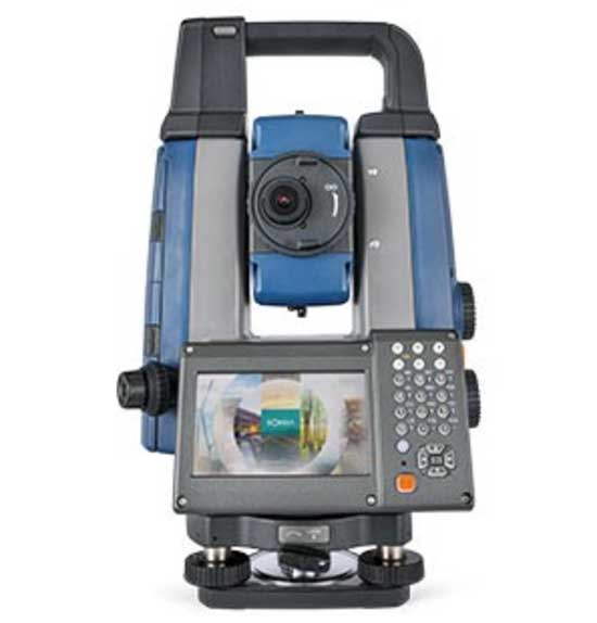
Total stations
Integrate with GNSS
Photo: Sokkia
The iX-1200 and iX-600 robotic total stations are designed to be a part of a workflow solution for survey and layout in construction and infrastructure. They’re engineered for integration with field controllers, software and GNSS receivers. Users can switch to total station measurement integrated with GNSS through an optional upgrade. The stations also can be seamlessly integrated into BIM workflows.
Sokkia, sokkia.com
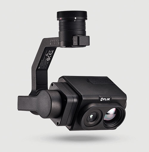
UAV
Thermal Payload
High-resolution gimbaled dual-thermal zoom
Photo: FLIR
The FLIR Vue TZ20 plug-and-play payload is fully integrated with the DJI V2 Matrice 200 and 300 series airframes. With 20X zoom capabilities, the FLIR Vue TZ20 provides drone pilots from the public safety and industrial inspection sectors with improved image detail and magnification to assess situations and make critical decisions. The 2x to 20x zoom provides a wide 95-degree field of view for maximum situational awareness, covering large areas in a single flight, or a narrow 18-degree field of view to put more pixels on target when needed. Factory calibrated, the dual 640 × 512 Boson thermal cameras are equipped with expandable infrared video streaming at 30 Hz.
FLIR, flir.com
Fixed-wing UAV
For surveyors, GIS professionals
Photo: SenseFly
The eBee Geo represents the first extension into a new eBee X series of fixed-wing UAVs and is positioned as a cost-effective option for surveyors and GIS professionals who may be unfamiliar with fixed-wing UAV mapping and data collection. With a maximum 45-minute flight time, the eBee Geo can achieve single-flight coverage of 160 ha at 122 m (395 A at 400 ft), suitable for smaller surveying firms and project-based drone service providers. Construction, urban planning and land management users can also benefit from the RGB imaging capabilities of the supplied senseFly S.O.D.A. camera fixed payload, while achieving greater efficiency and absolute accuracy down to 2.5 cm from the eBee Geo’s real-time kinematic (RTK) function. The eBee X is a premium version that offers users the high-precision of on-demand RTK/PPK for achieving absolute accuracy of down to 1.5 cm (0.6 in) without ground control points. Customers also have access to senseFly’s intuitive eMotion flight planning software.
SenseFly, sensefly.com
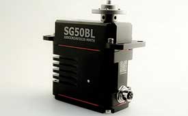
Actuator
With CAN and UAVCAN connectivity
Photo: Hitec Commercial Solutions
The SG50BL actuator includes CAN 2.0 A/B or UAVCAN control options. It is designed with robust steel gears and a high-performance brushless motor. It is capable of operating at 18 to 32 volts. The actuator features a programmable digital circuit with a MOSFET amplifier; a BLDC motor; a magnetic encoder position sensor; five hardened steel gears with low gear backlash (less than .5°); a four ball-bearing supported output shaft; and nine needle bearing supported idlers. It has a rugged anodized aluminum alloy case and an IP68 waterproof rating. The SG50BL also is capable of 360° proportional rotation and has T4131012051-000 TE connectivity. Custom connector options are available.
Hitec Commercial Solutions, hitecnology.com
Smart antennas
Designed for tough environments
Photo: Trimble
The AX940 and AX940i high-precision GNSS smart antennas are designed for a range of high-precision applications, including UAVs. With multi-frequency, multi-constellation support for GPS, Galileo, GLONASS, BeiDou, QZSS and NavIC, the smart antennas can deliver reliable centimeter-level accuracy in a variety of environments. In addition, the Trimble AX940 and AX940i provide reliable, high-accuracy positioning without the constraints of a local base station or cell modem by using Trimble RTX correction services. Built-in inertial sensors on the AX940i allow a tight integration with GNSS observations in the RTK/RTX positioning and orientation engine, providing continuous high-rate low-latency output to guidance and control systems. The Trimble AX940 and AX940i provide flexible interfaces with high-speed data transfer and configuration; simplified integrations reduce development times; and an intuitive 3D graphical web page allows easy input of the lever arm for easier set up.
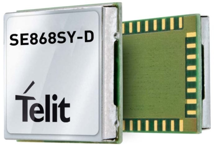
Telit has launched the SE868SY-D multi-frequency, high-precision GNSS receiver module for applications that require high accuracy, fast updates, multi-constellation support and multipath resistance.
At 11 x 11 mm, the SE868SY-D accommodates ultra-compact devices and IoT trackers.
Available now, the high-precision SE868SY-D module is Telit’s first multi-frequency, multi-constellation GNSS receiver module, featuring an ultra-sensitive -167 dBm (tracking) RF front end. By using both the L1 and L5 bands, the SE868SY-D supplies a significantly higher location accuracy than single-frequency devices — even in high-multipath environments such as urban canyons, Telit said.
This sub-1-meter precision is a major reason ABI Research expects more than 1 billion multi-frequency GNSS devices to ship annually by 2023.
The SE868SY-D is the first product from a new strategic collaboration between Sony and Telit, and features Sony’s next-generation CXD5610 GNSS receiver large-scale integrated circuit (LSI).
The Telit SE868SY-D is designed for battery-powered applications such as IoT trackers and wearables. With less than 45 mW in L1+L5 tracking mode, the module has low power consumption, despite using both L1 and L5 bands.
For high-dynamic applications, the SE868SY-D a high update rate of up to 25 Hz. Its high-accuracy, one-pulse-per-second signal also makes the module suitable for timing applications.
“With the new SE868SY-D, Telit is uniquely prepared to meet the burgeoning global demand for multi-frequency, multi-constellation GNSS receivers for IoT trackers, wearables and more,” said Eric Lagorce, Telit business development director. “The SE868SY-D also perfectly complements Telit’s two decades of GNSS expertise and its broad portfolio, and highlights the potential of our strategic collaboration with Sony.”
The Telit SE868SY-D provides pin-to-pin compatibility for applications based on Telit’s legacy GPS module JF2 and GNSS module SE868V3.
A roundup of recent products in the GNSS and inertial positioning industry from the February 2021 issue of GPS World magazine.
OEM
Development kit
Allows engineers to evaluate GNSS/INS module
Photo: Aceinna
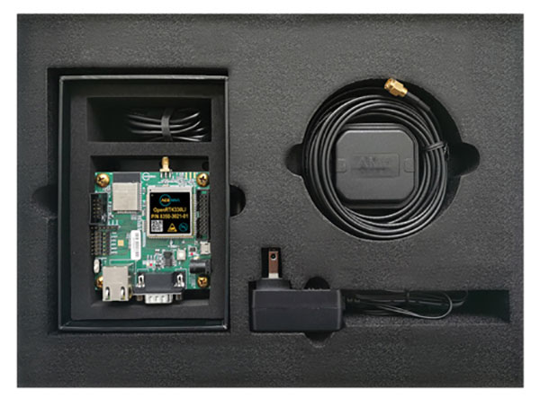
The Aceinna OpenRTK330LI EVK is a complete evaluation and development kit for the OpenRTK330LI GNSS/INS module. The kit accelerates development and reduces time to market of custom navigation and guidance systems fusing inertial measurements and multi-band RTK/GNSS positioning. It provides the essential hardware, firmware and development environment that engineers working on autonomous applications need to quickly start developing algorithms and solutions, allowing engineers to log and visualize positioning data with centimeter precision.
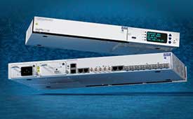
The OSA 5412 and 5422 are edge and access network synchronization devices with enhanced capabilities for next-generation applications such as 5G. The Oscilloquartz solutions address key challenges for a wide range of industries by bringing new levels of timing accuracy and resilience to edge networks. Both models provide in-service sync probing and assurance as well as innovative GNSS assurance capabilities. The devices also eight field-upgradeable, 10-gigabits-per-second ports, ensuring the scale and efficiency needed for next-generation smart grids, industrial internet of things (IoT) applications and 5G connectivity.
The AirgainConnect AC-HPUE 6-in-1 is a rugged outdoor mobile antenna with integrated modem, designed to meet the most demanding LTE connectivity needs of public safety and fleet vehicles. AC-HPUE provides two or three high-gain multi-band LTE antennas and one-band 14 LTE antenna powered by an HPUE LTE modem. The AC-HPUE supports an active GNSS element as well as two or three high-gain tri-band Wi-Fi antennas, including the new 6 GHz ISM band for Wi-Fi 6E (802.11ax), inside a single robust and compact housing. AC-HPUE attaches to the router WAN port via Ethernet data cable or directly to a laptop via USB cable. Wi-Fi and GNSS antennas connect to the router, meaning the router can be seamlessly used for Wi-Fi, location-based services, and managed using existing network management systems.
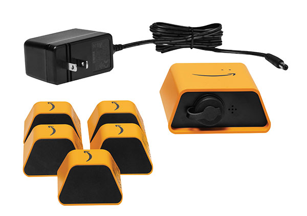
Amazon Monitron provides customers with an end-to-end machine monitoring solution comprised of sensors, gateway and machine learning service to detect abnormal equipment conditions that may require maintenance. Monitron is one of five new machine learning services that help industrial and manufacturing customers embed intelligence in their production processes to improve operational efficiency, quality control, security and workplace safety. The services combine sophisticated machine learning, sensor analysis and computer vision capabilities to address technical challenges faced by industrial customers. The other four services are Amazon Lookout for Equipment, the AWS Panorama Appliance, the AWS Panorama SDK and Amazon Lookout for Vision.
Carlson Layout allows fast, efficient layout capabilities for construction professionals using total stations or GPS receivers such as the Carlson CR+ series of robotic total stations and the Carlson BRx7 GNSS receiver. Included are the full Carlson driver library and a range of compatible hardware options. Features include an intuitive user experience, support for DXF and DWG files, integration with Google Drive and other cloud storage, compatibility with Carlson CRD and CRDB files, and the ability to check surface or fixed elevations without creating points. It also includes simple layout for points, lines and surfaces. Layout works with GPS real-time kinematic (RTK) systems and can receive RTK connections from a cellphone, internal modem, internal radio or external radio.
Surfer is a gridding, contouring and 3D surface-mapping package. The latest version offers a greater number of options for displaying scientific data. New display options enable users to more easily communicate the information extracted from their data. The Surfer package is used by professionals in oil and gas exploration, environmental consulting, mining, engineering and geospatial projects to easily visualize and interpret complex data sets. Surfer enables users to model data sets, apply an array of advanced analytics tools, and graphically communicate the results. Features include a new peaks and depressions layer type for mapping geohazards or drainage patterns in karst topographies.
Uinta’s data collection tools include detailed mapping with points, lines, areas and form-based notes for digital recordkeeping. Customization options allow organizations to create templates that better align with the type of data they are mapping and recording. Templates can be shared among users, and Juniper Systems has many templates for various industries and use cases. Users can export data to a file, print professional PDF map reports, and create optional cloud projects. Combined with a Mesa 3 Rugged Tablet running Windows 10 and a Geode Sub-meter GPS Receiver, Uinta offers a rugged, robust and powerful data collection solution. Industries using Uinta include utility mapping, government asset management and mapping, industrial assets, irrigation, and sectors within natural resources.
The FLY-R R2-150 has a top speed of 200 km/h (124 mph). Currently in functioning prototype form, the battery-powered R2-150 is designed for such tasks as fully autonomous surveillance, observation and reconnaissance. It has a wingspan of 1.5 meters (4.9 feet), a cruising speed of 115 km/h (71 mph), and can fly for up to two hours per charge while transmitting real-time video. It can automatically take off from a ship- or truck-mounted vacuum launcher and land in a recovery net. Another model, the jet-powered R2-HSTD, is expected to have a top speed of Mach 0.65 (803 km/h or 499 mph) and is intended to serve as a target drone for military exercises. FLY-R’s aircraft incorporate a rhomboidal wing design, which reduces wingspan by half and reduces aerodynamic drag.
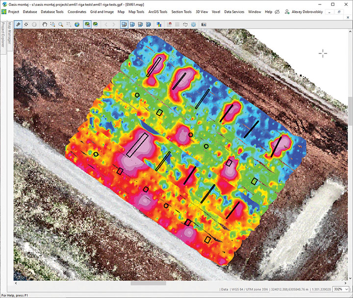
The drone-integrated metal detection system uses an airborne modification of the Geonics EM61-MK2 ground metal detector. The EM61 Lite airborne variant integrates with the UgCS SkyHub onboard computer and ground control station. Features include automatic data logging in geotagged form and automatic terrain following with radar altimeter. The use of UgCS SkyHub enables the drone to fly in true terrain following mode with the help of the radar altimeter and to log geotagged sensor data. An optional RTK/PPK GNSS receiver on the drone will geotag the data with centimeter-level precision. The integrated system has been extensively tested at SPH Engineering’s test range, and has shown excellent performance and repeatability for targets such as pipes (steel, stainless steel, reinforced concrete) and steel drums. Applications include unexploded ordnance (UXO) search, detection of underground infrastructure and archaeology.