New technologies use a variety of inputs to help ensure seamless navigation, even when GPS reception fails because of interference or jamming.
Honeywell has successfully demonstrated multiple alternate navigation technologies for military aircraft. These new products are intended to help ensure seamless navigation — even when GPS signals are blocked, interrupted or unavailable.
For military operations, GPS-jamming — intentional or not — can block vital signals from conveying critical information regarding positioning, navigation and timing (PNT). In these instances, it’s important for military vehicles and aircraft to be equipped with alternative navigation technologies, like celestial or vision navigation, to maintain operational readiness.
“For military operations, not having access to critical positioning and timing information can make or break a mission,” said Matt Picchetti, vice president and general manager, Navigation & Sensors, Honeywell Aerospace. “We’re very excited to roll out this robust lineup of alternate navigation solutions, which are specifically designed to address the needs of our military customers and give them the added layers of redundancy needed to successfully carry out their operations, even if they lose access to GPS signals.”
Illustration: Honeywell
Alternate navigation technologies provide a different means of measuring position, velocity and heading when GPS is disrupted. These technologies include:
Vision-aided navigation. This technology uses a live optical or infrared camera feed and compares it with maps to provide a passive, not jammable, highly accurate alternative PNT solution that provides GPS-like accuracy in GPS-denied or jammed conditions.
Celestial-aided navigation. Honeywell’s celestial-aided navigation technology observes stars and “reference objects” orbiting the earth such as satellites, which have known positions and velocities. This technology compares those reference objects to stars and can determine position and velocity, the same way a GPS receiver can.
Magnetic anomaly-aided navigation. This navigation technology measures magnetic strength using sensors and compares this data with known geographical magnetic maps to accurately identify the position of the aircraft relative to the Earth.
Prototypes of these alternate navigation systems will be available in 2022, with initial deliveries expected to start in 2023.
Honeywell navigation systems are used by nearly every aircraft flying to guide millions of passengers to their destinations. Since 1914 when the first autopilot used Honeywell gyroscopes to hold the plane stable during flight, Honeywell has delivered more than 500,000 high-performance inertial sensors across several platforms on land, in the air and at sea.
Dual-frequency timing module provides anti-jamming and anti-spoofing capabilities
Photo: Trimble
Trimble has introduced its first dual-frequency embedded timing module that provides next-generation networks with 5-nanosecond accuracy.
Surface mountable, the Trimble RES 720 GNSS timing module can be integrated into network equipment. It uses L1 and L5 GNSS signals to provide superior protection to jamming and spoofing, mitigates multipath in harsh environments, and adds security features to make it suitable for resilient networks.
Precise timing and synchronization optimizes and improves wireless network performance. At 19 x 19 millimeters, the RES 720 module provides a low-cost, easy-to-use, highly accurate and reliable GPS timing source for critical infrastructure in a broad range of industries. The RES 720 is suitable for 5G Open RAN/XHaul, smart grids, data centers, industrial automation and satellite communication networks, as well as calibration services and perimeter monitoring applications.
The RES 720 meets the resilient timing requirement mandated by the U.S. 2020 Executive Order (EO13095) for timing services and critical infrastructure operators. Using dual-frequency (L1 and L5), RES 720 provides better multipath detection capabilities than single frequency, and provides protection against signal jamming and spoofing. Multi-band capability helps compensate for the ionospheric error from multi-GNSS satellite constellations, while reducing the timing error under clear skies to less than 5 nanoseconds. To further improve its accuracy locally, the RES 720 module features differential timing modes for highly accurate local timing.
Powered by Trimble’s Smart GNSS Assurance technology, the RES 720 offers protection against jamming and hacking of signals with automatic fallback to available GNSS signals. Infrastructure equipment suppliers, system integrators and network operators can benefit by integrating highly accurate synchronization capabilities into their network and synchro-phasor devices, while enabling resilient timing for critical infrastructure.
The RES 720 is expected to be available in the second quarter of 2021.
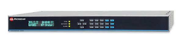
Microchip Technology has integrate its BlueSky technology signal-anomaly detection software into its SyncServer S600 Series network time server and instruments.
The SyncServer S600 Series now provides GPS jamming and spoofing detection and protection, in combination with local radio frequency (RF) data logging and analysis. The SyncServer S600 Series Stratum 1 instrument, along with the BlueSky technology’s intelligent jamming and spoofing detectors, continuously monitor local GPS constellation health and examine GPS and local RF signal integrity to assure validity.
If an anomaly is detected, the solution sends an alarm and, if necessary, the SyncServer instrument can be shifted to alternative time sources or an internal oscillator. This protects ongoing timing outputs while ensuring only minimal, predictable timing degradation to vital network and business operations in applications ranging from banking and stock trading to electric utilities and aerospace and defense.
The SyncServer BlueSky technology, which provides continuous detection and protection against GPS jamming and spoofing. includes a comprehensive suite of logging, charting and measuring tools to characterize local GPS satellite signals as well as local RF events over time.
This can help enable correlating, troubleshooting, identifying and correcting local anomalies, some of which may be related to consumer electronics, or nearby RF signal broadcasts. The solution is optionally available through the SyncServer v4.1 software release that provides a selection of features found in Microchip’s BlueSky GNSS Firewall solution for third-party GPS receivers and critical infrastructure.
PNT services, such as GPS, are a national critical function that enable many applications within the critical infrastructure sectors. However, “The increasing reliance on GPS for military, civil and commercial applications makes the system vulnerable,” according to Space Policy Directive-7 (SPD-7), issued Jan. 15. “GPS users must plan for potential signal loss and take reasonable steps to verify or authenticate the integrity of the received GPS data and ranging signal, especially in applications where even small degradations can result in loss of life.”
The PNT Integrity Library and Epsilon Algorithm Suite address this issue by providing users a method to verify the integrity of the received GPS data. “We are excited to release these resources to the PNT community to improve resiliency against potential GPS signal loss,” said DHS S&T PNT Program Manager Brannan Villee.
“Since GPS signals can be jammed or spoofed, critical infrastructure systems should not be designed with the assumption that GPS data will always be available or will always be accurate,” said Jim Platt, chief of Strategic Defense Initiatives at the Cybersecurity and Information Security Agency (CISA) National Risk Management Center. “Application of these tools will provide increased security against GPS disruptions. However, DHS also recommends a holistic defense strategy that considers the integrity of the PNT data from its reception through its use in the supported system.”
The PNT Integrity Library and Epsilon Algorithm Suite are open source and available free of charge. To view more details, visit the DHS S&T PNT Program.
To mark the one-year anniversary of the PNT Executive Order, Orolia will host an interactive Coffee Talk webinar on March 24 to explore the latest developments in the national initiative to protect U.S. critical infrastructure from GPS/GNSS jamming, spoofing and interference.
Panelists from the U.S. Department of Homeland Security (DHS) and the National Institute of Standards and Technology (NIST), among others, will focus on key actions and priorities for 2021 and beyond, including insights and context on recently published works such as the NIST Foundational PNT Profile issued on Feb. 11, 2021, and the DHS Conformance Framework of Dec. 18, 2020.
Critical infrastructure and PNT industry panelists will also share their perspectives on practical ways to increase resiliency and key factors to consider, in view of the latest Executive Order guidance.
More information about Resilient PNT and GNSS jamming/spoofing is available in Orolia’s online resource center.
Panelists include:
Ernest Wong, Technical Manager, Science and Technology Directorate, DHS
Jim McCarthy, Senior Security Engineer, National CyberSecurity Center of Excellence, NIST
Register here for the Coffee Talk “PNT Executive Order Update: 2021 Actions and Priorities,” 11 a.m. EDT, March 24. Use the registration form to share questions or comments on what to discuss.
integration with inertial measurement units (IMUs) and other sensors
positioning using cell phones and other consumer devices
any other areas or challenges they find particularly significant.
All four respondents in this issue, like to those in the January issue, report that they are making full use of the new GNSS signals available, taking hardware and software measures to counter jamming and spoofing, and integrating IMUs and other sensors with their GNSS receivers to help achieve continuous navigation and positioning in obstructed environments. In addition, they are continuing to develop mass-market applications, because high-precision positioning is becoming increasingly important for cellphones and wearable devices. For a fuller review of these trends, see my introduction to the first installment.
Notably, two of the companies featured in this issue, ComNav Technology and Unicore, are Chinese.
With Chad Pillsbury, Senior Director, Raytheon Intelligence & Space’s Resilient Navigation and Reconnaissance Solutions
Utilizing Galileo and BeiDou
Integration and fusion of multiple space position services is a key element in achieving assured positioning, navigation and timing (PNT). A combination of commercial and military-code navigation signals, when coupled with evolving sensors, provide more resilient methods of navigation and enable new concepts of operations related to PNT. Over the next two years, RI&S will customize these concepts of operation (CONOPS) for our United States and international allies to harness the power of fusion in resilience.
Dealing with jamming and spoofing
As threats to GPS continue to evolve and mature, RI&S continues to develop alternative navigation solutions, as well as GPS-capable receivers and antennas, aimed at defending against a variety of spoofing and jamming technologies. Our latest anti-jam, anti-spoof and high-precision solutions leverage a recent technology breakthrough that lowers size, weight, power and cost while boosting performance in the new M-code and alternative navigation applications.
Integration with IMUs and other sensors
IMUs are the cornerstone of high-performance navigation systems and will continue to be in the future. Recent innovations allow some systems to become more IMU agnostic, or even to consider microelectromechanical systems (MEMS) IMUs depending on performance, which can allow the customer greater flexibility and a more open architecture.
Positioning with consumer devices
RI&S sees 5G as a game-changing technology, with a lot of possibilities in the assured navigation market. We also look to cellphones as a great area of interest — especially for exploring unforeseen signals, considering human international models, and learning how the next generation of GPS users expect to see PNT information displayed.
Other significant challenges and opportunities
The future of GPS lies in a system-of-systems approach. Using time as a backbone, navigation systems can securely share time, data, position and intent across the network. Broadly, this approach can be used in civil, commercial and military environments. RI&S is fully focused on developing capabilities to achieve this ideal state.
Unicore Communications
With Gao Jingbo, Marketing Director
Utilizing Galileo and BeiDou
Most of Unicore’s high-precision products support all constellations and multiple frequencies. The new BeiDou 3 provides precise point positioning (PPP) service from three geostationary satellites via the B2b frequency, while Galileo offers up to five frequencies — E1, E5a, E5b, E5 AltBOC and E6. End users will benefit from improved PNT availability, reliability and continuity as access to those signals greatly reduces multipath effects and allows faster PPP convergence times.
Dealing with jamming and spoofing
To effectively deal with signal jamming and spoofing, it is important to know their sources. GNSS receivers also are susceptible to electronic interference and vulnerable to complex electromagnetic environments. Unicore integrates GNSS RF, baseband and algorithms into a single GNSS system-on-chip (SoC) that mitigates external interference. Joint time-frequency domain interference mitigation technology also is adopted in chip design.
Photo: Unicore Communications
Integration with IMUs and other sensors
Demand for seamless, accurate indoor-outdoor location is increasing. The integration of GNSS with IMUs, lidar, cameras and other sensors helps achieve continuous navigation and positioning in obstructed environments such as urban canyons and tunnels. Unicore offers receivers integrated with both high-end IMUs and affordable MEMS-based devices. Dual-frequency GNSS plus MEMS provides an ideal positioning solution for automotive applications.
Positioning with consumer devices
High-precision positioning is becoming increasingly important for cellphones and wearable devices, and multi-scenario adaptation is necessary. Instead of integrating standalone GNSS chips with smartphone processors, cellphone manufacturers prefer to cooperate with GNSS manufacturers through GNSS intellectual property (IP) licensing. To ensure high-precision service, better cellphone antennas are also important.
Other significant challenges and opportunities
We strive to deliver reliable, timely and smart positioning for anything, anywhere, anytime. Next-generation GNSS location products and services should be more end-user-friendly. The hardware interface will be more universal, flexible, configurable and adaptable with different algorithms for a diverse range of applications.
Teleorbit
With Daniel Seybold, CEO
Utilizing Galileo and BeiDou
Our GOOSE receiver has been able to use Galileo since its beginning and BeiDou since the forth quarter of 2020. Signals from both can be used individually or with other signals (GPS, Galileo, GLONASS and BeiDou, plus SBAS).
Dealing with jamming and spoofing
Open Service Navigation Message Authentication (OSNMA) is now implemented on the GOOSE, which helps mitigate spoofing attacks. GOOSE’s recording function enables users to record simulated jamming/spoofing attacks, and then analyze the behavior of the GOOSE and the received signals. We are developing various GNSS antenna arrays for nulling and beamforming, as well as a left- and right-hand circular polarized (LHCP/RHCP) antenna with GOOSE adaption for signal processing.
Signal conditioning on the GOOSE platform is based on a high-rate discrete Fourier transform (DFT)-based data manipulator algorithm, known as an HDDM algorithm, that fulfills multiple roles. The HDDM algorithm removes a wide range of interference signals, equalizes the spectrum, or restructures the spectrum.
Image: Teleorbit
Integration with IMUs and other sensors
We offer a GNSS antenna with an integrated IMU. Thanks to its open software interface, fusing IMU or other sensor data with GNSS data is easily done with GOOSE. Vector tracking, deep coupling and other sensor fusions (for example, 5G) are on the GOOSE roadmap.
Positioning with consumer devices
Our ongoing AMELIE project will study advanced techniques for the miniaturization and radiation enhancement of GNSS mass-market antennas to be applied in the design, manufacturing and testing of a multi-frequency, low-cost, high-gain dual circularly polarized antenna for the next generation of consumer devices. In 2021, we will build the following antenna demonstrators: single-frequency (L1/E1), dual-frequency (L1/G1/E1, L5/E5a/E5b) and multi-frequency (L1/G1/E1, L5/E5a/E5b, L2, E6).
Other significant challenges and opportunities
GOOSE can track the Galileo E5AltBOC (wideband) signal, which provides code-range variances below a few decimeters. This offers a significant increase in the accuracy of code measurements in terms of reduced noise and mitigation of multipath effects, compared to conventional signals. GOOSE will provide two different approaches for robust tracking: vector tracking for dealing with challenging environments where multipath occurs or buildings block signals, and adaptive tracking to allow the receiver to acclimate to its surroundings by adapting the bandwidth in the loop depending on movement, such as high dynamics.
ComNav Technology
With Min Xu, Director of GNSS Technology R&D Department
Utilizing Galileo and BeiDou
We keep up with the development of GNSS. Our new K8 series of high-precision GNSS modules support the recently completed BDS-3 and Galileo constellations concurrently, significantly improving positioning accuracy especially when signals are partially obstructed. Despite their complex design, the size of K8 modules decreased by almost 36% from their precursors and power consumption dropped to 1.0W, making them easier to integrate.
Dealing with jamming and spoofing
We have developed algorithms to eliminate specific forms of jamming and spoofing, with a focus on narrowband interference. The newly released Quantum III SoC chip — integrated with wideband signal-receiving technology, wideband and narrowband anti-interference technology, and anti-continuous wave interference technology — can provide high-quality observation information in a complex electromagnetic environment.
Photo: ComNav Technology
Integration with IMUs and other sensors
There is an increasing need to add IMUs to supplement obstructed GNSS signals. Empowered by a high-precision IMU, our N5 receiver supports tilt survey with accuracy of less than 2.5 cm. Users can survey without a centering bubble as its calibration-free tilt compensation protects it from magnetic disturbances. We are also focusing on image sensors, such as cameras and radars, to make data collection more flexible and reliable.
Positioning with consumer devices
Our high-precision products are mainly used in professional fields such as land surveying, deformation monitoring, and UAVs. We are continuing to explore GNSS products for consumer markets, which are sensitive to power consumption and cost. The upcoming M10 GNSS is a compact and portable receiver for mass-market applications, such as person or vehicle tracking and fleet management.
Other significant challenges and opportunities
GNSS technology can be widely applied in agriculture, transportation and infrastructure construction. We developed the AG360/AG360 Pro Agricultural Automatic Driving system, which drives autonomously without damaging crops. We collaborated with China Mobile to build more than 2,000 CORS stations to provide high-precision positioning services in support of smart-city construction, IoT and location-based services.
What should the new administration’s priorities be to make PNT more resilient?
We asked Brad Parkinson, the “Father of GPS” and a GPS World Editorial Advisory Board member, what the new U.S. administration’s priorities should be to make positioning, navigation and timing (PNT) more resilient. For more answers from board members, see below.
Brad Parkinson
Protect the Spectrum. Reverse FCC authorization for relatively high-powered Ligado transmitters that have been proven to degrade GPS and other GNSS operation for thousands of PNT users. All U.S. government departments and major user groups affected have pleaded with the FCC to reverse this terrible decision. There is little benefit from it to the American public.
Protect the rapidly evaporating and self-proclaimed Gold Standard of GPS. The GPS satellite designs are showing their age. They need to go to multiple launch (three at a time) and revert to simpler designs without the spot-beams and other weighty add-ons that greatly increase complexity and cost. The Chinese have added to BeiDou (a) inter-satellite precision ranging and wide-band communications, (b) geosynchronous satellites, probably with good spot-beam acquisition aids, and (c) a WAAS-like correction directly on the satellites, which may have accuracies down to real-time kinematic (RTK, perhaps a few centimeters). Also, they claim their basic accuracies to be better than GPS (it might be true!) — I think they already have operational retro-reflectors.
Allow and encourage export of the basic and quickest fix to jamming and spoofing for high-value PNT users. More than 40 years ago, we demonstrated, in hardware, a high anti-jamming receiver that could fly directly over a 10 kW GPS jammer and not be affected. We know that high-gain, digital beam-steering antennas will create close to immunity, but our manufacturers will not move this way because we cannot sell or use them on the international market.These devices, combined with inexpensive inertial components and the newer signals, would make PNT virtually immune to current threats of interference — both jamming and spoofing.
Move the military focus from alternative PNT techniques to seriously upgrading their receivers and useful signals. No current or reasonably anticipated alternative can provide the accuracy (3D), availability or integrity of GPS. The new M-code and L1C signals have been in the queue for about 20 years. (Loran for ground operations probably is very vulnerable to direct attack in a fluid battlefield operation. Loran’s main value is to distribute time and for maritime users.) In those 20 years, we now have cellphone chips costing less than $5 that can listen to about 200 ranging signals and process RTK, as well as use all the corrections available (WAAS, EGNOS, etc.). Such capability cannot be found in military receivers. The Defense Department must improve its acquisition strategy in terms of both speed and competition, and ncorporate existing civil capability into military user equipment.
Take government actions to rapidly identify, shut down, and prosecute GPS jammers. Some believe this problem is much larger than recognized already. All cellphones should be required to report extraordinary spectrum noise levels or apparent attempts at spoofing. This should be fed to a dynamic national database, perhaps maintained by the Coast Guard. GPS users should have an automated way to find out whether there are substantial threats in their operating area.
Brad Parkinson is the Edward Wells Professor, Emeritus, Aeronautics and Astronautics (recalled) and co-director of the Stanford Center for Position, Navigation and Time at Stanford University.
Editorial Advisory Board PNT Q&A
Here are additional responses to the question from more GPS World Editorial Advisory Board members.
John Fischer
“We hope the new administration continues on the path established with the Executive Order last year for resilient PNT, supporting progress made by DHS and NIST in establishing resilient and cybersecure frameworks. It will be important for them to maintain an open market concept toward future innovative solutions and not mandate a particular PNT approach. Awareness of the criticality for trusted PNT in our mobile connected society is established and we must not lose this.” John Fischer Orolia
Jules McNeff
“Resilient PNT should be a national security priority. Its continuity is vital to both military and economic/social activities of all kinds. Its qualities of spatial awareness and synchronization enable the efficient functioning of the most sophisticated modern technologies in the physical and cyber worlds while also simply getting people and things from point A to point B on schedule. In that context, the elements which comprise resilient PNT should be protected from natural or hostile disruption.” Jules McNeff Overlook Systems Technologies
Greg Turetzky
“Truly resilient PNT requires combining multiple positioning technologies to maximize resiliency. However, the government’s influence in many of the augmentation technologies (sensors, vision, etc.) is limited. What the administration can do is make GPS itself more resilient by speeding up the launch and acquisition schedule of GPS Block III. The new signals, particularly at L5, are invaluable for improved resiliency to jamming and spoofing as well as providing a significant improvement in accuracy.” Greg Turetzky Consultant
Senate poised to join House this week and override Trump’s veto
The U. S. Congress, especially the Armed Services Committees, have long been concerned about GPS and positioning, navigation, and timing (PNT) issues. Over the last two decades Congressional hearings, demands for reports, and investigations have dealt with acquisition, contingency plans for when space is not available, deliberate interference, and a host of other issues.
While these all evidenced Congress’ interest and concern, they were relatively passive measures.
The NDAA for 2021 seems to finalize Congress’ transition from an interested observer, mostly on the sidelines, to an active player in national PNT issues and policy.
This began to change in 2018 with passage of the National Timing Resilience and Security Act. It requires the Department of Transportation to establish a terrestrial timing system to backup GPS signals.
Then in 2019, Congress appropriated money for a GPS Backup Technology Demonstration. And the National Defense Authorization Act (NDAA) for 2020 required the Air Force to develop a prototype multi-GNSS receiver as part of its resiliency efforts.
The NDAA for 2021 seems to finalize Congress’ transition from an interested observer, mostly on the sidelines, to an active player in national PNT issues and policy.
Capitol Hill observers say this is the result of several things that have come to a head over the last year. Taken together, they have convinced many legislators that GPS is under threat and PNT issues are not being taken seriously enough by the executive branch. These include increased jamming and spoofing (especially by China and Russia), full implementation of China’s BeiDou system and its marketing to other nations as a superior alternative to GPS, the Federal Communications Commission’s (FCC) decision on Ligado Networks, and the Pentagon’s failure to respond to combatant commanders’ Joint Urgent Operational Needs Statements for non-GPS PNT.
Photo: Andrea Izzotti/Shutterstock.com
Here are some of the provisions of the 2021 NDAA of interest to the PNT community.
Military Multi-GNSS Receiver Prototype
The 2018 NDAA required the Defense Department to incorporate Europe’s Galileo and Japan’s QZSS satellite navigation signals into military user equipment. The idea was to make it more resilient to disruption. Also required was an investigation into using non-allied signals.
Apparently not satisfied with progress on this project, Congress mandated a project to develop a prototype multi-GNSS receiver as part of the 2020 NDAA.
The 2021 NDAA seems to indicate the Congress is still not happy. It withholds 20% of the funding for the Office of the Secretary of the Air Force until such time as the department certifies the prototype project is underway and provides briefings to the Senate and House Armed Services Committees.
Resilient Survivable PNT
Language in the 2021 NDAA also seems to show Congress is impatient with the Pentagon’s lack of responsiveness to combatant commanders’ requests for non-GPS PNT systems.
Section 1611 of the Act is entitled “Resilient and Survivable Positioning, Navigation, and Timing Capabilities.” It requires development, integration, and deployment of these capabilities for combatant commanders within two years. This, it says, is “… consistent with the timescale applicable to joint urgent operational needs statements…”
The act says the new PNT capabilities shall “generate resilient and survivable alternative positioning, navigation, and timing signals” and “process resilient survivable data provided by signals of opportunity and on-board sensor systems.”
The act also reverses the Defense Department’s 2018 PNT Strategy’s plan for future systems to be classified and for military use only. It directs the department to work with the National Security Council, Departments of Transportation, Homeland Security and others “to enable civilian and commercial adoption of technologies and capabilities for resilient and survivable alternative positioning, navigation, and timing capabilities to complement the global positioning system.”
To help ensure prompt action on this, the act requires a report to Congress within six months and authorizes the department to reprogram funds from other areas to finance the effort.
Responding to FCC’s Decision on Ligado Networks
By far the most PNT-related text in the 2021 NDAA includes a host of measures responding to FCC Order 20-48 approving an application by Ligado Networks. An order which the executive branch is on record as strongly opposing saying it will degrade GPS service for many.
Senator Jim Inhofe, chair of the Senate Armed Services Committee, has regularly expressed outrage at the FCC’s decision and has called for its reversal.
Among its provisions the act:
Requires the Department of Defense to estimate and report to Congress the cost of damage to department systems as a result of the FCC order.
Prohibits using department funds to upgrade or modify military equipment to make it resilient to interference caused by broadcasts in the spectrum allocated (the FCC order requires this to be funded by Ligado)
Prohibits contracting with any entity using the frequency bands allocated to Ligado unless the Secretary of Defense certifies the use will not interfere with GPS services
Requires the Secretary of Defense to contract with the National Academies of Sciences, Engineering, and Medicine for an independent technical review of the FCC order.
Speakers include Diana Furchtgott-Roth Deputy Assistant Secretary for Research and Technology; ship captains from Maersk Lines; and representatives from the National Security Council, the Maritime Administration and U.S. Coast Guard.
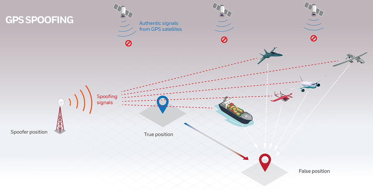
While GPS jamming and spoofing is a problem in many transportation and critical infrastructure sectors, it is often most visible in maritime. This is because the Automatic Identification System (AIS) used for collision avoidance and traffic management for major vessels transmits location data based on GPS inputs.
These transmissions are received by coastal networks and satellite systems. AIS data is often freely available to the public or easily accessed.
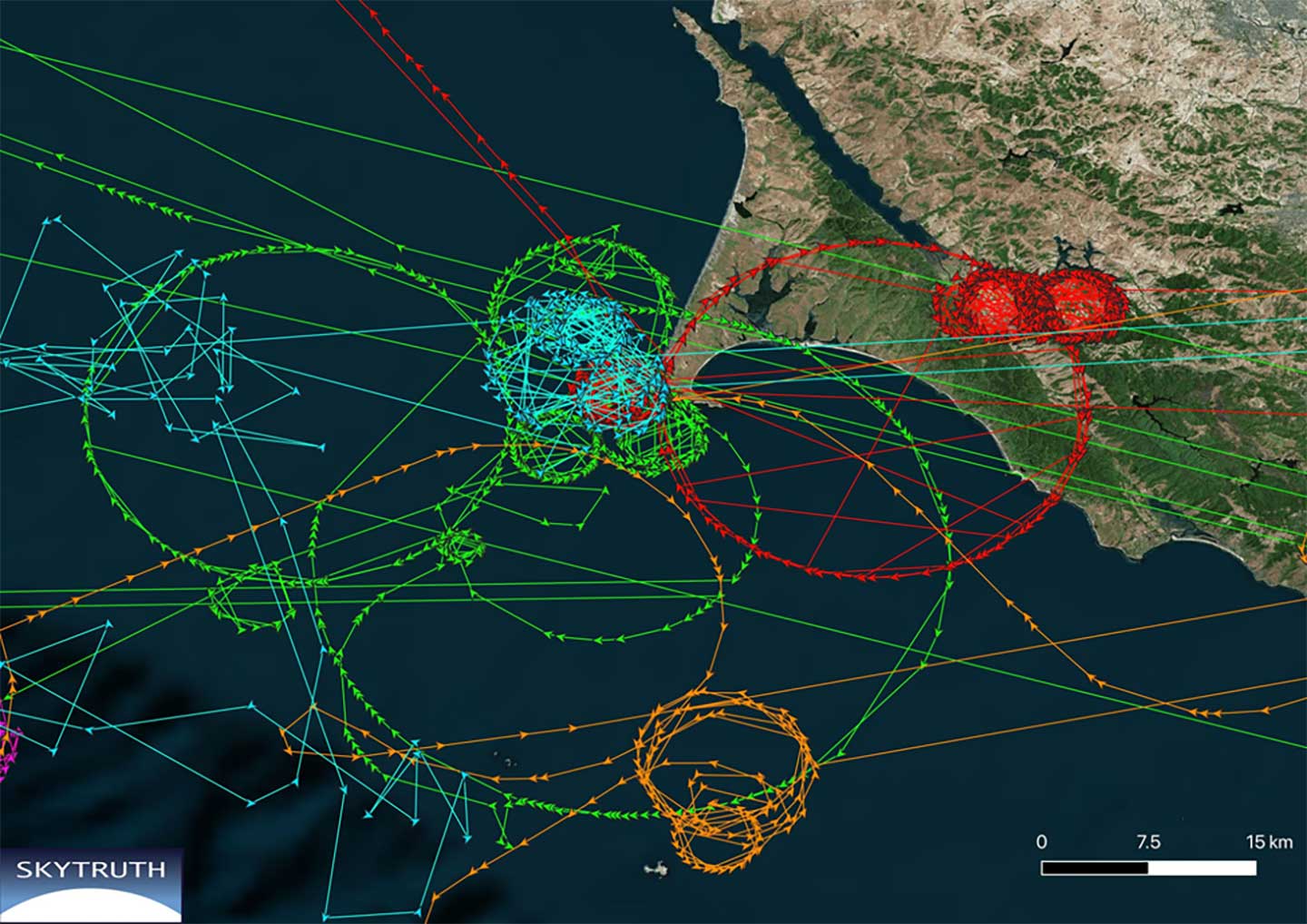
Ships in Russian waters being spoofed to inland airports, vessels in Chinese ports reporting they are inland and circling government buildings, and ships in one part of the world transmitting their location as thousands of miles away and circling in the ocean off northern California are three of the highest provide examples in recent years.
In 2019, the U.S. Coast Guard brought interference with GPS signals as an “urgent issue” to the International Maritime Organization.
In February, President Trump issued an Executive Order on responsible use of positioning, navigation and timing. This workshop is part of the federal government’s efforts, as a part of the order, to educate the public about vulnerabilities associated with over-reliance on GPA.
The U.S. Army is opening a new office and laboratory to develop agile position, navigation and timing solutions to reduce soldiers’ dependence on GPS, according to reports in C4ISRNET and Defense News.
The new PNT modernization product office will focus on developing and deploying solutions that keep soldiers operating in areas where the GPS signal has been denied, degraded or spoofed. The office will open Oct. 8, and will use an open-systems architecture.
The new office will also host an Open Innovation Lab, a space where commercial entities can work with the Army to develop PNT solutions. Within lab, the Army has set aside space for the CMOSS (C4ISR/EW Modular Open Suite of Standards) Lab and the Network Cross-Functional Team’s Orion Forge at Aberdeen Proving Ground in Maryland.
The lab will be physically separated from the more classified areas of the site to encourage engagement with industry. Technologies to be explored include radio frequency systems, GPS, alt-nav, chip-scale atomic clocks, other timing technologies and celestial navigation.
According to the reports, the technologies will be fielded fast, with new solutions every five years. This is in contrast to the usual method of a decade spent developing technologies meant to last 20 years so that soldiers can always combat adversaries’ capabilities.
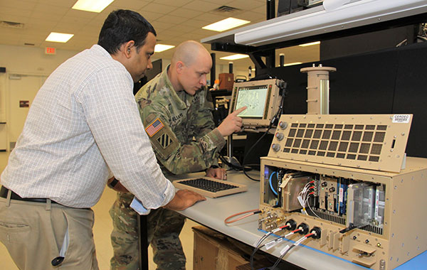
Andradige Silva, electronics engineer for the C5ISR Center’s Intelligence and Information Warfare Directorate, and Maj. Doug Williams, assistant product manager for the Joint Battle Command-Platform, access the C4ISR/Electronic Warfare Modular Open Suite of Standards (CMOSS). (Photo: U.S. Army)
A new monitoring system developed through an ESA-backed project works like a bodyguard for satellite navigation in use at strategic or safety-critical sites. Known as GIDAS, the scalable system immediately detects, identifies and pinpoints satnav interference sources in its vicinity.
It is estimated that there are currently the same number of satnav receivers on Earth as there are people. Positioning, navigation and timing signals from space-based constellations such as Galileo and GPS form an invisible, essential infrastructure, underpinning numerous modern aspects of modern life: communications, power and transportation.
Satellite navigation helps guide a growing number of aircraft, boats, trains and autonomous vehicles. Meanwhile satnav-based time stamps authentic multi-billion euro financial transactions, and coordinate the synchronised running of power grids. Satellite navigation is always on, available everywhere on Earth, so it is easy to take its availability for granted. But as crucial as these signals from space are, they are also vulnerable to ground-based interference.
“It’s simply a matter of output power,” said Andreas Lesch of Austria-based OHB Digital Solutions. “A navigation signal on the ground is equivalent to the light from a 60-watt lamp aboard a satellite, some 23,222 km away in space in the case of Galileo. So these faint signals can be jammed by more powerful local radio signals, either accidentally or deliberately, or even misleading fake navigation signals, known as spoofing.”
“Our new GNSS Interference Detection and Analysis System, GIDAS, is designed to safeguard critical infrastructure against jamming or spoofing, by performing continuous monitoring of key signal bands. By doing so, GIDAS can raise the alarm in real time, identify the type of interference then pinpoint the location of these dangerous portable devices causing the interference so the authorities can take immediate remedial action.”
GIDAS can provide interference detection and directionality with a single reporting station, although a minimum of three stations are required for pinpointing interference sources, linked to an overall monitoring center. Monitoring centers can also be connected together, making the GIDAS system easily scalable, from safeguarding an individual harbour, airport or system critical site up to an entire city or region.
GIDAS can provide interference detection and directionality with a single reporting station, although a minimum of three stations are required for pinpointing interference sources, linked to an overall monitoring center. (Photo: ESA)
“People are only now catching up to the seriousness of this problem,” adds Andreas. “Surveys of the highest-density parts of Europe surveys report around three to four jammers hourly.
“These small devices are technically illegal but are easily available online for a few hundred euros or less, often marketed as personal privacy devices. Jammers are sold as having a range of only a few metres, but can turn out to have a practical range of dozens of metres or more — leading to unintentionally widespread interference, like the famous jammer-equipped U.S. truck driver who shut down Newark Airport navigation systems whenever he drove past.
“Spoofing is more serious still, with a strong criminal element, where false satellite navigation signals replace real ones, to mislead receivers about their position, employed in the past to down put drones or divert boats.
“Working in this field for eight to nine years, we have seen a strong growth in interference, even as GNSS becomes ever more crucial. With our passion for GNSS and signal processing, we decided to something practical to combat this development, delivering rapid detection, classification and localisation of interference to our customers.”
GIDAS was developed by OHB Digital Solutions and Joanneum University through ESA’s Navigation Innovation and Support Programme (NAVISP), working with European industry and academia to develop innovative navigation technology.
“The company initiated the project through NAVISP’s second element, focused on strengthening European competitiveness in the navigation arena, proceeding on a co-funded basis,” said engineer Thomas Burger, overseeing GIDAS project for ESA. “The plan was to enable a commercially attractive business to get started, and I’m happy to say we made it.”
“Considering the budget, the project had a wide scope, including the development of a multi-constellation GNSS receiver with all processing stages, an extended digital front end for jamming and spoofing detection, processing blocks transferred to a parallel processor based on a customised fully programmable gate array.
“And that was only one ingredient of the overall GIDAS system, also including the actual interference detection machinery, the interference locating subsystem, and all the communication, database, and graphical user interface elements needed to create a distributed, human-usable system — which is able to go on working autonomously, only asking for human involvement when events are detected.”
Now that its two-year NAVISP project has concluded, GIDAS is now being rolled out to several Europe-based governmental and private sector customers.
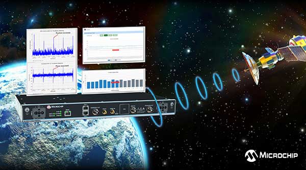
U.S. Department of Homeland Security’s live-sky testing evaluations influenced development of BlueSky GNSS Firewall Software Release 2.0
Microchip Technology Inc. has released a major software update for its BlueSky GNSS Firewall product, providing a higher level of resiliency against GPS vulnerabilities for systems dependent on GPS signal reception.
Such systems include critical infrastructure such as power utilities, financial services, mobile networks and transportation that rely on GPS-delivered timing to ensure ongoing operations.
Microchip’s BlueSky GNSS Firewall Software Release 2.0 performs real-time analysis to detect jamming and spoofing for protecting reception of the GPS signal and hardening response and recovery to avoid signal disruption.
Release 2.0 includes charting and advanced threshold settings of GNSS observables such as satellites-in-view, carrier-to-noise, position dispersion, phase time deviation and radio frequency (RF) power level to simplify system turn-up and deployment.
The release also includes improvements developed by Microchip as a result of participation in a 2019 industry live-sky testing event hosted by the U.S. Department of Homeland Security (DHS) Science and Technology Directorate.
Microchip’s participation in the DHS-hosted GPS Testing for Critical Infrastructure (GET-CI) events included scenarios with spoofed signals, and helped the company identify new solutions to prevent signal disruptions. As a result, Microchip developed the Release 2.0 to address operators’ evolving requirements.
As a leader in frequency and time systems, Microchip continuously innovates GPS signal reception security technologies for commercial and military operators similar to how network firewalls protect against virus threats. Updates are essential to defend against rapidly-evolving GNSS disruptions and enable critical infrastructure operators to avoid interruptions of service.
When connected to Microchip’s TimePictra management software, critical infrastructure operators can monitor and analyze GNSS signals in cities, across geographic regions, throughout a country and even globally.
Other complementary devices and software in Microchip’s suite of GPS systems and services include the TimeProvider 4100 Precise Timing Grandmaster with Gateway Clock, SyncServer 600/650 timing and frequency instrument, miniature atomic clock (MAC), Time Cesium and 5071A cesium primary frequency standard.