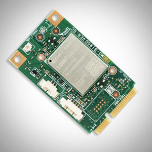
Swift Navigation‘s new Precision GNSS Module (PGM) is now available. The PGM module is designed to offer fast evaluation and a quick path to production for those requiring a precise positioning solution.
The PGM is available in a simple-to-use, industry-standard mPCIe (mini peripheral component interconnect express) format and is designed specifically for Swift’s Starling positioning engine running on a host application processor to deliver real-time precision navigation.
The PGM utilizes STMicroelectronics’ TeseoV chipset in Quectel’s multi-constellation, dual-band LG69T-AP receiver to create an affordable, easy-to-use solution for customers building industrial, last-mile and internet of things (IoT) platforms, Swift Navigation said.
The LG69T family of products, based on the ST TeseoV, is an designed for demanding precision applications that require centimeter accuracies. The LG69T-AP — supporting L1/L5 bands — has an integrated ST inertial measurement unit and processor to support dead reckoning for signal-compromised areas such as urban canyons, parking lots and underground structures.
According to Swift Navigation, this proven solution is ready for fast and easy integration and deployment — using industry-standard protocols — to reduce customer engineering investment and enable quick time to market.
This solution operates with the highest accuracy when used with Swift’s Skylark cloud-based, wide-area precise positioning service. Skylark delivers accuracy down to 10 cm. The solution supports standard RTCM OSR (Observation Space Representation) and SSR (State Space Representation) correction formats.
Skylark is available for integration into wide-area, high-precision positioning applications across the continental United States and Europe and is available in Japan, South Korea and Australia, with plans underway to expand globally. Skylark is an ever-expanding service and is scalable to service millions of users.
“We are excited to be offering the PGM utilizing the Quectel LG69T-AP receiver,” said Dave Huntingford, staff product manager at Swift Navigation. “The ability to provide a cost-effective, easily integrated solution, complete with corrections, opens up a host of opportunities for IoT, last-mile and industrial customers to benefit from precise positioning.”
“Quectel is delighted to be working with Swift Navigation to provide the market with an easy-to-use precision GNSS solution,” said Mark Murray, vice president of sales for GNSS and automotive at Quectel Wireless Solutions. “The LG69T-AP, together with Swift’s Starling positioning engine and Skylark corrections, is perfect for supporting applications and markets where <10-cm accuracy is required.”
This product is available today with full production by the first quarter of 2021; an evaluation kit is available. Contact Swift Navigation or Quectel.
GNSS positioning is highly accurate and reliable — until satellite signals are disrupted. Hexagon | NovAtel has developed SPAN technology that integrates GNSS positioning with inertial measurements for a three-dimensional understanding of position and orientation.
SPAN technology delivers accurate heading, velocity, azimuth, pitch and roll. NovAtel SPAN-enabled receivers and enclosures are effective across applications, including marine environments to monitor heave movements from waves and autonomous vehicles requiring a higher level of precision and integrity.
NovAtel has demonstrated SPAN technology’s capabilities in a sensor-fusion project alongside AImotive and STMicroelectronics. Leveraging sensors on a moving vehicle — GNSS, inertial measurements, and cameras for visual odometry — allowed the teams to produce promising results for continuous positioning on real roads, in underground parking garages, and through tunnels. NovAtel’s PwrPak7-E1 enclosure was used as a reference system in the project, gathering data to confirm the accuracy of the sensor-fusion solution.
Through this project, NovAtel and its partners validated how alternative PNT like SPAN and other sensor fusion solutions complement and extend GNSS positioning availability, accuracy, and reliability.
Swift Navigation, a firm specializing in GNSS positioning technology for autonomous vehicles, looks back on a year of progress in 2019 and forward to what’s ahead in 2020.
2019 highlights include the expansion of operations to Australia, continued Firmware Releases to improve Swift’s multi-band, multi-constellation GNSS receivers, the expansion of Skylark cloud corrections service across the United States and announcing a partnership with Arm to bring precise positioning technology to autonomous vehicle compute platforms.
While Swift is proud of these accomplishments, the company is most excited about its shift from a company providing RTK GNSS receivers to one that provides a full ecosystem of precise positioning GNSS solutions for autonomous and mass-market applications.
Swift has made it possible for customers and partners alike to incorporate Swift’s patented technology into a multitude of autonomous platforms.
From the receiver-agnostic Starling positioning engine that enables the accuracy of Swift GNSS receivers and opens it up for industry use, to cloud-based corrections delivered nationwide with Skylark, Swift is poised to bring precise positioning to those who can benefit from centimeter-level location accuracy the most — autonomous platforms and applications.
While Skylark and Starling work independently with many leading industry components and receivers, it is the two paired together that makes the precise positioning powerhouse that will make 2020 a pivotal year for Swift.
At this year’s CES, the following Swift partners and customers are showcasing how they are integrating Swift’s precision positioning solutions in their platforms:
Arm — a global leader in semiconductor IP — utilizes Starling to deliver a high-integrity, high-accuracy GNSS positioning solution enabling automotive OEMs, as well as Tier 1 and 2 auto suppliers, to integrate precise positioning into their sensor suite. Arm is hosting meetings by appointment on Level 2 of the Venetian at Veronese 2505 and Veronese 2506.
STMicroelectronics — a global semiconductor leader — provides GNSS measurement engines and ASIL-rated processors for autonomous driving and high-accuracy GNSS solutions. ST has integrated Starling on the ST ASIL-rated Telemaco Platform for OEM applications. ST is hosting meetings by appointment only at their Hospitality Suites during CES 2020.
Aceinna — a provider of sensing solutions — announced its OpenRTK330 precise positioning module at CES. The new OpenRTK330 is based on the ST TeseoV receiver and includes three ST ASM330LHH IMUs for inertial measurements. Skylark is the preferred corrections provider for the OpenRTK330 and evaluation kits. Aceinna will be demonstrating its new module in booth 6738 in the North Hall Automotive pavilion.
See Swift in action at the CES locations above or contact the Swift team at [email protected] to schedule a meeting.
A roundup of recent products in the GNSS and inertial positioning industry from the November 2019 issue of GPS World magazine.
SURVEYING & MAPPING
IMU-RTK receiver
Increases GNSS availability and reliability
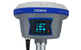
Photo: CHC Navigation
The i90 IMU-RTK GNSS series receiver is designed to dramatically increase GNSS real-time kinematic (RTK) availability and reliability. The i90 is powered by the company’s latest inertial measurement unit (IMU) and RTK technology to provide robust and accurate GNSS positioning in any circumstances. Unlike standard micro-electro-mechanical (MEMS)-based GNSS receivers, the i90 GNSS IMU-RTK combines a high-end calibration and interference-free IMU sensor with a state-of-the-art GNSS RTK engine and advanced GNSS tracking capabilities. The i90 is designed to increase the productivity and reliability of survey projects, with no complicated calibration process, rotation, leveling or accessories are necessary. A few meters’ walk will initialize the i90 internal IMU sensor and enable RTK survey in difficult field environments. The i90 GNSS automatic pole-tilt compensation boosts survey and stakeout speed by up to 20%.
Both accurate and rugged for machine control, logistics
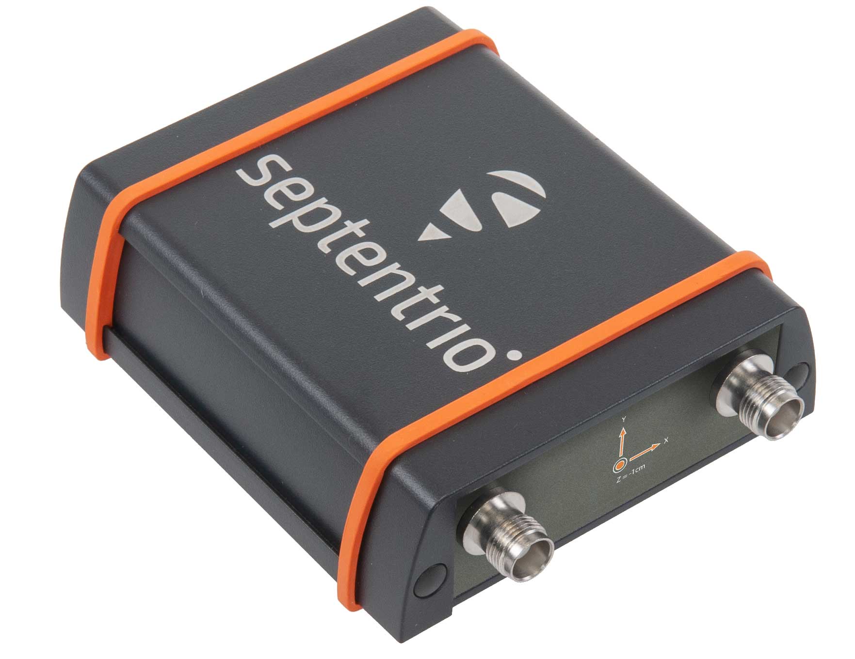
The AsteRX-SBi has a rugged housing, making it suitable for machine control and other outdoor uses. (Photo: Septentrio)
Septentrio has expanded its GNSS/INS portfolio with the AsteRx SBi, a new housed GNSS/INS receiver. The ruggedized AsteRx SBi fuses high-accuracy GPS/GNSS with a high-performance inertial sensor to provide reliable positioning and 3D orientation for machine control and logistic applications. Within its rugged, waterproof enclosure, a high-performance GPS/GNSS is coupled with an industrial-grade inertial sensor to provide high-accuracy, reliable positioning and 3D orientation (heading, pitch, roll). Offering the flexibility of either single or dual antenna, the AsteRx SBi is designed for quick and easy integration into any machine monitoring or control system. Reliable location and 3D orientation data is streamed with a high update rate and constant low latency. Septentrio’s reliable centimeter-level positioning is based on true multi-frequency, multi-constellation GNSS (GPS, GLONASS, Galileo, BeiDou, QZSS) technology.
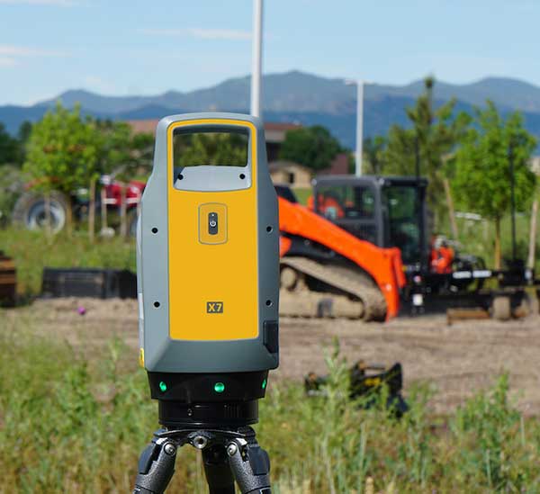
The Trimble X7 laser scanning system is designed for surveying, construction, industrial and forensic applications. It enables professionals to quickly and easily capture precise 3D scanning data to produce high-quality deliverables. The X7 features Trimble X-Drive technology, survey-grade self-leveling and a smart calibration system. It integrates streamlined workflows to provide automatic registration of point-cloud data in the field with Trimble Registration Assist, bringing scans together through self-leveling inertial measurement unit technologies and cloud-based software.
The Bluesky MetroVista range includes high-resolution imagery combined with high-accuracy, wide-scale 3D models. (Image: Bluesky)
The MetroVista city mapping service for Europe incorporates the Leica CityMapper hybrid airborne sensor designed for 3D city modeling and urban mapping. The sensor includes a vertical camera and survey-grade oblique cameras, and incorporates lidar to accurately collect elevation and infrared data. The MetroVista range includes high-resolution imagery combined with high-accuracy, wide-scale 3D models. CityMapper has already been used to capture MetroVista data for cities across the United Kingdom, including London, Manchester, Newcastle and Bristol.
The enhanced GSS9000 series GNSS constellation simulator has been updated to provide significantly improved capability, flexibility and performance to meet the test needs of high-performance navigation systems. It doubles the number of supported channels (320 in a single chassis) while maintaining its full performance specification in key areas such as signal iteration rate and low latency under maximum signal dynamics. These attributes, together with the ability to produce a comprehensive range of emulated multi-GNSS, multi-frequency RF signals, enables full and future-proofed testing of advanced applications. Greater signal flexibility is also built into the enhanced GSS9000 through its open application program interface (API) and flexible architecture. This delivers a highly sophisticated arbitrary waveform generator (AWG) capability.
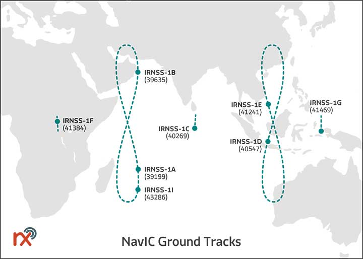
Rx Networks has added NavIC constellation support to its real-time and predicted-assistance data service. The company’s technology partners — semiconductor vendors, mass-market mobile device manufacturers and network operators — now have global support for all satellite navigation systems and L1 satellite-based augmentation systems (SBAS) for any region around the world. Used daily by more than two billion devices, Rx Networks data is delivered via ephemeris in RINEX and via the Location.io interface, with predictions in SP3. Predictions for NavIC via the Location.io platform will be added in the first quarter of 2020.
Endura micro-electro-mechanical system (MEMS) timing solutions are designed for aerospace and defense applications including precision GNSS. They provide high performance in harsh conditions such as severe shock, vibration and extreme temperature. SiTime offers customers 5 million possible part numbers that can be created from 17 programmable products. Solutions accommodate 4 parts per trillion per g force of acceleration (50 times better than quartz); support for –55° C and +125° C operation; timing specifications conforming to MIL-PRF-55310; and Endura Super-TCXOs (temperature compensated oscillators) for use in GNSS applications.
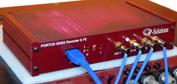
Portos Team paired with the Ninja. (Photo: IP-Solutions)
Portos Team is a new GNSS RF signal record-and-playback system. It can record and play back — or simulate —multi-frequency, multi-system GNSS signals when paired with the company’s Replicator. It can do the same for CRPA signals when paired with the company’s Ninja. The Portos itself can also operate as multi-frequency or CRPA front end for a GNSS software receiver.
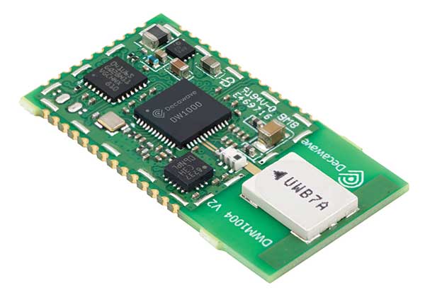
The DWM1004 module targets time difference of arrival (TDoA) tag applications that require years of battery life and a compact design. Based on the DW1000 chipset, the DWM1004C offers high-accuracy, real-time-location capability with a 6.8-Mbps data rate. It delivers more than five years of battery life. Real-time location systems (RTLS) enable managers to have a real-time view of their operations through data collected from connected objects such as tools, pallets, forklifts, badges and collars. The DW1000 is immune to multipath fading, with 2-centimeter precision in indoor environments.
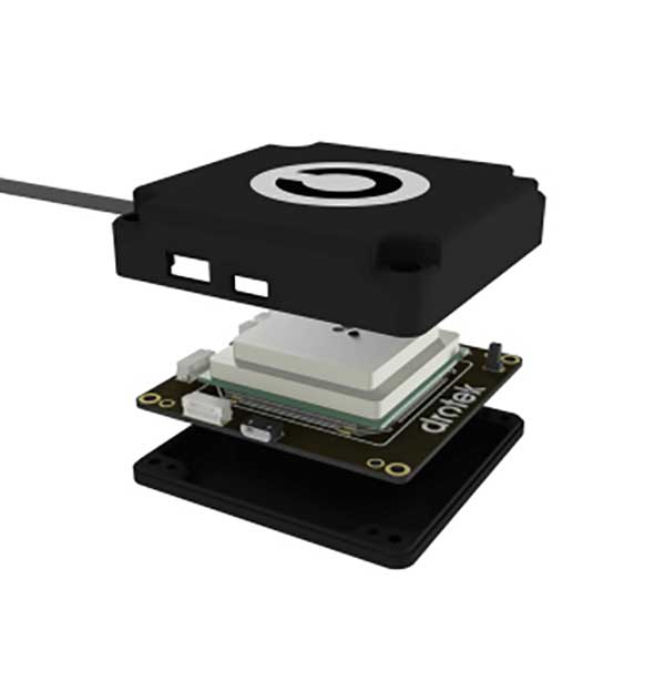
The F9P Sirius RTK GNSS rover is designed to be mounted on a moving vehicle. The u-blox ZED-F9P module inside provides 1-cm position accuracy, a convergence time under 10 seconds and a navigation update rate up to 20 Hz. The rover has a built-in active antenna patch. It receives GPS, Galileo, Beidou and GLONASS signals, providing additional accuracy. It is designed to fit most setup designs as well as integrate easily into a vehicle. Its six-pin JST-GH connector makes it plug-and-play with the Pixhawk Pro 3 autopilot.
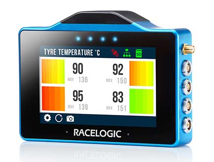
The VBOX Touch is a highly flexible GNSS datalogger with enhanced accuracy. The powerful hardware can be used diverse automotive tests such as acceleration, braking, speed verification, tire temperature monitoring, lap-timing and durability. The VBOX Touch comes preloaded with a sophisticated performance application that covers common use cases; applications can be downloaded from an online library. Racelogic can also write custom Python scripts based on customer requirements.
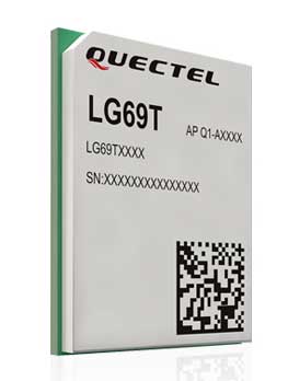
The LG69T GNSS module is an automotive-grade dual-band high-precision GNSS module that integrates dead-reckoning (DR) and real-time kinematic (RTK) technologies. The module facilitates open-sky positioning performance with an accuracy of up to 10 centimeters. It supports next-generation precision positioning capabilities for smart vehicles and autonomous driving scenarios. The LG69T module is based on ST’s STA8100GA, the latest automotive-grade dual-frequency positioning chip with 80 tracking channels and four rapid-acquisition channels compatible with GPS, BeiDou, Galileo, Navic and QZSS. The AEC-Q100-qualified dual-band module integrates multi-band RTK technology for centimeter-level accuracy. The LG69T module’s dead-reckoning capabilities feature an integrated inertial measurement unit (IMU) that provides continuous high-precision positioning.
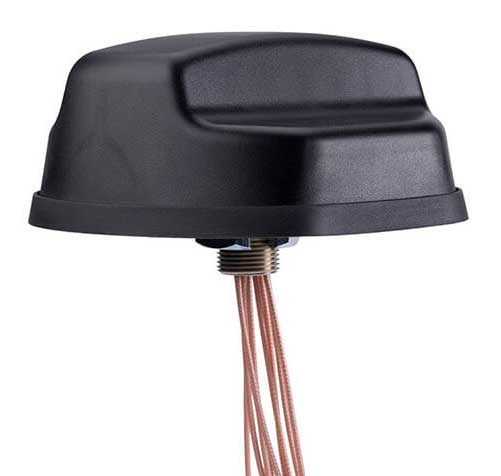
The Coach II antenna with GNSS L1/L2/L5 is designed to provide greater precision and reliability for advanced rail communications systems, enabling next-generation positive train control (PTC) and passenger Wi-Fi. The Coach II features global multi-GNSS compatibility, dual-port 4G LTE / sub-6 GHz 5G NR and 802.11ac Wi-Fi / Bluetooth connectivity. It is AAR compliant for railway applications and is IP67-rated.
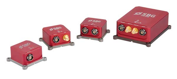
Includes new automotive package for Ellipse GNSS/IMU products
Photo: SBG Systems
New features have been added to the Ellipse product line with firmware update version 1.7. The update better answers needs of the autonomous testing and driving markets such as a CAN odometer. Users now have the choice to connect an external odometer (DMI) with pulses or use their car odometer with velocity information. New outputs include body velocity and slip angle, which calculate the drift angle between the vehicle’s assumed trajectory and its actual trajectory. For precision applications as well as low dynamics and reduced warm-up time, the new firmware allows users to run the Ellipse Kalman filter with no lever-arm estimation. This will ensure centimeter pass-to-pass accuracy for real-time kinematic (RTK) applications and allow operation in lower dynamics while reducing warm-up time. The firmware update also provides new features for advanced marine applications.
STMicroelectronics has grown its GNSS product offering with the Teseo-LIV3R ROM-based module. The module provides ST’s full GNSS algorithm capability for cost-conscious tracking and navigation devices.
ST’s new GNSS module provides odometer functionality with three trip counters and reached-distance alert, along with geofencing capabilities with up to eight configurable circles and crossing-circles alarm. Support for real-time assisted GNSS with free server access ensures uninterrupted positioning data for dependable navigation.
Simultaneous tracking of GPS, GLONASS, BeiDou and QZSS constellations, with satellite-based augmentation system (S-BAS) and Radio Technical Commission for Maritime Services (RTCM) V3.1 differential positioning ensures excellent accuracy to within 1.5 meters (50% circular error probability, CEP).
Tracking sensitivity of -163 dBm and time-to-first-fix faster than one second ensure high performance for demanding applications. The module is easy to use and responds to proprietary National Marine Electronics Association (NMEA) commands.
With scalable power consumption according to accuracy, average current, and frequency of fixes, a sub-15µA standby mode with RTC backup, and support for multiple low-power modes, Teseo-LIV3R is an ideal choice for battery-sensitive applications. The low-power modes include continuous-fix with adaptive and power-saving cycled modes, periodic-fix with GPS only, and fix-on-demand with the device in permanent standby.
To simplify and accelerate new-product development, the module is FCC certified and is supported by the STM32 Open Development Environment. STM32 applications for advanced geolocation, smart tracking, and server-assisted GNSS are available, while the EVB-LIV3x evaluation board and X-NUCLEO-GNSS1A1 expansion board provide a head-start with hardware. The Teseo Suite PC tool helps easily configure settings and fine-tune performance. Developers can also join the ST GNSS community to share information and increase their understanding of the field.
The Teseo-LIV3R is in volume production. The 9.7mm x 10.1mm LCC18 module is priced from $7.3 for orders of 1,000 pieces.
STMicroelectronics (ST) and Virscient are collaborating to enable faster delivery of connected-car systems with ST’s Telemaco3P automotive application processors. Virscient offers support to ST customers in the development and delivery of advanced automotive applications based on the ST Modular Telematics Platform (MTP).
STMicroelectronics is a global semiconductor leader serving customers across the spectrum of electronics applications. Virscient is a provider of hardware and software development services and support for customers building automotive solutions using ST’s Telemaco3P secure telematics and connectivity processors.
Virscient’s connected-car systems rely on technologies such as GNSS (precise positioning), LTE/cellular modems, V2X technologies, Wi‑Fi, Bluetooth and Bluetooth Low Energy.
MTP is a comprehensive development and demonstration platform incorporating ST’s Telemaco3P telematics and connectivity microprocessor. MTP enables the rapid prototyping and development of smart-driving applications, including vehicle connectivity to back-end servers, road infrastructure and other vehicles, the companies said.
The Telemaco3P incorporates Dual-Arm Cortex-A7 processors with an embedded hardware security module (HSM), an independent Arm Cortex-M3 subsystem, and a set of connectivity interfaces. With security at its core, and considerable flexibility in both hardware and software configurations, the Telemaco3P provides an excellent platform for connectivity within the vehicular environment.
“We chose to collaborate with Virscient for Telemaco3P-based designs because of their differentiated expertise in the development of embedded systems and wireless technologies, and their proven track record of helping customers take connected products from concept to market,” said Philippe Prats, head of EMEA marketing and application for STMicroelectronics’ automotive and discrete products. “The Telemaco3P platform enables our customers to deliver new categories and products in automotive telematics. By working with Virscient, we make this exciting technology accessible to a broader range of innovative companies.”
Commenting on the collaboration, Dr. Murray Pearson, CEO of Virscient, said, “We’re thrilled to work with STMicroelectronics to enable more companies to deliver innovative and market-leading platforms using the Telemaco3P devices.”
“ST and Telemaco3P are setting the security standard for processor and connectivity solutions in vehicular telematics. By leveraging Virscient’s hardware and software development capabilities, and our considerable experience with embedded wireless and connectivity technologies, Telemaco3P customers can push the envelope, and get their products to market quicker than ever.”
ST and Virscient are exhibiting the Modular Telematics Platform within the ST Automotive Telematics Ecosystem at Embedded World, ST stand (Hall 4A-138), Feb. 26-28, in Nuremberg, Germany.
Global semiconductor company STMicroelectronics has signed an agreement to acquire a majority stake in Swedish silicon carbide (SiC) wafer manufacturer Norstel AB.
After closing the deal, ST will control the entire supply chain for a portion of its SiC devices at a time of constrained global capacity and positions itself for a significant growth opportunity, ST said in a press release.
ST will acquire 55 percent of Norstel’s share capital, with an option to acquire the remaining 45 percent subject to certain conditions, which, if exercised, will result in total consideration of $137.5 million, funded with available cash.
“ST is the only semiconductor company with automotive-grade silicon carbide in mass production today,” said Jean-Marc Chery, president and CEO of STMicroelectronics. “We want to build on our strong momentum in SiC, both in volume and breadth of applications for industrial and automotive, targeting continued leadership in a market estimated at more than $3 billion in 2025.
“The acquisition of a majority stake in Norstel is another step forward strengthening our silicon carbide ecosystem: it will boost our flexibility, improve yield and quality, and support our long-term silicon carbide roadmap and business.”
Norstel, headquartered in Norrkoping, Sweden, was founded in 2005 as a spinoff of Linköping University. It develops and manufactures advanced 150-mm silicon carbide bare and epitaxial wafers.
A roundup of recent products in the GNSS and inertial positioning industry from the November 2018 issue of GPS World magazine.
OEM
Simulator signals
GPS L5 and Galileo E5 added to simulator
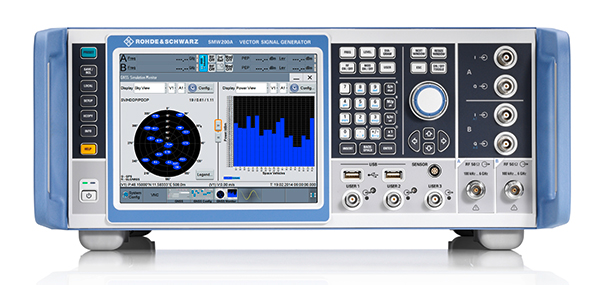
Photo: Rohde & Schwarz
Rohde & Schwarz has added GPS L5 and Galileo E5 simulation capabilities to its R&S SMW200A GNSS simulator. The R&S SMW200A GNSS simulator is designed for efficient test and characterization of multi-constellation and multi-frequency GNSS receivers. It now enables generation of complex and highly realistic test scenarios with up to 144 channels in the GNSS frequency bands L1, L2 and L5. In addition to GPS (L1/L2/L5), GLONASS (L1/L2), Galileo (E1/E5) and BeiDou (L1/L2), the R&S SMW200A also supports signal generation for QZSS and SBAS on L1. Channels can be routed to up to four RF outputs, so that even multi-antenna systems can be tested. The R&S SMW200A can generate complex coexistence and interference scenarios with multiple interferers.
The BlueSky GNSS Firewall enables critical infrastructure providers to harden the security of their operations from GPS threats and deliver a more reliable and secure service. The security-hardened system provides protection against GPS threats such as jamming, spoofing and complete outage. It also supports a range of precision timing technologies, including atomic clocks, to enable continuous operation when GPS may be completely denied for extended periods. The TimePictra software management suite provides centralized control and visibility of GPS reception across regional, national and global geographic areas. It can incorporate an optional internal miniature atomic clock.
For reference deployments, CORS networks and monitoring
The VeraChoke GNSS antenna. (Photo: Tallysman)
The VeraChoke is a high-accuracy choke ring antenna with a choice in form factor for reference and monitoring applications. The VC6100, the first model variant of the VeraChoke, shares a common high-efficiency element design with its counterpart VeraPhase. With the choke-style form-factor, however, the rings have been optimized for all GNSS signals and are slightly pyramidal in shape to improve reception of low-elevation satellites. The VC6100 offers a tight phase center variation (PCV) of no more than ±1 mm for every frequency. It is capable of receiving all GNSS signals, and achieves a very low axial ratio. The antenna also supports large and small SCIGN radomes.
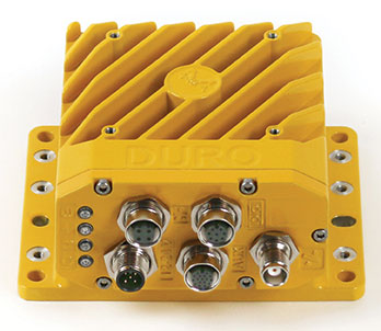
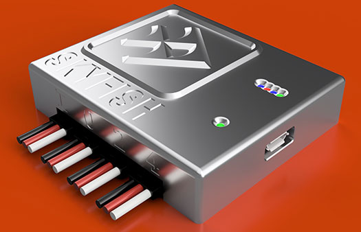
Duro Inertial is a ruggedized version of Swift Navigation’s Piksi Multi dual-frequency real-time kinematic (RTK) GNSS receiver combined with Carnegie Robotics’ SmoothPose sensor fusion algorithm, which fuses GNSS and inertial measurements into a combined solution. The blending of GNSS and inertial measurements provides a dead-reckoning capability that allows Duro Inertial to provide a highly accurate, continuous position solution during brief GNSS outages and to deliver a robust precision navigation solution in harsh GNSS environments.
The durable Instinct has GNSS; three-axis compass; barometric altimeter; and wrist-based heart-rate sensor. The watch includes a built-in sports apps, smart connectivity and wellness data. It is built to endure challenging environments, and is constructed to military standards for thermal, shock and water resistance. The multi-GNSS feature helps users track their location in challenging environments, while the Garmin Explore app helps plan and track a trip.
The Navsight Land & Air Solution provides high-performance inertial navigation to make surveyors’ mobile data collection easier, whether for mobile mapping, GIS or road inspection. The solution consists of an inertial measurement unit (IMU), available at two different performance levels, connected to Navsight, a rugged processing unit embedding fusion intelligence and a GNSS receiver. It also has connections for external equipment such as lidar, cameras or computer. SBG’s fusion algorithms allow the company to get the best performance from inertial, odometer and GNSS technologies; exclude false GNSS fixes; and improve the trajectory in complicated areas such as urban canyons, forests and tunnels. The solution supports all GNSS constellations, and real-time kinematic (RTK) and precise point positioning services such as Omnistar and TerraStar.
iSTAR Pulsar is designed to capture 360-degree data while mounted on a vehicle, drone or on foot. An upcoming feature in cloud-based processing software VR.WORLD uses artificial intelligence and image recognition to analyze the images captured by iSTAR Pulsar so that objects like cars, trucks, traffic lights, road signs, pedestrians and cyclists can be automatically identified in images. Handheld 3D mobile mapping company GeoSLAM and mobile mapping software company Orbit GT have introduced integration with iSTAR Pulsar.
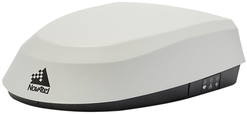
The SMART7 family features NovAtel’s GNSS + inertial navigation system (INS) SPAN technology; future-ready GNSS; Wi-Fi and internet protocol connectivity; superior tracking performance; and TerraStar-C PRO corrections. It is designed to increase GNSS availability, accuracy and reliability for major precision-agriculture equipment manufacturers. The SMART7-S includes SPAN technology, the SMART7-W includes Wi-Fi and an integrated NTRIP client, and the SMART7-I model also incorporates Ethernet. All SMART7 models provide exceptional positioning availability using signals from all constellations and frequencies to deliver assured positioning anywhere.
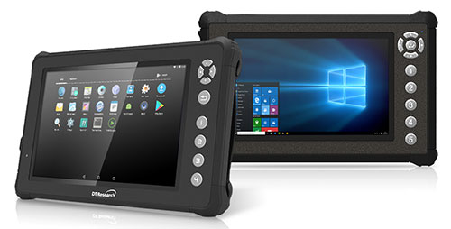
The DT301X rugged military-grade tablet is purpose-built to enhance the precision of 3D surveying, crime and crash scene reconstruction, and bridge and other construction inspections. An option is a dual-frequency GNSS module for real-time mapping and positioning. The tablet integrates the Intel RealSense depth camera, which provides real-time 3D imaging providing accurate measurements for CAD, engineering, design, utility management and crime-scene forensics. A high brightness 10.1-inch touchscreen offers flexible viewing in a wide range of lighting, and an Intel eighth-generation Core i5 or i7 processor offers high-performance while still being energy efficient. With high-capacity 60- or 90-watt hot-swappable batteries, the DT301X keeps working continuously, complemented with a variety of battery chargers so fully charged batteries are always available.
The Cedar CP3 rugged smartphone is capable of data collection and communication. It has a high-visibility 5.5-inch AMOLED display; 14- to 16-hour battery life operating at full brightness and running GPS; 16-megapixel user-facing camera and dual 12-megapixel rear camera; and 6 gigabytes of RAM with 64 gigabytes of internal storage.
Parachute rescue system DRS-5 is designed for multicopters up to 8 kg; the DRS-10 for multicopters weighing 5–20 kg. The system consists of a carbon cage in which the parachute is stored as well as associated electronics. The electronics, including the sensors, monitor the flight status of a drone independent of the flight controller. A sophisticated algorithm merges this sensor data, enabling automatic crash detection and parachute ejection. All flight data and movements are recorded in a black box.
PrecisionPass assesses UAV data collected in the field. The toolkit lets pilots quickly determine if a data-collection job meets the required criteria or if it needs to be collected again. PrecisionPass assesses coverage, assesses image resolution and quality, reviews required metadata, speeds upload and processing times, and packages data for processing. The immediate feedback reduces the risk of failures during the analysis stage, all but eliminating the need to re-fly a mission, so customer needs are met in a timely and cost-efficient manner.
The Skyfish computing platform fully automates crucial infrastructure inspection and measurement tasks. It supports DJI and PixHawk flight controllers and other drone architectures, as well as 3D modeling software from companies such as Bentley Systems. Its easy-to-use interface enables anyone to fly, inspect and model complex infrastructure. The platform also pre-processes the collected infrastructure data and metadata to help create impeccable 3D models.
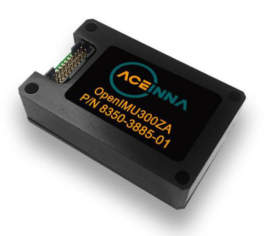
OpenIMU is a professionally supported, open-source GPS/GNSS-aided inertial navigation software stack for low-cost precise navigation applications. Integrating an inertial measurement unit (IMU)-based sensor network improves navigation and self-location capabilities. It is aimed at developing autonomously guided vehicles for industrial applications, autonomous cars, industrial robots and drones. OpenIMU enables advanced localization and navigation algorithm solutions; its extensible software infrastructure provides the code needed for algorithm development. A hardware development kit includes JTAG-pod, precision mount fixture, EVB and an OpenIMU300 module that features Aceinna’s 5 deg/hr, 9-Axis gyro, accelerometer and magnetometer sensor suite with an onboard 180-MHz ARM Coretex floating-point CPU.
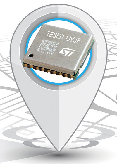
The Teseo-LIV3F module incorporates the Teseo III receiver. It speeds application development and adds up to 16 MB of Flash memory for firmware updating or data logging without a backup battery. Used by automotive and industrial sectors, the Teseo III multi-constellation receiver combines high accuracy with fast response time and low power consumption. The Teseo-LIV3F module enables makers and small engineering teams to leverage the Teseo III advantages in creating new products in the industrial and consumer market segments such as vehicle trackers, drones, anti-theft devices and pet locators, and systems for services such as fleet-management, tolling, vehicle sharing or public transportation.
Audi’s latest e-tron electric car will launch in Europe with a digital rear-view system. Developed by Ficosa, the camera monitoring system is made up of cameras and displays that replace traditional external side mirrors to increase safety and comfort. The vision system is comprised of two cameras, integrated into the sides of the car’s chassis, and two tactile displays inside the doors.
New connected-car automotive microcontroller (MCU) enables secure remote updates and high-speed in-vehicle networking.
Image: STMicroelectronic
STMicroelectronics (ST) has launched a new flagship SPC58 H Line as part of its Chorus series of automotive microcontrollers (MCUs).
The new line can run multiple applications concurrently to allow more flexible and cost-effective vehicle electronics architectures.
The SPC58 H line has three high-performance processor cores, more than 1.2MB RAM and powerful on-chip peripherals, the company said.
As critical vehicle powertrain, body, chassis and infotainment features increasingly become defined by software, securely delivering updates such as fixes and option packs over the air (OTA) enhances cost efficiency and customer convenience, the company said.
With high security and large on-chip code storage, ST’s Chorus automotive microcontroller is a gateway/domain-controller chip capable of handling major OTA updates securely.
Two independent Ethernet ports provide high-speed connectivity between multiple Chorus chips throughout the vehicle and enable responsive in-vehicle diagnostics. Also featuring 16 CAN-FD and 24 LINFlex interfaces, Chorus can act as a gateway for multiple ECUs (electronic control units) and support smart-gateway functionality via 2 Ethernet interfaces also on-chip.
“The way carmakers create, configure, deploy and maintain new vehicles is changing, as software-defined functionality makes advanced features, flexibility and convenience ever more widely accessible,” said Luca Rodeschini, microcontroller business unit director at STMicroelectronics. “Our latest and highest-performing Chorus microcontroller, being OTA-ready and with dual Ethernet ports up to Gigabit speeds, creates a state-of-the-art platform for seamless, safe and secure in-car connectivity and control.”
To protect connected-car functionalities and allow OTA updates to be applied safely, the new Chorus chip contains a Hardware Security Module capable of asymmetric cryptography. Being EVITA Full compliant, it implements industry-leading attack prevention, detection and containment techniques.
Some customers have received samples of the SPC58 Chorus H Line microcontrollers in the next generation of smart gateways and central body modules, and are also evaluating the devices for battery-management units and ADAS safety controllers.
Karamba Security, a provider of automotive cybersecurity, and STMicroelectronics (ST), a global semiconductor company, are integrating Karamba’s Carwall end-to-end protection on the ST Telemaco3P STA1385 Automotive Telematics and Connectivity Processor.
Together, ST and Karamba are leveraging the security architecture of the Telemaco3P with the addition of Carwall Electronic Control Unit (ECU) hardening software.
The combined solution provides cyber security features for both contents and run-time integrity verification by detecting attempts at modifications and preventing deviations from the ECU’s intended behavior, the companies said.
Karamba Security’s deterministic approach has shown to prevent vehicle cyberattacks with zero false positives.
“STMicroelectronics is a leading provider in the connected-car ecosystem,” said Ami Dotan, Karamba Security’s co-founder and CEO. “We are pleased to collaborate to protect automotive systems based on ST’s Telemaco3P microprocessor by automatically hardening them against cyberattacks to assure consumer safety.”
“Karamba Security’s differentiated cyber-prevention solutions have generated significant market traction in a very short time and are a strong fit to enhance the security and value of ST’s Telemaco3P architectures,” said Antonio Radaelli, director of STMicroelectronics’ Infotainment, Automotive Digital Division. “Karamba’s Carwall adds another layer of security to the Telemaco3P benefits, which include its state-of-the-art power-efficient design, fast connectivity interfaces, domain isolation, and embedded Hardware Security Module. The combination provides customers with even stronger cybersecurity protection for in-vehicle systems.”
For more information, visit STMicroelectronics’ booth at Electronica Munich on Nov. 13-16 in C3 Stand 101, where ST and Karamba will be available to discuss this joint security solution.
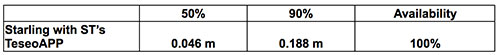
The mixed urban environment in San Francisco, where Starling + the TeseoAPP was tested and data collected and processed in real time. (Image: Swift Navigation)
The Starling modular and portable GNSS high-precision positioning engine leverages Swift’s Skylark Cloud Corrections Service. An advanced GNSS processing engine, Starling enhances measurements from commercially available GNSS receivers to provide true precision and integrity capabilities, the company said.
Starling is GNSS-receiver agnostic and works with a variety of automotive grade GNSS chipsets and inertial sensors, offering automotive companies choices in selecting the best components for their autonomous sensor suite, vehicle-to-vehicle (V2V) applications and automated driving systems.
In a test drive in California, Swift showcased the integration of Starling onto ST’s Telemaco3P MPU-based modular telematics platform with on-board TeseoAPP, confirming the accuracy of the combined solution as a compelling offering for safety-critical autonomous-vehicle positioning when ST makes production TeseoAPP chipsets available in 2019.
A new GPS + IRNSS module is being developed by Indian firm Ramakrishna Electro Component (REC) in partnership with STMicroelectronics and Shanghai Mobiletek, according to press reports.
The module will rely heavily on the Indian navigation satellite constellation IRNSS (also known as NaVIC), REC Managing Director Shivang Luthra told reporters at an event in New Delhi.
“There have been dependency of imported GPS module which use the U.S., European or Russian satellites,” Luthra said. “We have developed a GPS module, Utraq, that will mainly use the Indian satellites for GPS navigation.”
The module will be produced at a Shanghai Mobiletek factory in China, and the chips will be made by STMicroelectronics. REC owns the Utraq module and will roll it out in October for use in automotive end products. REC says the low cost of the chip compared to imports will make trackers more affordable in India.
The Indian government has mandated use of vehicle location tracking devices and one or more emergency buttons in public transportation vehicles; the mandate took effect April 1.
Utraq will be offered in two models: the L110 GNSS is a compact NavIC module, while the L100 GNSS module is a smaller-sized (patch on top) IRNSS module. Both modules can be used for tasks other than tracking, such as ranging, command, control and timing, and fo marine, aerial and terrestrial navigation.