Tag: Swift Navigation

  • Age of acceptance: Retirement communities embrace driverless shuttles

    Age of acceptance: Retirement communities embrace driverless shuttles

    Two companies have integrated GPS/PNT tech into a growing autonomous vehicle market: driverless shuttles for retirement communities. Powering the service, a cloud-based GNSS corrections system delivers centimeter-level accuracy without deploying and maintaining a GNSS network. This leading-edge application targets autonomy at scale and enables high-precision positioning for mass-market automotive and autonomous vehicle applications.

    Photo: Voyage
    Photo: Voyage

    For many seniors, retirement communities offer the best of both worlds: the freedom to live in their own homes and access to immediate assistance when they need it.

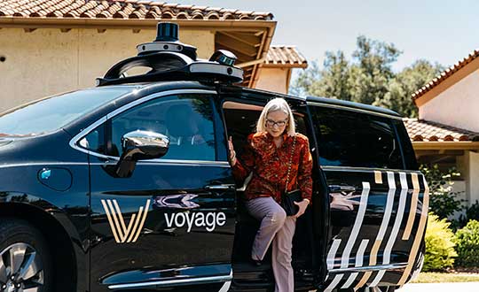
    Driverless cars are an option several retirement communities have embraced to better serve residents who no longer have the ability or desire to drive, but want to retain the ability to come and go as they please.

    “Autonomous vehicles are a great fit for any community where the environment is well-understood, less complex than dense urban areas, and the transportation demand is high,” said Justin Erlich, vice president of strategy, policy and legal for Palo Alto, California-based Voyage, a company that employs existing technology to develop fleets of autonomous vehicles. “Retirement communities satisfy all of these characteristics.”

    Serving Seniors

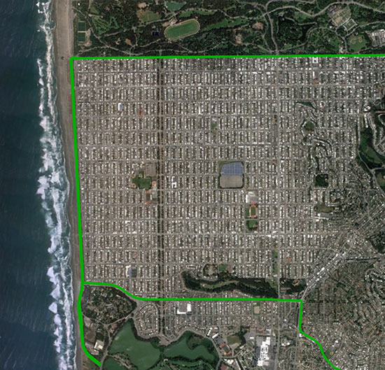
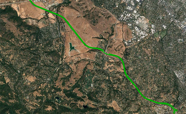
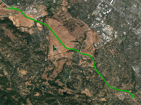
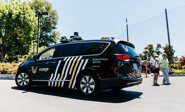
    Voyage deployed driverless shuttles to serve 130,000 retirees at The Villages, a massive retirement community encompassing more than 50 square miles in Sumter County, Florida.

    “The community’s residents enjoy an extremely active lifestyle, but often face challenges getting around,” Erlich said. “Autonomous vehicles are perfectly suited to meet this demand.”

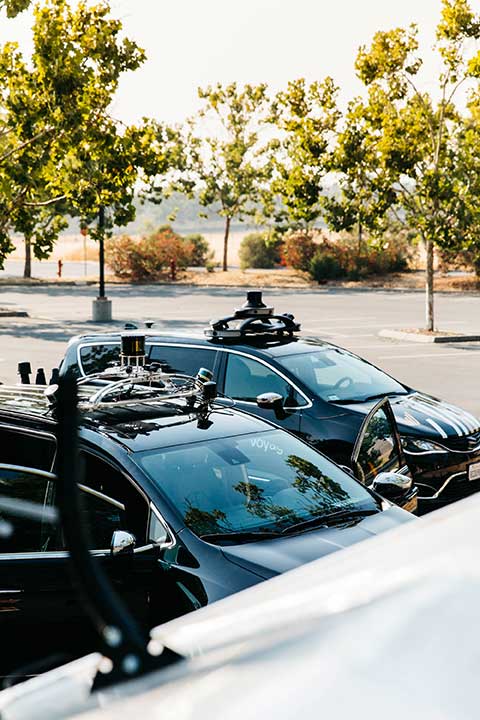
    The six vehicles in the fleet stay within the confines of the retirement community, where all roads have been precisely mapped, speed limits are lower and traffic patterns are more clearly defined than in a typical city. The vehicles travel over a network of roads that span 750 miles.


    THE VILLAGES

    Location: Sumter County, Florida
    Area: 50 square miles
    Road span: 750 miles
    Number of retiree residents: More than 130,000
    Number of Voyage autonomous vehicles: 6


    To request one of Voyage’s autonomous vehicles, a resident can summon the shuttle on-demand with a smartphone. Voyage is working with residents on the possibility of using other shuttle-request options, including text messages, phone calls and well-marked pickup zones in crowded downtown areas, Erlich said.

    All passengers ride with Voyage safety drivers in the front seat. The drivers take note of any “events” during rides so Voyage can investigate how to improve the riding experience.

    Photo: Voyage
    Photo: Voyage

    Eventually, residents will be the only passengers in the vehicles. If they need assistance during a ride, they will be able to communicate with remotely located Voyage employees, Erlich said.

    Testing and rolling out fleets of driverless vehicles in private communities like The Villages allows Voyage to develop and perfect the autonomous vehicle technology it uses. As a result, the company can deliver the service to new clients in mere months.

    Voyage, which has been working on its autonomous technology for more than two years, uses daily customer feedback to constantly adjust to its technologies to better serve riders.

    “Feedback collected during test drives is one of the biggest factors in shaping our technology roadmap,” Erlich said. “Driving data — collected across all sensors and traffic scenarios — is automatically processed each night, highlighting interesting ‘events’ for our engineering team to analyze and review.”

    During Voyage’s beta test process at The Villages, residents applied to be part of the company’s Pioneer Program for early access to the autonomous vehicles and the ability to offer feedback early on. Riders who test the service complete scorecards after each trip to help improve the experience for all riders.


    Europe Takes the Lead

    (Tire photo: iStock.com / TANAPHONG)
    (Tire photo: iStock.com / TANAPHONG)

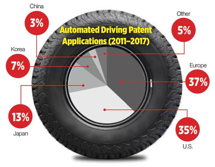
    Autonomous vehicle technology is taking off in Europe, shows a study published by the European Patent Office and conducted with the European Council for Automotive Research & Development. From 2011 to 2017, European patent applications related to automated driving increased 20 times faster than other technologies in recent years. The “Patents and self-driving vehicles” study reveals automated driving patent applications at the European Patent Office rose 330%, compared with 16% for all technologies during the same time.


    “As one of the only self-driving car companies that are picking up actual passengers as a part of our Pioneer Program, we believe we can learn a lot from the feedback we hear from our initial Pioneer riders as we try to make this the best service for The Villages,” said Oliver Cameron, co-founder and CEO of Voyage. “We are excited to see so much interest from other residents to become a part of this program.”

    When developing autonomous technology, safety is Voyage’s top priority, Erlich said. Every change to the hardware and software used undergoes a multi-stage validation process. Company engineers perform “on-desk” tests of every change using unit tests, functional tests and a driving simulation environment. Then, an operations team runs suites of real-world traffic and validation tests in a completely controlled environment at a closed-course testing facility in San Jose, California

    “Voyage makes extensive use of simulation testing and closed-course validation before any of our vehicles are driven in our partner communities,” Erlich said. “All changes must pass these closed-course tests before making their way onto the roads of our partner communities.”

    Vehicle design also ensures riders stay safe. “Our fleet vehicles have been designed with multiple levels of safety redundancies for braking, steering and power, and leverage an advanced diagnostics system to automatically detect anomalies and safely stop the vehicle,” he explained. “In addition, we have developed a remote teleoperations solution that allows the vehicle to request additional help when a driver is not physically in the vehicle.”

    Skylark provides high-precision localization. (Image: Swift Navigation)
    Skylark provides high-precision localization. (Image: Swift Navigation)

    Making Autonomous Work

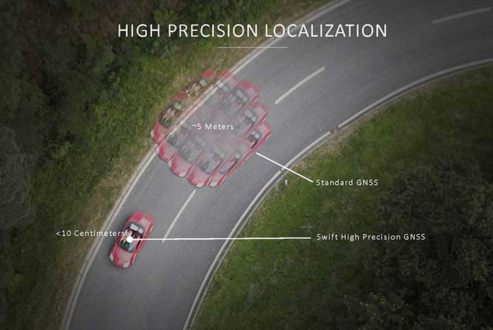
    When building an autonomous system, localization — knowing exactly where you are in the world — is critical. Erlich said it’s often difficult to estimate your position within an accuracy of several feet when using more traditional GPS solutions.

    “For autonomous driving, you need to be able to estimate within several centimeters,” he added.
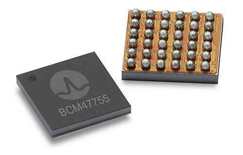
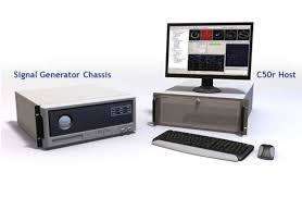
    Voyage uses Swift Navigation’s GNSS receivers and Skylark network as one of the primary inputs into its localization solution.

    Swift Navigation is a San Francisco-based tech firm that develops GPS technology to power autonomous vehicles. It is working to extend the Skylark network across the contiguous United States, and then plans to expand globally.

    “Coupled with high-definition maps, odometry sensors and other inputs, we’ve been able to use Swift Navigation’s differential GPS solution to achieve the localization results we needed to deliver a true autonomous driving service,” Erlich said.

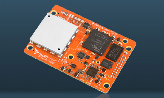
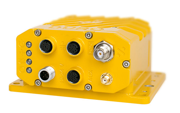
    Voyage’s autonomous vehicles are equipped with a suite of sensors on their roof racks that includes the Swift Navigation Piksi Multi GNSS receiver, lidar devices, cameras, radar and an inertial measurement unit. They create and constantly update a 3D map of the vehicle’s surroundings.

    Duro – Piksi enclosure. (Photo: Swift Navigation)
    Swift Navigation’s Duro is one of two GNSS receivers Voyage uses for its autonomous vehicles. (Photo: Swift Navigation)

    A computer in the trunk integrates all sensor signals and uses the vehicle’s Controller Area Network (CAN) bus to operate steering, braking and other functions.

    Skylark, Swift Navigation’s cloud-based GNSS corrections service, provides Voyage’s autonomous vehicles with precise positioning to eliminate the complexity of deploying and maintaining GNSS networks.

    Skylark offers a plug-and-play experience that delivers convergence times measured in seconds. Its positioning algorithms provide a continuous data stream to individual devices from the cloud. This data stream allows for quick positioning and high reliability and availability.

    The correction service enables receivers to connect to a constantly adapting, cloud-based model to obtain GNSS observations. Dependence on base stations in each area of deployment is eliminated, increasing the geographic area in which they can travel. Skylark works seamlessly with both of Swift Navigation’s GNSS receivers — Piksi Multi and Duro.

    In addition to Piksi Multi and Duro, Voyage uses third-party receivers and microprocessors that benefit from the lane-level positioning Skylark delivers.


    Equipment Specs

    Photo: Swift Navigation
    Photo: Swift Navigation

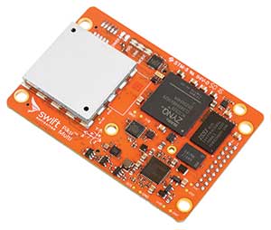
    GNSS receiver one. Swift Navigation — Piksi Multi
    • Dual-frequency and multi-constellation
    • Up to 20-Hz solution rates
    • Raw data outputs from on-board MEMS IMU
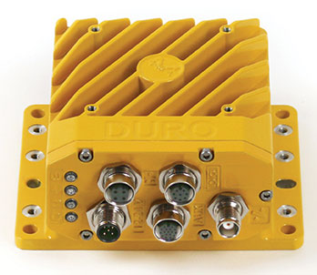
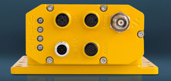
    GNSS receiver two. Swift Navigation — Duro
    • IP67 rated
    • Centimeter-level positioning
    • Raw data outputs from on-board MEMS IMU
    Lidar devices. Velodyne — VLS-128
    • 128 channels
    • Up to 300-meter range
    • Up to 360-degree surround view
    Cameras. iDS — Global-Shutter units
    Proximity sensors. Chrysler OEM
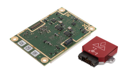
    Inertial measurement unit. Xsens — MTi-300
    • 375-Hz bandwith for accelerometers
    • 415-Hz bandwith for gyroscopes
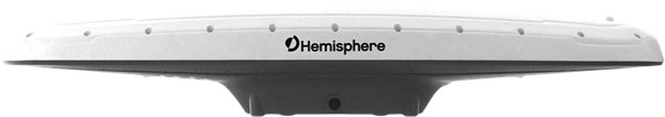
    Antenna. Swift Navigation — Mini-survey for the Duro RTK unit
    • 1 L1/L2 GPS/GLONASS/BeiDou mini-survey


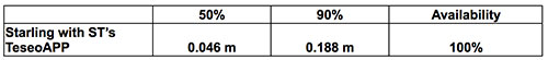
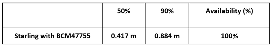
    The Swift product suite delivers centimeter-level localization —important to riders who may have mobility issues that require vehicles with smooth starts and stops.

    Skylark was built specifically to deliver the speed, security, precision and reliability demanded by automotive manufacturers with autonomous and safety applications architected to support ASIL-rated (Automotive Safety Integrity Level) systems.

    Because Skylark is a network, it is fault tolerant. In the unlikely event an individual cloud reference station goes offline, Skylark’s positioning algorithms will continue to provide a continuous stream of corrections.

    Once connected, Skylark creates a precise and constantly adapting model of the atmosphere and related errors affecting GNSS. Connected users simply turn on their devices to get the precise positioning data they need.

    Safety Drivers

    As drivers get older, their mental and physical health can affect their ability to operate vehicles safely. Vision and hearing loss keep many older drivers off the road. Fear of driving at night or in the rain also can be a problem for older drivers. According to the Centers for Disease Control and Prevention (CDC), about 7,400 adults over the age of 65 died as a result of car accidents in 2016. That same year, more than 290,000 of adults over the age of 65 were treated in emergency departments for injuries sustained in motor vehicle accidents.

    Residents at The Villages who have used the autonomous vehicles report positive feedback, Erlich said. They consider the service a major improvement to their day-to-day activities because it’s convenient. Plus, they prefer the ability to be more carefree during happy hour, fewer hassles with traffic and parking, and lack of interactions with poor drivers.

    Being on the cutting-edge of a generational technology also is a positive for many residents, Erlich said. “Autonomous vehicles create a clear path to safer, more accessible, and reliable transportation for everyone. From a safety perspective, autonomous vehicles have the potential to significantly reduce the more than 37,000 deaths attributed each year to driving. From a lifestyle perspective, there are also huge opportunities: from reclaiming daily commute time, to providing a reliable means of transportation to people with mobility challenges.”


    Positioning Intelligence Key to Autonomous

    Hexagon’s Positioning Intelligence (PI) division is an integral partner in many autonomous vehicle development projects, providing technologies such as SPAN (GNSS+INS technology), TerraStar-X corrections, and Automated Research and Development Platforms from its brands including NovAtel, VERIPOS and AutonomouStuff.

    NovAtel hardware and software products, along with engineering support, address the need for accurate, reliable and robust GNSS positioning. TerraStar-X correction services deliver worldwide coverage and assured positioning with continuous availability, and provide the accuracy and rapid convergence needed to achieve lane-level precision for safe autonomous operation.

    For developers of autonomous consumer transportation, integrated research and development automotive platforms from AutonomouStuff accelerate time to market.

    Making It Safe. For large-scale automotive production, safety is the main focus. The Hexagon PI software positioning engine and TerraStar-X technology are being developed to ASIL-B (Automotive Safety Integrity Level B) standards to provide precise positioning for lane-level performance in autonomous applications.


    Image: Trimble
    Image: Trimble

    Road Corrections

    Incorporating precise and consistent absolute location information is an essential component of enabling advanced driver assistance (ADAS) and autonomous driving (AD) technology for vehicles.

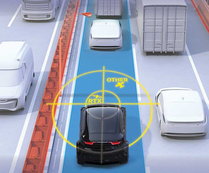
    To help meet this need, Trimble recently released Trimble RTX Auto. The Trimble RTX Auto correction service provides a precise point position (PPP) solution that can be used to correct the position of any auto grade GNSS chipset. RTX Auto works in parallel with other on-vehicle sensors to deliver a positioning solution that satisfies ADAS and AD requirements.

    Absolute position contributes to many features:

    • Lane centering. Systems designed to keep a car centered in a lane, relieving the driver of the task of steering, is often achieved with cameras and absolute position data. Absolute position can be used when lines disappear, or weather prevents them from being seen.
    • Map aiding. a combination of precise map and location data helps to navigate junctions, lane changes, roundabouts or intersections where lane information is essential to safe driving.
    • Prediction of future road structure. Both allow a vehicle to begin slowing in advance of a bend in the road and to avoid harsh braking that would happen if the system only relied on short range sensors.
    • Adhering to the speed limit. This helps drivers anticipate changes in speed limits when a downpour prevents cameras from seeing the speed limit signs or when they might be obscured by natural surroundings or another vehicle.

    RTX Auto is both Automotive Safety Integrity Level (ASIL) and Automotive Software Process Improvement and Capability Determination (ASPICE) certified. These certifications validate that Trimble RTX Auto meets functional safety requirements for ADAS and autonomous applications in the auto industry.

    Super Cruising. Trimble is on the road today providing RTX-based absolute positioning within General Motors’ Super Cruise driver assistance feature, a hands-free driving system for the freeway. For more information on Super Cruise, visit www.cadillac.com/world-of-cadillac/innovation/super-cruise.


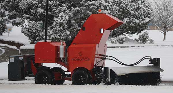
    See also Autonomous street sweeper relies on Unicore precision.

  • Autonomous Snowbot Pro hits the sidewalk

    Autonomous Snowbot Pro hits the sidewalk

    Photo: Left Hand Robotics
    Photo: Left Hand Robotics

    The autonomous SnowBot Pro is ready to clear your walkways. Offered by Left Hand Robotics and guided by Swift Navigation, it is a commercial-grade, robotically driven product for snow removal.

    Driving autonomously, SnowBot Pro clears snow from walkways with a 56-inch-wide rotating brush, reducing the number of hand shovelers or snow blower operators needed by up to 80 percent, the companies said. Various front and rear attachments allow for a multitude of tasks, such as snow removal in the front and deicing in the rear. It also reduces potentially costly slip and fall insurance claims.

    The SnowBot is programmed and controlled remotely from the cloud via an online dashboard or mobile app, and follows its programmed path using GPS, accelerometer and gyroscope technologies for navigation.

    Sensors detect any obstacles and can instruct the robot to stop to avoid collisions and send instructions about how to bypass obstacles. Location, weather and robot status data is recorded in real time, along with before and after photos. The detailed recording helps minimize insurance and risk-management costs while providing customers with proof of work.

    The robot has to navigate precisely, avoiding potentially damaging landscaping, walls, curbs and other obstacles along sidewalks and walkways. Centimeter-level GNSS ensures it avoids obstacles and stays on its designated route. Finding a reliable real-time kinematics (RTK) GNSS solution was critical given that many sidewalks are near buildings and underneath trees.

    After evaluation, Left Hand Robotics chose Swift Navigation’s Piksi Multi. Its centimeter-level accuracy keeps the robot in its designated path and allows its base robot platform to navigate in a variety of environments, whether in lines (sidewalks, bike paths) or large open areas (fields, parks). The Piksi Multi also retains a GNSS fix in challenging conditions and environments.

    Once Swift’s ruggedized Duro receiver was launched — and could be used by customers as a base station that was required for RTK — Left Hand Robotics had a complete offering for customers, which it launched in the winter of 2018–2019.

    A Piksi Multi is installed in each SnowBot Pro, and its Path Collection Tools (tools customers use to collect the initial path data the robot will follow) and Duro is used as the base station controlling the SnowBot Pro robot.

    The SnowBot Pro – the first self-driving snow clearing robot for commercial use. from Left Hand Robotics on Vimeo.

  • AgJunction, Swift Navigation partner on small tractor autonomy

    AgJunction, Swift Navigation partner on small tractor autonomy

    AgJunction Inc. is partnering with Swift Navigation to develop near-autonomous small tractor solutions for agricultural applications with high accuracy.

    The Duro enclosure. (Photo: Swift Navigation)
    The Duro enclosure. (Photo: Swift Navigation)

    The partnership will combine autosteering technology pioneered by AgJunction and the Duro RTK GNSS receiver from Swift Navigation. The research resulting from this partnership will ultimately lead to lower cost autosteering products with high accuracy, the company said.

    Duro, and the robust RTK GNSS positioning it delivers, is a source of pride for Swift,” shared Tim Harris, CEO of Swift Navigation. “With a mission to enable a future of autonomous vehicles, we strive to bring that autonomy to farm equipment — such as small tractors — at an affordable price for farmers and partnering with the renowned autosteering expert AgJunction helps make that a reality.”

    “AgJunction and Swift have been groundbreaking in their respective fields,” said Dave Vaughn, president and CEO of AgJunction. “I’m eager for what the future holds and how we can further deliver low-cost autosteering and navigation while delivering high accuracy down to a centimeter.”

  • Swift Navigation, Carnegie Robotics partner on Duro Inertial GNSS receiver

    Swift Navigation’s Samir Kapoor, Ph.D., gives quick hits on its Skylark cloud-based GNSS correction service and Duro Inertial ruggedized RTK GNSS receiver at Intergeo 2018 in Frankfurt, Germany. Duro Intertial combines the receiver with Carnegie Robotics’ SmoothPose sensor fusion algorithm.

  • Swift demos Starling with Teseo auto-grade chips from ST

    Swift demos Starling with Teseo auto-grade chips from ST

    The mixed urban environment in San Francisco, where Starling + the TeseoAPP was tested and data collected and processed in real time. (Image: Swift Navigation)
    The mixed urban environment in San Francisco, where Starling + the TeseoAPP was tested and data collected and processed in real time. (Image: Swift Navigation)

    Swift Navigation has demonstrated its Starling positioning engine with automotive-grade chips from STMicroelectronics’ Teseo platform.

    The Starling modular and portable GNSS high-precision positioning engine leverages Swift’s Skylark Cloud Corrections Service. An advanced GNSS processing engine, Starling enhances measurements from commercially available GNSS receivers to provide true precision and integrity capabilities, the company said.

    Starling is GNSS-receiver agnostic and works with a variety of automotive grade GNSS chipsets and inertial sensors, offering automotive companies choices in selecting the best components for their autonomous sensor suite, vehicle-to-vehicle (V2V) applications and automated driving systems.

    In a test drive in California, Swift showcased the integration of Starling onto ST’s Telemaco3P MPU-based modular telematics platform with on-board TeseoAPP, confirming the accuracy of the combined solution as a compelling offering for safety-critical autonomous-vehicle positioning when ST makes production TeseoAPP chipsets available in 2019.

    Another test in California demonstrated the synergistic benefits of integrating Starling with Broadcom’s BCM47755 chip, including centimeter-level positioning and low system-level power consumption.

    Horizontal Position

    Table: Swift Navigation
    Table: Swift Navigation
  • Swift Navigation and Carnegie Robotics introduce Duro Inertial

    Swift Navigation and Carnegie Robotics introduce Duro Inertial

    Duro Inertial fuses GNSS and inertial measurements into a combined solution. (Photo: Swift Navigation)
    Duro Inertial fuses GNSS and inertial measurements into a combined solution. (Photo: Swift Navigation)

    Swift Navigation and Carnegie Robotics LLC (CRL) have released their second joint product, Duro Inertial.

    Duro Inertial is a ruggedized version of Swift Navigation’s Piksi Multi dual-frequency real-time kinematic (RTK) GNSS receiver combined with CRL’s SmoothPose sensor fusion algorithm, which fuses GNSS and inertial measurements into a combined solution.

    The blending of GNSS and inertial measurements provides a dead-reckoning capability that allows Duro Inertial to provide a highly accurate, continuous position solution during brief GNSS outages and to deliver a robust precision navigation solution in harsh GNSS environments.

    Duro Inertial is an evolution of Swift and CRL’s first joint product, Duro. Building on the on-board MEMS inertial measurement unit (IMU) that exists in Duro today, Duro Inertial harnesses CRL’s loosely coupled (LC) sensor fusion algorithm, SmoothPose, to blend GNSS and inertial inputs, providing a smoother, more available and more robust position, velocity and time (PVT) solution, the companies said.


    Duro Inertial seamlessly blends CRL’s SmoothPose GNSS+INS algorithms with Swift Navigation’s Starling Positioning Engine to deliver a highly-accurate LC positioning solution even in GNSS / RTK denied environments.

    The inertial aiding feature can operate with RTK, autonomous GNSS and satellite-based augmentation system (SBAS) position solutions from Starling. Duro Inertial also inherits the full set of features from Duro and Piksi Multi including the light-weight SBP communication protocol, interoperability with legacy protocols such as NMEA output and RTCMv3 input, compatibility with RTK corrections services such as Skylark, Swift’s Cloud Correction Service and many third-party corrections services, and quad-constellation dual-frequency RTK navigation.

    The combination of Duro Inertial’s positioning accuracy and its ruggedized enclosure that protects against weather, moisture, vibration, dust and water immersion makes it suitable for construction, mining, logistics, positive train control, robotics and agriculture applications.

    “We are excited to introduce our second collaboration with Carnegie Robotics and build on the success of the Duro ruggedized receiver launched last year,” said Timothy Harris, co-founder and CEO of Swift Navigation. “The combination of Carnegie Robotics’ advanced inertial technology and robotics expertise with Swift’s positioning solution will enable an even broader customer segment to benefit from highly-accurate positioning.”

    “Duro Inertial is the culmination of our partnership with Swift over the past two years,” added John Bares, CEO of Carnegie Robotics. “Working together we are able to deliver a consistent and highly-accurate positioning solution to benefit a variety of robotics and industrial applications.”

    Duro Inertial is scheduled to be available at for purchase in the fourth quarter and is now available for select customer testing.

  • Swift Navigation Starling GNSS engine tested with Broadcom BCM47755 chip

    Swift Navigation Starling GNSS engine tested with Broadcom BCM47755 chip

    An open-sky freeway environment on Interstate 280 in California where Starling + the BCM47755 were tested and data collected and processed in real time. (Image: Swift Navigation)
    An open-sky freeway environment on Interstate 280 in California where Starling + the BCM47755 were tested and data collected and processed in real time. (Image: Swift Navigation)

    Swift Navigation has announced that its Starling positioning engine is available with Broadcom’s dual-frequency GNSS receiver chip, the BCM47755.

    The new solution is capable of delivering centimeter accuracy with minimal power consumption and small footprint for rapidly expanding precise positioning applications, the company said.

    The Starling Positioning Engine is a modular and portable GNSS high-precision positioning engine that leverages Swift’s Skylark Cloud Corrections Service. Platform independent, Starling is an advanced GNSS processing engine that enhances the measurements from commercially available GNSS receivers to provide true precision and integrity capabilities.

    Swift’s Starling software is GNSS receiver agnostic and works with a variety of GNSS chips and inertial sensors. According to the company, Starling features multi-band, multi-constellation support to provide centimeter-level accuracy and supports the calculation of integrity outputs to provide absolute position, velocity and time (PVT).

    Broadcom's BCM47755 chip now works with Starling. (Image: Broadcom)
    Broadcom’s BCM47755 chip now works with Starling. (Image: Broadcom)

    Swift showcased the integration of Starling with the Broadcom BCM47755 chip — the latest generation of Broadcom GNSS receiver chip — during a recent test drive in California. The synergistic benefits of integrating Starling with the BCM47755 measurement engine include low system-level power consumption and a smaller PCB (printed circuit board) footprint.

    The successful integration illustrated the accuracy of the combined solution and forthcoming offerings for autonomous vehicles including unmanned aerial vehicles, robotics, asset tracking, fleet management and other applications requiring precise positioning.

    The BCM47755 simultaneously supports GPS and GLONASS in the L1 frequency band or GPS and Galileo in both the L1/E1 and L5/E5a frequency bands, the company added. Starling combines the GNSS raw observations from the BCM47755 with corrections from Swift’s Skylark Cloud Corrections Service to deliver centimeter-level positioning.

    Horizontal Position


    Horizontal CDF (Cumulative Distribution Function). (Chart: Swift Navigation)
    Horizontal CDF (Cumulative Distribution Function). (Chart: Swift Navigation)

    “Broadcom is delighted to work with Swift in their integration of Starling and Skylark with our BCM47755,” said Vijay Nagarajan, senior director of product marketing for the Wireless Communications and Connectivity Division at Broadcom. “This is an exciting development for Swift and Broadcom, bringing together innovative hardware and software for the precise positioning market.”

    ​​“Swift has taken its mature Starling positioning engine that has long been powering Swift’s Piksi Multi and Duro receivers and made it interoperable with other industry leading chipsets to provide customers with a broader selection of precise autonomous navigation solutions,” added Samir Kapoor, executive vice president of engineering and product at Swift Navigation. “We are excited to offer an integrated solution with the Broadcom BCM47755 GNSS receiver chip.” ​

    Evaluation Kit

    Swift has developed an out-of-the-box evaluation platform for the combined Swift/Broadcom solution, called the Starling + BCM47755 Evaluation Kit, which will be available to order in the fourth quarter of this year.

    The Evaluation Kit includes:

    • Starling Evaluation Board
    • Cortex-A7 Processor Running Starling Positioning Engine on Linux
    • Broadcom BCM47755 Chip
    • I/O – RS-232, Ethernet, USB, CAN
    • Supports SBP, NMEA and RTCM3 Protocols
    • Built in NTRIP Client
    • Built in Client for Skylark, Swift’s Cloud-Based GNSS Corrections Service
    • Dual Frequency, Multi-Constellation Antenna
    • External Cell Modem
    • Power Supply, Cabling and Accessories
    • Evaluation Kit Hardware Design Documentation, including Schematics and Layout
    • Evaluation Kit User Manual, Swift Console PC Application and Firmware Image
  • Swift ​​Navigation ​​announces full BeiDou and Galileo support for ​​Piksi Multi

    Swift ​​Navigation ​​announces full BeiDou and Galileo support for ​​Piksi Multi

    The Piksi Multi GNSS receiver. (Photo: Swift Navigation)
    The Piksi Multi GNSS receiver. (Photo: Swift Navigation)

    Swift ​​Navigation has upgraded the firmware to ​​its flagship product — the Piksi Multi GNSS ​​receiver. This marks the sixth major release to Piksi Multi since it was launched in February 2017.

    The upgrade is available free of charge to Swift customers. ​​

    The firmware release also enhances Duro, the ruggedized version of the Piksi Multi receiver housed in a military-grade, weatherproof enclosure for long-term outdoor deployments.

    Swift ​​Navigation is a ​​San ​​Francisco-based ​​tech ​​firm building centimeter-accurate ​​GNSS ​​technology and a cloud-based corrections service​​ to ​​power ​​a ​​world ​​of ​​autonomous ​​vehicles, the company said. ​​

    The Duro enclosure. (Photo: Swift Navigation)
    The Duro enclosure. (Photo: Swift Navigation)

    Firmware Release 2.0 for Piksi Multi and Duro supports two additional major satellite constellations — the Chinese constellation (BeiDou B1/B2) which, once completed, will contain 37 satellites and the European Union-based constellation (Galileo E1/E5b), which will eventually consist of 30 satellites.

    Adding to the existing GPS, GLONASS and SBAS constellations already supported by Swift’s GNSS receivers means that users will have more access and visibility from satellite systems across the globe.

    Piksi Multi’s performance will further improve over time as the total of 136 satellites planned for these major constellations are fully deployed.

    The addition of BeiDou and Galileo constellations creates more robust positioning performance in a variety of challenging skyview environments and puts Piksi Multi on par with leading industry receivers costing up to ten times a much.

    With this 2.0 release, Piksi Multi is feature-complete, and Swift’s engineering team has delivered on planned product features on the Piksi Multi Product Summary.

    Firmware ​​Version ​​2.0 ​​Enhanced Receiver Performance Highlights

    MSM Messages 4-7. The ​​new ​​firmware ​​adds support for RTCM 3.2 Multi Signal Messages (MSM). Though Swift devices already support RTCM 3.1, the addition of MSM allows for another flavor of differential corrections supported by BeiDou and Galileo, while also supporting both GPS and GLONASS with MSM new messages. MSM also allows for interoperability with other existing third-party GNSS receivers for all modern signals and constellations.

    Fix Improvements. Firmware 2.0 provides Piksi Multi and Duro improvements on fixing in long base lines in poor atmospheric conditions, making the devices more resilient to Ionospheric effects during periods of high Ionospheric activity.

    Higher Baud Rate Support for UART. New baud rates were added including 460800 and 921600.

    Acquisition Improvements. Enhancements made allow Piksi Multi and Duro to power on to a usable signal more quickly and acquire satellites in start-up mode faster, by several seconds.

    “The growing Swift engineering team has been hard at work developing Piksi Multi to its full potential,” said Samir Kapoor, executive vice president of engineering and product at Swift Navigation. “With support for all modern satellite constellations and multiple performance improvements, Piksi Multi offers unmatched affordability, priced at ten times the savings yet on par with other leading GNSS receivers.”

    “Swift’s vision of making GNSS devices that are centimeter-accurate, with fast RTK convergence times and robust positioning performance all at highly-competitive prices has come to fruition,” Kapoor said. “With Piksi Multi feature complete, we look forward to adding to our line of products with additional offerings later this year.” ​

  • GNSS receiver, drone developments from AUVSI Xponential 2018

    GNSS receiver, drone developments from AUVSI Xponential 2018

    As the dust from this year’s AUVSI Xponential show, which took place May 1-4 in Denver, begins to settle, we complete the overview we began last month and wrap up our coverage of the show.

    Septentrio

    Septentrio introduced its AsteRx-i V product series of integrated GNSS/inertial receivers, based on the Septentrio m2 GPS/GLONASS/Galileo/BeiDou/QZSS/SBAS receiver and a high-end VectorNav MEMS IMU. Providing:

    • AsteRx-i V receiver & IMU. (Photo: Septentrio)
      AsteRx-i V receiver & IMU. (Photo: Septentrio)

      Reliable, accurate IMU-enhanced GNSS positioning down to the cm level

    • Full attitude — heading pitch and roll
    • Lightweight, low power <50 grams, typically 1.5 W — suitable for UAV applications
    • AIM+ interference monitoring and mitigation system
    • High update rate, low-latency positioning and attitude

    Also introduced at the show was the AsteRx SB, a packaged version of the m2 receiver with multiple interfaces and Bluetooth wireless, targeted at machine control and other sensor fusion applications.


    GSS9000 Simulator. (Image: Spirent)
    GSS9000 Simulator. (Image: Spirent)

    Spirent Federal

    Spirent offered a demo of its “flagship” GSS9000 simulator at the show — with capability to generate all constellations, all frequencies, plus L-band signals. Kalani Needham (director of sales) also mentioned the company’s sim-MNSA program with Rockwell Collins, aimed at providing support for M-code for the GNSS simulation market.


    DJI

    Inspire drone. (Image: DJI)
    Inspire drone. (Image: DJI)

    As usual, the DJI booth was extremely busy — with a demo area almost continuously flying each of the most popular DJI drones. What I learnt from my visit was that 70 percent of sales are recreational, and the balance is commercial. With quadcopters for hobbyists, using replaceable parts, auto-flight systems and data links, DJI was virtually the first drone manufacturer to market, and still one of the most successful. The Phantom now carries gimbal-mounted cameras and is finding lots of applications with business, academics and government agencies, including first adopters like the film and TV industry.

    Phantom 3 drone. (Image: DJI)
    Phantom 3 drone. (Image: DJI)

    DJI drones have weather resistant bodies, strong blades, swap-out easy-charge batteries, and ADS-B, RTK and heading capabilities. Set-up in the field is simple, with an SDK for lab developers, multi-spectral cameras for applications such as crop growth monitoring, real-time data available through the control uplink and infrared/visible slant-range outputs.

    DJI’s approach is to keep ahead of the competition by adding more and more technology over time, and the company clearly has the sales volume to support this strategy.


    CyPhy Works

    PARC tethered drone system. (Photo: Tony Murfin)
    PARC tethered drone system. (Photo: Tony Murfin)

    CyPhy Works makes and promotes tethered drones — enabling very long endurance reconnaissance/forward observation/inspection/communications. The company got into this specific drone niche because it found customers who couldn’t live with short duration battery-restricted drone operations.

    For ground forces, having a real-time video overview from higher altitude is of great benefit; similarly, they’re of great use for disaster recovery efforts, such as in the aftermath of hurricane Harvey in Texas. And if you add a Wi-Fi transducer working through one of two payload ports on its PARC (persistent aerial reconnaissance and communications) platform, you can also reconnect survivors and provide a comms network for first responders.


    Ruggedized Duro receiver. (Image: Swift Navigation)
    Ruggedized Duro receiver. (Image: Swift Navigation)

    Swift Navigation

    Swift is a relatively new GNSS receiver manufacturer, and its Piksi Multi receiver has a lot to do to catch up technically with the products offered by the predominant players in the market. So its approach is to use rock-bottom pricing for almost all of their offerings. Currently, the Piksi has only GPS L1/L2 and GLONASS L1/L2 plus SBAS, but Galileo and BeiDou are promised for later this year.

    The new Swift capability launched at the show is Skylark, a cloud-based, hybrid PPP/RTK network currently testing in around six U.S. areas and planned for national and even worldwide coverage sometime in the future. Skylark is apparently cellular, with a large number of base sites, each equipped with a Swift Duro receiver. With a target subscription price of only $495 per year, this could be a popular GNSS assistance service, provided you use compatible Swift receivers in your application.

    Swift is targeting automotive applications, and has a San Jose trial underway with Voyage at a retirement community — residents call for a self-driving taxi using a cell-phone app, and get transport anywhere in the 4,000-strong community. A similar trial at the Villages in Florida (125,000 residents and 750 miles of roads) is also apparently getting underway.


    Hemisphere GNSS

    Vector 500 Smart Antenna. (Photo: Hemisphere GNSS)
    Vector 500 Smart Antenna. (Photo: Hemisphere GNSS)

    Hemisphere GNSS was also at the show with its line of GNSS receiver solutions for UAVs, Atlas Correction Service and a new V500 Heading/Smart Antenna.

    The Vector V500 is an all-in-one multi- frequency, multi-GNSS smart antenna that provides RTK-level position and precise heading. The latest generation of Hemisphere’s heading antennas now appears with an integrated GNSS receiver and a rugged design sealed for the harshest environments — a design that has evolved over many years. It takes a great deal of sweat and tears to get to a reliable weather-hardened product, and Hemisphere has no doubt incorporated a lot of experience into this latest product.

    Atlas corrections are derived from public JPL data and are supplied worldwide over Inmarsat L-band satellite transmissions.


    Harxon Corporation

    D-Helix antenna. (Photo: Harxon)
    D-Helix antenna. (Photo: Harxon)

    Harxon’s D-Helix antenna got lots of attention at its booth, as did the OEM frequency-hopping transceiver. The D-Helix antenna supports GPS, Galileo, BeiDou and GLONASS, as well as L-band signal reception. With low wind resistance and ruggedized IP67 protection, this antenna appeared to be very popular at the show for UAV applications.

    The frequency-hopping OEM transceiver works over 840-900 MHz and weighs in at only 5 grams. With anti-jamming and wide signal capability, this miniature device is designed for complex data-intensive applications. In full duplex mode, secure data transmissions are possible over long distances with low latency. The popularity for this transceiver at the show might be connected with a recent FAA proposed rule that would require transmission of a drone’s registration ID for remote identification.


    More

    Other neat products and applications the GPS World team came across at the show included:

    • Topcon’s B111 multi-constellation GNSS receiver and the Topcon-distributed Sirius Pro fixed-wing UAV and Intel Falcon 8+ quadcopter;
    • the Rockwell Collins aviation Flight Management System, which is apparently being incorporated into the General Atomics commercial Flight Guardian system;
    • Northrop Grumman’s project, which is tracking polar bears with UAVs in Northern Canada on behalf of the San Diego Zoo;
    • the senseFly eBee series of drones with automated mapping capability and a BVLOS (beyond visual line of sight) trial in Canada with in-flight data — more on this later.


    GPS World will bring you a special UAV supplement later in the year, and we will carry more news and details on selected manufacturers and applications within this exciting and ever-expanding drone industry.

  • 5G, internet of things highlighted in webinar

    Testing autonomous driving support. (Photo: Volvo).
    Testing autonomous driving support. (Photo: Volvo).

    Location, principally provided by GPS/GNSS, plays a key role alongside deployment of 5G cellular networks, in the realization of the internet of things (IoT).

    A free webinar hosted by GPS World on May 17 will cover how location plays a role in the internet of things. The webinar will include presentations by Fergus Noble, co-founder and CTO of Swift Navigation; Oliver Cameron, co-founder and CEO of Voyage; and Steve Thompson, senior director and office of the CTO of Acorn Technologies.

    During his presentation, Noble will highlight the benefits of integrating a cloud corrections service with high-precision GNSS receivers. He also will provide an understanding for users of GPS about how high-precision GNSS receivers benefit from a cloud corrections service, including high-precision results in seconds and increased geographic range.

    Cameron will cover why private cities make for the perfect first deployments of self-driving cars and Thompson will offer an overview on cellular positioning technology for ultra-low-cost, ultra-long-battery-life IoT applications.

    Register and learn more about the webinar, which takes place at 1 p.m., here.

  • Swift’s latest Piksi Multi firmware release supports SBAS

    The Piksi Multi.

    Swift Navigation has issued a new ​​firmware ​​upgrade to ​​its ​​flagship ​​product ​​​Piksi Multi ​​GNSS ​​module.

    This marks the fifth major point release to Piksi Multi and is available free of charge to Swift customers. ​​The most recent provided GLONASS support, among other features.

    The firmware release also enhances Duro, the ruggedized version of the Piksi Multi receiver housed in a military-grade, weatherproof enclosure designed for long-term outdoor deployments.

    Duro – Piksi enclosure.

    Firmware Release 1.5 for Piksi Multi and Duro supports four regional Satellite Based Augmentation Systems (SBAS) — the United States-based Wide Area Augmentation Systems (WAAS), the pan-European Union-based European Geostationary Navigation Overlay Navigation System (EGNOS), the Japanese Multifunctional Transport Satellites (MTSAT) Satellite Augmentation System (MSAS) providing coverage for Japan and Australia and the GPS-Aided GEO Augmented Navigation (GAGAN) regional system operated by the Indian government.

    These four regional satellite systems are used to improve the overall performance of GNSS such as GPS and GLONASS, both of which are supported by Swift’s receivers.

    SBAS support is particularly relevant for Swift customers located in places where cell phone coverage is sparse or is not available, such as rural areas where precision agriculture operations are taking place or alternatively in marine locations, lakes, in-land waterways and up to approximately 100 miles off shore where cellular or internet coverage may not be feasible.

    Applications using SBAS do not require a local reference station, allowing rovers such as drones, combines and other agricultural equipment and marine vessels to benefit from satellite corrections accurate to a sub-meter, when centimeter-accuracy is not required and where internet or cell coverage is spotty or absent.

    Firmware ​​Version ​​1.5 ​​Enhanced Receiver Performance Highlights ​

    • SBAS Support — The ​​new ​​firmware ​​adds support for WAAS + EGNOS + MSAS + GAGAN regional satellite constellations and augments standard positioning performance for ​​GLONASS (G1/G2) + GPS (L1/L2C) for use with Swift Navigation products.
    • Acquisition Improvements — Firmware 1.5 allows Piksi Multi and Duro a faster time to first fix and once a signal has been acquired, improves accuracy and availability. Time to first RTK fix was improved by 21 seconds.
    • Standard Positioning Performance (SPP) Enhancements — Time to first SPP improved by 7 seconds.
    • Increased Satellite Count for RTK — Increased satellite count used in the RTK engine improves RTK performance in all environments, particularly those where skyview is partially obscured and/or rapidly changing.

    “The addition of four regional satellite constellations for our devices enhances reliability and improved position accuracy in challenging or remote environments where autonomous vehicles may have limited or no cell coverage. Essentially, SBAS provides a free corrections service, allowing our precision agriculture, marine and other customers to receive satellite corrections without a base station,” said Anthony Cole, Ph.D., director of the measurement and positioning team at Swift Navigation. “Being hardware-ready means that Piksi Multi and Duro users simply download the 1.5 firmware at no additional cost, to get the latest features and performance improvements.”


  • Swift Navigation presents Skylark GNSS corrections service

    Swift Navigation’s David Fischer gives GPS World an overview of the company’s Skylark GNSS corrections service at Xponential 2018. According to the company, Skylark is cloud-based and delivers affordable, fast, centimeter-level accuracy and eliminates the complexity of deploying and maintaining GNSS networks.