Topcon Positioning Group announces the release of the newest edition to the GLS line of laser scanners, the GLS-2000. Featuring an expanded field of view, the GLS-2000 is designed to pair with ScanMaster v3.0 software for quickly capturing and processing 3D point-cloud data.
“The GLS-2000 is the fastest and most versatile scanning system in its class,” said Charles Rihner, vice president for the Topcon GeoPositioning Solutions Group. “With a scan range of more than 350 meters, the GLS-2000 is capable of accurately capturing long-distance measurements in applications where access is limited due to safety or logistics concerns.”
Using Topcon Precise Scan Technology II, the GLS-2000 is designed to emit pulse signals three times faster than earlier models. “Using faster pulse signals enables timing to be detected more precisely, which results in reduced noise and higher-accuracy data,” said Rihner.
“With the on-board control software, scanning can simply be started with the touch of a button. Even entry-level users can intuitively operate the GLS-2000 that comes complete with a color graphical display,” said Rihner.
Additional features include a full-dome scanning range, user selectable Class 3R or 1M laser, and an exclusive laser plummet function that measures instrument height with a one-touch operation.
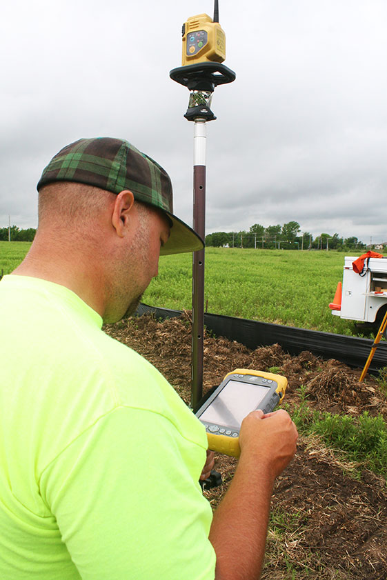
Topcon Tesla handheld controller combines the advantages of a PC tablet with the ruggedness of a fully equipped survey device.
An Oklahoma Survey Firm Is Increasing Productivity with Cloud-Based Solutions
By Larry Trojak
Until recently, the flow of real-time information and job-critical data between the office and personnel in the field for survey and construction has not kept pace with advances in onsite GNSS equipment. But enterprise software suites are closing the gap, producing across-the-board efficiencies, cost reductions, and an ability to bid more competitively.
Sisemore Weisz & Associates (SW&A) of Tulsa, Oklahoma, is an engineering specialist in site design and land planning, and has survey experience with ALTA/ACSM work, high-end civil construction, structural layout, and large survey control networks. Topcon’s cloud-based software suite Magnet gives SW&A the ability to have immediate access to the plans, data, and site information needed to respond to and complete the job.
“Providing the ability for any crew to immediately access their data from anywhere via a Tesla field tablet is invaluable. It’s literally changed the way we do business,” said SW&A chief of parties Shawn Collins.
Collins’ ultimate goal was to establish a platform for data collection, sharing, and transfer that best utilized today’s technology, including Internet access and the ability to email and text message crews in real-time.
His first instinct was that a tablet such as an iPad might be the answer, but iPads weren’t suitable for surveying Instead, they chose Topcon’s newly introduced Magnet Enterprise package along with a pair of Tesla controllers. Finding it the right solution, after a few weeks they bought more Teslas. “It was just the solution we needed,” Collins said.
Magnet Suite
Comprised of three individual software components — Field, Tools, and Office — as well as the Enterprise cloud environment itself, the Magnet suite of products is designed to bring real-time, cloud-based efficiency to any survey or construction operation, according to Jason Hallett, Topcon’s senior product manager for software applications.
“Magnet considers everything from data collection, to CAD, to data manipulation and reporting, to data exchange, to cloud-based project management in an enterprise environment,” Hallett said.
Components of Magnet:
Field. Connects field users to the cloud, and enables real-time communication, as well as cloud storage and data exchange. A powerful field software for topo, staking, roads, and calculations is included.
Tools. Allows the processing and exchange of data between the enterprise cloud and popular desktop applications, such as Autodesk Civil 3D.
Office. Exchanges design files, survey jobs, and surfaces through the enterprise cloud for simple project revisions and real-time survey data from the field.
Dillon Dossey is a one-man crew with Magnet and the cloud.
In the year since they began using Magnet, Collins said that the system has become an integral part of the way SW&A does business. “It can be something as simple as getting a crew working faster than we ever could in the past,” Collins said. “For example, say we are set to begin a large highway project several hours from the office, but we are wrestling with plans or have calculations that still need fine-tuning on one part of the job. In the past, the whole project would have been held up until those issues were resolved. Now, we can send a crew out with what we already have and, when that missing data is completed, upload it to the cloud for them to access when they need it. As a result, production is on track, deadlines are met, and the customer is pleased.”
Re-routing crews — a time-consuming effort in the past —is now a simple process. “If a crew wraps up a project and needs to be re-routed from their original follow-up job, they now can simply check email or chats on their Tesla and see what’s changed. All of their pertinent information is going to be in the chat and in the cloud — all the directives are there, all the paperwork, everything they need to make a fast, seamless transition to the next job without having to come back to the office. Just minimizing those trips back here has shown us a nice 14 percent reduction in fuel costs since going forward with Magnet. And taking that 14 percent off of a bid allows us to be that much more competitive.”
As chief of parties, one of Collins’ primary roles is quality control on projects, and Magnet has helped. “I can show up to a site to see how a crew is doing, have them upload data to the cloud, and confirm their progress. As a result, managing the parties, managing the control, managing the job flow is so much better. And, contrary to what one might think, the fact that the crews know they are being checked has not had any downside at all. They know we are all on the same team and appreciate that this technology is helping make us more competitive — which ultimately benefits everyone.”
Collins has witnessed dramatic changes in his 30 years of surveying, but sees Magnet as a game-changer for data management and flow, the exchange of information, and bidding on jobs which, thanks to Magnet Enterprise’s cloud-based environment, has become a streamlined, efficient process.
“It is now possible to easily cross-reference jobs to help in the bidding process,” he said. “We can go into our cloud and see if we did a similar job before, and, if so, view the work order, view the billing files, see how much that job actually cost, see what we bid on it, see if we were profitable, see how we did for time management, and so on. In the past that would have been a painstaking, time-consuming process. But with that all data readily at hand, it is easy to put together an informed, competitive bid and get it out to the client in no time.”
One area that Collins hopes to pursue further is deeper client involvement. “We recently added 5 GB of capacity to our cloud storage, and that should help us move forward with that push. Making it possible for the client to look at the project as it exists in real-time, to be able to review and red-line items or discuss issues, and do so without a trip to our office will be a real plus.”
One-Man Crew
A visit to a local development called Yorktown finds a single rod man, Dillon Dossey, at work, a typical scenario for SW&A. “This is a 120-lot development, and Dillon has been the sole SW&A person on this job since the outset, surveying and staking to rough in roads for the developer, and he will be here until our portion wraps up,” Collins said.
With Topcon’s PS-103 robotic total station (SW&A’s latest purchase), his Tesla, and Magnet — which is also built into the total station — Dossey can operate as a one-man crew with confidence, Collins said. “If Dillon gets into a situation where he suspects something is wrong or he needs help deciding something, he doesn’t have to break down his equipment and drive all the way back to town; he has everything he needs right there with him. He has the data, he can chat with me, with the office, and we can send data right back to him.”
Dossey offered his take on Magnet’s impact on his role at SW&A. “We are working toward eventually eliminating the need for us to go back to the office at all,” he said. “If we have to, we can come in to get gear in the morning, but that’s about it. However, right now, if I am halfway through a job and Shawn contacts me to head to another one, he just sends me all the info I need and I’m on my way. It is very cool. The amount of data that we can exchange back and forth through the cloud is just startling.”
Topcon Positioning Group has released the latest edition to the MS line of high-precision total stations in the North and South American markets. The MS AXII measuring station series is designed for precision-intensive tasks, such as monitoring, bridge construction, and other highly detailed engineering projects.
The series includes the MS1 AXII with 1-inch angle accuracy, and the MS05 AXII with 0.5-inch angle accuracy. “The MS1 AXII is perfect for long-distance measurement activities, while the MS05 AXII is built for high-accuracy survey and construction projects,” said Ray Kerwin, Topcon director of global surveying products.
“The fully robotic MS AXII models are vastly superior to conventional systems that simply lock on to the nearest targets,” said Kerwin. “The MS AXII auto-collimation system allows the instruments to lock on to targets that are closest to the center view of the telescope, providing long-rage precision and accuracy even in low-light conditions.”
Additional features include integrated Bluetooth connectivity options, durability with an IP65 rating, and TSshield technology for security and maintenance.
Topcon Positioning Group has added a cellular modem option for the HiPer SR for GIS receiver.
“The integrated modem provides greater functionality for the HiPer SR,” said Jason Hooten, Topcon GIS national sales manager. The unit can now be used as a cellular base station through the MAGNET® Relay option. In addition, the cellular feature allows the receiver to provide a connection to existing data collectors that do not contain internal cellular modems.
“With the new cellular modem and HSPA (High Speed Packet Access), the receiver not only enables users to easily obtain Spectrum-RTK (Real Time Kinematic) and RTK corrections via the Internet, it also allows it to function as a mobile base station as part of the MAGNET Relay GIS broadcasting service, ‘relaying’ corrections to multiple rovers,” Hooten said.
“The multiple configuration options make the compact and lightweight HiPer SR extremely versatile for any GIS user,” said Hooten.
Additional features of the HiPer SR for GIS include 226-channel Vanguard technology with Universal Tracking Channels and Fence Antenna® technology for signal tracking sensitivity and multipath rejection.
GPS World is at the 2014 Esri User Conference, being held July 14-18 in San Diego. Check out our slideshow for key photos from the first day of the conference. Follow tweets from GPS World and Geospatial Solutions for live updates from the conference.
Welcome to the 2014 Esri User Conference (UC) Photo Slideshow.
SmarterBetterCities creates 3D scenarios using its 3D Cities Libraries, functional in Esri CityEngine and ArcGIS Desktop.
Conference exhibitors at the Esri UC take a seat.
The 2014 Esri UC is being held July 14-18 in San Diego.
Motorola is focusing on its PremireOne public safety applications suite with realtime data.
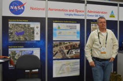
A member of NASA Langley’s GIS Team mans the booth on the show floor.
Topcon’s Sirius Pro is designed for high accuracy mapping using GNSS RTK.
GPS World will be producing a live webinar in this booth outside of room 27 at 1 p.m. EDT on Thursday.
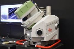
Leica’s Pegasus:Two is a mobile mapping solution integrates hardware platforms including cameras and lidar profilers.
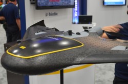
The Trimble UX5 focuses on image quality and photogrammetric accuracy.
Topcon Positioning Group announces the integration of the Android platform to the eGIS field software system.
A view of the Esri UC from the outside looking in.
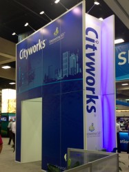
Cityworks’ booth at the Esri UC.
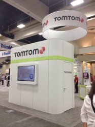
TomTom is at the Esri UC for the 22nd year.
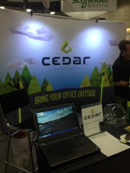
Cedar Tree Technologies is a recently launched rugged handheld company founded by Juniper Systems.
Riegl’s VUX-1 laser scanner.
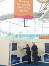
Exhibitors checking out the National Geospatial-Intelligence Agency’s Latin American physical and political geography map.
Juniper Systems is featuring its Archer 2 at the Esri UC.
Topcon Positioning Group announces a new data controller — the FC-500 — with numerous features and benefits, including a large 4.3-inch touchscreen display and 5MP camera with built-in LED flash.
The FC-500 is designed for the professional operating Topcon MAGNET Field, Site and Layout software and Topcon’s Pocket 3D.
Ray Kerwin, director of global surveying products, said, “The FC-500 works with all Topcon GPS/GNSS receivers and total stations, and meets or exceeds all field application requirements. Additionally, the FC-500 works with the new Topcon LN-100 instrument dedicated to BIM and one-person construction layout, simplifying workflow with the seamless integration with our MAGNET suite of software solutions.”
Kerwin said, “With a sunlight readable screen, the controller is easy to use even in bright sunlight. It is the ideal job site controller in any condition (waterproof up to one meter, IP68 rating) and the large camera format with built-in LED flash and built-in 8GB flash storage allows the storing of hundreds of job site photos.”
The standard model has both Bluetooth and Wi-Fi connectivity, while the FC-500 GEO has Bluetooth, WiFi and GPS. A third model comes with the addition of a 3.5G cellular modem that allows access to the MAGNET Enterprise Solutions suite, “making the FC-500 the perfect field instrument for sending and receiving data files to the MAGNET cloud,” Kerwin said.
For the GIS professional using MAGNET Field software, the FC-500 has a geotagging feature that allows imprinting file information, including GPS location, directly on photos.
Topcon Positioning Group has released the MAGNET Field GIS software kit designed for efficient data collection, navigation and maintenance tasks.
“MAGNET Field GIS is field data collection software with extremely useful data sharing capabilities,” said Jason Hooten, national sales manager, GIS products. “Utilizing the cloud, MAGNET Field GIS can send and receive data via a company’s MAGNET Enterprise account, allowing professionals in the field greater productivity and less time wasted driving to and from an office to deliver collected data.
“MAGNET Field GIS is powerful and intuitive — built to easily recognize and adapt to a user’s surroundings,” said Hooten. “Whether in an urban area within a GNSS network or in a rural setting with a DGPS connection, MAGNET Field GIS provides a modern data collection solution.”
The software package also includes features such as Microsoft Bing Maps for real-time background imaging, popular GIS file-format compatibility and a customizable interface.
Topcon Positioning Group announces two new updates for MAGNET Enterprise — the cloud-based solution for managing field and office data in a web browser environment. New to the system is the introduction of MAGNET Enterprise Mobile, an application for mobile devices, as well as new project management functions.
MAGNET Enterprise Mobile is designed to allow users to take the central hub of the MAGNET system of solutions with them on the go. Oscar Cantu, Topcon software marketing manager, said, “The MAGNET Enterprise Mobile app takes the powerful software solution for exchanging data between the office and field through a cloud-based Company Account and puts it in the pocket of the user for easy access wherever they travel.” The app is available on the Apple App Store for iPhones and iPads.
Another addition for both the full web browser solution, as well as the mobile version of MAGNET Enterprise, is the introduction of new project manager extensions. Customers will have new functions for coordinating and overseeing their projects including: an overview dashboard for all active projects, a proposal writing and task-creation operation, task assignments, a project-specific dashboard, project calendar, project status reports, and user schedule and timecard applications.
“MAGNET Enterprise has proven itself as an ideal solution for project managers overseeing the progression of multiple projects, managing company assets, safely storing and retrieving project related files and orchestrating daily efforts within their secure cloud-based Company Account. Now, with the addition of these tools, MAGNET customers will meet deadlines, gain productivity and collaborate like never before,” said Cantu.
“The project management oriented functionality, coupled with the introduction of the MAGNET Enterprise Mobile app is another step forward in the MAGNET system of solutions that brings together all facets of a company for unmatched collaboration.”
Topcon Positioning Group has added two new mobile applications to the Apple App Store. Topcon Tierra and Sitelink3D mobile apps are designed to offer on-the-go remote connections to equipment and job sites.
The Topcon Tierra mobile app lets customers login with their existing passwords and track their equipment fleets from an iPhone or iPad. “The Topcon Tierra app allows users to easily check on their fleets, fences, productivity reports and get alerts any time, anywhere,” said Kris Maas, construction products marketing manager. The Topcon Tierra mobile app is available to download at no charge.
Customers can also manage and monitor job sites with the new Topcon Sitelink3D mobile app. “The Sitelink3D app lets users visualize real-time project management information on their iPhone or iPad with their existing Sitelink3D logins,” said Maas. “Remote connection to equipment within Sitelink3D is easier than ever with the addition of the app.” The Sitelink3D mobile app is available for purchase on the Apple App Store.
TopNETlive Expands. Topcon Positioning Group also announced the expansion of its TopNETlive network service into 19 states and five Canadian provinces. TopNETlive uses a dense network of ground-based reference stations capable of supporting all major GNSS satellite constellations to provide high-accuracy with fast initialization time.
The 24 states and provinces now included in the service are Alabama, California, Connecticut, Delaware, Georgia, Illinois, Indiana, Maine, Maryland, Massachusetts, Mississippi, New Hampshire, New Jersey, New York, Pennsylvania, Rhode Island, Vermont, Virginia, Wisconsin, Ontario, New Brunswick, Newfoundland, Nova Scotia and Quebec.
“TopNETlive network service is a primary source for all levels of correction for users in the agriculture, construction, surveying, civil engineering and GIS industries,” said Jonathan Ball, senior manager for Topcon network business. “It is designed to support all makes and models of GNSS and guidance equipment, making it a logical choice for companies that use multiple brands of positioning equipment.” Ball further states that, “TopNETlive offers many different subscription plans to fit the operations and the budget of almost any user.”
Topcon Positioning Group has made several product and service announcements at CONEXPO-CON/AGG, being held this week in Las Vegas.
Haul Truck System. The HT-30 haul truck module for Sitelink3D features a small, portable GPS-enabled control box that mounts into the truck cab. As the truck is loaded, data about the load is input, such as material type, driver, and quantity. The load is then integrated into Sitelink3D and can be tracked for scheduling, rerouted if needed elsewhere, and recorded once delivery is made.
Whether the material is fill dirt, removal of overburden, select material, base course or even asphalt, HT-30 can be quickly plugged in so management and reporting can be maintained in real-time. For more information on the HT-30 or Sitelink3D, visit topconpositioning.com.
Topcon DS-200. Topcon has added the DS-200 with XPointing technology to its DS line of total stations in the North American market. XPointing technology allows the DS-200 to lock on to prisms quickly, even in dim or dark conditions, Topcon said.
The DS-200 can be configured for interaction with Topcon’s RC5 remote system, which allows users up to 1000 feet (300 meters) away to easily perform a QuickLock with a push of a button, Topcon said.
As a Hybrid Positioning capable total station, the DS-200 offers the use of both GNSS positioning and optical positioning technology designed to increase field efficiency. The system can become fully robotic with Hybrid Positioning technology, which can allow shots to measured with a GNSS receiver when the line-of-sight is blocked.
Standard additional features of the DS series include LongLink communications, TSshield security and maintenance technology, MAGNET integrated software onboard, and rugged water-resistant IP65 construction.
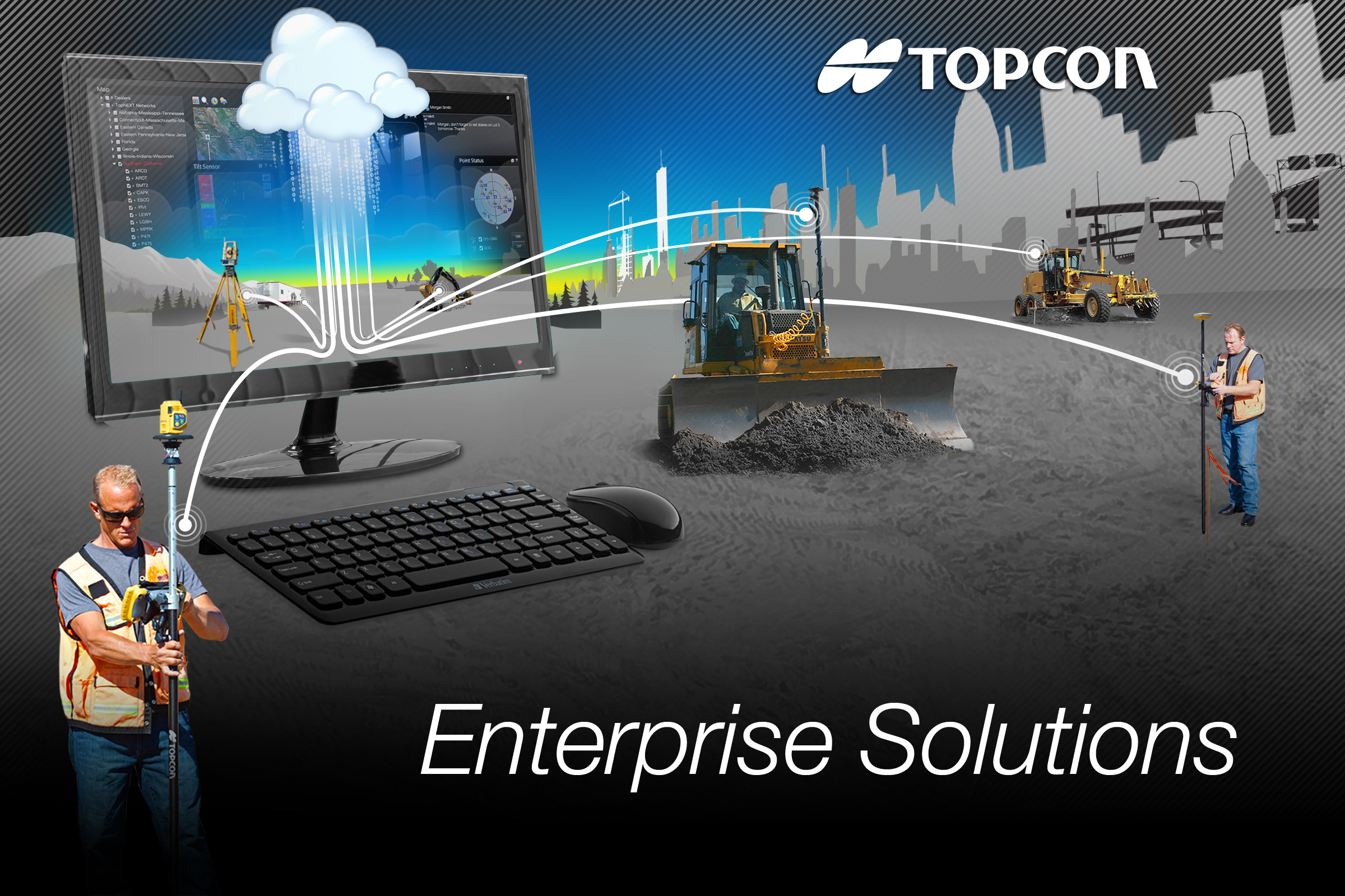
Enterprise Solutions. Topcon Positioning Group also announced a new workflow management system designed to connect all sites, all data, crews and equipment. Topcon Enterprise Solutions offers constant communication, data sharing, scheduling, updating, supporting, and accurate productivity data in real-time, no matter where the job or the office is located.
Cloud-based Topcon Enterprise Solutions provides seamless connectivity from any office or remote user, to any site, to each enabled machine and field crew, throughout the entire project life cycle, Topcon said.
The system is designed to allow users quicker accessibility and management of increasing volumes of data, thereby exponentially increasing a company’s efficiency. Integrating data in a cloud-based environment from Topcon software services like Sitelink3D or MAGNET allows users to make time-sensitive decisions faster.
The system can also be deployed to key partners of the company, such as engineers and sub-contractors, enabling instant updating of job files, material volumes and equipment schedules instantly with assured accuracy.
In addition to site and data management, Enterprise Solutions includes the option to activate a corporate Topcon TotalCare account, providing immediate access to online training and technical support for virtually all Topcon products.
Topcon Technology Roadshow 2014, by Topcon Positioning Systems, launches in April. The hands-on educational program is focused on advanced positioning technologies and will feature a 5,000 square-foot mobile classroom/theater housed in a custom-designed 18-wheeler.
The Technology Roadshow will cover North America, traveling more than 23,000 miles in six months. Each of the currently scheduled 23 stops for the free educational program – beginning April 10 in Pleasanton, California, and ending in October at Riverside, California — will include multiple sessions over two days. The events will focus on technology trends in the construction, surveying and GIS, engineering and architecture/engineering/contractor (AEC) professions.
“With technology advancing so rapidly, many of our customers are telling us that it is difficult for them to keep up,” said Mark Contino, Topcon vice president of global marketing. “The Technology Roadshow is a fresh ‘we’ll-bring-the-technology-to-you’ concept that will provide an educational experience to construction and surveying professionals who want to learn about these exiting new solutions first hand, so they can determine the best fit for their business. Instead of flying half way across the country to attend a trade show or conference, we’re excited for this opportunity to bring tomorrow’s positioning technology to the construction, engineering and surveying backbone of North America — on their timetable, close to home, on a one-on-one basis.”
“The focus of this unique learning event will demonstrate how the entire breadth of Topcon solutions works seamlessly together,” Contino said. “The real beauty is we’re bringing it directly to decision makers and end-users, allowing every company — big or small — the opportunity to see first-hand how new solutions and technologies can help them to become more productive and profitable.
“We believe this rolling ‘user conference’ is a proactive way to help make sure the opportunity to learn about new technology is available to anyone who wants to learn.”Topcon industry and application professionals will staff the traveling unit. Topcon dealer personnel from the local area are tour sponsors and will assist them at each stop.
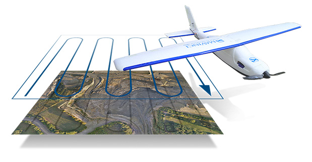
Topcon Positioning Group has released and made available in Europe the Topcon SIRIUS PRO powered by MAVinci, an Unmanned Aerial System (UAS) designed to produce the most accurate solutions for automated mapping of construction sites, pipelines, disaster areas, mines, quarries and myriad sites without regard to terrain.
During October 2013, Topcon Europe Positioning (TEP) entered into a strategic partnership with UAS provider MAVinci GmbH. The result of that partnership is the release of the fixed-wing UAS Topcon SIRIUS PRO powered by MAVinci.
“We are excited to announce our distribution agreement with Topcon. This partnership is the ideal expansion of our global distribution network,” Johanna Claussen, CEO at MAVinci GmbH said. “The simple operation of our UAS from flight planning to the final orthophoto and DEM (Digital Elevation Model), allows flexible use in highly demanding environments. Its flexible assisted auto-pilot landing mode enables navigation around any unforeseen obstacles.”
Based in St. Leon Rot, Germany, MAVinci is a aerial surveying company specializing in the development of UAS technology.
“By adding Topcon’s RTK solutions to the UAS and ground control station, the SIRIUS PRO is the first commercially available UAS that can reach 5-cm accuracy without the need for ground control points,” said Sander Jongeleen, mobile mapping product manager for Topcon Positioning Group. “This leads to an enormous reduction of operational cost and allows mapping of areas that are not easily accessible with high accuracy.”
The SIRIUS PRO is a fixed-wing UAS capable of producing high quality and pre-positioned aerial photography without the need of extensive ground control that is required by competitive products. Key features include:
Work in mountain areas — Flight plan adapts to elevation model
Cover areas that require multiple flights — Flight plan automatically splits and rejoins for post processing
Simple hand launch
Land in areas where automatic landing is impossible with assisted auto-pilot mode
Fly in all weather conditions — wind up to 50 km/h, temperature range of -20º C to 45º C and rain.