Trimble has introduced the ABX-Two OEM GNSS sensor, which delivers precise heading, pitch, roll and 3D positioning information. With two internal MB-Two modules, the ABX-Two offers a third antenna option that provides a drift-free, absolute attitude solution.
The ABX-Two is designed for a wide variety of applications such as agriculture, automotive, aviation, construction and marine systems.
The announcement was made at Ocean Business 2017, an international event for ocean technology.
The ABX-Two is a compact, lightweight and weatherproof enclosure that is built around two MB-Two modules. The sensor allows a wide range of voltage inputs and maintains low-power consumption regardless of the voltage. The ABX-Two speeds the integration process with a web user interface and a variety of interface connections for an easy addition into new and existing solutions.
“System integrators require high performance, reliability and support for their positioning solutions,” said Chris Wheeler, business area manager of Trimble’s Precision OEM GNSS group. “The ABX-Two is designed for easy integration. And its rugged dependability makes it ideal for harsh environment applications.”
The ABX-Two has a powerful RTK engine that delivers centimeter-level accuracy from a base station or Real- Time Kinematic (RTK) network. With Trimble RTX correction services, the ABX-Two achieves Precise Point Positioning without a base station.
The ABX-Two features a wide range of option-upgradable GNSS configurations from single sensor/single frequency/single GNSS to multi sensor/multi frequency/multi GNSS capability. Trimble’s patented Z-Blade technology drives a powerful GNSS agnostic engine, allowing the ABX-Two to use any single GNSS satellite system for positioning without any constellation preference to deliver fast and stable centimeter-accurate positioning and heading information.
The Trimble ABX-Two is available now through the Trimble GNSS OEM international network of representatives and authorized dealers.
Higher-Accuracy Positioning to Improve GNSS Network Performance and Reliability
Trimble has introduced version 3.10 of its Pivot Platform software, a modular solution for real-time GNSS infrastructure management, ranging from a single-base GNSS continuously operating reference station (CORS) to a full real-time network (RTN), serving thousands of end-users worldwide.
Version 3.10 provides improvements to network performance and office and field productivity. The new features and capabilities include:
Galileo support provides access to five GNSS constellations — GPS, GLONASS, BeiDou, QZSS and now Galileo — allowing end-users to expect improved positioning accuracy and fix performance from the 50 percent increase of accessible satellites;
GPS L5 support utilizes all available L5 third-frequency GPS observations to enable end users to further improve field productivity;
Code Bias Calibration client and server improvements provide a higher availability of network-modeled RTK corrections to allow field users to reduce dependency on station biases;
Sparse Network supports Galileo and BeiDou. Sparse Network, a Trimble technology, enables RTN operators to achieve the benefits of a full network-processed GNSS constellation even if the network is not fully covered with multi-constellation CORS.
Dynamic Station Coordinates (DSC) module improvements minimize the impact of erroneous reference station coordinates to improve system performance.
“Trimble continues to transform the way our customers manage their real-time GNSS infrastructure by making networks more robust and easier to manage,” said Mark Richter, director of marketing for Trimble’s Advanced Positioning Division. “Accessibility to the Galileo constellation and the addition of the L5 third-frequency observations in particular, makes Trimble’s Pivot Platform significantly more versatile to improve functionality and performance for end users in the field.”
Trimble Pivot Platform version 3.10 is available now from Trimble’s Distribution Network and Trimble Sales Representatives. Customers with a valid software maintenance agreement receive the new version at no additional cost.
Trimble is offering Trimble Earthworks for Excavators and Earthworks for Dozers. Trimble Earthworks is transforming machine control with integrated 3D aftermarket excavator automatics capability.
In addition, a new dozer configuration moves the receivers from the blade to the roof of the cab. Reengineered from the ground up, Trimble’s innovative, next generation grade control platform features intuitive, easy-to-learn software that runs on an Android operating system.
State-of-the-art software and hardware gives operators of all skill levels the ability to work faster and more productively than ever before, Trimble said.
“Trimble pioneered machine control,” said Scott Crozier, director of marketing for Trimble Civil Engineering and Construction. “Now, Trimble Earthworks takes machine control to the next level, with a platform that reinvents machine control technology, making it easy to use and learn, and more accessible for many different types of contractors.”
Live demonstrations of Trimble Earthworks for Excavators and Trimble Earthworks for Dozers will be showcased at ConExpo 2017, March 1-7, one of the world’s largest international exhibitions for the construction industry. Trimble will be located in the Las Vegas Convention Center North Hall #N-12067.
Intuitive Software. The Trimble Earthworks grade control application is built on the Android operating system, and runs on the new 10-inch (25.7 centimeter) Trimble TD520 touch-screen display. The Earthworks application was developed based on feedback from construction equipment operators around the world, resulting in an interface optimized for productivity.
Colorful graphics, natural interactions and gestures, and self-discovery features make the software intuitive and easy to learn. Each operator can personalize the interface to match their workflow and a variety of configurable views make it easier to see the right perspective for maximum productivity.
In addition, Earthworks allows data files to be transferred to or from the office wirelessly and automatically so that the operator is always using the latest design. Using the Android operating system, users can download other applications that provide the operator with additional useful tools inside the cab. To make the system even more flexible, contractors can use the Trimble TD520 display or a third-party Android device.
Excavator Automatics. With Trimble Earthworks, contractors can now take advantage of the first integrated 3D aftermarket grade control automatics for excavators, allowing operators to create smooth, flat or sloped surfaces more easily.
When the excavator is placed in Autos mode, the operator controls the stick, and Trimble Earthworks controls the boom and bucket to stay on grade, reduce overcut and increase production. By automating excavator operation, Trimble Earthworks allows operators to achieve grade consistently, with high accuracy and in less time.
Mastless Dozer Configuration. Trimble Earthworks for Dozers mounts dual GNSS receivers on top of the cab to eliminate masts and cables traditionally located on the blade. The dual-GNSS receivers are ideal for steep slope work and complex designs with tight tolerances. The new configuration keeps valuable receivers safer and can also save contractors time by reducing the time needed to remove and reinstall them each day.
Trimble Earthworks for Excavators is expected to be available globally in the second quarter of 2017 from the SITECH dealer channel. Trimble Earthworks for Dozers is expected to be available in the second half of 2017 from the SITECH dealer channel.
The Dutch state-owned rail company NS Groep N.V. is deploying a real-time remote diagnostics monitoring system. As a core component of NS’ overall real-time monitoring architecture, the system allows railway operators to streamline maintenance costs and provide efficiencies across their fleet by automating manual tasks.
NS in the Netherlands will join a growing number of large rail operators that have implemented GNSS solutions, in this case the Trimble R2M system. Others using R2M include South West Trains in the United Kingdom, Irish Rail, SNCF France, SBB Switzerland and VR Finland.
R2M processes diagnostic data from rail vehicles in real time. It provides a comprehensive view of the overall fleet’s status including specific vehicle faults. The system also identifies potential faults that may arise while analyzing and detecting anomalies in on-vehicle component behavior to identify component issues and the possible impact this behavior may have on the vehicle and overall fleet.
With the R2M software, NS will be able to aggregate data from a range of on-train and wayside sources and provide real-time information to the NS Train Helpdesk to monitor the fleet status. Information will also be available to fleet analysts, work-planning engineers and mechanics to support the operational repair process of NS in real time.
Trimble has launched a patent-pending VerticalPoint RTK system for grade control in agriculture.
VerticalPoint RTK provides significantly enhanced vertical accuracy and stability of standard single-baseline RTK systems reducing the downtime and costly delays experienced by many agriculture land improvement contractors today.
VerticalPoint RTK is available in North America and Australia as an unlock on the Trimble FmX integrated and TMX-2050 displays and works in combination with the Trimble FieldLevel II system, which streamlines the surveying, designing and leveling steps required for land leveling projects.
The VerticalPoint RTK system also includes two stationary supplemental rovers for live, dynamic data collection.
When vertical accuracy inconsistencies occur, agriculture contractors must wait to restart leveling until the vertical signal is once again accurate, and in some instances even rework portions of the field that were incorrectly leveled before the vertical signal inconsistency was discovered.
VerticalPoint RTK significantly reduces vertical design errors in leveling and land forming projects, which occur from inconsistent vertical GPS signals resulting from atmospheric interference. With VerticalPoint RTK, contractors can experience an approximate 25 percent increase in overall uptime.
The industry experiences about 75 percent uptime; however, with VerticalPoint RTK uptime can increase to approximately 95 percent. In addition, this increase in uptime occurs even in the most challenging environments and at any time of year.
“Trimble is excited to launch a world-first technology that enhances vertical GPS accuracy, enabling agriculture contractors to better perform leveling or land forming operations,” said Josh Shuler, product manager for Trimble’s Agriculture Division. “Our new VerticalPoint RTK system can significantly reduce downtime leading to reduced expenses in labor and fuel while also increasing productivity.”
“On average during the summer months we may see 5-6 hours a day where we don’t have the level of vertical GPS accuracy that we need to complete finish passes,” said Jarrett Lawfield, owner of Lawfield Land Grading, a custom land leveling business. “At times all we lack is a finish pass and then we very well may have to stop and wait. I can’t get onto the next job since I’m waiting for the vertical accuracy to be where it needs to be.”
“The vertical accuracy capabilities of VerticalPoint RTK allows the whole project—from bulk hauling to finish passes—to be more efficient. The more accurate bulk hauling is, the less work to be done while finishing,” Lawfield said. “From first thing in the morning until the evening or even to the next day, VerticalPoint RTK is consistent and repeats elevation, so it has virtually eliminated the times when we are unsure of the vertical GPS accuracy. It has helped us to be more timely and efficient in our work.”
TerraGo has joined Trimble’s Developer Partner Program, bringing Trimble GNSS Direct SDK to TerraGo’s mobile solutions. TerraGo Edge and TerraGo Magic now include Direct SDK to deliver high-accuracy positioning data from Trimble survey-grade receivers to iOS and Android mobile devices.
“We are excited that TerraGo is now part of our developer program. This relationship will enable TerraGo to embed Trimble technology into their products, and deliver GNSS position data that is fully integrated with TerraGo applications,” said Dan Colbert, manager of Partner Programs at Trimble. “The goal of this partnership is to create new opportunities and added value for TerraGo customers desiring to seamlessly bring Trimble GNSS receivers into their existing workflows by providing any level of accuracy they need for the job at hand.”
“This is great news for customers, resellers and integration partners that want the highest levels of GNSS performance from Trimble combined with the ease of use of TerraGo’s iOS and Android apps,” said Dave Basil, vice president of Product Development at TerraGo. “Many TerraGo Edge customers need better accuracy and richer positioning data than can be achieved with consumer devices. Now they can get the best of both worlds with ‘out-of-the-box’ survey-grade accuracy for all types of demanding applications including survey, utilities, energy and engineering work. At the same time, TerraGo Magic enables organizations to build their own branded, customized apps in minutes that integrate with Trimble GNSS devices, without writing any code.”
TerraGo Edge and TerraGo Magic including the Trimble GNSS Direct SDK are available today. Download the free iOS or Android app.
TerraGo is offering a live demonstration of the Trimble GNSS Direct SDK with TerraGo Edge in a Dec. 13 webinar.
Times have changed, and the technology landscape is much, much different today than it was as recently as ten years ago when GPS was the driving-force technology for geospatial users and geospatial equipment, and the exclusive concern of many companies in the industry. In that era, their challenges were to design the best performing receiver in terms of accuracy, size, weight, ruggedness and so on.
Now, GPS technology has been commoditized in mobile devices (the GNSS chip in your smartphone costs about $1.50), and high-precision GNSS is heading in that direction. It’s hard to make a living designing “GPS boxes.”
Sure, GPS is still a core technology offered in most hardware products that geospatial professionals use, but it’s not the centerpiece. It’s all about system solutions, of which software (and hardware besides GPS) is a major component.
As just one example of this overall industry trend, let’s look at how the message of system solutions was abundantly clear last week at the Trimble Dimensions User Conference in Las Vegas. This event reportedly drew 4,400 attendees from more than 80 countries.
More than 4.400 attended Trimble Dimensions at the Venetian Hotel.
Virtual/Augmented(AR/VR) Reality
The Trimble Dimensions general plenary discussion didn’t feature the latest GNSS technology. In fact, there was barely a mention of GNSS. Nonetheless, the cool factor was present, with the highlight being a live demonstration of virtually reality using Microsoft HoloLens goggles and Trimble SketchUp software.
Over the years I’ve written quite a bit about augmented and virtual reality. This technology has a bright future for locating hidden assets (think underground and inside wall infrastructure) and visualizing design ideas. For this technology to work, it’s not just about having a set of goggles. One needs software and an accurate geo-database.
During the plenary, architect Greg Lynn demonstrated the value of virtual reality technology by “displaying” a building concept on an empty table on the stage. Lynn and a colleague donned HoloLens goggles while a camera was set up with HoloLens goggles to display what they were “seeing” through the HoloLens.
AR/VR reality are a step closer to being a practical technology to deploy in the field. In a way, AR/VR technology seems to be taking the same path as tablet computers. Tablet computers existed way before the iPad was introduced. They were expensive, and history is littered with failed tablet computer ventures, just like Google Glass failed in the AR/VR world.
I remember paying ~$2,500 for a Fujitsu Stylistic tablet about 10 years ago for my work. Like the Stylistic, HoloLens isn’t cheap. It’s $3,000 for a development kit and $5,000 for the commercial version. It’s not priced for the average consumer, but the attraction is undeniable and due to the price tag; industrial markets will pick it up before the consumer market will.
It might take a Steve Jobs-like push to punch it through the finish line, but it’s just a matter of time before AR/VR technology is commonplace.
Solutions
Hardware isn’t sticky. Software is. Even better, hardware and software bundled tightly together is the sweet spot. Dimensions showed how, more and more, geospatial technique is geared around solutions, not boxes.
Trimble partner solutions area at Trimble Dimensions 2016.Trimble solutions area at Trimble Dimensions 2016.
One case in point: I took a 45-minute ride from the Venetian Hotel on the Vegas Strip to the outdoor demonstration site in the desert east of Las Vegas.
The demonstration site was a playground for heavy equipment utilizing Trimble hardware and software — from tractors to scrapers to bulldozers and paving machines. It’s difficult to imagine the scale of the outdoor demonstration site, so following are a few images.
Demonstration site facing south with the Las Vegas Strip to the southwest.
I caught a ride in a fully autonomous tractor that was outfitted with guidance technology (GNSS using RTX satellite correction service), collision avoidance sensor and display console. It repeatedly stayed within the track defined by the orange cones you see in the above image.
What good is autonomous guidance without collision avoidance? A sensor on the front of the tractor senses objects and either avoids them, slows down or stops. Trimble says they are working on perfecting the turns at the end of each line where traditionally a driver had to take control. This is a difficult task when the tractor is pulling an implement such as a planter or sprayer.
In the not-too-distant future, tractors will be completely hands-free from start to finish.
Wi-Fi radio.
Back inside the Venetian Hotel, I saw this little beast. No, it’s not a funky GNSS antenna. It’s an industrial Wi-Fi radio. Yes, Trimble owns some pretty cool outdoor Wi-Fi technology vis-à-vis Fidelity Comtech, a company that Trimble acquired in 2015.
I’ve set up outdoor Wi-Fi infrastructure before in relatively benign environments (think agriculture), but I didn’t use anything like this. This equipment is built to propagate outdoor, long-range Wi-Fi connectivity in nasty, noisy environments like shipping terminals and construction sites. It can reshape the antenna pattern on the fly in microseconds, and shape the beam width/range to cover a specific geographic area.
GNSS Gear
Even though I’ve been talking about how this isn’t a just a GPS or GNSS environment anymore, I can’t leave without investigating the latest GNSS gear.
Check this out.
Trimble Catalyst software GNSS receiver.
In the past, I’ve written about GNSS software receivers. They exist, but require some serious computing power. Well, some smartphones have powerful CPUs, such as the Samsung Galaxy 6 and 7. Trimble has developed a software GNSS receiver called the Trimble Catalyst that uses the CPU of a Samsung smartphone as the GNSS receiver…dual frequency. The antenna on the range pole is just an antenna, albeit an L1/L2 antenna. Using an RTK network, Trimble says it can deliver centimeter accuracy. Wow.
To be fair, it’s got some significant limitations such as it only uses GPS and Galileo, only runs on certain Android devices (it will likely never run on iOS devices), and eats up the smartphone battery. And although Trimble said it shares resources in a friendly manner, I must think that a rogue app or update might cause things to slow down. Although it won’t behave as snappy as RTK on an R10 and won’t recover as quickly from obstructions like trees, terrain and buildings, it most certainly could bring high-precision GNSS to a wide-array of previously non-RTK users.
The GSC2000 now works with Engon tiltrotator excavator attachments.
Trimble and Engcon announced at Trimble Dimensions that the Trimble GCS900 Grade Control System can now be used with Engcon tiltrotator excavator attachments. Trimble machine control gives excavator operators using an Engcon tiltrotator precision guidance, which can result in time and fuel savings for contractors.
“Working closely with Trimble, we have made high-precision guidance available for Engcon tiltrotator attachments,” said Fredrik Jonsson, development manager at Engcon. “Major gains in productivity and precision can be realized by customers when the Engcon tiltrotator is used with the Trimble GCS900 Grade Control System.”
“We are excited about linking Trimble machine control to Engcon’s tiltrotator system,” said Scott Crozier, marketing director for Trimble’s Civil Engineering and Construction Division. “When operators receive accurate guidance in the cab about the tilt and rotation position of the bucket, excavations to designs can be performed faster and more productively.”
When Engcon tiltrotators are used with the Trimble GCS900 Grade Control System the bucket position and orientation are always visible regardless of bucket rotation. The operator can see the height and the rotation, so the attachment can be more efficient when used for mass excavation, fine grading and working in confined areas.
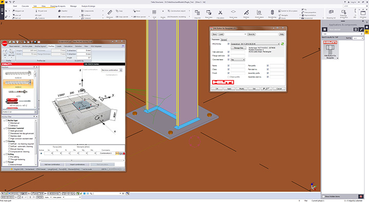
Trimble and the Hilti Group announced today that they are collaborating to deliver new software integration and data exchange solutions. These new integrated solutions provide a connected and improved digital experience for building construction professionals.
The Hilti PROFIS Plugin for Trimbe’s Tekla Structures.
New software and data exchange solutions include:
Sharing design information between software applications — Hilti PROFIS Plugin for Tekla Structures allows engineers and detailers to apply PROFIS design information directly in a Tekla Structures model through the Trimble Connect collaboration platform.
Easy access to data in the cloud — Hilti’s total stations POS 150/180 and PROFIS Layout Office solutions, and PROFIS detection solutions are now integrated with the Trimble Connect collaboration platform, enabling data to be easily exchanged and shared with others.
More design content, specification information and pricing at a user’s fingertips — Hilti has significantly increased its design content in the Tekla Warehouse to include anchors and cast-in solutions as well as providing more than 7,000 items through Trimble’s TRA-SER and LuckinsLive pricing services.
Since 2010, Trimble and Hilti’s relationship has been built upon shared values that focus on a deep understanding of customer needs and harnessing innovation to develop value-added solutions that increase customer productivity.
Hilti Corporation supplies the worldwide construction industry with technological products, systems, software and services.
As part of an ongoing commitment to transform the way mines manage their business, Caterpillar Inc. and Trimble are extending their collaboration to bring mining customers improved operational decision-making capabilities.
The collaboration will leverage Caterpillar Global Mining’s industry expertise and combine its in-pit operational execution system, Cat MineStar, with Trimble’s portfolio of technology-enabled mining information solutions.
This expanded collaboration in mining will include product integration and development, marketing, distribution and support of Trimble Connected Mine solutions.
The companies have signed an agreement that outlines areas for increased engagement to begin in early 2017. Caterpillar Global Mining is anticipated to become the primary sales, marketing, distribution and support channel for Trimble’s Connected Mine platform.
In addition, Cat MineStar and Trimble’s Connected Mine platform will be integrated and collaboratively developed. The expanded Caterpillar-Trimble collaboration will enhance both companies’ efforts to serve global customers with technologies and services across a mine?s entire operation and equipment fleet, regardless of brand, language or location.
“Caterpillar and Trimble have enjoyed a very successful relationship for decades and we are pleased to be working more closely to better leverage the products and capabilities in both companies for our mining customers,” said Tom Bluth, Caterpillar vice president with responsibility for the Surface Mining & Technology Division. “Whether it’s the mining pit supervisor or a corporate operational analytics teams, Caterpillar Global Mining continues to go beyond the iron by providing the technologies and expertise to help customers improve productivity and lower their cost per ton.”
“This collaboration demonstrates our mutual commitment to provide mine professionals with complete visibility from the mine to the mill,” said Bryn Fosburgh, vice president at Trimble. “As a result, mine operations can leverage accurate production, fleet and spatial data to optimize their workflow and control costs.”
Cat MineStar is a mining operational execution system purpose built to help miners boost productivity, enhance safety and improve equipment availability, regardless of equipment manufacturer. The system consists of five capability sets: Fleet, Terrain, Detect, Health & Command, which can be configured to suit the unique needs and capabilities of any mine, both surface and underground.
Cat MineStar has been a critical part of the digital transformation in mining since 1996 when it was first introduced. Today it is installed at more than 200 mine sites around the world. Utilizing improved interoperability, the Cat MineStar platform is uniquely positioned to help customers connect data and decision-making across the mining value chain, from the mine plan to plant processing or from an individual machine to across an enterprise.
Trimble Connected Mine provides an integrated and complete view of mine data to improve and accelerate operational and strategic decision making. Visual Intelligence is an optional module that enables the 3D visualization of Trimble Connected Mine data.
With a proven track record of enterprise-level implementations in some of the largest mines worldwide, Trimble is transforming the way mines work by combining mining expertise, spatial technology, business analytics, visualization and decision support tools to enable mining companies to fully optimize their resources for safe, productive and profitable mining.
Collaborating Since 1996. Caterpillar and Trimble have been collaborating in mining since 1996, when the two companies jointly developed a best-in-class machine control and guidance product, known today in the marketplace as Terrain. Today, Terrain is a leading guidance system for mining, with many of the world’s largest mining companies improving their productivity through use of this technology.
The companies’ first collaboration evolved into a joint venture in 2002 with the formation of Caterpillar Trimble Control Technologies (CTCT). Today CTCT develops machine control and guidance products for both the mining and construction industries, for any make or model of equipment regardless of manufacturer. Trimble positioning technologies, such as GPS and inertial navigation systems, are also used in many of Caterpillar’s semi-autonomous and autonomous systems.
Trimble is offering a new suite of services benefiting owners and operators of real-time networks (RTN): Trimble Network Management. The initial offering consists of three levels of service, ranging from simple backup to fully outsourced network operations.
Trimble Network Management is performed by Trimble’s global network operations team, comprised of network engineering, geodetic and IT professionals, already performing around-the- clock operations and maintenance in support of Trimble?s local and global networks.
Trimble Network Management is comprised of three levels of service, each one scalable and customizable to meet the requirements of the individual network owner.
Trimble Backup ensures users receive the highest possible level of uptime, maximizing productivity in the field. Trimble maintains a redundant network processor and server with 24/7 monitoring and support, and seamlessly maintains corrections to rovers in the event of a primary server failure.
Trimble Network Hosting brings RTN into the cloud using a fully redundant, decentralized data center. Network hosting can minimize the limitations of traditional IT solutions such as accessibility, server configuration and reliability.
Trimble Network Operations provides the expertise of the same Trimble network operations team trusted to maintain the Trimble RTX and VRS Now networks. Geodetic experts across the globe will monitor and maintain a RTN network 24/7.
Trimble Network Operations offers additional flexibility with resourcing, allowing RTN owners/operators to focus on their core competencies, or even expand into new horizons.
“Trimble Network Management is designed to reduce operating costs for the owner/operator,” said Patricia Boothe, general manager of Trimble Advanced Positioning. “And by leveraging Trimble’s team of network operations professionals as well as our scalable infrastructure, we can enable the private network owner to deliver improved network performance resulting in an enhanced end-user experience.”
Trimble Network Management is available today for RTN owner/operators using Trimble Pivot Platform network software.
 Trimble has introduced the ABX-Two OEM GNSS sensor, which delivers precise heading, pitch, roll and 3D positioning information. With two internal MB-Two modules, the ABX-Two offers a third antenna option that provides a drift-free, absolute attitude solution.