Tag: Trimble

  • Robotic total stations add scanning capabilities

    Robotic total stations add scanning capabilities

    A unique workflow enabled by scanning robotic total stations is the simultaneous operation, with the same data controller and software, of a GNSS rover while scanning and imaging are being performed. Pictured: a Trimble SX12 and R12i GNSS. (Image: Gavin Schrock)
    A unique workflow enabled by scanning robotic total stations is the simultaneous operation, with the same data controller and software, of a GNSS rover while scanning and imaging are being performed. Pictured: a Trimble SX12 and R12i GNSS. (Image: Gavin Schrock)

    This is part III of our III part cover story. Catch up on part I, Minnesota company develops new system for mapping underground utilities and part II, Review benefits of GNSS rover accuracy.


    Scanning capabilities, in one form or another, have been added to models of robotic total station (RTS) since 2007 — for instance, on the Trimble VX. Such capabilities were limited to a pattern of individual shots, as the RTS would “nod.” While not designed to compete with traditional scanners, even such painfully slow “pseudo-scanning” capabilities demonstrate the value of new options for capturing detailed features.

    It was not long before nearly all RTS offered limited (nodding scanning) capabilities, though at rates as slow as 15 shots per second. By 2013, the release of the Leica MS50 took the nodding scan to the next level, with a rate of up to 1,000 points per second, and then up to 30,000 in the subsequent MS60 model (which now also supports a tilting prism pole).

    The end of 2016 saw the release of Trimble’s SX10 (and SX12 more recently). This routed the laser through a pair of rotating prisms to capture a swath of points as it nodded. In 2019, Topcon took the approach of adding a piggy-backed compact conventional scanner to the top of an RTS: the GTL-1000 and GTL-1200 models.

    All these implementations were built upon high-quality RTS. Foremost, they can be operated as an RTS, with all the same integrated surveying capabilities as instruments with which surveyors were familiar, and in the same field software.

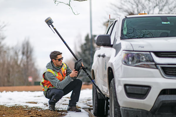
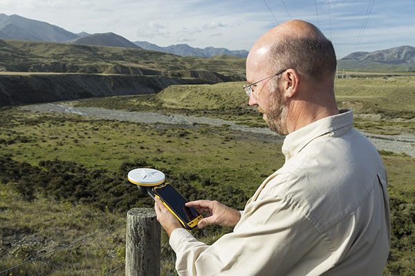
    This includes all the integrated GNSS workflows: resections, combining optical and GNSS captured points in the same survey, and adding a rover to the prism pole for track-on-GNSS methods. One huge advantage of scanning total stations is instant deliverables already fully registered, as adopters of these new systems quickly realized.

    Some initial users seemed skeptical of the relatively slow scan rates of these various models: 12 to 30 minutes for full-dome scans, and then a photo capture pass. Others, though, discovered that the time did not necessarily need to go to waste.

    First, it is not necessary to do a full-dome scan and image pass every time; it is sufficient to pre-select specific areas to scan and image.

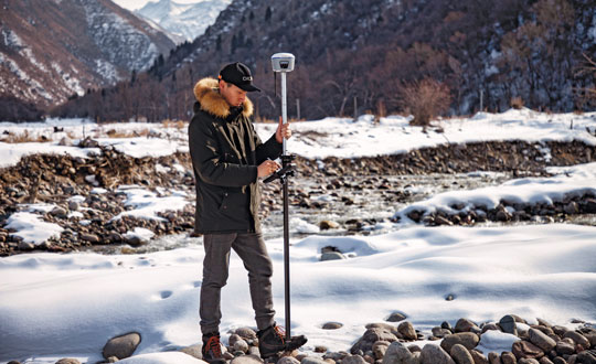
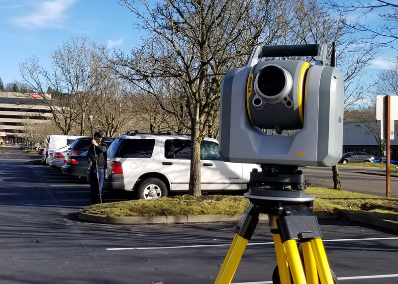
    The real kicker is that while the RTS is scanning, it is possible to fire up the GNSS rover and capture points that the RTS cannot see, such as behind curbs, cars and vegetation. This is true especially now, with the advent of no-compensation tilt capabilities on nearly every new GNSS rover system.

    This can be done in the same project, using the same software and field controller. This struck this writer as one of the coolest lateral features of scanning total stations when he first tried out an SX10 in 2017.

    Considering the benefits scanning total stations deliver (especially with the integrated GNSS bonus), what has the reception been like among surveyors and other segments of the architecture, engineering and construction (AEC) community?

    “As an industry, we’re getting better at tying solutions and workflow elements together, and not seeing them, or treating them, as individual functions or pieces of hardware,” said Derek Shanks, director of Geospatial Optical Product Management for Trimble. “We bring the system aspect, a case of using the best tool, using the strengths of each tool to their fullest.”

    Accoring to multiple manufacturers, sales numbers indicate that the adoption of scanning total stations for AEC applications — and not just surveying — has exceeded expectations.

  • Trimble introduces module for rail monitoring

    Trimble introduces module for rail monitoring

    Image: Geoff Eccles/ iStock / Getty Images Plus/Getty Images
    Image: Geoff Eccles/ iStock / Getty Images Plus/Getty Images

    Trimble has released Trimble 4D Control (T4D) version 6.4 software and an add-on monitoring module for automated and semi-automated rail monitoring. The T4D Rail module enables simple data collection and reduces office work required to automate movement detection for rail monitoring projects.  

     The T4D software offers four main elements for automated monitoring: sensor management and data integration for GNSS, total station, geotechnical, vibration and environmental sensors; geodetic processing and adjustments for accurate results; analysis and visualization through several tools that provide real-time updates to support in-depth analysis and data presentation; and alarming and reporting.  

     The T4D Rail module enables integration of rail as-builts collected with the Trimble GEDO system or with a track measuring bar paired with the Trimble Access Gauge Survey app. It can also automate calculations for track geometry parameters, generate analysis charts, and trigger alarms. 

     The T4D software is offered in five editions to fit various project requirements. The editions include T4D Access, T4D Field, T4D Intermediate, T4D Geotechnical and T4D Advanced. T4D Access and T4D Advanced are the two editions that support the add-on Rail Module.

    Image: Trimble
    Image: Trimble
  • Trimble: European company reduces emissions and improves deliveries

    Trimble: European company reduces emissions and improves deliveries

    Trimble Maps enables a shipping company to offer one-hour delivery windows. (Photo: Trimble)
    Trimble Maps enables a shipping company to offer one-hour delivery windows. (Photo: Trimble)

    To reduce its emissions, DPD Deutschland — a franchise of DPDgroup, one of the largest international parcel carriers in Europe — has asked Trimble Maps to help optimize its operations. DPD Deutschland’s parcel supply chain covers 80 franchise depots, 9,500 employees and more than 13,000 drivers, delivering about 2 million packages to businesses and consumers per day via a mixed fleet of vehicles, including electric ones.

    DPDgroup has a vision to become the international standard in sustainable delivery by 2030. Per parcel, it has reduced its CO2 emissions by 18.8% since 2013 and is on track to reach a 30% reduction by 2030, according to Trimble.

    One of DPD’s most popular service offerings, called Predict, allows parcel recipients to track the progress of their deliveries in real time, with an estimated one-hour delivery window and updated notifications along the way. Since 2014, Trimble Maps’ portfolio has helped calculate this one-hour delivery window and provided turn-by-turn navigation to DPD drivers, resulting in less overall travel time, more successful first-time deliveries and reduced emissions.

    DPD was the first, and still is the only, parcel carrier in Germany that provides recipients with an estimated one-hour delivery window, the company says, calculating it for every parcel. The service is made possible in part by the integration of Trimble Maps’ route optimization and mapping web services platform, known internally as DPD Maps. Recipients can reschedule deliveries as needed for future days and times, or perhaps to a convenient drop-off location. This reduces emissions created by multiple return trips.

    DPD Maps calculates an optimized route for drivers, who are then able to manually sort the stops and change the route to best fit their preferences. Once routes are locked in, Trimble’s commercial navigation application, CoPilot, provides drivers with real-time directions. Once a driver’s route is complete for the day, DPD can compare the actual route taken with the optimized route DPD Maps calculated in an easy-to-understand view that can be analyzed by the driver and the depot.

    DPD Maps allows the company to visualize, share and discuss results with different stakeholders within the organization. The solution also allows drivers to plan out their day as they see fit, while giving the back office access.

  • Trimble joins with Exyn on autonomous surveying solution

    Trimble joins with Exyn on autonomous surveying solution

    Trimble and Exyn Technologies are developing multi-platform robotic autonomy for complex, GPS-denied environments. (Photo: Trimble)
    Trimble and Exyn Technologies are developing multi-platform robotic autonomy for complex, GPS-denied environments. (Photo: Trimble)

    Trimble and Exyn Technologies are working on a proof of concept for a fully autonomous surveying solution for construction.

    The solution will integrate the Boston Dynamics Spot robot, the ExynPak powered by ExynAI, and the Trimble X7 total station. It will enable fully autonomous missions inside complex and dynamic construction environments, which can result in consistent and precise reality capture for production and quality-control workflows.

    Autonomous robots powered by ExynAI can sense and avoid obstacles, dynamically adapting to the complexity of construction environments. To ensure safety and efficiency, the ExynPak integrates with a robot, supporting Level 4 of autonomous exploration missions without requiring the robot to “learn” about its environment beforehand.

    A surveyor can define a 3D volume for a mission, and then the integrated robotic solution handles the complexities of self-navigation without needing a map, GPS or wireless infrastructure.

    The integration of the Trimble X7 provides high-speed, high-accuracy 3D laser scanning to capture the state of the environment. The captured data can be uploaded to the Trimble Connect collaboration platform and shared with project stakeholders for further analysis, including a comparison to building information models (BIM) and previous scans to monitor quality and progress. The result is a detailed and accurate map collected with minimal human intervention and risk.

    Exyn and Trimble will be demonstrating their technology at the Trimble Dimensions+ Conference Nov. 7-9 in Las Vegas.

  • Trimble and GM exceed 34 million miles in hands-free-driving

    Trimble and GM exceed 34 million miles in hands-free-driving

    More than 34 million miles have been driven with Super Cruise engaged on General Motors vehicles. (Photo: GM)
    More than 34 million miles have been driven with Super Cruise engaged on General Motors vehicles. (Photo: GM)

    General Motors and Trimble have reached more than 34 million miles of hands-free driving with Super Cruise engaged on General Motors vehicles.

    GM teamed with Trimble to develop a reliable way to maintain in-lane positioning for hands-free driving, putting safety top-of-mind.

    Trimble’s precise GPS technology enables a vehicle to maintain its lane position in a variety of environments, including inclement weather conditions (rain, snow, fog and more), which often challenges other sensors. GM’s Super Cruise, a hands-free driver assistance system, uses Trimble RTX (Real-Time eXtended) technology to deliver high-GNSS accuracy corrections since it introduced the technology in 2017 on the model year 2018 Cadillac CT6.

    “Trimble RTX has been in commercial use for more than 10 years, and in 2018 was the first precise point positioning correction service to log miles in a commercial autonomous driving system,” said Patricia Boothe, senior vice president of Autonomy, Trimble. “It works with Super Cruise to help a vehicle maintain its lane position, bringing more consumers access to a more enjoyable and convenient driving experience.”

    Standard GPS receivers can have a margin of error of up to 25 feet, which is not suitable for vehicles that require precise absolute position information to maintain lane-level positioning. Trimble’s RTX technology removes errors in GNSS satellite data broadcasts to improve location accuracy on our roadways.

    “Super Cruise is a life-changing technology, allowing customers to experience hands-free driving on compatible, mapped roads nationwide,” said Mario Maiorana, GM chief engineer, Super Cruise. “The technology is a collaborative effort internally and externally to bring this advanced driver assistance technology to life. Trimble Autonomy has been a valuable collaborator in bringing Super Cruise to our customers.”

  • Trimble announces new construction management solution

    Trimble announces new construction management solution

    Logo: TrimbleTrimble has announced Project MEP, a construction management solution that provides visibility into mechanical, electrical and plumbing (MEP) workflows including estimating, change management, project management, detailing and fabrication. Project MEP allows for greater efficiency, collaboration and visibility across projects in the electrical, mechanical, HVAC and plumbing contractors fields.

    Project MEP manages drawings, documents, budgets and field productivity while extending construction management workflows with a suite of capabilities including estimating, submittal management and fabrication collaboration. The solution also provides project managers with the tools to identify issues faster, reduce rework and deliver more profitable projects. Project MEP is available as part of Trimble’s cloud-based construction management platform, Trimble Construction One.

    “MEP project managers are closely involved with every detail of a project from bid to closeout, but in today’s construction environment the data they need isn’t always readily available,” said Lawrence Smith, vice president of Trimble Construction Management Solutions. “With Project MEP, Trimble is breaking down information silos … while also providing the tools project managers need to run a job more efficiently. Now MEP contractors have a construction management solution that gives them the big picture of project health and the ability to track details such as the status of a spool.”

    Project MEP addresses MEP workflows including bid turnover, model collaboration, submittal management, design to fabrication, model-based estimating and field-to-office.

  • Continuous evolution: What is new with GNSS receivers?

    Continuous evolution: What is new with GNSS receivers?

    GNSS receivers face the same old challenges (extremely weak received signal, orbit and satellite clock errors, ionospheric and tropospheric delays, multipath, dilution of precision, urban canyons, etc.) and new ones (increased interference). However, compared with just a few years ago, they benefit from new signals, many more satellites, a panoply of options for corrections, and improved integration with inertial navigation systems (INS).

    For example, pole-tilt compensation is quickly becoming standard. This feature enables users to locate dangerous or hard-to-reach points by measuring them at an angle with just the tip of the pole to which the receiver is attached.

    Pole-tilt compensation also makes surveying and mapping easier by removing, in many situations, the need to use total stations or offsets. Together with improvements in work processes, this makes GNSS receivers more user friendly. This is particularly welcome now that more surveyors are retiring than there are new surveyors entering the profession.

    The greater accuracy of GNSS receivers enabled by the increase in the number and quality of satellites, signals, corrections services and integration of GNSS with other sensors is also increasing the number of use cases, especially at the high end of the accuracy requirements, such as lane-level vehicle navigation. (Next month’s cover story will center on this year’s Google Smartphone Decimeter Challenge contest, in which competing teams aim to bring smartphone location down to the decimeter or even centimeter resolution using raw location measurements from Android smartphones. This could enable services that require lane-level accuracy, such as estimated time of arrival when using a high-occupancy vehicle lane.)

    This month’s cover story highlights what has changed “inside the box” to improve the accuracy and resilience of GNSS receivers for surveying, mapping and a variety of other applications. Read the success stories from five different companies below.

    Swift Navigation: Driving safety for consumers

    CHC Navigation: Making receivers user-friendly

    Trimble: Positioning engine optimized for fusion

    u-blox: Disruption leads to wide adoption

    Septentrio’s Stellar 2022

    Testing positioning algorithms with Kaggle

    Photo: CHC Navigation
    Photo: CHC Navigation
  • Trimble: Positioning engine optimized for fusion

    Trimble: Positioning engine optimized for fusion

    An interview with Chris Trevillian, director of product management, geospatial GNSS at Trimble about recent GNSS receiver innovations.


    Trevillian
    Trevillian

    What was the most significant technical innovation in your GNSS receivers in the past five years?

    In 2019, Trimble broke ground with Trimble ProPoint, the fifth generation high-precision positioning engine, engineered to provide position and orientation data from the fusion of GNSS signals, globally accessible high-accuracy correction services, and measurement data from a variety of sensors.

    When Trimble launched ProPoint signal processing with the Trimble R12 GNSS receiver, head-to-head testing with the Trimble R10-2 in challenging GNSS environments (near canopy and built environment) showed the R12 performed 30% better across a variety of factors, including time to achieve survey precision levels, position accuracy and measurement reliability.

    In September 2020, Trimble announced the Trimble R12i GNSS receiver. It incorporates tilt compensation based on an IMU using Trimble TIP technology, which enables points to be measured or staked out while the survey rod is tilted. This empowers land surveyors to focus on the job at hand and complete work faster and more accurately.

    What has it enabled users to do that they could not do before?

    Tilt-pole compensation enables measurements otherwise dangerous, difficult or impossible. Photo: Trimble
    Tilt-pole compensation enables measurements otherwise dangerous, difficult or impossible. Photo: Trimble

    ProPoint provides new levels of reliability and productivity. In addition, the ProPoint engine is a key enabler of the new TIP technology.

    The combination of ProPoint and TIP in the Trimble R12i allows users to accurately mark and measure points in areas previously inaccessible for GNSS rovers, such as building corners, or hazardous situations, such as the edge of an open excavation. The R12i also features real-time automatic inertial navigation system (INS) integrity monitoring. This system allows users to detect and correct for IMU biases introduced by use over time, temperature or physical shocks, helping ensure measurement quality and integrity for the life of the receiver. The combination of ProPoint and TIP technology improves accuracy, increases availability, provides better integrity and enhances constellation support.

    Available on Trimble products utilizing Maxwell 7 technology, ProPoint leverages the latest developments in GNSS signal infrastructure and Trimble’s high-precision receiver hardware to deliver improved positioning performance in challenging environments. It also contains dynamic models of specific application movements, allowing it to filter out unexpected dynamic movements for improved accuracy.

    What is a good example of this?

    Benchmark Surveys, a small firm in Southwest England, wanted to test the R12i’s capabilities on a narrow road between an industrial park and Exeter Airport lined with high hedges, thick tangled foliage and large trees. The road-widening project, which required surveying 10 meters on either side of the road, would have been a challenge for any combination of surveying equipment. James Richards, Land, Utility and Measured Building Surveyor with Benchmark Surveys, told us the R12i was able to fix and gather points “in places not accessible by other GNSS kits we’ve used.” He said, “With the tilt compensation, we could reach under the edge of hedges and shrubs, up against buildings and walls, and safely out into the road.”

  • New Trimble TerraFlex Premium Edition simplifies GIS data capture

    New Trimble TerraFlex Premium Edition simplifies GIS data capture

    Photo: Trimble
    Photo: Trimble

    Trimble has released the Trimble TerraFlex Premium edition, a new tier of Trimble’s flagship geographic information system (GIS) data-collection software. The edition provides customers with offline GNSS corrections.

    The new automated service works exclusively with Trimble GNSS receivers — including the Trimble DA2 receiver for the Trimble Catalyst positioning service — to provide high-accuracy GIS data capture in a wider range of locations and difficult GNSS environments than was previously possible.

    TerraFlex users can increase the quality and speed of their data collection using offline GNSS corrections in situations where real-time services are intermittent or unavailable. Using the new service, all data from the field is automatically processed in the cloud without user intervention.

    The most accurate real-time or offline processed position is stored for each feature, unlocking a high-productivity enhancement for all TerraFlex Premium subscribers.

    Combining data-collection software and offline GNSS corrections into a single TerraFlex subscription simplifies both the workflow and the purchasing process for GIS organizations, from state and local governments to enterprise customers, including federal governments and utilities companies. This workflow to collect, process and deliver the most accurate and reliable positioning information reduces complicated manual processing steps and helps preserve data integrity.

    Photo: Trimble
    Photo: Trimble

    Streamlined post-processing using TerraFlex offline GNSS corrections is also available to Esri ArcGIS users, with the new Trimble Terra Office add-in for the Esri ArcMap GIS application. The new add-in replaces both the Trimble Positions Desktop and Trimble TerraFlex Desktop add-ins and supports offline GNSS corrections as well as existing desktop post-processing workflows. Terra Office is available as a yearly subscription.

    “With Trimble offline GNSS corrections, we’ve taken the manual steps out of post-processing and made it as effortless as possible,” said Gareth Gibson, marketing director, Trimble Mapping and GIS. “This workflow enables TerraFlex customers to expand the locations and environments in which they work while still achieving high-accuracy results, and all without needing to become a GNSS expert.”

    The TerraFlex Premium edition subscription is available through Trimble Geospatial Distribution Partners.

    The TerraFlex offline GNSS corrections service uses a network of community base stations, and is broadly available in North America, the United Kingdom, Europe, Australia and New Zealand.

    The Trimble Terra Office add-in for Esri ArcMap software is available through Trimble Geospatial Distribution Partners.

  • Trimble acquires B2W Software to expand civil construction portfolio

    Trimble acquires B2W Software to expand civil construction portfolio

    Expanded Construction One Portfolio enables an end-to-end digital experience for heavy civil and infrastructure contractors to enhance productivity, profitability and sustainability

    Trimble has acquired privately held B2W Software, a provider of estimating and operations solutions for the heavy civil construction industry. Financial terms were not disclosed.

    With the passage of the U.S. Infrastructure Investment and Jobs Act (IIJA) and other infrastructure legislation across the globe, construction organizations are fast-tracking the digitization of their processes and operations. As infrastructure projects become increasingly complex, data-driven insights and analytics will be imperative to improve productivity, increase efficiency and drive sustainability.

    “Seamlessly connected workflows are key to unlocking the true potential of an organization’s data,” said Elwyn McLachlan, vice president of Trimble’s Civil Solutions Division. “With the acquisition of B2W, Trimble will be able to provide an unparalleled end-to-end digital experience — connecting the digital to the physical — for heavy civil and infrastructure contractors.”

    The addition of B2W’s comprehensive suite of pre-construction and operations capabilities will expand Trimble’s already extensive civil infrastructure portfolio and Trimble Construction One, a purpose-built connected construction management platform.

    Photo: Trimble
    Photo: Trimble

    B2W’s integrated suite of applications includes estimating, scheduling, field tracking, equipment maintenance, data capture and business intelligence. By combining these capabilities with Trimble’s field data, project management, finance and human capital management solutions, civil contractors will be able to bridge the gap between office and field in new ways, promoting transparency, efficiency and ultimately profitability.

    “B2W has helped thousands of heavy civil contractors increase their bid accuracy and operational efficiency,” said Paul McKeon, B2W founder and CEO. “Now with Trimble, we can realize the next chapter of our story. By linking the planned with the executed, we will provide civil contractors with a truly connected construction experience, unlocking valuable new insights for our customers across their entire operation.”

    B2W will be reported as part of the Buildings and Infrastructure segment.

    Perkins Coie LLP acted as legal advisor to Trimble. Piper Sandler & Co. acted as a financial advisor and Foley Hoag LLP acted as legal advisor to B2W Software.

  • Trimble sets climate goals to reduce greenhouse gas emissions

    Trimble sets climate goals to reduce greenhouse gas emissions

    Image: Sakorn Sukkasemsakorn/iStock/Getty Images Plus/Getty Images
    Image: Sakorn Sukkasemsakorn/ iStock/Getty Images Plus/Getty Images

    Trimble is committing to reduce greenhouse gas emissions in line with the ambitious goals of the Paris Agreement and a net-zero future to keep global temperature increase to 1.5° C.

    Trimble received approval of its emissions reduction targets by the Science-Based Targets initiative (SBTi), a coalition of the Carbon Disclosure Project (CDP), the United Nations Global Compact, the World Resources Institute and the World Wide Fund for Nature, joining a growing number of companies taking urgent action on climate change.

    “Taking decisive climate action is essential to protect our planet and communities for future generations,” said Rob Painter, president and CEO, Trimble. “It also demonstrates Trimble’s commitment to our purpose — to transform the way the world works as well as transform the way ‘we’ work.”

    “For decades, Trimble solutions have contributed to reducing greenhouse gas emissions and combating climate change,” Painter said. “The nature of Trimble’s technologies, which connect the physical and digital worlds, provides efficiencies and promotes sustainability in our end markets such as construction, agriculture, forestry, utilities and transportation. Our leadership team is committed to further reducing our carbon footprint as well as continuing to develop solutions that enable our customers to reduce their climate impacts — it is an important lever in our Connect and Scale strategy. Trimble is dedicated to do its part to help protect and build a better world.”

    Trimble’s science-based targets accelerate decarbonization across its value chain, and include the following commitments:

    • reduce absolute scope 1 and 2 greenhouse gas emissions by 50 percent by 2030 from a 2019 base year
    • achieve 100 percent annual sourcing of renewable electricity by 2025
    • reduce absolute scope 3 greenhouse gas emissions from fuel and energy-related activities, business travel and upstream transportation and distribution by 50 percent by 2030 from a 2019 base year
    • commit to partner with 70 percent of its suppliers by emissions covering purchased goods and services and capital goods to set science-based targets by 2026.

    This decade is considered the decisive one for climate change. As part of answering this urgent call to action, Trimble has joined forces with other companies and climate leaders in the Business Ambition for 1.5° C campaign, the We Mean Business Coalition and the Race to Zero Campaign.

    “Setting ambitious yet achievable climate targets is part of our commitment to reducing Trimble’s carbon footprint,” said Leah Lambertson, senior vice president and head of Sustainability, Trimble. “Embedding our climate action goals into Trimble’s operational choices will help ensure that our decision making and growth plans are consistent with our low-carbon vision. Today’s commitments are important steps in our journey to delivering growth in a responsible and sustainable way to achieve a net-zero future.”

    Trimble’s 2021 Sustainability Report

    Trimble also announced the release of its 2021 Sustainability Report. Built around the company’s mission of transforming the way the world works, the report describes how Trimble is helping to create a better future for the planet and the communities it serves.

    The report summarizes its initiatives and performance across environmental, social and governance (ESG) topics, highlighting the company’s sustainability approach; end-user industry solutions; community philanthropy through its Trimble Foundation Fund; employee engagement and development as well as diversity, equity and inclusion (DEI) initiatives; and governance.

  • Surveyors: Who are they?

    Surveyors: Who are they?

    Photo: U.S. Bureau of Labor Statistics
    Photo: U.S. Bureau of Labor Statistics

    The average age of surveyors in the United States is nearly that of retirement. Can new technology attract a new generation to the profession?

    “We do not fully understand the trend in the United States,” said Simon Peng, ComNav Technology, “but in China we find that modern survey technology — such as UAV/lidar mapping and total stations — make field work simple. New trends such as computer imaging, point clouds and building information models (BIM) attract young surveying engineers.”

    Using the equipment in the field is becoming increasingly easier, said Bernhard Richter, Leica Geosystems. “Our goal is that operating the field equipment should not be more difficult than playing with your smartphone. That means that you don’t need the super expert in the field so much anymore.” However, he argued, “someone who studied surveying should now be more the data manager, have the expertise to put the data in geospatial relation, and know in which reference frame he is operating.”

    For example, that person needs to know about orthometric and ellipsoidal heights, especially for engineering projects between countries that might have different height codes. “Anybody who has an interest to geolocate an object can capture the data and upload it to the cloud environment,” Richter said. “Then there are the data managers. Certainly, they need to know the physical limits of surveying technology, and they need to manage the complexity of modeling Earth. They need to become data managers to really put data to work.”

    “The anticipated number of new professionals is not necessarily replacing all the surveyors who are expected to retire over the next 10 years,” said Boris Skopljak, Trimble. To tackle this challenge Trimble is using a two-pronged approach: attracting younger workers by raising awareness of surveying as a future career and modernization of the profession. For the first prong, Skopljak cited “phenomenal programs out there, such as Get Kids into Survey.” He pointed out that many Trimble employees are part of those education programs, “promoting inclusion of not just a younger generation, but also of women and minority groups that are heavily underrepresented in our industry today.”

    For the second prong, “Digital data capture workflows present opportunities. A very common interview question we ask these days is ‘Do you play video games?’ Generally, those young professionals who are gamers thrive in the 3D environment. The technology aligns well with the interests of younger folks.”

    Additionally, a growing number of educational institutions are evolving their curriculums to meet these needs, said Skopljak. Trimble is establishing Trimble Technology Labs in selected academic institutions around the world that are helping students access the latest technology and the best modern engineering practices. Boosting productivity also helps compensate for the declining number of surveyors, because it reduces the number of people needed to get the job done. “As the technology becomes easier to digest and operate and more focused on the workflows, it also becomes easier for companies to standardize it and attract talent,” Skopljak said.

    One of the biggest threats to the survey profession, according to Huff, is that it “let bits and pieces of traditional surveys fall off to the wayside.” Geographic information systems (GIS) use the same positioning technology, he pointed out. “Fifty years ago, that was more of a function of the surveyor than it was necessarily the GIS profession. In many ways, while the surveyor is aging — the licensed cadastral surveyors certainly are aging — there is a new generation of folks coming through who are leveraging the new technology, such as drones and mobile mapping systems.”

    This new generation, Huff argued, will achieve the same accuracies as the previous one partly because it’s getting easier to do so. “We definitely have more of a generation of digital users that can leverage the technology to do things where even my mentors performed many calculations by hand, on the fly, from plain tables in their logbooks with sine, cosine and tangent in them. Now, I think that technology and 3D immersive technology, which hinges on GPS location, attracts a younger crowd to certain facets of the profession.”

    François Freulon, Septentrio, agreed that new technologies now available “can be easily adopted by new generations in the profession,” yet added that “quality surveying requires a good formation and experience in the field.” Therefore, he argued, “surveying education systems will need to adapt their programs and incorporate newer techniques such as new positioning modes and corrections.

    Surely RTK remains as the main accuracy technique, but this could change quickly in the coming years as correction services bring better performance and regional coverage.”