Advances in GNSS technology constantly expand the range of projects that benefit from them.
ComNav Technology
A telecom company adopted its CORS station to build China’s national CORS service for public companies. It is increasingly used for field robotics, including the development of self-driving cars.
Leica Geosystems
Bernhard Richter, vice president of Geomatics, Leica Geosystems AG, pointed to one of the biggest infrastructure projects in Europe, which aims to connect London to Birmingham, Manchester and Leeds with a high-speed railway system, avoiding the need to fly between those cities. This will have great environmental benefits because high-speed trains are much more efficient than planes.
However, high-speed rail requires tremendous precision. “First comes the prep work, moving dirt,” said Richter. “Then you must install the railroad ties with tenths of a millimeter precision relative to each other to avoid side accelerations. For a surveyor, it really has everything in one project. You need to constantly work with civil engineers. You then try to build as much as possible with machine-control-guided systems to make the leveling as automated as possible.” The project will include building bridges over whole valleys and monitoring them, particularly during the construction phase, to ensure that they are not moving.
“Even the factory they are building is huge, so just to build the factory you need a lot of surveying,” Richter said. The project is generating 25,000 jobs at 300 construction sites, all of which must be managed on very tight schedules. In this context, the quality of the survey gear is critical. “On a construction site, the surveyor should be an invisible person,” Richter said. “When they come with the big machines and want to get stuff done, they don’t want a surveyor on the site. So, he has to work off hours, then remain on alert and trust that what comes out of an instrument is correct.” Leica Geosystems is one of the main suppliers for this project. “They chose us because of our focus on reliability, trust and quality.”
Trimble
Software is increasingly driving sales, pointed out Boris Skopljak, vice president, Surveying & Mapping Strategy and Product Marketing at Trimble Inc. As an example, he cited Trimble’s SX12 scanning total station, which uses Trimble Access software to leverage scanning, imaging and traditional total station capabilities in the field. “We have provided more inspection tools to enable people to decide whether something is meeting the tolerance.” The Trimble Connect cloud-based collaboration platform, coupled with the continuous field and office connectivity, has driven productivity increases and moved customers toward choosing the company’s solutions, he said.
As an example of Trimble solutions, Skopljak cited City Rail Link, New Zealand’s first underground rail network and the largest transportation infrastructure project ever undertaken there. “The Trimble R10 was integral to acquiring static observations above the work site, while the Trimble S9, DiNi and Trimble Business Center network adjustment were game changers for the survey control network,” he said. To expedite mine tunneling the surveyors used the SX12’s combined total station and scanning functionality with Trimble Access field software infield inspection tools. “Fewer customers are choosing solutions on a spec. It’s not about how many satellites you can track, for how many days, or how many points you can scan. They are choosing solutions based on the ecosystem and productivity.”
Land surveying is an ancient practice, dating back at least 5,000 years to when Egyptian rulers used it to tax land plots. Over the centuries, it has been repeatedly transformed by new technologies — the compass (about 200 B.C), the theodolite (1550s), Gunter’s chain (1620), the sextant (1757), electronic distance measurement (1950s), and total stations (1970s). Then came GPS, followed by the other GNSS and corrections services.
Now comes sensor fusion, which aims to compensate for the limitations of GNSS — orbit and satellite clock errors, ionospheric and tropospheric delays, multipath, dilution of precision, urban canyons, jamming, extremely weak received signal, etc. — by integrating it with other sources of positioning data, including inertial measurement units (IMUs), lidar sensors and cameras. Even crowdsourced geolocation data collected with cell phones help expedite surveys by guiding surveyors to landmarks.
In the following article, representatives of five companies share their perspectives on recent advances in surveying and the remaining challenges.
Many More Satellites
City Rail Link is New Zealand’s first underground rail network and the largest transportation project ever undertaken there. In this photo, taken at Karangahape Station, the Mined Tunnel Team installs a lattice girder secondary support structure using a Trimble SX12. (Photo: Link Alliance)
Compared to just a few years ago, there are many more GNSS satellites, signals and options for correction services. Over the past decade, the average number of satellites in view has more than doubled to more than 40 today. Some parts of the world have more than 70 satellites in view, said Boris Skopljak, vice president, Surveying & Mapping Strategy and Product Marketing at Trimble Inc.
“The developments in GNSS field systems have always been geared toward simplifying workflows, improving accuracies and increasing productivity,” Skopljak said. “In the last few years, we’ve seen that on a massive scale. In some of our materials, we no longer even quote how many signals our GNSS receivers are tracking.”
The vast increase in the number of satellites has extended high-precision applications to the robotics and automotive markets. The challenge now is “position solution,” not just GNSS, said Simon Peng, director of the Overseas Department at ComNav Technology. The improvements in the satellite constellations, antenna technologies and algorithms also enable surveyors and other users to obtain results faster and to operate in environments previously impervious to GNSS, such as under heavy canopy and very close to buildings.
“Our customers can now operate in environments where there is no virtual reference station (VRS) infrastructure or real-time kinematic (RTK), by leveraging precise point positioning (PPP) solutions, such as the Trimble RTX corrections service,” Skopljak said.
“Additional satellite signals and constellations (like Beidou),” Skopljak said, “improved antenna technology and continuously evolving algorithms are contributing to improving the RTX accuracy while bringing the convergence times to almost instantaneous in normal conditions and making technology available in more regions.”
“When I first started surveying, if we had a 12-channel receiver, that was doing very well,” recalled Jesse Huff, head of Sales and Marketing, JAVAD GNSS. “Now, we’re tracking 36 birds in the sky at one time with an 874-channel receiver. That’s phenomenal.”
Huff described a patent-pending feature called real-time post-processed kinematic (RTPK). “It combines RTK, PPK and PP techniques, with multiple core processing engines and a single solution coming out of that. It is impressive standing underneath a giant oak tree and surveying that monument with GPS and knowing what your accuracies are. We’re not even chasing RMS values; we can report the actual positional uncertainties, which is amazing.”
Pole tilt compensation enables surveyors to precisely and easily localize points that are difficult or dangerous to access. (Photo: ComNav Technology Ltd.)
“With so many signals and the new ways of how we compute positions based on PPP technology, we can almost globally get to centimeter-level positioning within a couple of minutes from just one global correction link,” said Bernhard Richter, vice president of Geomatics at Leica Geosystems AG, part of Hexagon. “Under optimum conditions, you can have almost an instantaneous global accuracy of a couple of centimeters.” In mature areas, he added, a local RTK network infrastructure enables achieving centimeter accuracy within a couple of seconds.
Galileo, Richter pointed out, will be fully operational in 2023 with great signals, though he’s “a bit skeptical” about the system’s target date for its high-accuracy service. “So, we will basically get global constellation corrections that allow us also centimeter-level positioning.” BeiDou has been fully operational since 2020. “GLONASS is more unpredictable,” Richter said. “It looks like modernization is slowing down a bit, in particular the CDMA developments.” Additionally, he pointed out, it is possible that one or more governments may decide not to use those signals, for military or political reasons. “It’s not the manufacturers who decide which signals to take.”
“In open-sky conditions, additional satellites have added redundancy — which is always good for position integrity — but it’s only when obstacles start to appear on the horizon, blocking out parts of the sky, that all-in-view RTK really comes into its own,” said François Freulon, Head of Product Management at Septentrio. When they did not have a full view of the sky, he recalled, GNSS users used to have to carefully schedule their work to coincide with times of high satellite visibility. “Nowadays, by using multiple constellations and signals, RTK can reach the parts that receivers in the past could not tread. More signals and constellations have also helped in easing the collection workflow for surveyors, making the capture of data in difficult conditions much quicker and more efficient.” New correction services are further simplifying the workflow “thanks to new positioning techniques, pricing business models and simplified network density.” However, corrections companies still face challenges in ensuring that centimeter accuracy can be uniformly achievable at a global scale.
Sensor Fusion
The ongoing evolution in computing power and communication technology “leads to many more sensor combinations,” Skopljak said. “We are not talking about GNSS alone anymore. We are talking about integrating a GNSS antenna, a receiver, an IMU, power and communications into a single compact housing.” The integration of inertial sensors makes it possible to localize the instrument rod tip when the pole instrument is tilted. “That allows our customers to measure more safely in dangerous environments.”
“We are reaching a maturity stage of what we can do only with GNSS,” said Richter. “It’s all about sensor fusion. The problem when signals are obstructed, that’s not solved, even though we can do positioning from Wi-Fi hotspots or from local pseudolites.” So, fusing data from cameras, lidar, GNSS and IMUs in better ways is the way to go and presents “a huge open research ground.”
For Richter, the challenge is not just positioning, the orientation of objects is almost as important as that, especially for such tasks as machine control. “It’s also about what you do with the data that you collect. Hexagon’s vision is of an autonomous future where we put data to work in connected ecosystems to boost efficiency.” However, he pointed out, this requires large amounts of data, such as those from aerial photogrammetry, lidar and mobile mapping systems used to create city models and digital twins of buildings. “If you really want a car to drive autonomously through a city with all the things that could happen, you must rely on a perfect replication of the real world,” he said. Other examples he cited are more efficient evacuation plans and flooding simulations. “GNSS will never be enough, but it will always be a very good enabler because it works.”
Classes of Receivers
JAVAD GNSS designed its TRIUMPH-LS Plus receiver to work under heavy tree canopy. (Photo: JAVAD GNSS)
Two decades ago, we would often group GNSS receivers by accuracy into three buckets: consumer grade, resource or mapping grade, and survey grade. As accuracy has increased for all GNSS receivers, the boundaries between those categories — especially between mapping and surveying — have blurred. “The performance of GNSS has increased so much that we are not using the traditional accuracy-based differentiation between surveying and GIS,” said Skopljak. “For mapping professionals, 10 years ago it was all about points, lines and polygons; now it is all about locating assets and adding the most accurate positions as attributes to those assets. For our survey and engineering customers, what matters is still geometry and working with the models to serve the connected construction in the field.” As for the pure GNSS technology stack, “we are seeing fewer differences between mapping and surveying receivers, but we are focusing on serving the customer in terms of product-as-a-service or as a productivity tool.”
Huff made two points. First, that “survey grade” does not necessarily equal RTK. “Some education needs to happen so that people understand RTK as a technique, not an accuracy. You can get poor accuracy and poor fixes with RTK, even when you’re using good techniques. So, when I say ‘survey grade’ I’m still talking about the full frequency receivers, using all available signals.” Second, that consumer-grade receivers, such as the chipsets in our phones and computers, do not require the same robustness as professional ones. “While they may be achieving the same precision, surveyors must be able to defend their position in a court of law.”
Huff cited the “phenomenal” success of the simultaneous localization and mapping (SLAM) movement with all kinds of positioning challenges. “From a survey perspective,” he said, “we’re dealing with a much more feature-rich dataset than we were even just 10 years ago, with everybody having some type of GPS device on their phones. There are location tags on everything. That creates evidence for the surveyor to be able to go out and recreate things, reduce trips to the field, reduce rework times — all those things that make a surveyor’s life much easier.”
Surveyors now can fly aerial surveys of hundreds of acres in less than half an hour using drones with RTK, Huff said, instead of having to wait for the flying season with traditional airborne photos. If needed, they can pick a few ground-control points for ground truthing. “We’re able to do that with photogrammetry techniques, but using GNSS technology to position drones, whether it’s real time or post-processing, has definitely made surveying jobs easier.”
Correction Services
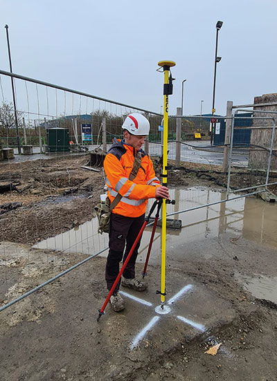
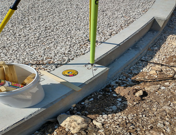
The adoption of GNSS in construction is growing and receiver manufacturers are making it easier to use their equipment in the field. (Photo: Leica Geosystems)
Correction services — such as satellite-based augmentation systems (SBAS), the ground-based Wide Area Augmentation System (WAAS) and the European Geostationary Navigation Overlay Service (EGNOS) — make a big difference along with PPP and similar techniques when base stations are not available. “We have the whole CORS network here in the United States,” Huff pointed out. “We also have services available from the National Geodetic Survey.”
Those who don’t want to have to fully engage in post-processing can upload their data to the Online Positioning User Service (OPUS), AUSPOS (a free online GPS data-processing facility provided by Geoscience Australia) or other corrections services that will post-process positioning data. “It has made it more accessible for all the surveyors all the way around, especially as the technology has improved and the cost barrier to entry into a survey-grade GPS receiver has come down significantly as well,” Huff said.
Growing Adoption of GNSS
The greater number of satellites in orbit significantly reduces convergence time and increases the accuracy of the solution, which makes the technology much more user-friendly for professionals and nonprofessionals alike.
For surveyors and mapping professionals, the increasing levels of GNSS performance means that “GNSS continues to be the dominant equipment and they can operate in challenging GNSS environments while still meeting the accuracy and precision requirements,” Skopljak said. GNSS usage is also growing in such industries as agriculture, construction, transportation and logistics. “Now, when farmers are on a combine, they don’t have to wait for an RTX or PPP solution to converge for 20 minutes. The solutions just work, and they can perform their task.”
Skopljak also pointed to “more flexible business models, such as pay-as-you-go or equipping seasonal workers or fleets of spatially enabled consumers to use GNSS,” that reduce the required upfront investment. “Surveyors now can go for longer and be productive in more areas where they could not use GNSS technology before. The non-surveying professionals — such as in natural resources, farming or construction — now can just turn on the machine and things work for them. They don’t have to worry about coordinate transformations and things like that.”
“Twenty years ago, when RTK and networks kicked in and then became popular, we were discussing whether it was the end of the automated total station,” Richter recalled. “Yet, the number of automated total stations has grown ever since.” To him, this is proof that GNSS alone will never solve all surveying problems. GNSS’ weak signal will always require surveyors to supplement it with other sensors, such as reflectorless total stations. “These instruments always need to work in harmony,” Richter said.
Success on both construction sites and in machine control require a very good robotic total station and a very good GNSS receiver, Richter said. “The simple problem of leveling a pole is actually solved, and we are using the technology that we developed for tilt-compensating GNSS receivers. We’re leveraging this now into the world of the total station.” This has solved one of the fundamental problems surveyors have long had, because they no longer need to level up and can measure tilted poles with a total station and with a GNSS receiver. “We have also made it very seamless for surveyors to switch between using GNSS receivers and total stations,” Richter said.
[SPONSORED CONTENT] It’s time to enable advanced action in any environment.
Our autonomy-ready solutions enable greater safety, productivity and efficiency. With interoperable, cross-industry capabilities built to meet your toughest challenges head-on, we’ll meet you where you are—to take you where you’re going. Leverage our decades of intelligence and experience to reach your autonomous potential.
Trimble has announced a new high-performance data collector for its Mapping and Geographic Information Systems (GIS) portfolio — the Trimble TDC650 handheld. Built for GIS data collection, inspection and asset management activities, the TDC650 provides users a rugged solution with scalable high-accuracy GNSS positioning for professional field workflows.
The TDC650 is fully integrated with today’s demanding GIS data environment, powered by the Trimble Software Development Kit (SDK) that enables precision GNSS positioning for apps such as Esri ArcGIS Field Maps and Trimble TerraFlex software. The TDC650 is also a scalable solution that allows customers to choose their desired accuracy down to the centimeter-level to meet needs and budget requirements.
“This is an ideal tool for customers tasked with modernizing critical utilities including electric, gas and telecommunications networks,” said Gareth Gibson, marketing director, Trimble Mapping and GIS. “The precision, quality and data integration workflows needed to map the physical world to a digital one in these projects requires a modern data-collection platform like the TDC650.”
City, state and local governments and utilities will benefit from this solution, which is part of the larger Trimble Public Sector ecosystem that includes Cityworks software for stormwater inspections and Trimble Unity for monitoring municipal water pressure and hazards. As GIS data continues to grow more complex, Trimble helps simplify, visualize and make sense of the data so customers can make better decisions in managing their communities’ assets.
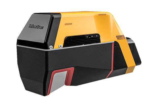
YellowScan has released a new long-range lidar scanner. Voyager is a powerful solution for both manned and unmanned aircraft.
With Voyager’s wide field of view, all of the points collected are oriented toward the ground, meaning there is no loss of points. This also means 1.5 million points per second will be usable, which would not be the case with a 360° scanner.
Voyager combines a Riegl VUX-120 laser scanner with a Trimble Applanix AP+ 50 AIR or Applanix AP+ 30 AIR GNSS-inertial board, providing precision of 0.5 cm and accuracy of 1 cm.
Voyager’s detection and processing of up to 15 target echoes per laser pulse allows for excellent vegetation penetration. Its has an extremely fast data-acquisition rate of up to 1800 kHz, suitable for projects requiring the highest point density.
The laser scanner’s specifications can be customized to fit the needs of various projects and platforms, and can be combined with YellowScan’s full suite of software solutions to easily extract, process, merge and colorize point-cloud data.
Business Model Enables Mass Adoption of Product with Service
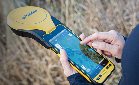
In September 2021, Trimble released its DA2 GNSS receiver with Trimble Catalyst service. I asked Gareth Gibson, the company’s marketing director, Mapping & GIS Solutions, about the product and recent developments in GNSS-enabled mapping.
When I started in this business, more than 20 years ago, we used to divide GNSS receivers into three categories, broadly speaking: consumer grade, resource grade, and survey grade. Are those distinctions still useful?
The survey world and the mapping world have been coming together over the last 20 years or so. Probably Jack Dangermond was one of the first people to publicly acknowledge that. Surveying is an ancient profession whereas mapping and GIS, as an industry, has evolved much more recently. The techniques and the expectations of precision and the complexity of the workflow coming from the survey side has always been somewhat at odds with what the mapping world has been trying to achieve, so the products and the tools of these industries were quite different.
The Trimble DA2 receiver boosts the performance of the Trimble Catalyst GNSS positioning service. (Photo: DroneWorks)
However, there has been a blurring of the lines. Today, the capabilities of mapping-grade GNSS systems are no different from those that can be used in the survey industry as well. Catalyst is an example of that. However, the focus is much more on ensuring that the technology gets out of the way. Let the technology vendor take care of the hard parts, to make it work in the environments where it needs to work, and to make sure it operates with the software that allows the mapping user to focus on the job, with less complexity. We’ve reached that point where it’s difficult to distinguish the capabilities of a survey-grade receiver from those of a mapping-grade receiver. Technically, there’s very little difference.
You can think of Catalyst as renting the performance of the receiver to enable the work to get done. The convergence of technology is enabling the business model transformation, and the business model transformation is aiming to better address the needs of the user. The types of services that these tools enable, the methods with which these tools communicate with homebase and with the vendors—licensing systems, platforms and so forth—have reached a point of enabling delivery of products as a service. That is a good thing because customers are not interested in owning a product as much as they are in getting to the solution that they need.
So, the focus switches from “How do we deliver this product?” to “How do we best deliver this service and the solution?” Catalyst attempts to do that by delivering, in effect, positioning as a service. You are not buying a piece of hardware; you are purchasing the capability to generate and use high accuracy within your workflow to get your job done. That shifts the focus from upfront expense to delivering positioning as an operational cost.
What does the DA2 with Trimble Catalyst service enable that was not previously possible?
It enables the mass deployment of precise GNSS across organizations with tens or hundreds or even thousands of workers. They can now benefit from adding GNSS technology to their work where it was previously prohibitively expensive, too complicated, or simply incompatible with their workflows. Catalyst and the DA2 is enabling that through the business model, which we have employed for the technology, and through the technical capabilities of the platform, which has reached a point of being much easier to be mass adopted across organizations.
The significant change that we’ve made with the DA2 was the addition of support for Apple-based devices. The norm now is to use the phone or the tablet that you have in your pocket, as opposed to purchasing dedicated equipment, especially as it relates to the group of workers we would describe as the location-enabled workforce. These are people typically who are not trained surveyors or GIS professionals but are performing a function with an organization and location-enabled workflows. Software applications are just part of their toolkit for their day-to-day work. It does not make sense to equip these teams with very expensive and complicated equipment, but the functionality that the equipment can provide can unlock some areas of productivity that would have otherwise been inaccessible to them.
What are the remaining technical challenges to mapping for GIS and asset management applications?
The nut that we’ve cracked is enabling precision at almost any practical level, using GNSS, anywhere around the world. We continue to strive towards having access to that level of precision in any environment. There’s a limit to what can be achieved with GNSS alone. So, we start to see more and more the use of combined technologies, different data and sensor fusion. People are leveraging different parts of the technology jigsaw — what is available on their phones, what is available from external sensors, and what they can do with the raw data they are capturing, either directly within a piece of software on their mobile device or somewhere in the cloud, to make better use of the raw information that has been captured.
The second major area is the merging and connecting of workflows, not just the types of data that these organizations are capturing. Organizations are working with field teams, all that data coming together and being able to be used in a toolbox to enable different types of work to get done. In the past, things have been a lot more siloed. Now, technology is enabling us to work together in more clever ways. It is easier to share information.
“The nut we’ve cracked is enabling precision at almost any practical level, using GNSS, anywhere around the world.”
Is accuracy the only difference between surveying and mapping?
For surveyors, the primary deliverable is location. The historical basis of that industry is all about being able to capture and work with information in the most precise way possible. In the mapping world the focus is more on the information that’s being captured about that position, and its precision is just another attribute. That has helped to change our perspective on the relative importance of precision as part of the workflow and has driven us more towards trying to simplify the way that location is captured in a mapping workflow.
Our goal is to capture the most accurate position and to simplify the process for the user. We’ve tried to automate such things as the choice of correction service so that it’s a much more approachable technology and the user can focus on their area of expertise, which is the collection and designation of the mapping attributes.
What are the components of the Trimble Catalyst solution?
There are two elements to Catalyst. One is positioning as a service, enabled through a subscription. The other is the GNSS antenna. The latest generation of that is the DA2. We have made some changes to the DA2 to enable some better functionality and broader applicability. Without a high-quality antenna, there’s only so much that you can do with GNSS. Our focus with DA2 was to make the antenna component of the solution as small and lightweight as possible, but as high performance as possible. We’ve enabled that through a combination of very clever engineering.
The physical structure of the antenna is quite different from that of any other antenna that we build within Trimble. The idea to make it simpler, lighter and lower cost influenced almost every design decision that went into how that antenna is built — from how it fits and mounts with varying carrying solutions to how it is powered. In the first version of Catalyst, we had this notion of running the GNSS receiver as software inside using a computer that was freely accessible and available to every user without needing to burden the antenna itself and create a smart antenna. We said, “Well, if we can deliver GNSS by software, let’s leverage the computing power of the user’s phone or tablet.” So, we took the Catalyst GNSS receiver engine and ran it as an app on a phone.
The Trimble DA2 receiver at work. (Photo: Trimble)
There were some limitations with that approach. We needed to have a fully cabled solution between the antenna and the phone to enable the required bandwidth from the antenna to the software itself, which required a USB connection and put a fairly heavy computational burden on the phone. However, that enabled us to strip out a lot of the excess weight and complexity from the antenna design, which lowered the cost of the antenna. It was a trade-off decision.
With the DA2 we’re acknowledging those changes, plus the limitations that are imposed by wanting to be compatible with the Apple environment of devices. We can still create a very low cost and lightweight computing package to run this same engine in software, but just move that computing resource back into the antenna again. So, it’s still a software defined receiver—effectively a completely different technology from what you would find on a typical hardware receiver.
We have added a wireless radio to allow GNSS positions to be communicated back to your phone or your tablet via Bluetooth. So, DA2 is a lot more versatile because it enables iOS device usage and wireless transfer information from the antenna to the phone or tablet.
Now, how do you make that work as a package to deliver high-precision results? You need access to correction services and a definition of how you want the receiver to behave based on a business model of what consumers are charged. That’s where the subscription component of the Catalyst service comes in. With Catalyst, we want to simplify the way that customers choose what they want and how they get it.
So, rather than purchasing a specific hardware configuration, figuring out what correction services to use, and how to configure them, you simply subscribe to whatever your required performance level is, and Trimble handles the rest. Each subscription is time-based, so it could be annual, monthly, or even hourly. It is a completely managed system that works everywhere in the world.
What are the options for receiving the corrections?
The DA2 supports delivery of corrections over the internet or through the antenna itself — so, in an offline or an online environment. Catalyst uses Trimble’s dedicated correction services, so Trimble VRS Now, which is available in parts of North America and most of Western Europe, as well as Trimble RTX, which is available everywhere in the world and is also delivered by internet or by satellite L band. Globally or regionally available augmentation systems such as EGNOS and WAAS, and those smaller systems for DGPS-type positions, are also used where it’s necessary as a fallback option.
The receiver will choose what correction service it needs to use based on the user’s subscription level and the environment in which the receiver is currently operating. It knows where in the world it is and which license type the user has, so it will try to use the best available source without the user needing to really think about it. The user just specifies to which precision level they want to subscribe — such as one centimeter or 10 centimeters — and the receiver figures out the rest. Catalyst also supports those customers who have their own correction services and want to use it. In most cases, however, that’s not necessary.
Does the current version of Trimble Catalyst differ from the previous version in any other way?
With the latest generation of Catalyst you no longer need a high-end phone to run the service because we have removed the reliance on USB to deliver the data from the antenna to the controlling device. Now, you can effectively do all the computation in the antenna and use Bluetooth for data transfer, which makes it a bit more versatile. Additionally, we have introduced a handle that allows you to use the DA2 in a handheld format that also stores a battery pack.
The biggest leap was certainly the addition of iOS support. After releasing the DA1, we quickly realized that it was not addressing your needs if you were not an Android user it. In North America, more than 70% of business organizations prefer Apple to Android. So, this improvement has more than doubled our addressable customer base. It’s also for those mixed fleet organizations that did not adopt Catalyst because they did not want to have one solution for their Android users and a different one for their iOS users.
What markets and applications are you targeting with it?
We’ve been pleasantly surprised by the response to DA2 and the types of customers that we are seeing. We define our customers in four buckets. One consists of small, independent, non-geospatial businesses, which is a new area for us—the geospatially enabled workforce, people who are using applications that have a location component, who previously would not have been able to justify the purchase of dedicated and expensive equipment. In this bucket I would put landscape gardeners for example, or golf course designers or people who now can create a map much more easily and effectively.
Another consists of consultants and contractors. These are organizations small and large doing geospatial contract work. They are specialists who get sent out into the field to either do mass data collection projects or to consult and provide professional services with a geospatial bent. These are much more traditional customers; they know a little bit more about the technology and what they’re doing. For these customers, Catalyst is a new tool. It enables them to deploy GNSS more broadly across their organizations.
Then there are the sort of organizations and businesses that run their own teams and perhaps have their own GIS department and a field crew dedicated to operating and maintaining the GIS. But they also have the field operations groups, who aren’t geospatially savvy or aren’t geospatial professionals. They’re starting to deploy GNSS across their teams more effectively, as well, because Catalyst is the type of tool that you can keep in the glove box of your car and have available to use at a moment’s notice. So, utilities, municipalities, public works organizations and the like, large federal government agencies in the United States especially.
Finally, the owners of large infrastructure assets, privately owned organizations running ports or oil and gas operations. Again, this is an attractive solution for them. We’re finding that this solution will enable us to address the full range of the market much more effectively.
Customizable system provides robust positioning without added site infrastructure for IHI Corp.
Photo: Trimble
Trimble has announced the first deployment of its map-based localization system for land-based autonomous vehicle applications.
IHI Corp., a heavy industry manufacturer based in Japan, will retrofit its existing container and haulage trucks with a customized Applanix POS LV system as part of its broader autonomy capabilities for the transport of goods around industrial facilities.
Map-based localization provides precise positioning and orientation estimation, augmenting GNSS/inertial data, which is critical for safe and efficient autonomous vehicle operations. The ability to provide IHI Corp. a full workflow and real-time data ensures seamless integration into IHI’s truck design.
The custom-built, locally supported system leverages Trimble’s engineering capabilities and technology to provide reliable performance across a variety of challenging environments, the company said. Using this system, IHI Corp. can provide robust positioning for its autonomous fleet without additional site infrastructure, lowering capital expenditure costs and improving scalability.
Tailoring POS LV to work within IHI’s unique specifications and existing autonomous platform, the map-based localization system couples an inertial navigation system (INS) with simultaneous localization and mapping-based (SLAM) capabilities, and works with several types of sensors, including lidar. POS LV provides an accurate base map using post-processed data and localizes vehicle positioning in real time, enabling the reliable and safe autonomous operation of industrial vehicles.
IHI continually enhances its work environments, while also compensating for varying labor scenarios and personnel shortages. This makes the need to automate transportation critical to operations. The complexities of the evolving industrial manufacturing environment require solutions that can be tailored to a customer’s specific application requirements.
By partnering with Trimble, IHI can develop a retrofit system that addresses two major challenges — affordability and reliability — within the autonomous operation of large-scale industrial equipment.
BAE Systems has expanded the capabilities of its Digital GPS Anti-Jam Receiver (DIGAR) by enabling beamforming with Trimble receivers, in addition to its own receivers.
DIGAR’s beamforming capabilities increase the level of GPS jamming protection for aircraft by a million-fold, helping pilots execute their missions in contested environments.
BAE Systems’ engineers in Cedar Rapids, Iowa, developed software to ensure the compatibility of its antenna electronics with industry-standard embedded GPS inertial navigation system (GPS/INS) technology, enabling fast communication with transmitter electronics for superior beamforming.
DIGAR beamforms with both BAE Systems receivers and Trimble GPS receivers embedded in aircraft GPS/INS, as well as federated GPS systems and stand-alone GPS receivers.
“The modern battlespace has evolved, and peer state positioning, navigation, and timing threat systems are challenging our ability to conduct combat operations in the place and manner of our choosing,” said Greg Wild, director of Navigation and Sensor Systems at BAE Systems. “By combining DIGAR’s beamforming with trusted inertial navigation system data, we offer the highest level of jamming protection available today.”
DIGAR is a high-performance military GPS-based system for fixed-wing, rotary-wing and unmanned airborne platforms. It combines field-proven antenna electronics, advanced signal-processing, and beamforming techniques to improve the reliability of positioning, navigation and timing data in the presence of disruptive electromagnetic signals.
DIGAR is also compatible with the advanced M-code – delivering additional security to the warfighters who rely on it.
BAE Systems’ anti-jamming GPS technology has defeated powerful and sophisticated adversary threat systems in testing and combat, and is available for airborne, shipborne and ground vehicle applications. The company’s military GPS business is based in Cedar Rapids, Iowa, where it is building a 278,000-square-foot state-of-the-art research and manufacturing facility scheduled to open this year.
In the decades since the U.S. GPS became fully operational, GPS has become a highly innovative, successful and increasingly ubiquitous technology critical to applications and services touching the lives of almost every American today and for decades to come. As GPS-enabled technologies have become an irreplaceable part of our national infrastructure, growing more deeply ingrained each year, GPS is a success story of what can happen when government-backed R&D, paired with a light-touch regulatory approach, is turned loose in the private sector.
At the GPS Innovation Alliance (GPSIA), our member companies and affiliates are driving this innovation forward. While we use their products every day now, they’re also focused on inventing the future. Several key features are necessary to this continued success: a stable and predictable spectrum environment; a regulatory framework that fosters innovation and balances the fundamental technical needs of navigation systems; and appropriate, established interference protections where necessary.
Regulators must take care not to fundamentally depart from the longstanding approach to spectrum policy that has enabled the GPS technologies and services that underpin our economy. The prize on the other side of a well-calibrated policy is the next generation of GPS-enabled applications and products, which, as a GPS enthusiast first and foremost, I get a front row seat to our members building every day. These innovations span land, sea and space, unlocking opportunity for their U.S. government partners and consumers alike.
Innovations on Land, at Sea and in Space
On Earth, GPS-based products and services are getting even better at improving our everyday lives, helping farmers, builders, drivers and hobbyists work more efficiently and providing the critical inputs for everything from trucks to cell phones.
Take GPSIA member Trimble’s recently introduced R750 modular GNSS receiver, a connected base station used in both civil construction and agriculture that provides improved base-station performance and gives contractors, surveyors and farmers more reliable and precise positioning in the field. John Deere is likewise helping build next-generation precision agriculture technology with its new autonomous tractors, which will use GPS signals to ensure optimal plowing, planting and harvesting by adapting to real-time data analytics on soil conditions and other factors.
Garmin, a household name in GPS consumer products,continues to enhance satellite location and communication technologies for increased safety and user awareness, recently launching its inReach Mini 2 compact device that offers up to 30 days of battery life, integrated location and situational awareness technologies, and two-way texting and SOS capabilities.
Elsewhere, CalAmp recently celebrated two years of partnership between their LoJack Stolen Vehicle Recovery System and BMW Group Italy, the first step in a larger plan toward a GPS-based security solution for BMW’s full product range, while Apple continues to build revolutionary consumer tech, such as their GPS-enabled Apple Watch that can track workouts, activity, elevation and time, all without connection to an actual iPhone.
The ubiquity of GPS is particularly critical at sea. Collins Aerospace, for example, just launched Artemis Elite, the first–ever military underwater navigation system (MUNS) with M-code technology, that improves GPS signals’ precise positioning, navigation and timing (PNT) capabilities, making them more resistant to threats of jamming and spoofing. Garmin is also improving the consumer boating experience with its suite of OnDeck products, which pair onboard sensors and GPS to create a remote monitoring and management solution giving boaters 24/7 access to critical and timely information about their vessels.
Of course, GPSIA members are driving the effort to modernize the GPS satellite constellation itself. Lockheed Martin is building the next generation GPS III satellites and follow-on GPS IIIF satellites that will improve antijamming capabilities and geolocation accuracy for GPS-enabled devices, while L3Harris is building critical inputs on these satellites, such as their advanced navigation and timing payloads.
Our companies are also leading the way to help nations operate in space, providing critical GPS applications including guidance systems for crewed vehicles; the management, tracking, and control of communication satellite constellations; and monitoring the Earth from space.
Raytheon, for example, announced this month that it installed the first global aircrew strategic network terminal (ASNT) for the U.S. Air Force to enable protected communication capabilities for aircrews, while Lockheed Martinis the primary contractor in a cutting-edge project from the Space Development Agency to improve U.S. missile tracking and defense through a layer of multi-orbit satellites speaking to one another and sharing location data in real time.
Looking across GPSIA’s member companies, it’s clear that we live on a globe propelled by GPS. We should continue to give them the tools — and protect the regulatory framework — that has allowed them to do what they do best, which is bring us products that transform our daily lives for the better and innovate new technologies and services.
Trimble announced today that it has entered into a definitive agreement to sell its Time and Frequency, LOADRITE, Spectra Precision Tools and SECO accessories businesses to Precisional LLC, an affiliate of The Jordan Company (TJC).
The divestiture is in line with Trimble’s strategy to focus on areas core to its long-term growth and strategic product roadmap. The global transaction is subject to a number of customary closing conditions and is expected to close in the second quarter of 2022. Financial terms were not disclosed.
“We are continually evaluating our product portfolio as we work on the execution of Trimble’s Connect and Scale 2025 strategy,” said Rob Painter, president and CEO of Trimble. “Trimble is focusing its efforts on the company’s connected industry platforms and digital transformation capabilities, making Precisional and TJC an ideal fit for the growth of the businesses.”
TJC, a private equity firm, is completing the acquisition in partnership with industry executive Drew Ladau to form Precisional LLC, a global platform focused on precision measurement and data solutions driving efficiencies in demanding infrastructure end markets.
“The Trimble businesses, which will join Precisional, have a long heritage of innovation, and each is a leader in the markets it serves,” said Drew Ladau, CEO of Precisional. “I’m excited to build upon this strong foundation alongside the dedicated employees that have served their customers so well over the years. In addition, we plan to accelerate the pace of innovation and growth with the focus of resources and investment on these core businesses supported by TJC.”
“The acquisition of four industry-leading businesses from Trimble by Precisional forms the foundation of a new platform focused on precise measurement and analytical insights to improve productivity across a broad range of applications that rely upon accuracy and reliability,” said Erik Fagan, partner at TJC. “By supporting existing management to make investments in Precisional’s operations and product development to integrate precision measurement with data solutions and enhanced connectivity, we intend to accelerate growth opportunities while also pursuing synergistic acquisitions.”
The Time and Frequency products use the accuracy of GNSS clocks to provide precise time, synchronization and frequency reference signals for many industries and applications. Communication systems, data centers, financial networks, utilities, factory automation, security and other infrastructure rely on precise timing for synchronization and operational efficiency.
The Spectra Precision Tools business designs and manufactures high-quality leveling, positioning and alignment instruments used for general, exterior and underground construction. The instruments incorporate laser and optical technology for general contractors and specialty contractors serving large and small commercial jobsites as well as residential builders and remodelers.
The LOADRITE business offers accurate scales for loaders, excavators, conveyor belts, tractors, refuse trucks and forklifts that connect with payload-reporting and monitoring systems for the waste, quarry and aggregates industry. The products improve user efficiency by weighing products while they are on a vehicle or belt, eliminating the need for a separate trip to a fixed-scale location.
The SECO business designs and manufactures a wide variety of accessory products used in conjunction with surveying and construction instruments. The portfolio of accessory products includes tripods, telescopic poles, prisms, carrying cases, GPS antenna poles, safety vests and leveling rods.
LOADRITE, Spectra Precision Tools and the SECO businesses have been reported as part of Trimble’s Buildings and Infrastructure segment. The Time and Frequency business has been reported as part of Trimble’s Geospatial segment.
Orrick acted as legal advisor and Lincoln International acted as financial advisor to Trimble. Mayer Brown acted as legal advisor and BMO Capital Markets acted as financial advisor to TJC.
On a project on the Butterfield Landfill — about 45 miles south of Phoenix, Arizona — Buesing Corp. needed to excavate and haul 1,850,000 cubic yards of dirt from a landfill more than 60 feet deep while grading the slope, basin and stockpile; inserting storm drains; and making an operations layer.
Buesing, founded in 1965, specializes in modeling and building complex underground systems in challenging conditions. It had four months to complete the initial mass grading, with another month for shaping the stockpile and a final month for the operations layer and piping. The mass grading of the site required an accuracy of plus or minus one tenth of a foot in a landfill with 4:1 slopes and a slope length of 300 linear feet, and the operations layer had to be two feet thick. The project also required installing storm drain inlets, flow lines, and outlets to grade.
To remain on schedule, the project required moving large quantities of soil quickly and efficiently, as well as adjusting grading models to incorporate design updates and changes while in production. “We used DTMs and orthophotos collected with our UAV to track progress quantities and adjust the stockpile model to minimize haul distances and slope rework as well as maintain proper drainage and control of stormwater,” said Rio Byman, Buesing’s GPS manager, who is responsible for building 3D models and managing the maintenance, calibration and updates for the company’s machine control (MC) solutions.
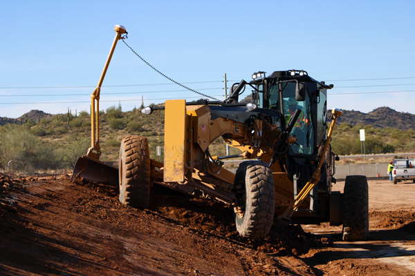
A caterpillar CAT14M3 motorgrader is guided by Trimble’s dual-mast Earthworks system. (Photo: Trimble)
For this project, the company used heavy equipment both with and without MC, including blades, excavators and dozers with MC, along with GNSS-based grade checkers to control the earthmoving operations. Specifically, Buesing, which started converting its equipment to Trimble around 2018, used the Trimble Earthworks Grade Control Platform and the Trimble GCS900 Grade Control System on the site and Trimble Business Center at its office.
Buesing works in a variety of market segments for public and private entities in seven states, though it performs most of its work in the Phoenix metropolitan area. Key to its success has been an emphasis on skilled crews, continuous training and technology. In fact, Buesing was one of the early adopters of machine control in 2006. “A decade ago, the technology was pretty rudimentary, which limited adoption,” Byman said. “That’s changed a lot in recent years, particularly in the ease of use and flexibility. Today, grade control is an integral part of the company’s ability to build ever-more-complex solutions in even more challenging site and soil conditions.”
The company started with the Trimble GCS900 on single-mast and dual-mast blades, excavators and dozers. It has since moved to the Trimble Earthworks Grade Control Platform along with Trimble Business Center for managing 3D models. Working closely with SITECH Southwest, Buesing has gone from six machines with grade control to more than 20 in just five years. The company relies on grade-control solutions on its excavators, dozers, motor graders and scrapers, and has used them on projects of every scope and scale, though their value is most evident on urban high-rise excavation.
“It takes time for operators to gain faith in the data, and know that the machine will excavate efficiently and accurately, whether building pads or cutting basements,” Byman said. He believes that improved productivity in the field comes with trust in the technology.
Using Trimble Earthworks’ Autos mode, the software controls the implements while the operator controls the machine’s direction and speed for consistent, high-accuracy finished grade in much less time than it would take without automation. “On any jobsite, the operators have to be aware of everything around them, as well as what’s going on with the blades or scrapers,” Byman said.
“With Autos, they’re able to focus on what’s going on around the job and plan for watering and other environmental conditions with confidence that the machine is digging to grade. This makes our jobsites more productive, safer and more efficient. We have happier operators who are excited to come to work with newer equipment.”
A positioning service energizes large pipeline surveying projects, saves time, and becomes a field crew favorite
For projects spanning large areas, a large engineering and construction firm discovered that a precise point positioning (PPP) service — Trimble’s CenterPoint RTX — could solve the challenge of receiving high-precision GNSS in remote areas.
Atwell Group LLC is a national consulting, engineering and construction services firm with 33 offices throughout the country and more than 1,000 team members. The company delivers a broad range of strategic and creative solutions to clients in three core markets: oil and gas, power and energy, and real estate and land development.
Atwell provides comprehensive turnkey services, including land and right-of-way support, engineering, land surveying, environmental compliance and permitting, and project and program management.
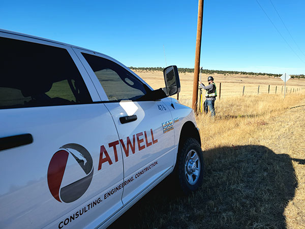
Photo: Trimble
Pipeline construction
Atwell’s introduction to PPP and Trimble’s CenterPoint RTX took place during two large-scale linear pipeline projects within remote areas. Atwell has substantial experience with projects of this scale, but the remoteness of some of the projects’ sections was proving to be a challenge. While they could expect to rely on base or network correction methods for most projects, Atwell needed to seek other correction alternatives — and up their efficiency for the long-corridor projects.
With the CenterPoint RTX service at hand, Atwell performed construction staking and as-built surveys for a 50-mile pipeline. The project spanned a five-month period, with an hour or more of time saved each day using the service.
Crews noticed an additional benefit: rapid response time. On any given day, there could be project managers, right-of-way agents, or inspectors on site, asking for additional survey data.
“Inspectors and others started to notice how fast our crews could jump from one place to another and get the shots they requested, without having to do any base setups,” said Jason Jung, project manager with Atwell.
“The speed at which our crews can get up and running with RTX is awesome.” — Jason Jung, 3D laser scanning projects manager, Atwell
Because of the range limits of base radios, the crews might have to do multiple setups of a conventional real-time kinematic (RTK) base each day. RTX removed this hindrance, saving the crews time by not having to use temporary RTK bases, which entails driving to base reference points, setup and teardown, and downtime from malfunctioning equipment and battery issues.
“RTX completely freed us from the time and hassle of base setups,” Jung said. “You turn it on, and it’s ready to go before you’ve had time to take a sip of coffee. And once our crews got used to it and gained confidence in the results, they have really loved this solution.”
Photo: Trimble
Scanning a pipeline
Atwell recently used CenterPoint RTX on a 135-mile large-diameter pipeline project that included 19 facilities along the route. Atwell provided as-built services related to the facilities using a Trimble X7 scanner.
The data captured was used to generate spatially correct site models that included the material traceability necessary to comply with Pipeline and Hazardous Materials Safety Administration (PHMSA) regulations. Crews used RTX to georeference point clouds from the scanner to provide the accuracy needed to comply with industry regulations. Each site was referenced with permanent monuments or scribes that tied into the master control system.
Crews also used the RTX service to establish hard checkpoints to meet Atwell’s strenuous quality-control requirements for ground targets, such as those used in UAS control work. To do the daily “in and out” check shots, they used the free BenchMap app to locate nearby survey control marks from the National Geodetic Survey database. Most checks were sub-0.08’.
The time saved in not having to change base positions, as well as setup and breakdown, were significant time savers along this lengthy project. The precisely registered scans helped speed up PHMSA required inspections and audits, and construction change management field operations.
A crew favorite
Atwell’s crews use Trimble R10 receivers and Trimble Access running on TSC7 controllers, but Jung noted that they have recently upgraded to some R12i GNSS receivers, “and they are already earning their keep.” He expects to realize even more benefits from RTX coupled with the advanced multi-constellation capabilities of the Trimble ProPoint RTK engine in the R12i.
RTX has not only become a crew favorite, it is fast becoming a go-to solution for many Atwell projects.