Drone experts will join with those from the medical field in a demonstration July 17 in Wise, Va. The event, “Let’s Fly Wisely,” aims to show how unmanned aerial systems (UAS) can alleviate the problem of health care access while creating economic opportunity for communities.
Many people in Virginia and across rural America are beyond reach of essential health services and basic supplies, ranging from bandages to medicine, according to event organizers. The drones will deliver essential medical supplies to an annual medical clinic held at the Wise County Fairgrounds every summer, organized by Remote Area Medical (RAM) USA and the Health Wagon.
At the clinic, thousands of medical specialists provide free eye, dental and health care services to people in urgent need, in what event organizers say is the largest free health care outreach in the nation.
The UAS used for the demonstration will be a completely autonomous rotorcraft, designed by Flirtey, capable of delivering small payloads of drugs and medical equipment to isolated areas, and a larger, fixed-wing aircraft operated by NASA Langley Research Center, capable of carrying up to 600 pounds of cargo.
The most urgent prescriptions will be provided from pharmacies located out of town, reports Startup Daily. To get the medicine to the community as soon as possible, the pharmacies will deliver them to their local airport, where they will be collected by NASA’s fixed-winged aircraft and flown to Lonesome Pine Airport. When the prescriptions arrive there, they will be loaded onto Flirtey drones and delivered to the Wise County Fairground. Flirtey drones are expected to deliver around 24 packages of prescription medication.
The FAA-approved research flights will put UAS technology to work for medical relief, to show how unmanned aircraft can help health professionals provide care more easily and efficiently, closing the gap between those who can offer medical help and those who need it most.
“In doing so, we will demonstrate the promise of a technology that offers a bright future for our youth — right here in Virginia, where Wise County is rapidly becoming a center for technology manufacturing and testing. We believe Let’s Fly Wisely is much more than a novel use of technology in healthcare. It is an example of the self-reliance, ingenuity and wherewithal of the American people and Virginians in particular,” organizers said.
The collaboration includes nonprofits, universities, corporations and government organizations, including Virginia Tech Institute of Critical Technology and Applied Sciences. The Federal Aviation Administration selected Virginia Tech in December 2013 as one of six national test programs to conduct research on integrating unmanned aircraft into the nation’s airspace.
Other partners include:
The Appalachian College of Pharmacy
Flirtey, Inc.
Health Wagon
The Mid-Atlantic Aviation Partnership
NASA Langley Research Center (pending approval of the Space Act agreement between NASA Langley Research Center and Virginia Tech)
Remote Area Medical
Rx Partnership
SEESPAN, Inc.
Wise County Economic Development
The video below shows how Australian start-up Flirtey delivers packages with its drones.
Flightline Geographics is a GIS company that has been involved in professional UAS since 2012 and provides base mapping and 3D terrain modeling through the use of UAS for energy corridors and other areas of interest.
“GIS is a technology that depends upon up-to-date content, and UAS is now a cost-effective way to provide aerial visual intelligence for GIS in the form of stunning 3D imagery. All delivered in days, not months,” said Flightline Geographics’ founder and CEO Devon Humphrey.
Tablerock provides survey, right-of-way and project management/inspection services.
“One of the challenges we have faced has been obtaining current aerial imagery and topographic information that meets industry needs for project design and GIS within the United States,” said Andrew Darlington, president of Tablerock Land Survey. “On most projects, our clients are limited to whatever current satellite imagery is available on the Internet, but it is often dated and of low quality. Content from FlightlineGeo changes all that.”
Flightline Geographics is an Esri Partner Network Company based in the Austin, Texas, area and Tablerock Land Survey is based in Denver.
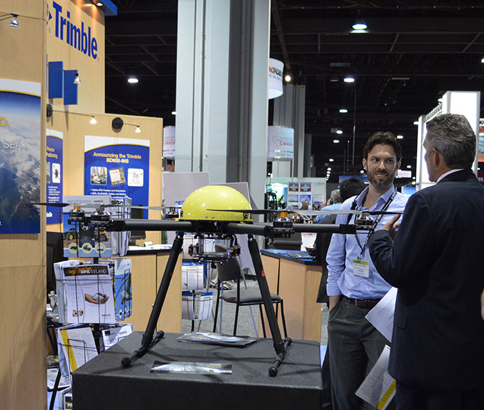
Trimble displayed the Multirotor G4 Surveying Robot at the AUVSI Unmanned Systems Show in May.
Trimble is partnering with unmanned aircraft system (UAS) manufacturer Multirotor service-drone, GmbH. The collaboration will allow Trimble to expand its existing UAS portfolio to provide its customers with additional solutions to choose from based on their aerial imaging project needs.
Multirotor service-drone, based in Germany, is a manufacturer of multirotor systems. Trimble will be Multirotor service-drone’s exclusive provider of multirotor vehicles for aerial mapping use in surveying, construction, mining, agriculture, oil and gas, and utilities. The combination of Multirotor service-drone’s stable and reliable platforms with Trimble’s industry-leading sensor technology and workflow efficiencies will provide customers with best-in-class solutions for aerial data capture.
Unmanned multirotor systems are powerful solutions for visually documenting smaller areas, vertical structures or environments where holding position is important. High-resolution imagery, orthophotos, terrain models and normalized difference vegetation index (NDVI) map deliverables created from multirotor data provide valuable information for the survey, engineering and agriculture industries that Trimble serves, the company said.
“We are very excited to partner with Multirotor service-drone. At Trimble we’re always looking for ways to meet our customer’s needs and enable them to solve the complex problems they encounter every day,” said Todd Steiner, product marketing director in Trimble’s Geospatial Division. “The collaboration will enable our customers to use a technology rapidly growing in popularity due to its flexibility and productivity.”
Founded in March 2011, Multirotor service-drone quickly became a market leader in the area of professional unmanned aerial systems. In 2013, service-drone acquired competitor Multirotor and together developed the award-winning fourth-generation flight control system used in its service-drone products today. Multirotor service-drone offers a broad range of commercially used UAS within the 8 to 50 pound (4 to 25 KG) weight class. Designed and manufactured in Germany, Multirotor service-drone products are built to deliver safety, quality and consistency for professional applications, according to the company.
In this special section, GPS World focuses on automous positioning and navigation technology, including unmanned aerial vehicles (UAVs), unmanned aircraft systems (UAS) and unmanned ground vehicles (UGVs).
SenseFly Launches Intelligent Mapping and Inspection Drone
SenseFly launched the eXom, a quadcopter for mapping and inspection, at the AUVSI Unmanned Systems show, held May 4–7 in Atlanta.
The 3.7-pound quadcopter offers professionals such as civil engineers and land surveyors the situational awareness, imaging flexibility and durability they need for challenging tasks, senseFly said. The sensors — GPS, inertial measurement units, barometers, magnetometers and magnetic encoders — maximize stability and safety.
Septentrio Launches UAS Receiver, Software for Drones
The AsteRx-m UAS by Septentrio.
Septentrio has launched the AsteRx-m UAS, an RTK-accurate GNSS receiver solution specially designed for the drone market. The AsteRx-m UAS provides high-accuracy GNSS positioning with low power consumption, according to Septentrio.
The launch of the AsteRx-m UAS board is complemented by the release of GeoTagZ software suite. The GeoTagZ suite works with the UAS camera and image-processing solution to provide centimeter-accurate position tagging of images without the need for a real-time data link.
Despite being Septentrio’s smallest receiver, the AsteRx-m UAS provides consistent, robust and accurate positioning from Septentrio’s in-house GNSS+ algorithm technology. The receiver delivers cm-level accuracy at less than 600 mW with GPS and less than 700 mW with GLONASS.
Kairos Kit Makes Vehicles Unmanned
Kairos Autonomi’s Pronto4 robotic applique kit is an add-on vehicle autonomy system that provides unmanned capabilities to current manned vehicles, rendering them optionally unmanned. Pronto4 delivers the torque needed to control traction, braking, throttle and implements in heavy vehicles and equipment, as well as smarter robotic functions such as GPS path following and supervised autonomous behaviors. The kit can be installed in any heavy vehicle or machine, rendering that vehicle optionally unmanned, and the equipment can still operate manually.
Applications include government and academic research and development; military training and testing; range clearance; mining; and tactical military uses.
Kairos displayed its Pronto4 unmanned kits at May’s AUVSI show.
Exelis, FAA Test Sites to Research Safety
Exelis has signed agreements with four FAA-designated UAS test sites for airspace situational awareness and research. The research will use the Exelis Symphony RangeVue sense-and-avoid tool to aid in safe integration of unmanned aircraft into the national airspace. The test sites will gain situational awareness of the range airspace via Symphony RangeVue, while Exelis gains product feedback. Symphony RangeVue enables UAS operators to access real-time and historical surveillance information via a web-hosted platform, helping to manage mission operations across multiple locations.
FAA Names MSU as Its Center of Excellence
The FAA has selected a Mississippi State University team as its Center of Excellence for Unmanned Aircraft Systems (COE UAS). The COE will focus on research, education and training in areas critical to safe and successful integration of UAS into the nation’s airspace.
Bipartisan Bill Would Expedite Exemptions
Sen. Cory Booker (D-N.J.) and Sen. John Hoeven (R-N.D.) have introduced the Commercial UAS Modernization Act, which would set temporary rules for those who want to fly commercial unmanned aircraft systems before the FAA establishes permanent laws regarding drone use. The senators believe the U.S. is falling behind other countries when it comes to creating rules for commercial drones.
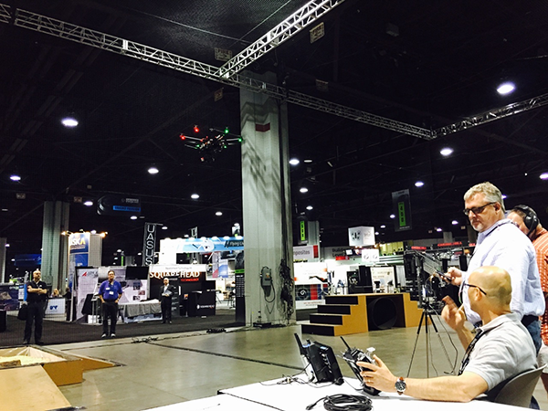
The Robotics in Action drone flying area at the AUVSI show.
The AUVSI show in Atlanta, held May 4-7, drew significantly more attention from TV media this year, as several of the major networks provided live coverage from the show floor. NBC’s Today morning show opened with a live shot of a drone hovering in front of an opening house door, as if patiently waiting to deliver a package from Google or Amazon — the potential good side of drones for consumers.
Then their coverage recalled the DJI drone crashing onto the White House front lawn in the early morning hours (perhaps an unfortunate loss of user control, but an odd time and place to be out flying a drone), and airline pilot reports of lighted drones appearing above nighttime final approach paths — the bad side of drones in common usage.
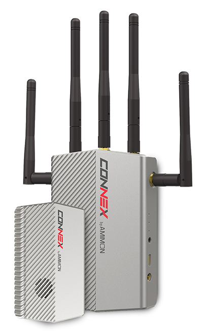
The Connex wireless system.
Then Brian Wynne, president and CEO of AUVSI, provided a positive insight on the latest forecasts of UAV’s contributing $82 billion to the U.S. economy. Wynne’s estimates included the generation of more than 100,000 new high-paying technical jobs within 10 years’ time. But in an effort to urge faster progress towards regulations, Wynne also suggested that for every day of delay in Federal Aviation Administration (FAA) rulemaking to allow open use of drones, the U.S. loses $27 million daily in economic impact.
There was similar encouraging coverage by Fox News from the Atlanta Convention Center show floor, followed by Brian Wynne again pitching for rapid introduction of commercial drone use in the U.S. Fox chose to broadcast from the Robotics in Action drone flying area, and to feature real-time, zero latency HD video transmitted via Amimon’s Connex wireless system. A good demo over live TV, and Amimon’s chance to tell the world about its wireless transmission system that can transmit HD video over up to half-a-mile away with zero latency — good news, incidentally, for Fox, NBC, CNN and other news gatherers.
This year, it also seems that the terminology battle with the U.S. media over the common usage of the term drone or drones, rather than the more accurate UAV or UAV, has been conceded. So now we can talk about drones no matter how much it pains us to do so.
But the FAA is not standing still. Well over 200 Section 333 exemptions have now been granted to allow commercial UAS applications to undertake or investigate revenue-generating business. FAA representatives came to the show to let people know they are working hard to progress towards the safe use of drones in U.S. airspace. Through a media-only press-conference, the FAA announced the B4UFly smartphone app to inform recreational drone operators if it’s safe to fly. Features include:
A clear “status” indicator that immediately informs operators about their current or planned location.
Information on the parameters that drive the status indicator.
A “Planner Mode” for future flights in different locations.
Informative, interactive maps with filtering options.
Contact information for nearby airports.
Links to other FAA UAS resources and regulatory information.
The app will access the user’s location to automatically generate this information. There is also a planning mode for what data could be available for a potential future location to which you may be preparing to go.
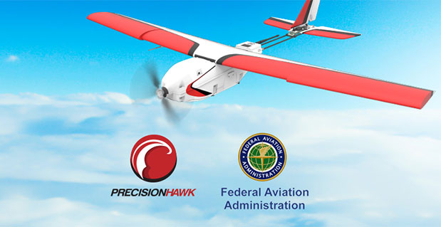
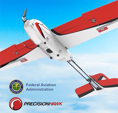
But the main news from FAA Administrator Michael Huerta at the press conference was about the Pathfinder program, which involves three U.S. companies undertaking research with the FAA to expand unmanned aircraft operations in the United States. Each project has a key element where boundaries are being stretched to gain experience and to develop new capabilities to overcome restrictions for UAVs.
CNN (Cable News Network) will use visual line-of-sight (LOS) drone newsgathering in urban areas. There have previously been heavy restrictions in most of the Section 333 exemptions on operating in populated areas. So, it would seem that care will be taken in how news coverage will be generated around and over people, but the news will still be working to get the live overhead video we are now seeing more often on TV.
PrecisionHawk and BNSF Railway will investigate operations in rural areas, flying outside LOS. This is big news, as most UAV operators want to extend their areas of operation much further than visual LOS. In particular, Amazon has been most critical about LOS restrictions — the retailer wants package delivery to be virtually automated. But more on that later.
Beyond visual LOS, investigations in largely unpopulated areas by PrecisionHawk and BNSF could result in safe technology and procedures that could be commonly used in populated area for other operators. This is clearly the FAA’s desire, and of course, its intent is also to deflect earlier criticism of lack of progress in this area.
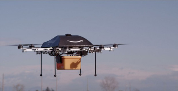
Onto Amazon. The company filed a UAV delivery patent with the U.S. Patent Office, where drone deliveries would be navigated by pulling location data from a customer’s smartphone — and real-time routes and directions would be constantly updated to guide the delivery process.
Amazon’s Prime Air “Delivery Drone.”
Amazon smart aircraft could interact between each other, passing on traffic and weather conditions. Delivery options for the consumer include a tool to deliver packages to your home, workplace or even to vacation locations.
Various safety precautions and caveats appear to have been appropriately addressed in the patent. Use of a number of sensors, including, radars, acoustic sensors and an infrared camera, are outlined in the patent to ensure safe navigation and landing. The patent also proposes a number of different types of unmanned aircraft with different shapes and weight for its delivery system.
And then on Tuesday, May 12, just after the AUVSI convention had wound down and left Atlanta, two U.S. senators jointly proposed a new bill that could expedite the commercial introduction of drones.
The senators believe the U.S. is falling behind other countries when it comes to creating rules for commercial drones. Sen. Cory Booker (D-N.J.) and Sen. John Hoeven (R-N.D.) introduced the Commercial UAS Modernization Act, which would set temporary rules for those who want to fly commercial unmanned aircraft systems before the FAA establishes permanent laws regarding drone use.
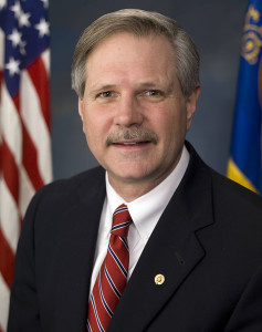
Sen. Corey Booker
The Commercial UAS Modernization Act outlines basic rules for commercial use around registration, certification, insurance, tests and safety. Operators would be required to keep the drones under 500 feet, fly only in daylight, and operate within visual line of sight (LOS). However, the proposal also creates a deputy administrator position that would be able to make an exemption for a commercial drone operator for beyond visual LOS and for “heavier unmanned vehicles.”
“Not later than 90 days after the date of the enactment of this Act, the Deputy Associate Administrator, in consultation with the Administrator, shall expedite and expand exemptions from the interim operating restrictions otherwise applicable to unmanned aircraft under section 337,” the act reads.
Sen. John Hoeven
When I talked with Sen. Hoeven this week, he emphasized that this bill seeks to accelerate the commercial use of drones in the U.S. and to make more use of the UAV test centers that the FAA has set up. These centers are capable of doing more, and can be the points that prospective drone operators visit to register their craft and take knowledge and proficiency qualification tests.
The bill gives tight timescales to the FAA to set up accessible locations to achieve registration and set up these operator qualification programs. In addition, the bill establishes a new deputy administrator position responsible for the safe integration of UAS in U.S. airspace, while also streamlining regulations that currently slow the industry’s ability to innovate new aircraft technologies.
In essence, the bill takes the core elements of the FAA’s past Section 333 approvals — less the requirement for a private pilot’s license — and makes them law. Operators would no longer need to ask the FAA for an exemption.
I asked Sen. Hoeven if the FAA has responded to the proposed bill, and he said he would be meeting with FAA Administrator Michael Huerta on May 14. “This follows their rules,” the senator said, so his message is let’s move forward together.
So, it would seem that momentum is at last gathering to overcome what would seem to be a lengthy period of FAA intransigence, including new innovative efforts by the agency itself to find ways to move forward more rapidly. Innovation in UAV technology, products and applications has been going on at a rapid pace, and the pent-up demand seems to be spilling over.
With more than 4,000 comments in hand for the FAA to deal with on its proposed rulemaking for small UAVs, it’s doubtful we’ll have any FAA regulations any time soon. So the Section 333 exemptions will probably continue, unless they are not totally overwhelmed by the new rules proposed by Senators Hoeven and Booker, who hope to see their bill approved sometime this year.
Two U.S. senators have jointly proposed a new bill that could expedite the commercial introduction of drones.
The senators believe the U.S. is falling behind other countries when it comes to creating rules for commercial drones. Sen. Cory Booker (D-N.J.) and Sen. John Hoeven (R-N.D.) introduced the Commercial UAS Modernization Act, which would set temporary rules for those who want to fly commercial unmanned aircraft systems before the FAA establishes permanent laws regarding drone use.
Sen. Cory Booker
The Commercial UAS Modernization Act outlines basic rules for commercial use around registration, certification, insurance, tests and safety. Operators would be required to keep the drones under 500 feet, fly only in daylight, and operate within visual line of sight (LOS). However, the proposal also creates a deputy administrator position that would be able to make an exemption for a commercial drone operator for beyond visual LOS and for “heavier unmanned vehicles.”
“Not later than 90 days after the date of the enactment of this Act, the Deputy Associate Administrator, in consultation with the Administrator, shall expedite and expand exemptions from the interim operating restrictions otherwise applicable to unmanned aircraft under section 337,” the act reads.
Sen. John Hoeven
When GPS World talked with Sen. Hoeven this week, he emphasized that this bill seeks to accelerate the commercial use of drones in the U.S. and to make more use of the UAV test centers that the FAA has set up. These centers are capable of doing more, and can be the points that prospective drone operators visit to register their craft and take knowledge and proficiency qualification tests.
The bill gives tight timescales to the FAA to set up accessible locations to achieve registration and set up these operator qualification programs. In addition, the bill establishes a new deputy administrator position responsible for the safe integration of UAS in U.S. airspace, while also streamlining regulations that currently slow the industry’s ability to innovate new aircraft technologies.
In essence, the bill takes the core elements of the FAA’s past Section 333 approvals — less the requirement for a private pilot’s license — and makes them law. Operators would no longer need to ask the FAA for an exemption.
GPS World asked Sen. Hoeven if the FAA has responded to the proposed bill, and he said he would be meeting with FAA Administrator Michael Huerta on May 14. “This follows their rules,” the senator said, so his message is let’s move forward together.
After a rigorous competition, the Federal Aviation Administration (FAA) has selected a Mississippi State University team as the FAA’s Center of Excellence for Unmanned Aircraft Systems (COE UAS). The COE will focus on research, education and training in areas critical to safe and successful integration of UAS into the nation’s airspace.
The team brings together 15 of the nation’s leading UAS and aviation universities that have a proven commitment to UAS research and development and the necessary resources to provide the matching contribution to the government’s investment.
“This world-class, public-private partnership will help us focus on the challenges and opportunities of this cutting-edge technology,” said U.S. Transportation Secretary Anthony Foxx. The Department of Transportation oversees the FAA. “We expect this team will help us to educate and train a cadre of unmanned aircraft professionals well into the future.”
The COE research areas are expected to evolve over time, but initially will include:
detect and avoid technology
low-altitude operations safety
control and communications
spectrum management
human factors
compatibility with air traffic control operations
training and certification of UAS pilots and other crew members, in addition to other areas.
“This team has the capabilities and resources to quickly get up and running to help the FAA address the demands of this challenging technology over the next decade,” said FAA Administrator Michael Huerta.
The FAA expects the COE will be able to begin research by September 2015 and be fully operational and engaged in a robust research agenda by January 2016.
Congress appropriated $5 million for the five-year agreement with the COE, which will be matched one-for-one by the team members.
In addition to Mississippi State University, the other team members include: Drexel University; Embry Riddle Aeronautical University; Kansas State University; Kansas University; Montana State University; New Mexico State University; North Carolina State University; Oregon State University; University of Alabama, Huntsville; University of Alaska, Fairbanks; University of North Dakota; and Wichita State University.
The FAA will determine the relationship between the new COE and the six UAS sites the FAA announced last year once the new team develops detailed research plans. The FAA expects COE flight testing to occur at one or more of the existing test sites.
Congress mandated that the FAA establish the COE under the Consolidated Appropriations Act of 2014. Like university think tank partnerships, the agency’s Centers of Excellence bring together the best minds in the nation to conduct research to educate, train and work with the FAA toward solutions for aviation-related challenges.
The U.S. Department of Transportation’s Federal Aviation Administration (FAA) today announced a partnership with industry to explore the next steps in unmanned aircraft operations beyond the type of operations the agency proposed in the draft small unmanned aircraft systems (UAS) rule it published in February.
“Government has some the best and brightest minds in aviation, but we can’t operate in a vacuum,” said U.S. Transportation Secretary Anthony Foxx. “This is a big job, and we’ll get to our goal of safe, widespread UAS integration more quickly by leveraging the resources and expertise of the industry.”
FAA Administrator Michael Huerta announced the initiative today at the Association for Unmanned Vehicle Systems International Unmanned Systems 2015 conference in Atlanta, Ga. See more coverage of the show from Geospatial Solutons.
The FAA is working with industry partners on three focus areas, including:
Visual line-of-sight operations in urban areas: CNN will look at how UAS might be safely used for newsgathering in populated areas.
Extended visual line-of-sight operations in rural areas: This concept involves UAS flights outside the pilot’s direct vision. UAS manufacturer PrecisionHawk will explore how this might allow greater UAS use for crop monitoring in precision agriculture operations.
Beyond visual line-of-sight in rural/isolated areas: BNSF Railroad will explore command-and-control challenges of using UAS to inspect rail system infrastructure.
“Even as we pursue our current rulemaking effort for small unmanned aircraft, we must continue to actively look for future ways to expand non-recreational UAS uses,” Huerta said. “This new initiative involving three leading U.S. companies will help us anticipate and address the needs of the evolving UAS industry.”
The three companies reached out to the FAA to work on research continuing to expand use of UAS in the nation’s airspace. CNN and the FAA already have been working together through a Cooperative Research and Development Agreement (CRDA). BNSF has a draft CRDA that is nearly complete and PrecisionHawk has been working with the FAA on a possible research partnership.
Further developing these operational concepts supports the FAA’s overall strategy to expand UAS access, which currently includes rulemaking, reviewing operational data from the six national UAS test sites, expanding commercial operations via the Section 333 exemption process, and issuing operational authorizations for type-certified UAS.
The FAA published a proposed rule for small UAS on February 23, 2015 and received nearly 4,500 public comments by the end of the comment period on April 24. The agency will work as quickly as possible, but must address all the comments submitted before finalizing the rule. The number and complexity of the comments will play a role in determining the timeline for a final rule.
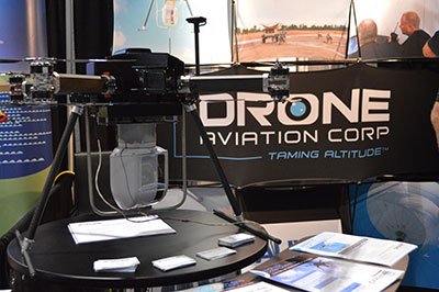
CNN will use Drone Aviation’s tethered drones to gather footage in in urban areas from never-seen-before angles and heights. The company’s WATT-200 was unveiled at the AUVSI this week.
Federal Aviation Administration (FAA) Administrator Michael Huerta announced two new initiatives related to unmanned aircraft systems (UAS) today at the Association for Unmanned Vehicle Systems International (AUVSI) Unmanned Systems 2015 conference in Atlanta, Ga.
Administrator Huerta told the large gathering of national journalists, “The unmanned aircraft industry is changing faster than any segment in the aircraft industry. A new project to harness that energy, the Pathfinder program, is partnering with three leading U.S. companies to expand unmanned aircraft operations in the United States.”
The FAA is working with industry partners on three focus areas:
CNN (Cable News Network) will research visual line of sight (LOS) operations for newsgathering in urban areas. CNN will continue working with Georgia Tech University to improve newsgathering for all organizations.
PrecisionHawk will investigate agricultural operations for rural areas, flying outside LOS.
BNSF Railway, second-largest freight railroad network in North America, will undertake inspection of rail infrastructure, also beyond visual LOS.
Huerta said that the partners, collectively, “are trying to push the envelope, what can we accommodate, accommodate safely, and what can we learn from that. We’ll test a little, learn a little, then test some more. How do we see a staged implementation? To integrate unmanned aircraft, but to do it safely, as directed by Congress. We’re trying to push the edges of what we can allow, working with partners who have specific uses and resources that they will apply to those.”
When asked for a timeframe to reach new UAV regulations, he replied, “I can’t comment a lot on the rule itself, but it’s fair to say that in the rulemaking comment process [which closed on April 24], we received more than 4,500 comments. It’s too early to say how those comments will shape what the final rulemaking will take. Assessment will be done in the coming months, perhaps by the end of the year, but that’s an aggressive timetable. This effort will go on as long as the partners want us to go on doing it. That’s not accomplished in six months, nor should it take a million years.”
As to LOS restrictions, and beyond LOS, he replied, “The framework of the previously published rule was focused on LOS, and on the use of visual observers in addition to the operator. Now we’re taking the next step, to explore beyond LOS uses. What are reasonable applications for that, and what mitigations for safety should be put in place for that? Everyone wants to get there. It’s important to figure out how we get there safely.”
What mitigations will be put in place for beyond LOS? A vice president of BSNF Railway said that the company is “working with FAA and several vendors around command and control infrastructure. This is yet to be fully defined. The railroad is a very safe an unforgiving environment. This doesn’t replace anything we’re doing today, it’s an addition.” He defined the operating environment as ” a 300 or 400-mile capability, to fly looking for broken rail, etc., beyond the visual, on-the-ground inspections that rail crews already do. ” He anticiated the use of “sense-and-avoid technology [for the UAVs], not using chase planes but perhaps using communications capabilities from cell towers and railway infrastructure along the right of way.”
The CEO of PrecisionHawk commented similarly, “We’re not changing much of our operational flow, just extending the baseline for it. We will implement a traffic-management technology, called Lattice, leveraging to ensure safety and reliability beyond the operator’s LOS.”
Gregory Agvent, CNN’s director of News Operations, said he looked forward to “some camera shots that were previously impossible for us, that now we’re going to be able to do.” Under the terms of the Certificate of Authorization (COA), Agvent said that “We’re capable of doing it [undertaking UAV missions] without asking for (FAA) permission” for specific flights.
The three industry participants concurred that they will work with their [UAV] partners in parallel with the rules to develop a certification process, so that the FAA can determine their vehicles are uniformly safe, the same way the y do with piloted aircraft currently. Both the railroad and PrecisionHawk have one currently operating flight platform each, and are looking at others, as theirs do not fit all applications.
“These are not exclusive [agreements],” emphasized Huerta, “limited to particular platforms or applications. This is a practical research effort to apply, learn, and integrate on the broadest scale.” When asked about possible further participants in the Pathfinder project, Huerta indicated the three companies represented on the briefing platform with him: “They came to us. You can interpret that as an invitation. We’re casting a very wide net. How do we et to a broader integration and implementation? We need multiple ways to gather information.”
Agvent urged, “It’s critical for manufacturers to come to the table, to get certified by make as opposed to individual models, to get free access to the sky.”
Huerta concluded, “We are learning together, as an industry and as a regulator. How can we collectively, as an industry, learn more in order to see a much more robust integration of unmanned aircraft into our aviation industry? We’re all interested in pushing the boundaries, and sharing the information broadly across the industry.”
The surprise preview of the pending announcement drew scores of curious and concerned industry representatives and exhibitors at the massive AUVSI show, who gathered anxiously outside the press briefing room, to which they were not admitted.
“The FAA is moving ahead with safe integration of UAS into the busiest, most complex airspace in the world,” according to an FAA statement issued prior to the briefing.”Even as the agency proceeds with rulemaking for small UAS, it continues to look at new ways to foster safe UAS operations by both hobbyists and businesses.”
The Association for Unmanned Vehicle Systems International’s (AUVSI’s) Unmanned Systems 2015 show, held May 4-7 in Atlanta, convenes the global community of commercial and defense leaders in intelligent robotics, drones and unmanned systems.
Avyon, a sUAS (Small Unmanned Aircraft Systems) integrator and distributor, is using the Applanix APX UAV for its md4 fleet, to provide users with cost-effective direct georeferencing technology.
The integration of the Applanix APX-15 UAV on the md4-1000 and md4-3000 microdrones will offer solutions for unmanned aircraft while complying with weight and size restrictions for payloads. The APX-15 works seamlessly with all other airborne sensors such as digital cameras, LIDAR and other sensors, Avy0n said.
The APX-15 on the md4-1000 microdrone is on display at booth 1803 at the AUVSI Unmanned Systems 2015 show, being held May 4-7 in Atlanta, Ga.
“The integration of the APX-15 with md4-1000 and md4-3000 will provide users with a precision mapping capability, minimizing or eliminating the requirement for ground control points and making mapping missions more efficient,” said Mike Hogan, Avyon’s business development manager.
The APX-15 UAV on the md4 fleet will improve aerial mapping by eliminating GCPs (ground control points) for triangulation, as well as reduce the amount of overlap in the surveying process. This will increase efficiency and effectiveness for area flown per mission and the post-mission data processing, Avyon said.
“We recognize the need to provide the growing UAS mapping market with the same highly efficient solutions that we pioneered for airborne mapping over 15 years ago,” said Joe Hutton, director of Inertial Technology and Airborne Products at Applanix Corporation (xyHt pg. 14). “We are now offering a cost-effective solution that meets the size, weight, power and cost requirements of small UAS, and maintains the Applanix pedigree for quality and performance. We are pleased Avyon has partnered with us. The md4-1000 DMS-UAV is a powerful new solution.”