Tag: UAV

  • Unicore GNSS guides XAG Drones in China

    Unicore GNSS guides XAG Drones in China

    XAG introduces agricultural drones for farmers in China. The XMission drone can reduce costs on fertilizer, pesticides and other treatments. (Photo: XAG/Unicore)
    XAG introduces agricultural drones for farmers in China. The XMission drone can reduce costs on fertilizer, pesticides and other treatments. (Photo: XAG/Unicore)

    Pesticides, fertilizers and water are the most important means to enhance agricultural crop production.

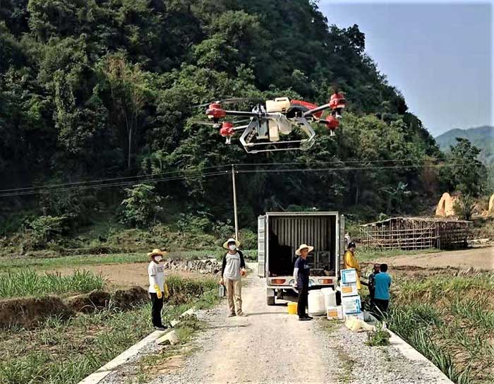
    The prevalent infestation of fall armyworm in China has resulted in reduced yields, threatening food security and the livelihood of smallholders. It’s impractical to conduct manual spraying over farmlands larger than 5 hectares, and this also runs both the risk of wasting large amounts of pesticides and chemical poisoning.

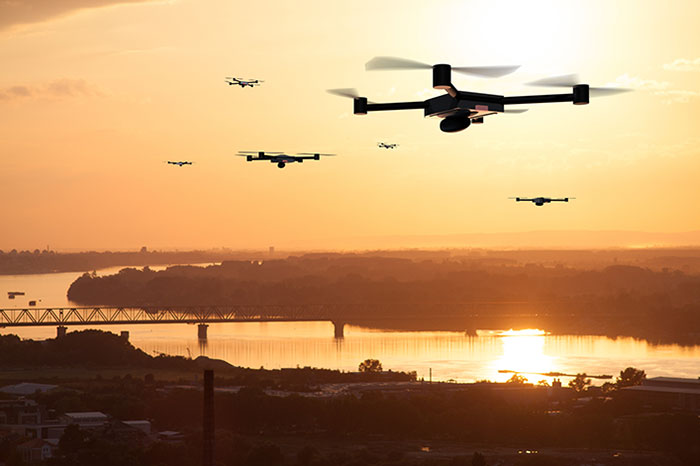
    Given the situation, smart agriculture devices such as drones have come in handy for fixing these problems, with minimal environmental impacts. In China, professional farmers and agricultural service providers have already harnessed existing drone technology to conduct appropriate chemical sprays to safeguard the country’s crop production.

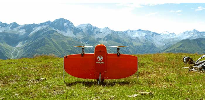
    The XAG XMission drone has centimeter-level navigation and can operate fully autonomously over complex terrain and easily adapt itself to different spraying conditions for various crop species. Farmers are therefore relieved from much physical effort while no longer risking their health in the battle against fall armyworm.

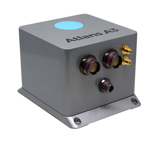
    Equipped with Unicore’s high precision dual-antenna GNSS module (UM482), dual RTK plus GNSS positioning system, real-time centimeter-level flight positioning provides reliable data support in various air tasks. XAG’s drone carries a 4G communication module connected to the XAG Cloud RTK network in order to immediately start missions without setting up portable ground RTK bases.

    Unicore UM482. Unicore’s GNSS high precision module (UM482) provides centimeter-level accuracy real-time positioning, with 0.2°, 1-meter baseline course information. UM482 supports single-module dual-antenna signal access and has a dual-RTK engine, enabling high-precision, high-reliability directional heading and dual-RTK real-time positioning, with each RTK engine calculating position independently. This receiver meets the flight needs of different types of UAVs for many different scenarios.

    Virus Fighting. XAG’s drones have also joined the fight against the spread of the coronavirus. In Feburary, XAG announced a 5-million-yuan fund for coronavirus response, to be put toward aerial disinfectant sprays to curb the spread of the virus in rural areas. The company’s fleets were used in China’s Shandong province on Jan. 28, where they reportedly disinfected a local community of more than 300,000 square meters in less than 4 hours.

  • Wingtra brings wind energy to the Swiss Alps

    Wingtra brings wind energy to the Swiss Alps

    Photo: Wingtra
    Photo: Wingtra

    Site-survey preparations for a windfarm of 20 300-foot tall wind turbines might have been quite complex for a location in a 2,500-foot-high valley in the Swiss Alps.

    However, the contractor decided to use a drone with vertical take-off and landing (VTOL) capability supplied by Wingtra to speed up the work and produce highly accurate geo-referenced data. Although multirotor drones are normally used for detailed survey work, they can cover much less area than fixed-wing drones during the same flight time. Fixed-wing drones can fly longer, farther and carry more weight.

    Multicopters tend to carry more expensive, higher accuracy sensors because the sensors are not subject to potential damage from fixed-wing belly landings. Wingtra solved this problem by developing a drone with vertical take-off, the ability to transition to horizontal flight and to then land upright. When equipped with heavier, more accurate sensors, longer and more complex surveys are possible.

    The Septentrio AsteRx-m2 was also chosen for the WingtraOne drone. The AsteRx-m2 is a high-precision, multi-frequency, four-constellation, PPK, low weight and power GNSS module. The low-latency AsteRx-m2 works for both rotorary- and fixed-wing UAV applications.

    The WingtraOne VTOL drone is able to cover 400 hectares (an area of around 570 football fields) in one 55-minute flight. The resulting mapping accuracy is as high as 1.27 centimeters (0.5 inches). The drone was equipped with the full-frame 42MP Sony RX1RII camera, with seven ground control points for increased accuracy.

    The WingtraOne took off vertically and transitioned to fly horizontally at the planned 1,500-foot altitude. Each flight took about 20 minutes to plan and involved 30 minutes of flying time. The flights covered a total area of 1,100 hectares — each flight was 200–300 hectares.

    Aerial data collected from the site was converted to 3D models that allowed visualization of planned roads and wind-turbine locations in the wind farm. The data-collection workflow only took 4 hours rather than the days required with traditional surveying. Use of high-end sensors ensure survey-grade imagery and accuracy — in this case, the engineers obtained an accuracy of 3–4 cm.

    Flying in an area as difficult as the Swiss Alps to collect aerial data has been one of Wingtra’s most complicated challenges. By reducing costs and the time to complete the survey and evaluation of the proposed site, the customer was able to maintain the overall wind farm project timelines.

  • Building a better aerial imagery program beyond UAVs

    Building a better aerial imagery program beyond UAVs

    Photo: Nearmap
    Photo: Nearmap

    The ability to capture and evaluate truth on the ground through aerial imagery is an ever-growing industry, thanks to the proliferation of UAVs and access to imagery on demand and online. Yet obstacles remain that could prevent organizations from capturing location intelligence.

    For organizations that require timely, accurate and current aerial imagery, an additional capture program outside of drones could be necessary. One company, Nearmap, flies fixed-wing aircraft two to three times per year over 430 urban areas across the United States. Using proprietary camera technology, Nearmap captures aerial data in a variety of formats: vertical, oblique and 3D. The location content is then delivered to customers via a web browser application and can be easily integrated into GIS/CAD applications.

    A mid-size tech company in New Mexico using a drone to capture digital surface model data ran into two obstacles: proximity to no-fly zones at Albuquerque International Airport and need for image consistency over an entire metro area. With a project due date looming, the company turned to Nearmap, which provided the necessary image data around the airport, as well as historical imagery. With the Nearmap data, the company was able to speed project planning from design to project completion.

    Nearmap aerial imagery also provides data at scale (an entire city, not one city block). The clarity of the imagery is 2.8-inch ground sample distance, providing optimal data for seeing truth on the ground.

  • VTOL UAV tackles difficult Sichuan survey

    VTOL UAV tackles difficult Sichuan survey

    The P330 takes off. (Photo: CHC Navigation)
    The P330 takes off. (Photo: CHC Navigation)

    The CHCNAV P330 vertical takeoff and landing (VTOL) UAV has been deployed to complete orthophoto acquisition with a resolution of 15–20 centimeters of the city of Xichang in the Sichuan Province, China. The project involved a series of technical and operating challenges: several no-fly zones, a 700-meter flight ceiling by airspace control, tricky winds, and a total area of 900 square kilometers — all within a tight schedule.

    The project involved 15 people, a fleet of four P330s and the set up of 200 ground control points.

    The hybrid P330 was selected for its ability to combine the advantages of a fixed-wing UAV with extended flight time with a rotor-based VTOL UAV, which enables aerial survey missions on complex terrain.

    Project area. (Photo: CHC Navigation)
    Project area. (Photo: CHC Navigation)

    Each P330s was fitted with a Sony A7R2 camera and high-accuracy GNSS positioning system. Because of its innovative design, the P330 can be assembled in less than five minutes without tools, saving the survey crew considerable time. Plus, basic operation training was completed in 2 hours.

    The P330 also has one-click take-off and landing, support for breakpoint flight resuming after temporary return to base, and self-diagnostic of all sensors before take off. It has dual-rotor and parachute protection in case of emergency landing.

    Other features include take-off and landing positioning accuracy within 20 centimeters and automatic return to base in case of a data communication failure. It offers survey-grade PPK accuracy.

    The P330’s battery life lasts up to 2.5 hours. It will operate safely under Class 5 wind conditions at an altitude up to 4,000 meters, providing stable attitude under bad weather conditions. It also meets imaging constraints under low-light conditions.

  • Canada approves BVLOS drone flights with Iris

    MVT Geo-solutions, in partnership with Iris Automation, has been granted the first beyond-visual-line-of-sight (BVLOS) Special Flight Operations Certificate (SFOC) by Transport Canada using only onboard detect-and-avoid (DAA) systems.

    The approval was granted based on the utilization of Iris Automation’s DAA system, called Casia, which provides commercial drones with automated collision avoidance maneuvers.

    The waiver permits flights within the Unmanned Aircraft Systems (UAS) Center of Excellence’s controlled airspace Remotely Piloted Aircraft System (RPAS) test range in Alma, Quebec. This is the first BVLOS flight at the location leveraging only onboard DAA for air risk mitigation, and does not require ground-based observers or radar.

    BVLOS flights unlock autonomous drone use for economically beneficial commercial applications including infrastructure inspection, mining, mapping, agriculture, emergency response and package delivery.

    “Achieving the first BVLOS approval in Canada further validates our technology alongside multiple permissions we have already received from regulators in the U.S. and South Africa,” said Iris Automation CEO Alexander Harmsen. ”This technology is critical to safely integrate drones into the airspace along with manned-aircraft, and we look forward to unlocking commercial operations for our customers in Canada.”

    Iris Automation’s onboard computer-vision DAA system is an effective, scalable and cost-effective technology to enable commercial BVLOS operations.

    “The UAS Center of Excellence is looking forward to leveraging Iris Automation’s DAA system and existing flight expertise within our network to conduct BVLOS flights with MVT Geo-solutions,” said UAS Center of Excellence Director William de Keiser. “We will continue to develop our partnership with Iris Automation to provide training to local operators and enable BVLOS flights in Canada.”

    The first BVLOS flights are scheduled to take place within weeks. The resulting data will inform more complex BVLOS operations in the future.

  • Analytics and drones detect trash in San Francisco Bay

    Kinetica simplifies active analytics with Kinetica Cloud

    Kinetica, provider of the Kinetica Active Analytics Platform, has unveiled the Kinetica Cloud. Enterprises can use the full capabilities of the Kinetica platform in an optimal cloud environment, which includes historical data analytics, streaming data analytics, location intelligence and machine learning.

    Kinetica Cloud was adopted by the San Francisco Estuary Institute (SFEI), which used the platform to detect trash in San Francisco Bay.

    “The San Francisco Estuary Institute uses Kinetica Cloud for high-performance computing and to manage thousands of high-definition images of the landscape, which our machine learning algorithm studies to detect trash,” said Tony Hale, program director for Environmental Informatics, SFEI.

    Photo: Thinkstock/Stockbyte/Getty Images
    Photo: Thinkstock/Stockbyte/Getty Images

    “With this more systematic way of monitoring when trash enters the landscape in uncontrolled ways, cities and governments that really care about the environment gain a remarkable resource to help them very quickly and effectively make decisions,” Hale said.

    “With Kinetica Cloud, organizations across industries gain invaluable business flexibility and agility to direct their mission-critical initiatives,” said Paul Appleby, CEO, Kinetica. “Kinetica Cloud gives customers the ultimate flexibility in a hybrid, multi-cloud environment, empowering them to determine where it is optimal to deploy Kinetica.”

    Organizations can use the Kinetica Active Analytics Platform on Kinetica Cloud without the complexity and wait times of deploying hardware systems and software.

    “As customers adopt active analytics, they want to start their initiatives quickly to gain insight from their data,” said Karan Batta, senior director, Product Management, Oracle Cloud Infrastructure. “We are very pleased that Kinetica Cloud is available for Oracle Cloud, allowing organizations to shift their focus away from infrastructure and towards bringing smart analytical applications to market faster.”

  • European drone-airspace integration project kicks off

    European drone-airspace integration project kicks off

    Photo by: aerogondo/iStock/Getty Images Plus/Getty Images
    Photo: aerogondo/iStock/Getty Images Plus/Getty Images

    GMV has been awarded the SUGUS project (Solution for E-GNSS U Space Service), which aims to speed the adoption of GNSS and Galileo in the unmanned aerial vehicle (UAV) segment and ensure safe airspace access by unmanned aircraft.

    SUGUS is an 18-month, 485,000-euro European Union research and development project. A series of trials will be held to show the benefits of E-GNSS for drone operators as well as its approval by aviation authorities.

    The project will be carried out by a GMV-led consortium including Everis Aerospace, Defense and Security; VVA Brussels; EGNOS service provider ESSP; FADA-CATEC and Unifly.

    The demand for UAV services is steadily increasing, with the potential to generate significant economic growth, as recognized in the 2015 European Union Aviation Strategy. More recently, the 2016 European Drones Outlook Study (by SESAR — Single European Sky ATM Research) estimated that the European drone market will clock up 10 billion euros a year by 2035 and more than 15 billion euros annually by 2050.

    U-Space services

    U-Space is a set of new airspace-management services and procedures designed to ensure airspace access too UAVs while looking out for operational security, the right to privacy and the safety of persons and infrastructure. These services rely on a high level of digitization and function automation, whether onboard the drone itself or part of the ground-based environment.

    Several initiatives are underway in Europe to develop U-Space and work toward the safe and efficient coexistence of manned and unmanned air traffic.

    At the same time, new European legislation on operating unmanned systems is providing a uniform, Europe-wide framework. The new regulation is broken down into three drone operation categories:

    • Open, calling for no AESA clearance or operator declaration
    • Specific, where both clearance and declaration will be necessary
    • Certified, reserved for riskier operations.

    To help integrate drones into the airspace, SUGUS will center on the Open and Specific flight categories.

    SUGUS tasks

    SUGUS will demonstrate the benefits for drone operations of the measures implemented at service-provision level and the new EGNSS API (European GNSS application programming interface) to be implemented in the project.

    These benefits included the mitigation of operating risks, improvement of preparation processes and clearance of the operator’s mission. Such measures as expected to ease future urban aerial mobility operations, such as aero taxis or parcel delivery.

    For the first step in this endeavor, SUGUS will carry out a review of the results of previous EGNSS projects while also pinpointing the needs of drone operators and unmanned traffic service providers in complex operations and built-up areas.

    This analysis will help to define and then implement the new EGNSS-based API.

    SUGUS will also be running several flight trials in complex environments to prove the benefits of the drone-operation measures. The overarching idea is to raise awareness and contribute towards drone standardization and regulation to maximize the chances of the proposed services being implemented as a U Space service.

  • Telstra partners with TEOCO on UAV strategy

    Telstra partners with TEOCO on UAV strategy

    Telstra logoAnalytics provider Teoco has been selected by Telstra — a mobile network in Australia — to assist with the development of its UAV strategy.

    Telstra will use Teoco’s AirborneRF solution to assess the readiness of its radio access network for future UAV applications, including communications, navigation, surveillance, safety and identity.

    Teoco is a provider of analytics, assurance and optimization solutions to more than 300 communication service providers (CSPs) and OEMs worldwide.

    Already deployed by several tier-one operators globally, AirborneRF ensures effective, mission-critical connectivity to enable effective traffic management and control for UAVs in the lower airspace. Telstra will use the solution to develop a platform for enabling a multitude of mission-critical services, vital in supporting successful UAV operations.

    The platform provides a link between cellular networks and aviation systems, such as air traffic management (ATM), unmanned traffic management (UTM) and flight information management systems (FIMS).

    TEOCO’s AirborneRF solution will play an important role in assisting Telstra enable a safe, equitable, secure and reliable urban air space platform. This has become all the more important to Telstra following Uber’s decision in 2019 to use Melbourne as one of three pilot cities to test out its “flying taxis” — the pilot is expected to begin this year, with commercial operations planned for 2023.

    Telecommunications companies can provide needed UAV services via their mobile networks. For the internet of things (IOT), they can provide drone registration, activation and identification. For 5G, they can provide super low-latency remote command and control and high-resolution video carriage.

    “We have been running a number of drone-related technology assessments with various industry customers, within law enforcement, humanitarian aid, post disaster, first responders and city councils, over the past 12 months,” said Thomas Neubauer, vice president of Business Development, TEOCO.

    “Commercial UAVs present a huge opportunity for [[telecommunications]] operators, but only if supporting mobile networks deliver the required connectivity to keep them airborne,” Neubauer said. “Mobile networks were not designed to meet the needs of the aviation industry, so tight focus is needed to guarantee the quality of service needed to safeguard the additional revenue that connected skies promise. Our Airborne RF solution offers this guarantee to a growing number of major operators around the world.”

  • iXBlue launches range of FOG-based INS for mobile mapping

    iXBlue launches range of FOG-based INS for mobile mapping

    The compact Atlans A3 INS. (Photo: iXBlue)
    The compact Atlans A3 INS. (Photo: iXBlue)

    iXBlue has launched a new range of FOG-based inertial navigation system (INS) dedicated to land and air mobile mapping applications, the Atlans Series. iXBlue is high-tech company specializing in the design and manufacturing of advanced navigation and georeferencing solutions.

    Based on iXBlue’s fiber-optic gyroscope (FOG) technology, the Atlans Series is a scalable range of north-seeking and north-keeping inertial navigation systems. They provide FOG performance to the full spectrum of land and air mobile-mapping applications and offer highly accurate positioning (up to 0.01 meter) in all conditions, including within GNSS-denied environments such as urban canyons, mountainous or forests areas.

    “Our existing high-grade Atlans A7 INS had already been adopted as the preferred georeferencing solution by leading U.S. companies operating in the pavement condition survey industry,” explained Marine Slingue, vice president, iXBlue. “Having identified the high potential of our technology for other land and mobile mapping applications, we decided to develop a complete range of scalable INS that each meet the specific requirements of every applications. With our new Atlans Series INS, we are now bringing the unrivaled georeferencing accuracy performance offered by the FOG technology to all land and air mapping applications, enabling robust and uninterrupted data-acquisition operations.”

    Quick and simple to install on all platforms, the new Atlans Series INS offers efficient “set-and-forget” operations for a wide range of land and air applications including asset inventory, pavement condition survey, vehicle automation, HD mapping, automotive testing, ground-truth, airborne surveys (UAVs, planes, helicopters), as well as precision pointing.

  • UPS to develop new delivery drones with Wingcopter

    UPS to develop new delivery drones with Wingcopter

    UPS Flight Forward (UPSFF) is collaborating with German drone-maker Wingcopter to develop the next generation of package delivery drones for a variety of use cases in the United States and internationally. UPSFF is a subsidiary of UPS dedicated to drone delivery.

    UPS chose Wingcopter for its unmanned aircraft technology and its track record in delivering a variety of goods over long distances in multiple international settings.

    “Drone delivery is not a one-size-fits-all operation,” said Bala Ganesh, vice president of the UPS Advanced Technology Group. “Our collaboration with Wingcopter helps pave the way for us to start drone delivery service in new use-cases. UPS Flight Forward is building a network of technology partners to broaden our unique capability to serve customers and extend our leadership in drone delivery.”

    Drone fleet. As part of this collaboration — UPSFF’s first new relationship with a drone manufacturer since its formation — both companies will work toward earning regulatory certification for a Wingcopter unmanned aircraft to make commercial delivery flights in the United States. It also is a critical step toward building a diverse fleet of drones with varying capabilities to meet potential customer needs.

    The Wingcopter drones feature vertical takeoffs and landings in tight spaces, transitioning to efficient, high-speed horizontal flight, enabling ranges suitable for a variety of uses. These capabilities will allow UPSFF to begin developing solutions that, if approved, will go well beyond the healthcare and retail industries to solve long-standing challenges for high-tech, industrial manufacturing, hospitality, entertainment and other customers.

    Wingcopter  drones have taken part in numerous beyond-visual-line-of-sight (BVLOS) projects and been used by diverse customers around the world — from commercial, factory-to-factory deliveries to life-saving humanitarian projects and emergency medical supply.

    For example, Wingcopter delivered insulin to an Irish island in the North Sea that is frequently cut off from the mainland because of bad weather. On the South Sea island of Vanuatu, the start-up, on behalf of the local Ministry of Health and supported by UNICEF, successfully set up an on-demand vaccines supply, delivering the urgently needed serums within minutes to multiple different health centers.

    Core innovation. The company’s electric vertical takeoff and landing drones have a patented tilt-rotor mechanism, which enables a seamless transition between two drone modes: multicopter for hovering and fixed-wing for low-noise forward flight. The aerodynamic Wingcopter aircrafts operate with stability even in harsh weather conditions.

    In 2019, UPSFF began operating commercial drone delivery flights in the UPS network, starting with delivery service at WakeMed’s flagship hospital and campus in Raleigh, N.C. Since then, the company has delivered thousands of medical samples via drones, supplementing a ground courier service.

    UPSFF later announced plans to establish drone delivery services on several healthcare campuses and has been exploring the use of drones to deliver retail, prescriptions and medical products in residential settings.

    In September 2019, UPSFF received the U.S. government’s Standard Part 135 certification to operate a drone airline, and has also completed drone deliveries under the U.S. Federal Aviation Administration’s Part 107 rules within the FAA’s Integration Pilot Program.

    “We are proud to partner with UPS, a global giant in delivery and logistics. Together we aspire to extend the speed and reach of package delivery,” said Tom Plümmer, Wingcopter chief executive officer and co-founder. “Our vision has always been to leverage technology to improve the lives of people around the world, and the strategic relationship with UPS will further accelerate our growth and global expansion, strengthening our role as an industry leader in drone technology.”

  • NASA Langley opens registration for SAND Challenge

    NASA Langley opens registration for SAND Challenge

    Logo: NASA Langley SAND Challenge

    NASA Langley opened registration for its Safeguard with Autonomous Navigation Demonstration (SAND) Challenge, which will be held May 2020 in Hampton, Virginia. According to NASA Langley, the SAND Challenge will be an opportunity for small businesses to compete in an autonomous unmanned aerial vehicle (UAV) competition.

    The challenge will address some of the safety critical risks associated with flying UAVs in the national airspace system.

    NASA released the competition scenario, which reads:
    Hampton, Virginia, was hit by a large and devastating hurricane. The effect of the hurricane was to flood much of the area, knock down trees, damage houses/buildings, disrupt power lines and cause some injuries to residents. As part of the recovery effort, crews are working to locate incapacitated people, assess the damage to neighborhoods, look for downed power lines and determine the extend of the remaining flooding. To meet those objectives, both manned and unmanned aircraft are being leveraged to expedite the response. The Concept of Operations employed assumes UAS will remain within a specific volume of airspace to ensure the safety of unmanned aircraft operating in the vicinity, as well as the safety of first responders that are working in adjacent zones. UAS are assigned to specific areas to perform search and surveillance efforts. Safeguard provides range containment for vehicles independent of the UAS operator’s ability to monitor the vehicle, either by direct line of sight or through telemetered data. Its use for SAND is similar to beyond visual line of sight applications.

    NASA Langley’s patented Safeguard technology will be used to help small business competitors mitigate such risks while they complete a set of complex mission profiles. For this competition, it will be configured to warn competitors (and auto-pilots) of impending excursions (or violations) while also objectively measuring performance with respect to the rules of the competition. The challenge will follow the Federal Aviation Administration Part 107 Regulation Small Unmanned Aircraft Regulations.

    The winning team will receive a $20,000 grand prize. Register for the competition here.

  • DJI urges FAA to reconsider ‘flawed’ remote ID rule in 89-page response

    DJI urges FAA to reconsider ‘flawed’ remote ID rule in 89-page response

    Photo: iStock.com/valio84sl
    Photo: iStock.com/valio84sl

    Drone-maker DJI has filed an 89-page formal comment urging the U.S. Federal Aviation Administration (FAA) to allow drone pilots to choose which method of remote identification to use with their drones.

    DJI’s filing includes an independent economic study that concludes the FAA’s Remote ID proposal would prove nine times as costly as the FAA’s estimates, imposing $5.6 billion worth of burdens on society over the next decade. The analysis finds many of those costs could be obviated if drone pilots could choose between two different methods of compliance, rather than doing both as the FAA proposed.

    The economic analysis was prepared by Christian Dippon, Managing Director at NERA Economic Consulting, who considered the societal costs of the FAA’s proposed rule. He concluded the average monthly cost of a remote ID network-based service for a drone user would be $9.83, rather than the FAA’s $2.50 estimate; that demand for drones would fall 10 percent if the FAA’s proposals were imposed as written; and that total costs over 10 years would be $5.6 billion instead of the FAA’s $582 million estimate.

    “We have known for years that Remote ID will be required by governments worldwide and will provide members of the public with confidence in productive drone uses, but the FAA’s deeply flawed proposal poses a real threat to how American businesses, governments, educators, photographers and enthusiasts can use drones,” said DJI vice president of Policy & Legal Affairs Brendan Schulman. “We hope our detailed economic analysis and comments, as well as tens of thousands of comments from other concerned parties, will encourage the FAA to develop a more risk-based, balanced and efficient remote ID rule, so our customers and the entire industry are not hurt by the final outcome.”

    DJI’s comment was one of more than 53,000 filed by the FAA’s March 2 deadline, available at this link. DJI’s comment is also available for download.

    Remote ID allows authorities to identify and monitor airborne drones in near-real time, so they can see the location of the drone as well as a serial number to identify its owner. Congress tasked the FAA in 2016 with exploring consensus-based technology standards that could lead to Remote ID regulatory solutions.

    In late 2019, the FAA proposed that almost all drones should broadcast that information directly to nearby receivers, as well as transmit it over wireless networks to a service provider’s database, with an anticipated monthly subscription fee for that service.

    DJI and many other drone stakeholders have instead said the FAA should let drone operators choose whether to use broadcast or network solutions for Remote ID. Any new Remote ID rule is unlikely to take effect before 2024.