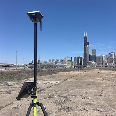
Leica Geosystems has released the Leica Aibot, its latest unmanned aerial vehicle (UAV) system based on DJI’s aerial platform, the M600 Pro, designed to rapidly and autonomously enable digitizing of critical infrastructure.
Leica Geosystems’ UAV technology enables users to get a complete data set in less time with a user-friendly and innovative interface, opening new business opportunities while reducing time, costs and effort from with traditional data collection methods.
A proprietary software suite supports the new UAV workflows. Using Leica Infinity for point cloud, digital surface model and orthophoto generation enables surveyors to process and visualize aerial data, increasing productivity and speeding data delivery. Supporting users to share data to Cylcone and Cloudworx, the integration of the UAV point cloud with terrestrial scan data enables informed decisions, while complete data sets increase project efficiency.
Use in construction
Throughout a construction project lifecycle of planning, designing and construction, Aibot provides easy access to critical information to perform volume calculations and monitor site progress. From creating digital terrain models to stripping and bulk earthworks and trenching to finally fine grading, paving and compaction, the solution facilitates actuals comparisons. This provides a more transparent view of site progression monitoring and volume calculations with safer operations, to keep projects on schedule.
High-definition imagery and 3D mapping enable viewing of site mapping or progress documentation, meaning users identify gaps early with high accuracy, and save time and money at all project stages.
Automating operations
The new technology, developed in partnership with UAV manufacturer DJI, allows users to process and analyze millions of data points gathered from above and to visualize the data for actionable information. UAV data can be combined with existing survey technologies, such as TPS, GPS and laser scanning, for a more complete set of information.
The three-year program helps emerging business partners bring new and innovative products to Esri customers.
The initial partnership between Hangar and Esri will enable ArcGIS customers to request and receive autonomous, precision-captured drone data on demand from within ArcGIS, enabling industries to gain real-time awareness and insight about locations and features.
The GIS community has grown accustomed to ambiguous and infrequent imagery. While emerging robotic enablers like drones provide a high-resolution, low-cost alternative to satellite and manned aircraft imagery, there hasn’t been a feasible way for GIS professionals to repeatedly gather precision location insight at scale, from potentially thousands of features within Esri maps, Hangar said in a statement.
Hangar not only makes aerial data possible at this scale, but also available on request from within ArcGIS. Using a system of systems, Hangar streamlines and automates the 4D data supply chain, enabling task-and-receive reality capture. In the near future, ArcGIS users will be able to request aerial insights at any feature, and have imagery delivered back in 24 to 48 hours or less.
“The pain we see in the GIS community is an inability to quickly and efficiently pair 2D data with the 3D reality,” said Jeff DeCoux, CEO and founder of Hangar. “We’re excited to work with Esri to deliver on-demand, precision 4D insight to ArcGIS users. Hangar will enable businesses to take full advantage of robotics as instruments of data collection, and provide the industry much needed repeatability and scale.”
ArcGIS Online users will have the capability to request and receive aerial imagery at variable frequencies or volumes. Requests can be made manually, on an as-needed basis, or automatically, based on contextual triggers or volume requirements. Data is autonomously captured, automatically processed, then delivered back to the customer via a high-speed delivery engine.
The digital missions behind requests are saved indefinitely, and can be performed repetitively with absolute precision and accuracy, preserving data integrity over time. ArcGIS users will be able to view captures within 24 to 48 hours from the initial request, across a variety of data types.
“Hangar empowers Esri users to explore any of the thousands of features within ArcGIS maps, observing ground truth at each pin in incredible detail, today and over time,” said Francis Kelly, Esri, global partner programs manager. “Hangar adds valuable data validity and scalability to the budding drone industry. We’re excited to work with them to give Esri users the ability to analyze and consume physical world content in a new and meaningful way.”
As big-data levels of precision spatial data are collected over time, Hangar will work with Esri to intelligently apply change detection and pattern recognition to enable a new era GIS that includes artificial intelligence and machine learning.
Hangar will be attending the Esri User Conference, July 9-13 in San Diego, at booth Z19 to demonstrate its technology and showcase the partnership with Esri.
Drones and robots complement traditional platforms, delivering insights in unique use cases.
Guest column by Mike Fuller
Geographic surveys have changed in the last 150 years. What started with early film cameras strapped to hot air balloons, kites and homing pigeons has advanced — both in terms of sensors and the platforms on which they’re deployed. These innovations — which include drones and robots — are changing the way we can collect data, enabling us to gather greater detail and providing richer insights about the world around us.
These nascent platforms are set to explode in popularity. The global market for remote sensing platforms will more than double in the next four years. It’s projected to reach more than $21 billion by 2022, driven in large part by use of drones, according to an October 2017 report from MarketsandMarkets.
Despite the anticipated growth in drone and robot usage, they will not replace traditional remote sensing platforms such as airplanes, satellites and vehicles. The new technologies bring with them some limitations with regard to the number, size and weight of sensors they can carry, capture rates, area covered and and line-of-site restrictions.
As a result, drones and robots will offer new capabilities that complement the traditional platforms and provide greater geographic detail, as well as the ability to be quickly deployed and constantly monitor areas where humans cannot routinely go.
How far we’ve come
To understand how far geographic information system (GIS) mapping and remote sensing technology has come, it’s important to consider how it started. Inventors in the 1800s relied on early film cameras and somewhat unreliable, imprecise airborne platforms — such as hot air balloons, pigeons and kites — to conduct land surveys and do surveillance.
The introduction of a new kind of “bird” — the airplane — opened up new opportunities in the 1900s, supporting the use of more accurate aerial photography for reconnaissance and mapping.
Satellite technology launched remote sensing into space in the 1970s, supporting the collection of detailed multispectral data that led to improved understanding of minerals, soils, urban growth, agriculture and other geographic features.
Even though the technology has become more sophisticated, GIS professionals still leverage data from many of these historical platforms:
Manned aircraft – planes and helicopters
Satellites – high-resolution satellites and cubesats
Terrestrial – survey vehicles and handheld devices
But — much like the impact of airplanes and satellites — we’re on the precipice of another significant milestone for remote sensing. Marked by use of burgeoning drone and robotic technology, this new technology will complement traditional platforms and deliver more insights than ever before possible.
Rise of drones and robots
Drones and robots are the newest remote sensing platforms catching the eye of the GIS community. Not only are they cool and cutting-edge, they open up a new class of use cases that were previously not possible with traditional aerial survey methods. They offer new opportunities to monitor remote areas, and their form factors and cost enables a higher frequency of data collection compared to aerial survey.
Because of their unique features, users are envisioning how these platforms can be implemented for remote sensing in many fields, such as energy, oil and gas, aviation, forestry, transportation, emergency management, and natural resource preservation and restoration.
When the frequency of data from these platforms is coupled with analytics and cloud infrastructure, it is possible to acquire, analyze and act in ways that were not possible before.
Keep in mind, though, that each technology comes with trade-offs. Users should assess their goals, and weigh these factors, to determine if drones or robots will deliver the results they wish to achieve. Let’s take a closer look:
Drones
Drones are capable of delivering ultra-high-resolution data, with ground sample distances (GSD) of 1 cm and accuracy of under 5 cm. However, accuracy is highly variable; it can vary based on the drone model, terrain and software used to process the collected data.
The form factor of many drones also limits the ability to do multi-sensor flights. A drone typically can cover no more than a few square miles per day with a visible or multispectral camera, compared to manned aircraft that span hundred of thousands of acres a day carrying hyperspectral, lidar and orthophotography devices simultaneously.
Because they can be deployed quickly, and on a daily basis, drones offer a cost-effective, practical approach for covering small areas compared to other aerial survey methods. But drone usage currently faces a significant impediment.
Current regulations require operators to maintain sight of the devices during all flights. These line-of-site restrictions limit the distance a drone can go on each flight, and require operators to change locations multiple times for a single survey. As a result, frequent revisits can be labor intensive.
Battery life also plays a role in the usability of drones. Most commercial drones can fly for only about 45 minutes, despite continued improvements in battery technology. Combined with the line-of-site restrictions, battery life impacts the amount of territory drones can cover. Most can handle only a few square or linear miles during each flight, making helicopters or airplanes better suited for projects that span hundred of miles or more.
Despite some of the drawbacks, drones are proving ideal in many use cases — from damage assessment and power restoration after hurricanes to data collection for hydraulic modeling, stream restoration design and aquatic habitat assessment.
For example, drones equipped with bathymetric and terrestrial laser scanning sensors are ideal for supporting riverine mapping applications. In these cases, drones offer an effective alternative when the waterway cannot be accessed, or it is too dangerous to use ground- or water-based survey methods for collecting channel geometry.
Robots
Robotic platforms are flexible, enabling users to attach a variety of sensors, including thermal cameras, lidar and sniffers for natural gas or other hazardous material. They are rarely hampered by payload restrictions, like drones.
And, with programming, robots can return to their chargers when their batteries dip below a certain threshold.
Like drones, there are many potential applications for terrestrial remote sensing robots. One use is for precision agriculture to test soil, water and plant health.
Many utilities are expressing serious interest, too, for robots. These robots can include onboard spectral, thermal and lidar sensors, precision navigation and hazard cameras to perform fine-scale spatial mapping and can acquire a wide array of data from electrical substations.
In this scenario, the robotic platform could detect physical and spectral changes, identify objects, monitor corrosion, detect liquid and gas leaks, and conduct thermal monitoring. Using this model, utilities could track substation environments remotely, saving time associated with physical inspections and enabling earlier detection of potential problems.
Systemwide approach required
Traditional remote sensing platforms — airplanes, satellites and vehicles — will continue to play an important role in GIS mapping. Drones and robots give us new tools that will have a dramatic impact on the amount of detailed geographic information collected.
For these new platforms to be used effectively as complements to traditional platforms, the industry must adopt a systems approach that takes into consideration a number of factors:
The end application
The sensors and acquisition protocol that will collect data at the precision required by the end application
The actionable analytics that need to be extracted from the data
How the data and insights integrate with the business processes used for decision making.
By taking this approach, those who work in a variety of fields can gather the insights they need to do their jobs more effectively and efficiently, while leveraging the unique strengths offered by these emerging platforms.
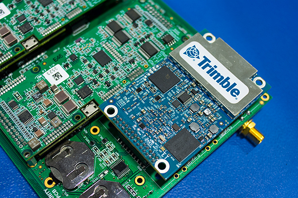
MicroPilot Inc. has teamed with Trimble to integrate high-precision GNSS technology as part of its autopilot for guidance and control of unmanned aerial vehicles (UAVs).
With centimeter-level, real-time kinematic (RTK) positioning capabilities, Trimble’s multi-constellation GNSS receivers are capable of tracking signals from GPS, GLONASS, Galileo and BeiDou, the company said. Trimble GNSS receivers are used in a wide variety of applications ranging from port automation and robotics to autonomous vehicle guidance.
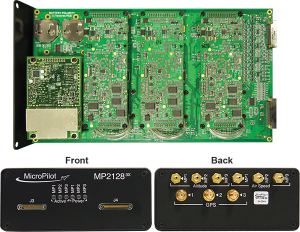
MicroPilot develops and manufactures autopilots for UAVs, including the triple-redundant MP21283X. The company also provides support products that enable customers to use their development time as efficiently as possible and bring their products to market faster. These products include the trueHWIL2 UAV autopilot simulator and the XTENDERmp software development kit.
The MP21283X UAV autopilot. (Image: Micropilot)
Working closely with Trimble gives MicroPilot the ability to better leverage Trimble’s GNSS technologies. This access improves the ability of MicroPilot’s support team to assist customers with their product development, testing and operations. Trimble will benefit from MicroPilot’s extensive experience integrating guidance, navigation and control systems for a wide variety of UAV platforms, the companies said.
“Reliable, robust and innovative GNSS solutions as well as strong technical support is key to bringing any UAV to market and our relationship with Trimble will allow MicroPilot to improve on our already industry-leading support,” said MicroPilot president Howard Loewen.
“We are very pleased to be working closely with MicroPilot to provide high-precision GNSS for its UAV autopilot solutions,” said Joseph Carey, director of strategic initiatives for Trimble’s Integrated Technologies Division. “MicroPilot autopilot’s simple installation, configuration and customization capabilities allow UAV manufacturers to easily integrate reliable, state-of-the-art, professional guidance, navigation and controls to their aerial platforms.”
“We know our diverse new partners will help us address a broad range of complex drone integration challenges,” said FAA Acting Administrator Dan Elwell. “The fields that could see immediate opportunities from the program include commerce, photography, emergency management, public safety, precision agriculture and infrastructure inspections.”
The 10 programs are:
Choctaw Nation of Oklahoma, Durant, Oklahoma
City of San Diego, California
Innovation and Entrepreneurship Investment Authority, Herndon, Virginia
Kansas Department of Transportation
Lee County Mosquito Control District
Memphis-Shelby County Airport Authority
North Carolina Department of Transportation
North Dakota Department of Transportation
City of Reno, Nevada
University of Alaska-Fairbanks
Over the next two and a half years, the selectees will collect drone data involving night operations, flights over people and beyond the pilot’s line of sight, package delivery, detect-and-avoid technologies and the reliability and security of data links between pilot and aircraft.
The data collected from these operations will help the FAA:
craft new enabling rules that allow more complex low-altitude operations,
identify ways to balance local and national interests related to UAS integration,
improve communications with local, state and tribal jurisdictions,
address security and privacy risks, and
accelerate the approval of operations that currently require special authorizations.
First announced in October 2017, the White House initiative partners the FAA with local, state and tribal governments, which then partner with private industry to safely explore the further integration of drone operations.
The program will help tackle the most significant challenges to integrating drones into the national airspace and will reduce risks to public safety and security.
Brian Wynne, president and CEO of the Association for Unmanned Vehicle Systems International (AUVSI), issued the following statement on the announcement of the participants selected for the FAA’s Unmanned Aircraft Systems (UAS) Integration Pilot Program:
“The participants selected for the FAA’s UAS Integration Pilot Program represent a commitment by governments at all levels to safely and efficiently integrate UAS into the national airspace. As more and more businesses and public institutions embrace UAS, it is more important than ever to have a process in which states, municipalities and tribal governments can provide input on federal policy without infringing on the U.S. government’s jurisdiction over the airspace.
“The data the participants will collect on UAS operations will help shape a national UAS policy framework, including for a UAS traffic management system and expanded UAS operations such as flying over people or beyond line of sight,” Wynne said. “We look forward to seeing the results of their work and the contributions these groups will make to keeping our skies safe.”
According to AUVSI, the potential economic benefit of drones in the nation’s air space, in less than a decade, is estimated at $82 billion and could create 100,000 jobs.
Drone maker DJI issued a statement saying it looks forward to the advances in drone regulatory procedures that will be enabled by the innovative proposals offered by the 10 state, local and tribal governments.
“Regulators and governments want to develop safe systems that encourage the beneficial uses of drones while addressing concerns about them, and today’s announcement is a major step forward in this effort,” said Brendan Schulman, DJI vice president of Policy & Legal Affairs. “By connecting state, local and tribal governments with industry partners and federal support, the Integration Pilot Program makes it easier to find ways for American businesses, governments and individuals to put drones to good uses all across the country.”
The event convenes the global community of commercial and defense leaders in intelligent robotics, drones and unmanned systems. Check out news, photos and videos from the show.
Five organizations that flew drones on critical, life-saving missions are winners of the inaugural XCELLENCE Humanitarian Award by the Association for Unmanned Vehicles Systems International (AUVSI).
“We are thrilled to recognize and reward organizations who have utilized drone technology to make great contributions to their communities and the environment, through AUVSI’s inaugural Humanitarian Awards,” said Michael Perry, managing director of North America at DJI.
“We congratulate the winners and thank all those who have participated for sharing the innovative ways they use drones to support humanitarian and life-saving efforts around the world,” Perry said. “We hope this award will inspire more organizations and drone operators to accomplish great feats and help others in their community.”
In Rwanda, fresh blood is launched to a hospital using a Zipline drone. (Image: CNN video)
These first recipients of the AUVSI XCELLENCE Humanitarian Award were recognized for using drones for disaster management, medical assistance and search-and-rescue operations at locations around the world:
Aeryon Labs Inc.: Aeryon SkyRanger UAS provides critical aerial intelligence to first responders in Sint Maarten in the wake of Hurricane Irma (Canada).
DroneSAR, DroneSAR UAV Search & Rescue (SAR) Solution: Executing autonomous aerial search and delivering live drone data to augment first response efforts (Ireland).
Nepal Flying Labs: drone hazard and vulnerability mapping in Nepal (Nepal).
ONG DroneSAR Chile: Emergency response team and humanitarian aid through the use of drones (Chile).
Zipline International: Zipline’s medical drone delivery operation in Rwanda (Rwanda).
“As these organizations have shown, unmanned aircraft systems that are typically flown for commercial purposes are also capable of accomplishing vital humanitarian missions,” said Brian Wynne, president and CEO of AUVSI. “With sophisticated on-board cameras and sensors, drones can quickly fly to remote locations or areas that are inaccessible to ground vehicles because of roads blocked by storm debris or flooding.”
The five organizations will equally divide a $25,000 donation as prizes for their ground-breaking humanitarian and philanthropic efforts.
As we approach the halfway point of 2018, one cannot help but notice the amount of technology that we use every day and how it affects our daily lives. While George Jetson isn’t whizzing by in a flying car to his glass condo in the clouds, we are utilizing an incredible amount of technology in normal life.
I can sit here typing on a computer or tablet that is many times advanced than the first one I used in junior high school and think nothing of it as futuristic technology has become the norm.
The old standard joke about technology used to be about cell phones and television remote controls; if you needed to figure it out, get your child or even grandchild to help. The youngsters were the majority that could embrace technology because they didn’t have past methods to confuse their ability to figure out how to work the new device.
A funny thing has happened along the way, though; those kids are now grown, and technology has advanced even further.
To help explain the names and timeframes of our generations, I found this chart that explained it all:
To help put this chart in context, the average age of the professional surveyor in the United States is 59 and solidly in the Baby Boomer category. But even with an average that high, there are still a significant number of surveyors in the Silent Generation as the economic downturn of the late 2000s has forced them to continue well into their golden years.
HOW SURVEYORS FIT IN THIS DISCUSSION
The surveying profession has suffered through the same generational challenge as the rest of society. The younger set that started out surveying with electronics have now graduated to much more complex yet capable machinery. Prior to the mid- to late 1970s, electronic technology did not play a role in most surveying operations and tasks. The professional surveyor was widely considered a boundary expert, map maker and establisher of topographic data, with the high-tech mapping work left to the government geodesists (see my July 2017 Survey Scene column).
Most surveyors who learned their craft prior to the electronic age were trained on the job or obtained an engineering degree through a program that may have offered a limited surveying curriculum. Surveying was a career for the outdoor type and required traversing rough terrain at times, as well as being able to withstand weather extremes.
THE NON-TECHNOLOGY GENERATIONS
As a second-generation surveyor, I was fortunate enough to have been exposed to land surveying literally as it was performed by our forefathers. While the tasks performed didn’t utilize a true Gunter’s chain and compass, they were completed with a modern transit and steel tape. The surveys we completed didn’t require high tech equipment as our manual procedures greatly exceeded commonly accepted positional tolerances.
A surveyor maps out boundaries for construction. (Photo: Bureau of Labor Statistics)
Most of the work performed by surveyors leading up to the early Baby Boomer generation was much simpler in theory but rarely easy to accomplish due to terrain, weather and the computations necessary to complete the boundary analysis. Traversing a parcel meant having a field crew of several people, often through brush and woods, and time consuming. A large parcel may be days or weeks of field to traverse around with most of it on foot. Once completed, the professional surveyor was tasked with often days of manual calculations, reduction of notes and determination of traverse closure. All the error from days of field work was then balanced through more hand calculations, usually by compass rule or transit rule, and hand drafted onto the final survey plat.
A similar story is followed with topographic and bathymetric surveys and creation of maps with existing conditions. Data collection performed to obtain locations and elevations of existing sites were by radial angle and distance or by grid method, with water depths being determined manually by use of lead lines. In the office this data is placed by manual drafting onto paper, sepia or vellum. Once elevations were plotted, contour intervals were determined by interpolation between each of these points. The creation of the contours was then drawn in by several methods, each with their own level of creativity by the drafter.
Because of the increased use and importance of electronic technology, data collection and advancements of the profession, today’s surveyor is faced with many more challenges than their predecessors. While the concepts for many tasks do follow the protocol for completing a multitude of survey duties, the way we go about collecting and analyzing the data is much more complex than in the past.
The need for our profession to identify these challenges and create opportunities for modern day surveyors is upon us, as our educational and training needs to be ramped up to stay current with demand. All professional surveyors, regardless of what generation they were born in, have filled or will fill an important role in society as expert measurers.
However, the rapid advancement of technology has exposed the lack of additional education and training necessary to keep our standing in serving the public’s health and welfare.
My point here is not that the work and tasks performed by past generations of surveyors was easier, but it did require more manual labor and less technical education and training. I liken the situation to automotive mechanics and how much more technology goes into working on a modern car versus vehicles of earlier generations.
Many mechanics tuned engines by “feel” with no recordable technology to tell them otherwise. I wouldn’t think of calling the expertise shown by past mechanics as inferior to today’s automotive mechanics; each has been trained to rely on different skills sets to work with completely different engines. Thus, I feel the same way in comparing different generations of surveyors. Different tools and methods require unique and specific training for the surveyor to perform at the highest level.
For example, look at the survey-related equipment, software and services within GPS World magazine; most of the articles, case studies and advertisements are for things not even considered five to 10 years ago. All these items require a different mindset of more technical and analytical processing, so the surveyor’s educational requirements and approach must adjust with the technology.
As time marches forward, the need for more advanced surveyors is reaching a critical point.
HOW TODAY’S SURVEYORS GET THE JOB DONE
Today’s surveying profession, including the field and office technicians, rely heavily on technology more than ever.
Many threads of advancing technology go into weaving the tapestry of modern surveying, with the primary material of GNSS being utilized throughout. I have written in the past regarding my thoughts on the single greatest advancement in surveying (see my May 2016 Survey Scene column) and my argument gets stronger with newer technology adding to the way we measure our world.
Here are some of the tasks in which the surveying profession uses GNSS as a basis of measurement and location, and why specific education and training is critical to proper execution:
Boundary surveys
Photo: Tim Burch
Like the surveyors before us, boundary establishment and re-establishment are the main responsibility of the profession. However, with GNSS, the ability to produce more location data has increased tremendously by reducing the need to perform intricate traverses through places when not necessary. It has also reduced the need to perform tedious traverse computations and adjustments; instead, least square adjustments are made to GNSS observational data to provide accurate results.
Topographic surveys
This data can be acquired by a combination of GNSS and conventional total station methods but is based upon geolocation information determined by primarily geodetic coordinates through GNSS solutions. Relying on GNSS data with no standard procedure for location and elevation verification can lead to major issues if not caught by an educated user.
All these methodologies, also known as remote sensing, have revolutionized mass data collection with the enormous amounts of information that can be acquired in a short amount of time. Each has specific functionality and limitations but rely on geolocation as a main attribute of the data. Because of the large data files that are created, the output is in the form of a point cloud rather than the traditional P,N,E,Z,D format normally utilized by surveyors. Like topographic surveys, this data typically relies on GNSS information for geolocation.
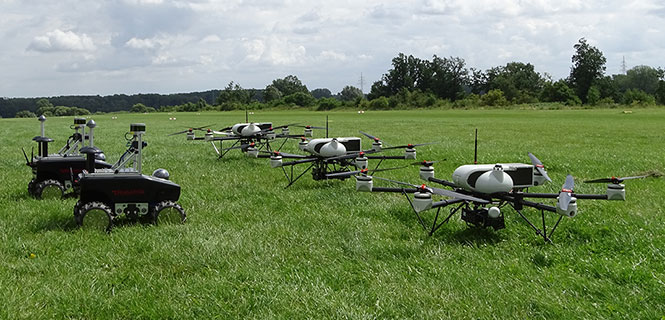
Photo: Simon Batzdorfer, Markus Bobbe, Martin Becker and Ulf Bestmann
Unmanned aerial and terrestrial systems
The newest of the data collection methodologies, the unmanned aerial vehicle (UAV) has taken the surveying world by storm. A good percentage of the new adopters (including me) utilize commercial grade multi-rotor units coupled with a high-resolution camera for orthometric photos and video clips of project sites.
While this method uses photogrammetry as its data collection method, it relies on GNSS for establishing ground control points (GCP) to establish geolocation to a known coordinate system. Higher end models incorporate RTK units to minimize the number of control points as well as utilizing lidar and/or hyperspectral modules for high end remote sensing.
Along with the airborne variety, land-based unmanned vehicles are starting to catch on as additional data collectors of open, navigable terrain. These autonomous devices are being equipped with lidar and cameras to augment aerial data in concert with UAVs to gather redundant information for quality checks.
As stated above, these remote sensing technologies, whether used statically or on an unmanned system, all create large point cloud data files that can be cumbersome to manage.
Bathymetric surveys
Many advancements have been made in producing measuring devices using sonar technology, including side- and multi-beam models for more detailed observations in varying conditions. GNSS plays a big role in this survey method due to the electronic ability to combine the depth readings of sonar instantaneously with geographic location. This improvement in data collection provides much more accurate and reliable information for the mapping of water bodies and passageways.
Bathymetric surveys are also getting in on the unmanned vehicle program as well with shallow draft autonomous watercraft being used in places where regular bathymetric vessels cannot go for survey data. More of these crafts are being implemented as they become more affordable.
What do these categories have in common? Most rely on specialized training and equipment to perform each specific task. Surveying has evolved past a “one size fits all” situation and demands that each sector of surveying have personnel trained for the job and have the right equipment to get it done.
A central figure in all these tasks is also GNSS technology; from survey-grade receivers to UAV’s, the tasks all revolve around geolocation.
HOW DOES THE PAST COEXIST WITH THE FUTURE?
The modern-day surveyor now has many different tools at their disposal that generations of surveyors before us couldn’t begin to fathom. The ability to perform at such levels of production and accuracy using new equipment and software is incredible and humbling. However, I’m afraid the technology is outpacing the profession. How many surveyors have taken the time to educate themselves on these enhancements? Because I think we are stretching ourselves too thin, now is the time for the professional surveying community to pause for a self-assessment of our abilities and what it will take to catch up with reality.
One of the biggest hurdles the surveying profession is facing are the lack of qualified technicians for positions both inside and out. The recession of 2008-2011 reduced the number of technicians in our field due to the lack of work being done in the economic downturn, but it also came at a time when technology was starting its upward run at increasing survey task efficiency. The downturn forced many surveyors and firms to make drastic cuts and reduce their investment in new technology, equipment and training to be more efficient. The surveying profession is now paying the price for that downturn with few adequately trained technicians along with licensed professionals not staying current with technological innovation and advances.
WHERE DO WE GO FROM HERE…?
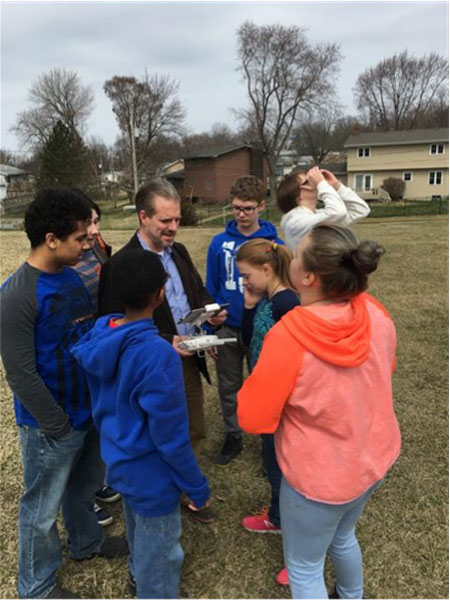
Tim Burch with seventh-and eighth-grade students.
The professional surveyor must embrace technology by promoting the profession to more places beyond the four-year college. We must start in junior-high and high school in math, science and history classes encouraging students to investigate surveying as a career. We also need to support technical and vocational programs that can help introduce surveying as a possible path beyond their certificate or associate degree. One of the simplest topics I use in presentations is the discussion of GNSS technology and how it is built into almost everything the student sees. From their cellphone to the cars their parent’s drive, GNSS surrounds us with geolocation information to make our lives easier.
These technicians aren’t going to all come from a four-year university programs; they are going to come from those teenagers who spend hours honing their hand-eye coordination with video games and drone racing. They will also be the fluid minds writing code for the next big app, and the surveying profession needs to embrace them to incorporate their work in our geolocation world.
The professional surveying occupation has become much more than establishing boundaries of parcels; it now requires knowledge for mapping literally anything in the world. The challenge now is to find those who want to help us continue this surveying and mapping tradition. Fellow surveyors: are you up to the challenge to find your replacement?
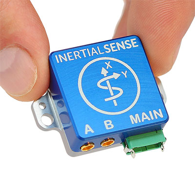
Inertial Sense has announced the availability of a micro-sized rugged version of its combined GNSS-INS module, which has an onboard GNSS receiver as well as a fully fused inertial navigation solution.
Designed to fill autonomous vehicle and sensing needs, the module is also available in AHRS/IMU versions.
At 10 grams and with 1 x 1-inch footprint, the solution provides accuracy of 0.1-degree roll/pitch and 0.3-degree dynamic heading. It is also ITAR-free module.
The modules represent 15 years of inertial navigation and motion measurement experience, according to the company.
“When I set out on this journey to provide an accurate and low-cost navigation solution, I wanted to produce a product that engineers could purchase off the shelf, hassle free,” said company founder Walt Johnson. “In my past as a UAV engineer, I was always looking for ways to save myself time and money. It’s all about convenience. There is no need to spend time choosing IMU sensors and writing the algorithms to fuse navigation data. We provide it all for you.”
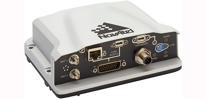
NovAtel has introduced several new precision positioning solutions for space-constrained applications. With enhanced positioning accuracy in a compact form, the PwrPak7D, PwrPak7DE1 and OEM7600 are suitable for automotive, airborne and other smaller unmanned systems.
PwrPak7D and PwrPak7D-E1 are dual-antenna, multi-frequency enclosures, and the OEM7600 receiver board, plus NovAtel’s new Waypoint Inertial Explorer Express post-processing software are being showcased this week at AUVSI Xponential 2018.
Dual-Antenna, Multi-Frequency Enclosures
The new PwrPak7D enclosure. (Photo: NovAtel)
NovAtel’s new PwrPak7D and PwrPak7D-E1 enclosures provide space efficiency without sacrificing position accuracy and heading stability, even in stationary, slow-moving or hovering dynamics.
The PwrPak7D-E1 enclosure integrates an inertial measurement unit (IMU) with NovAtel’s OEM7720 dual-antenna receiver board to deliver GNSS and inertial navigation system (INS) capabilities.
When combined with NovAtel’s SPAN technology, positioning and attitude performance is optimized during extended GNSS outages.
Both the PwrPak7D and PwrPak7D-E1 include NovAtel’s Interference Toolkit with advanced interference detection
and mitigation features applicable to all stages of integration. A web user interface, accessible through Ethernet or
Wi-Fi, allows for quick and easy system configuration and control.
OEM7600 Receiver Board for Smaller Autonomous Systems
The OEM7600 receiver board. (Photo: NovAtel)
The OEM7600 receiver board features NovAtel’s high-performance positioning solutions in an extremely small form factor, wrapped with protective shielding to isolate emissions from surrounding electronics in confined spaces.
This new receiver integrates easily with NovAtel’s SPAN technology to optimize performance during extended GNSS outages.
The new OEM7600 will be commercially available this summer.
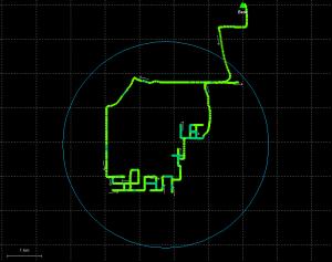
New Post-Processing Software for UAVs and Small Project Areas
Inertial Explorer Xpress centroid circle. (Image: NovAtel)
Inertial Explorer Express provides the same core processing and utilities as the
Waypoint Inertial Explorer software for applications including unmanned aerial vehicles (UAVs) and smaller projects.
Inertial Explorer Express will produce centimeter-level position and attitude solutions compatible for lidar, camera and other sensor data with faster processing times and reduced complexity
“We are very excited to be introducing our new OEM7-based and Inertial Explorer solutions at Xponential 2018,” said Neil Gerein, director of product management at NovAtel. “These systems provide robust positioning and accuracy in a compact footprint for UAVs and smaller autonomous projects. An advanced range of software options, including NovAtel’s tightly coupled GNSS+Inertial SPAN technology and Interference Toolkit, provide assured positioning anywhere.”
At least 65 people have been rescued by drones in the last year, according to a new report issued by DJI, a civilian drones and aerial imaging company.
The report gathers accounts from news outlets and public safety agencies around the world, and includes 27 separate incidents on five continents.
The report, “More Lives Saved: A Year Of Drone Rescues Around The World,” is available for download. It highlights how improved drone technology, rapid adoption by first responders, and smart aviation regulations have combined to increase the pace of drone use in critical public safety missions.
dropped buoys to struggling swimmers in Australia and Brazil,
spotted unconscious victims in sub-freezing weather in England and America, and
found stranded people in fields, rivers and mountains.
“Drones allow rescuers a way to find missing people, deliver supplies like food and life vests, and cut search and response times from hours to minutes,” said Brendan Schulman, DJI vice president for policy and legal affairs. “When laws and regulations allow public safety agencies to deploy drones easily, rescuers are able to save time and money, protect their personnel, and most importantly, rescue people from peril.”
More than one person a week was rescued by a drone over the last year on average, the report found, including at least 18 found by thermal imaging cameras that can sense a person’s body heat even in darkness or when hidden by thick brush.
In one case, police in Lincolnshire, England responded to a car crash on a dark rural road on a cold night but were unable to find the driver. A drone with a thermal imaging camera spotted the driver in a ditch away from the crash scene, and captured the dramatic moments when it guided officers to find him. See video below.
According to Phase One Industrial, the iXM 100MP is a high-productivity metric camera with a range of high-resolution lenses. Photo by Allison Barwacz
Phase One Industrial has launched the iXM series, an aerial camera platform driven by its fast medium-format imaging sensor.
Engineered for UAV-imaging missions, the iXM 100MP is a high-productivity metric camera with a range of high-resolution lenses. It is ready for integration with various UAV platforms, including Phase One’s DJI Matrice 600 Pro solution.
The iXM 100MP metric camera incorporates the first medium-format sensor with backside-illumination technology, enabling high light sensitivity and extended dynamic range. Fast, highly responsive, robust and weatherproof (IP53 compliant), the iXM 100MP delivers superior quality aerial imaging and flexible operation to satisfy diverse mapping, surveying and inspection applications, the company said.
In addition, Phase One announced four new specially developed RSM lenses — with focal lengths ranging from 35mm to 150mm — to seamlessly fit the new sensor’s 3.76 μm pixel size and 33 x 44 mm frame size, ensuring image sharpness across the entire FOV. The lenses are available with either fixed-focus or motorized-focus functionality.
The fixed-focus 35mm and 80mm lenses provide superior image radiometric quality, high ground resolution and large coverage, suitable for surveying applications.
The motorized-focus 80mm and 150mm lenses are designed for a wide range of inspection applications, including electricity poles, wind turbines, bridges, and other private-sector or government structures.
Motorized-focused lenses, having no external moving parts, enable a number of new uses for inspection applications where the focusing distance can be predefined based on flight planning, or by the operator, using a wireless remote control. With the motorized lens, the camera captures sharp and highly detailed images of multi-distance or 3D objects.
The cameras’ RSM lenses incorporate a new leaf-shutter technology, which supports 3 fps capture — with a speed of 1/2500 sec — while guaranteeing 500,000 actuations. The lenses are thermally stable to ensure consistent focus over a wide range of temperatures and flight altitudes.
With optics designed to exploit the full benefits of the new sensor technology, the lenses provide with greater productivity, flexibility and reliability, offering superb image quality.
The new iXM platform adds XQD high-speed storage technology to handle the sensor’s extremely fast frame rate. Also on all cameras, HDMI output from actual exposure provides UAV operators simple and outage-free feedback of actual view, exposures, and camera status in overlays.
In addition, the new platform includes USB-C and 10G Ethernet for versatility of connectivity to large UAVs and aircraft.
“Working with our UAV partners, we see a fast-growing market driven by great potential for time and cost savings over traditional inspection and surveying methods,” said Dov Kalinski, General Manager of Phase One Industrial. “With its new technology, design, and capabilities, the iXM 100MP promises to help start a new era in inspection missions with UAVs. Phase One Industrial continues to push technical boundaries to equip drones and larger UAVs with superior imaging technology — engineering advanced systems, cameras, and software — to help achieve that potential.”
The iXM 100MP and iXM 50MP metric cameras are available for advance order from Phase One Industrial partners worldwide with delivery in June 2018.
 The initial partnership between Hangar and Esri will enable ArcGIS customers to request and receive autonomous, precision-captured drone data on demand from within ArcGIS, enabling industries to gain real-time awareness and insight about locations and features.