Skyfora, a Finnish weather data company building a new global data layer for weather and AI, has raised €6.5 million to transform GNSS telecom infrastructure into a real-time atmospheric sensing network.
The funding comes as demand for high-resolution weather data surges, driven by AI forecasting models, climate volatility, and the growing need for weather-resilient operations.
GNSS metrology system
Traditional weather forecasting relies on sparse networks of expensive ground stations, weather balloons, and radar systems — methods that leave vast gaps in coverage, particularly in urban areas and developing regions. Instead, Skyfora combines atmospheric physics, advanced signal processing, and artificial intelligence to extract weather intelligence from GNSS data.
GNSS meteorology turns every GNSS receiver into a weather sensor. The more receivers in an area, the higher the resolution of atmospheric data achievable.
GNSS signals traveling through the atmosphere are delayed by water vapor. By measuring these delays from multiple satellites and ground stations, Skyfora can create detailed 3D maps of atmospheric moisture — a critical input for weather forecasting.
Once the atmospheric data is captured and reconstructed, the system uses AI and high-performance computing to turn it into accurate, actionable forecasts.
Using existing GNSS receivers
Skyfora’s core technology uses GNSS receivers already installed in telecom networks, complemented by StreamGNSS hardware where telecom GNSS is not available, to measure atmospheric humidity with high precision and frequency. The GNSS signal delays are processed into real-time weather data streams that power next-generation AI weather models and forecasting systems, enabling more accurate, earlier, and hyperlocal predictions.
The company’s approach addresses a structural bottleneck in weather forecasting: most of the world’s atmosphere remains underobserved, and existing observation infrastructure cannot provide the data coverage and resolution required by modern AI models. Skyfora’s solution scales using existing infrastructure, requiring no new hardware at telecom sites.
Skyfora operates active deployments across multiple countries, working with telecom operators, meteorological institutions, forecasting partners and weather-affected industries to build out real-time atmospheric sensing on a global scale.
Latest capital round partners
The new capital will be used to accelerate the commercial scale-up of Skyfora’s software platform and atmospheric data products, expand partnerships with telecom operators, forecasting providers, meteorological institutions and weather-affected industries, and grow the team. The primary focus is on scaling deployment and market adoption: bringing Skyfora’s real-time data, API and atmospheric intelligence dashboard to market.
The round includes equity participation from Eviny Ventures, Ugly Duckling Ventures, Lumo Labs and the European Innovation Council (EIC) Fund, alongside non-dilutive funding from Business Finland.
The company is actively working to deploy datasets and customer opportunities across several countries in Europe, the United States, Africa and the Middle East.
IBM, a global technology provider, has released its latest geospatial artificial intelligence (AI) initiative to address climate change. These efforts involve collaborations across various regions and uses advanced AI models designed for geospatial applications.
Central to these initiatives is IBM’s geospatial foundation model, developed jointly with NASA. These models aim to generate environmental insights and solutions related to climate change. Unlike traditional AI models, these use a vast amount of climate-relevant data to accelerate the analysis of various environmental aspects that are affected by climate change.
“AI foundation models utilizing geospatial data can be a game-changer, allowing us to better understand and address climate-related events with unprecedented speed and efficiency,” said Alessandro Curioni, IBM fellow and vice president of Accelerated Discovery.
Analyzing urban heat islands in UAE
IBM and the Mohamed Bin Zayed University of Artificial Intelligence (MBZUAI) have partnered to map urban heat islands in Abu Dhabi using a fine-tuned version of IBM’s geospatial foundation model. The goal of the project is to understand the impact of local landscapes on temperature anomalies, the company said. The initial results show a decrease in heat island effects, which can provide valuable insights for future urban design strategies.
Reforestation and water sustainability in Kenya
In partnership with Kenya’s Special Envoy for Climate Change, Ali Mohamed, IBM is supporting the National Tree Growing and Restoration Campaign. The initiative aims to plant 15 billion trees by 2032, particularly in critical water tower areas affected by deforestation. IBM’s geospatial model powers a digital platform to track tree planting activities, aiding local efforts in restoring forests and measuring carbon sequestration impact.
Elevating climate resiliency in the UK
In collaboration with the Science and Technology Facilities Council (STFC) and Royal HaskoningDHV, IBM is developing AI-driven tools for climate risk assessment in the UK. These tools will focus on assessing weather impacts on aviation operations, the company said. Additionally, the TreesAI research project aims to map areas suitable for tree planting to mitigate surface water flooding and offer urban developers a digital planning platform.
IBM extends collaboration with NASA for weather forecasting
IBM and NASA have partnered to develop an AI foundation model dedicated to weather and climate applications. The collaboration aims to enhance the accuracy and speed of weather forecasting, predict wildfire conditions and understand meteorological phenomena. IBM researchers will work closely with NASA to train and validate this model, IBM said.
PlantiQ — an atmospheric observing systems company — will begin daily delivery of its signal to noise ratio GNSS-radio occultation (RO) data to the National Oceanic Atmospheric Administration (NOAA) under the NOAA’s IDIQ-2 operational Delivery Order-2.
The NOAA has allocated $59.6 million over the next five years to use commercial satellite data to achieve high-quality weather forecasting and atmospheric research.
“By incorporating PlanetiQ’s commercial high quality GNSS-RO data, coupled with our deep understanding of RO technology, NOAA will have the information to significantly improve short and medium-range weather forecasts, and provide essential insights to enhance climate change research for the government, military and the private sector,” Ira Scharf, PlanetiQ CEO, said.
PlanetiQ supplies GNSS-RO data to NOAA from its growing constellation of satellites, which has become a critical part of the global observing system.
The same 91 signers also sent an identical letter to President Biden.
April 24, 2023
Dear Senators and Members of Congress:
Last year, many of the undersigned wrote in reflection of the unprecedented opposition to the Federal Communications Commission’s (FCC’s) Ligado Order(1) across the vast federal and commercial user base of Global Positioning System (GPS), satellite communications and weather forecasting services. Three years after adoption of the Order, as eight petitions for reconsideration remain pending, (2) we again urge you to work together with the FCC to stay and ultimately set aside the Order. (3) Critically, this is now necessitated by the crucial, previously unavailable information that was produced at the direction of Congress: the independent technical review undertaken by the National Academies of Sciences, Engineering, and Medicine (NAS) (4) analyzing the potential interference issues related to the Ligado Order.
We greatly appreciate your administration’s opposition to the Ligado Order and commitment that the National Telecommunications and Information Administration (NTIA), on behalf of the executive branch, will continue to actively pursue its petition for reconsideration of the Order. (5) As you know, the pending petitions for reconsideration convincingly demonstrate that the Ligado Order is legally and factually deficient. In the pending petitions, parties showed that the Ligado Order is fundamentally flawed, incompatible with the FCC’s rules and inadequate in protecting incumbent services from the harmful interference from Ligado’s proposed operations. This substantial documentation, among many other concerns from federal and commercial users, resulted in Congress enacting bipartisan legislation in consecutive years after the FCC’s adoption of the Ligado Order, mandating NAS’s independent technical review and requiring the Department of Defense (DoD) to brief federal representatives across the government “at the highest level of classification” on the potential for widespread harm from Ligado’s proposed terrestrial operations. (6) On this basis alone, the FCC should stay the Order in an acknowledgement that it clearly did not account for the full, real-world risk of harm associated with a nationwide terrestrial deployment in the L-band.
While the pending petitions have a strong likelihood of success on their own merits, the FCC’s rules and the public interest now require the FCC to reconsider the Order in response to the extensive analysis in the NAS Report. (7) This new, previously unavailable information presented in the Congressionally-mandated independent technical review confirms that Ligado’s proposed terrestrial operations would cause harmful interference (8) at significant ranges to incumbent L-band services across a broad range of deployment scenarios. This is consistent with the well-supported and robustly documented analyses and determinations of the federal government, (9) including fourteen federal agencies and departments, (10) and commercial parties (11) alike. Importantly, as concisely stated by DoD and detailed in the NAS Report, “[t]he terrestrial network authorized by [the Ligado Order] will create unacceptable harmful interference for DoD missions. The mitigation techniques and other regulatory provision [sic] in [the Ligado Order] are insufficient to protect national security missions.”(12)
The unequivocal conclusions of the NAS Report constitute the exact type of previously unavailable information that the FCC’s rules (13) dictate must be addressed on reconsideration. Indeed, NTIA stated on behalf of the executive branch that the NAS Report “offers the [FCC] an important opportunity to reconsider Ligado’s Authorization.”(14) We therefore urge you to work with the FCC to address the harm from Ligado’s proposed terrestrial network to critical GPS, satellite communications, and weather forecasting services by staying the Order, addressing the previously unavailable information contained in the NAS Report, and resolving the pending petitions for reconsideration.
Sincerely,
AccuWeather, Inc.
Aerospace Industries Association
Agricultural Retailers Association
Airborne Public Safety Association
Aircraft Electronics Association
Aircraft Owners and Pilots Association
Airlines for America
Alabama Agricultural Aviation Association
ALERT Users Group
Allied Pilots Association
Air Line Pilots Association, International
American Geophysical Union
American Meteorological Society
American Rental Association
American Road & Transportation Builders Association
American Weather and Climate Industry Association
Arizona Agricultural Aviation Association
Arkansas Agricultural Aviation Association
Associated Equipment Distributors
Association for Uncrewed Vehicle Systems International
(1) Ligado Amendment to License Modification Applications, IBFS File Nos. SES-MOD-20151231-00981, SAT-MOD-20151231-00090, and SAT-MOD-20151231-00091, Order and Authorization, 35 FCC Rcd 3772 (2020) (“Ligado Order” or “Order”).
(2) More than twenty parties in total signed petitions for reconsideration of the Ligado Order and all of these petitions remain pending before the FCC. See Petitions for Reconsideration of the National Telecommunications and Information Administration; the Air Line Pilots Association, International; the American Road & Transportation Builders Association, the American Farm Bureau Federation, and the Association of Equipment Manufacturers; the Joint Aviation Petitioners; Iridium Communications Inc., Flyht Aerospace Solutions Ltd., Aireon LLC, and Skytrac Systems Ltd.; Lockheed Martin Corporation; Trimble Inc.; and the Resilient Navigation and Timing Foundation, IB Docket Nos. 11-109 & 12-340 (all filed on or about May 22, 2020). The ten “Joint Aviation Petitioners” consist of the Aerospace Industries Association, the Aircraft Owners and Pilots Association, Airlines for America, Aviation Spectrum Resources, Inc., the Cargo Airline Association, the General Aviation Manufacturers Association, the Helicopter Association International, the International Air Transport Association, the National Air Transportation Association and the National Business Aviation Association.
(3) The Commission should also not proceed with any companion rulemakings causing harmful interference to weather forecasting and hydrology services that could result in Ligado deployments, particularly in light of the analysis and recommendations presented in the “Spectrum Pipeline Reallocation 1675–1680 MHz Engineering Study (SPRES) Program Report. See Allocation and Service Rules for the 1675-1680 MHz Band, Notice of Proposed Rulemaking, 34 FCC Rcd 3352 (2019); U.S. Department of Commerce. National Oceanic and Atmospheric Administration. National Environmental Satellite Data Information Service. Spectrum Pipeline Reallocation 1675–1680 MHz Engineering Study (SPRES) Program Report. Silver Spring, MD: NESDIS, October 2020 (public release August 2022).
(4) National Academies of Sciences, Engineering, and Medicine, Analysis of Potential Interference Issues Related to FCC Order 20-48 (2022), https://doi.org/10.17226/26611 (“NAS Report”).
(5) Letter from Gina Raimondo, Secretary of Commerce, U.S. Dept. of Commerce, to The Honorable James M. Inhofe, ranking member, U.S. Senate Committee on Armed Services (June 22, 2021) (reiterating the NTIA’s position opposing the Ligado Order).
(6) William M. (Mac) Thornberry National Defense Authorization Act (“NDAA”) for Fiscal Year 2021, Pub. L. 116-283, 134 Stat. 4074 § 1663; NDAA for Fiscal Year 2022, Pub. L. 117-81, 135 Stat. 1541 § 1613.
(7) These statements are based on the publicly available portions of the NAS committee’s work. In addition, NAS prepared a classified annex, which further details the risks of Ligado’s proposed terrestrial network and additionally warrants FCC action.
(8) The term “harmful interference” is herein used to describe the results of the NAS Report. In turn, the undersigned believe the results of the NAS Report dictate that the FCC must reach the legal conclusion that Ligado’s operations would cause harmful interference under the FCC’s rules.
(9) See, e.g., National Telecommunications and Information Administration Reply to Ligado Networks LLC’s Opposition to Petitions for Reconsideration or Clarification, IB Docket Nos. 11-109 & 12-340, at 10 n.26 (filed June 8, 2020); U.S. Department of Transportation, Global Positioning System (GPS) Adjacent Band Compatibility Assessment, Final Report (Apr. 2018) (“DOT ABC Report”),
(10) See Memorandum from Thu Luu, Executive Agent for GPS, Department of the Air Force, to IRAC Chairman (Feb. 14, 2020).
(11) See, e.g., Letter from J. David Grossman, Executive Director, GPSIA, to Marlene H. Dortch, Secretary, FCC, IB Docket Nos. 11-109 et al., at 6 (Sept. 17, 2020); Letter from Bryan N. Tramont, Counsel to Iridium Communications Inc., to Marlene H. Dortch, Secretary, Federal Communications Commission, IB Docket Nos. 11-109 et al. (Jan. 19, 2022); Update to 2016 Technical Assessment of Ligado User Terminal Interference to Iridium attached to Iridium Communications Inc. et al., Petition for Reconsideration, IB Docket Nos. 11-109 et al. ( May 22, 2020).
(12) NAS Report at 6, 73.
(13) 47 C.F.R. § 1.106(c)(2).
(14)Press Release, NTIA, NTIA Statement on National Academies of Sciences Report (Sept. 9, 2022).
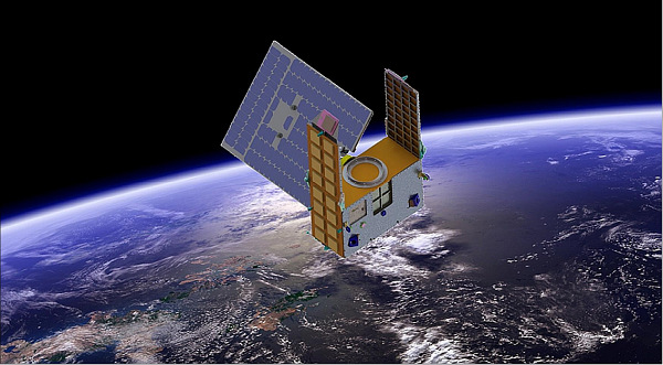
Artist’s illustration of a GNOMES satellite. (Image: Blue Canyon)
A new GNSS radio-occultation (RO) satellite is now in orbit. The GNOMES-3 — GNSS Navigation and Occultation Measurement Satellite — flew aboard the SpaceX Falcon 9 Transporter-4 rideshare mission on April 1 and was launched into a 646-km circular sun-synchronous orbit. The payload was powered on and operating nominally within four days of launch.
The GNOMES-3 was manufactured for PlanetiQ by Blue Canyon Technologies LLC, a wholly owned subsidiary of Raytheon Technologies. Using refracted GNSS signals, PlanetiQ can determine the density and moisture content of the atmosphere to improve weather predictions, helping improve NOAA weather models.
The GNOMES-3 joins GNOME-2 on orbit and is expected to achieve highly accurate GNSS-RO measurements using the fourth-generation Pyxis-RO sensor. PlanetiQ plans to launch more Pyxis-RO atmospheric and ionospheric sounding spacecraft in 2023. In all, PlanetiQ plans for a fleet of 20 GNOMES by 2024.
The GNOMES-2, launched in June 2021 on SpaceX’s Transporter-2 mission, produces more than 3,200 soundings of the Earth’s atmosphere and 5,000 ionosphere soundings per day with a large-aperture RO antenna that tracks all four GNSS constellations: GPS, Galileo, GLONASS and BeiDou.
The soundings have sufficient signal-to-noise ratio to indicate the location of the planetary boundary layer, as well as detect super refraction at the boundary layer and near the Earth’s surface. The higher quality GNSS-RO soundings, along with the associated lower troposphere assimilation tools, will be used to produce more accurate weather forecasting and hurricane tracking, and aid in energy, transportation and agriculture industries as well as serve as a climate record with its SI-traceable data.
TomTom integrates Vaisala’s environmental data capabilities into its Hazard Warnings service to deliver time-critical alerts for road weather hazards
Vaisala — a global leader in weather, environmental and industrial measurement — will bring its accurate insights and actionable road weather data to the TomTom Hazard Warnings service.
TomTom Hazard Warnings creates time-critical signals that alert drivers and automated vehicles to safety-critical incidents as they happen. These incidents include traffic, weather and road hazards.
“More than every fifth traffic accident is a result of inclement weather-related impacts, yet drivers often don’t receive real-time information about weather or driving conditions from their in-vehicle technology — even in new vehicle models,” said Petri Marjava, head of Automotive at Vaisala. “While TomTom has utilized our atmospheric weather data for years, our new arrangement equips its Hazard Warnings service with must-have predictive road weather information. Road weather data takes in-vehicle weather services to the next level by helping drivers stay safe while conveniently optimizing route and travel times in all weather conditions.”
TomTom Hazard Warnings uses Vaisala’s data to deliver early warnings related to weather hazards, such as slippery roads, reduced visibility and strong winds. This data enables better route planning and notifies drivers to prepare and adjust for driving in poor conditions.
In addition to general weather conditions and detailed point forecasts, Vaisala is now providing TomTom Hazard Warnings with road surface measurements and driving conditions forecasts.
The road weather data Vaisala delivers covers continent-wide road networks across the United States and Europe to enhance driver safety, efficiency and convenience, with other geographical regions to follow.
Can GPS support a greener, more sustainable planet? The answer is an emphatic “yes,” and it is already doing so today.
GPS has become a fundamental technology across nearly every sector of the U.S. economy, including agriculture, transportation, construction and municipal services. In each of these industries, the use of GPS has produced substantial environmental benefits, such as lowered carbon emissions, increased water efficiency, decreased use of environmentally sensitive inputs, and reduced waste.
Agriculture
Let’s take a closer look at how GPS is protecting our nation’s critical environmental resources. We begin with agriculture where it is estimated that the absence of GPS during peak planting season could result in an economic loss of more than $15 billion, according to a National Institute of Standards and Technology report.
During the past two decades, GPS has transformed American farming, enabling increased crop yields, cost efficiencies, and environmental sustainability through the precise application of seed, water, fertilizers and pesticides and the efficient use of fuel. In sum, precision agriculture lets farmers do more with less wasted seed, less fertilizer, less fuel, less pesticide, and more crop yield.
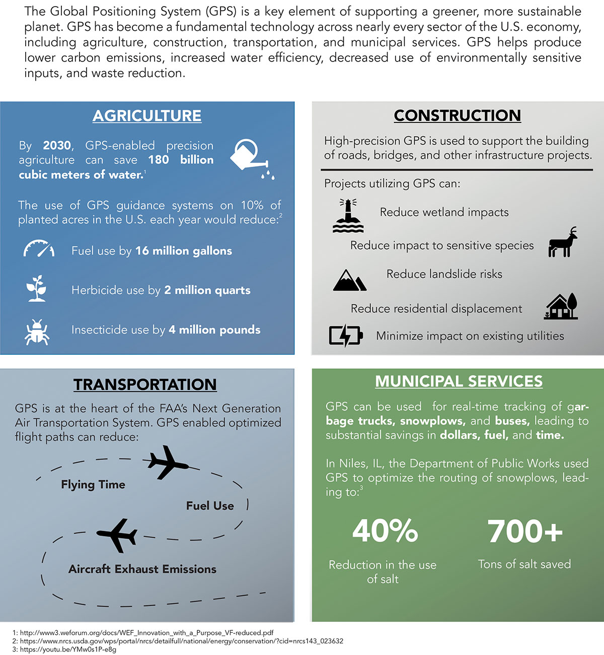
GPS Innovation Alliance (GPSIA) founding member Deere & Company reports that precision agriculture technologies can have a huge impact on resource efficiency and sustainability. By 2030, GPS-enabled precision agriculture implemented globally could save 180 billion cubic meters of water, says the World Economic Forum.
Similarly, according to the U.S. Department of Agriculture’s Natural Resources Conservation Service (NRCS), if “[GPS] guidance systems were used on 10 percent of the planted acres in the United States, fuel use would be cut by 16 million gallons, herbicide use by two million quarts, and insecticide use by four million pounds per year.” For a single Midwest row crop farmer, with 6,500 acres using precision agriculture techniques, Deere & Company estimates that more than 1,600 gallons of fuel could be saved, and more than 400,000 kg CO2 equivalent emissions could be avoided, over the course of a production cycle — the equivalent of nearly a million (992,000) passenger car miles driven per year.
Infographic: GPS Innovation Alliance
Construction
Construction is another industry that has been revolutionized by GPS. Today, high-precision GPS is used to support the building of roads, bridges and other significant infrastructure projects. In 2019, testimony before the U.S. House Small Business Committee, an executive of GPSIA founding member Trimble described several examples of how digital construction technologies, including GPS, can more efficiently plan and execute complex construction projects.
In one such example from Southern California, the improvements “reduced the wetland impact by 58 acres; reduced the impact to sensitive species; reduced landslide risk; reduced residential displacement; and minimized the impact on existing utilities (resulting in few utility relocations to undisturbed areas).”
GPS receivers are also embedded in many bulldozers, excavators and graders, resulting in reduced waste and lower fuel consumption. They can reduce greenhouse gas emissions, with an estimate from Trimble suggesting that the use of machine control technologies can cut more than one billion pounds of CO2 usage per year.
NextGen Air
GPS is also at the heart of the Next Generation Air Transportation System, or NextGen, of the Federal Aviation Administration (FAA). Capt. Sully Sullenberger, during a 2020 GPSIA-sponsored event, described air traffic control modernization as depending “massively on the ubiquity and reliability of GPS.”
Along with the safety benefits of knowing the precise location of an aircraft, GPS enables optimized flight paths that the FAA says can reduce “flying time, fuel use, and aircraft exhaust emissions.” These efficiencies have already resulted in $1.2 billion in fuel savings, according to the FAA.
During a 2010 test flight over Puget Sound, Washington, Alaska Airlines found that the use of GPS-aided flight procedures reduced emissions by 35% compared to a conventional landing. Other airlines have also quantified these benefits, finding substantial savings in fuel consumption simply by cutting a single minute from each flight.
Weather and Disaster Forecasts
No one can argue the fact that weather events like hurricanes, floods and droughts have a huge impact on the environment and public safety. According to the National Oceanographic and Atmospheric Administration (NOAA), in 2020 such events cost $95 billion in damages. You may not realize, however, that NOAA uses GPS signals to support three-dimensional meteorology, space weather and geophysical applications throughout the United States.
Even NOAA’s Geostationary Operational Environmental Satellites (GOES) use GPS signals to enhance their ability to provide the data we all receive in each morning’s TV weather forecast, improving weather predictions and our own storm situational awareness. GPSIA member Lockheed Martin manufactures both the GOES-R series of weather satellites and the U.S. Space Force’s more powerful, next-generation GPS III satellites that are now being launched to modernize the GPS constellation.
Municipalities
Lastly, we examine the environmental benefits for municipalities that use GPS for key government services, including the real-time tracking of garbage trucks, snowplows and buses. Throughout the country, towns and cities have seen substantial savings in dollars, fuel and time from implementing GPS-enabled technologies.
In Niles, Illinois, for example, the Department of Public Works partnered with GPSIA founding member Garmin to optimize the routing of snowplows. Using GPS technology, drivers reduced the use of salt by as much as 40%, resulting in more than 700 tons saved. In 2020, in recognition of its innovative use of GPS, the department received the Management Innovation Award from the American Public Works Association. Similarly, GPSIA member CalAmp found that GPS use for vehicle tracking can result in fuel savings of $90 per vehicle per month.
Ensuring GPS
Ensuring these environmental benefits can continue to be realized requires that the spectrum used by GPS be protected from harmful interference. It will also depend on continued funding by Congress to modernize the GPS constellation and ground control. Additionally, as Congress considers a major infrastructure bill, including funding for states and localities, we would encourage projects to make use of GPS and other innovative technologies that can drive down costs, reduce carbon emissions, and eliminate waste — including advanced digital-construction management systems that use GPS data to reduce project costs and speed project delivery.
GPS has changed our everyday lives for the better, and as our dependence on this technology continues to grow, so will its impact on environmental sustainability efforts.
To get the best measurements of Earth’s atmosphere, you sometimes have to leave it. This November, the Sentinel-6 Michael Freilich spacecraft will do just that.
News from the Jet Propulsion Laboratory
When a satellite by the name of Sentinel-6 Michael Freilich launches this November, its primary focus will be to monitor sea-level rise with extreme precision. But an instrument aboard the spacecraft will also provide atmospheric data that will improve weather forecasts, track hurricanes and bolster climate models.
“Our fundamental goal with Sentinel-6 is to measure the oceans, but the more value we can add, the better,” said Josh Willis, the mission’s project scientist at NASA’s Jet Propulsion Laboratory in Southern California. “It’s not every day that we get to launch a satellite, so collecting more useful data about our oceans and atmosphere is a bonus.”
A U.S.-European collaboration, Sentinel-6 Michael Freilich is one of two satellites that compose the Copernicus Sentinel-6/Jason-CS (Continuity of Service) mission. The satellite’s twin, Sentinel-6B, will launch in 2025 to take over for its predecessor. Together, the spacecraft will join TOPEX/Poseidon and the Jason series of satellites, which have been gathering precise sea-level measurements for nearly three decades. Once in orbit, each Sentinel-6 satellite will collect sea-level measurements down to the centimeter for 90% of the world’s oceans.
JPL-developed instrument
Meanwhile, they’ll also peer deep into Earth’s atmosphere with GNSS-RO to collect highly accurate global temperature and humidity information. Developed by JPL, the spacecraft’s GNSS-RO instrument tracks radio signals from navigation satellites to measure the physical properties of Earth’s atmosphere. As a radio signal passes through the atmosphere, it slows, its frequency changes, and its path bends. Called refraction, this effect can be used by scientists to measure minute changes in atmospheric physical properties, such as density, temperature, and moisture content.
The precise global atmospheric measurements made by Sentinel-6 Michael Freilich will complement atmospheric observations by other GNSS-RO instruments already in space. Specifically, the National Oceanic and Atmospheric Administration’s National Weather Service meteorologists will use insights from Sentinel 6’s GNSS-RO to improve weather forecasts.
Also, the GNSS-RO information will provide long-term data that can be used both to monitor how our atmosphere is changing and to refine models used for making projections of future climate. Data from this mission will help track the formation of hurricanes and support models to predict the direction storms may travel. The more data we gather about hurricane formation (and where a storm might make landfall), the better in terms of helping local efforts to mitigate damage and support evacuation plans.
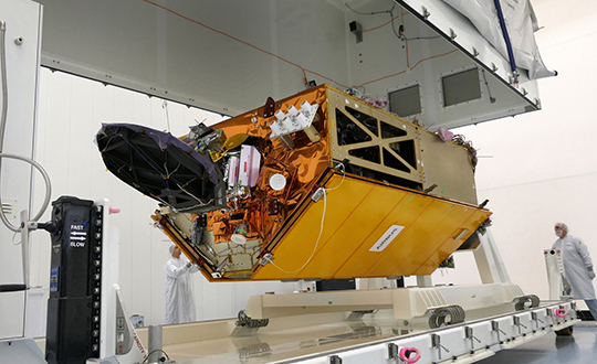
The Sentinel-6 Michael Freilich spacecraft undergoes tests at its manufacturer Airbus in Friedrichshafen, Germany, in 2019. The white GNSS-RO instrument can be seen attached to the upper left portion of the front of the spacecraft. (Photo: Airbus)
A brief history of radio occultation
Radio occultation was first used by NASA’s Mariner 4 mission in 1965 when the spacecraft flew past Mars. As it passed behind the Red Planet from our perspective, scientists on Earth detected slight delays in its radio transmissions as they traveled through atmospheric gases. By measuring these radio signal delays, they were able to gain the first measurements of the Martian atmosphere and discover just how thin it was compared to Earth’s.
By the 1980s, scientists had started to measure the slight delays in radio signals from Earth-orbiting navigation satellites to better understand our planet’s atmosphere. Since then, many radio occultation instruments have been launched; Sentinel-6 Michael Freilich will join the six COSMIC-2 satellites as the most advanced GNSS-RO instruments among them.
“The Sentinel-6 instrument is essentially the same as COSMIC-2’s. Compared to other radio occultation instruments, they have higher measurement precision and greater atmospheric penetration depth,” said Chi Ao, the instrument scientist for GNSS-RO at JPL.
GNSS-RO basics
The GNSS-RO instrument’s receivers track navigation satellite radio signals as they dip below, or rise from, the horizon. They can detect these signals through the vertical extent of the atmosphere — through thick clouds — from the very top and almost all the way to the ground. This is important, because weather phenomena emerge from all layers of the atmosphere, not just from near Earth’s surface where we experience their effects.
“Tiny changes in the radio signal can be measured by the instrument, which relate to the density of the atmosphere,” said Ao. “We can then precisely determine the temperature, pressure, and humidity through the layers of the atmosphere, which give us incredible insights to our planet’s dynamic climate and weather.”
With the help of JPL’s GNSS-RO principal investigator Chi Ao and NOAA’s National Weather Service meteorologist Mark Jackson, this video explains how the GNSS-RO instrument aboard Sentinel-6 Michael Freilich will be used by meteorologists to improve weather forecasting predictions. (Credit: NASA/JPL-Caltech)
But there’s another reason why probing the entire vertical profile of the atmosphere from orbit is so important: accuracy. Meteorologists typically gather information from a variety of sources – from weather balloons to instruments aboard aircraft. But sometimes scientists need to compensate for biases in the data. For example, air temperature readings from a thermometer on an airplane can be skewed by heat radiating from parts of the aircraft.
GNSS-RO data is different. The instrument collects navigation satellite signals at the top of the atmosphere, in what is close to a vacuum. Although there are sources of error in every scientific measurement, at that altitude, there’s no refraction of the signal, which means there’s an almost bias-free baseline to which atmospheric measurements can be compared in order to minimize noise in data collection.
And as one of the most advanced GNSS radio occultation instruments in orbit, said Ao, it will also be one of the most accurate atmospheric thermometers in space.
More on the mission
Copernicus Sentinel-6/Jason-CS is being jointly developed by the European Space Agency (ESA), the European Organisation for the Exploitation of Meteorological Satellites (EUMETSAT), NASA, and the National Oceanic and Atmospheric Administration (NOAA), with funding support from the European Commission and support from France’s National Centre for Space Studies (CNES).
The first Sentinel-6/Jason-CS satellite that will launch was named after the former director of NASA’s Earth Science Division, Michael Freilich. It will follow the most recent U.S.-European sea-level observation satellite, Jason-3, which launched in 2016 and is currently providing data.
NASA’s contributions to the Sentinel-6/Jason-CS mission are three science instruments for each of the two Sentinel-6 satellites: the Advanced Microwave Radiometer, the GNSS-RO, and the Laser Retroreflector Array. NASA is also contributing launch services, ground systems supporting operation of the NASA science instruments, the science data processors for two of these instruments, and support for the international Ocean Surface Topography Science Team.
On June 26, the U.S. National Oceanic and Atmospheric Administration (NOAA) released the summary of the results of Commercial Weather Data Pilot (CWDP) Round 2. View the summary here.
In Round 2, NOAA evaluated GNSS radio occultation data from two U.S. commercial space companies: GeoOptics and Spire. NOAA concludes that, based on the results of CWDP Round 2, the commercial sector is able to provide radio occultation data that can support NOAA’s operational products and services.
“As a result, NOAA is proceeding with plans to acquire commercial RO data for operational use,” the summary states.
According to GeoOptics, the report highlights the unique qualities of its commercial GNSS-RO data and its ability to improve weather and space weather forecasts around the world.
“As today’s report demonstrates, commercial satellite data will enable NOAA to make significant improvements in forecasting worldwide within the consistent budget limitations under which it operates,” said GeoOptics CEO Conrad Lautenbacher.
NOAA anticipates release of a request for proposals soon for operational purchase of commercial radio occultation data, continuing an acquisition process that began in April with NOAA’s release of a draft Statement of Work.
NOAA has requested $15 million in FY 2021 to support Commercial Data Purchase. The FY 2021 Budget also requests $8 million for CWDP to investigate new commercial technologies beyond radio occultation.
By moving into this next phase of engagement with U.S. industry, NOAA is leveraging commercial space sector capabilities to support its operational products and services and to continue to improve its weather forecasting capabilities. NOAA plans to implement additional rounds of the CWDP to evaluate commercial capabilities beyond radio occultation data for potential operational use.
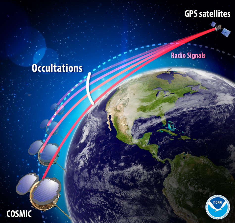
The COSMIC-1 program ended on May 1, when the last of six tiny satellites were decommissioned. The satellites were launched 14 years ago, and outlived their planned lifespan by 12 years.
COSMIC — the Constellation Observing System for Meteorology, Ionosphere and Climate (COSMIC) mission — uses GPS signals to provide a wealth of accurate atmospheric data and improve weather forecasts, according to Laura Snider, University Corporation for Atmospheric Research (UCAR), which ran the COSMIC program.
Meanwhile, the COSMIC-2 program (FORMOSAT-7 in Taiwan) continues. Its six satellites were launched on June 25, 2019, into low-inclination orbits. The mission was launched by NOAA as the agency’s first operational GNSS radio occultation mission.
COSMIC-1 demonstrated the value of GNSS radio occultation (GNSS-RO) to derive vertical atmospheric profiles of temperature, humidity and pressure by measuring the degree to which GPS signals bend as they travel through Earth’s atmosphere.
Weather centers used the high-quality, accurate data to improve forecasts; the data was also used by researchers.
“Throughout its lifetime, COSMIC-1 made an astounding 7 million vertical atmospheric profiles available to the operational forecast centers and research community,” writes Snider. “These data demonstrably boosted forecast accuracy and were referenced in more than 550 peer-reviewed scientific publications. In all, more than 5,000 users from over 100 countries have accessed COSMIC data.
COSMIC-1 was primarily funded by the National Space Organization in Taiwan, where the mission is called FORMOSAT-3. The leading U.S. sponsor on the project was the National Science Foundation. Other U.S. partners included NASA, the National Oceanic and Atmospheric Administration (NOAA), the Air Force and the Office of Naval Research.
UCAR also led the GPS/MET GPS radio occultation mission in the mid-1990s.
The agreement will enable AER to process satellite data for commercial companies that sell their Earth observation data products to government agencies and other organizations that provide customized environmental information to a range of clients.
Under the agreement, AER will adapt UCAR’s SatDAACâ software system to process observations from satellites using GNSS radio occultation to observe the atmosphere. Those observations can lead to significantly improved weather forecasts.
From basic research to industry
GNSS radio occultation measures the extent to which the radio signals from GNSS transmitter satellites (including GPS satellites) bend as they propagate through denser regions of the atmosphere.
The measurements can be further processed into information about temperature, pressure, and humidity in the lower atmosphere as well as the electron density in the ionosphere. The technique provides considerable accurate knowledge about a large volume of the atmosphere from near-Earth orbit down to the surface.
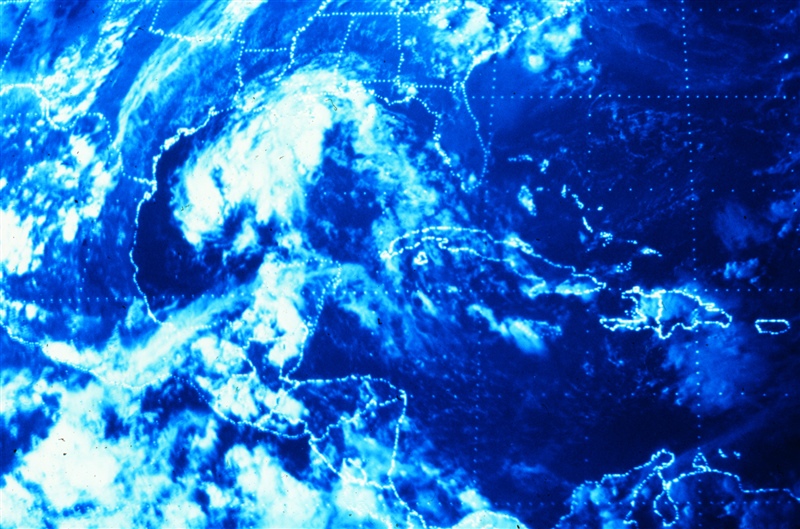
Image: NOAA
NASA’s Jet Propulsion Laboratory was first to use radio occultation to profile the atmospheres of Mars, Venus, and the outer planets starting in the 1960s. UCAR, in collaboration with JPL, pioneered the GNSS radio occultation observing technique for Earth’s atmosphere, building on basic research with funding from the National Science Foundation.
In 2006, UCAR began producing the first operational GNSS radio occultation data from a specialized constellation of small satellites known as the Constellation Observing System for Meteorology, Ionosphere, and Climate (COSMIC). The observations from COSMIC led to improved predictions of tropical cyclones and other storms as well as information about space weather and global climate.
A second constellation of small satellites, known as COSMIC-2, was launched in June 2019. It will provide twice as many soundings of the atmosphere with higher quality than COSMIC.
More GNSS-RO satellites coming
Now that the technology has been successfully demonstrated, additional satellites with GNSS radio occultation technology are being launched.
“This technology has moved quickly from being a research concept to providing vital information to forecasters,” said Ying-Hwa “Bill” Kuo. “The original investment in basic research is generating substantial benefits for society.”
Lead GNSS radio occultation researcher at AER Stephen Leroy said, “Earth radio occultation has a nearly 30-year history and has been a revolutionary force in numerical weather prediction and climate science in that time; and now with the commercialization of RO [radio occultation] data, we are looking forward to an explosion in RO data volume. I am really excited that we are performing the operational processing of this new data stream and expanding its scope and utility.”
The UCAR-AER agreement will likely lead to further advances in GNSS radio occultation technology, according to Bill Schreiner, director of the UCAR COSMIC Program.
“By transferring technology to the private sector, AER can take it to the next level in terms of distributing the data and finding new applications that help society,” he said. “This agreement will leverage SatDAAC’s advanced capabilities to develop new products for use by the environmental observing and prediction communities and will help us continue to innovate.”
At least three commercial enterprises are currently developing and deploying nanosatellites and microsatellites that perform GNSS radio occultation — Spire, GeoOptics and PlanetiQ — as well as several international space agencies.
AER works with governments and businesses worldwide to advance understanding of climate- and weather-related risks. The company develops analytical tools to help measure and observe the properties of the environment and translate those measurements into actionable information.
UCAR is a nonprofit consortium of 120 colleges and universities focused on research and training in the atmospheric and related sciences.
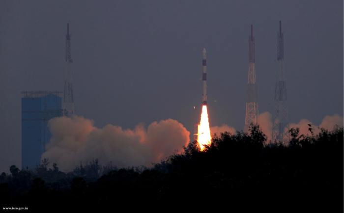
Two tiny GNSS-RO nanosatellites now circle the Earth, ready for action. The first European Pioneer mission lifted off Nov. 29 from Sriharikota, India, to put the satellites into orbit.
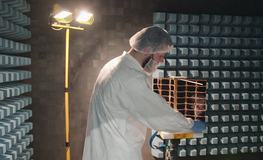
One of Spire’s Satellite Manufacturing Technicians (Tomasz Chanusiak) tests the Radio Frequency capabilities of a LEMUR2 nanosatellite in Spire’s cleanroom in Glasgow, Scotland. (Photo: ESA)
The shoebox-sized satellites were launched at 04:27 GMT into low Earth orbit by the Indian Space Research Organisation’s PLSV launcher, and opened their first communication windows with their owner, Spire Global, less than an hour after they separated from the rocket.
Both satellites were developed under ESA’s ARTES Pioneer programme, and will aim to prove the value of using nanosats for space-based GNSS Radio Occultation (GNSS-RO).
GNSS-RO. GNSS-RO is the process of using satellites to measure how GNSS signals are refracted by the Earth’s atmosphere. Experts can use these measurements to glean temperature, pressure and humidity information for weather forecasting and climate change monitoring.
In contrast, weather data gathered by weather balloons and aircraft can only reach certain altitudes, leaving the higher atmospheric layers untouched.
Satellites have no such restrictions. They can gather massive amounts of this data from the ground up to the mesosphere as they fly over the Earth. This is usually done by large satellites. Spire’s nanosatellites weigh just 5 kg each, and were assembled and tested entirely by Spire in under three months, at their headquarters in Glasgow, Scotland.
Named “Space as a Service,” the Spire Pioneer mission intends to prove that nanosat GNSS-RO is a commercially viable alternative to traditional methods.
Two nanosatellites built by Spire Global were launched into low Earth orbit Nov. 29. (Photo: ISRO)
The two tiny satellites will collect and distribute GNSS-RO data during their commissioning phase, after which they will go into full commercial data production mode, gathering weather information for meteorological institutions, maritime and aviation customers on demand.
ESA’s Pioneer initiative partners with companies like Spire to help them provide this kind of in-orbit demonstration and validation for third parties.
“We saw a gap in the market for what we call space mission providers: companies that offer all aspects of a space mission to validate a new technology or service for the benefit of others,” said ESA Pioneer Programme Manager Khalil Kably. “ESA is always looking to champion innovation in the space industry, and the idea of Pioneer is that these space mission providers can help this by being a one-stop shop for in-orbit demonstration and therefore reduce the barriers and complexity that can stifle new ideas.”
“Spire has been focused on developing unique data sources with high frequency updates for the entire Earth and has over 60 LEMUR-2 class satellites deployed in space complimented with a global ground station network,” Spire Global CEO Peter Platzer said. “Under Pioneer, we can offer our extensive experience in manufacturing and managing small spacecraft like these to those who cannot afford to waste money and time doing it themselves. This work with ESA helps further support the global development of commercial aerospace’s potential to make space access universal.”
“These incredibly clever shoebox-sized satellites built in Glasgow could slash the complexity and cost of access to space, presenting an exciting opportunity for the UK to thrive in the commercial space age,” UK Space Agency Chief Executive Graham Turnock said. “Through our £4m development funding, the government’s Industrial Strategy and by working closely with our international partners, we are helping UK businesses transform their ideas into commercial realities, resulting in jobs, growth and innovation.”