The European Union Space Programme Agency (EUSPA) has signed a framework contract entrusting France’s space agency with providing Galileo search-and-rescue (SAR) services. The 137 million euro 10-year contract includes maintaining assets in operational condition, coordinating with the host sites and interfacing with the Cospas-Sarsat community.
Image: EUSPA
The National Centre for Space Studies (CNES) has been responsible for operations of SAR-Galileo services for the European Union since 2016, providing the SAR-Galileo Forward Link Service and the Return Link Service. The coordination of operations and maintenance of the ground segment, deployed across Europe, is headquartered at the space center in Toulouse, France.
A network of reference beacons enables evaluation of the performance of the systems in real-time. CNES also provides its expertise to EUSPA for the definition of international standards, performance monitoring and future developments.
Emergency position-indicating radio beacon-based services is an addition to the framework contract. CNES has already been identified as the future operator of the Emergency Warning Service, an alert service for European communities scheduled to begin operations in 2024.
Nearly 50 years ago, in December 1973, the Defense Systems Acquisition Review Council approved the Navstar Global Positioning System for entry into Phase I of development. Since then, through its development, deployment and continuing modernization, GPS has grown into a complex program. It is operated by the Department of Defense based on legislation from Congress, executive orders from the White House, and policies established jointly with the Department of Transportation. It supports U.S. military missions as well as myriad scientific, commercial and consumer applications around the planet. Of course, the last category, with its billions of users, now dwarfs all the other ones combined.
The GPS program, with an annual budget of nearly $2 billion and no user fees, is a gift from U.S. taxpayers to the world. It has staff in Washington, D.C.; at the Pentagon in Arlington, Virginia; at Schriever Space Force Base, Colorado; at the Space Systems Command at Los Angeles Air Force Base, California; at Cape Canaveral, Florida; at the U.S. Coast Guard Navigation Center in Alexandria, Virginia; and at GPS ground antennas in additional locations around the world. From the White House to Congress to aerospace companies, from military officers to civilian civil servants, from policy makers to engineers, from the East Coast to the West Coast to remote islands in the Pacific, Indian and Atlantic Oceans, GPS is a vast enterprise — most of which is little known even to people in the industry and virtually unknown to the public.
The Global Positioning System is a vast and mostly unknown enterprise. This section — the first in an occasional series of authoritative reference pieces in this magazine — aims to clarify who does what to maintain GPS as a fantastic global utility. The relevant missions of agencies or units are in italics.
After I researched and drafted the piece, I asked the experts listed below to review it and provide corrections and additions. While grateful for their substantial feedback, I take sole responsibility for any remaining errors or omissions.
Thank you to the following experts:
Harold W. Martin III, Director, Space-Based Positioning, Navigation & Timing, National Coordination Office
Michael J. Dunn, Capability Area Integrator for PNT, Space Systems Command, United States Space Force
Lt. Col. Robert O. Wray, Commander, 2nd Space Operations Squadron, United States Space Force
Scott R. Calhoun, Commanding Officer, Navigation Center, United States Coast Guard
Paul Benshoof, Technical Director, 746th Test Squadron (AFMC), Central Inertial and GPS Test Facility
Bernard Gruber, Senior Director, Northrop Grumman
Please return to this page periodically to read corrections and updates to this special section. If you spot any significant inaccuracies or omissions, please bring them to my attention by writing to me at [email protected].
Fraunhofer IIS has opened paper submissions for The International Conference on Indoor Positioning and Indoor Navigation (IPIN) 2023, which takes place Sept. 25 -28 at the Nordostpark in Nuremberg, Germany.
The event is dedicated to indoor positioning, its applications and recent developments. The last decade has seen tremendous technical advances in indoor positioning. However, unlike the GNSS solutions established in the outdoor environment, there is not yet a technology that is affordable and accurate enough for the general market.
The potential applications of indoor localization are all-encompassing, from the home to vast public areas, from internet of things and personal devices, to monitoring applications.
The conference expects to attract up to 300 industrial and academic experts from the fields of computer science, electronics and surveying to address these challenges and the future of the industry.
To learn more about the conference and paper submissions, visit INIP-Confrence.org.
GeoCue has released the TrueView 535 imaging system for UAVs, and the TrueView 720, its fourth-generation Riegl integration. It also launched its LP360 software add-on called 3D Accuracy and the Accuracy Star hardware.
TrueView 535 is built on TrueView 515’s technology and consists of updated lidar sensors, adding a third return, increasing mapping abilities below canopy. An additional third nadir camera offers another point-of-view and improves photogrammetry quality. It also includes a longer, usable lidar range to increase flexibility.
TrueView 535. (Image: GeoCue)
TrueView 720 is a fourth-generation Riegl VUX-120 with three laser beam orientations. It provides high point-density corridor mapping. Using the Riegl VUX-120 with three laser beam orientations (nadir, +10-degrees forward and –10-degrees backward) and three oblique/nadir cameras enables data collection from more surfaces in one flight path.
Trueview 720. (Image: GeoCue)
One application of TrueView 720 is scanning power lines. Users can capture the poles vertically, front and back. The extreme range of this system means it can be integrated with UAVs, airplanes or helicopters.
In addition to the two sensor payloads, GeoCue has launched its LP360 software add-on for processing and visualization — the 3D Accuracy and the Accuracy Star hardware.
Accuracy Star. (Image: GeoCue)
“When used together, Accuracy Star and the 3D Accuracy add-on provide automated horizontal and vertical checks,” said Darrick Wagg, vice president of customer success for GeoCue. “You can automatically find a 3D target on a drone dataset. The software will calculate the correction for any 3D target and provide a seamless workflow to apply the correction on the point cloud.”
These products are suitable for geospatial professionals.
Feb. 4 saw the news networks alive with sometimes wild reports about UFOs, UAVs and then a balloon. Balloons are used for weather forecasting on a regular basis, launched daily into the stratosphere with payloads gathering wind speed and direction, temperature, humidity, pressure and, of course, position.
Synchronized twice a day at about 900 locations around the world, balloons are released into the stratosphere gathering essential atmospheric data to feed our weather forecasts. Reaching altitudes of 20 miles, these balloons often drift on winds as far as 125 miles from the release point, broadcasting measurements from their onboard sensors.
At first, maybe North American Aerospace Defense Command (NORAD) thought the balloon crossing into Alaska’s airspace was just one of these high-altitude weather prediction vehicles. Aircraft were apparently scrambled, and initially it was decided there was no threat, so the balloon was allowed to continue and enter Alaskan airspace. It was detected and subsequently tracked by both the United States and Canada for some time as it continued to drift on the jet stream over the border into the lower 48. Then, people in and around Billings Montana (home to one of the nation’s three nuclear missile silo fields at Malmstrom Air Force Base) started to send in reports of a very large balloon high overhead — according to one observer with a high-resolution camera, it even seemed to be stationary for 35 minutes.
Apparently, by the time the good folks in Montana were looking up, the Pentagon had decided the balloon was a Chinese surveillance vehicle. To get this detail, one or more U-2 high altitude reconnaissance aircraft had been dispatched to investigate. The collected U-2 information spotted markings of a Chinese manufacturer on the 200-foot-tall balloon. A payload the size of a small passenger jet dangled some 20 feet below the balloon canopy. It had several antennas of various configurations. A huge solar panel was attached — presumably to power its suite of surveillance sensors.
The Federal Aviation Administration (FAA) ordered a ground stop for all aircraft traffic at the Billings airport while decisions were made about downing the balloon or allowing it to proceed.
Meanwhile, it may seem obvious that both the United States and China have developed, launched and make use of surveillance satellites. I imagined that a couple of dozen of these space vehicles would be buzzing over not only each other’s landmass, but also surveilling dozens of other countries as they orbit the whole planet.
What I found was a report that China had at least 260 such orbital observation platforms in 2022, and the United States has even more. Isn’t that enough without resorting to lower-tech balloons?
It’s possible that some electronic transmissions are short range and would not be detected by surveillance satellites operating in geosynchronous orbit (22,000 miles out), or even at 300 miles where the International Space Station (ISS) and most surveillance satellites hang out. So, a slow-moving balloon at 20 miles up might be ideal to “sniff” ground transmissions from sensitive military installations, and if you could control the balloon to hover, all the better to pick up radio signals. Could the gathering of transmission data somehow be used to geo-locate the source? It’s something the U.S. military may be working on, too, as it is reportedly also building a fleet of autonomous dirigibles and balloons.
According to press reports, the United States decided not to immediately take down the balloon, even though it subsequently discovered its surveillance capabilities. Not only was there concern over debris falling on populated areas but allowing the balloon to continue its flight over the United States provided an opportunity to observe its behavior and gather useful information. U.S. bases along its path apparently shut down all communications in sequence, as the balloon passed overhead.
The balloon was apparently found to be transmitting – presumably reporting on where it was and what it had detected. But, at some time transmissions ceased, possibly when U.S. Air Force activity was detected nearby.
The take-down off Myrtle Beach
An F-22 flew to almost the same altitude as the balloon and fired an AIM-9X Sidewinder missile into it, leaving the payload to tumble from 60,000 feet into the shallow (50-foot deep) Atlantic Ocean off Myrtle Beach, South Carolina. Recovery boats were already on hand to pick up the collapsed canopy, and to begin locating the electronics payload on the seabed. At time of writing, the U.S. recovery effort has yet to inform us on finding the key electronic payload, which would go a long way to confirming the intended mission for the balloon.
Image: Screenshot of CNN news coverage
Strange, but a couple of days later over Canada, F-22s were again in action to take down a “cylindrical object” detected at 40,000 feet — an altitude posing a danger to airline traffic. Little has been released on what this object might have been — could it possibly be a re-entering piece of space debris? Again, debris recovery and analysis is underway, and we patiently wait for a public report about what this was all about.
What have we learned?
Both China and the United States operate huge fleets of surveillance satellites gathering intelligence daily about each other’s capabilities and those of other countries. Both China and United States have also invested in surveillance balloons, but China is the only country to send one over U.S. territory.
There may have been earlier balloon incursions, which are only now being reported. The U.S. response was initially to determine the configuration of the balloon and its payload, then to allow its journey along the jet stream to continue. The United States has said the balloon did not uncover anything already available by other means, but recovery and analysis of the payload would presumably confirm this announcement.
China is not happy about the U.S. takedown of a harmless, stray weather balloon. And what the heck were F-22s shooting at in Canada?
We’ll tell you more when we learn more….
Tony Murfin
GNSS Aerospace
Editor’s Note: Since the initial instance of an unidentified object floating across U.S. airspace — later identified as a Chinese surveillance balloon — three additional unidentified aerial objects were spotted in North American airspace. One was spotted in Alaska, one in northern Canada and one over the Great Lakes region. All three were shot down by U.S. fighter jets out of caution.
Trimble has released Trimble 4D Control (T4D) version 6.4 software and an add-on monitoring module for automated and semi-automated rail monitoring. The T4D Rail module enables simple data collection and reduces office work required to automate movement detection for rail monitoring projects.
The T4D software offers four main elements for automated monitoring: sensor management and data integration for GNSS, total station, geotechnical, vibration and environmental sensors; geodetic processing and adjustments for accurate results; analysis and visualization through several tools that provide real-time updates to support in-depth analysis and data presentation; and alarming and reporting.
The T4D Rail module enables integration of rail as-builts collected with the Trimble GEDO system or with a track measuring bar paired with the Trimble Access Gauge Survey app. It can also automate calculations for track geometry parameters, generate analysis charts, and trigger alarms.
The T4D software is offered in five editions to fit various project requirements. The editions include T4D Access, T4D Field, T4D Intermediate, T4D Geotechnical and T4D Advanced. T4D Access and T4D Advanced are the two editions that support the add-on Rail Module.
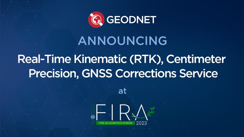
GEODNET has released a real-time kinematic (RTK), centimeter-precision, GNSS corrections service designed for OEMs and system integrators of agricultural robotics. GEODNET is compatible with several GNSS receivers from major brands, on-vehicle automated steering, spraying kits, and most UAVs and robots.
The GEODNET corrections service has more than 1,700 total full-constellation reference stations worldwide and supports GPS, Galileo, GLONASS and BDS signals. It also has the RTCM 3.2 data format for maximum rover/receiver compatibility and NTRIP sign-on and access.
Additional local reference stations can be added.
Free GEODNET correction service trials are available now for qualified OEMs and system integrators in most agricultural regions globally. Interested parties can apply for a trial stream here.
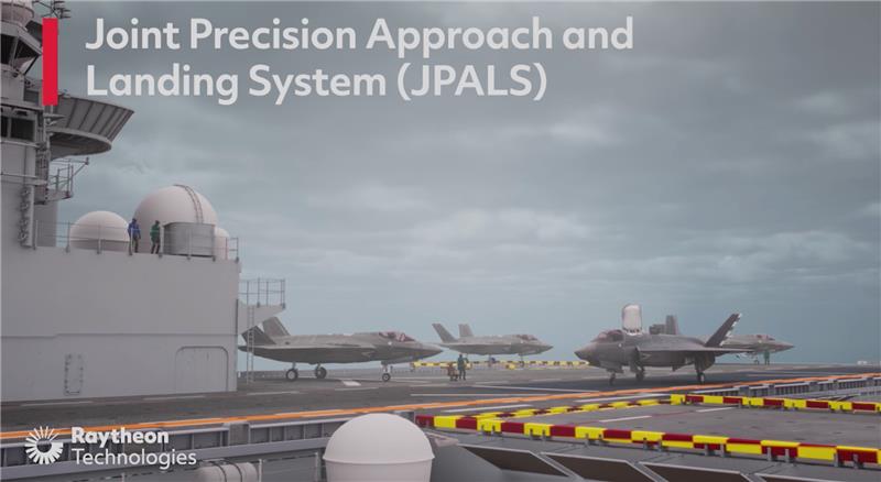
Raytheon Intelligence and Space has been awarded a contract from the United States Navy’s Naval Air Traffic Management Systems Program Office to deliver the Joint Precision Approach and Landing Systems (JPALS) to the Japan Maritime Self-Defense Force (JMSDF). The GPS navigation and precision landing system will be deployed on the JMSDF JS Izumo carrier.
The JPALS system guides aircraft onto carriers and assault ships in all weather and surface conditions and is integrated on all F-35 aircraft. JPALS is also being deployed on all U.S. Navy aircraft and assault ships.
In addition, JPALS will be deployed on two international platforms, including the United Kingdom Royal Navy’s HMS Queen Elizabeth, and an Italian aircraft carrier, the ITS Cavour, to support its F-35 squadron.
The primary work locations for JPALS are in Largo, Florida and Fullerton, California.
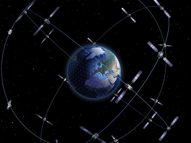
The European Space Agency (ESA) is in search of European companies interested in taking part in the in-orbit demonstration of a low-Earth-orbit (LEO) satellite navigation constellation utilizing novel frequencies and capabilities.
Those interested in participating are encouraged to attend ESA’s LEO-PNT Industry Day on March 7 at the ESTEC technical center in the Netherlands. The LEO-PNT Industry Day will give an overview of the project to companies, research institutions and ESA delegates from Member States.
A detailed invitation will be issued soon, covering all aspects of the LEO-PNT Orbit Demonstrator, including the space and ground segments, operations, launchers, the test user segment, experimentation, and segment demonstration.
Registration by Feb. 27 is required. To learn more, visit atpi.eventsair.com.
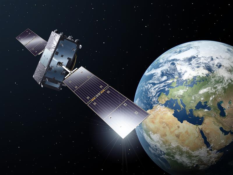
LEO satellites would supplement the existing Galileo constellation. (Image: ESA)
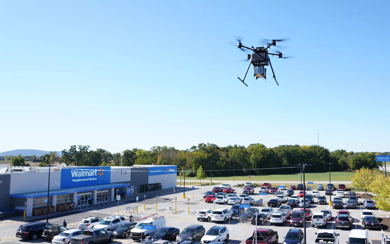
Two Walmart locations in Utah, one in Lindon and one in Herriman, are now providing UAV delivery for customers nearby. Walmart has UAV deliveries operated by DroneUp, Flytrex and Zipline at 36 stores in the United States.
For a $3.99 fee, customers within a mile of the stores can receive their groceries via UAVs. The two Walmart locations in Utah can deliver more than 120 times per day and each UAV can carry up to 10 pounds. The hubs for deliveries are in the parking lots of each Walmart location and are operated by Federal Aviation Administration-certified pilots.
Walmart is using UAV delivery in seven states, including Florida, Arizona, Texas, Utah, Virginia, North Carolina and Arkansas. The most common products delivered include ice cream, lemons, rotisserie chicken, Red Bull and paper towels, according to Walmart.
Walmart drone deliveries launched in October 2019 in Arkansas. In 2022, Walmart completed more than 6,000 deliveries across all 36 participating locations.
One Galileo satellite has been reconfigured to emit a new signal component optimized to serve low-end receiver devices and internet of things (IoT) applications. According to the European Space Agency (ESA), GSAT0202, in elliptical orbit, was reconfigured in January to transmit the new signal, also known as the G1 E5 Quasi Pilot.
The G1 E5 Quasi Pilot in the E5 band lies along a narrow part of the overall Galileo signal, intended to enable streamlined positioning fixes requiring less calculation — without affecting the E1 and E6 signal bands, on which Galileo also transmits. The initial receiver test showed that the signal component has the potential to reduce the signal acquisition time by a factor of three compared to the current GPS L5 or Galileo E5a signals.
Image: ESA
Once GSAT0202 was reconfigured, signal measurements were collected using the high-gain antenna installations from the Galileo in-orbit test facility, which confirmed the stability of the augmented signal. After G1 E5 Quasi Pilot was broadcast, it was successfully acquired and tracked by a set of receivers.
Airbus Defense and Space, Thales Alenia Space Italy, the European Union Agency for the Space Programme (EUSPA), the European Commission, and Spaceopal supported this test.
The other elliptical Galileo satellite, GSAT0201, will also be reconfigured after further testing. Selected chipset manufacturers will be involved in the testing under supervision of EUSPA. The test results will be evaluated at the Galileo Programme level, to eventually introduce G1 E5 Quasi Pilot into the constellation.
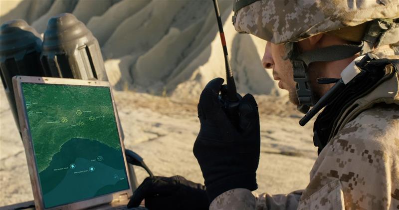
Hexagon’s Safety, Infrastructure & Geospatial division has released for Android defense applications. The platform is designed for the development of mobile applications for dismounted soldiers in the field.
With LuciadCPillar, developers can build applications with 2D and 3D views. It features military symbology and supports many geospatial data types including vector data, raster data, elevation data, point clouds and 3D meshes. It has the same capabilities found in desktops, in-vehicle and browser applications built with LuciadLightspeed, LuciadCPillar and LuciadRIA.
The platform offers capabilities to match high-resolution screens, graphic processing units and multi-core processors including the ability to display 3D data in mobile applications. LuciadCPillar supports ARM processors and an application programming interface, which aligns with the Android developer experience.
Impact, a French system integrator, partnered with Hexagon to test LuciadCPillar and will integrate it into its Delta Suite product, which is used by the French Special Operations Command.
LuciadCPillar is part of Luciad 2022.1, which is available now globally.