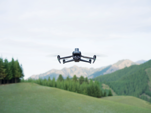
Atmos has integrated the Sony a7R mark III and IV camera into its vertical take-off and landing (VTOL) fixed-wing UAV, the Marlyn Cobalt. This will increase coverage and accuracy achieved in a single flight for surveyors.
Both cameras have an ISO of 32,000, which is expandable to 102,400, and camera sensors with high megapixel count — 42,4 MP for the a7R III and 61 MP for the a7R IV. When combined with Zeiss’ 35 mm and 21 mm lenses, it enables UAV surveyors to achieve ground sample distance levels below one 1 cm.
The integration of the two cameras enables Marlyn Cobalt users to map an area of 210 hectares with centimeter-level accuracy in a single flight.
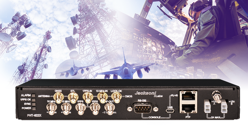
Viavi Solutions has unveiled the PNT-6200 Series Assured Reference for resilient positioning, navigation and timing (PNT). Viavi acquired Jackson Labs Technologies in November 2022.
The PNT-6200 Series Assured Reference provides resiliency and robust cybersecurity for critical infrastructure.
The compact system can supplement or replace GPS signals based on connectivity to the broadcast range of timing sources in the market including other GNSS satellites, and commercial satellite, terrestrial, wireline, and atomic clock services. The PNT-6200 Series will draw the timing signal from the most reliable source and use it as a replacement for the GPS input, enabling continuous operation.
The PNT-6200 Series will be showcased at Mobile World Congress in Barcelona, Feb. 27-March 2.
Golden Software’s Surfer package, designed for 3D surface mapping, now provides robust subsurface visualization and modeling functionality by incorporating many true 3D gridding and visualization tools.
With the enhanced functionality, users can now model an additional variable, a C variable, such as a contaminant or chemical concentration, along with the traditional X, Y, Z values. Surfer also includes the ability to create a 2D map of a slice-through 3D grid, which users can move up and down through the grid, illustrating how the C value changes with depth.
Part of Surfer’s enhancements is isosurface creation, enabling visualization of the 3D grid in the 3D view as an isosurface, providing another way to see how C data varies with depth or elevation. The new 3D-rendered volume functionality also allows users to visualize the 3D grid in the 3D view as a solid body by assigning colors to different C values, highlighting variations in the data.
Golden Software has released a beta version of Surfer simultaneously with the new version to give users a trial of the new features while they are still in development.
The company states that the software is suitable for geologists, geophysicists, hydrologists and environmental engineers.
TRX Systems has added a jammer finder capability to its NEON PT-MIL. The new function and expanded threat-mapping features enable dismounted soldiers to proactively respond to navigational warfare attacks (NAVWAR).
NEON PT-MIL helps warfighters carry out their missions even when operating in environments where GPS/GNSS signals are unreliable or intentionally denied. The device can detect and eliminate compromised GNSS data while providing an alternative source of positioning information by fusing inputs from inertial sensors, GNSS signals, ultra-wideband and more.
NEON PT-MIL can also be equipped to detect and map jamming and spoofing attacks. This feature was developed through a United States Army Rapid Capabilities and Critical Technologies Office program designed to extend NAVWAR functionality. The device accepts assured GNSS data from external devices — such as the Defense Advanced GPS Receiver, or DAGR, and the Orolia Defense and Security Broadsense Nano — to deliver a fused position and a NAVWAR threat indication when detected.
The device can also derive a line of bearing to an enemy jammer and display it within the warfighter’s Android Tactical Assault Kit (ATAK) user interface, by using the GPS jamming indications available from a connected GNSS source.
NEON PT-MIL with the jammer finding function is available in beta versions for field testing now and will be generally available in mid-2023.
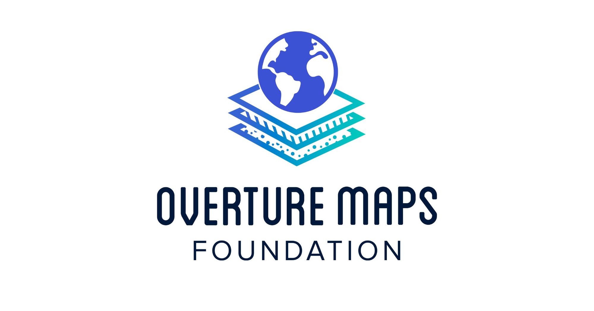
The Linux Foundation has launched the Overture Maps Foundation, interoperable open map data for developers who build map services or use geospatial data and to strengthen mapping services globally. Overture expects to release its first datasets in the first half of this year.
Overture aims to deliver services including collaborative map building by incorporating data from Overture members, civic organizations, and open data sources, creating a global entity reference system, quality assurance processes to detect map errors and ensure map data can be used in production systems, and a structured data schema to create an ecosystem of map data. Additionally, map data is open and extensible to users under an open data license.
Founded by Amazon, Meta, Microsoft and TomTom to help developers source and curate up to date map data, Overture will integrate with existing open map data from projects such as OpenStreetMap and city planning departments, as well as with new map data contributed by members, to create a living digital record of the physical world using artificial intelligence and machine leaning techniques.
The initial release of datasets will include basic layers including buildings, roads and administrative information with plans to improve coverage, resolution and accuracy of existing data over time. It also will introduce new layers including places, routing and 3D building data.
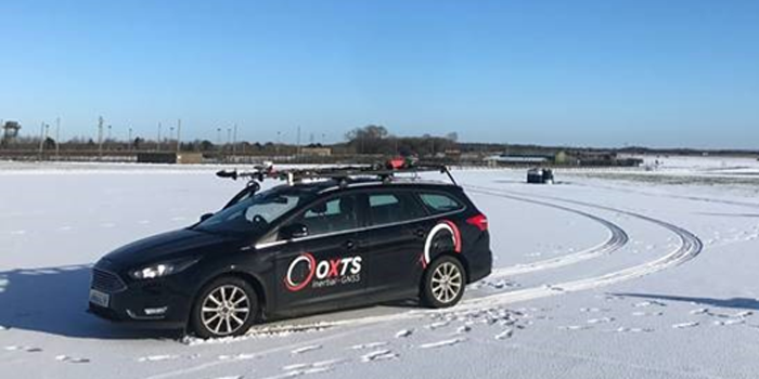
Mobile mapping is helping accelerate the progression of some of the most difficult engineering challenges on the planet, including those around autonomous driving and advanced surveying techniques, such as lidar.
The complexity of those challenges means that the outputs from a mobile mapping inertial navigation system (INS) must be as accurate as possible. A high-performing INS will make the most of any available GNSS signals, with the aim of providing centimeter-level accuracy even in areas where GNSS performs poorly, for instance in urban canyons. It also offers important data on pitch, roll and heading, which maintains the integrity of survey data even as the vehicle moves across large areas.
With such a wide variety of INS devices on the market, it can be difficult to narrow down the best option. It is important to establish criteria that will aid in evaluating the different INS propositions out there for mobile mapping projects.
Image: OxTS
1) How tightly integrated are the inertial measurement unit (IMU) and GNSS data?
INS is an essential element in providing accurate location data in as many environments as possible. Therefore, it is important to know how effectively the data from the IMU supports the GNSS data. In technical terms, this means evaluating whether the sensors are tightly integrated at all, and if so, how well.
The reason GNSS struggles in urban canyons and under tree canopies is that it is unable to get the six satellite signals necessary for a real-time kinematic (RTK) lock. In this situation, the GNSS will give readings that may be incorrect, as it is essentially trying to solve an equation without having all the numbers.
A tightly integrated GNSS and INS data stream will select the most reliable signals and use those to determine the position of the vehicle. If the data streams are not tightly integrated, then the INS’ ability to counteract GNSS issues is limited. Without accurate positioning, data scans will lose accuracy and even become completely incoherent the longer the user scans — making them unreliable at best, and unusable at worst.
2) Trading off accuracy and cost
Although accuracy is vital in mobile mapping, some INS devices will provide data that is far more accurate than the given job requires. Because greater accuracy equals greater cost, users may be paying more than necessary.
With that being said, the scale of accuracy and cost is not linear. An INS half the price of the most expensive one on the market will not be half as accurate. Look at each offering carefully to see what it includes and decide what level of accuracy and features are vital to the task. Eliminating unnecessary levels of precision or additional software features that are not needed is an effective way to make some savings.
3) How rugged is the device?
Mobile mapping vehicles will likely be out in the dry, wet, hot, cold, mud and snow. These vehicles will almost certainly be used consistently for long periods of time. Thus, it is essential to know that none of these conditions will stop the INS from working at peak effectiveness. Look for the IP rating (IP65 is essential for being weatherproof and protecting against shocks and dust) and ask what the average lifespan of the product is.
Image: OxTS
4) Can the device be properly calibrated?
Any INS is only as good as its calibration. Without calibration, the sensors in any INS can become misaligned and therefore provide inaccurate readings. Talk to vendors about their calibration processes — do they work to a nationally recognized standard of calibration like ISO 17025? Do their calibrations account for variations in temperature or humidity?
It is also worth considering how often sensors need recalibration. Recalibration is a chargeable service from most vendors, meaning the more the device needs recalibrating, the more the user will have to pay. This could also lead to delays if the user must send units abroad to have them recalibrated.
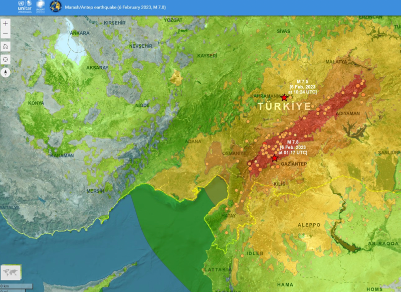
On Feb. 6, the United Nations Satellite Center (UNOSAT) announced via Twitter that it had activated emergency mapping services of Turkiye and northern Syria after the magnitude 7.8 earthquake hit earlier that day. The satellite images provide an overview of the damage, which can be used for humanitarian efforts and disaster relief, reported Space.com.
UNOSAT provides emergency mapping services, upon request, to provide satellite imagery analysis during emergencies and disasters. The maps show infrastructure that has been damaged during an emergency, which can then be used to provide relief by disaster response groups.
The impact of the earthquakes was significant and ranks in the red for economic losses and orange for fatalities, according to the U.S. Geological Survey (USGS). (Image: UNOSAT)
The earthquake caused massive destruction throughout Turkiye and Northern Syria, causing an estimated death toll of more than 19,000 as of Feb. 9. Several historical structures dating back thousands of years have also been severely damaged.
UNOSAT started in 2001 and is hosted by the European Organization for Nuclear Research. It does not operate its own satellites, but coordinates with United Nations member states to gather imagery from government agencies and privately owned satellites. United Nations offices, government agencies and relief organizations can request access to imagery collected by UNOSAT.
The USGS reports the earthquake resulted from strike-slip faulting at shallow depths. It appears to be associated with either the East Anatolia fault zone or the Dead Sea transform fault zone. (Image: UNOSAT)
All maps of Turkey and northern Syria from UNOSAT can be found here. A live interactive map can be found here.
Advanced Navigation’s Certus Evo enabled Nextcore to fly at 100 metres AGL, exceeding their goal. Nextcore required a MEMS INS that would enable their UAV-LiDAR to fly at 80 metres above ground level (AGL).
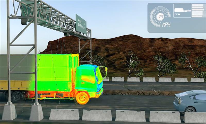
Cepton has secured a multi-million-dollar contract from the United States Highway Tolling System Operator to use its Sora series lidar sensors. The sensors will be deployed on several major tollways in the tri-state area in Northern California.
The Sora lidars provide detailed and accurate 3D profiling of vehicles passing at highway speeds. The lidar sensors have been used to modernize global tolling infrastructure by facilitating electronic toll collection, reducing traffic congestion and toll leakage.
Image: Screenshot of video from Cepton
“In addition to superior performance, our Sora lidars were designed using the same auto-grade building blocks that have been validated by OEMs through our flagship automotive lidar program, and are reliable, embeddable, scalable and energy efficient, which are key advantages for tolling applications,” said Jun Pei, co-founder and CEO of Cepton.
The contract is expected to be the largest commercial lidar deployment in the tolling sector, with potential to scale outside the United States in the future.
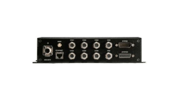
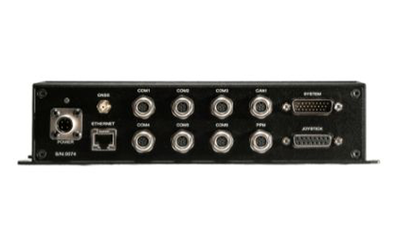
UAV Navigation-Grupo Oesía has released the GHU-100 ground control hub unit that helps platform manufacturers connect multiple ground devices to form a single network segment.
The GHU-100 enables multi-UAV and multi-ground control system (GCS) operation and is also designed to fulfill all requirements of maritime operations. This includes control of NMEA inputs, real-time kinematic corrections, and more. The ground control station hub unit also increases UAV flight safety, as it is independent from the computer OS and its potential PC crashes.
The GHU-100 is designed to increase a system’s robustness while maintaining a high flexibility with its extensive input/output capabilities, which makes it easy to integrate into complex and advanced GCS architectures. It also implements critical functionalities on a self-developed real-time operating system to ensure secure missions in all environments.
Indiana state legislators have filed multiple bills that would make tracking someone with a GPS-based device without their knowledge a crime, reported WTHR of Indianapolis. The bills are in response to the growing number of criminal cases involving Apple AirTags and other GPS-based tracking devices.
Tracking someone secretly is not currently a crime in Indiana; however, laws vary from state to state. Under one proposed bill, the penalty would be increased from a Class C misdemeanor to a Class A misdemeanor if the person tracked is under a protective order. The penalty could be enhanced for someone convicted of using tracking devices when committing a felony.
Similar incidents are on the rise around the United State regarding the use of AirTags and other tracking devices for criminal purposes. In December 2022, two women in California filed a class-action lawsuit against Apple for privacy concerns after being stalked by ex-partners using AirTags.
A roundup of recent products in the GNSS and inertial positioning industry from the January 2023 issue of GPS World magazine.
SURVEYING & MAPPING
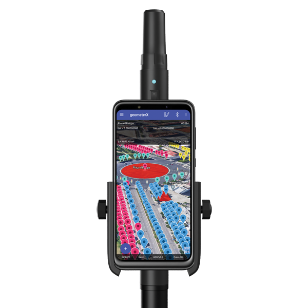
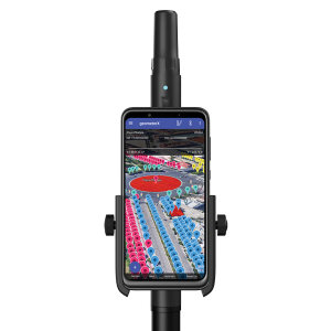
Image: Geometer International
Dual-Frequency Receiver
Receives all GNSS constellations plus SBAS
The Walker RTK is a dual-frequency GNSS receiver (L1, L2) for high-precision coordinate surveying in real-time kinematic (RTK) mode. It comes with a helical antenna, a bracket for attaching a smartphone, and the Geometer SCOUT mobile app. A classic geodesic antenna can be connected through the SMA connector. The Walker RTK has a rugged aluminum alloy casing with a shock-resistant coating, yet weighs only 250 grams. GNSS signals processed by the Walker RTK GNSS receiver include GPS (L1C/A, L2C), GLONASS (L1OF, L2OF), Galileo (E1B/C, E5b), BeiDou (B1I, B2I), QZSS (L1C/A, L1S, L2C) and SBAS (L1C/A). A built-in rechargeable battery provides 24 hours of continuous operation without recharging.
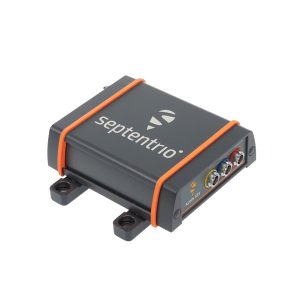
The AsteRx SB3 ProBase creates high-quality measurements for real-time kinematic (RTK) and differential corrections. The IP68-housed GNSS base station receiver features the latest quad-constellation GNSS technology and complements the SB3 receiver family: the AsteRx SB3 Pro rover receiver, the AsteRx SB3 Pro+ rover and base receiver, and the AsteRx SB3 CLAS for the Japanese market. The SB3 ProBase is easy to configure, the company says. It comes with Septentrio’s GNSS+ technologies, including anti-jam and anti-spoofing technology (AIM+) for robustness and reliability. AsteRx SB3 products are pin-to-pin compatible with the AsteRx SB ProDirect receiver and the recently released AsteRx SBi3 GNSS/INS system.
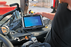
The Algiz 10XR is a rugged 10-inch Windows tablet that combines durability with a GNSS receiver and 5G communications. It was developed for challenging environments in logistics, mining, public transport, public safety, waste management or geographic information systems (GIS). The 10xR is customizable and has a dedicated multiband GNSS u-blox NEO-M8U receiver for accurate positioning as well as untethered dead-reckoning technology. The high-resolution, sunlight-readable 10-inch touchscreen has super-hardened glass and rain-and-glove mode. The tablet also has 4G/LTE high-speed data, Wi-Fi and Bluetooth.
The VZ-600i terrestrial laser scanner has a 3D position accuracy of 3 mm and less than 30 seconds of scan time for high-resolution scans with 6 mm point spacing at 10 m. This enables more than 60 scan positions per hour with real-time registration. Weighing less than 6 kg (13 pounds), the VZ-600i has a 2.2-MHZ pulse repetition rate, three internal cameras and an integrated GNSS receiver. It also includes key features to speed up workflows in indoor and outdoor applications such as architecture, engineering, construction, building information modeling, as-built surveying, forensic and crash scene investigation, archaeology and cultural heritage documentation and forestry.
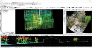
The LP360 Drone software system provides a geospatial-data workflow for UAV lidar and photogrammetry data processing. It provides powerful point cloud visualizations with multiple, synchronized windows. It can transform lidar and imagery data into survey-grade deliverables including visualization, quality checks, classification, analysis and 3D editing. For users of larger datasets, LP360 Geospatial can process captured lidar data or images from any aircraft or mobile sensor and analyze and extract values.
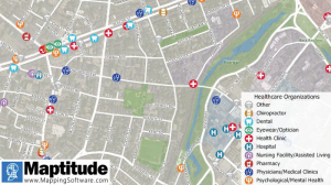
Free library offers data on healthcare, business, traffic
The extensive Maptitude library of free mapping databases has been updated for 2022 and is available for download, supporting insightful business development analysis. The data is available free to users of the latest version of the Maptitude mapping software. The data are also available as shapefile, KML, KMZ or GeoJSON for a fee. Maptitude includes business-critical data such as demographics, boundaries, streets, and the most ZIP Code/postal boundaries. Also available is a catalog of free premium datasets that can be used in other GIS applications, on the web, or in corporate databases.
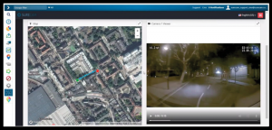
Indoor and outdoor tracking of low-power, small IoT devices
Traxmate is integrating Nestwave GNSS location technology into its asset-tracking platform for seamless indoor and outdoor positioning, tracking and routing of small, low-power and battery-powered devices for the internet of things (IoT). Nestwave’s NestCore IP and NestCloud cloud services enable power-efficient geolocation solutions, while Traxmate (pictured) is a comprehensive data-processing hub that simplifies setup of tracking environments and provides real-time visualization of device location. The resulting geolocation solution is suitable for applications ranging from carrier tracking to tracking individual parcels and packets. Traxmate is simple to use and set up, requires no coding, and provides an out-of-the-box feature set that includes dashboards, alerts and processing rules for taking actions on incoming data. Nestwave’s trackers include ThinTrack, an ultra-low-profile, compact GPS tracking solution that integrates an LTE-M/NB-IoT modem, antenna, battery and SIM into a device that measures 82 mm x 35 mm x3 mm and weighs 15 g.
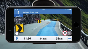
Provides guidance even without an internet connection
The Sygic GPS Navigation app uses a smartphone’s camera and augmented reality to display navigation instructions over the view ahead on the windshield. The head-up display is especially useful at night, enabling recognition of critical speed limit, road work or traffic restriction signs. Cockpit is a powerful tool that shows the real-time performance of the car, measuring the G force and actual speed to help users drive economically. The Dashcam feature records the road ahead and automatically saves the video in case of an accident. An Electric Vehicle Mode locates nearby charging stations.
Enhanced data-based rule implementation for fleets
An enhanced SureCam video telematics integration provides fleet managers with access to new capabilities to keep drivers safe and maximize fleet efficiency. The solution features a method for capturing video footage from SureCam cameras using Geotab’s powerful telematics device and rule-based system. The result is a seamless display of video within the MyGeotab platform. The enhanced SureCam fleet video solution leverages Geotab’s numerous data-based rules, such as improper seat belt usage and speeding. It uses G-force triggered alerts that detect unsafe driving behaviors and automatically captures video footage that can be reviewed later on the MyGeotab platform and alert managers to incidents when necessary. Camera configuration and customized triggers are managed directly within MyGeotab.
Driver 2.0 is a Level 4 production-ready autonomous driving solution that can operate in complex and challenging traffic environments. Demonstrations with Driver 2.0 showed an autonomous vehicle could maneuver around double-parked cars, e-scooters and pedestrians, negotiate oncoming vehicles to calculate the right timing and trajectory to pass busy intersections, and make multiple lane changes and unprotected left turns. In the case of long tail scenarios, the system will alert the remote monitoring center to intervene or take other safety measures. Driver 2.0 includes five solid-state lidar units, eight cameras and other sensors, and a computing platform integrated with a proprietary inference engine. The perception algorithm with sensor fusion can achieve precise object detection up to nearly 220 yards. The planning and control algorithm based on game theory can choose optimal routes and make decisions based on real-time situations when negotiating with oncoming vehicles and other road agents.
Provide improved signal gain for automotive antennas
Two new compounds could improve signal-gain performance compared to ceramics in second-generation automotive GNSS antennas. The new compounds — LNP Thermocomp ZKC0CXXD and LNP Thermocomp ZKC0DXXD — help enable the design and molding of antenna substrates with more complex pattern markings that add effective surface area, a critical factor in enhancing signal capture. They also provide flexibility to produce smaller parts with the same performance as ceramic, or equal-size parts with better performance. The LNP Thermocomp compounds feature electroplating capability, good thermal resistance for reliability, and the design freedom and production efficiency of thermoplastics. Both are well-suited for shark-fin-style and new conformal antenna designs.
SABIC, sabic.com
AUTONOMOUS
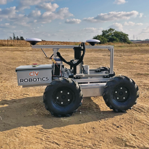
Image: Civ Robotics
Robotic Surveyor
Precisely marks thousands of coordinates per day
The CivDot unmanned ground vehicle (UGV) is designed for civil engineering and infrastructure projects such as solar farms, roadways, data centers, power plants and more. The autonomous surveying robot is designed to increase efficiency, productivity and safety on the job. Augmenting the surveyor’s work, CivDot marks thousands of coordinates per day precisely and efficiently, while delivering layouts faster than traditional methods. Civ Robotics uses Trimble’s high-precision GNSS positioning technology and surveying software.
The compact DJI Mavic 3E and 3T drones have been designed for an array of commercial missions. Flight time is 45 minutes. Both models have a real-time kinematic (RTK) module that enables surveying professionals to achieve centimeter-level accuracy with support for network RTK, custom network RTK services, and the D-RTK 2 Mobile Station. The D-RTK 2 Mobile Station is DJI’s upgraded high-precision GNSS receiver that supports all major GNSS, providing real-time differential corrections. The DJI Mavic 3E enables efficient mapping and surveying missions without the need for ground control points. The DJI Mavic 3T is engineered for aerial operations in firefighting, search and rescue, inspections and night missions.