InfiniDome has released GPSdome 2, its newest anti-jamming solution. The cost-effective and lightweight device provides simultaneous dual-frequency protection from three directions of attack.
GPSdome 2 is a high-end solution tailored to defend small- to medium-sized tactical UAVs as well as manned and unmanned ground vehicles.
Disruptions in critical positioning, navigation and timing (PNT) data mean loitering munitions that never find their targets, UAVs that fall to the ground, and ground vehicles that cannot be managed.
With a small form factor (500 g, 87 mm x 91 mm x 61.55 mm) and minimal power consumption, GPSdome 2 is suitable for loitering munitions as well as drones and UAVs, increasing resiliency while prolonging mission time and providing a superior return on investment. Fully retrofit and completely standalone, the system is compatible with almost any off-the-shelf GNSS receiver on the market as well as standard active GNSS antennas, meaning that it can be integrated into existing GPS systems or into new product lines, manned or unmanned.
With sophisticated algorithms and a proprietary RFIC, GPSdome 2 analyzes RF interference in the environment and combines multiple antenna patterns to create and dynamically steer three nulls in the direction of any hostile signal.
GPSdome 2 provides simultaneous dual-frequency protection (GPS L1 + L2 or GPS L1 + GLONASS G1), creating up to three nulls, protecting from three jamming directions within each band in real time, making it suitable for PNT applications.
The GPSdome 2 is a dual-use, non-ITAR device and comes with optional mil-spec compliance. It has been chosen by an Israeli defense contractor for integration with its platforms.
A team of researchers from the University of Texas Austin (UTA) have shown the Starlink broadband constellation’s potential to serve as a backup for GPS.
Todd E. Humphreys
The researchers, led by Todd Humphreys and funded by the U.S. Army, examined the downlink signal structure of the SpaceX Starlink constellation of ultrafast broadband satellites in low-Earth-orbit (LEO), reported MIT Technology Review. The team showed that Starlink could serve as a useful backup to GPS.
For the past two years, Humphreys’ team at UT Austin’s Radionavigation Lab has been reverse-engineering signals sent from thousands of Starlink internet satellites to ground-based receivers. Humphreys told the review that regular beacon signals from the constellation, designed to help receivers connect with the satellites, could form the basis of a useful navigation system.
Title: Signal Structure of the Starlink Ku-Band Downlink
Authors: Todd E. Humphreys, Peter A. Iannucci, Zacharias Komodromos, Andrew M. Graff
Abstract: We develop a technique for blind signal identification of the Starlink downlink signal in the 10.7 to 12.7 GHz band and present a detailed picture of
the signal’s structure. Importantly, the signal characterization offered herein includes the exact values of synchronization sequences embedded in the
signal that can be exploited to produce pseudorange measurements. Such an understanding of the signal is essential to emerging efforts that seek to dual-purpose Starlink signals for positioning, navigation, and timing, despite their being designed solely for broadband internet provision.
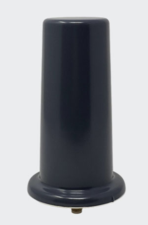
Tallysman Wireless has added the housed AJ977XF triple-band antenna with anti-jam technology to its line of GNSS products.
According to Tallysman, the AJ977XF uses a novel stacked antenna phased array that creates a null of typically 20-dB attenuation in the antenna’s radiation pattern from the horizon to an elevation angle of approximately 15 degrees.
The null in the radiation pattern strongly mitigates in-band and out-of-band signals. For example, the AJ977XF will continue to function in the presence of a ground-level 600-watt jamming signal, 100 meters or greater from the antenna. In addition to the null in the radiation pattern, the antenna’s OP1dB (compression point) is 15 dBm, which strongly protects the antenna’s low-noise amplifier (LNA) from saturating.
The triple-band AJ977XF antenna supports GPS L1/L2/L5, GLONASS G1/G2/G3, Galileo E1/E5ab and BeiDou B1/B2ab), and, in the region of operation, satellite-based augmentation systems (SBAS): WAAS (North America), EGNOS (Europe), MSAS (Japan), or GAGAN (India).
The AJ977XF is housed in a through-hole mount, weatherproof (IP67) enclosure. L-bracket (PN 23-0040-0) or pipe (23-0065-0) mounts are available for permanent installations.
The radio frequency spectrum has become congested worldwide as many new LTE bands have been activated. Their signals or their harmonics can affect the proper operation of GNSS antennas and receivers.
In North America, the planned Ligado service, which will broadcast in the frequency range of 1526 to 1536 MHz, can negatively affect the reception of GNSS signals. Similarly, new LTE signals in Europe [band 32 (1452–1496 MHz)] and Japan [bands 11 and 21 (1476–1511 MHz)] also have been shown to affect GNSS signal reception. Tallyman’s new AJ977XF mitigates the effects of these new signals.
Hemisphere GNSS has released the GradeMetrix Scraper Solution for pull pan and belly pan scrapers on the construction site.
“We believe by introducing affordable GNSS technology to the construction industry’s bulk earth moving process, we provide a significant opportunity for equipment operators to increase their speed, accuracy and efficiency, resulting in substantial savings in fuel costs and equipment maintenance,” said Miles Ware, vice president of marketing.
“Hemisphere continues its commitment to bring high-performance, world-class 3D machine control and guidance solutions to the global market,” said Randy Noland, vice president of Global Sales & Business Development. “By adding the GradeMetrix Scraper Solution to our expanding product portfolio, we lower the barrier of entry and raise access to more markets and applications.”
GradeMetrix Scraper kits will be available for purchase for new customers. Existing customers will have the option to add scraper support to their current GradeMetrix system via a software upgrade and machine activation.
More than 34 million miles have been driven with Super Cruise engaged on General Motors vehicles. (Photo: GM)
General Motors and Trimble have reached more than 34 million miles of hands-free driving with Super Cruise engaged on General Motors vehicles.
GM teamed with Trimble to develop a reliable way to maintain in-lane positioning for hands-free driving, putting safety top-of-mind.
Trimble’s precise GPS technology enables a vehicle to maintain its lane position in a variety of environments, including inclement weather conditions (rain, snow, fog and more), which often challenges other sensors. GM’s Super Cruise, a hands-free driver assistance system, uses Trimble RTX (Real-Time eXtended) technology to deliver high-GNSS accuracy corrections since it introduced the technology in 2017 on the model year 2018 Cadillac CT6.
“Trimble RTX has been in commercial use for more than 10 years, and in 2018 was the first precise point positioning correction service to log miles in a commercial autonomous driving system,” said Patricia Boothe, senior vice president of Autonomy, Trimble. “It works with Super Cruise to help a vehicle maintain its lane position, bringing more consumers access to a more enjoyable and convenient driving experience.”
Standard GPS receivers can have a margin of error of up to 25 feet, which is not suitable for vehicles that require precise absolute position information to maintain lane-level positioning. Trimble’s RTX technology removes errors in GNSS satellite data broadcasts to improve location accuracy on our roadways.
“Super Cruise is a life-changing technology, allowing customers to experience hands-free driving on compatible, mapped roads nationwide,” said Mario Maiorana, GM chief engineer, Super Cruise. “The technology is a collaborative effort internally and externally to bring this advanced driver assistance technology to life. Trimble Autonomy has been a valuable collaborator in bringing Super Cruise to our customers.”
New receiver provides a path to the security and performance benefits of dual-band technology
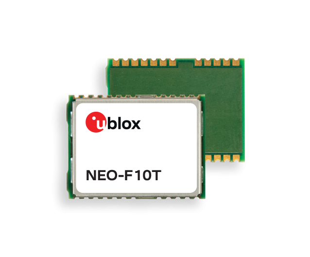
Photo: u-blox
U-blox has announced a new, compact dual-band timing module that offers nanosecond-level timing accuracy, thereby meeting the stringent timing requirements for 5G communications.
The new u-blox NEO-F10T is compliant with the u-blox NEO form factor (12.2 mm x 16 mm), allowing space-constrained designs to be realized without the need to compromise on size.
The NEO-F10T is the successor to the NEO-M8T module, providing an easy upgrade path to dual-band timing technology. This allows NEO-M8T users to access nanosecond-level timing accuracy and enhanced security.
U-blox’s dual-band technology mitigates ionospheric errors and greatly reduces timing error, without the need of an external GNSS correction service. Additionally, when within the operational area of a satellite-based augmentation system (SBAS), the NEO-F10T offers the possibility to improve the timing performance by using the ionospheric corrections provided by the SBAS system.
As the NEO-F10T supports all four global satellite constellations and L1/L5/E5a configuration, it significantly simplifies global deployments because the same device can be used universally.
NEO-F10T includes advanced security features such as secure boot, secure interfaces, configuration lock and T-RAIM to provide the highest-level timing integrity. This ensures that reliable, uninterrupted service is delivered as any attempt to interfere with the receiver is unlikely to be successful. Additionally, advanced anti-jamming and anti-spoofing algorithms are included to further enhance security.
The module has a single RF input for all the GNSS bands and dual SAW filters for exceptional signal selectivity and out-of-band attenuation. It is compatible with u-blox’s ANN-MB1 L1/L5 multi-band antenna, making it simple to evaluate the performance of the timing modules. The devices operate from a single 2.7 V to 3.6 V supply and draw just 19 mA (@ 3.0 V) during continuous operation.
“NEO-F10T is designed to meet the timing synchronization requirements in 5G small cells and private networks on a global scale. By significantly reducing the time error of cellular network synchronization, the NEO‑F10T module will help operators maximize the performance of their networks and so optimize the return on their investment in 5G communications,” said Samuli Pietila, Director Product Line Management, Timing and Infrastructure, at u-blox.
Cepton Inc. is working with LidarSwiss Solutions GmbH to deploy its lidar technology in a drone-based mapping and analytics solution for infrastructure management and engineering design applications.
Cepton is a Silicon Valley innovator of high-performance lidar solutions. LidarSwiss is a Switzerland-based provider of high-performance unmanned aerial vehicle (UAV) lidar solutions.
Utilizing Cepton’s Sora lidar sensor, the LidarSwiss Nano P60 system provides high-fidelity mapping and real-time processing on the fly to serve engineers, forestry managers and urban planners across the globe. To date, Nano P60 has been used to map and analyze powerlines, areas for site development, flood plains and highways in more than 20 cities in Asia, Europe and Australia.
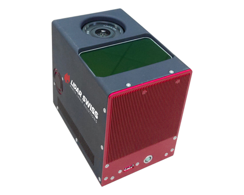
Nano P60 packages Cepton’s Sora lidar, a 42-mp camera, an Applanix IMU/GNSS and a LidarSwiss controller. (Photo: LidarSwiss)
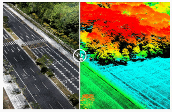
Nano P60 integrates Cepton’s Sora sensor with a high-precision IMU/GNSS unit from Applanix and high-resolution camera system. Its intelligent controller with LidarSwiss proprietary software automatically combines all raw data to generate high-density, high-precision RGB attributed 3D laser point clouds during flight.
With a total weight of 2.1 kg, this compact system can be mounted on small UAVs to produce mapping products such as digital orthophotos, digital elevation models and 3D models, or to interface with a third-party software to enable easy, seamless solutions for all kinds of industry applications, such as digital twins, smart cities and building information modeling (BIM).
“The prominent features of the Nano P60 are its high stability, point density and intelligence,” said Robert Kletzli, LidarSwiss founder and CTO. “This lidar-enabled system addresses the critical gap of 3D accuracy with traditional camera and stereo imaging technologies. Now, instead of needing two images to see a single point and detect its elevation, Nano P60 utilizes lidar’s intrinsic 3D imaging capabilities to achieve maximized efficiency, making real-time processing and analytics possible. Cepton’s Sora lidar is among the most compact, lightweight lidar sensors that we have tested and offers an unparalleled combination of high resolution, longer range in the same category and cost efficiency. Its unique lidar architecture allows seamless integration, making Nano P60 a true plug-and-play system with solid-state reliability.”
Nano P60 combines lidar point clouds with RGB imagery to generate high-density, high-precision 3D imaging with color by elevation features. (Image: LidarSwiss)
“We are proud to be supporting LidarSwiss and its customers with our lidar technology to unlock applications such as 3D modeling for BIM, historical site mapping, terrain modeling for heavy vegetation areas, volumetric calculations for mining, power line inspection and forestry mapping,” said Klaus Wagner, director of Product Management and Marketing at Cepton. “Our Sora lidar is a one-of-a-kind line scanner that combines high frame rate and long range. Powered by Cepton’s proprietary lidar technologies, it is compact, lightweight and rotation-free, making it ideal for small UAV applications.”
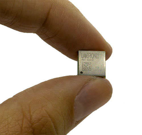
Lantronix Inc. has launched its new PNT Series GNSS receiver modules. The embedded modules provide an easy-to-use, cost-effective solution to enable the addition of GNSS functionality to products, Lantronix said, supporting the internet of things (IoT).
The new PNT Series modules are suitable for use in consumer solutions including people, pet and asset tracking devices, as well as agriculture asset monitoring and commercial solutions such as drones, toll-road charging, fleet management, maritime, rail, critical infrastructure and utilities.
“With the addition of the GNSS receiver modules, Lantronix is expanding its embedded IoT family to meet the growing demand for GNSS capabilities in a wide range of essential, often critical, consumer and commercial applications,” said Brian Jaroszewski, lead product line manager at Lantronix. “Adding positioning and tracking, navigation and timing capabilities supports essential processes in many industries, empowering our customers to propel our world forward with enhanced safety, security and the increased ability to more effectively and remotely manage people, places and things.”
According to the European Union Agency for the Space Program (EUSPA), by 2031 more than 10 billion GNSS devices will be in use across the world. Mass-market segments — consumer solutions, tourism and health — will contribute to 92 percent of all devices in use. The global GNSS downstream market revenues, covering both device sales and service-related revenues, is expected to grow at a CAGR of 9.2 percent over the next decade, reaching a total of USD $486 billion by 2031.
Available in Two Models
Lantronix PNT-SG3FS
Available now, the PNT-SG3FS flash-based module is designed for simultaneous tracking of multiple constellations. The PNT-SG3FS standalone module integrates a Teseo III receiver from STMicroelectronics.
The single-frequency receiver can track up to 32 satellite signals in view across GPS L1C/A, BeiDou B1, Galileo E1B/C, GLONASS L1OF, SBAS L1C/A (WAAS, EGNOS, MSAS, GAGAN) and QZSS L1C/A bands. The pin-compatible multi-frequency PNT-SG4FM adds support for GPS and QZSS L5C, BeiDou B2a and Galileo E5a bands.
PNT Series SG3FS evaluation board. (Photo: Lantronix)
The PNT-SG3FS module supports Differential GPS (DGPS) data according to RTCM 10402.3 for improving location accuracy. The module can output measurement data (carrier phase) supporting PPP-RTK host algorithms for precise positioning applications with a custom firmware and supports 1.8V or 3.3V power supply domains. Assisted GNSS algorithms support extended ephemeris data using local autonomous or server-assisted-based solutions for fast time to first fix (TTFF) operation.
The module provides a high stability pulse-per-second (PPS) output for time-synchronization for electricity transmission, telecom networks operation and timestamping of financial transactions as well as application uses in utility systems, scientific applications, IoT and in broadcast and datacom networks.
The PNT-SG3FS integrates 16MB flash memory that supports many capabilities, including data logging, geofencing, odometer, five-day autonomous assisted GNSS and firmware updates. Integrated is a temperature-compensated crystal oscillator (TXCO) for navigation performance and stability. Also included is a real-time clock (RTC) oscillator with a clock-trimming feature to compensate for the accuracy of the 32.768 kHz crystal in timing applications.
Lantronix PNT-SG4FM
Coming soon, the PNT-SG4FM is a pin-compatible flash-based module designed for multi-frequency GNSS deployments. The PNT-SG4FM is ready for IRNSS using a custom firmware build. The PNT-SG4FM relies solely on server-assisted-based assisted GNSS. In addition, the PNT-SG4FM has a built-in LNA and SAW filter and features short and open circuit detection functions for antenna status.
New PNT satellites will operate in low Earth orbit (LEO). (Image: ESA)
News from the European Space Agency (ESA)
Satellite navigation is headed closer to users. ESA’s Navigation Directorate is planning an in-orbit demonstration with new navigation satellites that will orbit just a few hundred kilometers in space, supplementing Europe’s 23,222-km-distant Galileo satellites.
Operating added-value signals, these novel low-Earth-orbit (LEO) positioning, navigation and timing (PNT) satellites will investigate a new multi-layer satnav system-of-systems approach to deliver seamless PNT services that are much more accurate, robust and available everywhere.
Global in coverage, free for everyone to use, GNSS such as Europe’s Galileo have already transformed our society, and due to their sheer omnipresence their influence continues to grow. In 2021, the population of satnav receivers reached 6.5 billion around the world, and the sector is projected to maintain a 10% annual growth rate in the years ahead. But in various respects the standard GNSS approach is nearing the limits of optimum performance — to get even better, added ingredients are becoming essential.
“Satellite navigation has enabled a vast range of applications in recent years, but this very success is inspiring still more demanding user needs for the coming decade,” said Lionel Ries, head of ESA’s GNSS Evolutions R&D team, overseeing the agency’s LEO-PNT studies.
“For use cases such as autonomous vehicles, ships or drones, robotics, smart cities or the industrial internet of things for control of factory systems, the positioning requirements are growing from the current meter-scale to centimeter scale or even more precise, based on continuously reliable signals that are available anywhere, anytime — even indoors —while able to overcome interference or jamming.
“Up until now we have relied for positioning on the classical solution of GNSS such as Galileo, located in medium Earth orbit and based on L-band signals. Standard GNSS alone is not going to be able to fulfil all these future user demands. Instead Europe needs to seize the opportunity to investigate the potential of the kind of LEO constellations that are already on the way in the global market to enable new kinds of PNT services.”
Simply by virtue of physics, with less of a distance to cover down to Earth, the signals from these LEO-PNT satellites can be more powerful, able to overcome interference and reach places where today’s satnav signals cannot reach.
Additionally, by adopting novel navigation techniques and a wider range of signal bands the satellites can address particular user needs: for instance at lower orbits the satellites themselves move more rapidly relative to Earth’s surface — think of the International Space Station at 400 km that orbits the Earth every 90 minutes — which offers possible advantage in the time needed to reach very accurate positions. Also some bands could offer greater penetration in difficult environments while other bands could offer higher robustness and precision.
Mega-constellations of hundreds or even thousands of low-orbiting satellites offer a means of acquiring continuous coverage for telecommunications services or Earth observation. (Image: ESA)
The purpose of ESA’s plan to perform an in-orbit demonstration of low Earth orbiting satnav satellites is precisely to consolidate the types of signals, enabling technologies and their potential for future services.
The plan is to build and fly an initial mini-constellation of at least half a dozen satellites to test capabilities and key technologies, as well as demonstrating signals and frequency bands for use by a follow-on operational constellation, in the same way that Europe’s GIOVE test satellites paved the way for Galileo. Success will place European industry in pole positions for follow-on commercial undertakings, as well as planned institutional programs.
“Each individual satellite would be comparatively small, below 70 kg in mass, compared to a 700 kg current Galileo operational satellite,” added Roberto Prieto-Cerdeira, Galileo Second Generation satellite payload manager and LEO-PNT project preparation manager as part of ESA’s FutureNAV program.
“They can be comparatively more streamlined because they can benefit from other means to calculate the accurate time without extremely precise atomic clocks on board — including relayed signals from the Galileo satellites above them. These satellites would also be built on a rapid batch production basis to save time and cost — we are targeting three years at the most from signing the contracts to the first satellites in orbit, the same kind of timescale achieved by GIOVE-A in the early 2000s.”
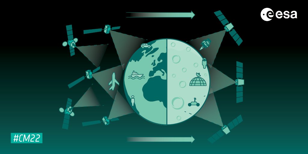
A vision of the future shows layered satellite navigation stretching from Earth to the Moon. (Image: ESA)
“It is ESA’s ambition to ensure Europe maintains a world-class space industry, and navigation today forms the single largest downstream space sector, worth about €150 billion annually and growing at the rate of 10% per year,” said ESA Director of Navigation Javier Benedicto-Ruiz. “Standing still is not an option; instead we need to explore new technical avenues to spur European competitiveness and commercialization.”
An operational version of the LEO-PNT constellation would represent a whole new layer for PNT delivery, combined with traditional GNSS as well as 5G/6G-based positioning on the ground, and fused with data from sensors in the user terminals.
Interest from industry
ESA has been researching core elements of the LEO-PNT concept since 2016. Now, with numerous low Earth orbit constellations already taking shape around the globe, the time is right to move from basic research to in-orbit demonstration.
Interest from European industry in the LEO-PNT project has been very high, shown by a recent Request for Information where ESA presented details of how companies and institutions might participate and a large number of companies registered and presented possible concepts and contributions.
Forward to FutureNAV
LEO-PNT is supported through the ESA Directorate of Navigation’s FutureNAV programme, which also includes the GENESIS satellite to measure the shape of Earth more accurately than ever before while also boosting the positioning performance of satnav satellites. The FutureNAV programme, which includes both GENESIS and the LEO-PNT initiative, is up for decision at ESA’s next Ministerial Conference, taking place in Paris on Nov. 22-23. Read the fact sheet here.
Until now, all navigation satellites have flown in medium-Earth orbit – up at 23,222 km in the case of Galileo, which delivers meter-level accuracy. At such altitudes the satellites move slowly across the sky, helping ensure global availability of satellite navigation signals, albeit at relatively low power.
ESA’s LEO PNT constellation would move to a “multilayer system of systems” approach, with medium-Earth orbit signals supplemented by those from LEO satellites at altitudes of less than 2,000 km — along with additional inputs from terrestrial PNT systems and user-based sensors, made up of approximately a dozen satellites, helping European companies move forward at a time when worldwide commercial interest is high in LEO constellations of all kinds, especially for telecommunications and PNT.
The satellites themselves can be stripped down compared to current navigation satellites, because they would essentially be relaying satnav signals from MEO. This is a key point because there will need to be many more satellites to ensure global coverage — because the lower the orbit the faster each individual satellite will pass across the sky. This fact also opens the way to a more agile “New Space” approach to satellite construction for European firms, with smaller payloads and simplified operations from the ground.
Their signals will be much stronger (potentially able to penetrate indoors), and transmitted on novel frequencies, which – along with the new geometries made possible by LEO satellites – should enhance overall service resilience. LEO PNT will also deliver faster position fixes and enable rapid two-way authentication checks. And overall signal availability will be boosted enormously, especially in high-latitude and polar regions.
Editor-in-Chief Matteo Luccio met with two representatives from YellowScan to discuss its global market and a recent end-user success story out of Antarctica.
Rx Networks, Inc., a GNSS data services company, announced the availability of TruePoint.io precise location services on Qualcomm’s Snapdragon 8 Gen 1 and Snapdragon 888 5G Mobile Platforms. TruePoint.io integration empowers Android smartphones to achieve enhanced location accuracy down to a meter or less – something previously only seen with high-grade receivers.
With enhanced location accuracy, superior user experience for such use cases as rideshare, micro-mobility, health and fitness and lane-level requirement applications can now be realized. The enablement of reliable meter-level location accuracy on mobile phones will unlock the potential of location-based services and open the door for other innovative and unique use cases. The limitations of a standalone GNSS chipset no longer become the barrier to pursuing the vision of connected ecosystems reliant on location.
TruePoint.io enables scalable, reliable, and affordable ways to leverage high-precision location on smartphones powered by Snapdragon mobile platforms. Rx Networks’ global coverage, including China, gives smartphone OEMs the advantage of a single GNSS corrections vendor that works across all continents.
“Rx Networks provision of GNSS data services for accurately positioning smartphones using Snapdragon mobile platforms will enable meter-level location accuracy almost everywhere smartphones can connect to a terrestrial cellular network,” said Francesco Grilli, Vice President, Product Management at Qualcomm Technologies, Inc. “Meter-level location accuracy is poised to improve smartphone user experiences and spur the creation of exciting and innovative services for businesses and consumers.”
TruePoint.io is scheduled to be available on Snapdragon mobile platforms initially in China in Q4 2022 and globally in H1 2023.
Leica Geosystems, a part of Hexagon, received the prestigious Wichmann Innovations Award at this year’s Intergeo in Essen, Germany, for its Leica AP20 AutoPole.
The Wichmann Innovations Award honors new technology that stands out for innovation, user-friendliness and practicality. A panel of industry leaders shortlisted the submissions. Subsequently, the public was able to weigh in by casting a vote for their favorite finalist.
The Leica AP20 AutoPole is an innovative solution for automated total stations that features tilt compensation, automatic pole height readings and unique target identification. The technological convergence in the AP20 addresses core pain points in today’s total station workflows by making it possible to measure with a tilted pole, adjust height readings in the software automatically and prevent the station from locking onto unwanted targets.
Photo: Leica Geosystems
“The Leica AP20 AutoPole boosts efficiency by removing the last analog steps in robotic total station workflows. We were pleased when customers told us they were able to double their productivity on some projects,” says Hans-Martin Zogg, business director TPS at Leica Geosystems, part of Hexagon. “This award represents the acknowledgment of the expert jury as well as the broader surveying community, and winning it is a wonderful recognition of our team’s accomplishment.”
 InfiniDome has released GPSdome 2, its newest anti-jamming solution. The cost-effective and lightweight device provides simultaneous dual-frequency protection from three directions of attack.