Blog

  • Launchpad: digital FOG, wind prediction, drone tracker

    Launchpad: digital FOG, wind prediction, drone tracker

    A roundup of recent products in the GNSS and inertial positioning industry from the April 2022 issue of GPS World magazine.


    OEM

    GNSS+5G Antenna

    9-in-one combination antenna with dual-band GNSS
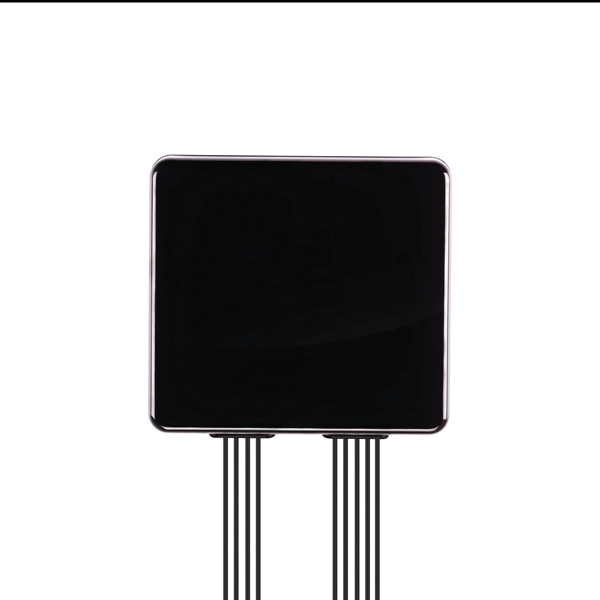
    Photo: Taoglas
    Photo: Taoglas

    The Taoglas MA990 Guardian antenna is a 9-in-1 combination antenna with dual-band GNSS (L1/L2) and globally supported cellular (5G/4G). It has been designed to support emerging market demand for modules that cover specific 5G/4G bands. Two of its eight cellular MIMO antennas cover from 600 Mhz to 6,000 MHz, while another two are optimized for 3,000 MHz to 6,000 MHz to cover high-band 5G and C-band/CBRS applications. The customizable antenna is designed to operate on all global carrier networks and is future-proofed to work with the latest 5G routers on the market. Housed in a low-profile, robust, IP67-rated waterproof, adhesive-mount external enclosure, the MA990 is designed for space-constrained, mission-critical applications, including asset and vehicle tracking, first-responder vehicles and high-definition video sources such as surveillance cameras.

    Taoglas, taoglas.com

    Digital FOG

    Fiber-optic-gyroscope inertial navigation system

    Photo: Advanced Navigation
    Photo: Advanced Navigation

    The Boreas fiber-optic-gyroscope inertial navigation system (INS) is an ultra-high accuracy, strategic-grade INS offering a reduction in size, weight, power and cost. It is based on Advanced Navigation’s new digital fiber-optic gyroscope (DFOG) technology. The Boreas is targeted at applications requiring always-available, ultra-high accuracy orientation and navigation including marine, surveying, subsea, aerospace, robotics and space. It delivers strategic-grade bias stability of 0.001 deg/hr. This allows it to achieve ultra-high roll/pitch accuracy of 0.005 degrees and heading accuracy of 0.006 degrees. The Boreas allows for full independence from GPS with dead-reckoning accuracy of 0.01% of the distance traveled with an odometer or Doppler velocity log. In addition, the Boreas features ultra-fast gyro compassing, taking only two minutes to acquire heading in both stationary environments or on the move. Gyro compassing allows the system to determine a highly accurate heading of 0.01 degrees secant latitude without relying on magnetic heading or GPS.

    Advanced Navigation, advancednavigation.com

    Ceramic-patch Antennas

    Support all four global constellations
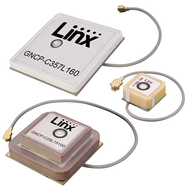
    Photo: Linx Technologies
    Photo: Linx Technologies

    Seven new GNSS active ceramic-patch antennas support global GNSS applications including GPS, Galileo, GLONASS, BeiDou, NavIC and QZSS systems in the L1/E1/B1, L2/E5/B2B, and L5/E5/B2A bands. Each antenna integrates a high-gain low-noise amplifier (LNA) and right-hand circular polarization (RHCP) to provide a high-performance solution for GNSS signal reception. Each active GNSS antenna has either a 60-mm or 100-mm coaxial cable terminated in a MHF1/U.FL-type plug (female socket) connector. They also meet the need for multi-band L1/L2, L1/L5, and L1/L2/L5 GNSS offerings.

    Linx Technologies, linxtechnologies.com

    Tactical-Grade IMU

    Designed for high performance in harsh conditions
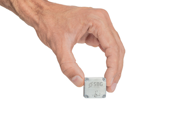
    Photo: SBG Systems
    Photo: SBG Systems

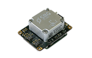
    The Pulse-40 inertial measurement unit (IMU) is a tactical-grade IMU designed for high performance in harsh conditions but miniaturized for applications where precision and robustness matter in all conditions. Use cases include warfare systems, satellite communications, robotics, lidar devices, gimbals, cameras and inertial navigation systems (INS). The Pulse-40 IMU provides six degrees of freedom. It integrates micro-electromechanical (MEMS) three-axes accelerometers and gyroscopes in a unique redundant design that allows the device size to shrink while pushing performance to its maximum. Among the performance specifications, the Pulse-40 features excellent gyro and accelerometer bias instability of 0.8°/h and 6 µg respectively, enabling long dead-reckoning and maintaining excellent heading performance. With sensors featuring extremely low vibration rectification error (VRE), the Pulse-40 can sustain high vibration environments, up to 10 g root-mean-squared. An embedded continuous built-in-test ensures data reliability during operation, a key parameter for critical applications. Features include 12 grams, 0.3W power consumption; ultra-low noise gyro (0.08°/√h) and excellent gyro bias instability (0.8°/h); high-precision accelerometers (6 µg); MIL-STD 810-qualified for shocks and vibrations; high bandwidth (480 Hz) and high data rate (2 KHz); highly tested and calibrated from –40° C to 85° C; and no export restrictions.

    SBG Systems, sbg-systems.com


    SURVEYING & MAPPING

    Surveying App

    Adds online services for field surveying and mapping
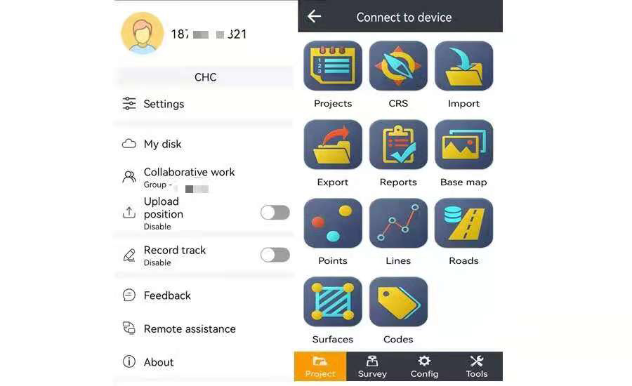
    Photo: CHC Navigation
    Photo: CHC Navigation

    LandStar version 7.3.7 adds cloud-based services and remote support features to simplify surveyors’ daily tasks. Online data storage and file sharing greatly facilitates interactions within a company and between field operators. LandStar 7’s remote assistance feature allows support personnel to take control of the field crew’s devices. Users simply provide a remote code to grant control of their data controller and be guided efficiently to the solution. The new version of LandStar 7 further improves support for CAD files and operates faster when importing 20MB DWG or 200MB DXF basemap files. Users can directly click on points, lines and blocks to stake out. In addition, object symbols and colors are displayed in the same way as in the original CAD design, making it easier for users to identify them.

    CHC Navigation, www.chcnav.com

    Android Software

    Surveying, mapping and data-collection software
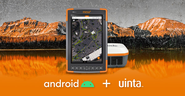
    Photo: Juniper Systems
    Photo: Juniper Systems

    Uinta is now available for devices running on Android. This is particularly valuable for workers who prefer to use an Android tablet or smartphone as a data collector. Uinta’s intuitive and customizable user workflow makes land measurement and asset mapping easier for data collection in the field. Uinta can now be used on a range of smartphones and tablets, including Juniper Systems’ Cedar CT8X2 and Mesa 3 rugged tablets running on Android. When using Juniper’s Geode GNSS receiver and running Uinta on an Android phone or tablet, users create a total mapping solution. They can collect high-accuracy GNSS data on the Geode, record the data in Uinta software, and see the data on a mobile or tablet. The intuitive software includes project templates that can be modified to meet individual project needs. Uinta is commonly used in utility mapping; commercial and agricultural irrigation; industrial asset inspections and rounds; and numerous environmental sciences in forestry, wetlands, wildlife and vegetation mapping.

    Juniper Systems, junipersys.com

    3D City Data

    Visualize the present and simulate the future of Scottish cities

    Photo: Bluesky
    Photo: Bluesky

    Scottish cities Edinburgh and Glasgow have been added to the growing coverage of MetroVista 3D city models. The data is available as ultra-high resolution 5-centimeter aerial photography with 16 points per meter (ppm) lidar. The data also is being processed to create a fully rendered mesh model suitable for use in a range of GIS, CAD and modeling software packages Acquired using the Leica CityMapper aerial sensor that simultaneously captures vertical and oblique imagery together with high-point density lidar, MetroVista data is becoming increasingly popular for smart city applications. Providing a geographically accurate and detailed 3D representation of the urban environment, MetroVista data provides insight for applications such as urban design, defense and security modeling, insurance assessments and utility and telecom planning.

    Bluesky, bluesky-world.com

    Wind Prediction

    App provides forecasts to firefighters

    Photo: WindNinja
    Photo: WindNinja
    Photo: WindNinja
    Photo: WindNinja

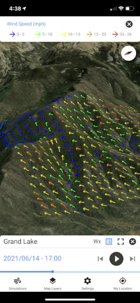
    WindNinja is a high-resolution wind modeling app created for firefighters who need to quickly compute and visualize wind direction and speed simulations. The simulations provide them with situational awareness, help keep them safe, and help them conduct work such as burnout operations. The mobile app, developed using ArcGIS AppStudio from Esri, provides high-resolution, near-surface wind forecasts that include wind speeds and directions displayed on a map. The user selects an area of interest of 50 square kilometers or less, names the simulation, chooses a forecast duration of up to 15 hours, selects whether to receive an email or SMS notification when the simulation is ready to view, and then submits the request. The user also can select from a variety of basemaps and turn on data layers — vegetation, atmospheric, oceanic, land-surface imagery — collected by NOAA satellites.

    WindNinja, www.firelab.org/project/windninja


    TRANSPORTATION

    eBike Positioning

    Intelligent control system meets urban transport requirements
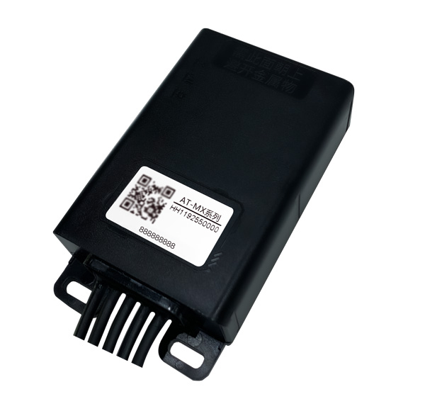
    Photo: Xiaoan Technology
    Photo: Xiaoan Technology

    The AT-MX intelligent control system for shared electric bicycles uses the latest ultra-low-power u-blox M10 GNSS technology to enhance the positioning performance of their fleet for improved compliance with increasingly stringent Chinese policy requirements. The growing popularity of shared micromobility solutions for short-distance urban travel has led municipal authorities around the world to introduce new legislation to mitigate their perceived negative impacts, for instance, with restrictions on where users can drive and park their vehicles. Meanwhile, vehicle operators and maintenance personnel need to efficiently locate vehicles requiring maintenance and gather reliable vehicle usage data to balance bicycle placement and operational safety. Enforcing regulatory compliance and optimizing operations both require the safe, accurate and efficient bicycle positioning solutions.

    Xiaoan Technology, xiaoantech.com; u-blox, www.ublox.com

    GNSS+INS Integration

    Ensures safe operations through reliable, robust and continuous positioning

    Image: Hexagon
    Image: Hexagon

    SPAN technology delivers a deeply coupled GNSS and inertial navigation system (INS) that provides robust, reliable and continuous centimeter-level positioning for operators to maintain safety and maximize uptime. Now available for the dynamic positioning of vessels, the GNSS+INS solutions can bridge outages in GNSS tracking and through short periods of radio-frequency interference, jamming or spoofing. It provides vessels with an added layer of resiliency and achieve continuous centimeter-level accuracy across all conditions. SPAN GNSS+INS technology is compatible with commercial inertial measurement units (IMUs) and scalable with the LD900 GNSS receiver, Quantum visualization software and APEX correction services. Features include continuous centimeter-level positioning made more robust and reliable through enhanced GNSS tracking and deep coupling of inertial measurements; rapid reacquisition of GNSS signals after outages or interruptions through a deep coupling process; constant monitoring of GNSS absolute positioning combined with heading, velocity and attitude measurements; and added positioning redundancy with system robustness against potential signal outages, interference or disruptions.

    Hexagon | Veripos, veripos.com


    UAV

    Drone Tracker

    GNSS-based device secures infrasturcutre
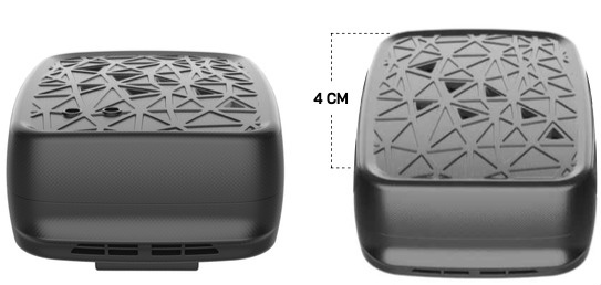
    Photo: Ibtechar
    Photo: Ibtechar

    Ibtechar, one of Qatar’s top providers of practical innovation and turnkey solutions, has developed a drone tracker and a GPS-based system that ensure the safety and security of critical infrastructure, VIP residents, national borders, and military facilities. The customized solution is made by a Qatar-based team of researchers and technologists with extensive knowledge and expertise in applied research and counter-drone systems. It aims to secure airports, power lines, and other vital assets that can be targets for drone attacks. Prototypes have gone through 487 flight tests in 19 locations, as well as 676 drive and walk tests. Features include compatibility with GPS, GLONASS and BDS; real-time tracking, popup notifications and SMS alerts; smart geo-fencing; drone whitelists/blacklists; base-station triangulation (cell ID); IMU, tilt, vibration sensor, and NFC; and offline mode. The new tracking system can identify the operating drones by displaying the drone itself, its serial number, the commercial frequency used, and motion details (speed, altitude, azimuth, path, etc.).

    Ibtechar, ibtechar.com

    Mapping Software

    User-friendly, cloud-based software

    Photo: DroneDeploy
    Photo: DroneDeploy

    DroneDeploy lets users capture, process and analyze data in one platform. Users can create high-resolution 2D and 3D interior and exterior maps and models accurate to between 1 cm and 5 cm. It is designed for individuals, teams or enterprises and is suitable for all use cases and industries. However, primary markets include agriculture, construction, mining, energy, roofing and inspection. Features include Mobile Flight App to capture images directly from
    an iOS or Android device; Live Map to create real-time, sharable
    2D maps; Autonomous Flight to preprogram routes; as well as
    360 Walkthrough for a 360-degree, virtual tour through a 3D model of a site. Industry-specific features are available, such as Plant Health to help farmers measure crop health and viability.

    DroneDeploy, dronedeploy.com

  • 90 groups mark 2-year Ligado Order anniversary with new letter

    90 groups mark 2-year Ligado Order anniversary with new letter

    A new letter has been sent to both President Biden and congressional leadership by 90 groups opposed to Ligado’s plans to launch a terrestrial network in the L-band used by GPS.

    The letter, dated April 25, marked the two-year anniversary of a controversial decision by the U.S. Federal Communications Commission (FCC) to adopt the Ligado Order.

    The 90 groups represent companies, organizations and associations united in their grave concerns over “imminent — but preventable — harm from Ligado’s proposed terrestrial network.” These groups have serious concerns about how Ligado’s plan threatens to interfere with services provided by the GNSS, aviation and real-time environmental satellite-data communities.

    Staying the order is necessitated by the clear bipartisan will of Congress. After adoption of the order in 2020, Congress mandated an independent technical review to further assess the harmful interference that would be caused by Ligado’s proposed network and required the Department of Defense to brief federal representatives across the government “at the highest level of classification” on the potential for widespread harm from Ligado’s proposed terrestrial operations.

    On this basis alone, the FCC should stay the order to adequately consider the material new information that will be uncovered as a result of these ongoing Congressionally mandated processes, according to the letter writers.

    Their concern was made even more real following the announcement by Ligado that the company intends “to commence operations in the 1526-1536 MHz band on or after Sept. 30, 2022.”

    Image: A-Digit/DigitalVision Vectors/Getty Images
    Image: A-Digit/DigitalVision Vectors/Getty Images
  • Microchip Technology offers GridTime 3000 for utilities

    Microchip Technology offers GridTime 3000 for utilities

    The GridTime 3000 GNSS time server meets rugged international environmental standards for power plants and substations

    The GridTime 3000 GNSS time server. (Photo: Microchip)
    The GridTime 3000 GNSS time server. (Photo: Microchip)

    Microchip Technology Inc. has announced its GridTime 3000 GNSS time server, a software-configurable solution providing power plants and substations with a new level of redundancy, security and resiliency to protect against surges, adverse weather and cyberattacks targeting critical infrastructure.

    Meeting the Need

    Power plants and substations rely on high-speed communications networks to transmit critical data including operability metrics, network health, fault monitoring, power measurement and usage trends. To synchronize communications and ensure continuity across these networks, substations require secure, precise timing and synchronization to avoid false tripping and to provide accurate time-stamping of substation data including system faults, power-measurement data and substation status information.

    The launch of the Microchip GridTime 3000 GNSS Time Server assists power-grid operators to meet these requirements.

    The GridTime 3000 system generates precise time and frequency signals to synchronize analog and digital communication systems. This resilient timing platform incorporates multiple timing inputs for protection in the event of a GNSS signal disruption caused by severe weather, environmental disturbances or signal jamming or spoofing.

  • SBG Systems launches Quanta Micro INS

    SBG Systems launches Quanta Micro INS

    Photo: SBG Systems
    Photo: SBG Systems

    SBG Systems has announced a new inertial navigation system (INS) named Quanta Micro, completing its Quanta product line.

    The Quanta Micro GNSS-aided INS offers a unique combination of navigation performance and low size, weight, power and cost (SWAP-C).

    Quanta Micro leverages a survey-grade inertial measurement unit (IMU) for optimal heading performance in single antenna applications, and high immunity to vibrating environments. An optional secondary antenna enables fast heading initialization in low dynamic applications.

    Main Features

    • Accuracy: 0.015° roll/pitch, 0.035° heading, 1 cm position (PPK)
    • Integrates a survey-grade IMU: 0.8°/h gyro bias instability
    • Versatile INS/GNSS to suit land, air or marine applications
    • Highly tested and calibrated from -40°C to 85°C
    • Robust to vibrating environments
    • Quad-constellation multi-band RTK GNSS receiver
    • Smooth post-processing workflow with Qinertia software
    • Major size reduction with no compromise on performance.
  • Tallysman adds XF antennas to helical line

    Tallysman adds XF antennas to helical line

    The HC885EXF embedded helical antenna. (Photo: Tallysman)
    The HC885EXF embedded helical antenna. (Photo: Tallysman)

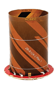
    Tallysman Wireless has added the housed HC885XF and embedded HC885EXF dual-band eXtended Filtering (XF) antennas to its line of helical antennas.

    The antennas receive GPS/QZSS L1/L5, GLONASS G1/G3, Galileo E1/ E5a/b, BeiDou B1/B2/B2a and L-band corrections services.

    Historically, dual-frequency antennas and receivers commonly supported GPS L1 and L2 and GLONASS G1 and G2. In recent years, GPS, GLONASS, Galileo, BeiDou and NavIC have added GNSS signals in the L5 frequency band (1160-1217 MHz).

    As a result, the new dual-frequency GNSS standard has become L1 and L5.

    Tallysman’s new HC885XF antenna has been tuned to provide optimal support for the entire L1/G1/E1/B1/L-band correction and L5/G3/E5/B2 bands.

    The radio frequency spectrum has become congested worldwide as many new LTE bands have been activated, and their signals or harmonic frequencies can affect GNSS antennas and receivers. In North America, the planned Ligado service, which will broadcast in the frequency range of 1526 to 1536 MHz, can affect GNSS antennas that receive space-based L-band correction service signals (1539-1559 MHz). New LTE signals in Europe [Band 32 (1452-1496 MHz)] and Japan [Bands 11 and 21 (1476-1511 MHz)] have also affected GNSS signals. Tallyman’s XF models mitigate the effects of these new signals.

    The Tallysman HC885XF housed helical antenna weighs ~42 g and is enclosed in a robust, military-grade IP67 plastic enclosure. The antenna base has an integrated SMA connector, a water-proofing O-ring, and three screw holes to enable secure attachment.

    Tallysman’s embedded HC885EXF helical antenna weighs ~8 g. It is easily mounted with an optional embedded helical mounting ring, which traps the outer edge of the antenna circuit board to the host circuit board or any flat surface. An MCX connector is installed in the base of the antenna.

    Tallysman HC885EXF and HC885XF antennas are suitable for a variety of applications, including lightweight unmanned autonomous vehicle navigation (land, sea, and air), land survey devices, automotive positioning, timing and other precise-positioning applications.

  • Analog Devices converter sets performance benchmarks for harsh environments

    Analog Devices converter sets performance benchmarks for harsh environments

    Radio frequency analog-to-digital converter sets performance benchmarks for space and harsh environments

    Photo: Analog Devices
    Photo: Analog Devices

    Analog Devices has released the AD9213S-CSH, a highly integrated RF analog-to-digital converter (ADC). The ADC is a 12-bit, 10.25 giga samples per second (GSPS) ADC in high-reliability packaging, with advanced production screening and quality inspection.

    It is the company’s fastest ADC available for the space environment.

    The AD9213-CSH enables the next generation of software-defined systems for satellite communications, radar and remote sensing, driving greater system integration, lower costs, reduced power consumption and decreased size, weight and power (SWaP).

    Additionally, a high sample rate and integrated post-processing enable further performance gains for narrow-band applications.

    The AD9213-CSH provides space customers with greater flexibility and the ability to process larger sections of the spectrum for electronic support measures, as well as increased-resolution radar designs.

    The wider Nyquist bandwidth allows satellite-communications customers to deliver products with increased bandwidth. In addition, wide input bandwidths combined with high sample rates enable new wideband digital predistortion architectures communications applications.

  • Bad Elf unveils base/rover feature for survey-grade GNSS accuracy anywhere

    Bad Elf unveils base/rover feature for survey-grade GNSS accuracy anywhere

    Photo: Bad Elf
    Photo: Bad Elf

    Bad Elf has introduced a base/rover feature built upon its Bad Elf Flex GNSS receiver. The new base/rover feature brings affordable centimeter-level accuracy to surveyors and geospatial professionals working anywhere in the world.

    The solution consists of two Flex GNSS receivers and two UHF radios, allowing customers to perform high-accuracy field data collection in areas where traditional real-time kinematic (RTK) corrections or cellular coverage is not available. Existing Flex customers can upgrade by adding Flex radio kits.

    Bad Elf designed the base/rover feature with emphasis on accuracy, affordability and versatility. The Bad Elf Flex enables reliable data collection either as a standalone receiver or paired with apps on iOS or Android phones and tablets. A checklist-based workflow ensures consistent results and eliminates many common issues associated with setup and deployment of a base/rover solution.

    Photo: Bad Elf
    Photo: Bad Elf

    “The Bad Elf app walks the user through these steps and more, and it doesn’t let the project proceed until each checklist is complete,” said Larry Fox, vice president of Marketing and Business Development at Bad Elf. “The automated checklists simplify every process, so that geospatial professionals and surveyors of every experience level get reliable results.”

    The base feature requires only one Flex Extreme and a radio kit. Customers may choose to use either Standard or Extreme Flex with a radio kit for rovers. Using Flex Standard and one daily token provides access to the rover feature.

    Bad Elf’s flexible hardware-as-a-service model provides a mechanism for customers to further reduce the capital cost of a complete base/rover system. In addition, customers can deploy multiple rovers in either configuration for larger projects.

    “For about one-third of the purchase price of competing products available today, our base/rover feature makes survey-grade one-centimeter accuracy a reality worldwide,” said Fox. “And our pay-as-you-go Flex Token model dramatically reduces operating expenses by allowing users to activate — and pay for — just the service levels needed on a given day.”

    Complete base/rover kits are available immediately, along with à la carte options for existing Flex customers. The Flex base/rover solution is compliant with FCC operating standards in the United States. Bad Elf provides customers with complete instructions for acquiring a radio operator license and call-sign designation.

  • Orbital Insight partners with Satellogic on satellite imagery and video

    Orbital Insight partners with Satellogic on satellite imagery and video

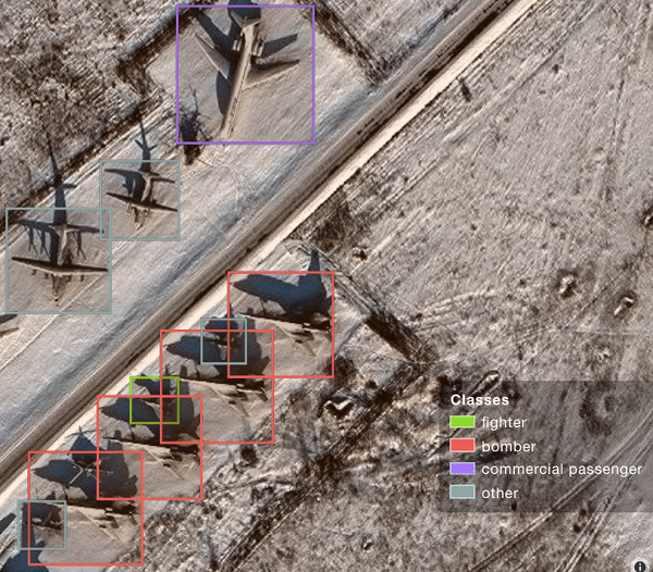
    A sample image from Orbital Insights showing classes of military aircraft at a base. (Image: Orbital Insights)
    A sample image from Orbital Insights showing classes of military aircraft at a base. (Image: Orbital Insights)

    Orbital Insight will integrate Satellogic’s high-resolution multispectral imagery, hyperspectral imagery, and full-motion video into its GEOINT platform

    Geospatial intelligence company Orbital Insight has partnered with Satellogic, a leader in sub-meter resolution satellite imagery collection. The partnership will integrate Satellogic’s high-frequency, high-resolution collections of satellite imagery and full-motion video into Orbital Insight’s platform and offer customers better access to high-quality data, improve the revisit rate, and reduce the cost of running analytics.

    Satellogic designs, manufactures and operates its own constellation of Earth observation satellites. It  has 22 operational satellites in low Earth orbit with plans to launch up to 12 additional satellites by the end of the year. The company aims to expand its constellation to more than 200 satellites by 2025 for daily global coverage of the entire surface of the Earth.

    Orbital Insight’s flagship GO platform combines information from the world’s sensors to analyze economic, societal and environmental trends at scale and support activity-based intelligence. Commercial businesses and government agencies use the self-service platform to synthesize answers to critical questions about what’s happening on and to Earth.

    Satellogic will provide high-resolution Earth observation data at vastly superior unit economics. This will allow Orbital Insight customers to increase the number of daily revisits on points of interest, see a more granular picture and get deep insights that were not possible before.

    “Advanced geospatial analytics require access to high-resolution, high-frequency satellite imagery and simple tasking,” said Kevin O’Brien, CEO, Orbital Insight. “Satellogic is disrupting the industry with a cost-effective, vertically integrated business model. This approach aligns well with our philosophy of making geospatial intelligence efficient, intuitive, and simple so that our customers can get timely insights, make critical decisions, and respond faster.”

    “Our mission is to enable greater access to critical Earth observation data. Working with Orbital Insight extends our reach, making our data available to more customers across diverse fields who need to know how the world around them is changing,” said Emiliano Kargieman, CEO and co-founder of Satellogic.

  • Draganfly drones head to Ukraine to meet medical needs

    Draganfly drones head to Ukraine to meet medical needs

    The first Draganfly humanitarian drone shipped to Revived Soldiers Ukraine (RSU) has arrived in Europe and will soon deliver insulin to hard-to-reach hospitals in Ukraine. Draganfly is a North American drone manufacturer.

    RSU ordered 200 Draganfly medical response drones equipped with temperature-managed payload boxes that can transport up to 35 pounds of blood, pharmaceuticals, insulin/medicines, vaccines and wound-care kits. Because insulin is a temperature-sensitive product, quick and safe transportation of the hormone is a top priority.

    About 2.3 million people in Ukraine live with diabetes. Many are Type 1 diabetics who need multiple daily injections of insulin to survive. For those living in high-conflict areas of the country, access to life-saving insulin is limited or non-existent.

    NuGen Medical Devices donated the needle-free injection devices and 5,000 needle-free disposable syringes to be filled with insulin. Not only are life-saving medical supplies like insulin dwindling in Ukraine, but there is also an urgent need for many medicines across the country as hospitals have been under direct attack since Russia invaded on Feb. 24.

    Draganfly medical relief drone. (Photo: Draganfly)
    Draganfly medical relief drone. (Photo: Draganfly)
  • Volvo adds Hemisphere GNSS smart antenna to construction options

    Volvo adds Hemisphere GNSS smart antenna to construction options

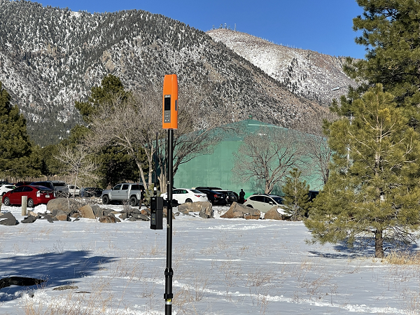
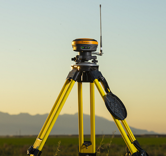
    The S631 smart antenna on a tripod. (Photo: Hemisphere GNSS)
    The S631 smart antenna on a tripod. (Photo: Hemisphere GNSS)

    Hemisphere GNSS distribution agreement with Volvo Construction Equipment to provide new S631 GNSS survey smart antenna

    Volvo Construction Equipment North America will add the Hemisphere GNSS S631 Survey Smart Antenna to its marketplace portfolio for Volvo CE dealers and end users. The new S631 adds robust performance and high precision in a compact and rugged package.

    The distribution agreement with Volvo CE expands Hemisphere GNSS’s list of partners offering Hemisphere’s latest technology for machine control products and solutions.

    The addition of the Hemisphere GNSS S631 Survey Smart Antenna aligns with Volvo CE’s focus on the latest technology and solutions for machine control applications, the company said.

    “Partnership between Hemisphere and Volvo Group companies goes back 15 years when we began to provide Volvo Penta our heading units for marine applications,” said Randy Noland, VP Global Sales and Business Development at Hemisphere. “That business provided a technological foundation between our two organizations that eventually brought us together again with Volvo CE as a provider of high-precision, rugged GNSS receivers for machine control for use in Volvo Co-Pilot products. We are pleased the partnership continues to grow, with additional GNSS receivers now available as an extended offering through Volvo CE North American dealers. We greatly value our relationship.”

    About the S361 Smart Antenna

    The S631 provides robust performance and high precision in a compact and rugged package. With multiple wireless communication ports and an open GNSS interface, the S631 can be used in a variety of operating modes, as a rover or base station.

    The built-in web user interface (WebUI) can be used to control and manage the receiver status and operation, as well as to upgrade the S631 with new firmware and activations.

    Corrections. S631 is Athena-enabled and Atlas-capable (subscription required). With Athena, S631 provides precision RTK performance when receiving corrections from a static base station or network RTK correction system. With multiple connectivity options, the S631 allows for RTK corrections to be received over radio, cell modem, Wi-Fi, Bluetooth or serial connection.

    The S631 receiver also enables users to work with Atlas, Hemisphere’s global correction service. Atlas delivers worldwide centimeter-level correction data over L-band communication satellites.

    Key Features

    • Multi-frequency GPS, GLONASS, BeiDou, Galileo, QZSS, IRNSS and Atlas L-band
    • Long-range RTK baselines up to 50 km with fast acquisition times
    • UHF (400 MHz and 900 MHz), cellular, Bluetooth and Wi-Fi wireless communication
    • Athena GNSS engine for precision RTK performance
    • Internal sensor corrects collected point coordinates to within 2 cm
  • Septentrio to provide GNSS positioning to MicroPilot UAV autopilots

    Septentrio to provide GNSS positioning to MicroPilot UAV autopilots

    Image: Septentrio
    Image: Septentrio

    The collaboration ensures smooth and easy integration of high-accuracy GPS/GNSS positioning and professional-level autopilots into control systems where safety and reliability matter

    Septentrio is collaborating with MicroPilot, maker of professional UAV autopilots.

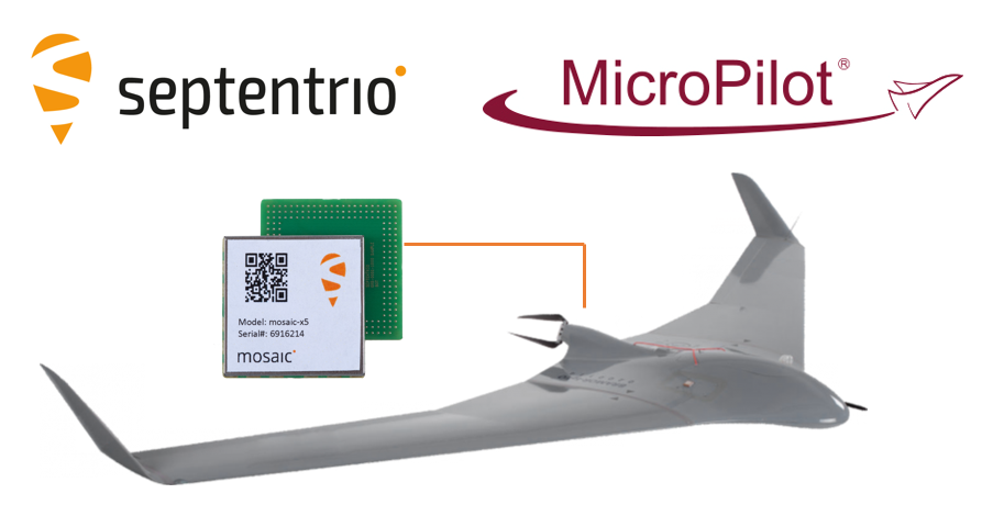
    Septentrio receivers, including the small form factor mosaic modules, as well as the OEM board AsteRx-m3, will support seamless integration of positioning and orientation into MicroPilot’s autopilot ecosystem.

    MicroPilot chose Septentrio GNSS receivers for their resilience to radio interference such as jamming and spoofing, as well as security and robustness with high-accuracy real-time kinematic (RTK) positioning.

    Self-interference or self-jamming is a common occurrence in UAVs, where devices such as cameras, servos or antennas, which emit electromagnetic radiation, are located close to the GPS receiver. Incorporating GNSS technology that is resilient to jamming and spoofing, in combination with reliable professional-level autopilots, is key to safe and secure flight navigation, according to Septentrio.

    “Adopting new and resilient technology in UAVs is vital, and we want to ensure a smooth integration process into professional drone systems,” said Gustavo Lopez, senior market access manager at Septentrio. “We are very excited about the strong collaboration between Septentrio and MicroPilot, which now provides new alternatives to drone companies looking for safe and reliable flight operations.”

    In addition to developing autopilots, MicroPilot provides supporting software and services that enable customers to use development time more efficiently, reducing time to market.

    “Working closely with Septentrio gives MicroPilot the ability to better leverage resilient and robust GNSS technologies strengthening our offering to the professional UAV market for safe and reliable flight control,” said Howard Loewen, president of MicroPilot.

  • Orolia partners with Meta to improve timing network

    Orolia partners with Meta to improve timing network

    The open-source collaboration features Orolia Atomic Reference Time Cards powered by its Spectratime micro-atomic clock

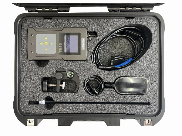
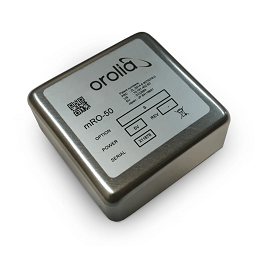
    Logo: OroliaOrolia is providing Atomic Reference Time (ART) Cards to support Meta’s implementation of high-precision timing protocols within its distributed timing infrastructure. The architecture of Orolia ART Cards is powered by the company’s Spectratime mRO-50 mini rubidium atomic-clock technology.

    The Spectratime mRO-50. (Photo: Orolia)
    The Spectratime mRO-50. (Photo: Orolia)

    “We are honored to have this opportunity to collaborate with Meta’s incredibly talented team of engineers to develop a unique open-source solution using our mRO-50 technology,” said Jean-Yves Courtois, Orolia CEO. “We look forward to a continuing partnership with Meta and other global network leaders working to advance solutions to ensure ongoing timing accuracy and resilience.”

    Orolia developed the ART Card solution in collaboration with the Meta engineering team to fulfill a new specification that Meta published for the Time Appliances Project Initiative of the Open Compute Project. This new collaborative community is focused on designing from scratch new hardware and software to efficiently support the critical timing accuracy and resilience demands on computer network infrastructure. This project is fully open-sourced and available on Orolia’s GitHub.

    Meta logoIn 2020, Meta began converting its data-center servers to a new time-distribution service based on network time protocol (NTP) and precision time protocol (PTP). The new service, built in-house and later open-sourced, was more scalable and improved the accuracy of timekeeping within the Meta infrastructure from 10 milliseconds to 100 microseconds. Orolia ART Cards will further increase the accuracy, resiliency and adoption of Meta’s new timing platform.

    Developed with long-term support in mind, Orolia’s ART Cards deliver management, disciplining and monitoring functions that can be integrated into any computer with a PCIe port and bring accurate and resilient timing for the most demanding applications such as NTP/PTP time reference, time stamping and latency calculation.