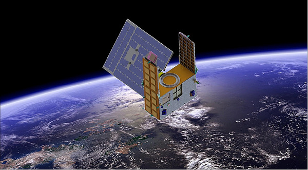
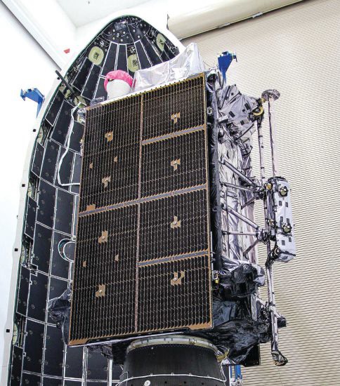
Artist’s illustration of a GNOMES satellite. (Image: Blue Canyon)
A new GNSS radio-occultation (RO) satellite is now in orbit. The GNOMES-3 — GNSS Navigation and Occultation Measurement Satellite — flew aboard the SpaceX Falcon 9 Transporter-4 rideshare mission on April 1 and was launched into a 646-km circular sun-synchronous orbit. The payload was powered on and operating nominally within four days of launch.
The GNOMES-3 was manufactured for PlanetiQ by Blue Canyon Technologies LLC, a wholly owned subsidiary of Raytheon Technologies. Using refracted GNSS signals, PlanetiQ can determine the density and moisture content of the atmosphere to improve weather predictions, helping improve NOAA weather models.
The GNOMES-3 joins GNOME-2 on orbit and is expected to achieve highly accurate GNSS-RO measurements using the fourth-generation Pyxis-RO sensor. PlanetiQ plans to launch more Pyxis-RO atmospheric and ionospheric sounding spacecraft in 2023. In all, PlanetiQ plans for a fleet of 20 GNOMES by 2024.
The GNOMES-2, launched in June 2021 on SpaceX’s Transporter-2 mission, produces more than 3,200 soundings of the Earth’s atmosphere and 5,000 ionosphere soundings per day with a large-aperture RO antenna that tracks all four GNSS constellations: GPS, Galileo, GLONASS and BeiDou.
The soundings have sufficient signal-to-noise ratio to indicate the location of the planetary boundary layer, as well as detect super refraction at the boundary layer and near the Earth’s surface. The higher quality GNSS-RO soundings, along with the associated lower troposphere assimilation tools, will be used to produce more accurate weather forecasting and hurricane tracking, and aid in energy, transportation and agriculture industries as well as serve as a climate record with its SI-traceable data.
RedLore has launched a high-resolution version of Locus Site, its patented solution for high-accuracy onsite positioning. The real-time location system (RTLS) pinpoints assets down to one-half foot or 15 cm without requiring wiring throughout the facility.
Locus Site provides high-accuracy tracking for companies and facilities where installing wires is not possible. A 200,000-square-foot facility can be equipped with positioning capability in one day.
“The world’s logistical processes are today stretched to the breaking point,” said RedLore CEO Niek Van Dierdonck. “Keeping track, in real-time, of the location and condition of assets onsite and during loading and unloading provides an immediate improvement in efficiencies. Locus Site offers exactly that at a fraction of the cost and burden of other systems.” The system uses wireless sensors and asset tags, configured with a desktop app and supported by a mobile app.
Locus Site is used by manufacturers, healthcare service providers, construction companies, logistics companies and others to track everything in their facility without manual intervention.
The U.S. Army Corps of Engineers, St. Louis District, has contracted with Aero-Graphics for photogrammetric and lidar surveying and mapping for the next five years. Aero-Graphics is a 56-year-old geospatial services company headquartered in Salt Lake City, Utah.
The $16 million contract is an indefinite delivery indefinite quantity (IDIQ), firm-fixed-price contract.
The services requested are for photogrammetric mapping and related surveys, as well as the preparation of maps for advance planning, design, real property, construction, land-use and land-type monitoring, and analysis for various projects.
“Being awarded the USACE St. Louis District contract is an honor, especially because we will support the Center of Expertise for Photogrammetric Mapping,” said Casey Francis, Aero-Graphics co-president. “Their focus on geospatial rapid response and technical proficiency is directly aligned with Aero-Graphics’ unique process. Our entire team looks forward to supporting this exciting contract.”
Francis added, “Our mantra is ‘agile responses to ever-changing environments.’ We look forward to demonstrating our unique abilities to the St. Louis District, enabling them to accomplish their mission of securing our nation, energizing our economy, and reducing disaster risk.”
New business development specialist hired
Angela Arriaga
In other company news, Aero-Graphics appointed Angela Arriaga as its new business development specialist. In her role, Arriaga will be responsible for expanding the company’s client base.
Arriaga comes to Aero-Graphics with more than 10 years of experience in geospatial, aviation, processing and surveying. “Angela has a strong background in operations management in lidar and ortho imagery,” Francis said.
“Aero-Graphics has always been a staple in this industry with an outstanding reputation and a commitment to excellence,” Arriaga said. “It’s exciting to be a part of this incredible team. The leadership is fully committed to professionalism, passion and enthusiasm for the work. I am looking forward to help continue its expansion and the success of our customers.”
Mason and Dixon were pioneers in bringing geodetic astronomy to the American colonies. Through the efforts of the Mason and Dixon Line Preservation Partnership, we can promote this scientific contribution along with the placement of the boundary stones.
Ask surveyors why they became engaged in the profession and why they had continued with it, most will centralize on one aspect: working outside. A career that allowed them to work outside in various environments, solving problems, and being part of a solution is typically the main answer they give.
Depending on the task at hand, a day in the field surveying can take one to several places, including urban/suburban neighborhoods, construction sites, and agricultural/wooded farmland.
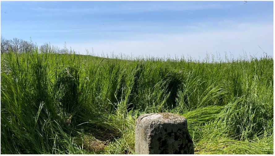
View from Mason Dixon Stone #95 looking toward Maryland. (Image: Tim Burch)
My entry into surveying was no different. From residential sites, condominium surveys, boundary and topographic surveys, and construction layout, my early years in surveying covered a lot of territory. While my career eventually took me out of the field and into an office managerial role, and now into leading a professional association, it does not erase the roots of one’s surveying knowledge and experience. Opportunities to be part of the field exercises of a survey, especially a boundary survey, are typically rare and subject to time constraints.
Having spent all my life in the flat topography of Illinois and surrounded by farm fields and urban sprawl, the ability to see for miles over the various horizons was the norm. Coupling these conditions with the Public Land Survey System (PLSS) and use of GNSS technology, it makes for a great environment for the professional surveyor to go about his or her work.
However, the United States covers many areas and contains distinct types of terrain, ecosystems and demographic groups that provide challenges to the surveyor. While I assumed moving from Illinois to the mid-Atlantic region would require adaptation, an opportunity to help retrace and inventory a significant part of American history provided me with an eye-opening experience. It also helped me appreciate the legacy of our surveying forefathers.
A small title dispute
Even in the 17th and 18th centuries, disagreeing title descriptions to common lands was an issue. Reviewing two conflicting legal descriptions describing adjacent land boundaries is the basis of this survey exercise, and thus began a symbolic establishment of a famous boundary line that would lead to political and demographic ramifications in later years.
Here is the situation:
1632: King Charles I grants to Cecilius Calvert (second Lord Baltimore), a royal charter for establishing a new colony north of Virginia to a point “which lieth under the Fortieth degree of north latitude” and westward to the source of the Potomac.
1681: King Charles II (eldest son of Charles I) grants William Penn a royal charter of land between 43° N and a line extending westward from “a Circle drawn at twelve miles distance from New Castle…” to “the beginning of the fortieth degree….”
1682: King Charles II grants to William Penn an additional grant in the Delaware peninsula, which Lord Baltimore claimed.
1685: King Charles II directed his Board of Trade and Plantations to issue an edict ordering that territory to be divide equally, the western half going to Baltimore. This order endorsed Calvert’s claim of a boundary line being 19 miles to the north and providing him claim to Philadelphia. Part of the edict placed a burden on Calvert of providing a survey to authenticate the claim, but the survey was not completed. The boundary would eventually be established 19 miles to the south.
1731-1732: Charles Calvert, the fifth Lord Baltimore, petitioned King George II for help in demarcating the final boundary. He agreed on the final boundaries; however, a commission created to study the legal claims failed to deliver instructions in which a survey would be based upon. Calvert disputed its interpretation and refused to implement the arrangements.
1730s: Ongoing conflict over the disputed land claimed by both people from Pennsylvania and Maryland resulted in Cresap’s War, named after the land agent, Thomas Cresap, hired by Calvert to settle new development. In 1736, Cresap was accused of murder, arrested by Pennsylvania officials and his housed burned was burned down.
1750: After years of bitter controversy, British Lord Chancellor Hardwicke ruled that the southern boundary of Pennsylvania should be a line running westward from the point at which the line dividing the Delaware peninsula was tangential to a circle with a radius of 12 miles from the center of Newcastle.
After 100+ years of boundary disputes and deadly confrontations, in 1760 Frederick Calvert was directed by the English monarch to accept the terms of the 1732 treaty.
Penn-Calvert Land Grant Agreement. (Image: National Archives)
The unfilled challenge, however, was to commission a survey to establish the terms of the agreed-upon boundary. Given that the final location of the Pennsylvania/Maryland border was geographically based (approximate latitude of N 39°43’20”), the surveyors chosen to establish this line would have to be knowledgeable in such calculations.
Finding qualified surveyors in the colonies turned into a bigger challenge than first considered, so the monarchy assigned two surveyors from the Royal Society (full name: Royal Society of London for Improving Natural Knowledge). Enter Jeremiah Dixon (surveyor) and Charles Mason (astronomer) — the field party charged with tackling this monumental deed.
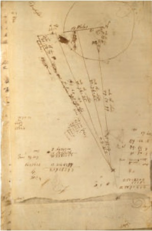
The survey calculations of Charles Mason. (Image: National Archives)
We know them by name for the lines they established in fulfilling the requirements of the boundary agreement, but how they accomplished their task remains a mystery to most. Previous exercises using geographical position determination was used in the sailing and shipping industries with lesser degrees of accuracy. This assignment would require higher levels of accuracy and precision, hence the reason for calling upon Dixon and Mason for the task.
By using geodetic astronomy, they were able to determine accurate (for the period) geographical positions of latitude. Geodetic astronomy is the art and science for determining, by astronomical observations, the positions of points on the earth and the azimuths of the geodetic lines connecting such points. It relies on spherical astronomy, using calculations and techniques developed by the Greeks in the second century A.D.
Besides the knowledge of performing the necessary calculations, the duo would also need to possess instruments to gather the accurate astronomical information. The survey of the agreed-upon line was to be established upon a constant line of latitude. The survey procedures would require turning angles (azimuths) from their meridian westwardly with accuracy not yet utilized in the New World.
Both instruments used for the project were built by John Bird, a well-respected instrument maker in London. The equipment consisted of a zenith sector, capable of measuring to two arc seconds. No field azimuth instrument of this accuracy existed in that era. They also brought a converted telescope/level set up for surveying purposes. This transit has no divided horizontal “plate,” only a tangent screw for slow azimuth motion.
In addition to the instruments and astronomical tables from Greenwich and Paris, the duo relied on a highly precise clock for marking time by the second, which was quite advanced for the period.
Dixon and Mason spent the better part of 1766-67 establishing the agreed-upon line using astronomy via the Bird instruments and taking copious notes documenting their calculations and survey conditions.
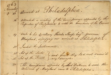
Field notes from Jeremiah Dixon. (Image: National Archives)
The markers set along the way —stone monuments chiseled back in England with demarcations — were quite accurately established despite the primitive nature of equipment and methodology for the survey. Mason and Dixon laid out the 233-mile long “West Line” in short segments, following the latitude arc of approximately N39°43’20” for 233 miles westward.
Old line versus new technology
In 2020, the Maryland Geological Survey (MGS) and the Pennsylvania Historical & Museum Commission (PHMC), members of the Mason and Dixon Line Preservation Partnership, began a new initiative to inventory these historic markers and submit them for inclusion into the National Registry. If accepted, the monuments will be part of a program established to help protect and preserve these physical boundary markers that define the boundary between the two states.
Part of the inventory has been the recovery and position confirmation by volunteer surveyors from the Maryland Society of Surveyors (MSS) and the Pennsylvania Society of Land Surveyors (PSLS). Using a geographic information system (GIS) app designed and implemented by the Maryland Geological Survey (MGS), volunteer retracers capture significant attributes about each monument.
While reestablishing the latitude/longitude of the recovered monuments with a smartphone or handheld GPS receiver is sufficient, several volunteers have used high-accuracy surveying equipment to determine a monument’s position.
Incredibly, the variation in the location of a given monument is well within reasonable tolerances from the originally intended installation. Also, because of GNSS technology, we now know more about continental drift. Because of this additional knowledge, 250+ years of tectonic plate movement should be considered when making these positional comparisons.
It should be noted that these monuments are a critical component of the boundary between states, and therefore must be considered senior to many other survey corners set after them. We cannot get lost in the sentimental aspect of recovering the monuments and not acknowledge the fact these points are the gospel when it comes to defining these state boundaries.
A Midwesterner in a ‘foreign’ land
My surveying career, as noted above, was solely in a state that is 200 years old, based upon the PLSS, and does not carry the history of the Mason-Dixon era of line establishment. So, when I was presented with the opportunity to join fellow surveying professionals from Maryland and Pennsylvania in recovering Mason-Dixon monuments for the inventory, I found it an easy event to join.
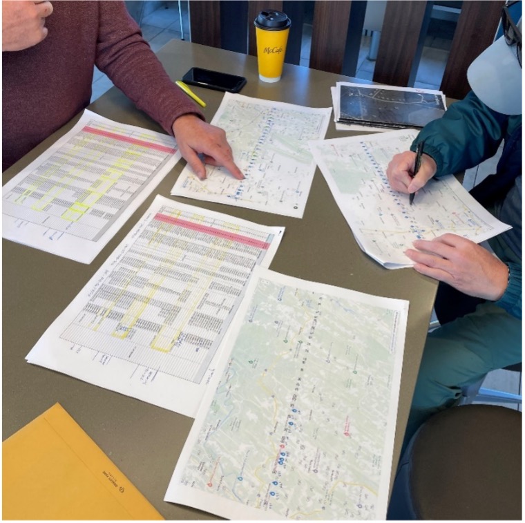
The planned meeting spot was a local fast food place at 8 a.m. on a sunny Saturday. Being it was in a small town, there were several groups meeting for their normal Saturday coffee klatches. Hearing a group mention “surveying,” I found my opening to identify myself as a fellow surveyor. After opening pleasantries, we settled into a game plan for recovering the targeted monuments for the day.
Planning a day of stone monument recovery along the Mason-Dixon line. (Photo: Tim Burch)
We settled on our assignments and enthusiastically went about our way. My partner for the day was Eric Gladhill, a Pennsylvania professional surveyor and veteran of Mason-Dixon monument retracement. In addition to his volunteer work, he has also authored several articles and a book on his surveying experiences, so it was quickly evident that we were in for a good day.
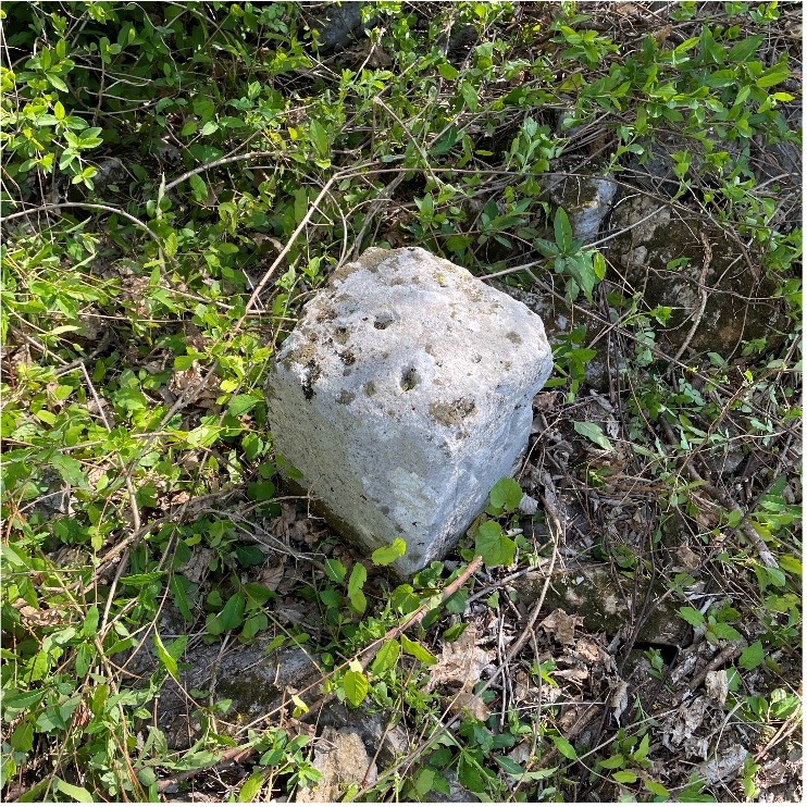
The first monument was not difficult to get to, and seeing it nearly brought a tear to my eye. Here before me was my first sighting of a Mason-Dixon monument stone, and it was simply amazing. Standing there admiring this 250+ year old stone, hand cut and carved in England and brought here by ship to be specifically placed on this line, I could not help but realize the importance of this monument.
This line, and these stones, were the culmination of two land grants that disagreed with each other more than 400 years ago. We were standing in the same location as a large survey party once did, where they observed the stars to determine an accurate position and directed axmen to clear the untamed forest to establish this important line. While it was a warm and sunny day, it gave me a chill to know we were following in the footsteps of our surveying forefathers.
Mason Dixon Stone #98 – My first recovery! (Photo: Tim Burch)
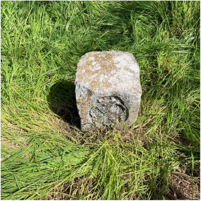
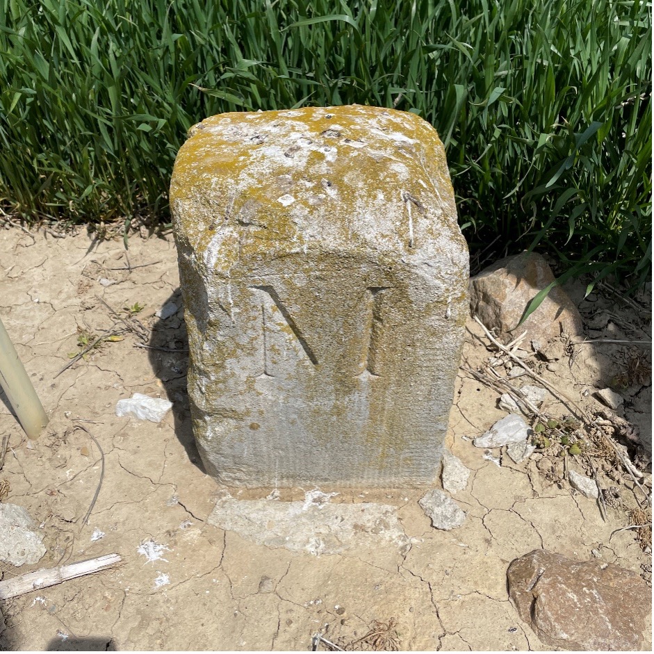
We continued our way and recovered six more monuments, including a crown stone. Crown stones were placed at 5-mile intervals. The detail in the carvings for most of the monuments was noticeably clear, and is a testament to the craftsmanship of the era’s stonecutters.
Mason Dixon Stone #95, a crown stone. (Photo: Tim Burch)
While locating these historic monuments, were felt we were standing on hallowed ground. The location of this line was important enough that people, both indigenous and settlers, fought for the right to build their lives there.
This was also a line that would be the site of many battles during the Civil War. Observing these monuments drove home the fact that surveyors play important roles in establishing land ownership both today as well as almost 300 years ago.
Mason Dixon Stone #93, a Maryland side marking. (Photo: Tim Burch)
Mason and Dixon were pioneers in bringing geodetic astronomy to the American colonies. Their work has provided inspiration for future generations of geospatial professionals, yet most of the public does not know about that portion of their contribution. Hopefully, through the efforts of the “Mason and Dixon Line Preservation Partnership,” we can promote this scientific contribution of Mason and Dixon along with the placement of the boundary stones.
My heartfelt thanks go out to Eric along with Wayne Aubertin and Rob Kundrick (Appalachian Chapter of the Maryland Society of Surveyors) for allowing me to join them for this task. They gave me a chance to be a true surveyor again and connect the past with the future.
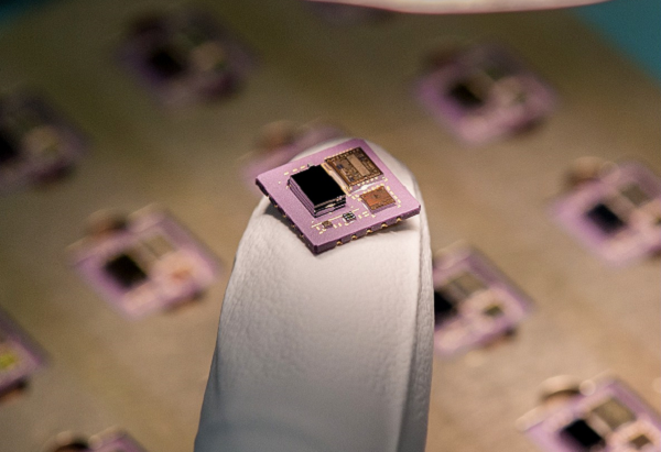
Safran Electronics & Defense is taking a major step forward in its inertial navigation strategy by grouping two subsidiaries, Safran Colibrys (Switzerland) and the recently acquired Sensonor (Norway,) under a single banner, Safran Sensing Technologies.
The similarities in expertise, market position, customers and technologies result in clear synergy between these two companies, which produce accelerometers, gyrometers and inertial measurement units (IMUs). The creation of Safran Sensing Technologies shows Safran’s commitment to developing its micro-sensor business through these two companies.
The STIM380H inertial measurement unit. (Photo: Sensonor)
The goal is to jointly offer a wider and comprehensive range of inertial technologies including vibrating sensors, optics and micro-electromechanical system (MEMS) for applications in aeronautics, defense, space and other industries.
The two subsidiaries have already delivered more than 20 million MEMS sensors to the aeronautics, defense, space, transport, mobility and industry sectors. For example, MEMS are used in the control accelerometers of automobile airbags, in high temperature accelerometers for guiding drill heads, and in seismic sensors measuring the structural health of buildings or civil engineering works. They are also used in IMUs for civil, military and space vehicles.
This change is part of a broader Safran Electronics & Defense strategy designed to strengthen the company’s position in the positioning, navigation and timing (PNT) market.
The two entities have been renamed Safran Sensing Technologies Norway AS and Safran Sensing Technologies Switzerland SA, respectively.
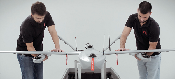
The AR3 maritime surveillance drone, usually launched horizontally, can be launched vertically with attachable propellers. (Photo Tekever)
Tekever, a European maritime surveillance provider, has unveiled a new version of its AR3 unmanned aerial system (UAS). The AR3 now has a “hot-swappable” vertical-takeoff-and-landing (VTOL) capability, able to switch from horizontal launch to vertical. It also now has integrated synthetic aperture radar (SAR).
Tekever made the announcement at AUVSI Xponential 2022 in Orlando, Florida. The company specializes in maritime surveillance services that deliver actionable real-time intelligence. The AR3 is a shipborne UAS designed to support multiple types of maritime and land-based missions up to 16 hours. With the upgrade, the AR3 becomes more operationally flexible, the company said.
“Users no longer have to choose between having pure fixed-wing assets for longer endurance missions, or fixed-wing VTOL assets for more challenging deployment conditions,” explained Ricardo Mendes, Tekever CEO. “The AR3 combines both capabilities and provides users with the ability to decide the configuration just moments before takeoff.”
The newly added SAR provides the AR3 with a vastly greater operational range, and the ability to effectively detect, recognize and identify targets under any weather condition. Covering more than 20,000 square nautical miles per mission, the new AR3 is the suitable for wide-area surveillance missions.
“Our SAR, which we named Gamasar in honor of the Portuguese navigator Vasco da Gama, is designed and built by Tekever specifically to provide our customers with capabilities that are typically only available through much larger systems,” Mendes said. “With an extremely reduced logistics footprint, the unprecedented VTOL flexibility and the unique capabilities provided by Gamasar, the new AR3 is a game changer that provides our customers with tremendous value and cost effectiveness.”
Auterion has introduced new capabilities for high-precision mapping missions and automated, end-to-end data workflows to make mapping more efficient, reliable and powerful across industries.
Unveiled at AUVSI Xponential 2022, updates to the Auterion OS serve enterprises with diverse use cases that need component and payload flexibility, alongside a centralized and streamlined software workflow.
Advantages for customers include:
Availability of precise mapping data in real time and automated processing that enables fast decision-making, saving time, ensuring consistency and reducing human errors.
Standardized process across any Auterion-powered vehicles, bringing an improved user experience, reducing training time, and affording easy scaling of operations.
Connectivity that enables automated end-to-end workflows with no need for manual data transfer, and integration with third-party data-processing software such as Esri Site Scan or Propeller.
“The mapping and workflow features included in this latest release of Auterion’s software focus on use cases from our enterprise customers,” said Markus Achtelik, vice president of engineering at Auterion. “We’re making sure that workflows are thoughtfully designed to meet customer needs and that the data they require is collected, automatically processed and streamlined through Auterion’s software platform for immediate use and longer term analysis.”
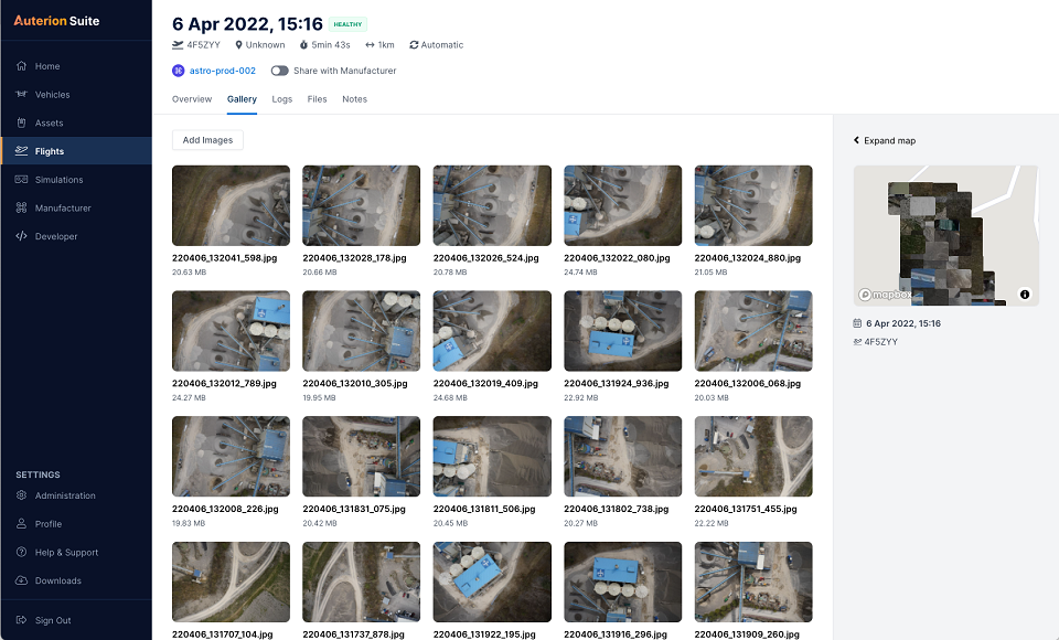
Auterion’s new platform capabilities are achieved through the enhancement of tightly integrated components. For example, the ground control app provides precise mission execution with fully integrated control of payloads, such as the Sony α7R IV camera. Then, capture and storage of geotagged images on the drone occur in real time.
Next, image data correction and processing happen seamlessly. This kind of automated workflow illustrates Auterion’s commitment to building efficient operational solutions for enterprise-ready drones, the company said.
“Auterion’s software is updated with its expanding open ecosystem in mind,” added Achtelik. “That gives customers the best options on the market, offering greater flexibility and choice to meet enterprise quality, scale, and regulatory needs.”
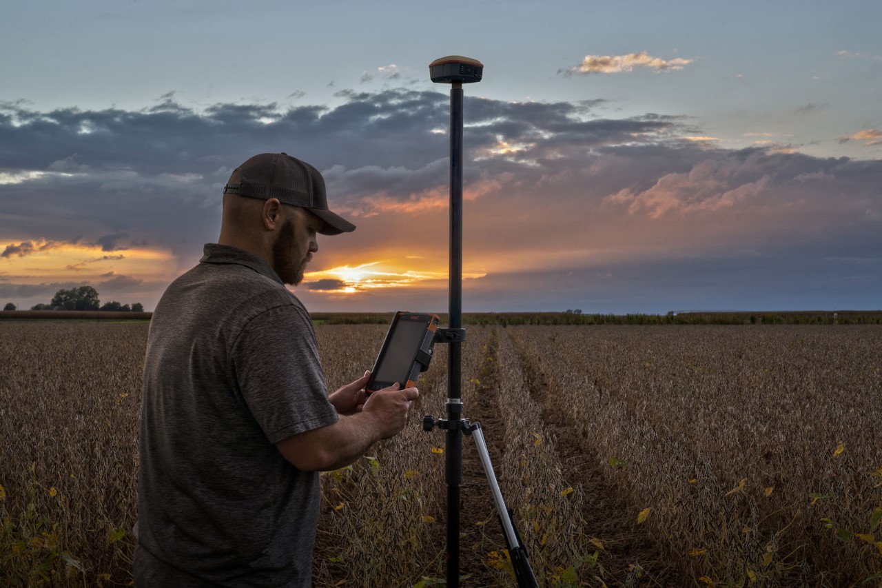
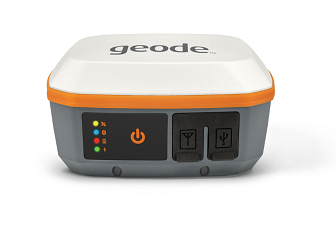
Juniper Systems has introduced the Geode GNS3 GNSS receiver, which allows users to collect real-time GNSS data with sub-meter, sub-foot and decimeter accuracy options.
With a scalable platform, users can purchase the level of accuracy they need now, while having the option to increase accuracy in the future.
“This new Geode offers expanded accuracy options to our users,” said John Florio, Geode product manager at Juniper Systems. “We set out to deliver a product that is scalable to our user’s needs. The GNS3 allows users to purchase a receiver that fits their accuracy needs at the moment, while still being able to unlock greater accuracy through subscriptions when that need arises.”
Photo: Juniper Systems
Available in both single-frequency and upgradable multi-frequency antenna configurations, users have the level of accuracy needed to get the job done. The Geode GNS3S offers superb sub-meter accuracy with a single-frequency antenna. The GNS3M allows for scalable accuracy; its multi-frequency antenna support all constellations on L1, L2 and L5 frequencies.
Multi-frequency signal tracking, together with Atlas L-band correction subscriptions, allow for up to decimeter accuracy. As with previous Geode devices, SBAS corrections are available for sub-meter accuracy in certain regions.
Both models also support local differential GNSS real-time kinematic (RTK) and continuously operating reference networks (CORS) through the Geode Connect NTRIP client.
“Providing Atlas corrections and scalable accuracy allows for the Geode to be used in new markets,” Florio said. “A few of these include water utility locating, agriculture and irrigation mapping, mapping projects in remote locations where other correction services are not available, and any other mapping need that requires a higher degree of accuracy.”
The Geode GNS3 offers flexible connectivity and can be used with Windows, Android, iPhone and iPad devices. A USB-C port allows for data transfer and fast charging and an antenna port allows for the use of an external antenna.
The Geode GNS3 GNSS receiver is now available worldwide.
Winners will present their projects at ION GNSS+ 2022 in Denver
The Institute of Navigation’s Satellite Division, in partnership with Google, will host the 2nd annual Smartphone Decimeter Challenge, with the winning teams presenting their methods at the ION GNSS+ 2022 meeting. ION GNSS+ 2022 takes place Sept. 19–23 at the Hyatt Regency Denver, adjacent to the Colorado Convention Centerx.
The Smartphone Decimeter Challenge is designed to advance research in smartphone GNSS positioning accuracy using state-of-the-art algorithms and technologies such as advanced machine learning models and precision GNSS algorithms.
While standard receivers using signals from GPS, other GNSS (Galileo, BeiDou, GLONASS) and regional systems (QZSS and IRNSS) provide accuracy between 3 and 10 meters (often worse in urban environments), better location can be obtained by processing carrier-phase measurements, inertial measurement unit (IMU) data, and base station corrections.
Teams will use datasets collected using the GPS receivers and IMUs of Android smartphones to compute location down to an accuracy of decimeters. Mobile users will benefit from lane-level-accuracy-based services, enhanced experience in location-based gaming, and greater specificity in location of road safety issues.
Winner selection is based on the accuracy of results from the test datasets compared to highly accurate ground truth. The top three winners will receive prizes valued at $15,000+ including a guaranteed speaking slot at the highly competitive ION GNSS+ 2022 conference (subject to technical paper and ION presentation requirements); a travel subsidy; and complimentary registration to attend ION GNSS+ 2022 in Denver.
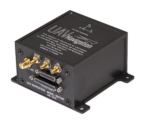
UAV Navigation has confirmed the safety and reliability of its Vector-600 autopilot for civil applications with an independent study. The study was performed as part of the European Union VaNeT project, and conducted by third-party company Anzen Engineering.
An autopilot system in an unmanned aerial vehicle (UAV) is the heart of the flight control system. For the Vector-600, the study included a reliability prediction report (RPR), failure mode effects and criticality analysis (FMECA) and fault tree analysis (FTA).
Reliability Prediction Report. The RPR analyzes probability of failure of every single sensor and component inside a system. It helps define component failure rates and, consequently, a prediction of the time that the VECTOR-600 is expected to operate free of failures under given operating conditions. According to this, the VECTOR-600 has shown a mean time between failures of more than 19,500 hours.
Failure Mode Effects and Criticality Analysis. A FMECA study identifies potential failures of system functions and assesses their effects, so that mitigation actions can be defined. It is a bottom-up analysis considering each single elementary failure mode and assessing its effects.
Fault Tree Analysis. Fault trees are a classic deductive analysis technique useful for both qualitative and quantitative analysis. For the Vector-600, a quantitative FTA provided probability estimates for major hazards, as well as identifying single-point failure modes and guiding further design for hazard reduction. According to the results, Vector-600 showed a probability of loss of mission per flight hour of 1,809E-05 under its operating conditions.
“The FMECA, RPR, and FTA analysis performed by the external and independent company Anzen have proven that our most advanced autopilot, Vector-600, is one of the most reliable GNC [guidance, navigation and control] systems for NATO Class I and II unmanned aircrafts available in the market and enables our clients to execute missions ensuring safety,” UAV Navigation stated in a press release.
The EU regulation framework defines three classes of operations: open, specific and certified. In specific and certified category operations, including most professional UAS flights, operators and aircraft manufacturers need to prove safe operation of their platforms. For this reason, the study of the reliability of the systems involved in the UAV becomes a must to demonstrate the system can operate free of failures under specific operational conditions.
By Michael J. Dunn, Space Systems Command, Capability Area Integrator for Positioning, Navigation and Timing
The Global Positioning System is the premier positioning, navigation and timing (PNT) source for more than six billion users worldwide. It is vital to the function of all 16 of the United States’ essential critical infrastructure components. Life as we know it relies on the essential services that GPS provides.
The United States Space Force (USSF) is committed to maintaining a healthy GPS constellation that continues to deliver the “gold standard” of PNT availability and reliability throughout the world. Continuous improvements in equipment and performance have been a hallmark of the enterprise since its inception. 2021 was no exception, with a continued record-setting delivery of new capabilities.
Space Systems Command (SSC) at Los Angeles Air Force Base in El Segundo, California, is laser-focused on delivering the most important modernization in GPS history. The government and industry team are committed to bringing major upgrades to the space, control and user-equipment segments. It is an exhilarating time for the GPS enterprise. The specific updates within each segment cement the continued evolution in GPS and the USSF commitment to delivering advanced capabilities to the nation and the world.
Space Segment
Currently, 37 GPS satellites are on orbit, with 29 satellites set healthy. The baseline constellation requirement is 24 satellites. The system continues to perform in stellar fashion, providing an average 48-centimeter position accuracy throughout 2021.
Orbital systems modernization is focused on the GPS III satellite fleet, and the program continues to deliver peerless capabilities. GPS III space vehicles (SV) 1–4 were all operationally accepted in 2020. In 2021, the most notable event was the launch of GPS III SV05 in June. The satellite successfully achieved operational acceptance and mission-capable status for USSF in just under two weeks: a new record. SVs 6–8 are available for launch and are awaiting their launch windows. SV09 system-level testing is in progress. SV10 component deliveries continue. GPS III provides up to eight times better anti-jam and a new L1C signal to improve user connectivity.
For the GPS IIIF program, the long-range picture remains bright as the contract for GPS IIIF SVs 15–17 was awarded in October 2021. The delivery of the first GPS IIIF is expected early in 2026. GPS IIIF will build upon the tremendous increase in capability provided by GPS III with the addition of a search-and-rescue payload, a laser retroreflector array for precise ranging, a fully digital navigation payload, and a Regional Military Protect capability that will provide 60 times greater anti-jam for operations in electromagnetically hostile environments.
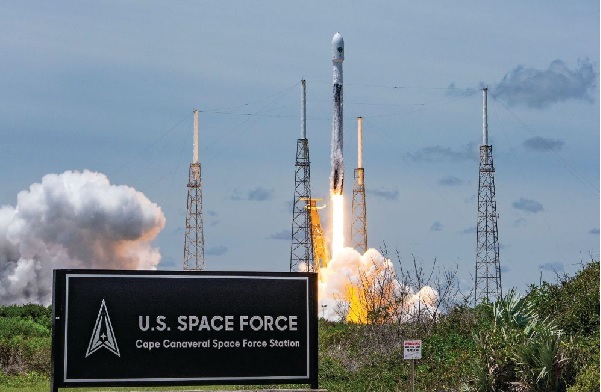
GPS III space vehicle 05 (GPS III-SV05) launched in June 2021 from Cape Canaveral Space Force Base, Florida, aboard a SpaceX Falcon 9 launch vehicle. (Photo: SpaceX)
Control Segment
The next-generation Operational Control System (OCX) continues to execute within its program baseline. OCX will provide enhanced command and control capabilities, modernized architecture, robust information assurance and cyber security.
OCX’s incremental development approach began with OCX Block 0, which is the launch and checkout system (LCS) for GPS III. The LCS successfully supported the launch and checkout of GPS III SV 01–05. OCX Blocks 1 and 2 will control all legacy GPS III satellites and both legacy and modernized signals.
Despite barriers presented by the global COVID-19 pandemic, all 17 global OCX monitoring station installations were completed in July 2021. Most of the remaining equipment was fielded throughout December 2021. System integration and verification continues with transition to operations scheduled for early 2023.
The Next Generation OCX 3F contract was awarded in April 2021. The program will modify OCX to launch and control GPS IIIF satellites with enhanced capabilities. Acquisition Milestone B is expected in 2022, and operational acceptance is planned for 2027.
MGUE: The future warfighter’s battlespace edge. (Image: Space Systems Command Production Corps)
User Equipment Segment
Millions of GPS receivers are fielded, but very few of them can use the military code (M-code) signal that is being broadcast by 24 GPS SVs. To keep our competitive advantage against the adversary, the GPS enterprise is focused on developing modernized GPS user equipment (MGUE) that takes advantage of these signals. The MGUE program is a joint service program developing modernized, M-code-capable military GPS receivers. The program is broken into two increments (Inc 1 and Inc 2). Both are designed to deliver secure PNT performance, allow navigation warfare operations, enhance anti-jam, anti-spoof and anti-tamper, and enable Blue Force Electronic Attack.
MGUE Inc 1 achieved a major milestone in September 2021 with successful testing on the Marine Corps Joint Light Tactical Vehicle (JLTV). The event took place in an electromagnetically degraded GPS environment at White Sands Missile Range, New Mexico. The JLTV is a pathfinder lead platform for the MGUE program. Lead platforms for the other services, the Army Stryker combat vehicle, Air Force B-2 bomber, and Navy Arleigh-Burke Class Guided Missile Destroyer, will commence integration testing in FY23 and FY24.
MGUE Inc 2 development continues to make progress in maturing the next generation ASIC technology required for all weapon-system platforms to provide functionality and backward compatibility. It will deliver a miniature serial interface card in CY26 to support handheld and ground applications. Eventually, MGUE receiver cards will be loaded onto hundreds of Department of Defense (DOD) weapon systems.
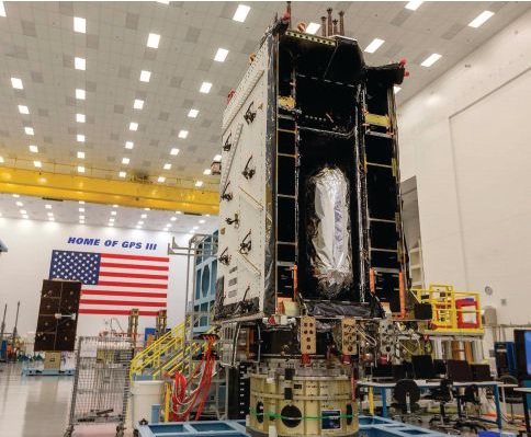
GPS III SV04 in Highbay (Photo: Lockheed Martin)
Partner Community
The GPS enterprise is committed to cooperation on a global basis. It works closely with the DOD, the armed services, the U.S. Coast Guard, other federal agencies, the International Civil Aviation Organization and all the other global and regional navigation satellite systems toward the development of PNT in the global commons.
A highlight of this cooperative work is GPS enterprise involvement in the National Executive Committee for Space-Based PNT (PNT EXCOM), which supports the interests of the various federal bodies, especially the Department of Transportation (DOT) and the Federal Aviation Administration (FAA). The PNT EXCOM is applying GPS technology to a broad variety of governmental activities, including the development of the Next Generation Air Transportation System and intelligent transportation systems.
The GPS enterprise commitment to international partners is unwavering. Our support to the North Atlantic Treaty Organization (NATO) is ongoing with support to the Capability Panel 2 for Navigation working toward the integration of MGUE and compatibility arrangements with Europe’s Galileo system. A highlight this year was the first delivery of MGUE loan equipment to the United Kingdom, Canada, Germany, and the Republic of Korea. Germany is the first country to purchase MGUE equipment.
Conclusion
GPS is the foundation of global PNT and a cornerstone of modern life. Improvements to the enterprise are continual. As the nation moves into the complex and dynamic world of the coming decades, the dedicated military, civilian and industry professionals that provide this world-changing capability will continue their challenging and rewarding work. Semper Supra!
The “encapsulation” of a GPS satellite. (Photo: U.S. Department of Defense)
The Open PNT Industry Alliance (OPIA) issued a statement regarding the recently approved U.S. Fiscal Year 2022 Appropriations Act. The alliance advocates for support of alternative positioning, navigation and timing (PNT) services.
In its statement, the 21 corporate members express support for the funding provided to the Department of Transportation to pursue alternative forms of PNT.
The OPIA also highlights a change to the National Timing Resilience and Security Act that eliminates the “land-based” technology requirement. The consensus among members is that the adjustment was needed so that the law would allow for multiple forms of PNT, a concept that aligns with the diverse technology principles of the coalition.
The Consolidated Appropriations Act for Fiscal Year 2022 (H.R. 2471) promotes robust positioning, navigation, and timing (PNT) technologies and preserves competition that drives innovation in the market.
Important Funding for PNT Services
The FY 2022 Appropriations Act, passed by the U.S. Congress and signed into law by President Biden on March 15, 2022, provides $15 million for the U.S. Department of Transportation (U.S. DOT) to establish a program that will support the U.S. government’s pursuit of many types of alternative PNT. The legislation aligns with U.S. DOT’s January 2021 “Complementary PNT and GPS Backup Technologies Demonstration Report” and summarizes how the funding will be applied.
OPIA encourages U.S. DOT to apply this funding to procure alternative PNT services and supplementary solutions that will protect critical infrastructure. Our members are prepared to engage civil government officials and critical infrastructure owners and operators to match needs with solutions.
Critical Change to Existing PNT Law
The National Timing Resilience and Security Act of 2018 (NTRSA) focused attention on the need to reinforce GPS. Congress subsequently recognized that NTRSA would be harmful to the commercial PNT market. The FY 2022 Appropriations Act revises the NTRSA to align with the U.S. DOT’s 2021 report that “the best strategy for achieving resilient PNT service is to pursue multiple technologies to promote diversity in the PNT functions that support transportation and other critical infrastructure sectors.”
This straightforward change to the NTRSA is as follows:
“Section 312(a) of title 49 United States Code, shall be amended by striking ‘land-based,’ after ‘operation of a’.” When the revised objective of the NTRSA is read in context, it is evident that the law is now fully inclusive of multiple forms of alternative PNT:
Subject to the availability of appropriations, the Secretary of Transportation shall provide for the establishment, sustainment, and operation of a land-based, resilient, and reliable alternative timing system (1) to reduce critical dependencies and provide a complement to and backup for the timing component of the Global Positioning System (referred to in this section as “GPS”); and (2) to ensure the availability of uncorrupted and non-degraded timing signals for military and civilian users in the event that GPS timing signals are corrupted, degraded, unreliable, or otherwise unavailable.
This move by Congress comports with the findings of the U.S. DOT’s report on PNT which state that “suitable and mature technologies are available in the private sector and offer owners and operators of critical infrastructure a diverse array of complementary PNT services to meet their GPS backup needs. Because such needs are application-specific, GPS resilience across all critical infrastructure sectors will require a plurality of diverse PNT technologies to meet multiple use cases.”
The commonsense modification to the NTRSA allows multiple alternatives to GPS and other global navigation satellite systems (GNSS) to deliver against a complex and ever-expanding set of institutional and end-user requirements.
The alignment with OPIA’s bedrock principles is clear:
A diverse technological landscape offers varied operational characteristics to support all critical infrastructure sectors.
True resilience requires diversity that a sole-source technology cannot meet in terms of reliability, performance, and the flexibility to address evolving attack prevention and threat response needs.
The ingenuity of the private sector marketplace will drive the emergence of multiple cost-effective GPS/GNSS alternatives that evolve according to technological innovations and market dynamics.
Open PNT Industry Alliance members provide what critical infrastructure needs for resilience: alternative forms of PNT that complement GPS/GNSS as well as augmentation services, security solutions, and hardware/software for time synchronization, navigation and location applications.