Blog

  • US Air Force procures Orolia’s CRPA testing solution

    US Air Force procures Orolia’s CRPA testing solution

    Orolia Defense & Security, provider of software-defined simulation solutions for navigation warfare, will supply a BroadSim Wavefront to the U.S. Air Force Guided Weapons Evaluation Facility (GWEF). BroadSim Wavefront is an innovative, Skydel-powered advanced GNSS simulator.
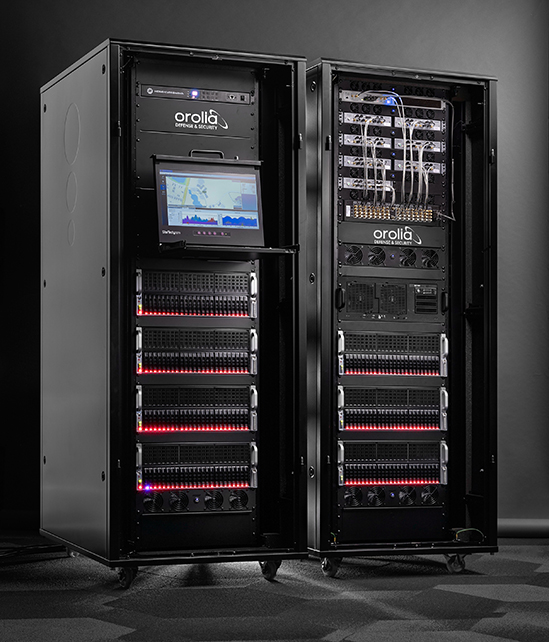
    The BroadSim Wavefront simulator from Orolia Defense & Security. (Photo: Orolia)
    The BroadSim Wavefront simulator from Orolia Defense & Security. (Photo: Orolia)

    The GWEF provides laboratory testing and simulation tools for developing precision-guided weapon technology, including a comprehensive scope of GPS plus inertial navigation systems (INS) and integrated components such as sensors, signals of opportunity and controlled reception pattern antennas (CRPAs). CRPAs are fundamental in many platforms due to their enhanced protection against electronic attacks in NAVWAR environments.

    The Broadsim Wavefront simulator will be integrated into a test environment for networked, collaborative and autonomous weapon systems being developed under the Golden Horde program. Golden Horde is one of four Air Force Vanguard programs designed to rapidly advance emerging weapons systems and warfighting concepts through prototype and experimentation.

    Of the several capabilities the GWEF required, features such as low-latency hardware-in-the-loop, automated calibration, and the flexibility to quickly integrate future signals and sensors were the most critical and serve as a key reason Orolia’s BroadSim Wavefront was selected. The system will also be capable of testing eight-element CRPA systems, eight simultaneous fixed radiation pattern antenna systems (FRPA), or a combination of CRPA and FRPA systems.

    “When designing BroadSim Wavefront, we re-imagined every aspect for the user,” said Tyler Hohman, director of products for Orolia Defense & Security. “Though the GWEF unit contains eight nodes (corresponding to each antenna element), it can be scaled from four to 16 antenna elements. One of the greatest advancements is our continuous phase monitoring and compensation technique. It automatically monitors, aligns and adjusts the phase of each RF output continuously throughout the duration of a scenario.”

    “Gone are the days of re-calibrating each frequency on your system, limiting your scenario duration or re-calibration every time you power cycle your system,” Hohman said. “Simply turn the system on, start the scenario, and your Wavefront system phase aligns and remains aligned for the entirety of the test.”

    Leveraging the Skydel Simulation Engine, BroadSim Wavefront also supports high-dynamics, MNSA M-code, alternative RF navigation, open-source inertial measurement unit (IMU) plug-ins and a 1000-Hz iteration update rate.

    “Because of the software-defined architecture, many upgrades don’t require additional hardware, which has been a crucial advantage for customers who are already using this solution,” Hohman said.


  • Space Codesign obtains ESA/NAVISP funding for spaceborne GNSS receiver

    Space Codesign obtains ESA/NAVISP funding for spaceborne GNSS receiver

    Space Codesign logoSpace Codesign Systems has received funding from the European Space Agency (ESA) to support the design of a spaceborne GNSS receiver. The company is a provider of an end-to-end automated solution, from high-level application specification to physical board compilation.

    The spaceborne receiver will target system-on-chip (SoC) field programmable gate arrays (FPGA). SpaceStudio software by Space Codesign Systems is a development environment that eases the design flow of advanced algorithms targeting FPGA technology without the inherent complexity of FPGA.

    In avionic systems, transition from federated avionics architectures to integrated modular avionics (IMA) is observed. IMA architectures provide a shared computing platform, communications, and input/output resource pool that is partitioned by multiple tasks of differing design assurance criticalities. A similar transition is occurring in the world of satellite systems.

    “The main objective of the project is to add features to explore different architectures and hardware/software partitions for spaceborne GNSS receivers, such as [for] GPS and Galileo, operating in both low Earth orbits (LEOs) and high Earth orbits (HEOs),” said Guy Bois, founder,  Space Codesign System.

    The project will also support the XtratuM Next Generation (XNG) hypervisor for mixed-criticality systems in the virtual platform offered by SpaceStudio, where multiple tasks with different criticality and certification assurance levels are integrated using a shared computing platform.

    The funding is under ESA’s Navigation Innovation and Support Programme (NAVISP) Element 2,  made possible thanks to the Canadian Space Agency’s participation in the NAVISP. NAVISP is an optional program of ESA initiated in 2017 to support the generation and introduction of innovation in various positioning, navigation and timing (PNT) market segments. The main goal of NAVISP is to generate innovative concepts, techniques and systems linked to the highly competitive and evolving global market for PNT technologies. Element 2 continues to demonstrate its relevance, with more than 120 projects incubated so far.

  • Seen & Heard: Driving fish, North Korean tests

    Seen & Heard: Driving fish, North Korean tests

    “Seen & Heard” is a monthly feature of GPS World magazine, traveling the world to capture interesting and unusual news stories involving the GNSS/PNT industry.


    GO, FISH!

    Scientists at Ben-Gurion University in Israel discovered goldfish are good drivers. An aquarium on wheels uses lidar, an onboard camera, and motion-detection software to track a fish in the tank. When it swims toward a side of the tank, the vehicle rolls in the same direction. Fish learned to navigate a small area to hit a target for a reward at least 15 times per half-hour, showing their sense of direction isn’t limited to a watery environment.


    Photo: narvikk/iStock/Getty Images Plus/Getty Images
    Photo: narvikk/iStock/Getty Images Plus/Getty Images

    NORTH KOREA GUIDED BY GLONASS

    North Korea’s recent missile tests are being guided by GLONASS rather than BeiDou, claims a source close to the Chinese military. In January, Pyongyang fired at least four short-range ballistic missiles into the sea off the coast of the Korean peninsula. North Korea also tested hypersonic missiles on Jan. 5 and 11. As reported by the South China Morning Post, the source said North Korea has been using GLONASS and has benefited from Soviet technology.


    Photo: Prakhar Gupta/iStock Editorial/Getty Images Plus/Getty Images
    Photo: Prakhar Gupta/iStock Editorial/Getty Images Plus/Getty Images

    AUTOMATED AUTOWAYS IN INDIA

    The National Highways Authority of India (NHAI) will start using GNSS/3D automated machine guidance to construct highways. First up: the new Lucknow-Kanpur Expressway. Three machine-control systems will be integrated, guided by a computerized 3D model of the project. NHAI expects the technology to almost double the speed of highway construction, as well as provide stakeholders with mobile updates.


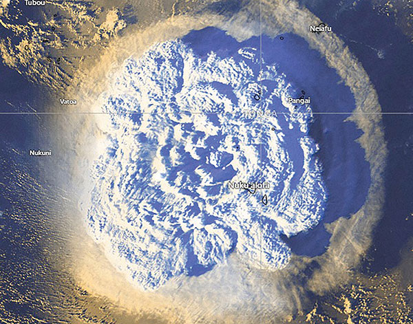
    Photo: Tonga Meteorological Services, Government of Tonga
    Photo: Tonga Meteorological Services, Government of Tonga

    SATELLITES REGISTER OCEAN ERUPTION

    While imagery satellites captured the explosive Jan. 15 underwater volcanic eruption in Tonga, GNSS satellites also registered its effects. The energy released reached the ionosphere and was picked up by GNSS signals passing through it (see JPL’s findings). The eruption blanketed Tonga’s main island in ash and devastated its western coastline, affecting up to 80,000 people, according to news reports. It also caused damage to an underwater cable, resulting in a major communication outage. The tsunami that followed reached as far as Japan and the U.S. West Coast, and caused a massive oil spill off of Peru.

  • GNSS shows how volcanic eruptions cause ionospheric disruptions

    GNSS shows how volcanic eruptions cause ionospheric disruptions

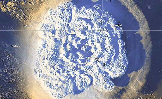
    On Jan. 15, Hunga-Tonga-Hunga-Ha’apai, an uninhabited volcanic island on the Tongan archipelago in the South Pacific Ocean, erupted with spectacular force, churning ocean waters halfway across the globe.

    GNSS engineers also detected its effects hundreds of miles above, in the ionosphere. The GNSS community is now moving from such after-the-fact detection to real-time monitoring using NASA’s Global Differential GPS (GDGPS) system, according to a team with the Tracking Systems and Application Section at NASA’s Jet Propulsion Laboratory (JPL) in Southern California.

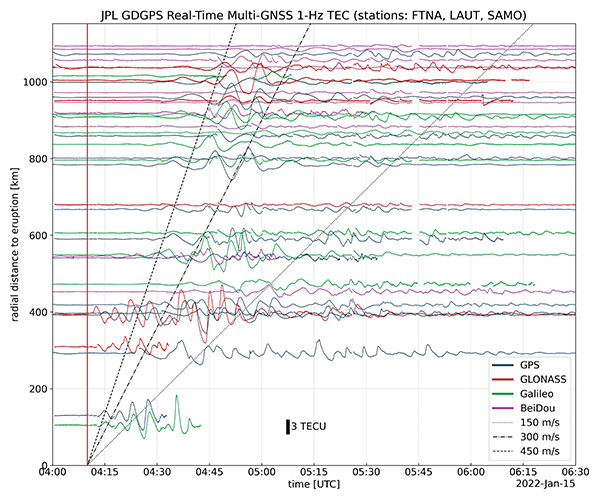
    “We monitored, in real time, four GNSS satellite constellations from numerous stations around the world using the GDGPS network. In particular, the three stations closest to the volcano, in Samoa, Fiji and Tahiti,” said postdoctoral associate Leo Martire. “We could see extremely high and strong signals in the ionosphere, which is very unusual. As a function of radial distance from the eruption, the first detected ionospheric perturbation likely originated directly from the explosion. Then we see patterns propagating at increasing distances at different radial propagation speeds.”

    Monitoring such events adds information to the catalog of signals from natural hazards, pointed out Siddharth Krishnamoorthy, a research technologist who manages JPL’s GUARDIAN near-real-time tsunami warning system, currently under development. “That is useful because, in the future, if you want to be able to spot natural hazards and issue alerts, you need to know what the signal looks like. There have been reports of a tsunami in Tonga due to this event, so we will look at potential tsunami-induced signatures in the ionosphere. We are trying to get to a place where we pick up a signal like this and we are able to say, ‘This is a tsunami propagating at this speed and in this direction.’”

    Chart: Jet Propulsion Laboratory
    Chart: Jet Propulsion Laboratory

    Before being detected in the ionosphere, signals from natural hazards must travel all the way from the surface. For tsunamis, this usually takes more than 10 to 20 minutes, but the volcanic eruption only took a couple of minutes to reach the ionosphere because it shot straight up. “We do not know yet, based on observations, how exactly different events on the surface caused by natural hazards couple with the atmosphere,” said research technologist Panagiotis Vergados. “Every event is unique in its spectral properties.”

    The event did not affect the quality of GDGPS’s GNSS positions or orbits, because dual-frequency measurements remove significant ionospheric effects. “Instead of looking at the direct effects on the position of our available reference stations, which is what our traditional real-time monitoring does and which was basically negligible, imagine the links from each of those stations to a dozen or more satellites,” said Larry Romans, GDGPS chief technologist. “Every time one of those many links pierces the ionosphere, we can monitor that signal for ripples as waves go by. So, this is an incredibly powerful method for seeing disturbances, just in terms of the density of data. It is very complementary to position-based natural-hazards monitoring because the data is much richer.”

    In addition to volcanoes and tsunamis, several other natural events, such as earthquakes and very large thunderstorms, also produce these effects. “These natural forcings cause large-scale, low-frequency pressure perturbations that tend to travel up and be visible in the ionosphere,” Krishnamoorthy said. “There are also perturbations of the ionosphere due to events from outside the Earth, such as solar flares or bolide impacts.”

    Many of these perturbations start from the troposphere, which ranges between 10 km and 15 km in altitude — including hurricanes, which overshoot gravity waves all the way to the ionosphere, and thermal tides that have been observed to go all the way up to 600 km, said Vergados. “There are also geomagnetic storms and sub-storms that, during electron precipitation, can change the ionization of the ionosphere. So, the coupling can happen from either below or above or simultaneously, and then the effect can be dramatically enhanced.”

    Most of the perturbations that come from below are of a pressure nature — that is, they start out as mechanical waves — while most of those that come from above are electromagnetic. “Aside from nuclear explosions, very large chemical ones, such as the 2020 Beirut explosion, also cause a signature on the ionosphere because they create very large pressure waves,” Krishnamoorthy said.

    Photo: Tonga Meteorological Services, Government of Tonga
    Photo: Tonga Meteorological Services, Government of Tonga
  • Registration open for Munich Satellite Navigation Summit

    Registration open for Munich Satellite Navigation Summit

    Photo:

    The Munich Satellite Navigation Summit program is now online and registration for the event is open. The summit will be held online March 7-8.

    The Munich Satellite Navigation Summit focuses on satellite navigation in the present day and future, featuring global speakers and highlighting the latest developments in the field of GNSS. This year’s theme is “AI in GNSS – Intelligence brought to Navigation”.

    The summit will feature 12 sessions from industry experts, including sessions on the following topics:

    • First and Second Generation of the European Satellite Navigation System Galileo
    • Modernization of the US Global Positioning System
    • Status and modernization of the Russian Global Satellite Navigation System GLONASS and the Chinese Beidou System (BDS)
    • Developments of regional systems like the Japanese QZSS and the Indian IRNSS and the Korean Positioning System (KPS)
    • Use of AI within the navigation world and its implications
    • Jamming, spoofing, interference, and countermeasures; understanding secure Galileo services (OSNMA, PRS)
    • GNSS and the new race to the Moon; upcoming space mission related to PNT
    • Advanced technologies for PNT (quantum, optical) even beyond Galileo 2nd Generation

    The summit will also offer a free job market discussion and company pitches prior to the main conference for all attendees.

    To view the Munich Satellite Navigation Summit program and register, visit munich-satellite-navigation-summit.org

  • How precise point positioning became a survey crew favorite

    How precise point positioning became a survey crew favorite

    A positioning service energizes large pipeline surveying projects, saves time, and becomes a field crew favorite

    For projects spanning large areas, a large engineering and construction firm discovered that a precise point positioning (PPP) service — Trimble’s CenterPoint RTX — could solve the challenge of receiving high-precision GNSS in remote areas.

    Atwell Group LLC is a national consulting, engineering and construction services firm with 33 offices throughout the country and more than 1,000 team members. The company delivers a broad range of strategic and creative solutions to clients in three core markets: oil and gas, power and energy, and real estate and land development.

    Atwell provides comprehensive turnkey services, including land and right-of-way support, engineering, land surveying, environmental compliance and permitting, and project and program management.

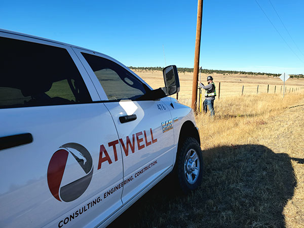
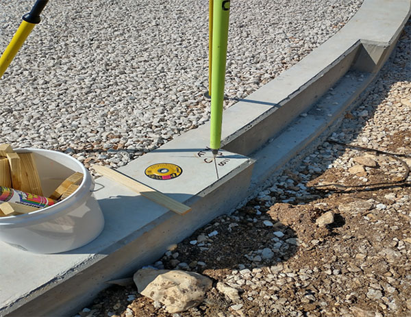
    Photo: Trimble
    Photo: Trimble

    Pipeline construction

    Atwell’s introduction to PPP and Trimble’s CenterPoint RTX took place during two large-scale linear pipeline projects within remote areas. Atwell has substantial experience with projects of this scale, but the remoteness of some of the projects’ sections was proving to be a challenge. While they could expect to rely on base or network correction methods for most projects, Atwell needed to seek other correction alternatives — and up their efficiency for the long-corridor projects.

    With the CenterPoint RTX service at hand, Atwell performed construction staking and as-built surveys for a 50-mile pipeline. The project spanned a five-month period, with an hour or more of time saved each day using the service.

    Crews noticed an additional benefit: rapid response time. On any given day, there could be project managers, right-of-way agents, or inspectors on site, asking for additional survey data.

    “Inspectors and others started to notice how fast our crews could jump from one place to another and get the shots they requested, without having to do any base setups,” said Jason Jung, project manager with Atwell.


    “The speed at which our crews can get up and running with RTX is awesome.” — Jason Jung, 3D laser scanning projects manager, Atwell


    Because of the range limits of base radios, the crews might have to do multiple setups of a conventional real-time kinematic (RTK) base each day. RTX removed this hindrance, saving the crews time by not having to use temporary RTK bases, which entails driving to base reference points, setup and teardown, and downtime from malfunctioning equipment and battery issues.

    “RTX completely freed us from the time and hassle of base setups,” Jung said. “You turn it on, and it’s ready to go before you’ve had time to take a sip of coffee. And once our crews got used to it and gained confidence in the results, they have really loved this solution.”

    Photo: Trimble
    Photo: Trimble

    Scanning a pipeline

    Atwell recently used CenterPoint RTX on a 135-mile large-diameter pipeline project that included 19 facilities along the route. Atwell provided as-built services related to the facilities using a Trimble X7 scanner.

    The data captured was used to generate spatially correct site models that included the material traceability necessary to comply with Pipeline and Hazardous Materials Safety Administration (PHMSA) regulations. Crews used RTX to georeference point clouds from the scanner to provide the accuracy needed to comply with industry regulations. Each site was referenced with permanent monuments or scribes that tied into the master control system.

    Crews also used the RTX service to establish hard checkpoints to meet Atwell’s strenuous quality-control requirements for ground targets, such as those used in UAS control work. To do the daily “in and out” check shots, they used the free BenchMap app to locate nearby survey control marks from the National Geodetic Survey database. Most checks were sub-0.08’.

    The time saved in not having to change base positions, as well as setup and breakdown, were significant time savers along this lengthy project. The precisely registered scans helped speed up PHMSA required inspections and audits, and construction change management field operations.

    A crew favorite

    Atwell’s crews use Trimble R10 receivers and Trimble Access running on TSC7 controllers, but Jung noted that they have recently upgraded to some R12i GNSS receivers, “and they are already earning their keep.” He expects to realize even more benefits from RTX coupled with the advanced multi-constellation capabilities of the Trimble ProPoint RTK engine in the R12i.

    RTX has not only become a crew favorite, it is fast becoming a go-to solution for many Atwell projects.

  • ESA Navigation Lab showcases multi-receiver UAV

    ESA Navigation Lab showcases multi-receiver UAV

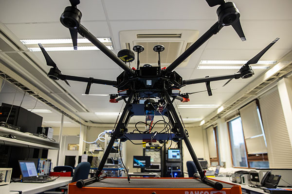
    Photo: ESA
    Photo: ESA

    The Navigation Laboratory of the European Space Agency (ESA) has acquired an unmanned aerial vehicle (UAV) that can carry different types of satellite navigation receivers to collect data for follow-on analysis.

    The NavLab, based at ESA’s ESTEC technical centre in Noordwijk, the Netherlands, is focused on the testing, analysis and characterization of navigation systems for both ESA and external customers.

    With UAVs representing a rapidly expanding user base, the new UAV is a timely addition to the NavLab’s suite of platforms for testing GNSS technologies and techniques, ESA said. Other tools include static, mobile and pedestrian platforms and a pair of test vans.

    Along with receivers and antennas, the UAV can host radio-frequency spectrum samplers and support equipment such as inertial sensors and stereo cameras, allowing the assessment of performance in specific dynamics and environments related to UAV applications, such as approach, landing, flying beside buildings or indoors.

  • Synzen antennas and Next Big Thing join on IoT GNSS platform

    Synzen antennas and Next Big Thing join on IoT GNSS platform

    Antenna company Synzen Precision Technology has teamed up with Next Big Thing AG (NBT) to produce the sensor-based LTE-M/NB-IoT development platform Prometheus, which promises fast cellular internet of things (IoT) prototyping.

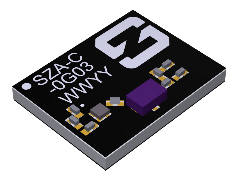
    The PROXIMA GNSS antenna will be part of the Prometheus platform. (Photo: Synzen Precision Technology)
    The PROXIMA GNSS antenna will be part of the Prometheus platform. (Photo: Synzen Precision Technology)

    Prometheus is an IoT sensor-based development platform designed to simplify prototyping and speed time to market for developers of IoT and cloud-based solutions. The latest platform showcases Synzen’s expertise in GNSS and LTE 4G antenna solutions when combined with the Nordic nRF9160 module.

    The building blocks enabling the mobility and IoT revolution are “always-on” connected 4G cellular and accurate and reliable GNSS solutions, regardless of the operating environment, Synzen said. Prometheus provides 4G connectivity combined with high-performance GNSS positioning solutions.

    For the Prometheus platform, NBT chose the low-power FR4 active GNSS solution. “The selection of our latest PROXIMA low-power active solution in an FR4 package helped enable a fully certified solution optimized for low power consumption over the full industrial temperature range of –40 to +85 degrees centigrade,” said Chris Tomlin, Synzen technical director.

    The PROXIMA GNSS SMD active antenna includes an amplifying front end to boost the signal as well as provide out-of-band filtering to prevent receiver saturation.

  • New device puts Trimble Catalyst in user’s hands

    New device puts Trimble Catalyst in user’s hands

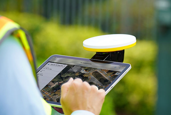
    Photo: Trimble
    Photo: Trimble

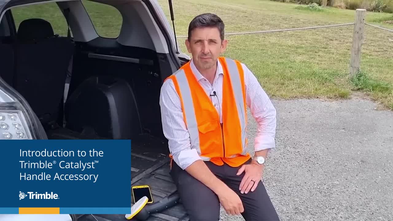
    Trimble has introduced the Trimble Catalyst handle, which adds a new level of flexibility to accessing GNSS data. The lightweight, ergonomic handle provides a convenient way to carry Trimble’s Catalyst-enabled mapping and field data-collection workflows.

    Users can:

    • choose their device, whether iOS or Android, which turns any smartphone or tablet into a Trimble-quality handheld positioning system
    • swap out a device at any time, whenever an upgrade is needed
    • adjust accuracy level as requirements change by switching the accuracy-based Catalyst subscription
    • affix a monopole when decimeter-level or better positions are crucial.

  • DOD tasks Orbital Insight to help identify intentional GNSS disruptions

    DOD tasks Orbital Insight to help identify intentional GNSS disruptions

    A new platform will detect and characterize GNSS spoofing operations using artificial intelligence and commercially available data

    Geospatial intelligence company Orbital Insight has been awarded a contract from the U.S. Department of Defense (DoD) to deliver a technology platform for identifying intentional GNSS interference and manipulation operations across the world.

    The platform will leverage commercially available data to detect GNSS spoofing, where falsified or manipulated GNSS signals are used to confuse adversaries or obscure illicit activities, presenting risk to both government and commercial operations. Orbital Insight was selected through DoD’s Defense Innovation Unit (DIU) solicitation process seeking commercial solutions to counter the growing threat of GNSS disruptions to national security.


    Research suggests that Russia conducted nearly 10,000 spoofing operations from 2016 to 2018 alone.


    The new technology will significantly improve situational awareness for warfighters, intelligence analysts and safety-of-life applications. Orbital Insight’s platform will leverage its multisensor data stack, artificial intelligence and machine-learning capabilities to alert analysts and operators to potential jamming and spoofing events, techniques commonly used by adversarial actors to cover up activities or sabotage operations.

    The platform leverages a suite of geolocation data — satellites, AIS, ADS-B and internet-of-things devices — along with new advanced algorithms designed to automatically recognize anomalies linked to spoofing, complemented by research intelligence from the nonprofit partner Center for Advanced Defense Studies. Research suggests that Russia conducted nearly 10,000 spoofing operations from 2016 to 2018 alone.

    “Helping organizations understand what’s happening on and to the Earth is at the heart of what Orbital Insight does, and spoofing is a national security problem that has proven challenging to solve,” said Kevin O’Brien, CEO, Orbital Insight. “GNSS spoofing is essentially a data problem, and Orbital Insight’s AI and deep data stack can help identify spoofing, along with other major humanitarian and environmental challenges. This is a perfect example of private and public sectors uniting through technology.”


    Other areas that may be addressed: identifying drug trafficking, illegal fishing, sea-borne piracy and unintentional commercial aviation disruptions


    The technology has broad implications that extend beyond situational awareness of intentional GNSS interference. Other national security, humanitarian and environmental challenges may be addressed, such as identifying drug trafficking, illegal fishing, sea-borne piracy and unintentional commercial aviation disruptions.

    Federal agencies are increasingly complementing their systems with commercial technology and data sources that are unclassified, universally accessible, and shareable with allies. The National Air and Space Intelligence Center will be the first customer to utilize the technology. Upon successful integration, the goal will be to expand this platform widely across the defense, intelligence and civil communities.

    Orbital Insight received the DoD contract on the heels of announcing a Phase II Small Business Innovation Research contract from the National Geospatial-Intelligence Agency to deliver a computer-vision model that uses synthetic data to detect novel classes of objects.

    The company also recently launched a new class of multiclass object-detection algorithms within its flagship GO platform to help the intelligence community monitor and differentiate activity at thousands of areas of interest. Like all of Orbital Insight’s products, these algorithms are being developed within an ethics framework that shapes the company’s work and values privacy.

    Image: matejmo/iStock/Getty Images Plus/Getty Images
    Image: matejmo/iStock/Getty Images Plus/Getty Images
  • Europe’s Project NAV-SSHE to demo GNSS + 5G for critical applications

    Europe’s Project NAV-SSHE to demo GNSS + 5G for critical applications

    NAV-SSHE logoThe Navigation Sensor Switching in Hostile Environments (NAV-SSHE) project aims to design, prototype and demonstrate new solutions for positioning, navigation and timing using 5G plus GNSS for critical applications in hostile environments. NAV-SSHE is supported by the European Space Agency (ESA).

    Geolocation company M3 Systems Belgium is taking part in the project in collaboration with Telespazio Belgium. The project began in September 2021 and will last until January 2023.

    In the context of NAV-SSHE, M3 Systems Belgium will implement both a GNSS and a 5G signal based on positioning engines. The output of both engines will be fused to provide a unique solution with increased robustness.

    The complete system will be demonstrated on two real-use cases:

    • autonomous vehicles on an airport platform (specifically autonomous lawn mowers)
    • autonomous docking of vessels in port

    The demonstrations will also be used to test potential use of these technologies for drone applications — specifically for the navigation system of the autonomous remotely piloted aircraft Boreal.

  • Hexagon announces senior management changes

    Hexagon announces senior management changes

    Logo: HexagonHexagon AB has made the following organizational changes, effective immediately:

    Paolo Guglielmini, currently president of the Hexagon’s Manufacturing Intelligence (MI) division, has been appointed chief operating officer (COO) for Hexagon AB.

    In his new role, Guglielmini will support Hexagon President and CEO Ola Rollén to develop and implement Hexagon’s strategy, as well as overseeing the operations of the company’s divisions. Guglielmini will retain his current role as President for the MI division until a successor has been appointed.

    Guglielmini has been leading MI since January 2020, and has served in key roles since joining Hexagon in 2010, from strategy and business development to M&A and general management. He has been instrumental in expanding MI’s focus towards software-centric quality data solutions, and with his team driving the business towards all-time-high performance in 2021.

    Prior to joining Hexagon, Paolo held positions at CERN, the European Organization for Nuclear Research in Switzerland, and Accenture. He holds a Master of Science in Engineering and Master of Business Administration from IMD.

    Norbert Hanke, currently Hexagon’s COO, has been appointed executive vice president (EVP) and will continue leading Hexagon Ventures, HR, IT, the India R&D and Sales organizations and other related tasks.

    Both Guglielmini and Hanke will continue to report directly to Rollén and remain members of Hexagon’s executive management team.