Blog

  • Research Roundup: Meeting urban navigation challenges

    Research Roundup: Meeting urban navigation challenges

    Photo: eli_asenova/E+/Getty Images
    Photo: eli_asenova/E+/Getty Images

    Researchers presented hundreds of papers at the 2021 Institute of Navigation (ION) GNSS+ conference, which took place virtually and in person Sept. 20–24 in St. Louis, Missouri. The following five presentations focused on the challenges of urban navigation. The papers are available at www.ion.org/publications/browse.cfm.

    Integrating Autonomous Air Vehicles

    The emergence and development of advanced technologies and vehicle types has created a growing demand for the introduction of new forms of flight operations. These new and increasingly complex operational paradigms, such as Advanced and Urban Air Mobility (AAM/UAM) present regulatory authorities and the aviation community with several design and implementation challenges — particularly for highly autonomous vehicles.

    An overarching and daunting task is finding methods to integrate these emerging operations without compromising safety or disrupting traditional airspace operations. Predictive risk mitigation is critical to meeting this challenge. The authors of this study focus on the development and testing of a prognostic service aimed at estimating the quality of GNSS performance for an autonomous aircraft in complex environments. Flight operations would be able to factor into pre-flight and in-flight route planning an estimate of GNSS quality, thereby predicting poor or unacceptable navigation system performance. The authors provide methodologies for producing quality estimates, and provide results for selected simulation and flight-test cases.

    Citation. Dill, Evan, Gutierrez, Julian, Young, Steven, Moore, Andrew, Scholz, Arthur, Bates, Emily, Schmitt, Ken, Doughty, Jonathan, “A Predictive GNSS Performance Monitor for Autonomous Air Vehicles in Urban Environments,” Proceedings of the 34th International Technical Meeting of the Satellite Division of The Institute of Navigation (ION GNSS+ 2021), St. Louis, Missouri, September 2021, pp. 125–137. https://doi.org/10.33012/2021.18138

    Processing Scheme for Integrity Monitoring

    Integrity monitoring is of great importance for GNSS applications. Unlike classical approaches based on probabilistic assumptions, the alternative interval-based integrity approach depends on deterministic interval bounds as inputs. Different from a quadratic variance propagation, the interval approach has intrinsically a linear uncertainty propagation adequate to describe remaining systematic uncertainty.

    To properly characterize all ranging error sources and determine the improved observation interval bounds, the authors propose a processing scheme. The team validated how the sensitivity analysis is a feasible way to determine uncertainty intervals for residual ionospheric errors and residual tropospheric errors, taking advantage of long-term statistics against reference data. Transforming the navigation problem into a convex optimization problem, the interval bounds are propagated from the range domain to the position domain. The authors implemented this strategy for multi-GNSS positioning in an experiment with static data from International GNSS Service (IGS) station Potsdam (POTS) and an experiment with kinematic data from a measurement campaign conducted in the urban area of Hannover, Germany, on Aug. 26, 2020.

    Citation. Su, Jingyao, Schön, Steffen, “Improved Observation Interval Bounding for Multi-GNSS Integrity Monitoring in Urban Navigation,” Proceedings of the 34th International Technical Meeting of the Satellite Division of The Institute of Navigation (ION GNSS+ 2021), St. Louis, Missouri, September 2021, pp. 4141–4156. https://doi.org/10.33012/2021.18078

    Removing Multipath Errors

    In the urban environment, multipath and non-line-of-sight cause measurement errors and signal power loss. In urban canyons, while multi-GNSS provides the required number of satellites to obtain a position, the signals may be affected by gross multipath errors, leading to a potentially unsafe position. In this paper, the authors use machine-learning techniques to model multipath error distributions. The features assessed are commonly used parameters such as elevation, S/N and user speed.

    The authors drove a sensor-equipped vehicle in Toulouse, France, collecting hours of experimental data for evaluation of their model’s validity. The multipath error component was extracted from data processed from a single-frequency GNSS receiver using measurement differential, clock bias estimation and other techniques. The quantile of multipath error was then modeled using a neural-network-based regression technique. Results using the proposed method are validated by an integrity assessment of the experimental data.

    Citation. No, Heekwon, Milner, Carl, “Machine Learning Based Overbound Modeling of Multipath Error for Safety Critical Urban Environment,” Proceedings of the 34th International Technical Meeting of the Satellite Division of The Institute of Navigation (ION GNSS+ 2021), St. Louis, Missouri, September 2021, pp. 180–194. https://doi.org/10.33012/2021.17874

    GNSS/INS/Radar Sensor Fusion

    Autonomous driving has gathered much interest in recent years with significant research directed at solving the localization problem. To enable a fully autonomous platform, the navigation system must provide accurate solutions at high rates, be reliable, and be available in all types of environments. These requirements necessitate the use of multiple sensors while remaining cost-effective to enable widespread adoption.

    To maintain accurate positioning in GNSS-challenged areas, perception sensors such as cameras, lidar or radar provide another source of absolute positioning information. This paper presents a multi-radar integrated version of AUTO, a real-time integrated navigation system that provides an accurate, reliable, high rate and continuous (always available) navigation solution for autonomous platforms by integrating INS, GNSS-RTK, odometer and multiple radars sensors with high-definition maps. AUTO uses a tight nonlinear integration scheme to fuse information from multiple imaging radars with the INS/GNSS/odometer solution. The HD maps may come from a map provider or be crowdsourced from radar data.

    The results in this paper compare multi-radar configurations of one to five imaging radars for a vehicle and demonstrate the accurate solution achieved through the tightly integrated system. Key performance indices are presented for a multi-radar configuration of AUTO for vehicle and robot. The results show how radar data contributes significantly with other sensors to provide a high-rate, accurate, reliable and robust navigation solution in GNSS-degraded environments and adverse weather conditions.

    Citation. Krupity, Dylan, Ali, Abdelrahman, Chan, Billy, Omr, Medhat, Salib, Abanob, Al-Hamad, Amr, Wang, Qingli, Georgy, Jacques, Goodall, Christopher, “AUTO: Multiple Imaging Radars Integration with INS/GNSS for Reliable and Accurate Positioning for Autonomous Vehicles and Robots,” Proceedings of the 34th International Technical Meeting of the Satellite Division of The Institute of Navigation (ION GNSS+ 2021), St. Louis, Missouri, September 2021, pp. 77–92. https://doi.org/10.33012/2021.17903

    Feature Matching for Visual Nav

    Typical feature matching on aerial imagery results in a majority of features being placed on trees and other seasonally variable features. The researchers tested the effectiveness of using semantic segmentation to create and force robust features onto desired areas of an image for the purpose of visual navigation. The process involves testing several segmentation algorithms to achieve state-of-the-art segmentation results and evaluating the effectiveness of feature matching on segmented imagery. The aim is to develop a near state-of-the-art semantic segmentation model for aerial imagery that can extract desired buildings from an image.

    The research will then focus on feature-selection and feature-matching algorithms to compare the segmented aerial key features with a database of features from satellite imagery. So far, results show that feature selection algorithms such as SIFT fail to overcome the nuances among multisource aerial imagery. Improving the feature selection algorithm ideally will allow for an increased quantity and quality of matches, ultimately resulting in a camera pose estimation sufficient to be a reliable alternative to GPS.

    Citation. Hussey, Tyler, Leishman, Robert C., Woodburn, David, “Towards More Robust Vision-based Map Matching Through Machine Learning & Improved Feature Matching,” Proceedings of the 34th International Technical Meeting of the Satellite Division of The Institute of Navigation (ION GNSS+ 2021), St. Louis, Missouri, September 2021, pp. 1647–1653. https://doi.org/10.33012/2021.17911


  • Editorial Advisory Board Q&A: Should all GNSS follow NavIC?

    Would it be beneficial for GNSS constellations to transmit signals at higher frequencies, such as in the S-band or the C-band, following the example of the Indian NavIC?

    Jean-Marie Sleewaegen
    Jean-Marie Sleewaegen

    “The S- and C-bands refer to frequency bands centered around 2492 MHz and 5020 MHz. The main advantage compared to L-band is the reduced effect of the ionosphere. However, this comes at the expense of higher propagation losses, increased phase jitter due to the lower wavelength, and extra cost in the receiver and antenna when combined with L-band. The added value for existing GNSS systems already transmitting multiple signals in L-band is probably low. However, because they are less congested than L-band, those bands could be attractive to new space-based PNT services.”
    — Jean-Marie Sleewaegen, Septentrio


    Alison Brown
    Alison Brown

    “The main challenge with adding additional bands to GNSS constellations (other than getting frequency allocations) is that these will not be compatible with any existing GNSS chip sets or fielded antennas. The cost/benefit analysis is unlikely to be attractive for most GNSS chip vendors to develop products with this capability.”
    — Alison Brown, NAVSYS Corporation


    Ellen Hall
    Ellen Hall

    There are benefits that the higher bands can offer in GNSS, however the constellation and system must be designed to take advantage of them, which makes it very difficult for the legacy systems that were designed around L-band only to tap into any of these benefits. Higher bands have lower ionospheric distortion, which enables better single-frequency accuracy and unlocks some interesting multi-frequency capability, while shorter wavelengths can allow for smaller antennas in user equipment. However, the tropo/atmospheric distortion gets worse as well as the spreading losses. Another consideration for the higher bands is spectrum interference, as the S-band area especially is extremely busy.

    — Ellen Hall, Spirent Federal Systems

  • SBG Systems drives GNSS+inertial in Paris

    SBG Systems drives GNSS+inertial in Paris

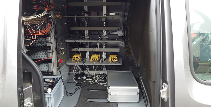
    Photo: SBG SystemsAutonomous vehicles require lane-level accuracy at all times and in all conditions. However, under many conditions, such as in urban canyons and tunnels, they may lose line-of-sight to enough GNSS satellites to achieve accurate and robust positioning or may have no signal at all. In these situations, they need data from other sensors, including an odometer and an inertial measurement unit (IMU). Creating reliable and safe autonomous navigation requires fusing GNSS and inertial technology in a multi-layered system.

    SBG Systems and its partners LeoDrive.ai and Intempora, have been doing this to develop solutions for autonomous vehicles. SBG’s technology enables multi-sensor integration while addressing such autonomous navigation challenges as time synchronization, integrity, precise positioning and high-definition mapping.

    “To ensure performance and build trust, we assemble our own IMUs from carefully selected industrial-grade parts, then we calibrate all our products individually,” said Laurent Le Thuant, business manager for SBG, in a recent webinar.

    For safe operation, Le Thuant explained, the vehicle’s true positional error (PE) must be smaller than its protection level (PL), which in turn must be smaller than its alert limit (AL): PE < PL < AL. Otherwise, the solution is declared unavailable or reports misleading information.

    In automotive tests conducted in a business district near Paris, an SBG vehicle was equipped with both a GNSS-only, automotive-grade multiband RTK receiver equipped with a PL determination algorithm and an RTK GNSS receiver tightly-coupled with an IMU and an odometry input. A comparison showed that the former was not suited for self-driving, while the latter significantly improved the solution availability, accuracy and protection levels.

    For self-driving in the most severe conditions, even this solution requires integration of supplementary sensors, such as cameras, lidars and radars for precise localization.

  • Skytraq Technology modules meet market needs

    Skytraq Technology modules meet market needs

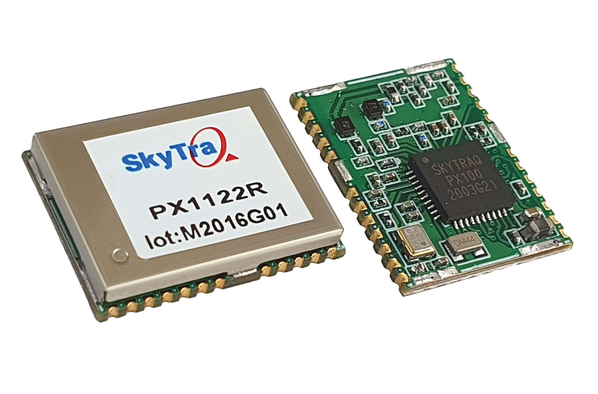
    SkyTraq Technology, a fabless semiconductor company, develops GPS/GNSS chipsets and modules for meter-level accuracy vehicle navigation and tracking applications and for centimeter-level accuracy real-time kinematic (RTK) surveying and precision guidance applications.

    Photo: SkyTraq
    Photo: SkyTraq

    The company’s chipset design is driven by market trends, said Oliver Huang, the company’s general manager. He explained the company has moved from single-frequency to dual-frequency devices.

    SkyTraq’s chipset is designed to be common hardware for different target applications enabled by customized software. Traditionally, in the automotive market, vehicle navigation systems have relied on fusing GNSS receivers with dead-reckoning technology that uses micro-electromechanical (MEMS) inertial measurement units (IMUs) and wheel-tick data.

    “We are now seeing more aftermarket vehicle tracking applications that take advantage of superior GNSS/DR performance using untethered dead-reckoning technology that uses sensor fusion of GNSS receiver and MEMS IMUs without the need for wheel-tick data,” Huang said. “GNSS receivers with decimeter or better accuracy, combined with dead-reckoning that uses low drift IMUs, will be important in emerging autonomous vehicle applications.”

    SkyTraq’s PX100 chipset for L1 meter-level accuracy applications and centimeter-level accuracy RTK applications uses L1 and L1/L2 signals from all four major GNSS constellations (GPS, GLONASS, Galileo and BeiDou).

    Because of the trend toward high-precision, which requires good carrier-phase raw measurement data, the biggest challenge in receiver design is with the antenna, Huang explained. “Using an advanced semiconductor process, one can have low power, small size chipsets taking advantage of all the available GNSS signals, yet there is no small antenna capable of producing high-quality carrier phase data for high-precision GNSS applications. So far, we have only seen bulky RTK antennas capable of generating high-precision results.”

  • Engaging data for scooters, cars and trains

    Engaging data for scooters, cars and trains

    Swift Navigation designs, manufactures and integrates GNSS receivers, as well as providing the Skylark wide-area GNSS corrections service. Its markets are automotive, transportation (last mile delivery, commercial trucking, rail), robotics/machine control (construction, mining, precision agriculture, landscaping), UAVs, micromobility and mobile devices and applications.

    The company’s technology is compatible and interoperable with most major GNSS receivers for multiple markets. Its Starling positioning engine and Skylark corrections “are scalable to bring precision to legacy low-cost single-frequency receivers, all the way to the most sophisticated state-of-the-art triple-frequency multi-constellation systems,” said Joel Gibson, Swift’s executive vice president of Automotive. “By working with a multitude of receiver vendors for different applications, Swift leverages all constellations and all signals and maximizes the performance required for the application.”

    The most accurate and reliable navigation system for every application would take advantage of all available GNSS signals, as well as all available corrections, dead reckoning and fused data from other sensors, such as cameras, lidar and radar. However, of course, that is not possible due to cost, size, weight and power considerations. Swift’s approach to the trade-offs required depends on each use case.

    Micromobility

    In the area of micromobility (such as scooters), the main constraints for implementing a positioning solution are cost and power, coupled with the challenge of satellite signal outages and multipath in dense urban environments where these vehicles primarily operate, Gibson explained. “Cost-effective dual-frequency GNSS receivers are now showing up in micromobility architectures. Pairing them with our Starling positioning engine, which integrates inertial sensor data and wheel ticks, and augmenting them with Skylark corrections data, makes it possible to meet such compliance requirements as geofencing and limiting sidewalk use.”

    Additionally, by achieving decimeter-level positioning, Swift’s micromobility solution makes it easier for both users and service staff to find scooters, which increases the scooter companies’ revenues.

    Photo: Swift Navigation
    Photo: Swift Navigation

    Automotive

    In the automotive industry, inertial sensors and wheel odometry are ubiquitous and pair naturally with GNSS to mitigate satellite signal outages, Gibson pointed out. Likewise, cameras and radar — cornerstones of ADAS — are very complementary to GNSS for safety applications, and lidar further complements GNSS in feature-rich environments such as dense urban areas.

    Rail

    Rail applications, such as Positive Train Control, have traditionally needed an accuracy of one or two meters, coupled with ruggedized hardware. “Swift’s precise positioning solution is deployed across continental rail systems today, and we are now engaging rail OEM and operator programs requiring sub-meter accuracy to ensure track-to-track accuracy and safety requirements in support of the transition to more autonomous rail operations,” said Gibson. “Leading rail companies are also looking for operational efficiencies by transitioning away from the high operational costs of maintaining reference base stations along track routes, instead moving to the more cost effective, reliable and seamless Skylark corrections coverage.”

  • Racing to an autonomous finish

    Racing to an autonomous finish

    Photo: Penske Entertainment: Walt Kuhn
    Photo: Penske Entertainment / Walt Kuhn

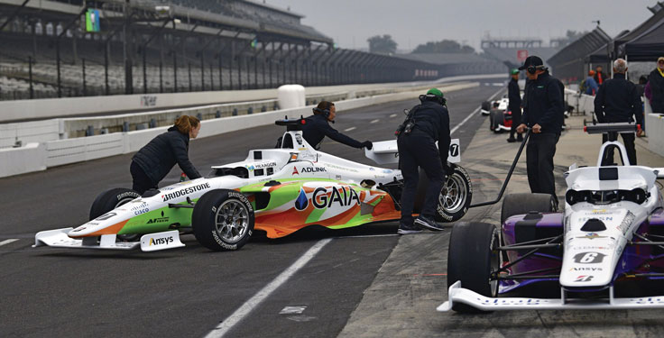
    Flipping the traditional scenario, in which car racers risk their lives on a racetrack, the Indy Autonomous Challenge (IAC) aimed to help save lives by improving collision avoidance systems, train future automotive engineers, and make the public more comfortable with autonomous cars. Held Oct. 23 at the Indianapolis Motor Speedway and organized by Energy Systems Network, the race saw 21 universities from nine countries forming nine teams to compete for a $1 million grand prize. Following in the footsteps of the DARPA Grand Challenge, first held in 2004 and later renamed the DARPA Urban Challenge, the IAC was the world’s first high-speed autonomous race. The winning team was TUM Autonomous Motorsport from the Technical University of Munich, Germany.

    All competing teams were given the same identical vehicle to work with, a Dallara AV-21, modified to carry no one in the cockpit and equipped with two Hexagon | NovAtel PwrPak7-Ds multi-frequency, multi-constellation GNSS receivers, six cameras (two of which faced backward), three lidar scanners and four radars. Each team had to develop its own autonomy-enabling software stack, including the algorithms and neural networks. All the components, except the computer, had to be commercial-off-the-shelf, available on the market. No sensors could be custom-made.

    Since 2001, Dallara has been the sole supplier of the Indy Lights series, a championship to prepare drivers for the NTT IndyCar Series. The Dallara AV-21 is a collaboration between Dallara’s Italian headquarters in Varano Melegari (Parma) and Dallara IndyCar Factory in Speedway, Indiana. The new car offers a modern, stylish appearance and provides the proper training required for drivers as the final step on the ladder to the NTT IndyCar Series.

    The process by which the automated vehicle sensors and computers were fused into a singular package and integrated into the AV-21 was led by Clemson University’s International Center for Automotive Research’s Deep Orange 12 (DO12) project. The Deep Orange process mirrors that of automotive original equipment manufacturers (OEMs), and the DO12 project scope allowed for engineering and innovation across multiple subsystems. Student groups within the DO12 team explored solutions within and across multiple subsystems, including:

    • vehicle-to-vehicle communications
    • perception systems
    • onboard computing
    • drive-by-wire chassis control systems
    • vehicle dynamics
    • vehicle-to-infrastructure communications
    • powertrain design and integration
    • vehicle demonstration based on high precision GPS.

    Hexagon’s Autonomy & Positioning division provided GNSS receivers and subject-matter experts to the Deep Orange 12 team. The team architected the sensor kit for the Dallara reference vehicle, which AutonomousStuff then replicated 10 times. The team did not compete in the IAC to avoid a conflict of interest and allow students to work closely with competitor teams from universities around the world. The PwrPak7-E1 contains a MEMS IMU to deliver Hexagon | NovAtel’s SPAN technology, a deeply coupled GNSS + inertial engine in a single-box solution. Each GNSS receiver has two antennas to provide heading. The Deep Orange 12 team used HxGN SmartNet RTK corrections, which brought the accuracy down to a few centimeters.

    Without developing a driverless decision-making algorithm, Clemson students tested the vehicle with the help of a high-precision positioning system. They developed a control algorithm that can track the optimal line around the Indianapolis Motor Speedway such that all vehicle systems could be validated in a simulated racing environment. Data from these tests were shared with the competition teams to aid in their development of driverless algorithms.

    Energy Systems Network will host a head-to-head, high-speed autonomous racecar passing competition at the Las Vegas Motor Speedway on Jan. 7, 2022, during the Consumer Electronics Show. Several of the teams that competed in the IAC, including the winner and finalists, will participate. The primary goal is to advance technology to speed commercialization of fully autonomous vehicles and deployments of advanced driver-assistance systems.

  • u-blox: Designing reliable car navigation

    u-blox: Designing reliable car navigation

    Swiss company u-blox designs and manufactures GNSS receivers used in the automotive market, including driverless cars, and for micro-mobility devices, such as the Bird scooter.

    In deep urban canyons, the biggest challenge for positioning cars is achieving sufficient accuracy despite multipath, said Aravinthan Athmanathan, product manager for the company’s Automotive GNSS line of receivers. “The challenge for autonomous driving is reliable lane-accurate positioning and integrity.”

    The company develops its own dead-reckoning algorithms, which use data from an inertial measurement unit (IMU) and wheel speed sensors. “We also provide dual output, so the end customer can choose whether to use GNSS only or a sensor-fused solution,” said Athmanathan. This is especially challenging at the sub-meter accuracy level.

    Different Uses, Different Sensors

    Different automotive use cases require different GNSS receivers. To meet this challenge, u-blox offers the NEO-M9L for standard precision and the ZED-F9K for high precision, depending on the customer’s needs. Additionally, it is investing a lot “in functionally safe GNSS and in being the GNSS enabler for car manufacturers,” said Karin Steinhauser, the company’s senior marketing communications manager.

    For navigation with meter-level accuracy, the NEO-M9L is integrated with dead-reckoning technology and sensor fusion, using algorithms that process sensor data from the IMU and from wheel-speed sensors. It can provide reliable location data in challenging environments, such as urban canyons, where multipath becomes an issue, or tunnels, where GNSS signals are partially or totally denied, Steinhauser said. Additionally, the NEO-M9L can operate in temperatures of up to 105° C, making it suitable for integration on the roof, behind the windscreen, or inside hot electronic control units. The NEO-M9L addresses the use cases in urban environments for both navigation and systems, such as Europe’s eCall, that provide an automated message to emergency services following a road crash, including the precise location of the accident.

    The ZED-F9K, on the other hand, is well suited for use cases at the higher levels of advanced driver assist systems (ADAS) defined by the Society of Automotive Engineers (SAE), which require decimeter-level accuracy. “At L3 and above, you need correction services with integrity to allow for trustworthy and reliable GNSS positioning,” Steinhauser said. “We have partnerships with Bosch on projects to develop functionally safe GNSS solutions based on a ISO26262-certified version of u-blox generation 9 GNSS technology.” The ZED-F9K is a multi-band receiver that uses GPS signals on L1-L2 and Galileo signals on E5b. “We also have a special set of features adequate for the ADAS and the autonomous driving features,” Athmanathan said.

    Image: 3alexd/E+/Getty Images
    Image: 3alexd/E+/Getty Images

    Bottlenecks

    One of the factors limiting how quickly u-blox can roll out solutions based on the ISO 26262 standard (titled “Road vehicles – Functional safety”) is that highly autonomous systems require more integration work by the customers, said Alex Ngi, the company’s product manager for High Precision GNSS. “The first systems are now available.” Another hurdle, he pointed out, is the legal framework for deploying autonomous driving systems. “The regulations about how things need to be tested, and the liabilities for when systems fail, affect how quickly these systems can get adopted.”

    GNSS can be used as a complementary technology to enable absolute positioning for systems that fuse data streams from cameras and lidars, such as those used for ADAS level 2 applications. “Fusing all this is computationally intensive and requires high processing power, such as NVIDIA GPUs, which tend to be very hot systems. We see a lot of requirements for very high-temperature GNSS receivers, because our receivers are often co-located with these hot systems.”

    Of course, u-blox does not simply hand its modules to Bosch and car manufacturers and say, “You take it from here.” Design and integration is an iterative process. “We bring in the GNSS know-how and integration support and Bosch brings in the functional safe automotive development know-how,” Ngi said.

    Dead Reckoning and Map Matching

    For the automotive market, u-blox has more than 20 years of experience with dead reckoning. “The sensor-fusion solution receives data from both the GNSS and the IMU, and we provide the complete final solution,” Athmanathan explained.

    The system also aids the receiver by providing it external map data. “If you’re driving your car northbound and the GNSS receiver tells you that it’s headed in the opposite direction, or that you’ve jumped over to the lane to the other side of the highway, clearly that cannot be right,” Ngi said. “Map matching relies on simple messages that come into our receivers to give us positive feedback on our measurements.”

    For non-automotive applications, u-blox makes the ZED-F9R. It is used, for example, in robotic lawnmowers, very common in Asia and Europe, which require centimeter-level accuracies. “That’s why it focuses on delivering corrections using SPARTN, which can be a continent-wide data stream,” Ngi said. “We also make the design so that it’s very easy to integrate and enables the designers to easily pass the corrections to their receivers fully encrypted. This way, the value of the data is delivered to the lawnmower without exposing it to the system designer, so that we don’t need to go check every design to see whether somebody is leaking secured correction services.”

    By the end of November, according to u-blox, updates of the ZED-F9P multi-band GNSS receiver will include decryption of the SPARTN correction data and a 95-percentile protection level. The protection level increases the trust non-safety-critical applications can place in its position output. By continuously outputting the upper bound of the maximum likely positioning error, referred to as the protection level, the receiver lets autonomous applications, such as UAVs or robotic lawnmowers, make efficient real time path planning, increasing the quality of their operations.

    Guiding eScooters and EVs

    In some places, Ngi pointed out, e-scooters are required to use a bike lane, which might be only two or three feet wide and may not be along the side of a building as it would be on a sidewalk. “The ZED-F9R is a much more flexible solution than camera systems that only know sidewalks or bike lanes.” Bird uses it to throttle driving speeds to match speed limits, which change from one location to another. “It is also much more scalable for them as opposed to such solutions as using UWB [ultra-wideband] beacons to fence off different areas, which are not really scalable for a company that wants to deploy solutions to hundreds of cities.”

    Xpeng Motors, a manufacturer of smart electric vehicles, uses u-blox F9 GNSS receivers, which use signals from all four GNSS constellations, in its P7 super-long-range sports electric vehicle sedan. The vehicle uses ADAS for navigation-guided driving, automated parking and autonomous driving. For instance, once a navigation destination is set on a specific highway, the P7 will follow the route guidance to execute autonomous lane changing, switch to high-speed routes, and select the optimal route in real-time.

  • Domino’s delivers with Nuro and GNSS

    Domino’s delivers with Nuro and GNSS

    Photo: Domino's
    Photo: Domino’s

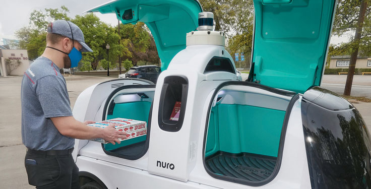
    In April, the pizza company Domino’s and self-driving delivery company Nuro launched autonomous pizza delivery in Houston, Texas. Select customers who place a prepaid online order on certain days and times from Domino’s in Woodland Heights can choose to have their pizza delivered by Nuro’s R2 autonomous, occupantless on-road delivery vehicle.

    Customers selected for the service receive text alerts, which update them on R2’s location and provide them with a unique PIN to retrieve their order. Once R2 arrives, customers are prompted to enter their PIN on a touchscreen, opening its doors.

    In February 2020, Nuro became the first autonomous vehicle developer to be given exemptions by the U.S. National Highway Traffic Safety Administration for testing on public roads without the need to have controls for human operators. Unlike many other autonomous vehicle companies, Nuro engineered its self-driving road vehicles to transport goods instead of people.

    There’s no set timetable for how quickly Domino’s and Nuro will evaluate their testing or expand the service.

    Nuro is also carrying out trials and pilot deliveries with several other companies, including restaurant chain Chipotle, Kroger grocery stores, CVS pharmacies, Walmart and FedEx.

  • Bird and u-blox: Keeping sidewalks for walkers

    Bird and u-blox: Keeping sidewalks for walkers

    Photo: Bird
    Photo: Bird

    Scooter company Bird and u-blox have jointly developed a new Smart Sidewalk Protection system to help prevent shared scooters from operating on city sidewalks. It uses the u-blox ZED-F9R, a dead-reckoning module that fuses GNSS and sensor data, delivering centimeter-level location information in any condition. This allows the system to monitor whether a Bird e-scooter is being operated unsafely, such as on a sidewalk or speeding. Using Bird data, the companies co-developed a version of the ZED F9R module tailored to meet the needs of the shared micromobility industry.

    The dual-band ZED-F9R GNSS receiver supports up to eight times more satellite signal types and four times more constellations (GPS, Galileo, GLONASS and BeiDou) than typical solutions. The module processes real-time vehicle data, including wheel speed, IMU sensor data (including acceleration and heading), and real-time kinematic data that corrects for ionospheric interference. The technology is also optimized for e-scooters by applying dynamic models matching their movements.

    To turn this sensor-fusion module into its Smart Sidewalk Protection system, Bird developed a five-step process for creating sidewalk maps with centimeter accuracy. It starts with a geofence outline constructed from satellite imagery or city GIS data. Bird then uses surveying equipment to measure the location of three city landmarks. Only a few measurements are needed for each city. Once the landmarks have been identified, they compare their location to the satellite imagery to determine offsets and rotations and use them to shift and transform each of the original geofence outlines. Finally, they pre-load the updated geofence outlines onto Bird vehicles to eliminate latency. When combined with the hyper-accurate location measurements provided by Bird’s sensor-fusion module, they can detect and respond to sidewalk riding almost instantly, according to Bird.

    The micromobility module is being piloted in Milwaukee and San Diego. Madrid will be Bird’s first pilot city in Europe, with plans for a broader roll-out slated in 2022.

  • Catching DARPA’s gremlins and flying a Renault 4L

    Catching DARPA’s gremlins and flying a Renault 4L

    Developments in the autonomous space this month include an cargo aircraft with unmanned passengers, another way drones can deliver really heavy cargo, and a fanciful recreation of a beloved vintage car.

    How do you catch a gremlin? Wait, what’s a gremlin?

    Gremlins are supposed to be unmanned aircraft which are launched and recovered in flight from a cargo or bomb-carrying aircraft. Flying in small collaborating swarms, gremlins are equipped with sensors for communications, jamming, reconnaissance or other needs.

    As envisioned by the U.S. Army’s Defense Advanced Research Projects Agency (DARPA), gremlins are reusable, may be autonomous, can operate in GNSS-denied environments, and can be flown on high-risk missions into high-risk areas — places that high-value manned aircraft would avoid.

    DARPA has contracted Dynetics to come up with a system that meets those criteria — a pretty demanding list of capabilities. So far, prototype X-61A UAVs have been built and flown through four flight test campaigns.

    Many military technologists have dreamed of unmanned flying aircraft carriers, which could be put to a variety of uses. If the gremlin system works, the commercial world might well find its own applications.

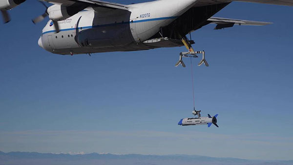
    Carried under the wings of a C-130A cargo transport, gremlins have been launched and flown through three flight tests. Capture and recovery has been attempted but was unsuccessful because of unanticipated turbulence. One  test vehicle was lost when its parachute recovery system failed — altogether, three vehicles have been lost.

    Finally, on Oct. 25 over the Dugway Proving Ground in Utah, one Gremlin X-61A was flown onto the C-130A capture system and successfully recovered.

    The gremlin X-61A test vehicle is recovered into C-130 transport on its fourth test flight. (Photo: DARPA)
    The gremlin X-61A test vehicle is recovered into C-130 transport on its fourth test flight. (Photo: DARPA)

    The DARPA program requires a number of Gremlin UAVs to be captured, recovered and stowed in the mother aircraft within 30 minutes. The current recovery system is somewhat complex, so it remains to be seen if subsequent tests can achieve this substantial goal. Recovery might become easier and more reliable with an increase in the degree of autonomous operation for both the UAV and the recovery system.

    A Guided Box for Disaster Relief

    We turn now from a complex system to a direct and simple one that fulfills a key logistical requirement for disaster relief. It’s a fully autonomous UAV that lacks any integrated power source. Essentially, it’s a guided box.

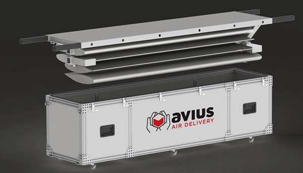
    The AVIUS Air Delivery Mercy-2000 by Yates Electrospace Corp. is basically an air-dropped cargo container that can glide from an altitude of 25,000 feet to a fixed location. From up to 35 miles away, this precision-guided drone can land safely within 110 yards of the desired site and deliver more than 1,600 pounds of material for critical medical and humanitarian needs.

    Initially developed for military air-drop purposes (the U.S. Air Force just ordered 15), the cargo container is an 8-foot-long box with two sets of folded wings, fitted with a small nose-cone and a larger tail-cone before launch that help stabilize flight. The wings are carried inside the box and are installed by simply turning over the top cover.

    Photo: Yates Electrospace Corp
    Photo: Yates Electrospace Corp.

    The assembly includes the essential guidance system. A COTS (commercial-off-the shelf) GPS receiver, lidar, magnetic heading sensor, barometric altimeter, inertial measurement unit and pitot speed sensor are integrated into proprietary software running on a COTS computer.

    Anyone who has ever tried to land a glider from 25,000 feet knows that actually landing safely in the right place is tough to do. It’s quite an achievement to create a reliable, precision, autonomous solution that works when pushed out the back of an aircraft.

    New Model of Old Renault Takes Flight

    Now to a more fanciful story about an old friend – the Renault 4L.  Many of us remember driving or riding in one, with its gear-change on the dash, uncomfortable seats, suspension and “sewing machine” engine.

    The Renault 4L was manufactured from 1974 to 1978. (Photo: ribeiroantonio/iStock Editorial/Getty Images Plus/Getty Images)
    The Renault 4L was manufactured from 1974 to 1978. (Photo: ribeiroantonio/iStock Editorial/Getty Images Plus/Getty Images)

    In celebration of its 60th anniversary, Renault (now part of the Renault–Nissan–Mitsubishi Alliance) and TheArsenale have teamed up in France to make a flying 4L known as the AIR4.

    The body shell has been re-engineered in carbon fiber with the same shape of the original 4L. The frame has been built for vertical and horizontal flight, with propellers at each corner of the vehicle. The body shell lifts at the front for pilot access. The Air4 carries lithium polymer batteries, providing up to 90,000 mAh. It can achieve 58 mph when tilted forward at 45°.

    The Air4 will go on public display until the end of the year in the center of Paris at the Renault Center on the Champs Elysées, along with other antique models of the Renault 4. Miami will be the next stop for the AIR4, followed by New York and then Macau, China.

    To sum up, we have gremlins making progress and being recaptured, a 1-ton flying box  for important deliveries, and a celebration of 60 years of the Renault 4L — quite a wide range of ingenious unmanned vehicle applications.

    Tony Murfin
    GNSS Aerospace

  • Tallysman offers embedded triple-band GNSS antenna

    Tallysman offers embedded triple-band GNSS antenna

    Tallysman Wireless Inc. has added the low-profile triple-band HC997EXF to its line of embedded helical GNSS antennas, and the TWA928LXF to its AccuAuto line. Both feature the company’s eXtended Filtering (XF).

    Designed for UAVs and Other Applications

    Photo: Tallysman
    Photo: Tallysman

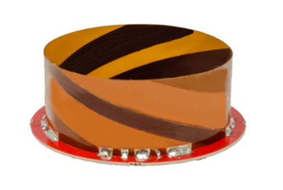
    The HC997EXF is designed for precise positioning, covering the GPS/QZSS-L1/L2/L5, GLONASS-G1/G2/G3, Galileo-E1/E5a/E5b, BeiDou-B1/B2/B2a, and NavIC-L5 frequency bands. It also covers the satellite-based augmentation system (SBAS) available in the region of operation — WAAS (North America), EGNOS (Europe), MSAS (Japan) or GAGAN(India) — as well as L-band correction services.

    The low-profile helical antenna is packaged in a light (11 g) and compact form factor (60 mm wide and 25 mm tall). Its precision-tuned, high-accuracy helical element provides an excellent axial ratio and operates without a ground plane. These features make the HC997EXF suitable for lightweight unmanned aerial vehicle (UAV) navigation and a wide variety of precision applications.

    The HC997EXF antenna base has a flying lead and a variety of connectors. To facilitate installation, Tallysman provides an optional embedded helical mounting ring that traps the outer edge of the antenna circuit board to the host circuit board or any flat surface. Tallysman provides support for installation and integration of its embedded helical antennas to ensure optimal performance.

    New Vehicle Antenna Launched

    Photo: Tallysman
    Photo: Tallysman

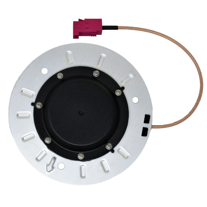
    Another new XF antenna, the TWA928LXF, is part of Tallysman’s  AccuAuto autonomous vehicle family of compact and rugged embedded antennas.

    The triple-band TWA928LXF supports GPS/QZSS-L1/L2/L5, GLONASS-G1/G2/G3, Galileo-E1/E5a/E5b, BeiDou-B1/B2/B2a, and NavIC-L5 signals and frequency bands, including L-band correction services.

    The TWA928LXF vehicle antenna features a patented Tallysman Accutenna technology antenna element, an integrated ground plane, radome and underside cover that provides mist and condensation protection. The bottom cover also supports the antenna cable and mitigates cable vibration to ensure that the antenna has a long service life, while the ground plane improves antenna performance.

    All AccuAuto antennas are built with Automotive Electronics Council (AEC) certified electronic components designed to perform under the most challenging environmental conditions, such as extreme temperatures, shock and vibration.

    XF Coming to All Lines

    eXtended Filtering enables the HC997EXF antenna to mitigate new and existing radio frequency bands that interfere with GNSS signals. The custom XF filtering has been tested to mitigate new (Europe and Japan) and existing LTE signals, enabling the XF antennas to produce clean and pure GNSS radio frequency data.

    For example, in North America, the planned Ligado service, which will broadcast in the frequency range of 1526 to 1536 MHz, could affect GNSS antennas that receive space-based L-band correction service signals (1539–1559 MHz).

    Similarly, LTE signals or their harmonics, such as the new LTE bands in Europe–Band 32 (1452–1496 MHz)–and Japan–Bands 11 and 21 (1476–1511 MHz)–have affected GNSS antennas and receivers.

    Lastly, the Inmarsat satellite communication uplink (1626.5–1660.5 MHz), commonly used on maritime vessels, can also affect nearby GNSS antennas.

    Tallysman Wireless also has added eXtended Filtering (XF) to its TW3800 series of Accutenna precision antennas, and will be rolled out to all of Tallysman’s product lines.

  • MCP works with NHTSA to assess GIS data sharing for 911

    MCP works with NHTSA to assess GIS data sharing for 911

    Photo: Thinkstock/Stockbyte/Getty Images
    Photo: Thinkstock/Stockbyte/Getty Images

    The National Highway Traffic Safety Administration (NHTSA) and Mission Critical Partners (MCP) will collaborate to assess the status of geographic information systems (GIS) within the 911 community.

    The goal of the initiative is to define what is required to achieve interoperable GIS data sharing nationwide. NHTSA selected MCP following a full and open solicitation and comprehensive evaluation of all proposals. The National 911 Program, housed within NHTSA, will lead the effort.

    Thousands of 911 centers in the U.S. have not deployed a nationally uniform, consistent GIS capability or mechanism for sharing GIS data. According to the NHTSA, GIS is an essential element of a truly interoperable, interconnected national Next Generation 911 (NG911) system.

    In 2019, the “National NG911 Roadmap,” a report published by the National 911 Program and supported by MCP, highlighted GIS as a significant barrier to achieving a nationwide system of systems. The report emphasized the need to develop standards, requirements and best practices for sharing GIS data. Later in 2019, the program published the “Strategic Plan for 911 Data and Information Sharing,” which also underscored the need for GIS data uniformity.

    Critical elements of the National 911 Program/MCP final report will include:

    • Current status of GIS. As 911 centers deploy NG911 and transfer calls across jurisdictions, the lack of GIS consistency poses significant problems. Many technical and non-technical challenges are associated with how GIS data is developed, processed, shared and stored among 911 entities. The report will identify the technical issues that the community must address.
    • Assessment of required entities, issues and partner agencies. Governance, administrative, financial and operational issues will be addressed, including resources, budget and organizations needed to overcome the gaps.
    • Strategies and metrics. The report will identify metrics to determine the accuracy of GIS data. It also will present strategies for overcoming the challenges found throughout the assessment process.

    The National 911 Program is responsible for improving coordination and communication among federal, state and local 911 centers, personnel, and telecommunications carriers and vendors. One of the program’s primary objectives is to develop and share resources concerning the technology used in providing 911 services.

    Mission Critical Partners (MCP) provides data integration, consulting, network and cybersecurity solutions for mission-critical communications networks in the public safety, justice, healthcare, transportation and utility markets.