Blog

  • Launchpad: Vehicle tracking, camera drones, e-bikes

    Launchpad: Vehicle tracking, camera drones, e-bikes

    A roundup of recent products in the GNSS and inertial positioning industry from the December 2021 issue of GPS World magazine.


    OEM

    Satellite-cell terminal

    With built-in GPS receiver
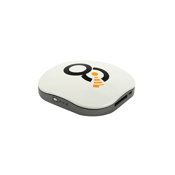
    Photo: OQ
    Photo: OQ

    OQ Technology’s dual-mode satellite-cellular IoT modem and tracker is a plug-and-play, small, low-cost and low-power solution that can collect data from more than 1,000 sensors. It has a built-in GPS receiver and supports 5G NB-IoT, GSM, LTE-M and bi-directional satellite links. The flexible, robust and programmable dual-mode terminal has pre-paid data packages suitable for remotely monitoring and controlling fixed and mobile assets in industries such as transportation, oil and gas, utilities, and maritime.

    OQ Technology, oqtec.space

    Fiber Extension

    Provides mission-critical, extended length GPS over fiber
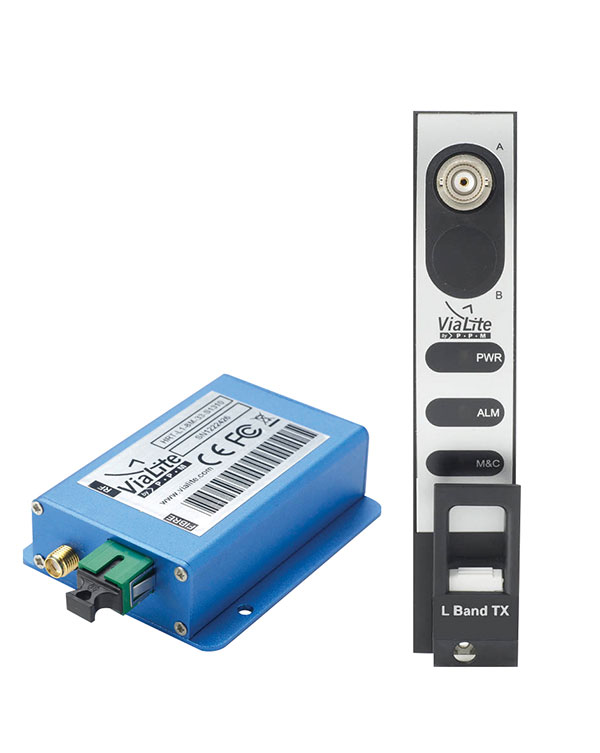
    Photo: ViaLite
    Photo: ViaLite

    ViaLite’s GPS over Fiber Extension Kit for Microchip/Microsemi GPS timing servers provides mission-critical GPS timing and synchronization for systems requiring extremely accurate clock signals. Standard transmission distances for the extension kit can be up to 10 km, while solutions are available for distances as long as 50 km. The ViaLite kit was chosen for its unique performance with Microsemi’s S650 timing server. The ViaLite GPS link is designed to provide a remote GPS/GNSS signal or derived timing reference to equipment located where no signal is available, such as inside buildings or tunnels. By using optical fiber instead of traditional coaxial cable, extreme distances are possible with no radio frequency loss and zero introduction of noise.

    ViaLite, vialite.com

    Edge Computing Device

    Acts as a high-performance master clock
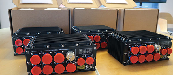
    Photo: Soc-e
    Photo: SoC-e

    The RELY-MIL-TIME-SERVER, which complies with MIL-STD-810G and MIL-STD-461G, embeds the latest timing, networking and security technology in a single SWaP platform. The all-in-one rugged edge computing device acts as a high-performance master clock and serves secure accurate timing distribution (PTP, NTP, GNSS). The timing feature is combined with high-bandwidth and high-availability Ethernet switching and L2/L3 cybersecurity services in a unique commercial-off-the-shelf device. At its heart is a Xilinx Ultrascale+ MPSoC device powered by SoC-e hardware IP cores for PTP and high-availability low-latency Ethernet networking.

    Relyum by SoC-e, www.soc-e.com

    IMU

    Provides improved attitude and vibration control
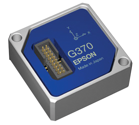
    Photo: Epson
    Photo: Epson

    The M-G370PDS0 inertial measurement unit (IMU) is equipped with a high-performance six-axis sensor. It has an angle random walk (short-term variation in output) of 0.03°/√h, which is half that of its predecessor, and can more accurately detect very slight changes in the attitude of equipment and systems, since they do not get lost in sensor noise. The small size, light weight and low power consumption will help customers make their own products smaller and lighter. It also maintains compatibility with earlier products (the M-G370/365/364/354), making performance upgrades easy.

    Seiko Epson Corp., global.epson.com

    Timing Solution

    Embedded module for third-party hardware

    Image: ADVA
    Image: ADVA

    The OSA 5400 SyncModule enables technology suppliers to integrate precise synchronization into their hardware. Its M.2 form factor can add timing capabilities to switches, routers, open compute servers and other IT devices. The SyncModule provides GNSS, precision time protocol (PTP) and network time protocol (NTP) engines as well as comprehensive PTP and GNSS monitoring and assurance functionality. It can enable assured sub-microsecond timing in public and private networks as well as critical infrastructure. Featuring multiple interface options for easy integration, the OSA 5400 SyncModule comes with an open API. It also can be managed by ADVA’s proven Ensemble Sync Director management system.

    ADVA, adva.com

    Evaluation software

    For u-blox M10 GNSS technology integrators
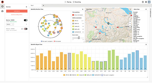
    Photo: u-blox
    Photo: u-blox

    Running on Microsoft Windows, u-center 2 offers anyone working with 10th-generation (M10) u-blox GNSS technology a highly intuitive interface to configure GNSS products, evaluate their performance, improve the quality of their software, and experience the performance boost achieved using GNSS-related services. The software is the successor to the u-center GNSS evaluation software, which has been used by design engineers for almost two decades to develop GNSS receiver applications. Compatible with u-blox M10 GNSS technology, u-center 2 is designed to offer improved performance over its predecessor. New features in u-center 2 simplify configuration, evaluation and software development of GNSS-based solutions. It is free for download.

    u-blox, www.u-blox.com

    GNSS Antenna

    Low profile for easy installation
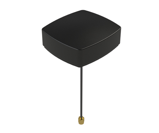
    Photo: Maxtena
    Photo: Maxtena

    The MEA-1227-SM is a GNSS/L1 and L2 low-profile screw-mount antenna. It has high performance suitable for maintaining constant network connectivity. The MEA-1227-SM covers all GPS/GLO/BEI/ QZSS/Galileo/SBAS/L1L2 standard frequencies. It is designed for telematics systems, remote surveillance, asset tracking and any internet of things (IoT) system applications. This screw mount antenna is easy to install, with a low profile suitable for challenging installations. It has a IP67-rated housing and anti-rotation mounting.

    Maxtena, maxtena.com


    Transportation

    E-Bike Guidance

    Mapping and navigation for city riders

    Photo:
    Photo: Cowboy

    The Cowboy e-bike solution provides riders with high-performance, real-time GNSS accuracy, enabling them to map their own paths and those of the cities in which they live. It uses smart road-companion applications to ensure riders get precise information, regardless of the route they travel. The positioning component uses Taoglas’ Accura GVLB258.A, a multi-band GNSS L1/L5, high-performance stacked patch antenna, in conjunction with u-blox’s SAM-M8Q GNSS positioning module. The combination allows for extremely low power and high accuracy. The solutions works with “micromobility” services offered by Cowboy, such as Easy Rider for theft detection, bike insurance and crash detection notifications.

    Taoglas, taoglas.com; u-blox, u-blox.com

    Vehicle Tracking

    Instant decimeter-level accuracy with automotive sensors

    Photo: Profound Positioning
    Photo: Profound Positioning

    The Profound-IVT (instant vehicle tracking) provides cost-effective vehicle navigation. Based on a firmware library, and rapidly adaptable to any navigation platform, IVT combines precise point GNSS positioning (PPP), dead reckoning and radar technologies in an integrated solution to provide decimeter-level positioning accuracy plus orientation and velocity. IVT performs in tunnels, dense urban environments, multi-level highway junctions and parking garages. With errors <1% of distance travelled, resolution is extremely rapid. Base stations are not required and there are no operating range limitations. Applications include driver assistance, mobility and taxi, autonomous vehicles, geofencing, fleet tracking, insurance, driving and safety management, and connected driving.

    Profound Positioning Inc., profoundpositioning.com


    Surveying & Mapping

    City Twins

    Off-the-shelf map data through the HxGN Content Program

    Photo: Hexagon
    Photo: Hexagon

    Metro HD city data is a new offering of ultra-high-resolution 2D and 3D digital twins of major cities. Metro HD expands the data stack to include high-definition true orthophotos, obliques, digital terrain models, lidar point clouds, 3D building models (LOD2), 3D meshes and land-use maps. Cities captured in 2021 include Munich, Cologne, Vienna, Milan, Amsterdam, Stockholm, Tokyo, Dallas, New York, Stuttgart and Frankfurt. More cities will be added in early 2022. The program uses a hybrid urban mapping sensor, the Leica CityMapper-2, that concurrently collects lidar and aerial imagery. The derived products, based on the strength of each subsystem, result in superior accuracy and temporal consistency across all three data dimensions.

    Hexagon Geospatial, hexagon.com

    GNSS + Laser

    Workflow for Esri ArcGIS Field Maps
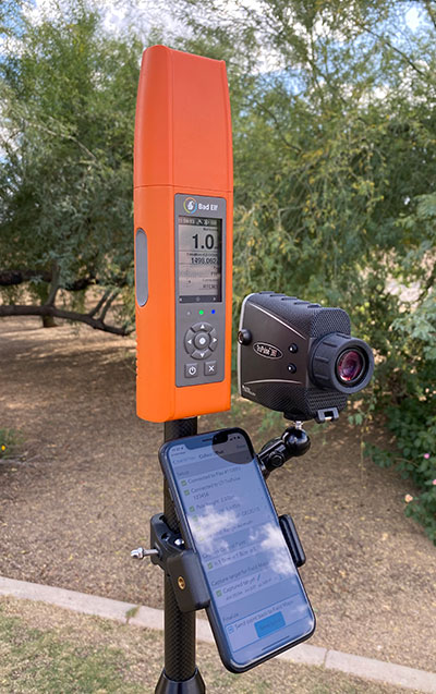
    Photo: Bad Elf
    Photo: Bad Elf

    Bad Elf LLC and Laser Tech are providing an integrated laser offset workflow for acquiring high-accuracy field data in GNSS-challenged environments. The new workflow integrates Bad Elf and LTI hardware in collaboration with ArcGIS technology from Esri. The Bad Elf Flex GNSS receiver connects to any LTI TruPulse rangefinder over a wired or Bluetooth connection to deliver high-accuracy location data to Esri ArcGIS Field Maps. Field workers can now efficiently complete position and height data collection in access-limited situations, saving time, money and effort. The Bad Elf app workflow runs on Android and iOS.

    Bad Elf, bad-elf.com; Laser Tech, www.lasertech.com; Esri, esri.com

    Survey Platform

    Cloud based for collaboration

    Photo:
    Photo: Handheld

    Geo-genie is a cloud-based collaborative and professional mapping and surveying platform enabling customization and creation of geocentric information systems. Teamed with Handheld’s Algiz RT8 rugged field tablet, it streamlines work and allows non-professionals to perform accurate geodetic mapping, guiding and monitoring of their data collection. The platform enables organizations to have an advanced, professional surveying and GIS platform with customized procedural workflows, management of user hierarchies, and integration with other organizational information systems. Geo-genie can connect with professional surveying equipment, such as GPS and total stations, and integrates data into a cloud-based central database with no restriction for specific data-collection hardware.

    Handheld Group, handheldgroup.com; Geo-genie, Geo-genie.com

    GNSS Amplifier

    Marks forest, urban trees in logbook app
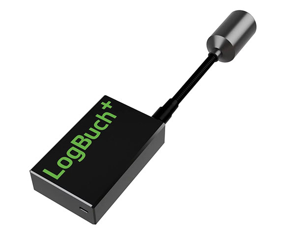
    Photo: Stihl
    Photo: STIHL

    The wireless GNSS amplifier LogBuch+ increases the accuracy of location data with the cloud-based LogBuch application. The app enables voice-based digital mapping via a smartphone app, such as for the maintenance of trees. The compact device receives satellite signals on several radio frequencies, delivering significantly more precise data than a smartphone alone. Foresters can carry the GNSS amplifier in a pocket and digitally mark trees for felling using the LogBuch app.

    STIHL, stihl.com

    Lidar Unit

    Can be mounted on plane or UAV
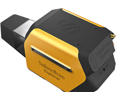
    Photo: YellowScan
    Photo: YellowScan

    The YellowScan Explorer lidar can be mounted on a light manned aircraft or helicopter, as well as a UAV platform such as the DJI M300. This versatility allows the end user to tackle a wide range of projects with the same unit. It uses an Applanix APX-20UAV GNSS/inertial solution and has a precision of 2.6 cm and an accuracy of 2.2 cm. Its high-power laser scanner can catch points up to 600 meters away. Flight operation speed is 5–35 m/s; it is capable of above-ground-level altitude up to 300 m. The low-weight unit (2.3 kg without battery) can be combined with YellowScan’s suite of software to extract and process point cloud data for surveying, forestry, environmental research, archaeology, industrial inspection, civil engineering and mining sectors.

    Yellowscan, yellowscan-lidar.com


    UAV

    Folding camera drone

    Designed for aerial photography

    Photo: DJI
    Photo: DJI

    The DJI Mavic 3 improves on its predecessor with better sensors, a dual-camera system, omnidirectional obstacle sensing, smarter flight modes and longer flight times. A powerful positioning algorithm improves hovering precision with signals from GPS, GLONASS and BeiDou satellites, enabling the drone to lock onto multiple satellite signals faster. The increased positioning precision also makes the drone less likely to drift in the air and more stable when shooting long exposures and time lapses. The Advanced Pilot Assistance System (APAS) 5.0 combines inputs from six fish-eye vision sensors and two wide-angle sensors to sense obstacles in all directions and plan safe flight routes.

    DJI, dji.com

    Remote Operations

    Conduct missions, manage fleets and view video feeds

    Photo: SkyGrid
    Photo: SkyGrid

    SkyGrid’s autonomous remote UAV operations solution enables drone operators to remotely conduct missions, control flights, manage fleets and view live video feeds. Using artificial intelligence and airspace-related data feeds, SkyGrid enables safe remote operations, whether conducting routine inspections or generating optimal flight paths. Advanced route generation capabilities create the safest route for each drone based on the flight plan, environmental conditions, the vehicle’s performance, and the mission criteria with minimum on-site support required. SkyGrid Launch allows video feeds from drones to be consolidated to a remote central location, such as a ground station.

    SkyGrid, skygrid.com

    Helicopter

    Ready for the long haul
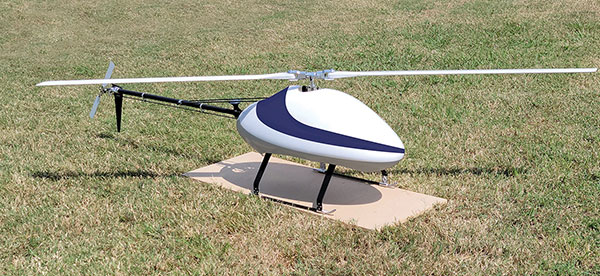
    Photo: UAS Global Services
    Photo: UAS Global Services

    The Sicura EG-1100 is a heavy-lift, long endurance, single-rotor helicopter. Now in its third generation, the helicopter can haul 15 pounds. It cruises at 55 knots. The EG-1100 is available in both electric and gas engine configurations, with an endurance at 3.5 hours on gasoline and 1 hour on electric power. The new gas engine is the high-performing and efficient Skypower 110, tuned to the craft’s internally developed chassis and rotor blades. It offers stable performance in challenging environmental conditions, exceptionally stable flight and immediate flight response for image capture and lidar operations. Multiple payload sets can be carried in one flight.

    UAS Global Services, uas-gs.com

    Small UAS

    High performance in low weight class

    Photo: Ascent Aerosystems
    Photo: Ascent Aerosystems

    The Spirit dual-rotor coaxial unmanned aerial system (UAS) is a versatile and durable system for mission-critical operations. Combined with a fully modular, plug-and-play payload design, the Spirit’s open architecture allows operators to easily add or upgrade software to unlock new operating capabilities without the need to design or develop a new aircraft. It has an all-weather airframe. With nearly 10 pounds available for batteries and payloads, Spirit sets the new standard for performance in its weight class. Setup is quick and easy, allowing for takeoff from any type of terrain. The highly streamlined all-weather airframe has a top speed of 60 miles per hour and can operate in high winds. Payloads and batteries can be mounted or stacked on the top or bottom point.

    Ascent AeroSystems, ascentaerosystems.com

  • Ireland’s danalto to demonstrate indoor positioning for ESA

    Ireland’s danalto to demonstrate indoor positioning for ESA

    Danalto was visited by Ireland’s Minister Damien English upon the announcement of ESA contract. (From left) English, Mary Kathryn Midgett (danalto), Tom Kelly (Enterprise Ireland) and David McDonald (danalto). (Photo: Danalto)
    Danalto was visited by Ireland’s Minister Damien English upon the announcement of an ESA contract. (From left) English, Mary Kathryn Midgett (danalto), Tom Kelly (Enterprise Ireland) and David McDonald (danalto). (Photo: danalto)

    Dublin-based danalto Ltd., has won a contract with the European Space Agency (ESA) to demonstrate low-infrastructure indoor location technologies that complement GNSS, particularly Galileo. ESA seeks to improve this European capability in order to enable impactful, societal use cases, thus prompting its call for this investigation, assessment, and demonstration by danalto.

    Danalto is a internet of things (IoT) software company specializing in positioning and spatial intelligence technologies. It has extensive experience in positioning intelligence with its FiLo, a LoRa 2.4 GHz-enabled solution known for both its low power and low infrastructure requirements.

    During the 18-month contract, danalto will determine the best positioning technology, system algorithms and deployment aspects across a range of location accuracies. This will be done by critically analyzing both classic (observables-based) and disruptive (signal-based) positioning techniques, culminating in a hybrid combination technology solution.

    The resulting solution will support use cases across multiple industries — including healthcare, logistics and emergency services — and will accelerate the increased adoption of location positioning solutions within the European market and beyond. The trajectory of this project aligns with danalto’s progression plan for next generation positioning solutions, which will be brought to market for commercial use in 2022.

    On Oct. 27, danalto was visited by Minister Damien English and Enterprise Ireland for a briefing on FiLo’s progress to date and plans moving forward aligned with ESA and beyond.


  • ISRO partners with OPPO on NavIC messaging app

    ISRO partners with OPPO on NavIC messaging app

    logoThe Indian Space Research Organization (ISRO) and India’s Department of Space have signed a memorandum of understanding (MOU) with OPPO India to strengthen the research and development of the NavIC messaging service to provide a convenient and user-friendly platform.

    The MoU will pave the way for future collaborations between ISRO and OPPO India to develop indigenous solutions by incorporating the NavIC short-messaging feature into smartphones released by OPPO India.

    The MoU will enable ISRO and OPPO India to exchange technical information on the NavIC messaging services. This will enable the building of rapid, ready-to-use, end-to-end application-specific solutions that integrate the NavIC messaging service with OPPO’s mobile handset platform, with Indian end-users in mind.

    The MOU also aims to help fulfill “Atmanirbhar Bharat,” which translates to “self-reliant India.” Atmanirbhar Bharat is a phrase used and popularized by Indian Prime Minister Narendra Modi and the Government of India in relation to the country’s economic development and vision.

  • Nestwave geolocation added to Sequans IoT platform

    Nestwave geolocation added to Sequans IoT platform

    Nestwave is collaborating with Sequans to deliver accurate and efficient GNSS positioning for low-power internet of things tracking

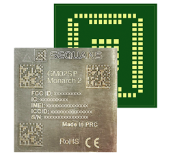
    The Nestwave IP provides the latest Sequans LTE-M/NB-IoT platform with geolocation. (Photo: Sequans)
    The Nestwave IP provides the latest Sequans LTE-M/NB-IoT platform with geolocation. (Photo: Sequans)

    Nestwave has announced that its technology has been selected by Sequans Communications S.A., provider of 5G/4G cellular internet of things (IoT) connectivity solutions. Specifically, Nestwave’s technology will add GNSS positioning to the Sequans Monarch 2 LTE-M/NB-IoT platform.

    Integrated into the Sequans Monarch 2 GM02SP module, the Nestwave GNSS solution offers Sequans’ IoT customers accurate positioning with ultra-low-power consumption while minimizing component count, cost and size by removing the need for an external positioning chipset.

    This makes the Sequans platform suitable for a wide variety of intermittent, power-limited tracking use cases including personal trackers, parcel and pallet location, and fleet trackers, as well as car, bike and scooter location and theft recovery. Cosmo Connected, a leader in urban mobility solutions, has already adopted the Monarch 2 GM02SP solution to reduce the cost and power consumption of its tracker products.

    Nestwave’s technology allows geolocation to be added to existing IoT chipsets by implementing a GNSS receiver using the chip’s existing radio and computing capabilities. This eliminates the need for an external GNSS chipset and product redesign.

    “Nestwave’s technology provides the smallest, most power efficient, and lowest component count solutions for IoT geolocation,” said Nestwave CEO Ambroise Popper. “Our strategic partnership with Sequans addresses the challenge of integrating accurate geolocation into compact, often battery-powered, low-cost IoT nodes and allows Sequans customers to benefit from higher performing, lower cost tracking solutions.”

    “Leveraging Nestwave’s innovative technology to provide low-power GNSS on Monarch 2 widens its capabilities and makes many types of IoT tracker use cases more affordable because there is no need for additional positioning chips or modules,” said Georges Karam, Sequans CEO.

    Nestwave IP has been integrated into a variety of chip architectures and on various DSP/CPU cores. In combination with Nestwave cloud services, this IP enables a very short time-to-first-fix, which allows for much lower power consumption in tracking use cases, without compromising on sensitivity or accuracy. The company’s technology roadmap includes the addition of 5G/4G cellular-based hybrid location functionality and solutions that will improve the accuracy of indoor tracking.

  • Quectel and Point One bring precise location to robotics and agriculture markets

    Quectel and Point One bring precise location to robotics and agriculture markets

    Photo: Quectel
    Photo: Quectel

    Quectel Wireless Solutions, a supplier of IoT modules and antennas, and Point One Navigation, a provider in precision location technology, have announced the LG69T-AM, the latest addition to the LG69T GNSS Module Series. Point One’s positioning engine powers the LG69T-AM and enables centimeter-level global accuracy by integrating augmented GNSS in a module with open-source API.

    The LG69T-AM GNSS module features STMicroelectronics’ Teseo V dual-band L1/L5 positioning receiver platform with 80 tracking and four fast acquisition channels compatible with GPS, GLONASS, Galileo, BeiDou, QZSS and NAVIC.

    The LG69T-AM leverages Point One’s RTK and SSR technology for centimeter-level accuracy and ultra-fast convergence time. It is designed for easy integration with minimal e-BOM modification and is well-suited for mass market adoption without the need for an expensive external co-processor. Due to its small package size, light weight, and excellent power consumption, it is ideal for applications such as robotics and precision agriculture.

    Embedded in the LG69T-AM is Point One’s FusionEngine and its Polaris correction service client. FusionEngine is compatible with standards-based corrections services including those based on RTCM.

    Polaris is Point One’s own GNSS correction service that unlocks better than 10cm absolute accuracy with a coast-to-coast footprint in the United States and coverage across Europe. It offers a variety of connectivity options including delivery over cellular and L-band. The network is purpose-built for precision agriculture customers and includes advanced anti-jam, interference mitigation, end to end security and automatic integrity monitoring unmatched by any other provider.


  • The trolley problem: What would a self-driving car do?

    The trolley problem: What would a self-driving car do?

    Image: metamorworks/iStock/Getty Images Plus/Getty Images
    Image: metamorworks/iStock/Getty Images Plus/Getty Images

    Years ago, a trucker driving down the western slope of the Rocky Mountains lost his brakes. As his truck accelerated, he hoped to make it to the next runaway truck ramp before losing control. However, when he reached it, he saw a car parked at its base with a group of teenagers drinking beers. In a split-second decision, he veered to the left instead and went off the cliff. In the coming years, faced with the same moral dilemma, what would a self-driving truck do?

    Matteo Luccio
    Matteo Luccio

    Many similar scenarios have been discussed in the technical literature on self-driving vehicles. Most of them are variations on the “trolley problem” presented to generations of college philosophy students since it was first formulated by philosopher Philippa Foot in 1967 and adapted by Judith Jarvis Thomson in 1985. In the trolley problem, a person can choose to divert a trolley from the main track, saving five people who are working on it but killing a person on the other track who otherwise would not have been involved.

    When faced with an inevitable crash, should a self-driving car slam into a wall to save the lives of three children crossing the street or, in effect, target them to save its two occupants? Most people, when polled, choose the former. When shopping for a new car, however, those same people are more likely to buy one that will make their own safety its highest priority.

    Human drivers react to emergencies instinctively — motivated by neither forethought nor malice — and in real time. By contrast, the choices made by autonomous vehicles are predetermined by programmers; their control systems can potentially estimate the outcome of various options within milliseconds and take actions that factor in an extensive body of research, debate and legislation. Therefore, our judgment is harsh if those vehicles make what we deem to be the “wrong” choice.

    However, there is no universal agreement as to what constitutes the “right” choice, other than the fact that people generally prefer self-driving cars to minimize the number of lost lives and to privilege people over animals and younger people over older ones. General principles such as “to minimize harm” are of little help in complex and dynamic real-life situations.

    Self-driving cars, in addition to their many other benefits, will dramatically reduce traffic accidents and fatalities, because they will never be distracted, drowsy, drunk or drugged. Yet accidents will still happen, and their outcomes will be largely determined far in advance.

    The mass introduction of self-driving cars onto public roads will require overcoming technical, legal and ethical challenges. As a society, we will have to agree on a uniform set of ethical codes that will guide these vehicles’ decision-making processes in emergencies. This will force us to explicitly quantify the value of human life and property, and encode it in software. These are hard and uncomfortable choices.

    Autonomous systems, fusing data from multiple sensors, will guide these vehicles. It is up to us to decide whom they will target and whom they will spare.

    Matteo Luccio | Editor-in-Chief
    [email protected]

  • STMicroelectronics offers triple-band automotive GNSS receiver

    STMicroelectronics offers triple-band automotive GNSS receiver

    Photo: STMicroelectronics
    Photo: STMicroelectronics

    STMicroelectronics has introduced an automotive satellite-navigation chip designed to deliver high-quality position data needed by advanced driving systems.

    Joining ST’s Teseo V family, the STA8135GA automotive-qualified GNSS receiver integrates a triple-band positioning measurement engine. It also provides standard multi-band position-velocity-time (PVT) and dead reckoning.

    The STA8135GA’s triple-band enables the receiver to efficiently acquire and track the largest number of satellites in multiple constellations simultaneously for superior performance in difficult conditions such as in urban canyons and under tree cover.

    Triple band has historically been used in professional applications such as surveying, mapping and precision agriculture that demand millimeter accuracy with minimal reliance on correction data, usually available on larger and more expensive modules than ST’s single-chip STA8135GA.

    The compact STA8135GA will help driver-assistance systems make accurate decisions about the road ahead. The multi-constellation receiver delivers raw information for the host system to run any precise-positioning algorithm, such as PPP/RTK (precise point positioning/real-time kinematic). The receiver can track satellites in the GPS, GLONASS, BeiDou, Galileo, QZSS and NAVIC/IRNSS constellations.

    The STA8135GA also integrates separate low-dropout voltage regulators on chip to supply the analog circuitry, digital core and input/output transceivers, simplifying selection of the external power supply.

    The STA8135GA also enhances the performance of in-dash navigation systems, telematics equipment, smart antennas, V2X communication systems, marine navigation systems, drones, and other vehicles.

    “The high precision and single-chip integration delivered by the STA8135GA satellite receiver enables the creation of reliable and affordable navigation systems that enable vehicles to be safer and more context aware,” said Luca Celant, general manager, ADAS, ASIC and Audio Division, Automotive and Discrete Group, STMicroelectronics. “Our unique in-house design resources and processes for high-yield manufacturing are among the critical capabilities that have made this industry-first device possible.”

    The STA8135GA is housed in a 7 x 11 x 1.2 BGA package. Samples are available now and full qualification AEC-Q100 and Start Of Production are scheduled for the first quarter of 2022.

  • Telit launches GNSS module with 2G fallback for Latin America

    Telit launches GNSS module with 2G fallback for Latin America

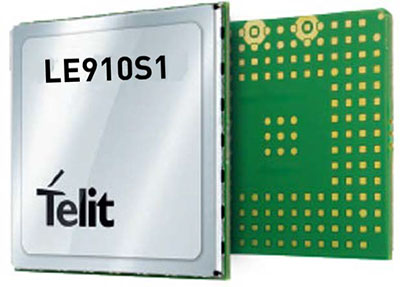
    Photo: Telit
    Photo: Telit

    Telit, a global enabler of the internet of things (IoT), has launched the LE910S1-ELG, a new LTE Cat 1 module designed for IoT applications in Latin America (LATAM) that need a combination of performance, affordability, voice support and 2G fallback in a compact form factor.

    With an embedded GNSS receiver, the cost-optimized LE910S1-ELG is suitable for tracking applications such as fleet management, stolen-vehicle tracking and recovery, and other mobile IoT applications that need to maintain a reliable connection when moving around in a country, region or multiple regions.

    The LE910S1-ELG is the latest member of Telit’s flagship xE910 module family, whose unified form factor and electrical and programming interfaces spanning 2G, 3G and 4G products enables developers to implement a “design once, use anywhere” strategy. The module supports LTE Cat 1 with single-antenna reception, providing downlink speeds of up to 10 Mbps and uplink speeds up to 5 Mbps. Its streamlined configuration, compared to LTE Cat 1 devices with two antennas, helps significantly reduce cost and complexity.

    Supporting 2G fallback, the LE910S1-ELG is suitable for applications that require full mobility throughout the LATAM regions, including areas that have not upgraded to 4G yet. It also supports both circuit-switched voice and VoLTE for those applications that require making phone calls, such as healthcare mobile personal emergency response systems (mPERS), connected elevators, alarm systems and more. The power-saving embedded GNSS receiver enables the use of GNSS positioning even when the cellular modem is switched off.

    “The LE910S1-ELG is a great option for migrating customers that use legacy 2G and 3G modules in Latin America, especially where nationwide LTE-M and NB-IoT coverage does not yet exist,” said Marco Stracuzzi, head of product marketing, Telit. “Our all-in-one cellular and GNSS module covers all LATAM 4G and 2G bands, as well as mainstream bands used in Europe and Asia, which makes it well-suited particularly for high-performance tracking across intercontinental deployments.”

    The LE910S1-ELG is sampling now, and will be commercially available during the first quarter of 2022.

  • ADVA boosts PNT resilience with new software release

    ADVA boosts PNT resilience with new software release

    Photo: ADVA
    Photo: ADVA

    Upgraded range of synchronization solutions now includes enhanced PNT resiliency against jamming and spoofing attacks and cyberthreats

    ADVA has announced a new software release of its core and edge timing technology, to provide higher levels of positioning, navigation and timing (PNT) security and resilience to synchronization networks. The new release follows the Resilient PNT Conformance Framework issued by the U.S. Department of Homeland Security (DHS).

    The upgraded series of PTP grandmaster clock solutions now enables operators to automatically harness public key infrastructure. Along with enhanced certificate management, this delivers more robust security and removes complexity, the company said.

    ADVA’s core and mid-sized PTP grandmaster devices now also integrate enhanced aPNT+ technology, providing advanced jamming and spoofing detection as well as mitigation with automatic switchover in the event of cyberattacks.

    The software replaces costly hardware devices previously used for PNT protection and achieves enhanced DHS Level 4 Resiliency in PNT self-survivability, the highest in the industry. The new software release also supports 100 Mbit/s over fiber for interconnectivity with optical timing channels from third-party vendors as well as support for PTP profiles for a wide range of industries.

    “Today’s timing networks require greater accuracy than ever before. But mission-critical national networks need improved resilience and security as defined by the latest standards. With our trusted PNT assurance solutions, we’re providing the GNSS protection and cybersecurity that today’s operators need to meet current and future challenges,” said Gil Biran, GM of Oscilloquartz, ADVA. “From phase synchronization in critical national infrastructure to traceable timestamping in financial networks, highly precise and protected timing is key to successful operations. This upgrade sets a new standard for secure synchronization and delivers it to more networks than ever before.”

    The new 11.1.1 software release features upgrades to ADVA’s comprehensive range of Oscilloquartz edge timing products, the OSA 5412/22 series, as well as its core synchronization devices, the OSA 5430/40 series. The solutions now provide multi-layered security for synchronization infrastructure through improved certification management and PKI.

    As part of ADVA’s intelligent and scalable assured PNT platform, the ADVA aPNT+, the solutions also feature innovation for detection of spoofing and jamming as well as countermeasures to prevent service disruption. With PTP capabilities for new verticals, including the PTP broadcast profiles (SMPTE ST-2059-2/AES67), the new release will bring precise, reliable synchronization to many new customers.

    Further information is available in these slides.

  • China, Arab states to expand BeiDou cooperation

    China, Arab states to expand BeiDou cooperation

    Image: XinhuaNet
    Image: XinhuaNet

    China and the Arab states will expand their cooperation in using the China-developed BeiDou Navigation Satellite System (BDS), according to the third China-Arab States BDS Cooperation Forum and reported by XinhuaNet.

    China and the Arab states will jointly implement pilot projects in key domains in the application of BDS and GNSS over the 2022-2023 period, according to a cooperation action plan signed at the forum, held Dec. 8 in Beijing.

    Both sides will facilitate the establishment of BDS/GNSS centers in the Arab states, hold training courses on satellite navigation technologies, and exchange visiting scholars. Each year, China will offer scholarships to three to five students majoring in navigation and communications from the Arab states, said the action plan.

    China and the Arab states will also carry out joint BDS/GNSS tests and evaluations, and promote the application of BDS in international search and rescue, among other initiatives.

    All the moves are expected to boost “win-win cooperation” and make BDS better serve the Arab states, said the action plan.

    First forum after BDS-3 commissioned

    The forum was jointly hosted by the China Satellite Navigation Office and the Arab Information and Communication Technologies Organization, attracting more than 300 participants from China and 17 Arab states.

    This year’s forum was held after China officially commissioned BDS on July 31, 2020, opening the new BDS-3 system to global users.

    Along with positioning, navigation and timing services, the BDS-3 system can provide a variety of value-added services such as global search-and-rescue assistance, short message communication, ground- and satellite-based augmentation, and precise point positioning.

    The forum highlighted the achievements and experience of China and Arab states in BDS/GNSS cooperation and proposed a platform for both sides to upgrade the win-win cooperation.

    BeiDou benefits in Arab States

    The BDS-based applications and solutions have benefited multiple industries in Arab states. BDS has been providing real-time, continuous, stable and precise GNSS positioning information data and timely information via continuously operating reference stations (CORS) in Tunisia, Algeria and other places.

    High-precision BDS/GNSS applications are also serving diverse fields such as land mapping, transportation, precision agriculture and environmental monitoring.

    Project management of railway construction in the United Arab Emirates (UAE) has benefitted from the integrated technologies of BDS/GNSS and the internet of things, with efficient use of data and information.

    BDS has entered a new phase of industrial and international development, according to the China Satellite Navigation Office.

  • SBG Systems provides major firmware update for its INS

    SBG Systems provides major firmware update for its INS

    Image: SBG Systems
    Image: SBG Systems

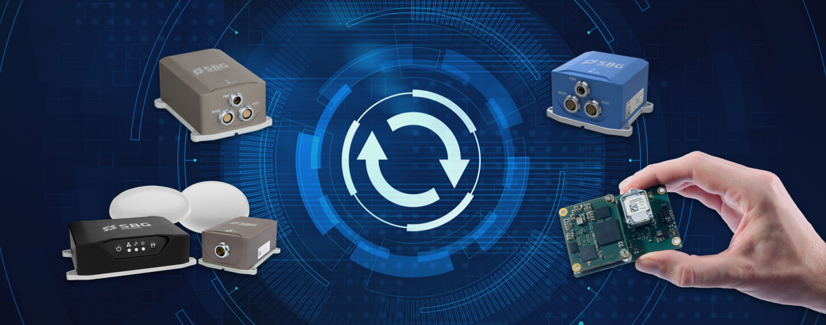
    SBG Systems has released a major firmware update for all its high-performance inertial navigation systems (INS), including its Ekinox, Apogee, Navsight and Quanta brand sensors.

    Developed in collaboration with customers, firmware 4.0 provides new features and is designed to make integration easier for system designers. It aims to provide improvements in these areas:

    System accuracy and robustness

    • Enhanced heading in a single antenna allows for easier UAV survey operations.
    • Improved GNSS antenna auto lever arm calibration provides a faster and easier system setup.

    Easier system integration

    • New PTP and NTP features for time synchronization eliminate the need and cost of an external timing module.
    • An integrated NTRIP client eases access to NRTK/VRS correction services.
    • A logged RTCM raw stream eases post-processing in SBG Systems’ post-processing software Qinertia using the user’s NRTK/VRS data.
    • A new Access Rights Management System sets up specific user roles.
    • Two serial outputs have been added on Navsight and Quanta for advanced survey setups.
    • REST API has been introduced for power users and integrators.

    Learn more and download the firmware 4.0 on the SBG Systems website.

  • BAE Systems awarded a $316M contract to deliver military GPS modules

    BAE Systems awarded a $316M contract to deliver military GPS modules

    Image: BAE Systems
    Image: BAE Systems

    The U.S. Defense Logistics Agency has executed a $316 million contract option for BAE Systems’ advanced M-code GPS modules, raising the contract funding to $641 million.

    The modules provide dependable positioning, navigation, and timing for ground troops, vehicles, aircraft and precision munitions. The contract will ensure the availability of Common GPS Modules (CGM) for advanced military GPS receivers with anti-jamming and anti-spoofing capabilities that enable operation in contested environments.

    Under the contract option executed in November, BAE Systems will manufacture CGMs for future ground, airborne and weapon GPS receivers for the U.S. Department of Defense (DoD) and its allies. The award builds on a May $325 million contract and enables BAE Systems to continue to meet domestic and international demand for Military GPS User Equipment (MGUE) Increment 1 M-Code modules in GPS receivers through the end of the decade.

    “Military operations require assured positioning, navigation and timing, and our customers are shifting to M-code to harden their GPS receivers against jamming and spoofing,” said Frank Zane, Navigation and Sensor Systems business development director at BAE Systems. “We’re ready to meet this need today with secure, reliable M-code GPS solutions, and we’re developing the next-generation of solutions to stay ahead of the threat.”

    BAE Systems is delivering two advanced M-code GPS receivers: the Miniature Precision Lightweight GPS Receiver Engine – M-Code and the NavStrike-M GPS receiver.

    Deliveries of the ultra-small MicroGRAM-M are expected in 2022, and deliveries of the Strategic Anti-jam Beamforming Receiver – M-Code are expected in 2024.