Centimeter-level positioning and high-accuracy orientation of machinery enable automation of many construction, mining and farming tasks, and take them one step closer to being performed by autonomous machines. Machine control increases jobsite safety, operational efficiency and productivity.
Using data from GNSS satellites, total stations and 3D models, machine-control hardware and software solutions determine a machine’s current position on the Earth and compare it with the desired design surface, mining task or cultivation technique. They also monitor and sometimes control the position and orientation of implements — such as blades, buckets and seeders — with respect to the machine. By talking directly to the machine’s hydraulics, machine automation shifts responsibility for accuracy and speed from the operator to the technology.
On construction sites, automation guides motor graders, excavators, dozers and other heavy machines, making operations easier to manage. This makes contractors more productive and experienced operators more efficient. With this technology, less experienced operators are able to take on more complex tasks, and all operators become more accurate. Machine automation also increases the capabilities of the machines themselves, so that excavators and compact machines are now doing finish grade work once reserved for larger and more expensive dozers.
Operators in the cab and engineers and supervisors at their desks can control and monitor progress in real time, with views of the whole layout as well as specific slopes, roads, ditches and other elements, including those under water.
Using GNSS guidance to aid application of fertilizer, pesticides and herbicides saves time and money. (Photo: Septentrio)
About half of all motor graders and a third of all dozers use positioning sensors and a display to provide operators with the position of the blade with reference to the target grade. A typical machine control set-up consists of a GNSS receiver and a display (jointly referred to as a “cab kit”) and inertial measurement units (IMUs) on the blades and other implements.
From the display, the operator loads a project design, which tells the system the cut, fill and other design information it needs. The operator then chooses a lane and may choose a vertical offset, which temporarily adjusts the design grade, making it possible to accomplish the work in steps, from rough to finish grading. Operators can also record points and scan a pavement in real time as they repair it.
While used by the construction industry on earthworks equipment since the late 1990s, machine control has recently benefited from:
The increase in the number of GNSS signals available, particularly on the new L5 frequency
IMUs, which measure blade movements with respect to the machine 100 times per second, one order of magnitude more than non-IMU grade-control systems
The growing availability of continuously operating reference stations (CORS) and other GPS networks, which eliminate the need to set up a base
New mastless systems, which integrate a receiver into the top of the cab and connect it wirelessly with IMUs to orient the blade, obviating the need to install a long mast pole on the blade and connect it by cable to the receiver and improving safety, visibility and equipment durability
New interfaces designed to be as easy to use as a cell phone, shortening the operators’ learning curve.
While these developments are hastening the advent of autonomous construction, mining and farming machines, remaining barriers to this vision include hardware and software issues as well as questions of data exchange, legal liability and operator training — issues analogous to those facing the development of autonomous cars and trucks.
The DINO is a one-ton farming robot made by NAIO Technologies that operates autonomously using GNSS positioning and maps for navigation. Of the 170 NAIO farming robots currently in operation, about 30% are DINOs, which are typically used on large farms.
In 2016, NAIO and Septentrio, a manufacturer of industrial high-end GNSS technologies, began to research the integration of full GNSS solutions into NAIO’s robots.
Today, the DINO carries a Septentrio NR3, consisting of a GNSS receiver and antenna in a single housing, which provides it with RTK centimeter-level positioning accuracy. Farmers can use the NR3 to map their fields, then attach it to the DINO to guide it.
The DINO automates weeding within complex and quickly changing environments. NAIO plans to soon add seeding and fertilization to its robot’s capabilities.
To operate reliably in the narrow lanes between crops, the DINO requires an accurate GNSS receiver with strong resistance to multipath and jamming.
The safety of field hands and the protection of the crops also require the receiver to have good integrity, which is a measure of the trust that can be placed in the correctness of the information it supplies. Accuracy, robustness, and integrity are all strong suits of Septentrio’s NR3.
While the DINO mostly operates continuously, it sometimes stops to avoid animals or humans, or for other safety reasons. A major advantage of the NR3 and other sensors that NAIO is using, is that they enable the robot to perform cold-starts very rapidly and with a stable heading.
Machine control, guidance and automation defined
Using GNSS guidance to aid application of fertilizer, pesticides and herbicides saves time and money. (Photo: fotokostic/iStock/Getty Images Plus/Getty Images)
The terms machine control, machine guidance and machine automation are not interchangeable.
Machine control is a generic term that refers to the integration of positioning tools into a construction, mining or farming machine to determine its position on the Earth and relative to a desired design surface, mining task or cultivation technique.
Within machine control, machine guidancesystems display these data in the cab — assisting the machine’s operator in steering the machine and in maneuvering its implements to shape the ground, mine minerals, plant seeds or perform other related tasks — while machine automation systems directly steer the machine, achieving greater levels of precision than human operators could. The term automated machine guidance (AMG) is sometimes also used.
While farmers work on growing and gathering their crops in the most efficient ways possible, other people key to the agriculture industry are hunters. These hunters seek the most efficient and groundbreaking ways to carry out such tasks as plowing, planting, fertilizing, weeding and, finally, gathering.
This month, among other machine-control applications, we focus on using GNSS technology to improve agricultural efficiency. According to research firm MarketsandMarkets, the precision farming market is estimated to be $7 billion in 2020 and is projected to reach $12.8 billion by 2025, growing 12.7% every year between.
Factors driving growth include increasing farm mechanization in developing countries, rising labor costs, increasing strain on the global food supply, substantial cost savings associated with smart farming techniques, and government initiatives to adopt modern agricultural techniques. For a look at today’s technology, see our cover story.
James Litton
Sadly, this month we also say goodbye to a pioneer in the precision ag field. James D. Litton founded NavCom Technology in 1995 with three partners, Ron Hatch, KT Woo and Jalal Alisobhani.
Litton’s career began at Magnavox in the early days of GPS, where he worked on the original proposal for GPS Phase I and helped develop new and advanced commercial navigation and survey receivers for both the Navy’s TRANSIT system and the Air Force’s GPS.
In 1992, Litton opened a consulting firm, and in 1994, he and his partners founded NavCom with Litton as CEO. Under contract, NavCom developed a single-frequency WAAS-capable GPS aircraft navigation receiver.
“His work transformed agriculture into a data-driven, technological industry.” — Brad Parkinson
NavCom also began a relationship with Deere & Company, supporting more efficient and productive agriculture. This relationship was so successful that Deere, which recognized GNSS tech as a smart investment, purchased NavCom in 1999.
Litton continued to lead the company and serve as part of Deere’s senior management team for eight more years.
Among his many contributions to the GNSS field, his impact on global agriculture might well have been his greatest, according to Brad Parkinson, the original chief architect for GPS and Editorial Advisory Board member.
“His work transformed agriculture into a data-driven, technological industry that was incredibly more efficient,” Parkinson said. “The cost savings and increases in productivity have impacted billions around the world.”
Litton also authored several articles for GPS World.
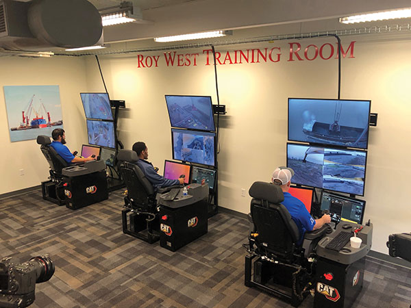
Caterpillar’s Cat Command system enables operators, including disabled veterans, to control machines in dangerous environments from the safety of a remote command center. (Photo: Caterpillar)
Caterpillar, the world’s largest manufacturer of construction equipment, has invested in the development of autonomous vehicles for more than 30 years and has the world’s largest autonomous fleet of haul trucks.
Its Cat Command suite of remote and semi-autonomous products for the construction industry helps increase safety, machine utilization and productivity for hauling, loading, excavating, drilling and dozing operations. They include onboard electronic and vision systems that allow machines to be controlled without anyone in the cab.
Options include
The line-of-sight Cat Command Console, which is supported by a shoulder harness
The Cat Command Station, which can be located onsite, for line-of-sight operation, or offsite
The semi-autonomous Cat Command for Compaction technology, which automates soil compaction to help deliver consistent results.
Over time, the company expects most of its machines to become compatible with its Cat Command technology.
Here are a few examples of how construction companies are using Caterpillar technology:
Cargo Barges. Associated Terminals, which transloads dry bulk and general cargo in the Port of South Louisiana, uses Cat Command to remotely control its small wheel loaders and excavators, keeping its personnel off the barges.
“It gives me a lot of peace of mind knowing that when we are doing our jobs, digging in these cargo holds in the vessels, my friend and co-worker is not operating the machine in the hold,” said Thomas Ramagos, a production manager for the company.
Fleet Management. Beverly Companies is a landscaping, snow removal and topsoil contractor in Chicago that owns equipment ranging from bulldozers to lawnmowers. The company uses my.cat.com and other Caterpillar fleet-management tools to track all its equipment in one place, help reduce machine downtime, manage repairs and maintenance, and order parts.
Civil Contracting. Saiia Construction Company, a civil contractor in Birmingham, Alabama, uses Cat Command to increase the safety of its employees, said Frank Montgomery, the company’s president. The material with which it deals is sometimes unpredictable, and rain events can change conditions significantly, explained Superintendent Clint Kennedy.
A remotely controlled front loader operates inside a barge. (Photo: Caterpillar)
Cat Command enables employees to work from an office trailer, rather than having to trudge through mud and muck to get to a piece of equipment. The controls in the seat are almost identical to the ones in the cab, Kennedy pointed out. Another employee can stand behind the chair and coach the operator.
High-quality cameras on site enable the operator to view the whole job site, while four on the machine enable the operator to distinguish brown dirt from red dirt and rocks from sand.
Caterpillar machines also collect massive amounts of data and transmit them over the air to the company, where they are analyzed and used in business applications.
Customers can access these data via my.cat.com and a mobile app to better understand and manage their vehicle fleets and operations, reduce fuel consumption, and improve productivity and safety. They can also access equipment locations, engine hours, parts and service records, and inspection reports.
According to Caterpillar, it had one million connected assets at the end of 2019, almost twice as many as three years earlier, and almost all its new construction machines are equipped with these connectivity systems. The Cat Productivity web-based suite of solutions works with Caterpillar machines of any age and brand. Of course, newer machines will provide richer data and more accurate results.
Trimble hardware and software tracked the position and motions of the machines and displayed to the operators the position of their tools underwater. (Photo: Trimble)
A new, twin cable-stayed bridge was built a few yards north of the original bridge by Tappan Zee Constructors LLC (TZC), a consortium of firms. The Left Coast Lifter — a huge crane on a barge previously used to replace a span of the San Francisco-Oakland Bay Bridge — was used to install groups of pre-assembled girders one full span at a time. Construction of the new bridge and demolition of the old one overlapped, with the entire project completed in May 2019.
The project was huge, complex and on an accelerated schedule. “Challenges included the size of the bridge, the river’s current, tidal variations, the water’s turbidity and strong winds,” recalled Jonathan White, product manager for Trimble Civil Construction Field Solutions, Marine. Conditions were particularly challenging for bathymetric data collection before and during the project. “The low visibility in the water made it a prime situation for sonar technology to play a major role.”
A licensed surveyor conducted a pre-dredge bathymetric survey, which was loaded into the construction software as a baseline. Trimble hardware, software and technical advice supported the demolition of the old bridge.
“As they were beating down the bridge with the jack hammers and trying to pick up the rubble from the river with the cranes, the main challenge was to keep the 11 machines that they had updated in real time with the most accurate 3D data, so that they could keep working,” explained Nathan Keys, a geospatial engineer at Measutronics, a Trimble dealership and project lead for the Tappan Zee Bridge project.
Rather than mount a sonar to the front of each construction barge, they used a single survey vessel to serve the machines (eight excavators and three clamshell cranes) with real-time data, using networked connections to update one machine at a time.
Whenever a crane operator thought he was done in an area — the machine guidance display in his cab told him that he had achieved the design depth — the survey boat would verify that, and either give the operator the go-ahead to continue working or point out any spots that were still too high or too low. “That way, they would avoid having to return to an area, which costs time and money,” Keys said.
Trimble equipment provided the positioning of the machines, tracked their motions, and visualized them, enabling the operators to “see” underwater where their bucket, grapple tool, clamshell, or other tool was operating. Trimble supported its dealer and the consortium that was executing the project, White said. “Measutronics is very well versed in the capabilities of Trimble equipment and, more broadly, marine construction workflows generally. If a piece of their equipment went down, we could swap something out and provide them with any support that they needed, and expedite that support because we knew how crucial it was with them being in the field pretty much 24/7.”
Marine excavation. The survey vessel was equipped with a Teledyne RESON T-20 multibeam sonar and a Trimble Applanix POS MV WaveMaster for motion and position. “The eight excavators were equipped with a Trimble marine excavator guidance package, which includes a GPS receiver and angle sensors working together to give guidance to the tool, whether it is a jack hammer, a bucket or whatever,” said Keys. “They also had three clamshell cranes with rotational encoders on the wire-out drums, to keep track of the bucket’s vertical. The central piece to all this is the Trimble Marine Construction software, which takes in the data from all the sensors, including the sonar, in real time and updates the display in the cabin.”
To install its sensors on machines, Trimble provides flexible aftermarket kits that come with weld plates. “We just point out to the customer where to weld the plates, then we will put the sensors on, run the cables to the cab, and do all the wire runs,” Keys explains. “It does not matter whether it is a Caterpillar or a Kobelco or whatever. They are aftermarket systems, so they can go on pretty much any machine.”
This project, Keys clarified, involved only machine guidance, not automation. “We were not using any of the machines’ own sensors. We showed them where they were and then the operator would have to control it.”
Trimble provided precise position and heading, White said. “Through a very accurate measure of where each of these sensors is installed relative to the phase center of the GPS antenna, we can determine how the machine is moving and measure that movement, so that we know exactly where the tool is relative to the position that we are getting from our satellite trilateration. It is not like the guy is sitting in the seat drinking a cup of coffee while the machine parallel parks itself. However, he is receiving a lot of information from all those sensors as to his tool’s position relative to that GPS location.”
Keys said the machines constantly log the data and their movements while they are running. “We can go back into those log files and pull out whatever we want,” he said. “On the survey side, when they do a scan or a survey of an area, that data is captured as a 3D point cloud of what the bottom looks like, which you can import into any software to visualize and quantify the riverbed and the rubble.
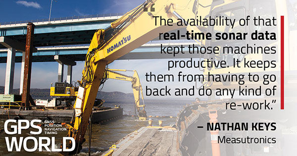
“The availability of that real-time sonar data kept those machines productive,” Keys said. “It keeps them from having to go back and do any kind of re-work.”
White said the technology is getting more affordable and user-friendly. “That is leading us, as a manufacturer, to look for ways to help further bring it into our standardized workflows. We have been working with Teledyne on those objectives.”
Trimble is also keen to advance the networking component, specifically to the marine sector, White added. “It is relatively new to marine construction projects. The ability to have a sonar vessel speaking to a machine, and all the machines to speak to each other, and to share a survey file is a very important objective for us.”
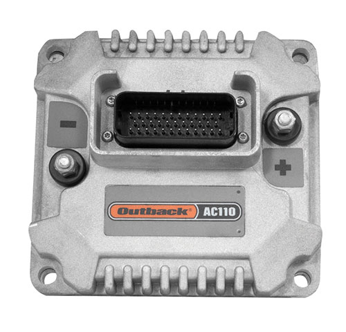
Hemisphere GNSS is primarily known for its Outback brand. It includes the Outback Guidance autosteering solution (a smart antenna that combines a GNSS receiver and a GNSS antenna in a single housing), the ESI² electric wheel that steers a tractor, the AC110 application controller that controls the rate and section, and the Rebel terminal in the cab that runs the application software. Hemisphere’s A222 smart antenna is being used by Raven and AgJunction.
“We put these product components together in different configurations for the solutions,” said Miles Ware, the company’s marketing director. “We support hundreds of tractor models with this type of solution or using our terminal for a steer-ready integration, in which you just plug our terminal and steering controller right into the tractor’s interface and it sends the commands to the hydraulic steering.”
One of the challenges with guidance for precision agriculture is that people think that tractors always operate in a wide-open field, where satellite availability is not a problem, Wares explained. That is often not true, however, due to obstructions such as tree canopies.
That is particularly an issue when using real-time kinematic (RTK) corrections for planting and seeding, which require a couple of centimeters of cross-track accuracy. Farmers want to quickly acquire a line and then maintain it. “All those functions are immediately impacted if you have challenges in the positioning solution,” Wares said.
The Outback Guidance brand offers three different packages:
Atlas Broad-Acre farming for uses that require sub-meter accuracy, such as large seeders or fertilizer sprayers;
Atlas H10 or the Atlas Row-Crop Service for row crop-level accuracy, for example to plant corn; and
a sub-inch package that uses RTK technology for automated steering.
One of the key benefits of automated steering is less fatigue for the driver, explained Roland Moelder, Hemisphere GNSS’ product manager for Agriculture Technology. “Especially when it is dark, it is very hard to do a proper job, minimizing the overlap but also not leaving gaps.”
Automated steering also enables farming practices that require more accurate driving than is humanly possible, such as for strip till, the practice of driving on exactly the same lines year after year.
Application-Guided Planting. Hemisphere’s devices can monitor, control and manipulate implements that use ISOBUS standard communications. Operators can select the attributes of their planter in the application; the display will then show them the planter’s location and which sections are active.
For example, if they are approaching a section of the field that they already planted, the AC110 control will turn off some of the seeding heads during the turn.
The same applies to spraying. The product automates the section control and coordinates it with the centimeter-accuracy steering.
Hemisphere’s solution is built around an after-market, so that farmers are not forced to buy the latest and greatest piece of equipment to take advantage of its technology, Wares added. “They can take a lot of their existing equipment, on which they may have already achieved the return on investment or are close to it, and add our solution.”
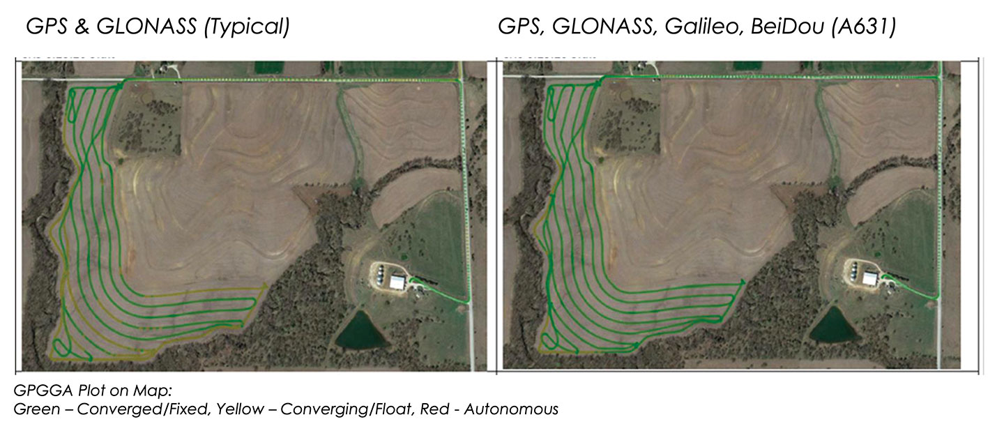
These two plots show how signals from additional GNSS constellations improve mapping. The map on the left is based on only GPS and GLONASS signals, which is typical. The one on the right is improved by adding signals from Galileo and BeiDou. In both images, the green lines are converged/fixed. In the image on the left, the yellow lines are converging/floating. (Images: Hemisphere GNSS)
Do-It-Yourself. To facilitate the installation of its smart antenna, Hemisphere works with all the manufacturers of tractors, sprayers, combines and other field vehicles to make kits that enable customers to perform the installation themselves.
“We take pride in that,” Moelder said, adding that some installations are done by dealers. The ESI2 electric wheel solution is a much easier installation than a hydraulic one. “We also support a list of ‘steer-ready’ vehicle installation kits, which are kits that utilize pre-existing components that are already on the OEM machine, where we just plug-and-play components and make it very easy for the customer to use what is already there.”
Historically, many of these solutions were built around adding hydraulic valves to a tractor, which was a lot of work. “Now, we can communicate directly to the smart valves on steer-ready models,” Wares said, “and it does not require, say, extra hoses, valves and brackets.” Electric wheels, which have tens of thousands of teeth, can manipulate the hydraulics with even finer resolution and are much easier to install than hydraulic valves.
Multi-GNSS technology has a big value for precision agriculture, Moelder said. He cited Hemisphere’s new S631 smart antenna, which tracks all available signals, greatly speeding convergence and maintaining it much better in challenging environments.
Unlike other corrections systems, Hemisphere’s Atlas uses all the available GNSS constellations. “If you are not taking advantage of them, you are really missing out,” said Wares. You cannot take full advantage of a multi-GNSS receiver without multi-GNSS corrections, he pointed out.
Successful test progresses Royal Australian Air Force’s teaming aircraft program
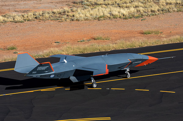
Boeing Australia and the Royal Australian Air Force (RAAF) successfully completed the first test flight of the Loyal Wingman uncrewed aircraft on Feb. 27.
The flight of the first military aircraft to be designed and manufactured in Australia in more than 50 years flew under the supervision of a Boeing test pilot monitoring the aircraft from a ground control station at the Woomera Range Complex in the South Australian outback.
“The Loyal Wingman’s first flight is a major step in this long-term, significant project for the Air Force and Boeing Australia, and we’re thrilled to be a part of the successful test,” said Air Vice-Marshal Cath Roberts, RAAF head of Air Force Capability. “The Loyal Wingman project is a pathfinder for the integration of autonomous systems and artificial intelligence to create smart human-machine teams. “Through this project we are learning how to integrate these new capabilities to complement and extend air combat and other missions,” she said.
Following a series of taxi tests validating ground handling, navigation and control, and pilot interface, the aircraft completed a successful takeoff under its own power before flying a predetermined route at different speeds and altitudes to verify flight functionality and demonstrate the performance of the Airpower Teaming System design.
“Boeing and Australia are pioneering fully integrated combat operations by crewed and uncrewed aircraft,” said Boeing Defense, Space & Security President and CEO Leanne Caret. “We’re honored to be opening this part of aviation’s future with the Royal Australian Air Force, and we look forward to showing others how they also could benefit from our loyal wingman capabilities.”
With support from more than 35 Australian industry teams and leveraging Boeing’s innovative processes, including model-based engineering techniques, such as a digital twin to digitally flight-test missions, the team was able to manufacture the aircraft from design to flight in three years.
This first Loyal Wingman aircraft is serving as the foundation for the Boeing Airpower Teaming System being developed for various global defense customers. The aircraft will fly alongside other platforms, using artificial intelligence to team with existing crewed and uncrewed assets to complement mission capabilities.
Additional Loyal Wingman aircraft are under development, with plans for teaming flights scheduled for later this year.
In its closing days, the Trump administration issued several new policy documents affecting positioning, navigation and timing (PNT) issues.
Some have questioned the long-term impact of these, given the significant policy differences between the previous and current administrations. Yet policies in relatively non-controversial areas such as PNT are generally developed by career personnel who tend to remain in place from administration to administration. While they must adhere to the philosophical tenets of extant elected officials, these policies tend to endure longer than others.
Even if this weren’t the case, considering the wealth of other issues the new administration is grappling with, these new policies could remain in force for some time, even if the new regime ultimately decides to change them.
Several themes run through many of the documents. These include:
Space-based PNT is vulnerable and must be protected.
The first of these late-term documents to be published was the National Space Policy issued on Dec. 9, 2020. Highlights and possible impacts for the PNT community include:
A goal to “Promote and incentivize private industry” could have implications for low-Earth orbit (LEO) PNT services.
A goal to “Increase the assurance of national critical functions” could include GPS/PNT resilience.
A pledge to “Safeguard space components of critical infrastructure” undoubtedly includes GPS. The section also has ominous statements about U.S. responses to purposeful interference and tasks the Defense and Homeland Security secretaries with having those responses ready.
Another pledge to “Maintain and Enhance Space-based Positioning, Navigation and Timing (PNT) Systems” is followed by eight explanatory paragraphs, many of which repeat previous policy. One new item is a promise to invest in detection and mitigation of harmful interference. A mention is also made of the need for multiple and diverse PNT sources, and responsible use of PNT, echoing the February 2020 Executive Order on the subject. Both of the latter two mentions were in the context of critical infrastructure and mission essential functions versus the security of the nation and economy as a whole.
Congress mandated a GPS backup technology demonstration in 2017, and $10 million was subsequently provided for that purpose. Various internal government delays resulted in the project not getting underway until March 2019. It concluded about a year later.
While some people have been critical, it is important to remember the report documents 11 vendor demonstrations, not engineering tests. Technologies were demonstrated in different locations and under differing conditions.
There is no silver bullet for meeting the nation’s needs. It must be a system of systems.
Also, the amount of effort and equipment in the demonstrations depended in some cases upon infrastructure available and the amount of money the government and vendors were able to spend. This meant that at least one technology was “demonstrated” mostly by explaining the concept, and other vendors were able to only partially demonstrate their technologies.
All of that said, the report offers valuable information about how America should make its national PNT much more resilient and reliable. First, it reinforces DOT’s message that there is no silver bullet for meeting the nation’s needs. It must be a system of systems. Second, the report goes further and says what that system of system should look like: “Those technologies are LF and UHF terrestrial and L-band satellite broadcasts for PNT functions with supporting fiber-optic time services to transmitters/control segments.”
From a policy perspective, this is a huge step forward. It resolves previous ambiguity and positions the nation to establish a resilient PNT architecture, one that will do more than be a “GPS backup.” It will be an architecture that will better support current applications and better enable emerging ones like autonomy, 5G and “NextG.”
Published one hour and fourteen minutes before the end of the administration on inauguration day, this plan was mandated as part of the February 2020 Executive Order on responsible use of PNT. By taking a comprehensive look at how we can do better, it provides an interesting outline of the challenges associated with America’s current over-reliance on GPS. While not a policy or directive document, it does suggest two or three departments and agencies that might be tasked with addressing each challenge.
It also addresses the need for interference detection and monitoring, and diverse sources of PNT.
This directive was published five days before the end of the administration and replaced the previous policy, 2004’s NSPD-39.
While the old policy calls for performance monitoring of GPS signals, the new one also has investment in interference detection and monitoring as a goal.
Perhaps the most significant change in the new policy was the absence of the words “backup capability” and the lack of a mandate for DOT to lead its establishment. Yet the policy hammers home multiple times the need for more than GPS as a source of PNT. And it doesn’t abandon the idea of government involvement in making that happen.
In addition to reinforcing Executive Order 13905 on responsible use of PNT, the directive defined a new (for presidential policies) term. “Alternative PNT Service” was described as “a PNT service that has the capability to operate completely independent of, or in conjunction with, other PNT services.” The directive goes on to say that “Multiple, varied PNT services used in combination may provide enhanced security, resilience, assurance, accuracy, availability and integrity. An alternative PNT service allows a user to transition from the primary source of PNT signals in the event of a disruption or manipulation.”
And while the policy does not say the government will establish or support an alternative PNT service, it comes pretty close. One of its goals is “Invest in… as appropriate, alternative sources of PNT for critical infrastructure, key resources, and mission-essential functions.”
It goes on to task the departments of Defense, Homeland Security and Transportation with making that happen.
So “backup” is out, “alternative PNT” is in. We agree words are important and are happy to have the new words. Let’s hope the new administration will match the new words with action (as appropriate).
The Frontier Precision 2021 TechXpo User Conference takes virtual its popular and informative in-person user conferences, sponsored by Frontier Precision for the past two decades. The conference will take place March 30-April 1, 11 a.m. to 5.pm. Central Daylight Time.
During the 2021 TechXpo, participants can engage in more than 70 webinars, live question-and-answer sessions, daily prizes and a virtual trade show with more than 15 industry vendors such as Trimble, DJI, Yellowscan and more.
Participants will learn new ways to measure, with a wealth of knowledge to be learned and shared, the company said.
“We’ve continued to take our core values of customer service and training, and be the first to bring new technology to the customer as a basic part of our DNA as a company,” said Dennis Kemmesat, Frontier Precision president and CEO.
The virtual conference is highly interactive, making information and technology accessible from a desktop whether in another city, another state, or somewhere on the other side of the world.
The three-day conference will explore the best technology from the engineering, land survey, geospatial information systems (GIS), construction and unmanned aerial system (UAS) industries.
The $49 registration includes 30-day access to recordings.
About Frontier Precision. Frontier Precision is an employee-owned company with 33 years of experience serving survey, mapping, engineering, construction, GIS, forensics, law enforcement, forestry, water resources, mosquito and vector control, and natural resources professionals.
As one of the top Geospatial Trimble dealers in the world, Frontier Precision has been at the forefront of technology. The company provides business solutions in the areas of UAS/drones, laser-based scanning, 3D visualization and virtual reality.
The company is headquartered in Bismarck, North Dakota, with locations in South Dakota, Minnesota, Colorado, Montana, Idaho, Oregon, Washington, Alaska and Hawaii.
New Galileo OS SIS ICD V2.0 is now fully supported by IFEN’s NCS Nova GNSS simulator
Photo: IFEN
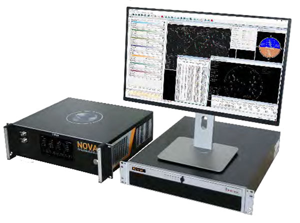
IFEN GmbH, a manufacturer of GNSS navigation test products and services, announced that its NCS Nova GNSS simulator now fully supports the simulation of Galileo Open Service (OS) signal improvements based on the new Galileo OS SIS ICD V2.0.
The NCS Nova GNSS simulator is a high-end, powerful and easy-to-use satellite navigation testing and R&D device. It is fully capable of multi-constellation and multi-frequency simulations for a wide range of GNSS applications. It provides multiple GNSS frequencies in one box.
A key enhancement to the NCS Nova GNSS simulator is comprehensive support of new Galileo OS signal message improvements on E1B. By enabling real-time simulation of the Galileo OS message improvements, the NCS Nova GNSS Simulator expands the user’s Galileo signal capability.
The NCS Nova GNSS simulator will, in future, also fully support the new Galileo E1B OS-Navigation Message Authentication (OS-NMA) and Galileo E6B High Accuracy Service (HAS) capabilities.
The GNSS simulator enhancements were developed through ESA’s Navigation Innovation and Support Programme (NAIVSP) Element 2, within the project STX2G.
“Through a simple software update, NCS Nova GNSS Simulator customers can automatically generate the new Galileo signal capabilities,” said Günter Heinrichs, head of Client Solutions at IFEN. “Adding Galileo OS signal improvement support to our NCS Nova GNSS simulator comes at the perfect time given the recent release of the Galileo OS SIS ICD V2.0 specification.”
In our 10th annual Simulator Buyers Guide, we feature simulator tools, devices and software from 10 prominent companies that aid GNSS receiver manufacturers in product design.
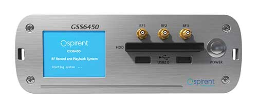
The GSS6450 RF record and playback system. (Photo: Spirent)
GSS9000, SimMNSA, CRPA test system, anechoic chamber testing, mid-range testing
Spirent Federal Systems provides PNT/GNSS test equipment that covers all applications, including research and development, integration/ verification, and production testing.
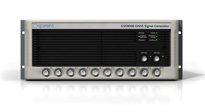
GSS9000. The GSS9000 Series Multi-Frequency, Multi-GNSS RF Constellation Simulator is Spirent’s most comprehensive simulation solution. It can simulate signals from all GNSS and regional navigation systems and has a recently-enhanced system iteration rate (SIR) of 2 kHz (0.5 ms), enabling higher dynamic simulations with more accuracy and fidelity. The GSS9000 supports restricted/classified signals, Alt RF, and other non-GNSS sensors. Users can evaluate the resilience of navigation systems to interference and spoofing attacks, and have the flexibility to reconfigure constellations, channels, and frequencies between test runs or test cases.
The GSS9000 Constellation Simulator. (Photo: Spirent)
SimMNSA. Spirent Federal has the first fully-approved MNSA M-code simulator. Authorized users of the GSS9000 series of simulators will be able to utilize the advanced capabilities of SimMNSA to create more robust solutions for their customers. SimMNSA has been granted security approval by the Global Positioning System Directorate.
CRPA Test System. Spirent’s Controlled Reception Pattern Antenna (CRPA) Test System generates both GNSS and interference signals. Users can control multiple antenna elements. Null-steering and space/ time adaptive CRPA testing are both supported by this comprehensive approach.
Anechoic Chamber Testing. Spirent’s GSS9790 Multi-Output, Multi-GNSS RF Constellation Wave-Front Simulator System is a development of the GSS9000. The GSS9790 provides the core element for GNSS applications that require a test system that can be used in both conducted (lab) and radiated (chamber) conditions.
Mid-Range Solutions. Spirent also offers solutions that cater to intermediate GPS/GNSS testing needs. The GSS7000 multi-constellation simulator provides an easy-to-use solution for GNSS testing that can grow with users’ requirements. The GSS6450 RF record and playback system enables repeated replay of a real-world GNSS/GPS test in the lab.
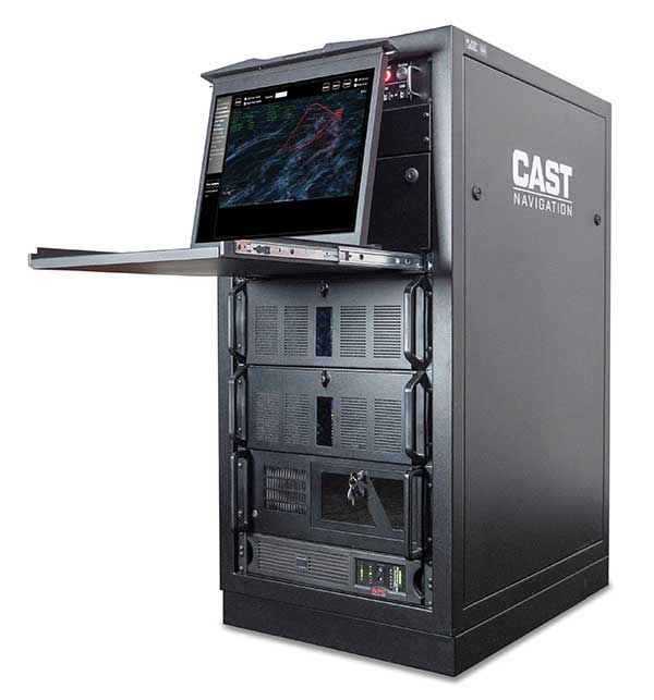
CAST-CRPA. The CAST-CRPA Simulation System produces a coherent wavefront of GPS RF signals to provide repeatable testing in the laboratory environment or anechoic chamber. The CAST CRPA system is configurable for any number of coherent outputs that users want.
With an intercard carrier-phase error of less than 1 millimeter, the CAST-CRPA Simulation System is extremely accurate.
The system generates a wavefront of GPS signals when its GPS RF generator cards are operated in a ganged configuration. Each generator card provides a set of GPS satellites coherent with the overall configuration. Several RF generator cards may be utilized together, ensuring phase coherence among the signal generator cards in each bank. The CRPA antenna, the antenna electronics and the GPS receiver can be tested as a unit with or without radiating signals.
CAST-CRPA features
Generates single coherent wavefront of GPS signals
Orolia advanced GNSS simulators offer a wide breadth and depth of simulation tools to test mission-critical positioning, navigation and timing (PNT) applications and scenarios. They are feature-rich and easy to use, providing a way to harden GPS/GNSS-based systems without the limitations of live-sky testing.
Skydel — Advanced Software-Defined Simulators
Skydel Simulation Engine. This flexible, high-performance simulator transmits GNSS digital signals in real time to many kinds of software-defined radios. Skydel uses graphics processing units (GPUs) to compute the digital GNSS signals of all simulated satellites, scaling from simple to complex use cases. Skydel simulates civil signals from global and regional navigation satellite systems, many kinds of GNSS receiver trajectories with high dynamics, and advanced jamming and spoofing. All Skydel models offer these features:
Easy configuration with intuitive UI and automation
Support for global constellations and frequencies
Support for jamming, spoofing and repeating, including jamming waveforms
Comprehensive API (Python, C#, C++, LabVIEW)
Advanced signal customization and scenario creation
Ability to integrate interference with no additional hardware
1000-Hz simulation iteration rate
IQ file generation and playback
Ability to record and export user interactions as Python script
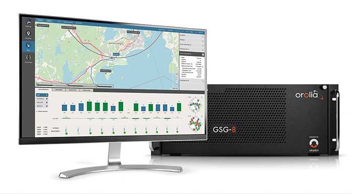
GSG-8. This software-defined system GSG8 is a globally available hardware platform for aerospace and critical infrastructure applications. It will support future EU encrypted signals. The rack-mounted unit has the option of one to four RF outputs and is configurable.
BroadSim. Designed for military NAVWAR applications, the BroadSim software-defined simulator supports encrypted military codes (Y-code, M-AES and M-MNSA) and provides documentation and procedures for classified operations. BroadSim has two GPUs and four RF outputs. It runs on a custom Linux operating system, with RMF STIG support coming soon.
Skydel Anechoic. This simulator system for radiated over-the-air testing is designed for testing CRPA/multi-element antennas, antenna electronics and entire PNT systems in an anechoic chamber.
Skydel Wavefront. This GNSS simulator system for conducted wavefront testing is designed to test the jamming/spoofing resiliency of CRPA and multi-element antenna electronic systems, and for applications with high dynamics.
GSG 5/6 Scenario-Based Simulators. The GSG 5/6 enable testing of smart applications such as drones, the internet of things, connected cars and cellular. They provide a comprehensive set of pre-defined scenarios and the ability to create scenarios. They simulate all constellations and frequencies as well as movements and trajectories anywhere on or above Earth.
Application packages are available for real-time kinematic, eCall, high-velocity, jamming and sensors.
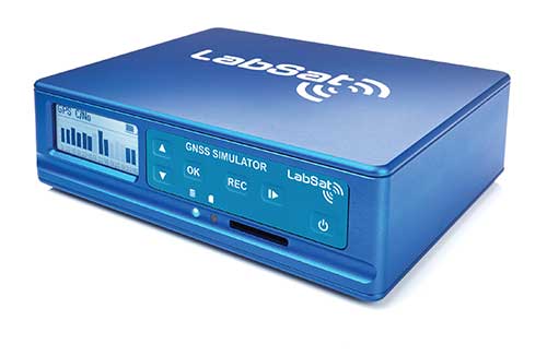
LabSat 3 Wideband. The LabSat 3 Wideband is a compact yet powerful multi-constellation and multi-frequency GNSS testing solution. The easy-to-use, one-touch record-and-replay function provides an efficient way to test and develop GNSS-based technology without the cost and limitations of live-sky signals.
It is lightweight and portable and makes it easy to collaborate with colleagues by sharing scenario files over the internet — making it a suitable testing partner for remote working. Additionally, the removeable solid-state drive (an SSD of up to 7 terabytes) and a two-hour runtime provided by an internal battery is ready for field testing in any environment.
LabSat 3 Wideband can record and replay up to three different channels at 56-MHz bandwidth across all major constellations and signals, including:
GPS: L1/L2/L5
Galileo: E1/E1a/E5a/E5b/E6
GLONASS: L1/L2/L3
BeiDou: B1/B2/B3
NavIC: L5/S-band
QZSS: L1/L2/L5
L-band correction services including SBAS
2x CAN and 4x digital input channels tightly synchronized with GNSS data
Future signal launches are also supported, including L2C, L5 and L1C
SatGen Simulation Software. SatGen software allows users to quickly create bespoke, accurate scenarios with their own time, location and trajectory that can be replayed via a LabSat GNSS simulator.
The latest version of SatGen can be used to create a single scenario containing all the upper and lower L-band signals for GPS, Galileo, GLONASS, BeiDou and NavIC.
High-end GNSS simulation solutions for R&D, integration and product testing
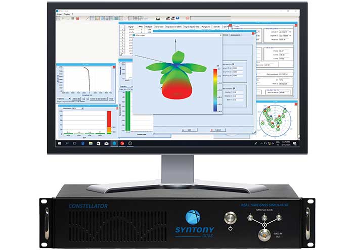
Constellator. Syntony’s GNSS simulator Constellator supports all constellation signals available and provides a high level of service in different ranges. It covers, in a single unit, a wide spectrum of use cases from entry-level with L1C/A up to very demanding configurations such as multifrequency and up to 660 L1C/A-equivalent signals. Extensively used in aeronautics, space and defense industries, Constellator answers complex requirements:
Standalone mode (on the ground and in space)
Multi-frequencies
All constellations and their signals, including BeiDou, Navic/IRNSS and QZSS
Hardware-in-the-loop (HIL) mode with zero effective latency and 1000-Hz update rate
CRPA generation capability
Capability to generate “Restricted Signals” through a dedicated interface, called PRN-Link
In the space industry, Constellator implements the advanced models (Earth gravity, drag, 3D ionospheric models, side lobes, etc.) needed to achieve accurate simulations for all kinds of orbits (from LEO to GEO and SSTO). Combined with other Syntony GNSS simulation products (interference generator, Echo recorder and player), Constellator can tackle challenging use cases such as testing of jamming, spoofing, multipath and multiple antennas. It is based on a software-defined radio, making it hardware-ready for future constellations, signals and codes. It is easily upgradeable and versatile.
GNSS Recorder and player. Echo is an ultra-high-fidelity GNSS record-and-playback solution that captures real-life signals and environments — for instance, from airplanes — and then replays them for R&D or production tests. Echo offers:
3 RF channels of 100-MHz bandwidth each (for the whole set of GNSS signals from all constellations)
16-bit resolution (I&Q)
From seven to more than 1,000 hours of record/replay capabilities depending on the configuration
The Echo platform allows full 16 bits of I/Q recording at 100 Mhz for three channels, simultaneously. As such, it provides the highest achievable record/replay fidelity. Echo-R can also record complex and very long realistic scenarios from a simulator. Echo-P can replay them with very high fidelity for long-run or production tests.
Please contact Remy Thellier (based in San Francisco) for North America at 415.599.9230, or contact the EMEA Sales team at: [email protected] syntony-gnss.com
+33.5.81.319.919
The advanced customization and configurability of Xidus enables users to perform rigorous and extensive testing of GNSS systems.
Test scenarios. Xidus meets all requirements regarding multi-GNSS, multi-frequency and multi-RF signal generation out of the box. Innovative Xidus signal extension and enhancement (SEE) technology allows users to integrate bespoke generation blocks into the signal generation path. In addition, Xidus’ advanced support capabilities allow remote support and updates, remote training and even remote scenario execution.
Easy hardware or software upgrades. Xidus has modular signal generation hardware that allows easy and robust field upgrades. New modules are automatically calibrated, allowing users to accomodate multiple concurrent navigation development projects.
Expert background. WORK Microwave has been designing and building GNSS simulators for more than 15 years. The Xidus hardware leverages WORK Microwave’s 35+ years of experience in the design and manufacturing of bespoke digital and analogue microwave products.
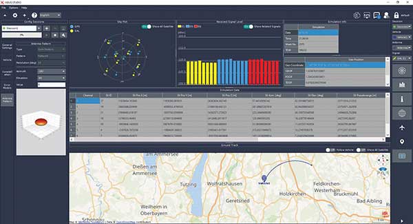
Xidus-Studio (Photo: Work Microwave)
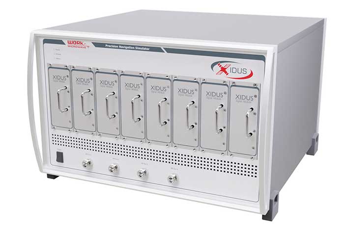
Xidus-424 GNSS Simulator. The Xidus-424 has up to 128 LOS channels, 512 multipath channels and two RF outputs. It supports all GNSS frequencies and signals. It supports an update rate up to 100 Hz and has very wide dynamic power range configurability.
Xidus-648 GNSS Simulator. The Xidus-648 provides all the capabilities of the Xidus-424 plus additional features: up to 256 LOS channels, 1,024 multipath channels, four RF outputs and a 1000-Hz update rate.
Xidus-Studio client software. The software provides everything for testing GNSS systems: different vehicle models with 6DOF, multiple vehicle simulation, spoofing and meaconing, multiple TX antenna patterns, multiple RX antenna patterns, industry-standard error models and runtime distortions on individual channels. Xidus-Studio also allows the design of bespoke satellite orbits ranging from LEO to GEO. Available on Linux and Windows.
Xidus Series. Connect up to four Xidus units to produce a simulator capable of mega-constellation simulation, with precise phase synchronization across units.
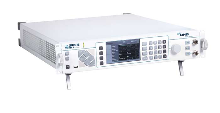
GIPSIE-RTX (GNSS Multisystem Performance Simulation Environment – Real Time Extension)
GIPSIE-RTX is a fully featured GNSS signal generator with real-time streaming functionality, including real-time control of the simulation environment. It consists of a high-quality signal simulator as the hardware platform and a flexible and powerful GNSS simulation environment.
The multi-system and multifrequency-capable GIPSIE-RTX simulates arbitrary satellite orbits using a sophisticated orbit integrator. It is able to model all error sources, delays and propagation effects. These include various models for satellite clocks, ionosphere and troposphere, multipath, signal power, antenna patterns and noise. In addition, multiple types of signal interference, like jamming and spoofing, can be defined. Customized navigation message formats and contents can be used to simulate future GNSS signal features.
Besides generating RF signals, GIPSIE-RTX is also capable of directly simulating digital signals, taking into account user-defined modeling of a radio-frequency front end. Comprehensive data logging of all intermediate results is available for detailed analyses.
GIPSIE-RTX provides a real-time input interface and thus supports hardware-in-the-loop (HIL) testing, such as for automotive applications.
GIPSIE-RTX Features
GIPSIE-RTX is a new compact multi-channel high performance platform for complex and versatile GNSS testing. Features include:
Highly reproducible scenarios
Modeling of all error sources, delays and propagation effects
Interference (jamming and spoofing) simulation
HIL simulation
Synchronization of multiple simulators for advanced testing (e.g., array antenna)
QA707 is the cutting edge solution for global threat GNSS awareness and management. It is a GNSS simulator specifically designed to test cyber-attacks and authentication, and includes the simulation of GNSS interference, deception, jamming, spoofing and advanced cyber-threats such as data and code level attacks.
The high flexibility in the creation of the scenarios and the definition of the type of attacker allow cyber-threat and vulnerability testing for several applications,These applications may include, for example, autonomous driving and vehicle tracking, aeronautics and high dynamics applications, space GNSS receivers and timing.
OSNMA support. The Galileo Open Service Navigation Message Authentication (OSNMA) simulation is an opportunity to test the new Galileo data protected service against a number of known vulnerabilities in GNSS applications. The OSNMA simulator is also available as a standalone tool, allowing the generation of OSNMA data that can be used with third party simulators.
PC-capable. QA707 runs on a standard PC. It is compatible with several third-party hardware RF up-converters, including National Instruments’ USRP. Additionally, it can support customer-specific hardware through the hardware API interface.
QA707 main features
Multi constellation (currently GPS L1, GALILEO E1, SBAS L1).
Galileo OSNMA
RF simulation, binary file dump, signal record and replay
Support to SDR platforms and open API for custom RF upconverters
Runtime streaming of scenario information over UDP (motion, channel data)
Data level cyber-attacks
Accurate spoofing signals control, trajectory spoofing, signal replay attacks
Narrow band, wide band, frequency modulated jamming
Integrity threats (on request): evil waveform, erroneous ephemerides, code/carrier divergence, low satellite signal power, excessive range acceleration
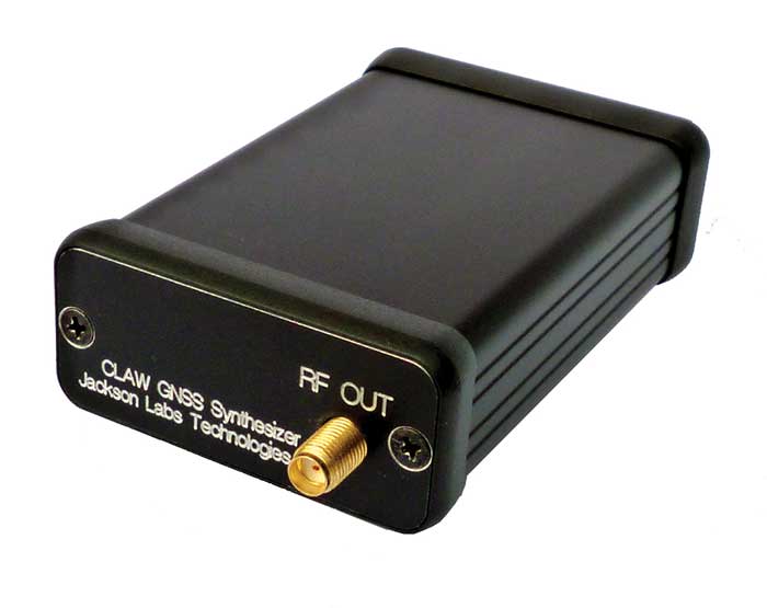
The 18-channel miniature full-constellation CLAW GPS Simulator is a fully self-contained, low size, weight, power and cost (SWaP-C) miniature GPS simulator. It is very popular in manufacturing environments as well as R&D applications that require consistent and repeatable local GNSS signals at low price points.
The CLAW simulator does not require external computers for processing and control — it works fully self-contained by simply applying power, and storing location/time/date data in internal non-volatile (NV) memory, or by storing complex vector data to simulate highly dynamic scenarios.
The CLAW also can be used to transcode NMEA or SCPI position/velocity/time (PVT) data into GPS RF signals. JLT offers an easy to use, highly configurable and cost-free SimCon Windows application program that is downloadable from the JLT website.
The SimCon application allows random scenario generation and is thus usable to simulate leap-second events, week 1023 rollover events, or any other GPS live-sky scenarios, including highly complex yet easy-to-create dynamic vector simulations.
For authorized U.S. government users, a version that does not have altitude and velocity limitations is popular for low-Earth-orbit (LEO) simulations. Multipath simulation allows use of the entire 18-channel simulator capability.
The unit can be field-upgraded with an easy to use in-field software upgrade feature. The CLAW is also very useful in GNSS receiver sensitivity testing for R&D or mass-production assembly lines as it allows accurate control of RF output power ranging from –100 dBm to less than –130 dBm with 0.1-dB resolution and typically better than 1-dB accuracy over the controllable power range.
The CLAW GPS Simulator also has a built-in RF signal generator with sweep, CW and random noise functions that are useful in simulating GNSS jamming scenarios, as well as GPS spoofing scenarios. The simulator comes in an FCC-certified metal desktop enclosure with numerous accessories.
For 2021, the CLAW firmware has been updated to allow live-sky almanac and ephemerides to be automatically uploaded from various externally connected GNSS receivers. This makes simulations using real-time live-sky constellations (such as used in simulating spoofing attacks) an easy task. A free firmware update is available from JLT.
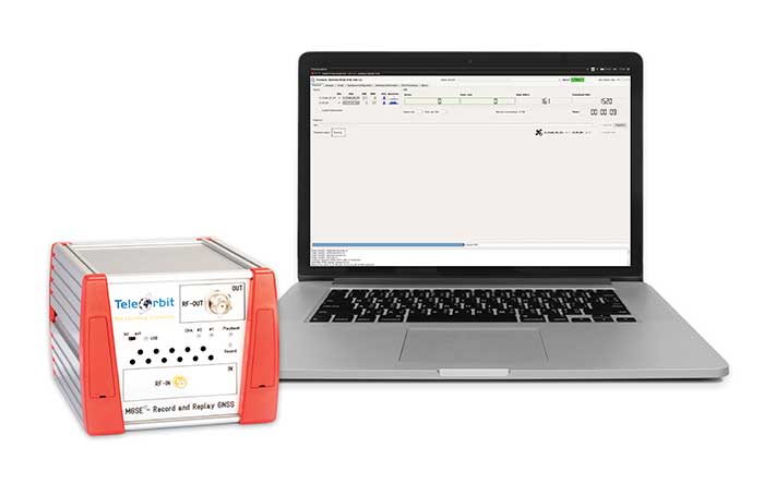
The MGSE product family creates a versatile GNSS test and simulation environment that improves the development, qualification and certification process of GNSS receivers within development phases and for the validation and certification in end-to-end tests.
MGSE enables mobile and stationary interference monitoring, such as for protecting critical infrastructures (based on MGSE REC), and can be used for interference mitigation if combined with TeleOrbit’s GNSSA-6E (six-element antenna array) or its GNSSA-DCP (dual circularly polarized antenna).
With MGSE REC-REP 2.0 users can, among other tasks, record Galileo PRS signals in a real user environment and replay them for Galileo PRS receiver testing. It is also possible to replay simulated GNSS signals.
MGSE SIM-REP supports the development of software-defined radios/receivers (SDR) or specialized algorithms by creating a simulation environment that provides the possibility and flexibility to use synthetically generated GNSS data and recorded real-world samples — both exactly reproducible.
For jamming and spoofing test and evaluation, TeleOrbit offers a sophisticated solution based on the MGSE simulation, recording and replaying product family.
Technical background. The multi-band RF front-end (MGSE REC) receives the GNSS RF signals in different frequency bands simultaneously to obtain digital IF data, which can be used for GNSS multi-system signal analysis and comparison.
MGSE REC also includes a reception board to receive and process the NavIC S-band signal in addition to other L-band frequencies.
The MGSE Replay Unit (MGSE REP) includes a flexible multi-band RF replay device that can stream simulated and recorded raw IF data to a digital baseband output or to an analog RF signal.
MGSE REP simultaneously supports up to two independent RF channels and up to four GNSS signals, such as L1, E1, B1, G1.
In separate letters to the Office of Management and Budget (OMB) and new Secretary of Transportation Buttigieg, influential members of Congress have urged the Biden administration to take prompt action and establish a backup timing capability for GPS.
Danger and Benefits, Solution in Hand
On March 1, Republican representatives Sam Graves and Bob Gibbs wrote to the acting OMB director citing the dangers of not having a backup, and the benefits one would bring. Graves is the ranking member of the House Transportation and Infrastructure Committee.
Calling backup timing for GPS “important telecommunications infrastructure,” they said the capability is essential. Without a backup “… it is not a question of if our transportation, financial, and telecommunications infrastructure systems will fail, it is a question of when.”
After describing some of the threats to GPS, they observed that America will suffer from an outage more than many of its adversaries. Russia and China were cited as examples of nations that already have terrestrial backup systems for space-based PNT.
The letter to OMB also cited the benefits to safety, autonomous and intelligent transportation systems, along with “5G & Future Telecommunications.” GPS interference has led to a near crash of a commercial passenger aircraft, drone accidents, and allowed white-hat hackers to force cars off the road. The letter also referenced a report by the Alliance for Telecommunications Industry Solutions (ATIS) calling for a national timing solution to complement GPS. Such a solution would “…allow faster 5G implementation and enable it to reach more Americans.”
Graves and Gibbs also mentioned the Department of Transportation’s (DOT) January report to Congress on its GPS Backup Technology Demonstration. The report called for an architecture that included signals from space in the L band, terrestrial broadcasts in the Ultra High Frequency and Low Frequency spectra, and a fiber backbone to synchronize and feed precise time to terrestrial transmitters.
Studies and Broken Promises
By contrast, a letter signed by Democratic House members focused on decades of administration studies, a broken promise, and failure to follow the law.
Transportation and Infrastructure Committee Chair Peter Defazio, along with Representatives Garamendi and Carbajal, wrote to DOT Secretary Buttigieg on Feb. 25. The letter noted that the need for a GPS backup was first identified in a 2001 DOT report. Since then, “…there have been over 18 studies and recommendations by the Federal Government calling for a land-based, wireless nationwide backup system.” Also mentioned were comments in 2014 by DHS officials calling the nation’s over-dependence on GPS “a single point of failure” for critical infrastructure.
Congress was encouraged in 2015 when the Obama administration said it would establish an eLoran timing system and follow it with a broader approach to GPS vulnerability. “This well-reasoned approach gave Congress encouragement that this national security problem would finally be addressed.”
“However, in 2018, after no additional action was taken, Congress took responsibility to codify the commitments outlined in the 2015 letter, and on a nearly unanimous bipartisan basis in both Houses, passed the National Timing Resilience and Security Act (NTRSA) to implement the land-based timing back-up system.”
The letter also notes that Congress further nudged the administration on this issue in last year’s appropriations. The act for 2021 provided funding for six new DOT staff positions to support the project and directed the department to make the hires.
Timing and Positioning
Observers say that it is almost certain the capabilities implemented to satisfy the terrestrial timing requirement in NTRSA will also provide a positioning capability independent of GPS.
NTRSA requires DOT to “… incorporate the recommendations from any GPS back-up demonstration program” into the solution set. The combination of technologies recommended by the demonstration report will provide users one or more terrestrial services from which location can be derived.
Also, mobile devices must know their locations to use wireless timing signals. Location information independent of space-based signals is needed to provide these users resilient timing service.
Abstracts for the ION GNSS+ 2021 show, “GNSS + Other Sensors in Today’s Marketplace,” are due March 5.
ION GNSS+ 2021 will be held Sept. 20-24 at the St. Louis Union Station Hotel. The show will also include a virtual option.
The 2021 show will feature in-person presentations with video presentations for remote viewers. It’ll also cover two tracks: commercial and policy tracks, and research tracks.
The commercial and policy tracks will include high performance and safety critical applications, status and future trends in GNSS, and mass market and commercial applications. The research tracks will include multisensor and autonomous navigation, algorithms and methods, and advanced GNSS technologies.
Authors whose abstracts are accepted in these sessions (either as a primary or as an alternate presenter) will have the option to have their papers peer-reviewed.